Mid Reddish

Settlement in Lancashire

England

Mid Reddish

A weir on the River Tame, Reddish Vale Country Park The River Tame (Greater Manchester), not to be confused with its namesake in the West Midlands, rises on Denshaw Moor. Its catchment lies mainly on the western flank of the Pennines. The named river starts as compensation flow  from Readycon Dean Reservoir in the moors above Denshaw. The source is a little further north, just over the county border in West Yorkshire, close to the Pennine Way. The highest point of the catchment is Greater Manchester's highest point at Black Chew Head.

The river flows generally south through Delph, Uppermill, Mossley, Stalybridge, Ashton-under-Lyne, Dukinfield, Haughton Green, Denton and Hyde. After Mossley  the river marks much of the historical boundary dividing Cheshire and Lancashire, before its confluence with the River Goyt to form the River Mersey at Stockport.
A weir on the River Tame, Reddish Vale Country Park Credit: habiloid

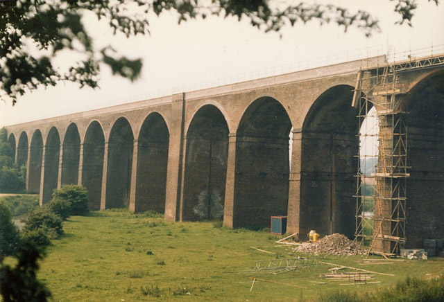
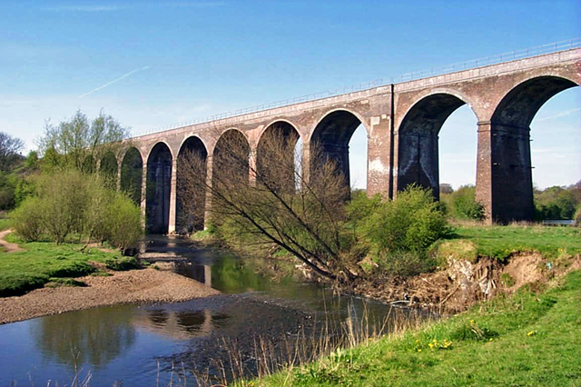
Mid Reddish is a small village located in the county of Lancashire, England. Situated approximately 5 miles southeast of Manchester city center, it falls within the Metropolitan Borough of Stockport. The village lies on the eastern bank of the River Tame and is bordered by the neighboring areas of Reddish, Gorton, and Denton.

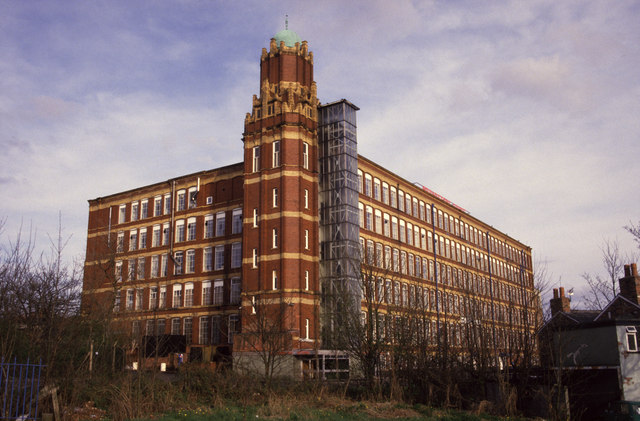
Historically, Mid Reddish was primarily an agricultural community, but it underwent significant industrialization during the 19th century. The village became known for its cotton mills, which played a crucial role in the region's textile industry. However, as the textile industry declined in the 20th century, the village transitioned into a predominantly residential area.

Today, Mid Reddish offers a mix of housing options, ranging from Victorian terraced houses to more modern developments. The village maintains a close-knit community feel, with a range of local amenities including shops, schools, and recreational facilities. The nearby Reddish Vale Country Park provides residents with green spaces and scenic walking trails along the river.

Transport links to Mid Reddish are convenient, with regular bus services connecting the village to surrounding areas. The nearby M60 motorway allows for easy access to Manchester and other parts of Greater Manchester. Additionally, Reddish North railway station provides train services to Manchester Piccadilly, Stockport, and beyond.

Overall, Mid Reddish is a charming village that combines its industrial heritage with a peaceful residential environment, making it an attractive place to live for those seeking a suburban lifestyle within easy reach of city amenities.

If you have any feedback on the listing, please let us know in the comments section below.

Mid Reddish Images

Images are sourced within 2km of 53.435072/-2.1637434 or Grid Reference SJ8993. Thanks to Geograph Open Source API. All images are credited.

A weir on the River Tame, Reddish Vale Country Park The River Tame (Greater Manchester), not to be confused with its namesake in the West Midlands, rises on Denshaw Moor. Its catchment lies mainly on the western flank of the Pennines. The named river starts as compensation flow  from Readycon Dean Reservoir in the moors above Denshaw. The source is a little further north, just over the county border in West Yorkshire, close to the Pennine Way. The highest point of the catchment is Greater Manchester's highest point at Black Chew Head.

The river flows generally south through Delph, Uppermill, Mossley, Stalybridge, Ashton-under-Lyne, Dukinfield, Haughton Green, Denton and Hyde. After Mossley  the river marks much of the historical boundary dividing Cheshire and Lancashire, before its confluence with the River Goyt to form the River Mersey at Stockport.
A weir on the River Tame, Reddish Vale Country Park
The River Tame (Greater Manchester), not to be confused with its namesake in the West Midlands, rises on Denshaw Moor. Its catchment lies mainly on the western flank of the Pennines. The named river starts as compensation flow from Readycon Dean Reservoir in the moors above Denshaw. The source is a little further north, just over the county border in West Yorkshire, close to the Pennine Way. The highest point of the catchment is Greater Manchester's highest point at Black Chew Head. The river flows generally south through Delph, Uppermill, Mossley, Stalybridge, Ashton-under-Lyne, Dukinfield, Haughton Green, Denton and Hyde. After Mossley the river marks much of the historical boundary dividing Cheshire and Lancashire, before its confluence with the River Goyt to form the River Mersey at Stockport.
Old Boundary Marker near Holt Wood in Reddish Vale Boundary Marker beside the Tameside Trail footpath in Reddish Vale, south of Holt Wood. Formerly on the boundary of Denton, Lancashire and Brinnington, Cheshire, Brinnington became part of Bredbury in 1902, then Bredbury and Romiley in 1936. Now entirely in an unparished part of Tameside Metropolitan District. Without an inscription its date and function is unclear.

Milestone Society National ID: LA_DENTON01bm
Old Boundary Marker near Holt Wood in Reddish Vale
Boundary Marker beside the Tameside Trail footpath in Reddish Vale, south of Holt Wood. Formerly on the boundary of Denton, Lancashire and Brinnington, Cheshire, Brinnington became part of Bredbury in 1902, then Bredbury and Romiley in 1936. Now entirely in an unparished part of Tameside Metropolitan District. Without an inscription its date and function is unclear. Milestone Society National ID: LA_DENTON01bm
Tame Viaduct, Reddish Vale Impressive fourteen-arch wading through the River Tame. Built in 1875 for the Sheffield and Midland Railways Committee. Grade II listed.
Tame Viaduct, Reddish Vale
Impressive fourteen-arch wading through the River Tame. Built in 1875 for the Sheffield and Midland Railways Committee. Grade II listed.
Reddish Vale Railway Viaduct
Lenham Towers, Brinnington One of several apartment blocks on the estate, viewed from the 7th floor of the adjacent block.
Lenham Towers, Brinnington
One of several apartment blocks on the estate, viewed from the 7th floor of the adjacent block.
Reddish Vale Country Park The Trans Pennine Trail long distance path passes through this grid square, which is almost entirely the Reddish Vale Country Park. The park was formerly an industrial site with a calico print works amongst other factories and the lakes in the park provided the water to the mills.
Reddish Vale Country Park
The Trans Pennine Trail long distance path passes through this grid square, which is almost entirely the Reddish Vale Country Park. The park was formerly an industrial site with a calico print works amongst other factories and the lakes in the park provided the water to the mills.
River Tame going under the Reddish - New Mills, Buxton Railway Viaduct
Brinnington station
Brinnington station
Brinnington station booking office A classic Greater Manchester PTE structure for station renewals or, as in this case, a brand new station to serve new housing areas.
Brinnington station booking office
A classic Greater Manchester PTE structure for station renewals or, as in this case, a brand new station to serve new housing areas.
Reddish Vale Viaduct A railway viaduct across the River Tame.
Reddish Vale Viaduct
A railway viaduct across the River Tame.
Brinnington station - shiny and new Only recently opened as a new station for a large housing area, Brinnington station was built to a standard design used in several other places in Greater Manchester in the mid-1970s. The "lean-to" on the left was, I think, a cycle store, but it didn't last long. For a 1989 comparative view, see: <a title="https://www.geograph.org.uk/photo/827994" href="https://www.geograph.org.uk/photo/827994">Link</a>.
Brinnington station - shiny and new
Only recently opened as a new station for a large housing area, Brinnington station was built to a standard design used in several other places in Greater Manchester in the mid-1970s. The "lean-to" on the left was, I think, a cycle store, but it didn't last long. For a 1989 comparative view, see: Link.
Brinnington Station The train is bound for Manchester.
Brinnington Station
The train is bound for Manchester.
Brinnington Station Compare with the 1977 view <a href="https://www.geograph.org.uk/photo/1012260">SJ9192 : Brinnington station - shiny and new</a> and the 1989 view <a href="https://www.geograph.org.uk/photo/827994">SJ9192 : Brinnington station booking office</a>.
Brinnington Station
Flat on fire! ... Brinnington, Stockport View from Dane Bank in Denton across the Tame Valley.
Flat on fire! ... Brinnington, Stockport
View from Dane Bank in Denton across the Tame Valley.
Reddish Vale viaduct Spanning the River Tame
Reddish Vale viaduct
Spanning the River Tame
South Reddish - Woodhall Crescent
South Reddish - Woodhall Road
Show me another place!

Mid Reddish is located at Grid Ref: SJ8993 (Lat: 53.435072, Lng: -2.1637434)

Unitary Authority: Stockport

Police Authority: Greater Manchester

What 3 Words

///making.winks.bath. Near Heaton Chapel, Manchester

Nearby Locations

Reddish Green Mid Reddish

Related Wikis

Broadstone Mill, Reddish

Broadstone Mill was a double cotton spinning mill on the eastern bank of the Stockport Branch Canal in Reddish, Stockport, Greater Manchester, in England...

Houldsworth Model Village

Houldsworth Model Village was a model village situated in the centre of Reddish, 3 miles north of Stockport in the North of England. It was built by William...

St Elisabeth's Church, Reddish

St. Elisabeth's Church is an Anglo Catholic church in Reddish, Stockport designed by Alfred Waterhouse in the Victorian Gothic style. It is a grade I listed...

Reddish

Reddish is an area in Metropolitan Borough of Stockport, Greater Manchester, England. 4.6 miles (7.4 km) south-east of Manchester city centre. At the 2011...

Nearby Amenities

Located within 500m of 53.435072,-2.1637434
Reddish South
Naptan AtcoCode: 9100REDISHS
Network: National Rail
Network Website: https://www.nationalrail.co.uk/stations/rds/
Network Wikidata: Q26334
Public Transport: station
Railway: station
Ref Crs: RDS
Source: NPE
Train: yes
Wikidata: Q7305639
Wikipedia: en:Reddish South railway station
Lat/Long: 53.4359636/-2.1586843
Traffic Signals
Lat/Long: 53.4348092/-2.1574599
Fuel
Texaco
Brand: Texaco
Brand Wikidata: Q775060
Brand Wikipedia: en:Texaco
Operator: Texaco
Lat/Long: 53.435715/-2.164679
Post Box
Brand: Royal Mail
Brand Wikidata: Q638098
Brand Wikipedia: en:Royal Mail
Operator: Royal Mail
Operator Wikidata: Q638098
Post Box Type: pillar
Lat/Long: 53.4374874/-2.1596291
Telephone
Booth: K6
Covered: booth
Operator: BT
Operator Wikidata: Q593786
Lat/Long: 53.437633/-2.160043
Post Office
Reddish Post Office
Addr Postcode: SK5 6AF
Branch: Reddish
Brand: Post Office
Brand Wikidata: Q1783168
Check Date: 2020-02-20
Contact Website: https://www.postoffice.co.uk/branch-finder/2164329/reddish
Ref Pol Id: 7961
Lat/Long: 53.4376652/-2.1595648
Turning Circle
Source: Bing
Lat/Long: 53.4330188/-2.1689263
Turning Circle
Source: Bing
Lat/Long: 53.4315811/-2.1674166
Turning Circle
Source: Bing
Lat/Long: 53.4311267/-2.1655099
Turning Circle
Source: Bing
Lat/Long: 53.4316429/-2.1651485
Turning Circle
Source: Bing
Lat/Long: 53.4321646/-2.1669062
Bus Stop
Reddish, Broadstone Road / opposite Houldsworth Street
Bus: yes
Naptan AtcoCode: 1800SG06481
Naptan Bearing: SW
Naptan CommonName: Broadstone Road/Houldsworth Street
Naptan Indicator: Union Pub
Naptan Landmark: UNION PUB
Naptan NaptanCode: manjampa
Naptan PlusbusZoneRef: MNCRPIC
Naptan ShortCommonName: Houldsworth St
Naptan Street: Broadstone Road
Naptan Verified: no
Network: TfGM
Operator: TfGM
Public Transport: platform
Source: naptan_import
Lat/Long: 53.4354137/-2.1654441
Bus Stop
Reddish, Gorton Road / near Higginson Road
Bus: yes
Naptan AtcoCode: 1800SG12401
Naptan Bearing: N
Naptan CommonName: Gorton Road/Higginson Road
Naptan Indicator: Jewellers
Naptan Landmark: CHURCH
Naptan NaptanCode: mantgdmj
Naptan PlusbusZoneRef: MNCRPIC
Naptan ShortCommonName: Higginson Road
Naptan Street: GORTON ROAD
Naptan Verified: no
Network: TfGM
Operator: TfGM
Public Transport: platform
Shelter: no
Source: naptan_import
Lat/Long: 53.4387654/-2.1596463
Bus Stop
South Reddish, Reddish Road / opposite Greg Street (N)
Bus: yes
Naptan AtcoCode: 1800SG39141
Naptan Bearing: S
Naptan CommonName: Reddish Road/Greg Street
Naptan Indicator: O/s House 304
Naptan Landmark: HOUSE 304
Naptan NaptanCode: manjgtpw
Naptan PlusbusZoneRef: MNCRPIC
Naptan ShortCommonName: Greg Street
Naptan Street: REDDISH ROAD
Naptan Verified: no
Network: TfGM
Operator: TfGM
Public Transport: platform
Source: naptan_import
Lat/Long: 53.434589/-2.1570868
Bus Stop
South Reddish, Reddish Road / near Greg Street (N)
Bus: yes
Naptan AtcoCode: 1800SG39151
Naptan Bearing: NW
Naptan CommonName: Reddish Road/Greg Street
Naptan Indicator: Op House 376
Naptan Landmark: SELF STORAGE
Naptan NaptanCode: manjgtwa
Naptan PlusbusZoneRef: MNCRPIC
Naptan ShortCommonName: Greg Street
Naptan Street: REDDISH ROAD
Naptan Verified: no
Network: TfGM
Operator: TfGM
Public Transport: platform
Source: naptan_import
Lat/Long: 53.4349834/-2.1579161
Bus Stop
Reddish ,Reddish Road / Houldsworth Square (Stop C)
Bus: yes
Local Ref: C
Naptan AtcoCode: 1800SG39161
Naptan Bearing: NW
Naptan CommonName: Reddish Road/Houldsworth Square (C)
Naptan Indicator: Stop C
Naptan Landmark: REDDISH GREEN
Naptan NaptanCode: manjgtwd
Naptan PlusbusZoneRef: MNCRPIC
Naptan ShortCommonName: Houldsworth Sq
Naptan Street: REDDISH ROAD
Naptan Verified: no
Network: TfGM
Operator: TfGM
Public Transport: platform
Ref: C
Source: naptan_import
Lat/Long: 53.4366354/-2.1593824
Bus Stop
Reddish, Reddish Road / Houldworth Square (Stop D)
Bus: yes
Local Ref: D
Naptan AtcoCode: 1800SG39181
Naptan Bearing: SE
Naptan CommonName: Reddish Road/Houldworth Square (D)
Naptan Indicator: Stop D
Naptan Landmark: SQUARE
Naptan NaptanCode: manjgtwg
Naptan PlusbusZoneRef: MNCRPIC
Naptan ShortCommonName: Houldsworth Sq
Naptan Street: REDDISH ROAD
Naptan Verified: no
Network: TfGM
Operator: TfGM
Public Transport: platform
Ref: D
Source: naptan_import
Lat/Long: 53.4370758/-2.1594292
Bus Stop
Reddish, Broadstone Road / Houldsworth Square (Stop B)
Bench: no
Bin: yes
Bus: yes
Local Ref: B
Naptan AtcoCode: 1800SG39191
Naptan Bearing: SW
Naptan CommonName: Broadstone Road/Houldsworth Square (B)
Naptan Indicator: Stop B
Naptan Landmark: PUBLIC HOUSE
Naptan NaptanCode: manjgtwj
Naptan PlusbusZoneRef: MNCRPIC
Naptan ShortCommonName: Houldsworth Squar
Naptan Street: Broadstone Road
Naptan Verified: no
Network: TfGM
Operator: TfGM
Public Transport: platform
Ref: B
Shelter: no
Source: naptan_import
Lat/Long: 53.4372365/-2.1602276
Bus Stop
Reddish, Broadstone Road / Houldsworth Square (Stop A)
Bench: no
Bus: yes
Local Ref: A
Naptan AtcoCode: 1800SG39201
Naptan Bearing: NE
Naptan CommonName: Broadstone Road/Houldsworth Square (A)
Naptan Indicator: Stop A
Naptan Landmark: SHOPS
Naptan NaptanCode: manjgtwm
Naptan PlusbusZoneRef: MNCRPIC
Naptan ShortCommonName: Houldsworth Sq
Naptan Street: Broadstone Road
Naptan Verified: no
Network: TfGM
Operator: TfGM
Public Transport: platform
Ref: A
Shelter: no
Source: naptan_import
Lat/Long: 53.437103/-2.1606988
Bus Stop
Reddish, Broadstone Road / near Sylvia Grove
Bus: yes
Naptan AtcoCode: 1800SG39211
Naptan Bearing: SW
Naptan CommonName: Broadstone Road/Sylvia Grove
Naptan Indicator: Op Carpark
Naptan Landmark: OP CARPARK
Naptan NaptanCode: manjgtwp
Naptan PlusbusZoneRef: MNCRPIC
Naptan ShortCommonName: Sylvia Grove
Naptan Street: Broadstone Road
Naptan Verified: no
Network: TfGM
Operator: TfGM
Public Transport: platform
Shelter: yes
Source: naptan_import
Lat/Long: 53.435993/-2.1624809
Bus Stop
Reddish, Broadstone Road / opposite Sylvia Grove
Bench: no
Bin: yes
Bus: yes
Naptan AtcoCode: 1800SG39221
Naptan Bearing: NE
Naptan CommonName: Broadstone Road/Sylvia Grove
Naptan Indicator: O/s Car Park
Naptan Landmark: CAR Park
Naptan NaptanCode: manjgtwt
Naptan PlusbusZoneRef: MNCRPIC
Naptan ShortCommonName: Sylvia Grove
Naptan Street: Broadstone Road
Naptan Verified: no
Network: TfGM
Operator: TfGM
Public Transport: platform
Shelter: yes
Source: naptan_import
Lat/Long: 53.4359745/-2.1629023
Bus Stop
Heaton Chapel, Broadstone Road / near Broadstone Mill
Bus: yes
Naptan AtcoCode: 1800SG39231
Naptan Bearing: SW
Naptan CommonName: Broadstone Road/Broadstone Mill
Naptan Indicator: O/s House 35
Naptan Landmark: HOUSE 35
Naptan NaptanCode: manjgwad
Naptan PlusbusZoneRef: MNCRPIC
Naptan ShortCommonName: Broadstone Mill
Naptan Street: Broadstone Road
Naptan Verified: no
Network: TfGM
Operator: TfGM
Public Transport: platform
Shelter: no
Source: naptan_import
Lat/Long: 53.4341083/-2.166884
Bus Stop
Heaton Chapel, Broadstone Road / opposite Broadstone Mill
Bus: yes
Naptan AtcoCode: 1800SG39241
Naptan Bearing: NE
Naptan CommonName: Broadstone Road/Broadstone Mill
Naptan Indicator: O/s House 104
Naptan Landmark: HOUSE 96/98
Naptan NaptanCode: manjgwag
Naptan PlusbusZoneRef: MNCRPIC
Naptan ShortCommonName: Broadstone Mill
Naptan Street: Broadstone Road
Naptan Verified: no
Network: TfGM
Operator: TfGM
Public Transport: platform
Source: naptan_import
Lat/Long: 53.4340361/-2.1671095
Bus Stop
Heaton Chapel. Broadstone Road / near Briarfield Road
Bus: yes
Naptan AtcoCode: 1800SG39251
Naptan Bearing: SW
Naptan CommonName: Broadstone Road/Briarfield Road
Naptan Indicator: O/s House 181
Naptan Landmark: HOUSE 181
Naptan NaptanCode: manjgwaj
Naptan PlusbusZoneRef: MNCRPIC
Naptan ShortCommonName: Briarfield Road
Naptan Street: Broadstone Road
Naptan Verified: no
Network: TfGM
Operator: TfGM
Public Transport: platform
Source: naptan_import
Lat/Long: 53.4326599/-2.1677363
Bus Stop
Heaton Chapel, Broadstone Road / near Broadstone Hall Road
Bus: yes
Naptan AtcoCode: 1800SG39261
Naptan Bearing: NE
Naptan CommonName: Broadstone Road/Broadstone Hall Road
Naptan Indicator: O/s House 166
Naptan Landmark: HOUSE 166
Naptan NaptanCode: manjgwam
Naptan PlusbusZoneRef: MNCRPIC
Naptan ShortCommonName: Broadstone Road
Naptan Street: Broadstone Road
Naptan Verified: no
Network: TfGM
Operator: TfGM
Public Transport: platform
Source: naptan_import
Lat/Long: 53.4317237/-2.1687561
Bus Stop
Heaton Chapel, Keswick Road / adjacent Carnforth Road
Bench: no
Bus: yes
Naptan AtcoCode: 1800SG39411
Naptan Bearing: E
Naptan CommonName: Keswick Road/Carnforth Road
Naptan Indicator: Opp House 34
Naptan Landmark: HOUSE 36
Naptan NaptanCode: manjgwgm
Naptan Notes: INDICATOR AMENDED
Naptan PlusbusZoneRef: MNCRPIC
Naptan ShortCommonName: Carnforth Road
Naptan Street: KESWICK ROAD
Naptan Verified: no
Network: TfGM
Operator: TfGM
Public Transport: platform
Shelter: no
Source: naptan_import
Lat/Long: 53.4340851/-2.1705868
Bus Stop
Heaton Chapel, Keswick Road / near Carnforth Road
Bench: no
Bus: yes
Naptan AtcoCode: 1800SG39421
Naptan Bearing: W
Naptan CommonName: Keswick Road/Carnforth Road
Naptan Indicator: O/s House 31
Naptan Landmark: HOUSE 31
Naptan NaptanCode: manjgwgp
Naptan Notes: INDICATOR AMENDED
Naptan PlusbusZoneRef: MNCRPIC
Naptan ShortCommonName: Carnforth Road
Naptan Street: KESWICK ROAD
Naptan Verified: no
Network: TfGM
Operator: TfGM
Public Transport: platform
Shelter: no
Source: naptan_import
Lat/Long: 53.433888/-2.1701495
Bus Stop
Heaton Chapel, Carnforth Road / opposite Tarvin Avenue
Bus: yes
Naptan AtcoCode: 1800SG39431
Naptan Bearing: NE
Naptan CommonName: Carnforth Road/Tarvin Avenue
Naptan Indicator: O/s House 115
Naptan Landmark: HOUSE 115
Naptan NaptanCode: manjgwgt
Naptan PlusbusZoneRef: MNCRPIC
Naptan ShortCommonName: Tarvin Avenue
Naptan Street: CARNFORTH ROAD
Naptan Verified: no
Network: TfGM
Operator: TfGM
Public Transport: platform
Source: naptan_import
Lat/Long: 53.4357405/-2.1695397
Bus Stop
Heaton Chapel, Carnforth Road / near Tarvin Avenue
Bus: yes
Naptan AtcoCode: 1800SG39441
Naptan Bearing: SW
Naptan CommonName: Carnforth Road/Tarvin Avenue
Naptan Indicator: O/s House 100
Naptan Landmark: HOUSE 100
Naptan NaptanCode: manjgwgw
Naptan PlusbusZoneRef: MNCRPIC
Naptan ShortCommonName: Tarvin Avenue
Naptan Street: CARNFORTH ROAD
Naptan Verified: no
Network: TfGM
Operator: TfGM
Public Transport: platform
Source: naptan_import
Lat/Long: 53.4358308/-2.1692992
Turning Circle
Lat/Long: 53.4316619/-2.1632304
Turning Circle
Lat/Long: 53.4309579/-2.1639328
Car Wash
Lat/Long: 53.435689/-2.1650276
Pub
Grey Horse
Addr Housenumber: 99
Addr Postcode: SK5 7AS
Addr Street: Broadstone Road
Fhrs Id: 94624
Name Source: Openstreetbugs
Source Addr: FHRS Open Data
Lat/Long: 53.4351521/-2.1658001
Houldsworth Mill
Building: apartments
Lat/Long: 53.4358673/-2.1657704
Transport for Sick Children
Addr Housename: Williamson House
Addr Postcode: SK5 6AA
Addr Street: Williamson Street
Building: yes
Lat/Long: 53.4378198/-2.1583795
Restaurant
Dragon Palace
Cuisine: chinese
Drive In: no
Microbrewery: no
Organic: no
Outdoor Seating: no
Smoking: no
Takeaway: yes
Wheelchair: limited
Lat/Long: 53.438046/-2.159522
Fast Food
Reddish Express
Cuisine: pizza
Drive In: no
Drive Through: no
Wheelchair: limited
Lat/Long: 53.438557/-2.15979
Pub
Union Inn
Addr Street: Broadstone Road
Lat/Long: 53.4353681/-2.1653528
Londis
Brand: Londis
Brand Wikidata: Q21008564
Brand Wikipedia: en:Londis (United Kingdom)
Shop: convenience
Lat/Long: 53.4356701/-2.1648452
Atm
Lat/Long: 53.4356142/-2.1648291
Rushmore Digital Ltd.
Addr City: Stockport
Addr Housename: Suite 433
Addr Housenumber: Houldsworth Mill
Addr Postcode: SK5 6DA
Addr Street: Houldsworth Street
Building Levels: 6
Office: it
Opening Hours: Mo-Fr 08:30-18:00
Phone: +44 8435 071 820
Lat/Long: 53.4366986/-2.1657454
Addr Housenumber: 35
Addr Street: Broadstone Road
Source Addr: Naptan
Lat/Long: 53.4340247/-2.166774
Addr Housenumber: 104
Addr Street: Broadstone Road
Source Addr: Naptan
Lat/Long: 53.4340633/-2.1673319
Reddish
Is In: Stockport;Cheshire;England;United Kingdom
Place: suburb
Postal Code: SK5
Wikidata: Q12067007
Wikipedia: en:Reddish
Lat/Long: 53.4372674/-2.159912
Reddish Police Station (Closed)
Addr City: Stockport
Addr Housename: Reddish Police Station
Addr Postcode: SK5 6XD
Addr Street: Gorton Road
Building: yes
Building Levels: 3
Description: Reddish County Police Station, Closed in 2011.
Lat/Long: 53.4383813/-2.1594431
Place Of Worship
St Josephs R C Church
Addr City: Stockport
Addr Housenumber: 23
Addr Postcode: SK5 6AZ
Addr Street: Gorton Road
Denomination: roman_catholic
Religion: christian
Lat/Long: 53.4384293/-2.1600683
Access: private
Entrance: emergency
Lat/Long: 53.4393464/-2.1614892
Bar
Reddish Ale
Addr City: Stockport
Addr Housenumber: 14
Addr Postcode: SK5 7AE
Addr Street: Broadstone Road
Addr Suburb: Reddish
Contact Facebook: https://www.facebook.com/profile.php?id=100085899429139
Contact Twitter: https://twitter.com/reddishalesk5
Fhrs Id: 1553006
Food: yes
Outdoor Seating: sidewalk
Real Ale: yes
Smoking: no
Surveillance: yes
Takeaway: yes
Lat/Long: 53.4371519/-2.1607447
Quiligotti Stone and Tile
Craft: stonemason
Lat/Long: 53.4347454/-2.1581095
Car Wash
Bubbles Car Valeting Centre
Phone: +44 7912 482274
Surveillance: yes
Lat/Long: 53.4341974/-2.1573072
Atm
Lat/Long: 53.4341595/-2.1566673
Fast Food
Tiger Chilly
Cuisine: asian
Delivery: yes
Drive Through: no
Takeaway: only
Lat/Long: 53.4372727/-2.1594802
Generator Method: photovoltaic
Generator Output Electricity: yes
Generator Source: solar
Generator Type: solar_photovoltaic_panel
Location: roof
Power: generator
Lat/Long: 53.433479/-2.1707037
Generator Method: photovoltaic
Generator Output Electricity: yes
Generator Source: solar
Generator Type: solar_photovoltaic_panel
Location: roof
Power: generator
Lat/Long: 53.4334774/-2.1706098
Generator Method: photovoltaic
Generator Output Electricity: yes
Generator Source: solar
Generator Type: solar_photovoltaic_panel
Location: roof
Power: generator
Lat/Long: 53.4370758/-2.1641779
Generator Method: photovoltaic
Generator Output Electricity: yes
Generator Source: solar
Generator Type: solar_photovoltaic_panel
Location: roof
Power: generator
Lat/Long: 53.4375343/-2.1636388
Generator Method: photovoltaic
Generator Output Electricity: yes
Generator Source: solar
Generator Type: solar_photovoltaic_panel
Location: roof
Power: generator
Lat/Long: 53.4375279/-2.1635476
Generator Method: photovoltaic
Generator Output Electricity: yes
Generator Source: solar
Generator Type: solar_photovoltaic_panel
Location: roof
Power: generator
Lat/Long: 53.4375263/-2.1634457
Generator Method: photovoltaic
Generator Output Electricity: yes
Generator Source: solar
Generator Type: solar_photovoltaic_panel
Location: roof
Power: generator
Lat/Long: 53.4375263/-2.1633518
Generator Method: photovoltaic
Generator Output Electricity: yes
Generator Source: solar
Generator Type: solar_photovoltaic_panel
Location: roof
Power: generator
Lat/Long: 53.4375263/-2.1632713
Generator Method: photovoltaic
Generator Output Electricity: yes
Generator Source: solar
Generator Type: solar_photovoltaic_panel
Location: roof
Power: generator
Lat/Long: 53.4375247/-2.1631855
Generator Method: photovoltaic
Generator Output Electricity: yes
Generator Source: solar
Generator Type: solar_photovoltaic_panel
Location: roof
Power: generator
Lat/Long: 53.4375216/-2.1631104
Generator Method: photovoltaic
Generator Output Electricity: yes
Generator Source: solar
Generator Type: solar_photovoltaic_panel
Location: roof
Power: generator
Lat/Long: 53.4375216/-2.1630406
Generator Method: photovoltaic
Generator Output Electricity: yes
Generator Source: solar
Generator Type: solar_photovoltaic_panel
Location: roof
Power: generator
Lat/Long: 53.437039/-2.1633545
Generator Method: photovoltaic
Generator Output Electricity: yes
Generator Source: solar
Generator Type: solar_photovoltaic_panel
Location: roof
Power: generator
Lat/Long: 53.437039/-2.1634242
Generator Method: photovoltaic
Generator Output Electricity: yes
Generator Source: solar
Generator Type: solar_photovoltaic_panel
Location: roof
Power: generator
Lat/Long: 53.437039/-2.163502
Generator Method: photovoltaic
Generator Output Electricity: yes
Generator Source: solar
Generator Type: solar_photovoltaic_panel
Location: roof
Power: generator
Lat/Long: 53.4370438/-2.1635959
Generator Method: photovoltaic
Generator Output Electricity: yes
Generator Source: solar
Generator Type: solar_photovoltaic_panel
Location: roof
Power: generator
Lat/Long: 53.4370454/-2.1636683
Generator Method: photovoltaic
Generator Output Electricity: yes
Generator Source: solar
Generator Type: solar_photovoltaic_panel
Location: roof
Power: generator
Lat/Long: 53.4370454/-2.1637541
Generator Method: photovoltaic
Generator Output Electricity: yes
Generator Source: solar
Generator Type: solar_photovoltaic_panel
Location: roof
Power: generator
Lat/Long: 53.4370486/-2.1638373
Generator Method: photovoltaic
Generator Output Electricity: yes
Generator Source: solar
Generator Type: solar_photovoltaic_panel
Location: roof
Power: generator
Lat/Long: 53.4367946/-2.1681207
Generator Method: photovoltaic
Generator Output Electricity: yes
Generator Source: solar
Generator Type: solar_photovoltaic_panel
Location: roof
Power: generator
Lat/Long: 53.4365533/-2.1680778
Generator Method: photovoltaic
Generator Output Electricity: yes
Generator Source: solar
Generator Type: solar_photovoltaic_panel
Location: roof
Power: generator
Lat/Long: 53.4374688/-2.1694833
Generator Method: photovoltaic
Generator Output Electricity: yes
Generator Source: solar
Generator Type: solar_photovoltaic_panel
Location: roof
Power: generator
Lat/Long: 53.4374736/-2.1696925
Generator Method: photovoltaic
Generator Output Electricity: yes
Generator Source: solar
Generator Type: solar_photovoltaic_panel
Location: roof
Power: generator
Lat/Long: 53.4374832/-2.169891
Generator Method: photovoltaic
Generator Output Electricity: yes
Generator Source: solar
Generator Type: solar_photovoltaic_panel
Location: roof
Power: generator
Lat/Long: 53.437488/-2.1700224
Generator Method: photovoltaic
Generator Output Electricity: yes
Generator Source: solar
Generator Type: solar_photovoltaic_panel
Location: roof
Power: generator
Lat/Long: 53.4369463/-2.1705857
Generator Method: photovoltaic
Generator Output Electricity: yes
Generator Source: solar
Generator Type: solar_photovoltaic_panel
Location: roof
Power: generator
Lat/Long: 53.4366332/-2.1707466
Generator Method: photovoltaic
Generator Output Electricity: yes
Generator Source: solar
Generator Type: solar_photovoltaic_panel
Location: roof
Power: generator
Lat/Long: 53.4365661/-2.170355
Generator Method: photovoltaic
Generator Output Electricity: yes
Generator Source: solar
Generator Type: solar_photovoltaic_panel
Location: roof
Power: generator
Lat/Long: 53.4350801/-2.1709693
Generator Method: photovoltaic
Generator Output Electricity: yes
Generator Source: solar
Generator Type: solar_photovoltaic_panel
Location: roof
Power: generator
Lat/Long: 53.4348148/-2.1712589
Generator Method: photovoltaic
Generator Output Electricity: yes
Generator Source: solar
Generator Type: solar_photovoltaic_panel
Location: roof
Power: generator
Lat/Long: 53.4348564/-2.1712106
Generator Method: photovoltaic
Generator Output Electricity: yes
Generator Source: solar
Generator Type: solar_photovoltaic_panel
Location: roof
Power: generator
Lat/Long: 53.435307/-2.1712428
Generator Method: photovoltaic
Generator Output Electricity: yes
Generator Source: solar
Generator Type: solar_photovoltaic_panel
Location: roof
Power: generator
Lat/Long: 53.4353581/-2.1711972
Generator Method: photovoltaic
Generator Output Electricity: yes
Generator Source: solar
Generator Type: solar_photovoltaic_panel
Location: roof
Power: generator
Lat/Long: 53.4352462/-2.1707761
Generator Method: photovoltaic
Generator Output Electricity: yes
Generator Source: solar
Generator Type: solar_photovoltaic_panel
Location: roof
Power: generator
Lat/Long: 53.4353405/-2.1706635
Generator Method: photovoltaic
Generator Output Electricity: yes
Generator Source: solar
Generator Type: solar_photovoltaic_panel
Location: roof
Power: generator
Lat/Long: 53.4355003/-2.1704811
Generator Method: photovoltaic
Generator Output Electricity: yes
Generator Source: solar
Generator Type: solar_photovoltaic_panel
Location: roof
Power: generator
Lat/Long: 53.4355754/-2.1703765
Generator Method: photovoltaic
Generator Output Electricity: yes
Generator Source: solar
Generator Type: solar_photovoltaic_panel
Location: roof
Power: generator
Lat/Long: 53.4356185/-2.1703362
Generator Method: photovoltaic
Generator Output Electricity: yes
Generator Source: solar
Generator Type: solar_photovoltaic_panel
Location: roof
Power: generator
Lat/Long: 53.4360659/-2.1710148
Generator Method: photovoltaic
Generator Output Electricity: yes
Generator Source: solar
Generator Type: solar_photovoltaic_panel
Location: roof
Power: generator
Lat/Long: 53.4361602/-2.1705616
Generator Method: photovoltaic
Generator Output Electricity: yes
Generator Source: solar
Generator Type: solar_photovoltaic_panel
Location: roof
Power: generator
Lat/Long: 53.4364446/-2.1697247
Generator Method: photovoltaic
Generator Output Electricity: yes
Generator Source: solar
Generator Type: solar_photovoltaic_panel
Location: roof
Power: generator
Lat/Long: 53.4364159/-2.1695235
Generator Method: photovoltaic
Generator Output Electricity: yes
Generator Source: solar
Generator Type: solar_photovoltaic_panel
Location: roof
Power: generator
Lat/Long: 53.4362225/-2.169942
Generator Method: photovoltaic
Generator Output Electricity: yes
Generator Source: solar
Generator Type: solar_photovoltaic_panel
Location: roof
Power: generator
Lat/Long: 53.4362034/-2.1698561
Generator Method: photovoltaic
Generator Output Electricity: yes
Generator Source: solar
Generator Type: solar_photovoltaic_panel
Location: roof
Power: generator
Lat/Long: 53.436181/-2.1697408
Generator Method: photovoltaic
Generator Output Electricity: yes
Generator Source: solar
Generator Type: solar_photovoltaic_panel
Location: roof
Power: generator
Lat/Long: 53.4359157/-2.1696308
Generator Method: photovoltaic
Generator Output Electricity: yes
Generator Source: solar
Generator Type: solar_photovoltaic_panel
Location: roof
Power: generator
Lat/Long: 53.4358199/-2.1690622
Generator Method: photovoltaic
Generator Output Electricity: yes
Generator Source: solar
Generator Type: solar_photovoltaic_panel
Location: roof
Power: generator
Lat/Long: 53.4359333/-2.1689844
Generator Method: photovoltaic
Generator Output Electricity: yes
Generator Source: solar
Generator Type: solar_photovoltaic_panel
Location: roof
Power: generator
Lat/Long: 53.4359285/-2.168228
Generator Method: photovoltaic
Generator Output Electricity: yes
Generator Source: solar
Generator Type: solar_photovoltaic_panel
Location: roof
Power: generator
Lat/Long: 53.4356968/-2.1683273
Generator Method: photovoltaic
Generator Output Electricity: yes
Generator Source: solar
Generator Type: solar_photovoltaic_panel
Location: roof
Power: generator
Lat/Long: 53.4353261/-2.1676728
Generator Method: photovoltaic
Generator Output Electricity: yes
Generator Source: solar
Generator Type: solar_photovoltaic_panel
Location: roof
Power: generator
Lat/Long: 53.4353501/-2.1678418
Generator Method: photovoltaic
Generator Output Electricity: yes
Generator Source: solar
Generator Type: solar_photovoltaic_panel
Location: roof
Power: generator
Lat/Long: 53.4353741/-2.1679384
Generator Method: photovoltaic
Generator Output Electricity: yes
Generator Source: solar
Generator Type: solar_photovoltaic_panel
Location: roof
Power: generator
Lat/Long: 53.4355259/-2.1687108
Generator Method: photovoltaic
Generator Output Electricity: yes
Generator Source: solar
Generator Type: solar_photovoltaic_panel
Location: roof
Power: generator
Lat/Long: 53.435561/-2.1688798
Generator Method: photovoltaic
Generator Output Electricity: yes
Generator Source: solar
Generator Type: solar_photovoltaic_panel
Location: roof
Power: generator
Lat/Long: 53.4355882/-2.1689804
Generator Method: photovoltaic
Generator Output Electricity: yes
Generator Source: solar
Generator Type: solar_photovoltaic_panel
Location: roof
Power: generator
Lat/Long: 53.4353477/-2.1691319
Generator Method: photovoltaic
Generator Output Electricity: yes
Generator Source: solar
Generator Type: solar_photovoltaic_panel
Location: roof
Power: generator
Lat/Long: 53.4353325/-2.1690662
Generator Method: photovoltaic
Generator Output Electricity: yes
Generator Source: solar
Generator Type: solar_photovoltaic_panel
Location: roof
Power: generator
Lat/Long: 53.4353197/-2.1689951
Railway: railway_crossing
Source: survey
Lat/Long: 53.431149/-2.1613645
Barrier: bollard
Bollard: fixed
Foot: yes
Lat/Long: 53.4362821/-2.1622108
Barrier: bollard
Bicycle: yes
Foot: yes
Horse: yes
Motor Vehicle: no
Lat/Long: 53.4380646/-2.16534
Telephone
Booth: K6
Covered: booth
Operator: BT
Operator Wikidata: Q593786
Lat/Long: 53.4376336/-2.1600629
Traffic Signals
Traffic Signals: signal
Traffic Signals Direction: forward
Lat/Long: 53.4374493/-2.1599547
Crossing
Crossing: traffic_signals
Lat/Long: 53.4375531/-2.1599028
Clock
Display: analog
Support: tower
Lat/Long: 53.4375498/-2.1601877
Bench
Lat/Long: 53.4374275/-2.1604049
Bench
Lat/Long: 53.4374906/-2.1601702
Bench
Lat/Long: 53.4374986/-2.16024
Pharmacy
Dispensing: yes
Healthcare: pharmacy
Lat/Long: 53.4376768/-2.1599275
Bicycle Parking
Access: yes
Bicycle Parking: stands
Capacity: 2
Covered: no
Fee: no
Operator: Stockport Metropolitan Borough Council
Operator Type: government
Lat/Long: 53.4337658/-2.1688185
Bicycle Parking
Access: yes
Bicycle Parking: stands
Capacity: 4
Covered: no
Fee: no
Operator: Stockport Metropolitan Borough Council
Operator Type: government
Lat/Long: 53.4379025/-2.1663788
Bicycle Parking
Access: yes
Bicycle Parking: stands
Capacity: 1
Covered: no
Fee: no
Operator: Stockport Metropolitan Borough Council
Operator Type: government
Lat/Long: 53.4376342/-2.160023
Bicycle Parking
Access: yes
Bicycle Parking: stands
Capacity: 1
Covered: no
Fee: no
Operator: Stockport Metropolitan Borough Council
Operator Type: government
Lat/Long: 53.43742/-2.1603516
Cycleway: asl
Direction: forward
Lat/Long: 53.4374627/-2.1598995
Traffic Signals
Traffic Signals: signal
Lat/Long: 53.4375159/-2.1599728
Cycleway: asl
Lat/Long: 53.437541/-2.1599256
Traffic Signals
Traffic Signals: signal
Traffic Signals Direction: backward
Lat/Long: 53.4373356/-2.1596515
Cycleway: asl
Direction: backward
Lat/Long: 53.4373651/-2.1596681
Cycleway: asl
Direction: backward
Lat/Long: 53.4375829/-2.1597445
Traffic Signals
Traffic Signals: signal
Traffic Signals Direction: backward
Lat/Long: 53.4376227/-2.1597424
The data included in this document is from www.openstreetmap.org. The data is made available under ODbL.

Have you been to Mid Reddish?

Leave your review of Mid Reddish below (or comments, questions and feedback).