Metal Bridge

Settlement in Cumberland Carlisle

England

Metal Bridge

Floriston Bridge over M6 northbound
Floriston Bridge over M6 northbound Credit: Alpin Stewart

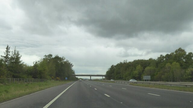
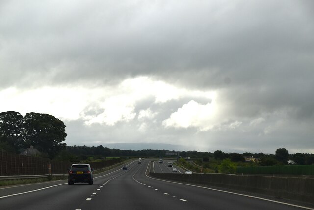
Metal Bridge is a small village located in the county of Cumberland, situated in the northwest region of England. It lies approximately 8 miles southwest of the city of Carlisle, and is nestled amidst the picturesque countryside of the Eden Valley.

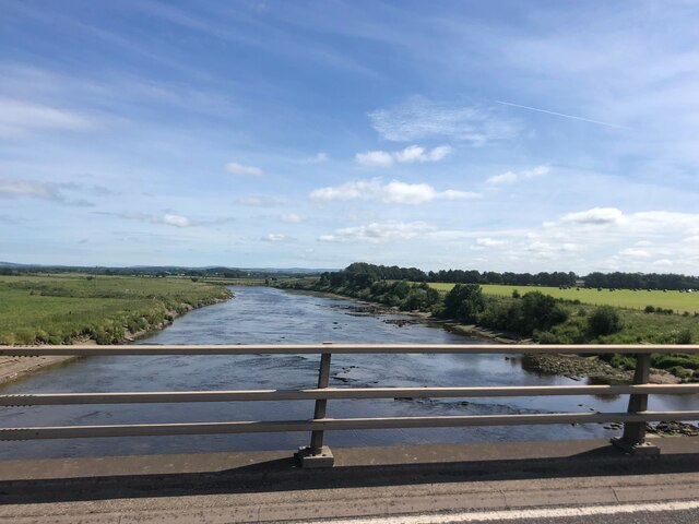
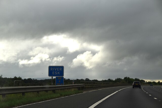
The village takes its name from the iconic metal bridge that spans the River Eden, which runs through the heart of the community. This bridge, constructed in the 19th century, is a striking architectural landmark and an integral part of the village's identity.

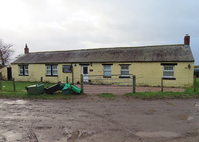
Metal Bridge is a close-knit community with a population of around 500 residents. It offers a peaceful and serene setting, surrounded by lush green fields and rolling hills. The village is known for its tranquil and idyllic atmosphere, making it an attractive destination for those seeking a rural retreat.

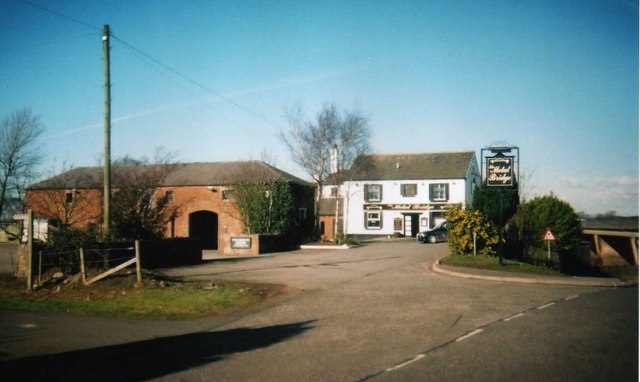
Although small in size, Metal Bridge boasts a range of amenities to cater to the needs of its residents. These include a local pub, a primary school, a village hall, and a few shops that provide essential goods and services. The village also benefits from excellent transport links, with a nearby train station and good road connections, making it easily accessible for both residents and visitors.

Metal Bridge is a gateway to outdoor activities, with the River Eden offering opportunities for fishing and boating. The surrounding countryside provides ample opportunities for hiking, biking, and exploring nature. The village also holds various community events throughout the year, fostering a strong sense of community spirit and camaraderie among its residents.

If you have any feedback on the listing, please let us know in the comments section below.
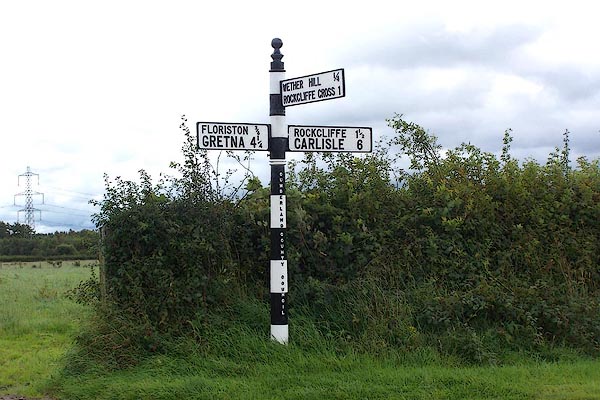
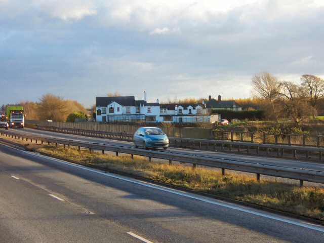
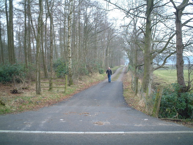
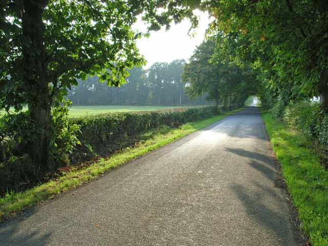
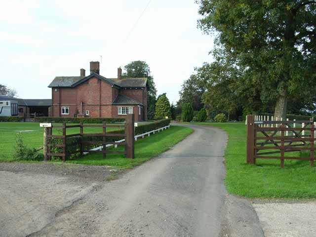
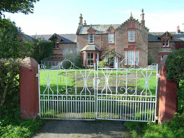
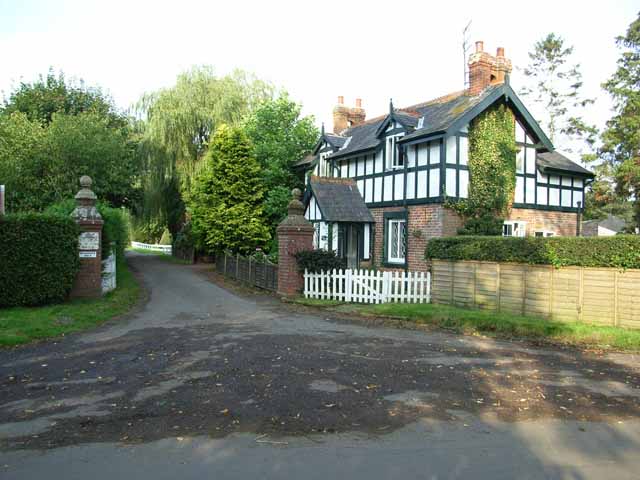
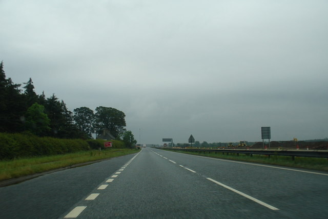
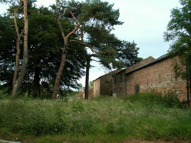
Metal Bridge Images

Images are sourced within 2km of 54.973749/-3.0087014 or Grid Reference NY3564. Thanks to Geograph Open Source API. All images are credited.

Floriston Bridge over M6 northbound
Esk Boathouse This was the home of the ferryman who took passengers across the Solway until a bridge was built across the River Esk. Notice the <a href="https://www.geograph.org.uk/photo/7379272">NY3463 : Plaque with Poem</a> on the wall left of the door.
Esk Boathouse
This was the home of the ferryman who took passengers across the Solway until a bridge was built across the River Esk. Notice the NY3463 : Plaque with Poem on the wall left of the door.
Plaque with Poem This is displayed on the outside wall of <a href="https://www.geograph.org.uk/photo/7379270">NY3463 : Esk Boathouse</a>.
Plaque with Poem
This is displayed on the outside wall of NY3463 : Esk Boathouse.
River Esk At Metal Bridge, north of Carlisle
River Esk
At Metal Bridge, north of Carlisle
View east from the M6
M6, southbound
M6, southbound
M6 crossing the River Esk
M6, southbound The M6 motorway runs from junction 19 of the M1 at the Catthorpe Interchange, near Rugby to the Gretna junction (J45). Here it becomes the A74(M) and M74 which continues to Glasgow.

The M6 is the longest motorway in the United Kingdom (232 miles) and one of the busiest. It incorporates the first length of motorway opened in the UK (the Preston bypass in 1958) and forms part of a motorway "Backbone of Britain", running north-south between London and Glasgow via the industrial north of England. It is also part of the east-west route between the Midlands and the east coast ports.
M6, southbound
The M6 motorway runs from junction 19 of the M1 at the Catthorpe Interchange, near Rugby to the Gretna junction (J45). Here it becomes the A74(M) and M74 which continues to Glasgow. The M6 is the longest motorway in the United Kingdom (232 miles) and one of the busiest. It incorporates the first length of motorway opened in the UK (the Preston bypass in 1958) and forms part of a motorway "Backbone of Britain", running north-south between London and Glasgow via the industrial north of England. It is also part of the east-west route between the Midlands and the east coast ports.
Direction Sign - Signpost east of Wether Hill in Rockliffe parish Located on the east side of the junction east of Wether Hill in Rockcliffe parish. 3 arms and pawn finial. See also <span class="nowrap"><a title="http://www.geog.port.ac.uk/webmap/thelakes/photos/boa81.jpg" rel="nofollow ugc noopener" href="http://www.geog.port.ac.uk/webmap/thelakes/photos/boa81.jpg">Link</a><img style="margin-left:2px;" alt="External link" title="External link - shift click to open in new window" src="https://s1.geograph.org.uk/img/external.png" width="10" height="10"/></span> and <a title="https://www.geograph.org.uk/photo/5432653" href="https://www.geograph.org.uk/photo/5432653">Link</a>.

Milestone Society National ID: CU_NY3563
Direction Sign - Signpost east of Wether Hill in Rockliffe parish
Located on the east side of the junction east of Wether Hill in Rockcliffe parish. 3 arms and pawn finial. See also LinkExternal link and Link. Milestone Society National ID: CU_NY3563
Metal Bridge Metal Bridge is more an area of marshland than a hamlet, on both sides of the estuary where the confluence of the rivers Esk and Lyne flow west into the Solway Firth. The public house and a few other dwellings (seen here) comprise the totality of the hamlet. Viewed from the layby on the southbound side of the A74.
Metal Bridge
Metal Bridge is more an area of marshland than a hamlet, on both sides of the estuary where the confluence of the rivers Esk and Lyne flow west into the Solway Firth. The public house and a few other dwellings (seen here) comprise the totality of the hamlet. Viewed from the layby on the southbound side of the A74.
Track To Hespin Woods
Country road near Floristonrigg
Lynefoot Farm Just upstream from the confluence of the Lyne with the Esk. Unfortunately there is no public access to the river bank here.
Lynefoot Farm
Just upstream from the confluence of the Lyne with the Esk. Unfortunately there is no public access to the river bank here.
Burnfoot Farm A fine farmhouse on the flats along the lower reaches of the River Esk.
Burnfoot Farm
A fine farmhouse on the flats along the lower reaches of the River Esk.
West Lodge, Justicetown
Metal Bridge Inn The metal bridge that gave the Inn its name was built by Thomas Telford in 1820 and destroyed in 1916. A small part survives in the garden of Tullie House Museum in Carlisle
Metal Bridge Inn
The metal bridge that gave the Inn its name was built by Thomas Telford in 1820 and destroyed in 1916. A small part survives in the garden of Tullie House Museum in Carlisle
A74 - The last 10Km It is often said a motorway runs all the way from Folkestone to Perth in Scotland. This isn't true - but it soon will be. This is the last stretch of the A74 remaining, and runs for 10Km from the end of the M74 in Scotland, to  the M6 in England. This last section of the link - on English soil - is only now being upgraded, and this dual carriageway will soon be consigned to history when the M6 is finally extended to the Scottish border, to meet the M74 at last.
A74 - The last 10Km
It is often said a motorway runs all the way from Folkestone to Perth in Scotland. This isn't true - but it soon will be. This is the last stretch of the A74 remaining, and runs for 10Km from the end of the M74 in Scotland, to the M6 in England. This last section of the link - on English soil - is only now being upgraded, and this dual carriageway will soon be consigned to history when the M6 is finally extended to the Scottish border, to meet the M74 at last.
Show me another place!

Metal Bridge is located at Grid Ref: NY3564 (Lat: 54.973749, Lng: -3.0087014)

Administrative County: Cumbria

District: Carlisle

Police Authority: Cumbria

What 3 Words

///banana.checked.approvals. Near Gretna, Dumfries & Galloway

Related Wikis

Metal Bridge, Cumbria

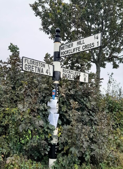
Metal Bridge is a small settlement in Cumbria, England between Carlisle and Gretna, formerly on the main A74 road. The settlement consists of a few properties...

River Lyne

The River Lyne is a river of Cumbria in England. The river is formed near the hamlet of Stapleton, five miles west of Bewcastle, by the confluence of the...

Floriston railway station

Floriston railway station was a station which served the rural area around Floristonrigg, Rockcliffe Parish, south of Gretna in the English county of Cumberland...

River Esk, Dumfries and Galloway

The River Esk (Scottish Gaelic: Easg), also known as the Border Esk, is a river in Dumfries and Galloway, Scotland, that enters the English county of Cumbria...

Rockcliffe Cross

Rockcliffe Cross is a village in the parish of Rockcliffe, in the City of Carlisle district of the county of Cumbria, England. == Location == It is located...

Todhills, Cumbria

Todhills is a small village on the outskirts of Carlisle, Cumbria, England. The village's name is from Old English tota-hyll "look-out hill". Located north...

2020s in United Kingdom political history

2020s political history refers to significant political and societal historical events in the United Kingdom in the 2020s, presented as a historical overview...

United Kingdom

The United Kingdom of Great Britain and Northern Ireland, commonly known as the United Kingdom (UK) or Britain, is a country in Northwestern Europe, off...

Nearby Amenities

Located within 500m of 54.973749,-3.0087014
Source: PGS
Lat/Long: 54.9748565/-3.0100307
Source: PGS
Lat/Long: 54.9751261/-3.0093548
Source: PGS
Lat/Long: 54.9751391/-3.0089605
Source: PGS
Lat/Long: 54.9754257/-3.0083042
Source: PGS
Lat/Long: 54.9756396/-3.0077657
Source: PGS
Lat/Long: 54.9758544/-3.0073808
Source: PGS
Lat/Long: 54.9760932/-3.0069048
Source: PGS
Lat/Long: 54.9763223/-3.006383
Source: PGS
Lat/Long: 54.9765592/-3.0058846
Source: PGS
Lat/Long: 54.9767835/-3.0054728
Source: PGS
Lat/Long: 54.9771599/-3.0048627
Source: PGS
Lat/Long: 54.977071/-3.0036241
Source: PGS
Lat/Long: 54.9766733/-3.0043111
Source: PGS
Lat/Long: 54.976415/-3.0047161
Source: PGS
Lat/Long: 54.9762043/-3.0051371
Source: PGS
Lat/Long: 54.9759506/-3.0056359
Source: PGS
Lat/Long: 54.9756713/-3.0061081
Source: PGS
Lat/Long: 54.9754314/-3.0065812
Source: PGS
Lat/Long: 54.9751754/-3.0070982
Source: PGS
Lat/Long: 54.974793/-3.0079612
Source: PGS
Lat/Long: 54.9745853/-3.008158
Source: PGS
Lat/Long: 54.9742342/-3.0088292
Source: PGS
Lat/Long: 54.9745402/-3.0094196
Metal Bridge
Place: hamlet
Source: NPE
Wikidata: Q15058953
Wikipedia: en:Metal Bridge, Cumbria
Lat/Long: 54.9749203/-3.0088418
Created By: Merkaartor 0.12
Lat/Long: 54.9721518/-3.0064558
Created By: Merkaartor 0.12
Lat/Long: 54.9724443/-3.0068635
Created By: Merkaartor 0.12
Lat/Long: 54.9735949/-3.008256
Created By: Merkaartor 0.12
Lat/Long: 54.9738945/-3.0085104
Created By: Merkaartor 0.12
Lat/Long: 54.9740977/-3.0088054
Created By: Merkaartor 0.12
Lat/Long: 54.9742086/-3.0086606
Bus Stop
Metal Bridge
Local Ref: AT
Naptan AtcoCode: 090033221376
Naptan Bearing: S
Naptan CommonName: Metal Bridge
Naptan Indicator: at
Naptan Landmark: junction with road to Metal Bridge
Naptan NaptanCode: cumapwta
Naptan Street: A74(T)
Naptan Verified: no
Source: naptan_import
Lat/Long: 54.9730806/-3.006936
Bus Stop
Metal Bridge out
Local Ref: AT
Naptan AtcoCode: 090033223607
Naptan Bearing: NW
Naptan BusStopType: CUS
Naptan CommonName: Metal Bridge out
Naptan Indicator: At
Naptan Landmark: Metal Bridge junction
Naptan NaptanCode: cumatadt
Naptan Street: A74
Naptan Verified: no
Source: naptan_import
Lat/Long: 54.9721132/-3.0058762
Phone
Check Date: 2022-08-15
Emergency: phone
Lat/Long: 54.9706364/-3.0039231
Phone
Check Date: 2022-08-15
Emergency: phone
Lat/Long: 54.9708861/-3.003597
Pro Paintball
Addr Postcode: CA6 4HG
Leisure: sports_centre
Lat/Long: 54.970951/-3.0058021
Ford: yes
Lat/Long: 54.9730628/-3.0117057
Power: pole
Lat/Long: 54.9719608/-3.0064706
Power: pole
Lat/Long: 54.976311/-3.0077828
Power: pole
Lat/Long: 54.9769613/-3.0065251
Power: pole
Lat/Long: 54.977606/-3.0052746
The data included in this document is from www.openstreetmap.org. The data is made available under ODbL.

Have you been to Metal Bridge?

Leave your review of Metal Bridge below (or comments, questions and feedback).