Martletwy Cross

Settlement in Pembrokeshire

Wales

Martletwy Cross

Minwear Church and farm Minwear Church was founded by the Norman knight Lodomer and was granted to the knights at Slebech in 1150.
Minwear Church and farm Credit: Deborah Tilley

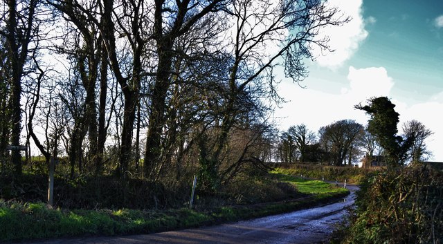
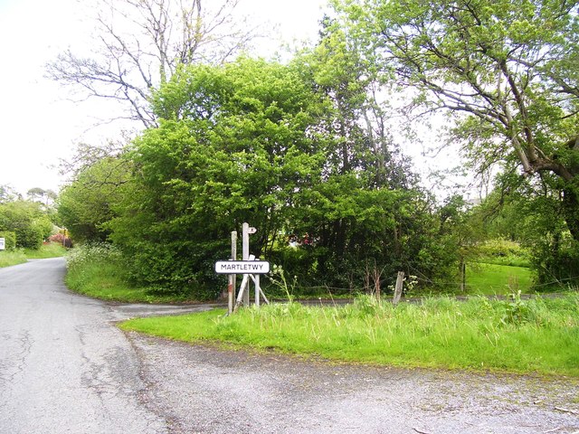
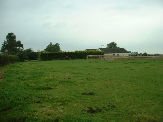
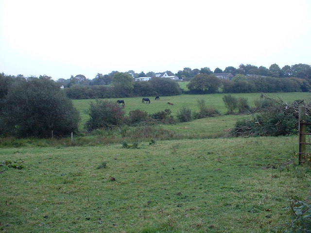
Martletwy Cross is a small village located in Pembrokeshire, Wales. Situated near the town of Narberth, Martletwy Cross is known for its picturesque countryside and rural charm. The village is surrounded by rolling hills, lush green fields, and meandering streams, creating a tranquil and idyllic setting.

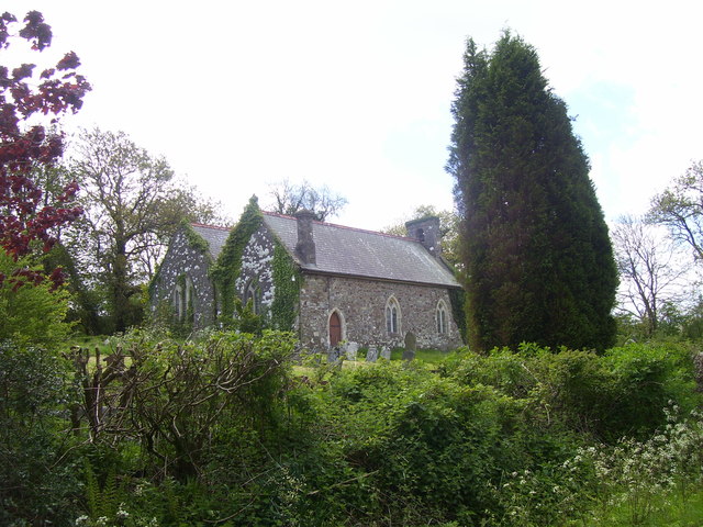
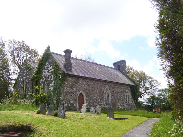
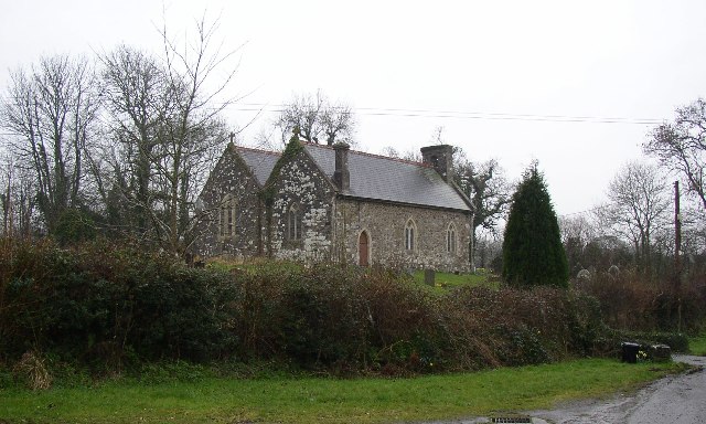
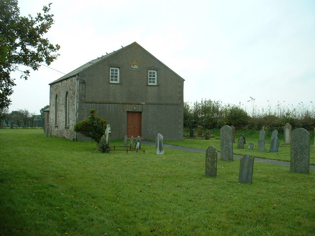
Martletwy Cross is home to a close-knit community of residents who take pride in their village and its heritage. The village features a mix of traditional Welsh cottages and modern homes, giving it a unique and charming character. The local church, St. Marcellus, is a prominent landmark in the village and dates back to the 12th century.

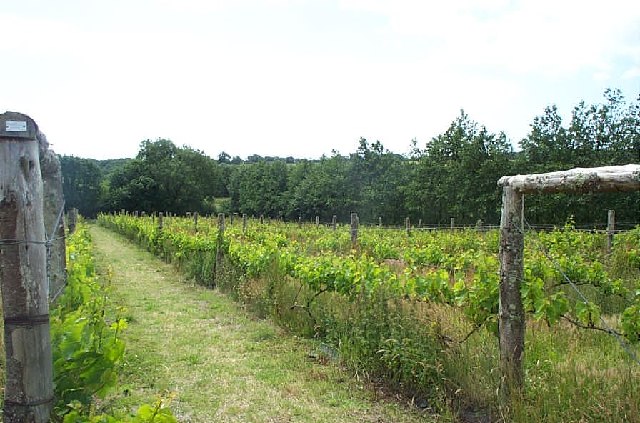
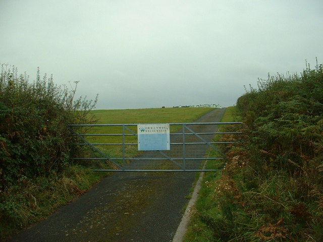
The surrounding area offers plenty of opportunities for outdoor activities such as hiking, cycling, and fishing. The nearby Cleddau River provides a scenic backdrop for leisurely walks and picnics. Martletwy Cross is also conveniently located near the Pembrokeshire Coast National Park, offering stunning coastal views and sandy beaches just a short drive away.

Overall, Martletwy Cross is a peaceful and welcoming village that provides a true taste of rural Welsh life.

If you have any feedback on the listing, please let us know in the comments section below.

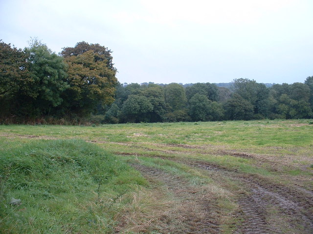
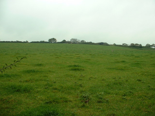
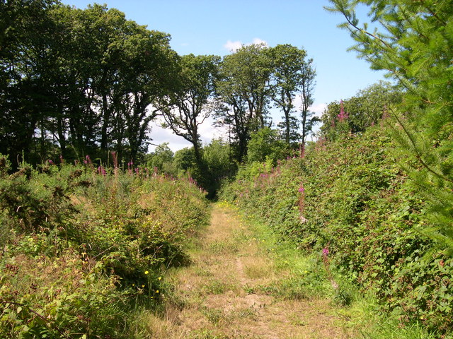
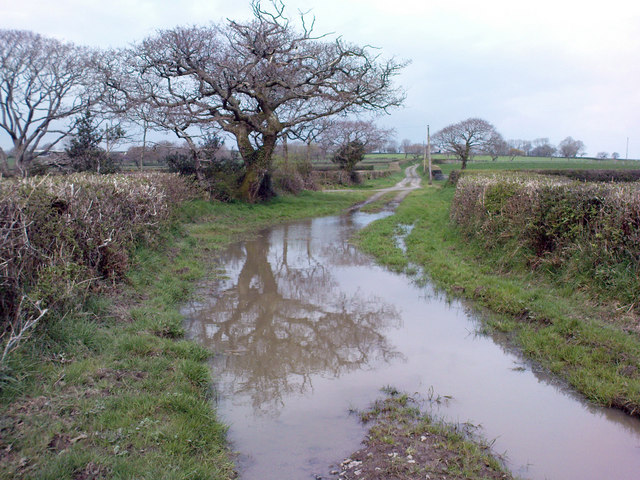
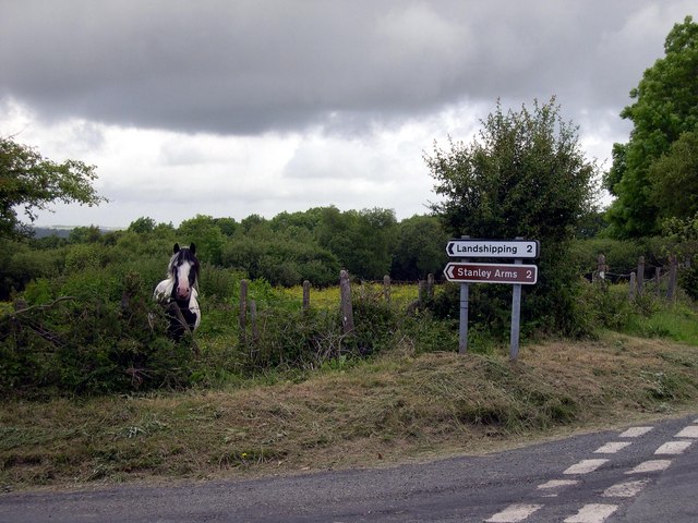
Martletwy Cross Images

Images are sourced within 2km of 51.763578/-4.8400398 or Grid Reference SN0411. Thanks to Geograph Open Source API. All images are credited.

Minwear Church and farm Minwear Church was founded by the Norman knight Lodomer and was granted to the knights at Slebech in 1150.
Minwear Church and farm
Minwear Church was founded by the Norman knight Lodomer and was granted to the knights at Slebech in 1150.
Lane to Minwear Church and Farm Leading on to the Sisters' House across the fields.
Lane to Minwear Church and Farm
Leading on to the Sisters' House across the fields.
St Marcellus Church, Martletwy
Martletwy Village Sign
Cwm Deri Vineyard The vineyard is now the largest in Wales.
Cwm Deri Vineyard
The vineyard is now the largest in Wales.
Martletwy Church St Marcellus's Church has nave, chancel, and an aisle the same width as the nave, with a bellcote at the western end.  It was much rebuilt in 1848-50 and the interior restored in 1896-7, but the chancel arch is probably 13C and there is a south porch of the 16C or 17C with a round arched doorway having a sundial carved into one of its arch-stones.  The font is Norman, with a square bowl with panelled sides.  The church is at SN033106.
Martletwy Church
St Marcellus's Church has nave, chancel, and an aisle the same width as the nave, with a bellcote at the western end. It was much rebuilt in 1848-50 and the interior restored in 1896-7, but the chancel arch is probably 13C and there is a south porch of the 16C or 17C with a round arched doorway having a sundial carved into one of its arch-stones. The font is Norman, with a square bowl with panelled sides. The church is at SN033106.
Green Plain bungalow Not shown on the 1:50,000 map, but it is on the 1:25,000. It is close to Green Plain farm.
Green Plain bungalow
Not shown on the 1:50,000 map, but it is on the 1:25,000. It is close to Green Plain farm.
Welsh Water road It's not apparent from the map, or by sight, what this track leads to - it just seems to finish on Beacon Hill.
Welsh Water road
It's not apparent from the map, or by sight, what this track leads to - it just seems to finish on Beacon Hill.
Chapel at Martletwy Cross
Farmland near Weston Lane Farm The farm is visible in the distance.
Farmland near Weston Lane Farm
The farm is visible in the distance.
The road to Landshipping I couldn't find the derivation of this somewhat curious name, but the area is a very ancient mining area in the Pembrokeshire coal fields which used quays at Landshipping Ferry and Landshipping Quay to transport the coal.
The road to Landshipping
I couldn't find the derivation of this somewhat curious name, but the area is a very ancient mining area in the Pembrokeshire coal fields which used quays at Landshipping Ferry and Landshipping Quay to transport the coal.
Development at Whitlow farm
Woodland near Nash Farm Nash Farm is beyond the trees, which conceal the valley of Minwear Brook.
Woodland near Nash Farm
Nash Farm is beyond the trees, which conceal the valley of Minwear Brook.
Broomhill Farm The farm is just visible on the horizon.
Broomhill Farm
The farm is just visible on the horizon.
Martletwy Wood
Martletwy Wood
Track to Flimstone and Highgate Farm An extremely deep puddle in the track to Flimstone and Highgate farm. The track to the left leads to Eweton Farm buildings. There is also an unmarked track that leads to Knapps farm on the right.
Track to Flimstone and Highgate Farm
An extremely deep puddle in the track to Flimstone and Highgate farm. The track to the left leads to Eweton Farm buildings. There is also an unmarked track that leads to Knapps farm on the right.
Road junction to Landshipping
Show me another place!

Martletwy Cross is located at Grid Ref: SN0411 (Lat: 51.763578, Lng: -4.8400398)

Unitary Authority: Pembrokeshire

Police Authority: Dyfed Powys

What 3 Words

///swaps.above.drifters. Near Llangwm, Pembrokeshire

Related Wikis

Martletwy

Martletwy is a village, parish and community in the county of Pembrokeshire, Wales. == Description == Martletwy lies in south of the county, the nearest...

Martletwy (electoral ward)

Martletwy is the name of an electoral ward in Pembrokeshire, Wales. It is bordered to the west by the River Cleddau and includes three communities within...

Minwear

Minwear is a former parish and village in the community of Martletwy, in the county of Pembrokeshire, Wales, on the Eastern Cleddau river, 4+1⁄2 miles...

Minwear Wood

Minwear Wood is a Site of Special Scientific Interest (or SSSI) in Pembrokeshire, South Wales. It has been designated as a Site of Special Scientific Interest...

Nearby Amenities

Located within 500m of 51.763578,-4.8400398
Martletwy Cross
Junction: yes
Lat/Long: 51.7636139/-4.8400849
Give Way
Direction: backward
Lat/Long: 51.765159/-4.8400008
Give Way
Direction: forward
Lat/Long: 51.7635972/-4.8400549
Give Way
Direction: backward
Lat/Long: 51.7674366/-4.8404685
Power: pole
Lat/Long: 51.7622208/-4.8405156
Power: pole
Lat/Long: 51.761585/-4.8409742
Power: pole
Lat/Long: 51.7613592/-4.8426211
Power: pole
Lat/Long: 51.7611866/-4.8437557
Power: pole
Lat/Long: 51.7608836/-4.8458532
Power: pole
Lat/Long: 51.7655492/-4.8387024
Power: pole
Lat/Long: 51.7653417/-4.839963
Power: pole
Lat/Long: 51.7650877/-4.8411566
Power: pole
Lat/Long: 51.7648769/-4.8422536
Power: pole
Lat/Long: 51.7646727/-4.8433775
Power: pole
Lat/Long: 51.7643432/-4.8441459
Power: pole
Lat/Long: 51.761766/-4.8449037
Power: pole
Lat/Long: 51.7623968/-4.844901
Power: pole
Lat/Long: 51.7633414/-4.8449385
Power: pole
Lat/Long: 51.7640535/-4.8449627
Power: pole
Lat/Long: 51.7648122/-4.8449466
Power: pole
Lat/Long: 51.7656504/-4.8449573
Power: pole
Lat/Long: 51.7610285/-4.8449252
The data included in this document is from www.openstreetmap.org. The data is made available under ODbL.

Have you been to Martletwy Cross?

Leave your review of Martletwy Cross below (or comments, questions and feedback).