Manorside

Settlement in Monmouthshire

Wales

Manorside

Old Baptist Chapel at Whitebrook Churches and chapels no. 49. The old Baptist Chapel is on a very steep descent from Pen-y-Fan. Built in 1829 now converted to a dwelling.
Old Baptist Chapel at Whitebrook Credit: Andy Stott

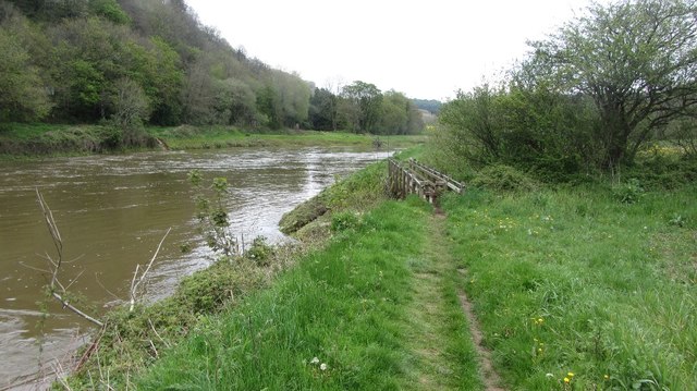
Manorside is a picturesque village located in Monmouthshire, Wales. Situated on the banks of the River Wye, it is surrounded by stunning natural beauty and offers a peaceful and idyllic setting for its residents and visitors.

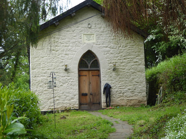
The village is known for its charming cottages and traditional stone houses that line its streets. Many of these buildings date back several centuries, adding to the village's historic appeal. Manorside is proud of its heritage, and local residents actively preserve and maintain the architectural integrity of the area.

The community thrives on its close-knit atmosphere, with a population of approximately 500 residents. The village has a strong sense of community spirit, with regular events and activities organized by local groups. These include seasonal fairs, craft markets, and community gatherings that bring residents together.

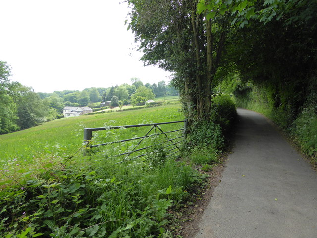
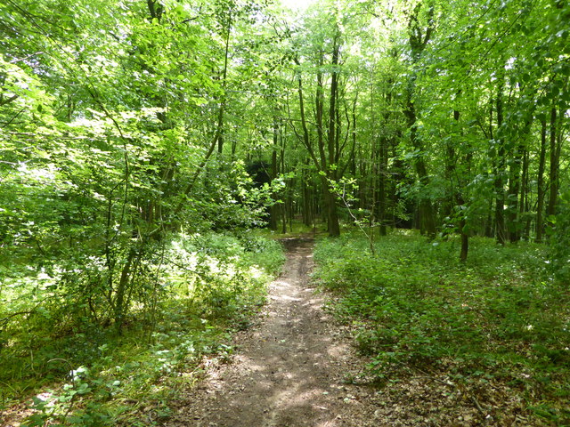
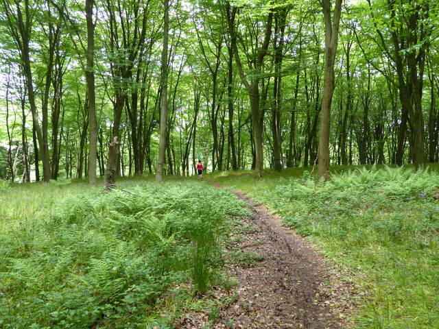
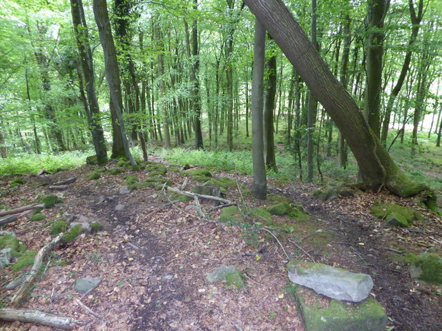
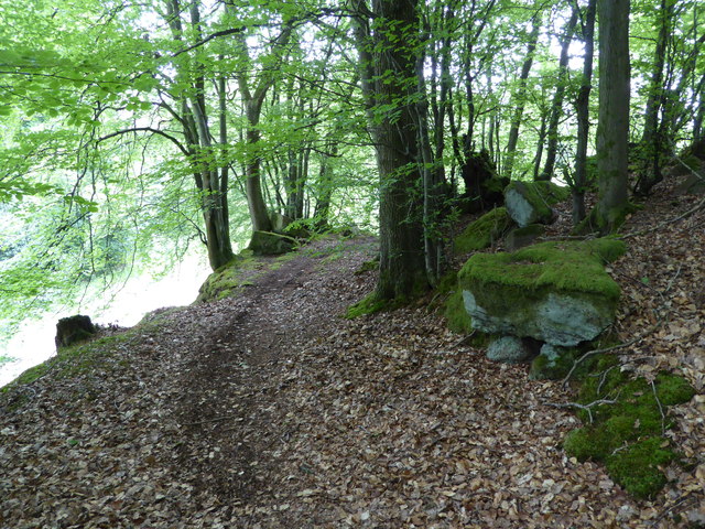
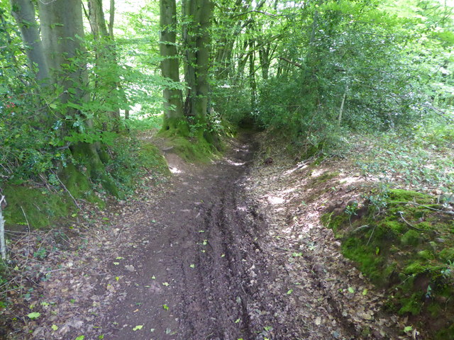
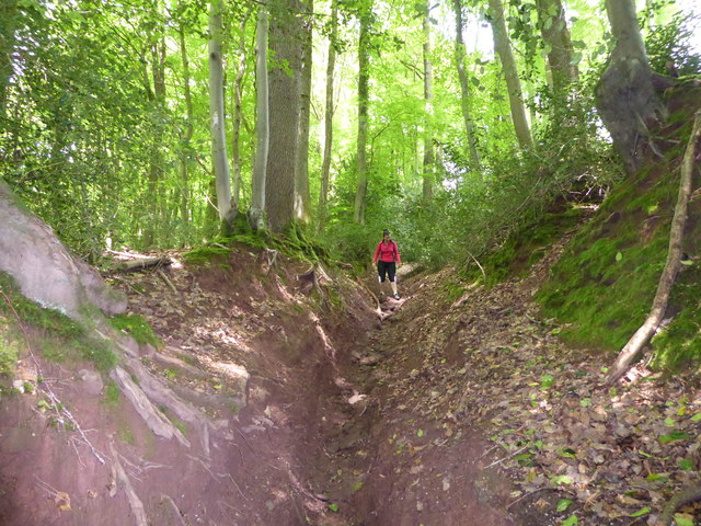
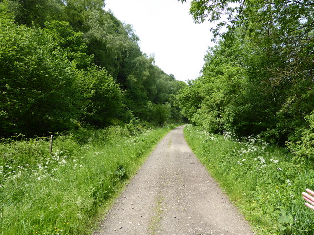
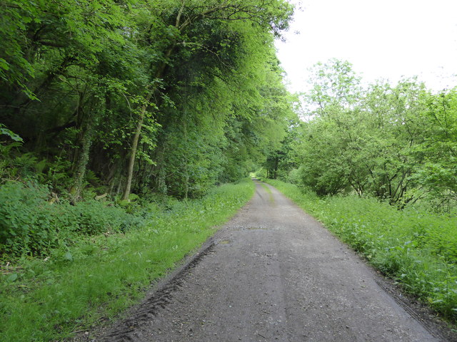
Manorside benefits from its proximity to the stunning countryside that surrounds it. The rolling hills, woodlands, and meandering River Wye offer endless opportunities for outdoor activities such as hiking, fishing, and birdwatching. The village is also a popular destination for nature enthusiasts and tourists seeking a tranquil retreat away from the hustle and bustle of city life.

In terms of amenities, Manorside has a small but well-stocked village shop, a cozy pub serving traditional Welsh cuisine, and a primary school that caters to the local children. For more extensive amenities, the nearby town of Monmouth is easily accessible, offering a wider range of shops, restaurants, and leisure facilities.

Overall, Manorside is a charming village that combines natural beauty, a strong community spirit, and a rich historical heritage. It is a hidden gem in Monmouthshire, attracting those seeking a peaceful lifestyle in a picturesque setting.

If you have any feedback on the listing, please let us know in the comments section below.

Manorside Images

Images are sourced within 2km of 51.74995/-2.6909018 or Grid Reference SO5205. Thanks to Geograph Open Source API. All images are credited.

Old Baptist Chapel at Whitebrook Churches and chapels no. 49. The old Baptist Chapel is on a very steep descent from Pen-y-Fan. Built in 1829 now converted to a dwelling.
Old Baptist Chapel at Whitebrook
Churches and chapels no. 49. The old Baptist Chapel is on a very steep descent from Pen-y-Fan. Built in 1829 now converted to a dwelling.
Monmouthshire lane near Tre-gagle One of my fave areas in this blessed county.
Monmouthshire lane near Tre-gagle
One of my fave areas in this blessed county.
Footpath into the woods Nice May walking.
Footpath into the woods
Nice May walking.
A walk in the woods Nice walking.
A walk in the woods
Nice walking.
On a path in the woods Mountain bikers seem to like riding under this leaning tree.
On a path in the woods
Mountain bikers seem to like riding under this leaning tree.
Old path in the wood We discovered this old route.
Old path in the wood
We discovered this old route.
Old sunken way in the wood Now much used by mountain bikes and scramblers.
Old sunken way in the wood
Now much used by mountain bikes and scramblers.
Old sunken way in the wood Used and it seems abused by motorbike scramblers. The track has been eroded.
Old sunken way in the wood
Used and it seems abused by motorbike scramblers. The track has been eroded.
In the wood above Whitebrook, Mnmouthshire The village emerges beneath us.
In the wood above Whitebrook, Mnmouthshire
The village emerges beneath us.
Part of Whitebrook village The old Trinity church is now a holiday let I believe.
Part of Whitebrook village
The old Trinity church is now a holiday let I believe.
In Whitebrook village A house here, once a pub I believe.
In Whitebrook village
A house here, once a pub I believe.
Farm house at Whitebrook A handsome place.
Farm house at Whitebrook
A handsome place.
Beside the Wye at Whitebrook, Monmouthshire A dairy herd graze here beside the river.
Beside the Wye at Whitebrook, Monmouthshire
A dairy herd graze here beside the river.
On the Wye Valley Walk north of Whitebrook On the old railway line.
On the Wye Valley Walk north of Whitebrook
On the old railway line.
Part of the River Wye / Afon Gwy north of Whitebrook A family group has alighted from their Canadian canoes and is settling on the English river bank meadow for their lunch. Lucky peeps.
Part of the River Wye / Afon Gwy north of Whitebrook
A family group has alighted from their Canadian canoes and is settling on the English river bank meadow for their lunch. Lucky peeps.
On the Wye Valley Walk between Whitebrook and Redbrook On the Welsh bank heading north on the old railway line.
On the Wye Valley Walk between Whitebrook and Redbrook
On the Welsh bank heading north on the old railway line.
Bigsweir Bridge View over oilseed rape on the west side of the Wye.
Bigsweir Bridge
View over oilseed rape on the west side of the Wye.
River Wye below Bigsweir Bridge The footbridge crosses the Mork Brook.
River Wye below Bigsweir Bridge
The footbridge crosses the Mork Brook.
Show me another place!

Manorside is located at Grid Ref: SO5205 (Lat: 51.74995, Lng: -2.6909018)

Unitary Authority: Monmouthshire

Police Authority: Gwent

What 3 Words

///rejects.gender.ratio. Near Mitchel Troy, Monmouthshire

Related Wikis

The Narth

The Narth (Welsh: Pennarth) is a village in Monmouthshire, Wales. It is located about 6 miles (9.7 km) south of Monmouth, and about 2 miles (3.2 km) east...

Maryland, Monmouthshire

Maryland is a small village in Monmouthshire, Wales. == Geography == Maryland is located six miles south east of Monmouth. It is situated in what is now...

The Whitebrook

The Whitebrook, formerly known as The Crown at Whitebrook, is a restaurant with rooms in Whitebrook, 6 miles (9.7 km) south-south-east of Monmouth, Monmouthshire...

Whitebrook

Whitebrook (Welsh: Gwenffrwd) is a small village in Monmouthshire, south-east Wales, United Kingdom. It is located four miles south east of Monmouth in...

Nearby Amenities

Located within 500m of 51.74995,-2.6909018
Manorside
Place: hamlet
Lat/Long: 51.7495297/-2.6909882
Barrier: lift_gate
Lat/Long: 51.7458025/-2.6888676
Direction: 175
Generator Method: photovoltaic
Generator Output Electricity: yes
Generator Solar Modules: 3
Generator Source: solar
Generator Type: solar_photovoltaic_panel
Location: roof
Power: generator
Lat/Long: 51.7521446/-2.695152
Direction: 175
Generator Method: photovoltaic
Generator Output Electricity: yes
Generator Solar Modules: 3
Generator Source: solar
Generator Type: solar_photovoltaic_panel
Location: roof
Power: generator
Lat/Long: 51.7521405/-2.6952539
Direction: 175
Generator Method: photovoltaic
Generator Output Electricity: yes
Generator Solar Modules: 6
Generator Source: solar
Generator Type: solar_photovoltaic_panel
Location: roof
Power: generator
Lat/Long: 51.7522077/-2.6952405
Direction: 80
Generator Method: photovoltaic
Generator Output Electricity: yes
Generator Solar Modules: 8
Generator Source: solar
Generator Type: solar_photovoltaic_panel
Location: roof
Power: generator
Lat/Long: 51.7515796/-2.6943068
Direction: 260
Generator Method: photovoltaic
Generator Output Electricity: yes
Generator Solar Modules: 8
Generator Source: solar
Generator Type: solar_photovoltaic_panel
Location: roof
Power: generator
Lat/Long: 51.7515743/-2.6943571
Direction: 145
Generator Method: photovoltaic
Generator Output Electricity: yes
Generator Solar Modules: 10
Generator Source: solar
Generator Type: solar_photovoltaic_panel
Location: roof
Power: generator
Lat/Long: 51.7543829/-2.6897044
Direction: 235
Generator Method: photovoltaic
Generator Output Electricity: yes
Generator Solar Modules: 6
Generator Source: solar
Generator Type: solar_photovoltaic_panel
Location: roof
Power: generator
Lat/Long: 51.7538598/-2.6915753
Direction: 235
Generator Method: photovoltaic
Generator Output Electricity: yes
Generator Solar Modules: 10
Generator Source: solar
Generator Type: solar_photovoltaic_panel
Location: roof
Power: generator
Lat/Long: 51.7537768/-2.6914868
Direction: SE
Generator Method: photovoltaic
Generator Output Electricity: yes
Generator Solar Modules: 12
Generator Source: solar
Generator Type: solar_photovoltaic_panel
Location: roof
Power: generator
Lat/Long: 51.752865/-2.6929576
Direction: 145
Generator Method: photovoltaic
Generator Output Electricity: yes
Generator Solar Modules: 14
Generator Source: solar
Generator Type: solar_photovoltaic_panel
Location: roof
Power: generator
Lat/Long: 51.7529614/-2.693194
Direction: SSE
Generator Method: photovoltaic
Generator Output Electricity: yes
Generator Solar Modules: 16
Generator Source: solar
Generator Type: solar_photovoltaic_panel
Location: roof
Power: generator
Lat/Long: 51.749257/-2.688944
Defibrillator
Access: yes
Defibrillator Location: outside Narth Village Hall
Emergency: defibrillator
Indoor: no
Lat/Long: 51.7533834/-2.6920119
Entrance: yes
Lat/Long: 51.7533079/-2.6920286
Advertising: board
Lat/Long: 51.7532793/-2.6918591
The data included in this document is from www.openstreetmap.org. The data is made available under ODbL.

Have you been to Manorside?

Leave your review of Manorside below (or comments, questions and feedback).