Mahollam

Settlement in Herefordshire

England

Mahollam

Park Wood The tree on the left is an import from Burma, Juniperus recurva coxii.
Park Wood Credit: Jonathan Billinger

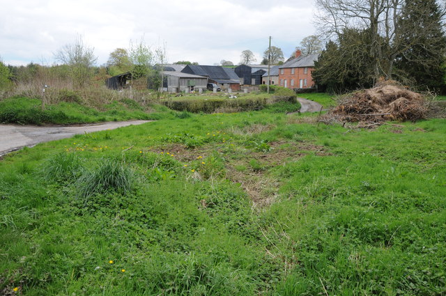
Mahollam is a charming village located in the county of Herefordshire, England. Situated in the picturesque Wye Valley, this idyllic rural community exudes a tranquil ambiance and is surrounded by stunning natural beauty. With a population of around 500 residents, Mahollam offers a close-knit community atmosphere that is cherished by both locals and visitors alike.

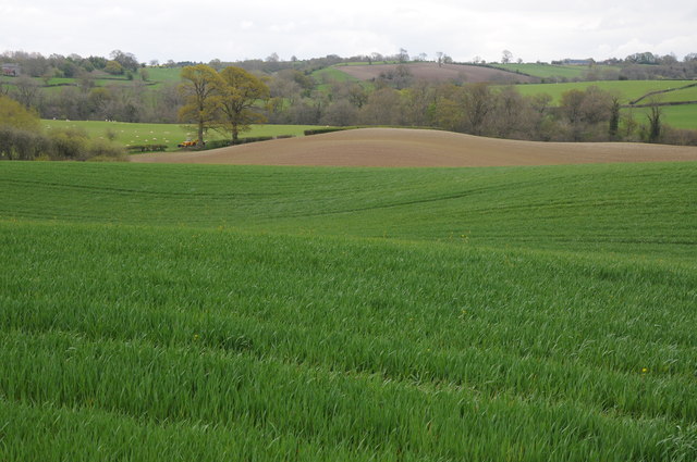
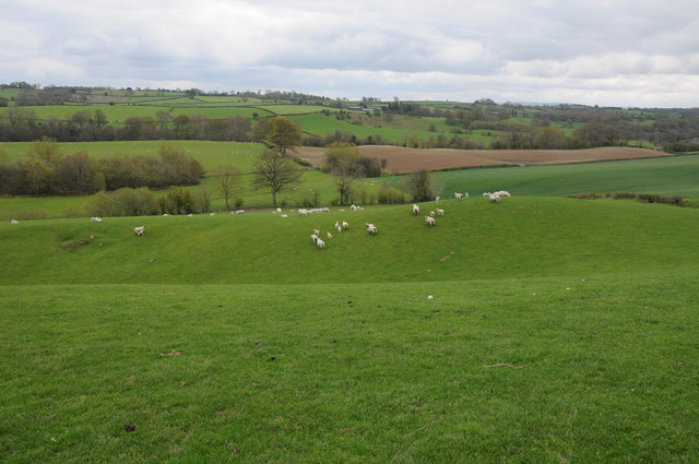
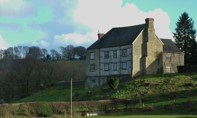
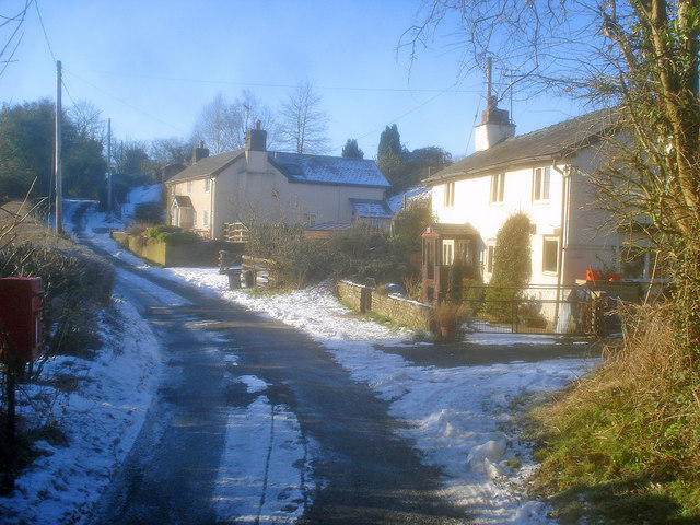
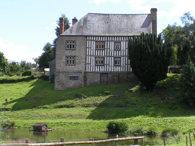
The village is characterized by its well-preserved historic buildings, showcasing a blend of architectural styles from different periods. Strolling through its narrow streets, one can admire the traditional timber-framed houses, quaint cottages, and the iconic village church, which dates back to the 12th century. The surrounding countryside provides breathtaking views, with rolling hills, meandering rivers, and lush green fields stretching as far as the eye can see.

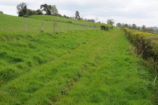
Nature enthusiasts will find plenty to explore in Mahollam and its surroundings. The village is a gateway to the nearby Herefordshire Beacon, a prominent hill that offers panoramic vistas of the Herefordshire countryside. The area is also known for its scenic walking trails, where visitors can immerse themselves in the beauty of the Wye Valley Area of Outstanding Natural Beauty.

In terms of amenities, Mahollam boasts a charming village pub, where locals and visitors can enjoy a pint of locally brewed ale and savor hearty pub meals. The village also hosts an annual summer fair, which showcases local crafts, produce, and entertainment, adding to the community spirit.

Overall, Mahollam is a hidden gem in Herefordshire, offering a picturesque setting and a warm community atmosphere that captivates all who visit.

If you have any feedback on the listing, please let us know in the comments section below.
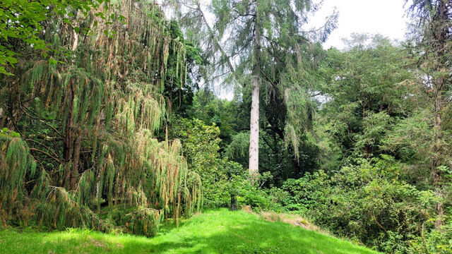
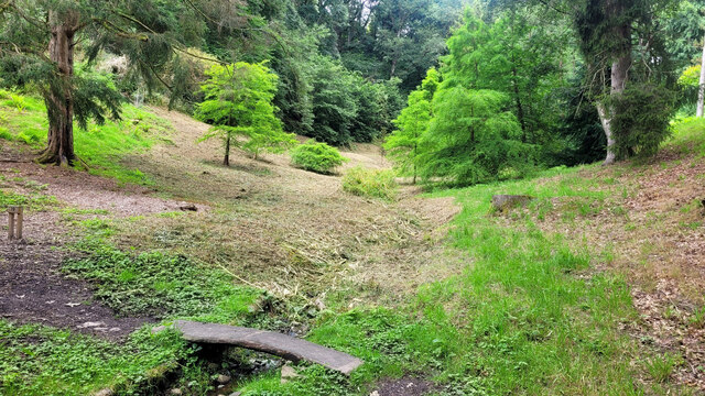
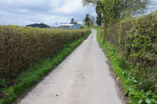
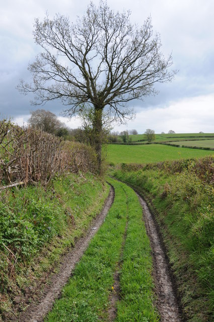
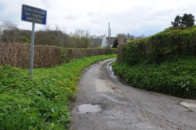
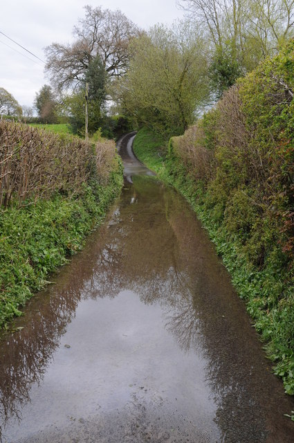
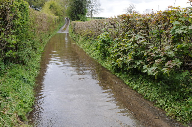
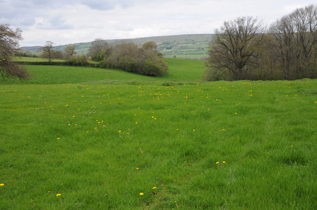
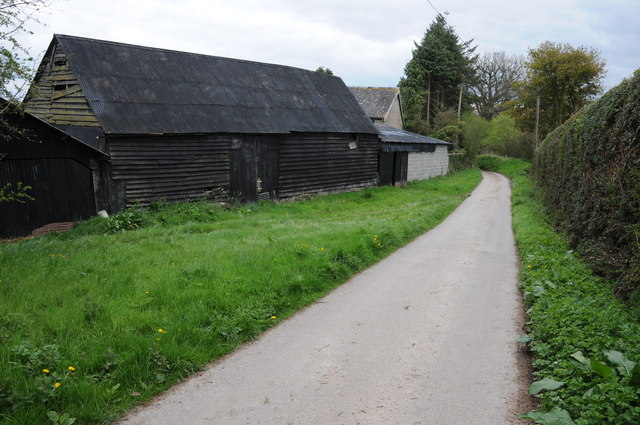
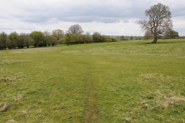
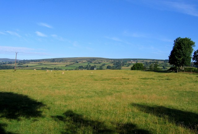
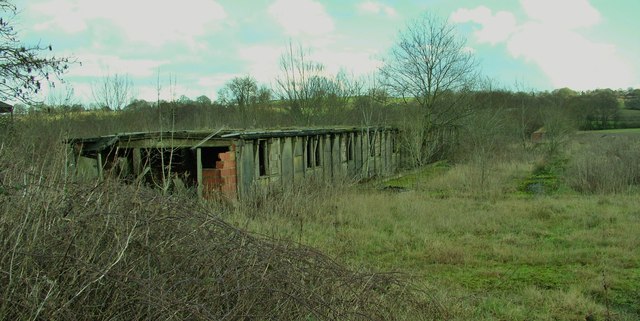
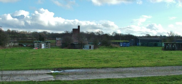
Mahollam Images

Images are sourced within 2km of 52.18172/-3.0672434 or Grid Reference SO2754. Thanks to Geograph Open Source API. All images are credited.

Park Wood The tree on the left is an import from Burma, Juniperus recurva coxii.
Park Wood
The tree on the left is an import from Burma, Juniperus recurva coxii.
Tiny footbridge The circular path around Hergest Croft's Park Wood Garden crosses the stream at the lowest end of the valley.
Tiny footbridge
The circular path around Hergest Croft's Park Wood Garden crosses the stream at the lowest end of the valley.
Road to Lodge Farm, Huntington A footpath follows this road which gives access to Lodge Farm.
Road to Lodge Farm, Huntington
A footpath follows this road which gives access to Lodge Farm.
Track below Empton Farm Track above the River Arrow leading from the river to a country road near Empton Farm.
Track below Empton Farm
Track above the River Arrow leading from the river to a country road near Empton Farm.
Chickward Farm, Chickward The hamlet of Chickward is no more than a couple of farms.
Chickward Farm, Chickward
The hamlet of Chickward is no more than a couple of farms.
The Arrow valley, Huntington The Arrow valley near Lodge Farm, Huntington
The Arrow valley, Huntington
The Arrow valley near Lodge Farm, Huntington
Footpath near Lodge Farm Footpath and farmland track near Lodge Farm, Huntington.
Footpath near Lodge Farm
Footpath and farmland track near Lodge Farm, Huntington.
Rolling farmland, Huntington Rolling ridges are a feature of the land in this part of the Arrow valley near Huntington.
Rolling farmland, Huntington
Rolling ridges are a feature of the land in this part of the Arrow valley near Huntington.
Road near Park Stile Mill The sign reads 'Unsuitable for motor vehicles', in fact there is just a short section of metalled road before is becomes a rough track which then fords the River Arrow.  On this occasion after a period of heavy rainfall the river is in spate and the track very wet indeed.
Road near Park Stile Mill
The sign reads 'Unsuitable for motor vehicles', in fact there is just a short section of metalled road before is becomes a rough track which then fords the River Arrow. On this occasion after a period of heavy rainfall the river is in spate and the track very wet indeed.
Standing water on a country road After heavy recent rainfall, water is flowing onto this country road and flooding it.
Standing water on a country road
After heavy recent rainfall, water is flowing onto this country road and flooding it.
Water on the road After heavy recent rainfall, water is flowing onto this country road and flooding it.
Water on the road
After heavy recent rainfall, water is flowing onto this country road and flooding it.
Farmland near Huntington View across farmland near Huntington, with Hergest Ridge in the background.
Farmland near Huntington
View across farmland near Huntington, with Hergest Ridge in the background.
Farm buildings at Chickward Roadside farm buildings at Chickward.
Farm buildings at Chickward
Roadside farm buildings at Chickward.
The Herefordshire Trail The Herefordshire Trail to the south of Chickward.
The Herefordshire Trail
The Herefordshire Trail to the south of Chickward.
View towards Hergest Ridge View across the fields from Kingswood towards Hergest Ridge.
View towards Hergest Ridge
View across the fields from Kingswood towards Hergest Ridge.
Kington Camp ruins One of the derelict buildings remaining at Kington Camp on the Brilley Road, South-West of Kington. Built for use "by the British as a re-grouping point after Dunkirk, by the Americans as a major hospital installation, and after the war by the Polish Resettlement Corps". One of a number of these buildings that still remain on the site that has been used as a semi-industrial estate since WW2. See the excellent KINGTON CAMP website for more information.
<span class="nowrap"><a title="http://www.kingtoncamp.co.uk" rel="nofollow ugc noopener" href="http://www.kingtoncamp.co.uk">Link</a><img style="margin-left:2px;" alt="External link" title="External link - shift click to open in new window" src="https://s1.geograph.org.uk/img/external.png" width="10" height="10"/></span>
Kington Camp ruins
One of the derelict buildings remaining at Kington Camp on the Brilley Road, South-West of Kington. Built for use "by the British as a re-grouping point after Dunkirk, by the Americans as a major hospital installation, and after the war by the Polish Resettlement Corps". One of a number of these buildings that still remain on the site that has been used as a semi-industrial estate since WW2. See the excellent KINGTON CAMP website for more information. LinkExternal link
Kington Camp derelict buildings One of the derelict buildings remaining at Kington Camp on the Brilley Road, South-West of Kington. See the excellent KINGTON CAMP website for more information.
<span class="nowrap"><a title="http://www.kingtoncamp.co.uk" rel="nofollow ugc noopener" href="http://www.kingtoncamp.co.uk">Link</a><img style="margin-left:2px;" alt="External link" title="External link - shift click to open in new window" src="https://s1.geograph.org.uk/img/external.png" width="10" height="10"/></span>
Kington Camp derelict buildings
One of the derelict buildings remaining at Kington Camp on the Brilley Road, South-West of Kington. See the excellent KINGTON CAMP website for more information. LinkExternal link
Hergest Court, near Kington, Herefordshire. Hergest Court to the West of kington in Herefordshire,
<span class="nowrap"><a title="http://en.wikipedia.org/wiki/Red_Book_of_Hergest" rel="nofollow ugc noopener" href="http://en.wikipedia.org/wiki/Red_Book_of_Hergest">Link</a><img style="margin-left:2px;" alt="External link" title="External link - shift click to open in new window" src="https://s1.geograph.org.uk/img/external.png" width="10" height="10"/></span>
Hergest Court, near Kington, Herefordshire.
Hergest Court to the West of kington in Herefordshire, LinkExternal link
Show me another place!

Mahollam is located at Grid Ref: SO2754 (Lat: 52.18172, Lng: -3.0672434)

Unitary Authority: County of Herefordshire

Police Authority: West Merica

What 3 Words

///empires.blackmail.declares. Near Kington, Herefordshire

Nearby Locations

Mahollam

Related Wikis

Upper Hergest

Upper Hergest is a hamlet in Herefordshire, England. == References ==

Lower Hergest

Lower Hergest is a hamlet in Herefordshire, England.The local manor house, Hergest Court, is a Grade II* listed building built of a mixture of stone and...

Kington Rural

Kington Rural is a civil parish in west Herefordshire, England, and is approximately 17 miles (30 km) north-west from the city and county town of Hereford...

Huntington, Herefordshire

Huntington is a village and civil parish in Herefordshire, England, and on the border with Wales. == History == Huntington was a Medieval borough founded...

Huntington Castle

Huntington Castle was situated in the village of Huntington in Herefordshire, England, 2+1⁄2 miles south-west of Kington (grid reference SO249539). �...

Hergest Ridge

Hergest Ridge is a large elongated hill which traverses the border between England and Wales in the United Kingdom, between the town of Kington in Herefordshire...

The Recreation Ground, Kington

The Recreation Ground is a cricket ground in Kington, Herefordshire. The first recorded match on the ground was in 1996, when Herefordshire played Wales...

Lady Hawkins' School

Lady Hawkins' School is a 11-16 secondary school in Kington, Herefordshire. The headteacher is Paul Jennings.The school comprises two houses named after...

Nearby Amenities

Located within 500m of 52.18172,-3.0672434
Mahollam Farm
Naptan AtcoCode: 2090A20968
Naptan Bearing: SW
Naptan BusStopType: CUS
Naptan CommonName: Mahollam Farm
Naptan Indicator: opp
Naptan Landmark: Farm
Naptan NaptanCode: herapwjw
Naptan Street: Mahollam Road
Naptan Verified: no
Source: naptan_import
Lat/Long: 52.181782/-3.0669253
Mahollam Farm
Naptan AtcoCode: 2090A20970
Naptan Bearing: NE
Naptan BusStopType: CUS
Naptan CommonName: Mahollam Farm
Naptan Indicator: adj
Naptan Landmark: Farm
Naptan NaptanCode: herapwma
Naptan Street: Mahollam Road
Naptan Verified: no
Place: locality
Source: naptan_import
Lat/Long: 52.1819068/-3.0670453
Barrier: stile
Lat/Long: 52.1842868/-3.0655289
Information: guidepost
Tourism: information
Lat/Long: 52.1824011/-3.0648204
Information: guidepost
Tourism: information
Lat/Long: 52.1839905/-3.0652507
Barrier: stile
Lat/Long: 52.1841443/-3.0654761
Barrier: stile
Lat/Long: 52.1844938/-3.0660184
Barrier: stile
Lat/Long: 52.1842765/-3.0655251
Pumping Station
Man Made: water_tower
Lat/Long: 52.183932/-3.0623135
Barrier: stile
Lat/Long: 52.1859385/-3.0648017
Barrier: stile
Lat/Long: 52.1850654/-3.0650858
Barrier: stile
Lat/Long: 52.1849835/-3.0651817
Barrier: stile
Lat/Long: 52.1823203/-3.0620583
Information: guidepost
Tourism: information
Lat/Long: 52.1801761/-3.0726257
Barrier: stile
Lat/Long: 52.1802812/-3.0725426
Barrier: kissing_gate
Lat/Long: 52.1824085/-3.0690782
Entrance: yes
Lat/Long: 52.1827681/-3.0687319
Information: guidepost
Tourism: information
Lat/Long: 52.1829171/-3.0680281
Barrier: stile
Lat/Long: 52.1830527/-3.0677591
Crossing
Crossing: unmarked
Lat/Long: 52.1828715/-3.0691108
Description: Unsuitable for Motor Vehicles (2021)
Information: guidepost
Tourism: information
Lat/Long: 52.1816629/-3.0743287
Barrier: stile
Description: 2021 Dec: overgrown
Material: wood
Stile: stepover
Lat/Long: 52.1800688/-3.0625316
Barrier: stile
Material: wood
Stile: stepover
Lat/Long: 52.1835971/-3.0655589
Barrier: yes
Description: 2022 Feb: here at this time. Locked, but 2foot climbable fencing. Fence looked permanent. May be temporary. Used to pen sheep. Have to veer off footpath's route to use entrance.
Lat/Long: 52.1819262/-3.0708835
Information: route_marker
Tourism: information
Lat/Long: 52.183614/-3.0655608
The data included in this document is from www.openstreetmap.org. The data is made available under ODbL.

Have you been to Mahollam?

Leave your review of Mahollam below (or comments, questions and feedback).