Lower Broughton

Settlement in Lancashire

England

Lower Broughton

Castle Park Care Home The derelict Castle Park care home in Broughton.
See also <a href="https://www.geograph.org.uk/photo/5371734">SD8200 : Castle Park Care Home</a>.
Castle Park Care Home Credit: Peter McDermott

Lower Broughton is a small suburban area located in the City of Salford, Greater Manchester, England. Situated about 1.5 miles northwest of Manchester city center, it falls within the historic county boundaries of Lancashire. The district is bordered by the River Irwell to the south and the A56 road to the east, offering convenient access to the wider region.

Historically, Lower Broughton was an industrial area known for its cotton mills and factories during the 19th and early 20th centuries. However, the decline of the textile industry led to significant changes in the area. Today, it has undergone extensive urban regeneration, transforming into a residential neighborhood with a diverse mix of housing options.

The district is characterized by rows of terraced houses, many of which have been refurbished to modern standards. There are also several council housing estates and apartment buildings, providing a range of affordable housing options for residents. The community is home to a diverse population, with a mixture of families, professionals, and students.

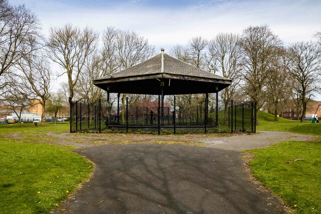
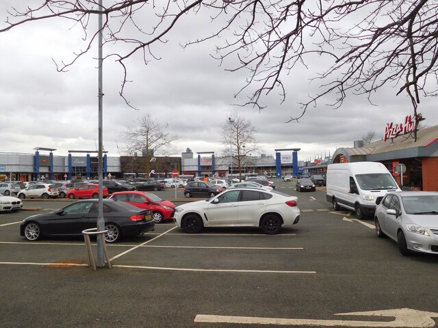
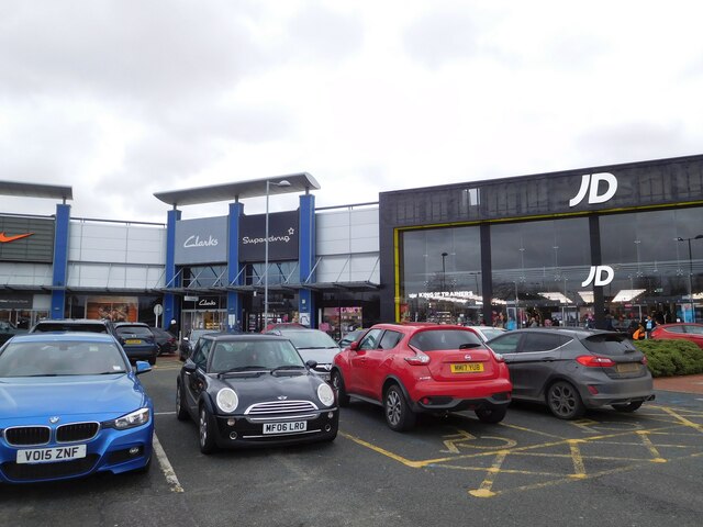
Lower Broughton enjoys close proximity to a variety of amenities and services. The nearby Salford Shopping Centre provides a range of shops, supermarkets, and other retail outlets, while recreational spaces like the nearby Peel Park and Buile Hill Park offer green spaces for leisure activities. The area benefits from good transport links, with regular bus services connecting it to Manchester city center and surrounding areas.

Overall, Lower Broughton offers an affordable and convenient place to live, with its ongoing regeneration efforts and proximity to amenities making it an attractive choice for residents seeking a suburban lifestyle near the heart of Manchester.

If you have any feedback on the listing, please let us know in the comments section below.

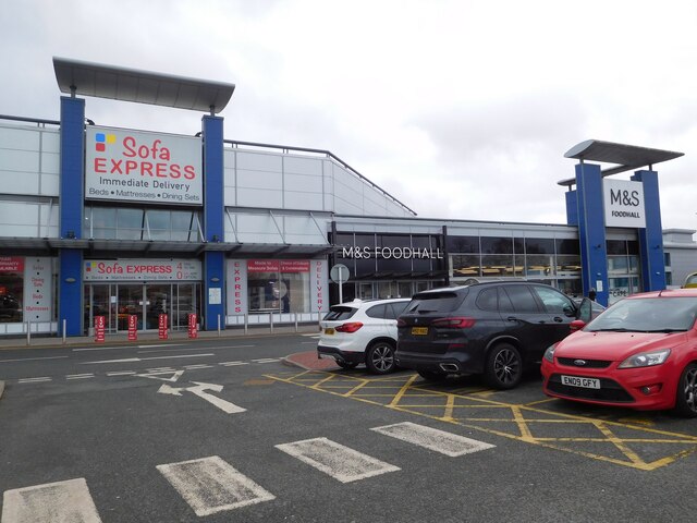
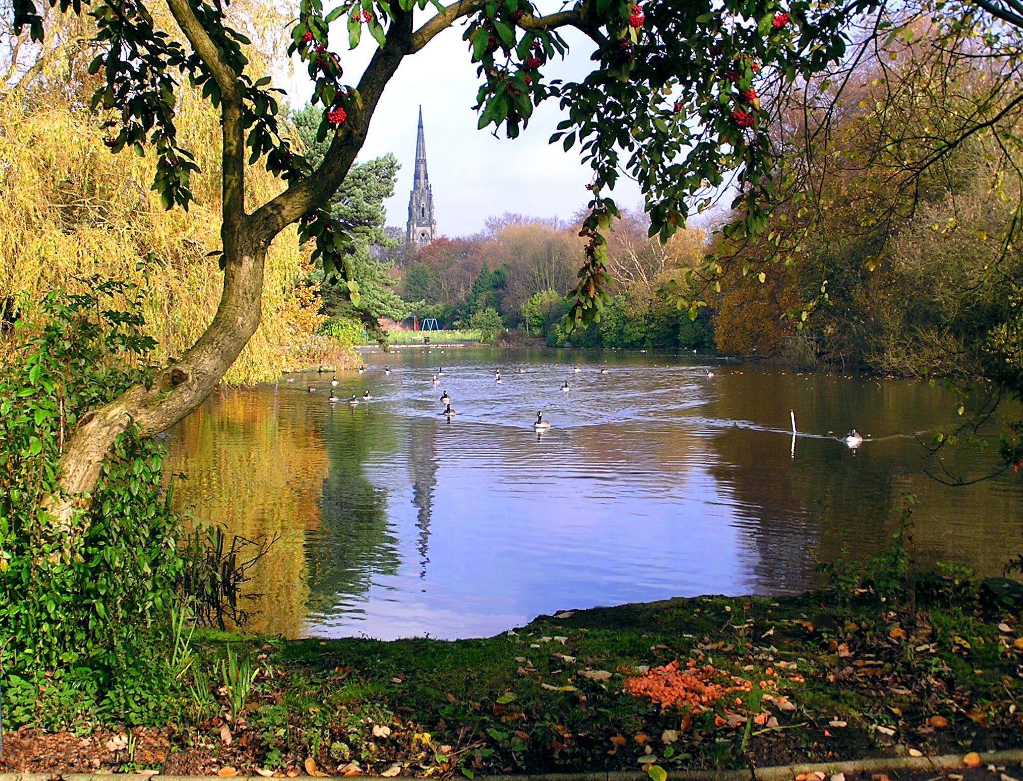
Lower Broughton Images

Images are sourced within 2km of 53.496414/-2.2660905 or Grid Reference SD8200. Thanks to Geograph Open Source API. All images are credited.

Castle Park Care Home The derelict Castle Park care home in Broughton.
See also <a href="https://www.geograph.org.uk/photo/5371734">SD8200 : Castle Park Care Home</a>.
Castle Park Care Home
The derelict Castle Park care home in Broughton. See also SD8200 : Castle Park Care Home.
Cheetham Park The disused bandstand at Cheetham Park.
Cheetham Park
The disused bandstand at Cheetham Park.
Cheetham Hill Wasteland, ready for development at Cheetham Hill.
Cheetham Hill
Wasteland, ready for development at Cheetham Hill.
Manchester Fort 
Large retail park in North Manchester.
Manchester Fort
Large retail park in North Manchester.
Manchester Fort 
Large retail park in North Manchester.
Manchester Fort
Large retail park in North Manchester.
Manchester Fort 
Large retail park in North Manchester.
Manchester Fort
Large retail park in North Manchester.
View from Kersal Wetlands over the skyline of central Manchester and Salford The raised path (Derek Antrobus Way) runs around the perimeter of the Castle Irwell Flood Storage Basin, forming the tranquil Kersal Wetlands
View from Kersal Wetlands over the skyline of central Manchester and Salford
The raised path (Derek Antrobus Way) runs around the perimeter of the Castle Irwell Flood Storage Basin, forming the tranquil Kersal Wetlands
Cromwell Bridge Across the River Irwell, erected in 1882
Cromwell Bridge
Across the River Irwell, erected in 1882
River Irwell View from an old path around the former racecourse perimeter
River Irwell
View from an old path around the former racecourse perimeter
Modern Footbridge Across the River Irwell
Modern Footbridge
Across the River Irwell
River Irwell View from Littleton Bridge towards the weir
River Irwell
View from Littleton Bridge towards the weir
River Irwell Approaching Charlestown in Salford
River Irwell
Approaching Charlestown in Salford
Lower Broughton Road Development alongside Lower Broughton Road.
Lower Broughton Road
Development alongside Lower Broughton Road.
Footpath towards a riverside walk 
The path from the northwest side of Cromwell Bridge leads to the side of the River Irwell.
Footpath towards a riverside walk
The path from the northwest side of Cromwell Bridge leads to the side of the River Irwell.
Cromwell Bridge 
Carrying  the A576 over the River Irwell.
Cromwell Bridge
Carrying the A576 over the River Irwell.
River Irwell 
Looking upstream from Cromwell Bridge.
River Irwell
Looking upstream from Cromwell Bridge.
Queens Road (A6010), Manchester The A6010 is part of the Manchester intermediate ring Road. It runs 10 miles from Higher Broughton to Chorlton-cum-Hardy.
<span class="nowrap"><a title="http://www.sabre-roads.org.uk/wiki/index.php?title=A6010" rel="nofollow ugc noopener" href="http://www.sabre-roads.org.uk/wiki/index.php?title=A6010">Link</a><img style="margin-left:2px;" alt="External link" title="External link - shift click to open in new window" src="https://s1.geograph.org.uk/img/external.png" width="10" height="10"/></span>
Queens Road (A6010), Manchester
The A6010 is part of the Manchester intermediate ring Road. It runs 10 miles from Higher Broughton to Chorlton-cum-Hardy. LinkExternal link
Elizabeth Street (A6010), Manchester The A6010 is part of the Manchester intermediate ring Road. It runs 10 miles from Higher Broughton to Chorlton-cum-Hardy.
<span class="nowrap"><a title="http://www.sabre-roads.org.uk/wiki/index.php?title=A6010" rel="nofollow ugc noopener" href="http://www.sabre-roads.org.uk/wiki/index.php?title=A6010">Link</a><img style="margin-left:2px;" alt="External link" title="External link - shift click to open in new window" src="https://s1.geograph.org.uk/img/external.png" width="10" height="10"/></span>
Elizabeth Street (A6010), Manchester
The A6010 is part of the Manchester intermediate ring Road. It runs 10 miles from Higher Broughton to Chorlton-cum-Hardy. LinkExternal link
Show me another place!

Lower Broughton is located at Grid Ref: SD8200 (Lat: 53.496414, Lng: -2.2660905)

Unitary Authority: Salford

Police Authority: Greater Manchester

What 3 Words

///scores.poker.prom. Near Salford, Manchester

Nearby Locations

Lower Broughton

Related Wikis

Broughton Suspension Bridge

Broughton Suspension Bridge was an iron chain suspension bridge built in 1826 to span the River Irwell between Broughton and Pendleton, now in Salford...

Wheater's Field

Wheater's Field was a rugby ground in Broughton, Salford, England. It was home to the Broughton Rangers rugby league club of the Northern Union. On 19...

Church of the Ascension, Lower Broughton

The Church of the Ascension is a Grade II listed Anglican church in Lower Broughton, Salford, England. In February 2017 a fire destroyed the roof and interior...

Broughton, Salford

Broughton is a suburb and district of Salford, Greater Manchester, England. Located on the east bank of the River Irwell, it is 1 mile (1.6 km) northwest...

Nearby Amenities

Located within 500m of 53.496414,-2.2660905
Bus Stop
Seaford Road/Gerald Road
Bus: yes
Naptan AtcoCode: 1800NF05151
Naptan Bearing: N
Naptan CommonName: Seaford Road/Gerald Road
Naptan Indicator: The Fryer
Naptan Landmark: HOUSE 103
Naptan NaptanCode: mantgjwa
Naptan PlusbusZoneRef: MNCRPIC
Naptan ShortCommonName: Gerald Road
Naptan Street: SEAFORD ROAD
Naptan Verified: no
Network: TfGM
Public Transport: platform
Source: naptan_import
Lat/Long: 53.4962669/-2.2734316
Bus Stop
Lower Broughton Road/Heath Avenue
Bus: yes
Naptan AtcoCode: 1800NF08181
Naptan Bearing: SE
Naptan CommonName: Lower Broughton Road/Heath Avenue
Naptan Indicator: Opp House 71
Naptan Landmark: HOUSE 27
Naptan NaptanCode: mantjtwg
Naptan PlusbusZoneRef: MNCRPIC
Naptan ShortCommonName: Heath Avenue
Naptan Street: LWR BROUGHTON R
Naptan Verified: no
Network: TfGM
Public Transport: platform
Source: naptan_import
Lat/Long: 53.4924304/-2.2646797
Bus Stop
Camp Street/Vernon Street
Bus: yes
Naptan AtcoCode: 1800NF00851
Naptan Bearing: SW
Naptan CommonName: Camp Street/Vernon Street
Naptan Indicator: Recreation Cnr
Naptan Landmark: RECREATION CNR
Naptan NaptanCode: mangjdwg
Naptan PlusbusZoneRef: MNCRPIC
Naptan ShortCommonName: Vernon Street
Naptan Street: CAMP STREET
Naptan Verified: no
Network: TfGM
Public Transport: platform
Source: naptan_import
Lat/Long: 53.4981351/-2.262047
Bus Stop
Great Clowes Street/Muriel Street
Bus: yes
Naptan AtcoCode: 1800NF40121
Naptan Bearing: S
Naptan CommonName: Great Clowes Street/Muriel Street
Naptan Indicator: House 172
Naptan Landmark: HOUSE 176
Naptan NaptanCode: mangpagd
Naptan PlusbusZoneRef: MNCRPIC
Naptan ShortCommonName: Muriel Street
Naptan Street: Gt Clowes Street
Naptan Verified: no
Network: TfGM
Public Transport: platform
Source: naptan_import
Lat/Long: 53.4981859/-2.2593489
Bus Stop
Great Clowes Street/Broughton Lane
Bus: yes
Naptan AtcoCode: 1800NF40131
Naptan Bearing: N
Naptan CommonName: Great Clowes Street/Broughton Lane
Naptan Indicator: Ex Els W`house
Naptan Landmark: HOUSE 131
Naptan NaptanCode: mangpagj
Naptan PlusbusZoneRef: MNCRPIC
Naptan ShortCommonName: Broughton Lane
Naptan Street: Gt Clowes Street
Naptan Verified: no
Network: TfGM
Public Transport: platform
Source: naptan_import
Lat/Long: 53.4966035/-2.259505
Bus Stop
Great Clowes Street/Broughton Lane
Bus: yes
Naptan AtcoCode: 1800NF40151
Naptan Bearing: S
Naptan CommonName: Great Clowes Street/Broughton Lane
Naptan Indicator: Cussons Technol
Naptan Landmark: CUSSONS TECHNOL
Naptan NaptanCode: mangpagm
Naptan PlusbusZoneRef: MNCRPIC
Naptan ShortCommonName: Broughton Lane
Naptan Street: Gt Clowes Street
Naptan Verified: no
Network: TfGM
Public Transport: platform
Source: naptan_import
Lat/Long: 53.495202/-2.259195
Bus Stop
Lower Broughton Road/Wheaters Crescent
Bus: yes
Naptan AtcoCode: 1800NF40221
Naptan Bearing: SE
Naptan CommonName: Lower Broughton Road/Wheaters Crescent
Naptan Indicator: House 168
Naptan Landmark: PRIMARY SCHOOL
Naptan NaptanCode: mangpajm
Naptan PlusbusZoneRef: MNCRPIC
Naptan ShortCommonName: Wheaters Crescent
Naptan Street: Lr Broughton Road
Naptan Verified: no
Network: TfGM
Public Transport: platform
Source: naptan_import
Lat/Long: 53.4937045/-2.2657428
Bus Stop
Lower Broughton Road/Wheaters Crescent
Bus: yes
Naptan AtcoCode: 1800NF40231
Naptan Bearing: NW
Naptan CommonName: Lower Broughton Road/Wheaters Crescent
Naptan Indicator: House 147
Naptan Landmark: HOUSE 149
Naptan NaptanCode: mangpajp
Naptan PlusbusZoneRef: MNCRPIC
Naptan ShortCommonName: Wheaters Crescent
Naptan Street: Lr Broughton Road
Naptan Verified: no
Network: TfGM
Public Transport: platform
Source: naptan_import
Lat/Long: 53.4940897/-2.2663029
Bus Stop
Lower Broughton Road/Camp Street
Bus: yes
Naptan AtcoCode: 1800NF40241
Naptan Bearing: SE
Naptan CommonName: Lower Broughton Road/Camp Street
Naptan Indicator: Housing Estate
Naptan Landmark: HOUSE 198
Naptan NaptanCode: mangpajt
Naptan PlusbusZoneRef: MNCRPIC
Naptan ShortCommonName: Camp Street
Naptan Street: Lr Broughton Road
Naptan Verified: no
Network: TfGM
Public Transport: platform
Source: naptan_import
Lat/Long: 53.4952477/-2.2670036
Bus Stop
Great Cheetham Street West/Grecian St
Bus: yes
Naptan AtcoCode: 1800NF40291
Naptan Bearing: W
Naptan CommonName: Great Cheetham Street West/Grecian St
Naptan Indicator: Albert Park
Naptan Landmark: ALBERT PARK
Naptan NaptanCode: mangpamg
Naptan PlusbusZoneRef: MNCRPIC
Naptan ShortCommonName: Grecian St
Naptan Street: Gt Che`ham Street W
Naptan Verified: no
Network: TfGM
Public Transport: platform
Source: naptan_import
Lat/Long: 53.4999414/-2.2662793
Bus Stop
Great Cheetham St West/Grecian St
Bus: yes
Naptan AtcoCode: 1800NF40301
Naptan Bearing: E
Naptan CommonName: Great Cheetham St West/Grecian St
Naptan Indicator: House 49
Naptan Landmark: HOUSE 49
Naptan NaptanCode: mangpamj
Naptan PlusbusZoneRef: MNCRPIC
Naptan ShortCommonName: Grecian St
Naptan Street: Gt Che`ham Street W
Naptan Verified: no
Network: TfGM
Public Transport: platform
Source: naptan_import
Lat/Long: 53.4997226/-2.2676648
Bus Stop
Lower Broughton Road/Frederick Road
Bus: yes
Naptan AtcoCode: 1800NF40311
Naptan Bearing: N
Naptan CommonName: Lower Broughton Road/Frederick Road
Naptan Indicator: Op Bridge Pub
Naptan Landmark: HOUSE 240
Naptan NaptanCode: mangpamp
Naptan PlusbusZoneRef: MNCRPIC
Naptan ShortCommonName: Frederick Road
Naptan Street: Lr Broughton Road
Naptan Verified: no
Network: TfGM
Public Transport: platform
Source: naptan_import
Lat/Long: 53.4962882/-2.2679748
Bus Stop
Camp Street/Nelson Street
Bus: yes
Naptan AtcoCode: 1800NF40321
Naptan Bearing: SW
Naptan CommonName: Camp Street/Nelson Street
Naptan Indicator: Broughton Sec S
Naptan Landmark: FLATS
Naptan NaptanCode: mangpamt
Naptan PlusbusZoneRef: MNCRPIC
Naptan ShortCommonName: Nelson Street
Naptan Street: CAMP STREET
Naptan Verified: no
Network: TfGM
Public Transport: platform
Source: naptan_import
Lat/Long: 53.4971503/-2.2643322
Bus Stop
Camp Street/Nelson Street
Bus: yes
Naptan AtcoCode: 1800NF40331
Naptan Bearing: NE
Naptan CommonName: Camp Street/Nelson Street
Naptan Indicator: Opp School
Naptan Landmark: HOUSE 104
Naptan NaptanCode: mangpamw
Naptan PlusbusZoneRef: MNCRPIC
Naptan ShortCommonName: Nelson Street
Naptan Street: CAMP STREET
Naptan Verified: no
Network: TfGM
Public Transport: platform
Source: naptan_import
Lat/Long: 53.4973485/-2.2641224
Bus Stop
Camp Street/Vernon Street
Bus: yes
Naptan AtcoCode: 1800NF40341
Naptan Bearing: NE
Naptan CommonName: Camp Street/Vernon Street
Naptan Indicator: Opp Rec Centre
Naptan Landmark: ROMAN COURT
Naptan NaptanCode: mangpapa
Naptan PlusbusZoneRef: MNCRPIC
Naptan ShortCommonName: Vernon Street
Naptan Street: CAMP STREET
Naptan Verified: no
Network: TfGM
Public Transport: platform
Source: naptan_import
Lat/Long: 53.4983875/-2.2617018
Bus Stop
Frederick Road/Lower Broughton Road
Bus: yes
Naptan AtcoCode: 1800NF40351
Naptan Bearing: SW
Naptan CommonName: Frederick Road/Lower Broughton Road
Naptan Indicator: Church
Naptan Landmark: CHURCH
Naptan NaptanCode: mangpapd
Naptan PlusbusZoneRef: MNCRPIC
Naptan ShortCommonName: Lwr Broughton Rd
Naptan Street: FREDERICK ROAD
Naptan Verified: no
Network: TfGM
Public Transport: platform
Source: naptan_import
Lat/Long: 53.4953527/-2.2682704
Bus Stop
Frederick Road/Patten Court
Bus: yes
Naptan AtcoCode: 1800NF40361
Naptan Bearing: NE
Naptan CommonName: Frederick Road/Patten Court
Naptan Indicator: Opp Open Land
Naptan Landmark: OPP OPEN LAND
Naptan NaptanCode: mangpapg
Naptan PlusbusZoneRef: MNCRPIC
Naptan ShortCommonName: Patten Court
Naptan Street: FREDERICK ROAD
Naptan Verified: no
Network: TfGM
Public Transport: platform
Source: naptan_import
Lat/Long: 53.495099/-2.2691733
Bus Stop
Cromwell Road/Castle Irwell
Bus: yes
Naptan AtcoCode: 1800NF40431
Naptan Bearing: W
Naptan CommonName: Cromwell Road/Castle Irwell
Naptan Indicator: Op Casino
Naptan Landmark: CASINO
Naptan NaptanCode: mangpatg
Naptan PlusbusZoneRef: MNCRPIC
Naptan ShortCommonName: Castle Irwell
Naptan Street: CROMWELL ROAD
Naptan Verified: no
Network: TfGM
Public Transport: platform
Shelter: yes
Source: naptan_import
Lat/Long: 53.4992288/-2.2714004
Bus Stop
Cromwell Road/Castle Irwell
Bus: yes
Naptan AtcoCode: 1800NF40441
Naptan Bearing: E
Naptan CommonName: Cromwell Road/Castle Irwell
Naptan Indicator: Opp Casino
Naptan Landmark: OPP CASINO
Naptan NaptanCode: mangpatj
Naptan PlusbusZoneRef: MNCRPIC
Naptan ShortCommonName: Castle Irwell
Naptan Street: CROMWELL ROAD
Naptan Verified: no
Network: TfGM
Public Transport: platform
Source: naptan_import
Lat/Long: 53.4992549/-2.2717624
Bus Stop
Lower Broughton Road/Victoria Lodge
Bus: yes
Naptan AtcoCode: 1800NF02671
Naptan Bearing: S
Naptan CommonName: Lower Broughton Road/Victoria Lodge
Naptan Indicator: House 264
Naptan Landmark: HOUSE 264
Naptan NaptanCode: mangjmad
Naptan PlusbusZoneRef: MNCRPIC
Naptan ShortCommonName: Victoria Lodge
Naptan Street: Lr Broughton Road
Naptan Verified: no
Network: TfGM
Public Transport: platform
Source: naptan_import
Lat/Long: 53.4974824/-2.2685401
Bus Stop
Seaford Road/Gerald Road
Bus: yes
Naptan AtcoCode: 1800NF03651
Naptan Bearing: S
Naptan CommonName: Seaford Road/Gerald Road
Naptan Indicator: The Fryer
Naptan Landmark: GREGGS
Naptan NaptanCode: mangjmjd
Naptan PlusbusZoneRef: MNCRPIC
Naptan ShortCommonName: Gerald Road
Naptan Street: SEAFORD ROAD
Naptan Verified: no
Network: TfGM
Public Transport: platform
Source: naptan_import
Lat/Long: 53.4962674/-2.2731904
Crossing
Lat/Long: 53.4958759/-2.27202
Crossing
Crossing: unmarked
Crossing Island: yes
Crossing Markings: no
Tactile Paving: yes
Lat/Long: 53.4947897/-2.2697052
Barrier: bollard
Bicycle: yes
Foot: yes
Motor Vehicle: no
Lat/Long: 53.4961551/-2.2696074
Crossing
Crossing: unmarked
Crossing Island: yes
Crossing Markings: no
Tactile Paving: yes
Lat/Long: 53.4942752/-2.2708658
Car Wash
Salford Car Wash & Valeting Station
Lat/Long: 53.4959212/-2.2590114
Turning Circle
Lat/Long: 53.4967672/-2.2708842
Bus Stop
Frederick Road/Seaford Road
Bus: yes
Naptan AtcoCode: 1800NF40371
Naptan Bearing: NE
Naptan CommonName: Frederick Road/Seaford Road
Naptan Indicator: Old Bus Depot
Naptan Landmark: SANCTUARY STDNT
Naptan NaptanCode: mangpapj
Naptan PlusbusZoneRef: MNCRPIC
Naptan ShortCommonName: Seaford Road
Naptan Street: FREDERICK ROAD
Naptan Verified: no
Network: TfGM
Public Transport: platform
Source: naptan_import
Lat/Long: 53.4938866/-2.2718966
Barrier: kissing_gate
Bicycle: yes
Foot: yes
Lat/Long: 53.4947051/-2.2728955
Buff Shoes
Addr City: Salford
Addr Housenumber: 1A
Addr Postcode: M7 1UH
Addr Street: Kent Street
Shop: yes
Lat/Long: 53.4955734/-2.2588869
Barrier: bollard
Lat/Long: 53.4970183/-2.2651807
Camera Direction: 180
Camera Height: 4
Camera Mount: wall
Camera Type: fixed
Man Made: surveillance
Surveillance: outdoor
Surveillance Type: camera
Lat/Long: 53.4944908/-2.2721182
Camera Direction: 270
Camera Height: 4
Camera Mount: wall
Camera Type: fixed
Man Made: surveillance
Surveillance: outdoor
Surveillance Type: camera
Lat/Long: 53.4945618/-2.2719599
Camera Mount: pole
Camera Type: fixed
Man Made: surveillance
Surveillance: outdoor
Surveillance Type: camera
Lat/Long: 53.4943656/-2.271603
Camera Mount: pole
Camera Type: fixed
Man Made: surveillance
Surveillance: outdoor
Surveillance Type: camera
Lat/Long: 53.4948172/-2.2713
Camera Mount: pole
Camera Type: fixed
Man Made: surveillance
Surveillance: outdoor
Surveillance Type: camera
Lat/Long: 53.4946927/-2.2717144
Camera Mount: pole
Camera Type: fixed
Man Made: surveillance
Surveillance: outdoor
Surveillance Type: camera
Lat/Long: 53.4944358/-2.2722857
Camera Direction: 245
Camera Height: 4
Camera Mount: wall
Camera Type: fixed
Man Made: surveillance
Surveillance: outdoor
Surveillance Type: camera
Lat/Long: 53.4945108/-2.2720737
Entrance: main
Lat/Long: 53.4943624/-2.2725611
Crossing
Lat/Long: 53.4984187/-2.267716
Crossing
Lat/Long: 53.4995026/-2.2689105
Crossing
Lat/Long: 53.4983216/-2.2684814
Location: outdoor
Power: transformer
Lat/Long: 53.4941292/-2.2722029
Barrier: cycle_barrier
Bicycle: yes
Cycle Barrier: double
Cycle Barrier Installation: fixed
Foot: yes
Material: metal
Wheelchair: yes
Lat/Long: 53.4948705/-2.2697854
Barrier: cycle_barrier
Bicycle: yes
Cycle Barrier: double
Foot: yes
Motor Vehicle: no
Lat/Long: 53.4947005/-2.2696445
Barrier: bollard
Lat/Long: 53.4969477/-2.265146
Covered: no
Leisure: picnic_table
Lat/Long: 53.4940796/-2.2603733
Covered: no
Leisure: picnic_table
Lat/Long: 53.4941159/-2.2603713
Crossing
Lat/Long: 53.4955488/-2.2725771
Crossing
Lat/Long: 53.4957045/-2.2725789
Crossing
Lat/Long: 53.4958236/-2.2719174
Crossing
Lat/Long: 53.4954935/-2.2719547
Crossing
Lat/Long: 53.4952084/-2.2725772
Crossing
Lat/Long: 53.4954049/-2.2726623
Fast Food
Subway
Brand: Subway
Brand Wikidata: Q244457
Brand Wikipedia: en:Subway (restaurant)
Contact Website: https://restaurants.subway.com/united-kingdom/en/manchester/unit-1-poets-corner-seaford-road
Cuisine: sandwich
Takeaway: yes
Lat/Long: 53.4959405/-2.2729592
Atm
Lat/Long: 53.4959501/-2.2728788
Spar
Brand: Spar
Brand Wikidata: Q610492
Brand Wikipedia: en:SPAR (retailer)
Shop: convenience
Lat/Long: 53.4960024/-2.2728273
Fast Food
Greggs
Brand: Greggs
Brand Wikidata: Q3403981
Brand Wikipedia: en:Greggs
Contact Website: https://www.greggs.co.uk/shop-finder?shop-code=1953
Cuisine: sandwich;bakery
Takeaway: yes
Lat/Long: 53.4962609/-2.2728551
Waste Basket
Lat/Long: 53.4959757/-2.2723395
Waste Basket
Lat/Long: 53.4959412/-2.272023
Waste Basket
Lat/Long: 53.4959374/-2.2718964
Waste Basket
Lat/Long: 53.4957172/-2.2718449
Waste Basket
Lat/Long: 53.4955202/-2.2718328
Waste Basket
Lat/Long: 53.4950143/-2.2725662
Crossing
Lat/Long: 53.4956283/-2.2718851
Lower Broughton
Place: suburb
Lat/Long: 53.4943208/-2.2594316
Traffic Calming: hump
Lat/Long: 53.4977187/-2.259881
Give Way
Lat/Long: 53.4962366/-2.2663483
Give Way
Lat/Long: 53.4966842/-2.2654295
Give Way
Lat/Long: 53.4970286/-2.2646454
Give Way
Lat/Long: 53.496532/-2.2659691
Bicycle Rental
Camp Street/Broughton Lane
Bicycle Rental: docking_station
Capacity: 8
Email: support@beryl.cc
Fee: yes
Network: tfgm_cycle_hire
Operator: Beryl
Operator Wikidata: Q106575369
Payment App: yes
Payment Cash: no
Payment Credit Cards: no
Payment Cryptocurrencies: no
Payment Debit Cards: no
Payment Electronic Purses: no
Phone: +44 20 3003 5044
Ref Gbfs: beryl_greater_manchester:4043
Rental: city_bike;ebike
Website: https://beryl.cc/scheme/greater-manchester
Lat/Long: 53.49712/-2.264402
Bicycle Rental
The Vibe/Baronet Walk
Bicycle Rental: docking_station
Capacity: 6
Email: support@beryl.cc
Fee: yes
Network: tfgm_cycle_hire
Operator: Beryl
Operator Wikidata: Q106575369
Payment App: yes
Payment Cash: no
Payment Credit Cards: no
Payment Cryptocurrencies: no
Payment Debit Cards: no
Payment Electronic Purses: no
Phone: +44 20 3003 5044
Ref Gbfs: beryl_greater_manchester:4049
Rental: city_bike;ebike
Website: https://beryl.cc/scheme/greater-manchester
Lat/Long: 53.496304/-2.262226
Bicycle Rental
Duke Street
Bicycle Rental: docking_station
Capacity: 8
Email: support@beryl.cc
Fee: yes
Network: tfgm_cycle_hire
Operator: Beryl
Operator Wikidata: Q106575369
Payment App: yes
Payment Cash: no
Payment Credit Cards: no
Payment Cryptocurrencies: no
Payment Debit Cards: no
Payment Electronic Purses: no
Phone: +44 20 3003 5044
Ref Gbfs: beryl_greater_manchester:4132
Rental: city_bike;ebike
Website: https://beryl.cc/scheme/greater-manchester
Lat/Long: 53.497903/-2.262201
Barrier: bollard
Bicycle: yes
Foot: yes
Motor Vehicle: no
Lat/Long: 53.496133/-2.2704615
Barrier: bollard
Lat/Long: 53.4991209/-2.2687669
Barrier: cycle_barrier
Foot: yes
Lat/Long: 53.499042/-2.2635087
Generator Method: photovoltaic
Generator Output Electricity: yes
Generator Source: solar
Generator Type: solar_photovoltaic_panel
Location: roof
Power: generator
Lat/Long: 53.4986823/-2.2697489
The data included in this document is from www.openstreetmap.org. The data is made available under ODbL.

Have you been to Lower Broughton?

Leave your review of Lower Broughton below (or comments, questions and feedback).