Logaston

Settlement in Herefordshire

England

Logaston

Celtic cross, Kinnersley Celtic cross in Kinnersley churchyard.
Celtic cross, Kinnersley Credit: Philip Halling

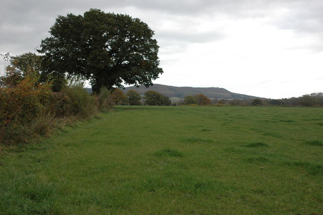
Logaston is a small village located in the county of Herefordshire, England. Situated approximately 7 miles northwest of the city of Hereford, Logaston rests in a picturesque rural setting. The village is surrounded by rolling hills and lush green fields, offering residents and visitors a tranquil and idyllic atmosphere.

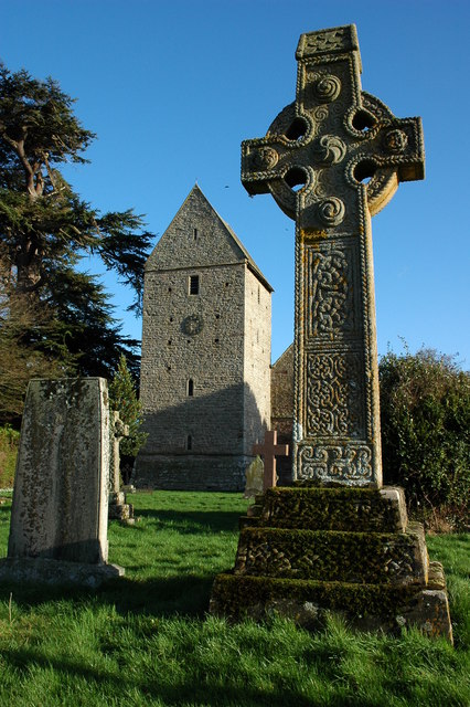
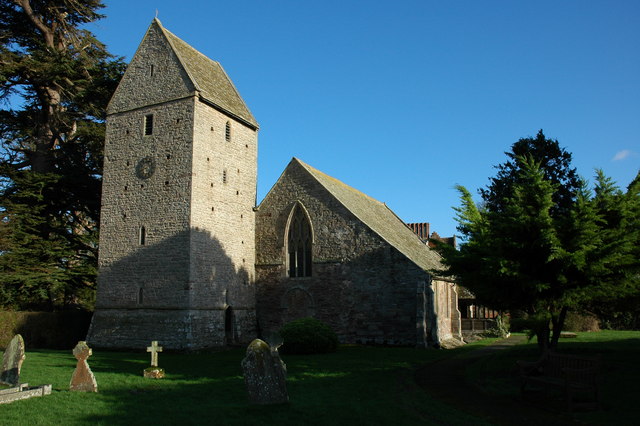
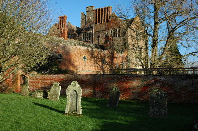
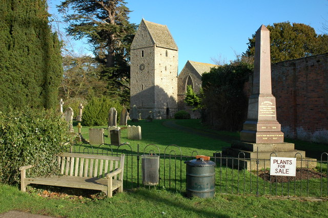
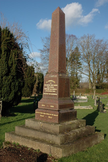
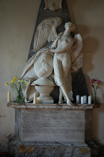
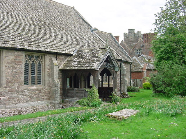
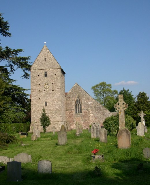
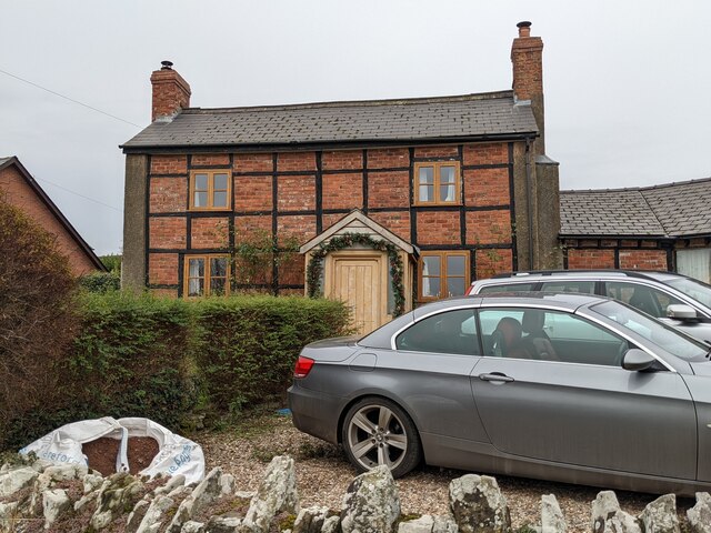
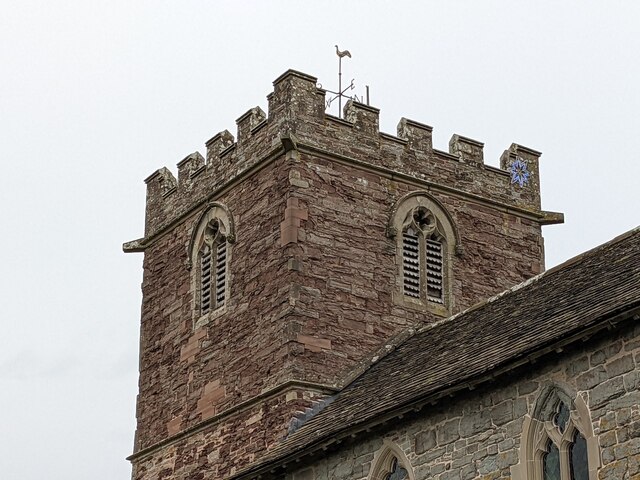
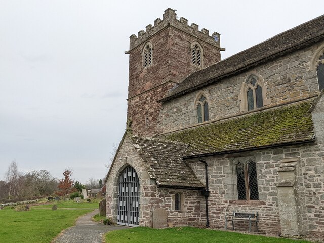
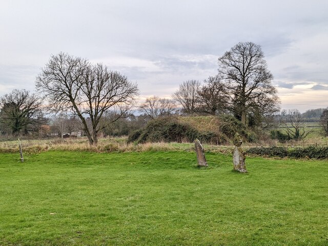
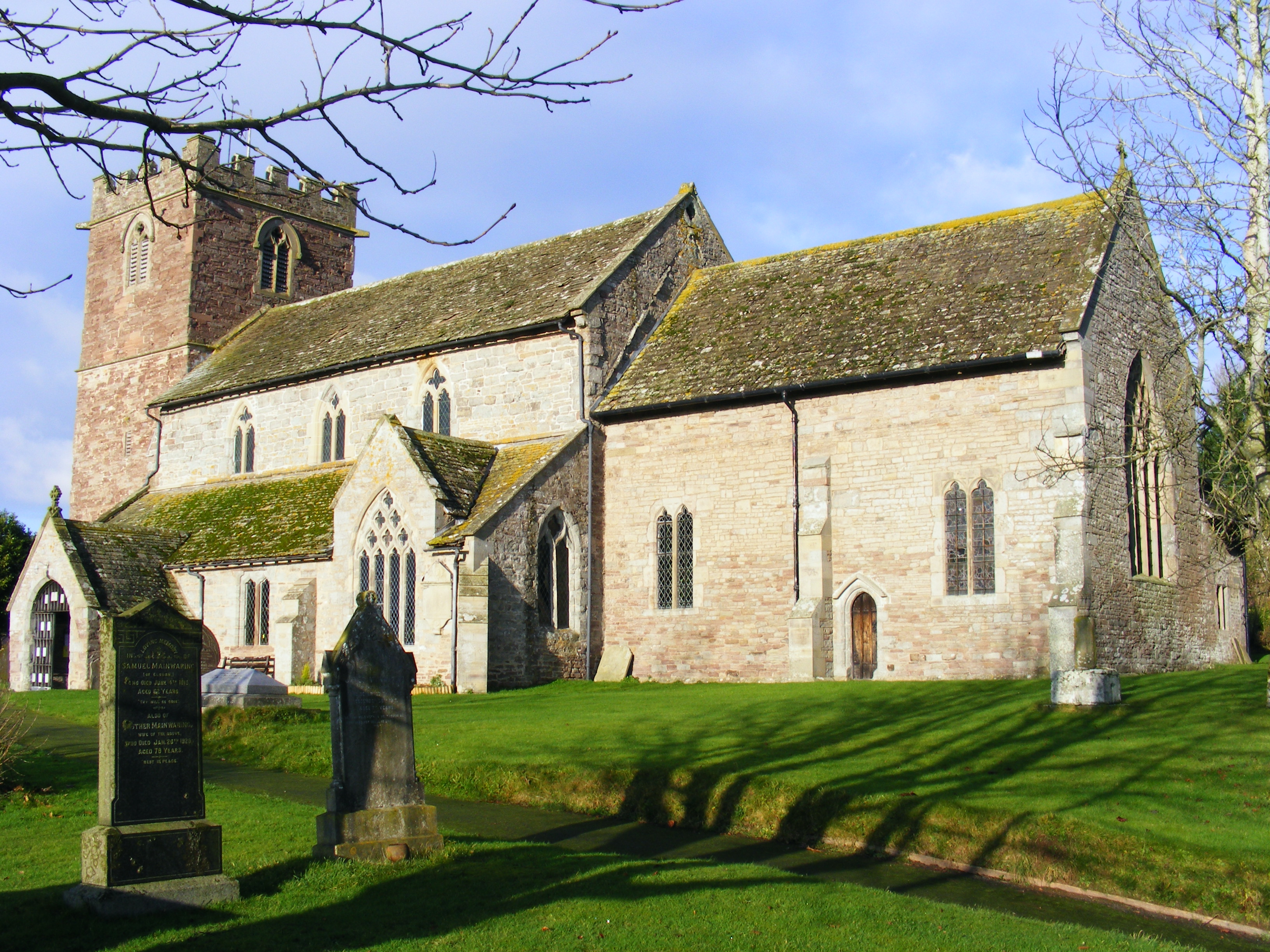
Although Logaston is a small village, it has a rich history that dates back to medieval times. The village is known for its charming architecture, with several timber-framed houses and traditional stone cottages still standing today. The local church, St. John the Baptist, is a notable landmark, showcasing beautiful stained glass windows and intricate stonework.

The village is primarily residential, with a close-knit community of locals. There are limited amenities in Logaston, with no shops or pubs within the village itself. However, the larger nearby towns provide access to a range of services and amenities, including schools, healthcare facilities, and shopping centers.

Logaston offers an abundance of natural beauty and outdoor activities. The surrounding countryside provides opportunities for hiking, cycling, and horse riding, with many scenic trails and bridleways to explore. The village is also close to the River Wye, which is popular for fishing and leisure activities.

Overall, Logaston is a charming and peaceful village, perfect for those seeking a rural lifestyle in a picturesque English countryside. Its rich history, stunning natural surroundings, and strong community spirit make it a delightful place to live or visit.

If you have any feedback on the listing, please let us know in the comments section below.

Logaston Images

Images are sourced within 2km of 52.156746/-2.9525541 or Grid Reference SO3451. Thanks to Geograph Open Source API. All images are credited.

Celtic cross, Kinnersley Celtic cross in Kinnersley churchyard.
Celtic cross, Kinnersley
Celtic cross in Kinnersley churchyard.
Kinnersley church Kinnersley church is dedicated to St James and dates back to the 12th century and contains some interesting monuments.
Kinnersley church
Kinnersley church is dedicated to St James and dates back to the 12th century and contains some interesting monuments.
Kinnersley Castle Viewed from the churchyard. According to Pevsner Kinnersley Castle is Elizabethan and built by Roger Vaughan c.1585 to 1601 and is a remodelling of a true castle. See: <span class="nowrap"><a title="http://www.kinnersleycastle.co.uk/history.html" rel="nofollow ugc noopener" href="http://www.kinnersleycastle.co.uk/history.html">Link</a><img style="margin-left:2px;" alt="External link" title="External link - shift click to open in new window" src="https://s1.geograph.org.uk/img/external.png" width="10" height="10"/></span>
Kinnersley Castle
Viewed from the churchyard. According to Pevsner Kinnersley Castle is Elizabethan and built by Roger Vaughan c.1585 to 1601 and is a remodelling of a true castle. See: LinkExternal link
Kinnersley church and War Memorial
Kinnersley War Memorial The War Memorial stands by the entrance to the churchyard.
Kinnersley War Memorial
The War Memorial stands by the entrance to the churchyard.
Monument in Kinnersley church Monument in memory of Dame Anne Morgan who died on September 18th 1764 aged 50. <a href="https://www.geograph.org.uk/photo/4260789">SO3449 : Detail of a memorial in Kinnersley church</a>
Monument in Kinnersley church
Monument in memory of Dame Anne Morgan who died on September 18th 1764 aged 50. SO3449 : Detail of a memorial in Kinnersley church
Kinnersley - St James Church Entrance porch and main door.  Kinnersley Castle in the background.
Kinnersley - St James Church
Entrance porch and main door. Kinnersley Castle in the background.
Bridleway near The Parks A bridleway follows this hedge to the north of a farm called The Parks near Kinnersley.
Bridleway near The Parks
A bridleway follows this hedge to the north of a farm called The Parks near Kinnersley.
St James, Kinnersley
Pavilion at Almeley cricket ground This pavilion is on the cricket ground at Almeley, situated adjacent to the village hall and primary school.
Pavilion at Almeley cricket ground
This pavilion is on the cricket ground at Almeley, situated adjacent to the village hall and primary school.
Almeley village hall Here is the rear view of the village hall at Almeley from the car park by the primary school.
Almeley village hall
Here is the rear view of the village hall at Almeley from the car park by the primary school.
Almeley primary school Here is the primary school at Almeley, housed in a Victorian building that may have been built in the 1860s. This is the rear view of the school, and this view shows a modern extension to the right that dates from 2012. This was taken from the car park by the primary school.
Almeley primary school
Here is the primary school at Almeley, housed in a Victorian building that may have been built in the 1860s. This is the rear view of the school, and this view shows a modern extension to the right that dates from 2012. This was taken from the car park by the primary school.
Brick timber-framed house (Almeley) This brick timber-framed house is placed close to the primary school at Almeley, and this might have been built in the 17th century. The Christmas decorations on the porch looks nice, although this building does not have listed status.
Brick timber-framed house (Almeley)
This brick timber-framed house is placed close to the primary school at Almeley, and this might have been built in the 17th century. The Christmas decorations on the porch looks nice, although this building does not have listed status.
St. Mary's church (Bell tower | Almeley) Here is the west bell tower at St. Mary's parish church, which was built in the early 13th century. There was a Christmas star on the north-east turret when I visited.
St. Mary's church (Bell tower | Almeley)
Here is the west bell tower at St. Mary's parish church, which was built in the early 13th century. There was a Christmas star on the north-east turret when I visited.
St. Mary's church (Bell tower and porch | Almeley) Here are two structures in the west end of St. Peter's parish church in Almeley, and the bell tower dates from the early 13th century.
St. Mary's church (Bell tower and porch | Almeley)
Here are two structures in the west end of St. Peter's parish church in Almeley, and the bell tower dates from the early 13th century.
Star inside St. Mary's church (Porch | Almeley) This seven-pointed star hangs from the ceiling of the south porch at St. Mary's parish church in Almeley during December, and it lights up automatically when someone enters the church interior.
Star inside St. Mary's church (Porch | Almeley)
This seven-pointed star hangs from the ceiling of the south porch at St. Mary's parish church in Almeley during December, and it lights up automatically when someone enters the church interior.
Almeley Castle (Motte) Here is the motte south of the parish church of St. Mary at Almeley, taken from the interior of the south porch.
Almeley Castle (Motte)
Here is the motte south of the parish church of St. Mary at Almeley, taken from the interior of the south porch.
Christmas tree inside St. Mary's church (Almeley) The Christmas tree in the west end of the nave at St. Mary's parish church has nice decorations on it.
Christmas tree inside St. Mary's church (Almeley)
The Christmas tree in the west end of the nave at St. Mary's parish church has nice decorations on it.
Show me another place!

Logaston is located at Grid Ref: SO3451 (Lat: 52.156746, Lng: -2.9525541)

Unitary Authority: County of Herefordshire

Police Authority: West Merica

What 3 Words

///drivers.trail.ironclad. Near Kinnersley, Herefordshire

Nearby Locations

Logaston

Related Wikis

Woonton

Woonton is a hamlet which forms part of the parish of Almeley in Herefordshire, England. It is on the A480 road and is near the town of Kington.

Almeley

Almeley (pronounced ) is a village and civil parish in Herefordshire, England. The civil parish includes the hamlets of Almeley Wooton, Woonton and Upcott...

Kinnersley Castle

Kinnersley Castle in Herefordshire, England, is one of the many marches castles along the Welsh Borders. The Castle of Kinnersley, on the A4112 3 km (1...

Church of St James, Kinnersley

The Church of St James is a Church of England parish church at Kinnersley in the English county of Herefordshire. It is a Grade I listed building. ��2...

Nearby Amenities

Located within 500m of 52.156746,-2.9525541
Power: pole
Lat/Long: 52.1525691/-2.9525703
Power: pole
Lat/Long: 52.1538313/-2.9536647
Power: pole
Lat/Long: 52.1549273/-2.9545806
Power: pole
Lat/Long: 52.1568477/-2.9561699
Power: pole
Lat/Long: 52.1582694/-2.9573769
Power: pole
Lat/Long: 52.1590979/-2.9583733
Logaston
Place: hamlet
Source: OS OpenData StreetView
Lat/Long: 52.1567424/-2.9519534
Material: wood
Power: pole
Lat/Long: 52.1559253/-2.9554175
The data included in this document is from www.openstreetmap.org. The data is made available under ODbL.

Have you been to Logaston?

Leave your review of Logaston below (or comments, questions and feedback).