Littlebeck

Settlement in Yorkshire Scarborough

England

Littlebeck

Sleights Moor Farm Track Leading to High Quebec Farm.
Sleights Moor Farm Track Credit: Ian Rob

Littlebeck is a charming village located in the Scarborough district of North Yorkshire, England. Situated within the North York Moors National Park, it offers visitors a serene and idyllic setting surrounded by breathtaking natural beauty. With a population of around 100 residents, it is a small and close-knit community.

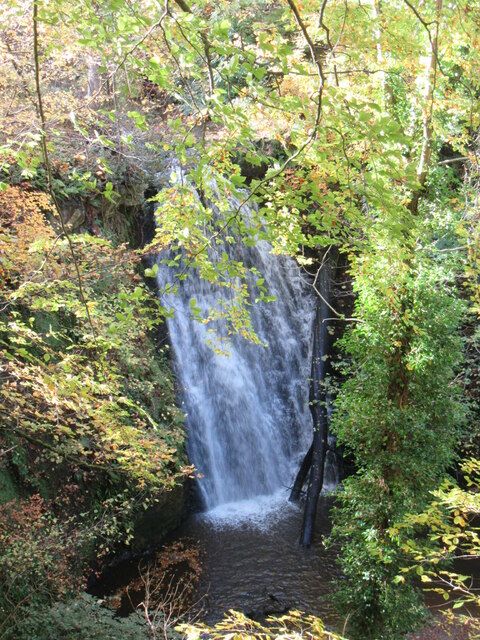
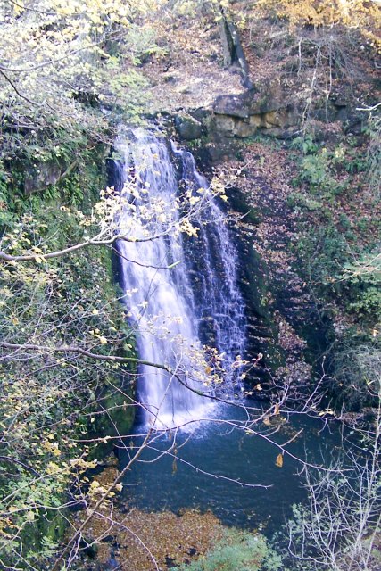
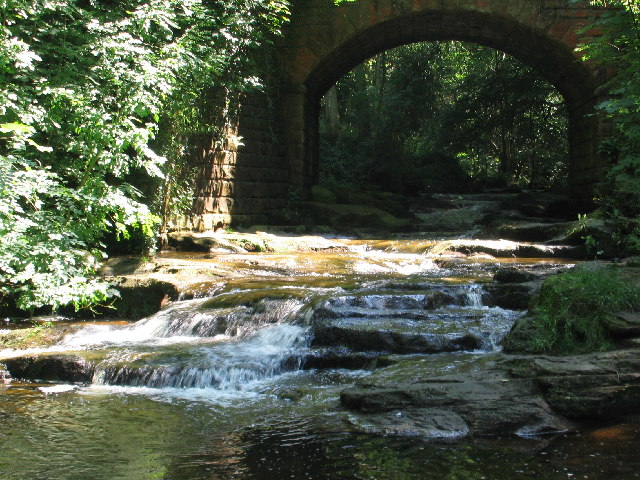
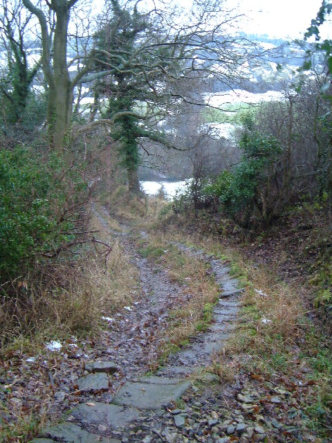
The village is nestled in a secluded valley, surrounded by dense woodland, rolling hills, and picturesque streams. It is known for its stunning waterfalls, with Falling Foss being the most prominent. The waterfall, cascading down a 30-foot drop, is a popular attraction and a great spot for nature lovers and hikers.

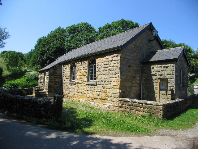
Littlebeck is also home to St. Joseph's Church, a Grade II listed building dating back to the 12th century. The church's historical significance, combined with its beautiful architecture, makes it a must-visit for history enthusiasts.

The village offers a range of outdoor activities, including hiking, cycling, and birdwatching. The surrounding moors provide ample opportunities for exploration, with numerous walking trails and pathways. The area is rich in wildlife, and visitors may spot various bird species, deer, and even the occasional badger or fox.

Although there are no shops or amenities within the village itself, nearby villages and towns provide all the necessary facilities, including accommodation options, restaurants, and shops.

Littlebeck is a hidden gem, offering a peaceful retreat from the hustle and bustle of city life. It captures the essence of rural Yorkshire, with its stunning landscapes and rich history, making it a must-visit destination for nature enthusiasts and history buffs alike.

If you have any feedback on the listing, please let us know in the comments section below.
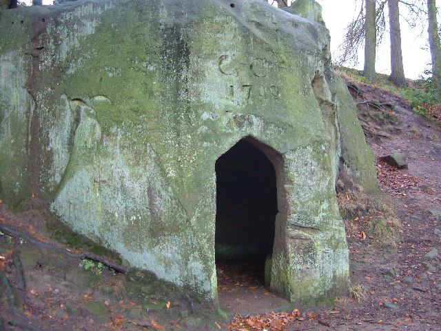
Littlebeck Images

Images are sourced within 2km of 54.431967/-0.64637753 or Grid Reference NZ8704. Thanks to Geograph Open Source API. All images are credited.

Sleights Moor Farm Track Leading to High Quebec Farm.
Sleights Moor Farm Track
Leading to High Quebec Farm.
Near Greenland's Howe Looking NE from the edge of the moor.
Near Greenland's Howe
Looking NE from the edge of the moor.
Near Falling Foss Autumn colours near Falling Foss.
Near Falling Foss
Autumn colours near Falling Foss.
Falling Foss Falling Foss, October 2022.
Falling Foss
Falling Foss, October 2022.
The Hermitage The Hermitage near Littlebeck.
The Hermitage
The Hermitage near Littlebeck.
The view from Little Beck Lane Looking SE.
The view from Little Beck Lane
Looking SE.
Near Bleach Garth Looking east.
Near Bleach Garth
Looking east.
Parsley Beck Rigg Looking NE, the power lines shown on the map have now been demolished.
Parsley Beck Rigg
Looking NE, the power lines shown on the map have now been demolished.
Sneaton Forest - Falling Foss water fall
Bridge over May Beck
Chapel at Daisy Bank
Signpost at T-junction of minor roads near Ugglebarnby Near to the B1416.
Signpost at T-junction of minor roads near Ugglebarnby
Near to the B1416.
Blue Bank The A169 at the top of its notoriously steep descent to Sleights. Viewpoint car park on the right, Whitby Abbey in the distance.
Blue Bank
The A169 at the top of its notoriously steep descent to Sleights. Viewpoint car park on the right, Whitby Abbey in the distance.
Newton Farm
Newton Farm
Seggymire Lane Looking WSW down the stone trods of Seggymire Lane, dropping from Ugglebarnby to the Little Beck valley. "Seggymire Lane is undoubtedly an historic route, appearing for example in part on Robert Rowe's New Map of Yorkshire map dated 1810. It could well have been one of many packhorse routes to Whitby. It was recorded as being maintainable at public expense in 1932 Highway records and remains on North Yorkshire County Councils List of Streets as highway Number WY133G" - from  North York Moors National Park Authority Services Committee minutes from 11 July 2005.
Seggymire Lane
Looking WSW down the stone trods of Seggymire Lane, dropping from Ugglebarnby to the Little Beck valley. "Seggymire Lane is undoubtedly an historic route, appearing for example in part on Robert Rowe's New Map of Yorkshire map dated 1810. It could well have been one of many packhorse routes to Whitby. It was recorded as being maintainable at public expense in 1932 Highway records and remains on North Yorkshire County Councils List of Streets as highway Number WY133G" - from North York Moors National Park Authority Services Committee minutes from 11 July 2005.
Ford across Little Beck Between Littlebeck village and Iburndale, this ford is on the lane to Low Farm
Ford across Little Beck
Between Littlebeck village and Iburndale, this ford is on the lane to Low Farm
The Hermitage, nr Falling Foss A shelter carved out of a huge boulder, apparently in 1790, on the footpath between Littlebeck and Falling Foss. See <span class="nowrap"><a title="http://www.nymcam.co.uk/050605.htm" rel="nofollow ugc noopener" href="http://www.nymcam.co.uk/050605.htm">Link</a><img style="margin-left:2px;" alt="External link" title="External link - shift click to open in new window" src="https://s1.geograph.org.uk/img/external.png" width="10" height="10"/></span> for more details and photos
The Hermitage, nr Falling Foss
A shelter carved out of a huge boulder, apparently in 1790, on the footpath between Littlebeck and Falling Foss. See LinkExternal link for more details and photos
Falling Foss, near Littlebeck One of the highlights on the last day of Wainwright's Coast to Coast walk from St Bees to Robin Hood's Bay
Falling Foss, near Littlebeck
One of the highlights on the last day of Wainwright's Coast to Coast walk from St Bees to Robin Hood's Bay
Show me another place!

Littlebeck is located at Grid Ref: NZ8704 (Lat: 54.431967, Lng: -0.64637753)

Division: North Riding

Administrative County: North Yorkshire

District: Scarborough

Police Authority: North Yorkshire

What 3 Words

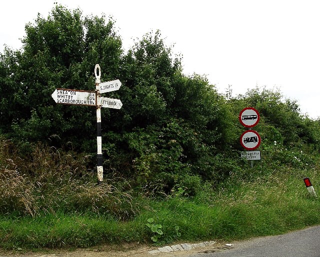
///hops.forkful.fruity. Near Sleights, North Yorkshire

Related Wikis

Littlebeck, North Yorkshire

Littlebeck is a hamlet in the North York Moors National Park, near Whitby, in North Yorkshire, England. It stands on the Little Beck, a minor tributary...

Eskdaleside cum Ugglebarnby

Eskdaleside cum Ugglebarnby is a civil parish in the Scarborough district of North Yorkshire, England, comprising the two villages of Sleights and Ugglebarnby...

Woodsmith Mine

Woodsmith Mine is a deep potash and polyhalite mine located near to the hamlet of Sneatonthorpe, Whitby in North Yorkshire, England. The venture was started...
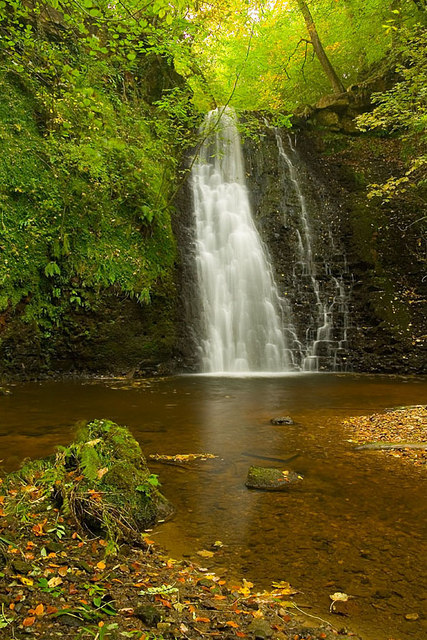
Falling Foss

Falling Foss is a waterfall that lies in the north-east section of The North York Moors National Park and is a popular spot for walking. It is 5 miles...

Nearby Amenities

Located within 500m of 54.431967,-0.64637753
Post Box
Operator: Royal Mail
Post Box Type: lamp
Ref: YO22 38
Lat/Long: 54.4323352/-0.6452309
Passing Place
Lat/Long: 54.433702/-0.6428643
Access: yes
Barrier: kissing_gate
Lat/Long: 54.43218/-0.6457052
Littlebeck
Place: hamlet
Source Name: OS_OpenData_StreetView
Wikidata: Q6652879
Wikipedia: en:Littlebeck, North Yorkshire
Lat/Long: 54.4323725/-0.6460296
Information: board
Tourism: information
Lat/Long: 54.4320067/-0.6461709
Bench
Lat/Long: 54.4322358/-0.6457429
Information: guidepost
Tourism: information
Lat/Long: 54.4322082/-0.6457072
Passing Place
Lat/Long: 54.4321087/-0.6534334
Bench
Lat/Long: 54.4319764/-0.6462274
Description: flood level indicator rod
Man Made: monitoring_station
Monitoring Water Level: yes
Lat/Long: 54.4321007/-0.6460608
Telephone
Booth: KX100
Covered: booth
Lat/Long: 54.4324756/-0.6470213
Barrier: cattle_grid
Lat/Long: 54.4330694/-0.6470337
Little Beck Wood Nature Reserve
Information: board
Tourism: information
Lat/Long: 54.431575/-0.6448602
Natural: cave_entrance
Lat/Long: 54.430813/-0.6412357
Grit Bin
Lat/Long: 54.4323001/-0.645852
Grit Bin
Lat/Long: 54.4322267/-0.6457069
Ford: yes
Lat/Long: 54.4319763/-0.6461972
Waste Basket
Lat/Long: 54.4319396/-0.6462896
Grit Bin
Lat/Long: 54.431962/-0.6462582
Leisure: picnic_table
Lat/Long: 54.4319771/-0.6466026
The data included in this document is from www.openstreetmap.org. The data is made available under ODbL.

Have you been to Littlebeck?

Leave your review of Littlebeck below (or comments, questions and feedback).