Little Basing

Settlement in Hampshire Basingstoke and Deane

England

Little Basing

Clump of trees - Oakridge Over looking the ring road.
Clump of trees - Oakridge Credit: Mr Ignavy

Little Basing is a small village located in the county of Hampshire, England. Situated approximately 3 miles northeast of the town of Basingstoke, it forms part of the larger civil parish of Old Basing and Lychpit. The village is surrounded by picturesque countryside, providing a tranquil and idyllic setting for its residents.

Despite its small size, Little Basing boasts a rich history that dates back centuries. The village is home to several historical landmarks, including the Grade II listed St. Mary's Church, which dates back to the 13th century. This charming church features a beautiful Norman tower and is a popular attraction for visitors interested in historical architecture.

The village itself is characterized by a mix of traditional and modern housing, with a close-knit community feel. It offers a range of amenities for its residents, including a local pub, a primary school, and a village hall that hosts various community events throughout the year.

Little Basing benefits from its proximity to Basingstoke, which provides additional amenities such as shopping centers, restaurants, and leisure facilities. The village is well-connected to the surrounding areas by road, with easy access to major transport routes like the M3 motorway.

With its quaint charm, historical significance, and peaceful atmosphere, Little Basing offers a desirable place to live for those seeking a rural lifestyle within reach of urban conveniences.

If you have any feedback on the listing, please let us know in the comments section below.

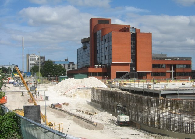
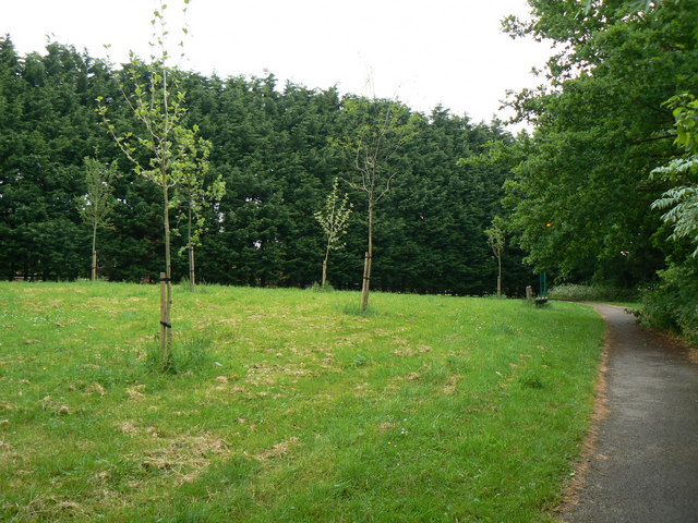
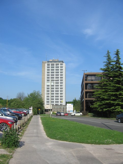
Little Basing Images

Images are sourced within 2km of 51.277524/-1.0573761 or Grid Reference SU6553. Thanks to Geograph Open Source API. All images are credited.

Clump of trees - Oakridge Over looking the ring road.
Clump of trees - Oakridge
Over looking the ring road.
Basing Road (to nowhere)
Full car park - Christmas 2023
The Street - Old Basing
Always popular - Bartons Mill
In between homes Storage facilities off the Reading Road.
In between homes
Storage facilities off the Reading Road.
Building a new John Lewis The side of a hill has been dug out and now upward work proceeds at a rapid pace.
Building a new John Lewis
The side of a hill has been dug out and now upward work proceeds at a rapid pace.
Chineham car park
Chineham car park
Centre of Old Basing I wonder how the railway was received when it was first built through the old village.
Centre of Old Basing
I wonder how the railway was received when it was first built through the old village.
An old house in Old Basing
That's a lot of chalk Digging into the hillside to create access for the new John Lewis car park.
That's a lot of chalk
Digging into the hillside to create access for the new John Lewis car park.
Once this was a road Five months later the Reading Road had been relaid along this route.
Once this was a road
Five months later the Reading Road had been relaid along this route.
No sign of a builder The new John Lewis for Basingstoke, due to open by Christmas 2015.
No sign of a builder
The new John Lewis for Basingstoke, due to open by Christmas 2015.
Traffic lights and junction on A33 Taken travelling towards Basingstoke at junction with Lillymill Chine.
Traffic lights and junction on A33
Taken travelling towards Basingstoke at junction with Lillymill Chine.
Retail outlet off A33 The A33 here is designated as 'Reading Road'
Retail outlet off A33
The A33 here is designated as 'Reading Road'
Skip road onto A339 Part of the ring road network to the east of Basingstoke.
Skip road onto A339
Part of the ring road network to the east of Basingstoke.
Approach to Black Dam Roundabout on Ringway East Southbound on the A339 in Basingstoke. Footbridge provides safe crossing for walkers on a public footpath.
Approach to Black Dam Roundabout on Ringway East
Southbound on the A339 in Basingstoke. Footbridge provides safe crossing for walkers on a public footpath.
Works for the New John Lewis For a while this road was dug up whilst the services were put underground and foundations laid.
See <a href="https://www.geograph.org.uk/photo/4191885">SU6452 : View up the old Reading road</a> for a similar view taken near the start of the works before the old road was dug up.
Works for the New John Lewis
For a while this road was dug up whilst the services were put underground and foundations laid. See SU6452 : View up the old Reading road for a similar view taken near the start of the works before the old road was dug up.
Show me another place!

Little Basing is located at Grid Ref: SU6553 (Lat: 51.277524, Lng: -1.0573761)

Administrative County: Hampshire

District: Basingstoke and Deane

Police Authority: Hampshire

What 3 Words

///income.stray.walks. Near Chineham, Hampshire

Nearby Locations

Daneshill Little Basing

Related Wikis

Daneshill Park Woods

Daneshill Park Woods is a 4.4-hectare (11-acre) Local Nature Reserve in Basingstoke in Hampshire. It is owned and managed by Basingstoke and Deane Borough...

The Mill Field, Hampshire

The Mill Field is a 11.7-hectare (29-acre) Local Nature Reserve in Basingstoke in Hampshire. It is owned by Basingstoke and Deane Borough Council and...

Lychpit

Lychpit is now the name of a modern housing development adjacent to Old Basing near Basingstoke, Hampshire. The modern development started in the early...

Basing House

Basing House was a Tudor palace and castle in the village of Old Basing in the English county of Hampshire. It once rivalled Hampton Court Palace in its...

Old Basing

Old Basing is a village in Hampshire, England, just east of Basingstoke. It was called Basengum in the Anglo-Saxon Chronicle and Basinges in the Domesday...

Battle of Basing

The Battle of Basing was a victory of a Danish Viking army over the West Saxons at the royal estate of Basing in Hampshire on about 22 January 871.In late...

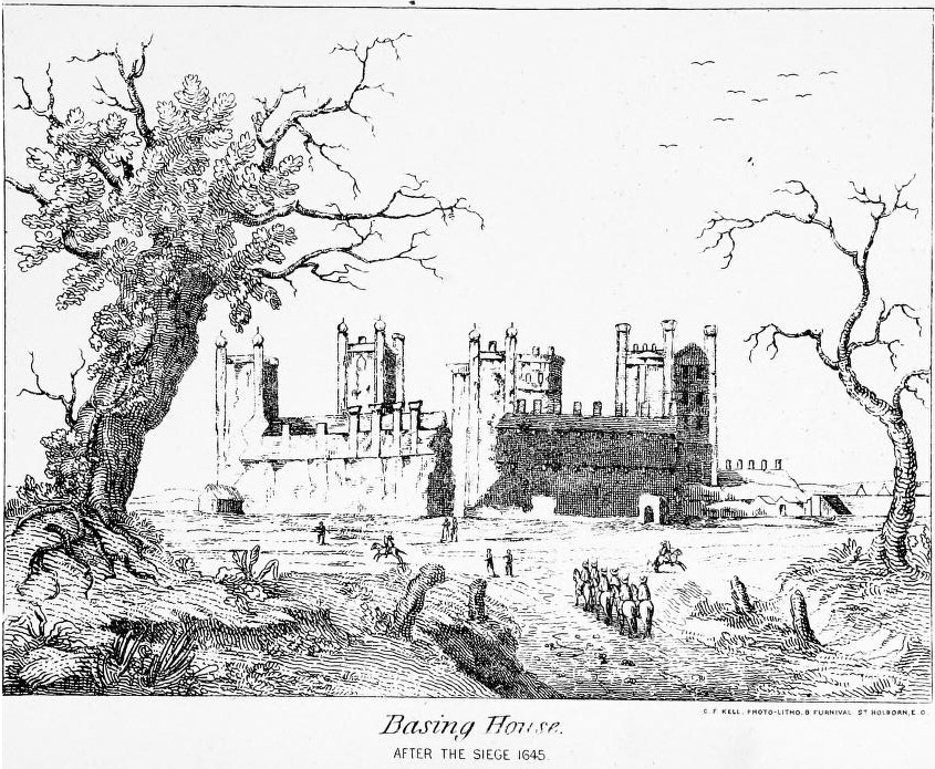
Siege of Basing House

The siege of Basing House near Basingstoke in Hampshire, was a Parliamentarian victory late in the First English Civil War. Whereas the title of the event...

Fanum House

Fanum House is the headquarters of the Automobile Association in Basingstoke, in the English county of Hampshire. It is one of several current and former...

Nearby Amenities

Located within 500m of 51.277524,-1.0573761
Crossing
Crossing: unmarked
Crossing Island: no
Kerb: lowered
Sloped Curb: yes
Tactile Paving: no
Lat/Long: 51.2778465/-1.0515644
Atm
Check Date: 2022-12-30
Operator: Tesco Bank
Lat/Long: 51.2767788/-1.0574031
Crossing
Crossing: unmarked
Crossing Island: no
Kerb: lowered
Sloped Curb: yes
Tactile Paving: no
Lat/Long: 51.2782881/-1.0520865
Pub
Cromwell Inn
Lat/Long: 51.2763892/-1.0580239
Lychpit
Place: suburb
Wikidata: Q6707271
Lat/Long: 51.2772978/-1.056601
Turning Circle
Lat/Long: 51.2777336/-1.0597646
Post Box
Note: the ref is "RG24 326" - suspect it should be "RG24 362"
Postal Code: RG24
Lat/Long: 51.2787937/-1.0539975
Barrier: bollard
Lat/Long: 51.2812042/-1.0567768
Bench
Lat/Long: 51.2808193/-1.0583274
Recycling
Lat/Long: 51.2766112/-1.0585076
Crossing
Crossing: zebra
Lat/Long: 51.2809793/-1.0598231
Crossing
Crossing: uncontrolled
Kerb: lowered
Sloped Curb: yes
Lat/Long: 51.2819697/-1.0568289
Barrier: bollard
Lat/Long: 51.2762261/-1.0570362
Post Box
Collection Times: Mo-Fr 09:00; Sa 07:00
Post Box Type: lamp
Ref: RG24 128D
Royal Cypher: EIIR
Royal Cypher Wikidata: Q33102113
Lat/Long: 51.2752927/-1.0531676
Barrier: bollard
Bollard: fixed
Lat/Long: 51.2782569/-1.0519383
Barrier: bollard
Bollard: removable
Lat/Long: 51.2780264/-1.051347
Mill Field
Leisure: nature_reserve
Wikidata: Q96097722
Lat/Long: 51.2765625/-1.0511406
Kerb: no
Lat/Long: 51.2741702/-1.0548884
Power: tower
Source: bing
Lat/Long: 51.2746916/-1.0524156
Leisure: playground
Lat/Long: 51.2737953/-1.053551
Dane Mead
Place: locality
Lat/Long: 51.2779089/-1.0534809
Barrier: bollard
Lat/Long: 51.2788635/-1.0528674
Barrier: bollard
Lat/Long: 51.2791745/-1.0585281
Barrier: bollard
Lat/Long: 51.2795937/-1.0594015
Barrier: bollard
Lat/Long: 51.2795764/-1.0596908
Source: Bing
Sport: basketball
Lat/Long: 51.2745044/-1.0623589
Public Building
Lychpit Community Hall
Lat/Long: 51.2764673/-1.057511
Healthcare
Eclipse Foot Clinic
Addr City: Basingstoke
Addr Housename: Eclipse Foot Clinic - Lychpit Surgery
Addr Place: Lychpit
Addr Postcode: RG24 8TF
Addr Street: Great Binfields Road
Healthcare: podiatrist
Layer: 1
Website: https://eclipsefootclinic.co.uk/
Lat/Long: 51.2765964/-1.0575053
Barrier: bollard
Lat/Long: 51.2758231/-1.0560201
Power: tower
Source: bing
Lat/Long: 51.2737211/-1.0560941
Bus Stop
Saxon Way
Bus: yes
Naptan AtcoCode: 1900HA011033
Naptan Bearing: SW
Naptan CommonName: Saxon Way
Naptan Crossing: Opp Saxon Way
Naptan NaptanCode: hamgdmgw
Naptan PlusbusZoneRef: BSNGSTK
Naptan Street: Great Binfields Road
Naptan Verified: no
Public Transport: platform
Source: naptan_import
Lat/Long: 51.2737988/-1.0585269
Bus Stop
Saxon Way
Bus: yes
Naptan AtcoCode: 1900HA011034
Naptan Bearing: NE
Naptan CommonName: Saxon Way
Naptan Crossing: Saxon Way
Naptan NaptanCode: hamgdmjp
Naptan PlusbusZoneRef: BSNGSTK
Naptan Street: Great Binfields Road
Naptan Verified: no
Public Transport: platform
Source: naptan_import
Lat/Long: 51.2740432/-1.0583702
Bus Stop
Cromwell Inn
Bus: yes
Naptan AtcoCode: 1900HA011035
Naptan Bearing: SW
Naptan CommonName: Cromwell Inn
Naptan Crossing: Higher Mead
Naptan Landmark: The Cromwell Inn
Naptan NaptanCode: hamgdmjg
Naptan PlusbusZoneRef: BSNGSTK
Naptan Street: Great Binfields Road
Naptan Verified: no
Public Transport: platform
Source: naptan_import
Lat/Long: 51.2768596/-1.0584021
Bus Stop
Cromwell Inn
Bench: yes
Bin: no
Bus: yes
Naptan AtcoCode: 1900HA011036
Naptan Bearing: E
Naptan CommonName: Cromwell Inn
Naptan Crossing: Great Binfields Crescent
Naptan NaptanCode: hamgdmpg
Naptan PlusbusZoneRef: BSNGSTK
Naptan Street: Great Binfields Road
Naptan Verified: no
Public Transport: platform
Shelter: yes
Source: naptan_import
Tactile Paving: no
Lat/Long: 51.2777741/-1.0569497
Bus Stop
Great Binfields Crescent
Bench: no
Bin: no
Bus: yes
Naptan AtcoCode: 1900HA011037
Naptan Bearing: W
Naptan CommonName: Great Binfields Crescent
Naptan Crossing: Opp Gt Binfields Cresc
Naptan NaptanCode: hamgdmtg
Naptan PlusbusZoneRef: BSNGSTK
Naptan Street: Great Binfields Road
Naptan Verified: no
Public Transport: platform
Shelter: no
Source: naptan_import
Tactile Paving: no
Lat/Long: 51.2779783/-1.0555118
Bus Stop
Field Way
Bench: no
Bin: no
Bus: yes
Lit: yes
Naptan AtcoCode: 1900HA011038
Naptan Bearing: W
Naptan CommonName: Field Way
Naptan Crossing: Field Way
Naptan NaptanCode: hamgdpad
Naptan PlusbusZoneRef: BSNGSTK
Naptan Street: Great Binfields Road
Naptan Verified: no
Public Transport: platform
Shelter: no
Source: naptan_import
Tactile Paving: no
Lat/Long: 51.2781771/-1.0522961
Bus Stop
Centre Court
Bus: yes
Naptan AtcoCode: 1900HA011045
Naptan Bearing: W
Naptan CommonName: Centre Court
Naptan Crossing: Opp Centre Drive
Naptan Landmark: Centre Court Hotel
Naptan NaptanCode: hamgdmpa
Naptan PlusbusZoneRef: BSNGSTK
Naptan Street: Great Binfields Road
Naptan Verified: no
Public Transport: platform
Source: naptan_import
Lat/Long: 51.2817989/-1.0575986
Crossing
Crossing: unmarked
Kerb: lowered
Sloped Curb: yes
Lat/Long: 51.2784032/-1.0521708
Crossing
Crossing: uncontrolled
Kerb: lowered
Sloped Curb: yes
Lat/Long: 51.2818186/-1.0578137
Crossing
Crossing: uncontrolled
Kerb: lowered
Sloped Curb: yes
Lat/Long: 51.281792/-1.0590021
Barrier: kerb
Kerb: lowered
Tactile Paving: no
Lat/Long: 51.2784095/-1.0520917
Crossing
Crossing: unmarked
Crossing Island: no
Kerb: lowered
Sloped Curb: yes
Tactile Paving: no
Lat/Long: 51.2787921/-1.0509075
Barrier: kerb
Kerb: lowered
Tactile Paving: no
Lat/Long: 51.2787702/-1.0509531
Barrier: kerb
Kerb: lowered
Tactile Paving: no
Lat/Long: 51.278391/-1.0522157
Little Basing
Place: neighbourhood
Source: OS_OpenData_StreetView
Lat/Long: 51.2756529/-1.0534598
Access: private
Entrance: main
Lat/Long: 51.2813403/-1.0585953
Bus Stop
Inkpen Gardens
Bench: no
Bin: no
Bus: yes
Lit: no
Naptan AtcoCode: 1900HA011039
Naptan Bearing: NE
Naptan CommonName: Inkpen Gardens
Naptan Crossing: Inkpen Gardens
Naptan NaptanCode: hamgdpap
Naptan PlusbusZoneRef: BSNGSTK
Naptan Street: Great Binfields Road
Naptan Verified: no
Public Transport: platform
Shelter: no
Source: naptan_import
Tactile Paving: no
Lat/Long: 51.278468/-1.0515733
Post Box
Postal Code: RG24
Ref: RG24 317
Lat/Long: 51.2768568/-1.0574331
Crossing
Crossing: zebra
Lat/Long: 51.2810033/-1.0591915
Duologi
Level: 0
Office: financial
Operator: Specialist Lending Limited
Website: https://www.duologi.com/
Lat/Long: 51.2814915/-1.0583626
Cafe
Grove House Bistro
Cuisine: sandwich
Opening Hours: Mo-Fr 08:30-14:30
Lat/Long: 51.2812494/-1.0590694
Access: private
Indoor: door
Lat/Long: 51.2813878/-1.0586535
Access: private
Entrance: staircase
Lat/Long: 51.2812804/-1.0582565
Access: permissive
Barrier: swing_gate
Bicycle: no
Lat/Long: 51.2817679/-1.0594004
Toilets
Lat/Long: 51.2813096/-1.0582102
Entrance: yes
Lat/Long: 51.2812651/-1.0589445
Vending Machine
Vending: coffee
Lat/Long: 51.2812863/-1.0590494
Toilets
Access: customers
Toilets Disposal: flush
Lat/Long: 51.281225/-1.0590623
RG24 8AG
Description: Lisa Ives Osteopathy
Lat/Long: 51.2813475/-1.0587093
Precision Cycles
Addr City: Basingstoke
Addr Place: Lychpit
Addr Postcode: RG24 8SR
Service Bicycle Repair: yes
Service Bicycle Retail: no
Shop: bicycle
Website: https://www.precisioncycles.co.uk/
Lat/Long: 51.2768981/-1.06204
Restaurant
Cuisine: indian
Fixme: can't remember the name
Source: sign
Lat/Long: 51.2764144/-1.0582337
Noexit: yes
Lat/Long: 51.2754434/-1.0597037
Give Way
Lat/Long: 51.2790298/-1.0589307
Crossing
Crossing: uncontrolled
Crossing Island: yes
Kerb: lowered
Lat/Long: 51.2760937/-1.0595132
Crossing
Crossing: uncontrolled
Crossing Island: yes
Kerb: lowered
Lat/Long: 51.2760873/-1.0595729
Give Way
Source: Hampshire-Aerial-FCIR
Lat/Long: 51.2764827/-1.0613194
Barrier: kerb
Lat/Long: 51.2754251/-1.0590419
Barrier: kerb
Lat/Long: 51.2739247/-1.0583355
Barrier: kerb
Lat/Long: 51.2739813/-1.0585013
Crossing
Crossing: uncontrolled
Crossing Island: yes
Kerb: lowered
Lat/Long: 51.2738191/-1.0586004
Barrier: kerb
Kerb: flush
Tactile Paving: yes
Lat/Long: 51.2775456/-1.0574409
Crossing
Crossing: uncontrolled
Crossing Island: yes
Kerb: lowered
Tactile Paving: yes
Lat/Long: 51.2775253/-1.0574165
Crossing
Crossing: uncontrolled
Crossing Island: yes
Kerb: lowered
Lat/Long: 51.277219/-1.0578657
Crossing
Crossing: uncontrolled
Crossing Island: yes
Kerb: lowered
Lat/Long: 51.2772494/-1.057928
Barrier: kerb
Kerb: raised
Tactile Paving: no
Lat/Long: 51.2779951/-1.055523
Kerb: no
Lat/Long: 51.2780809/-1.0552568
Barrier: bollard
Bollard: removable
Lat/Long: 51.2780966/-1.0552498
Crossing
Crossing: uncontrolled
Crossing Island: yes
Kerb: lowered
Tactile Paving: yes
Lat/Long: 51.2774863/-1.0573698
Crossing
Crossing: uncontrolled
Crossing Island: yes
Kerb: lowered
Lat/Long: 51.2775013/-1.0577925
Crossing
Crossing: uncontrolled
Crossing Island: yes
Kerb: lowered
Lat/Long: 51.2774728/-1.0578526
Barrier: kerb
Kerb: raised
Lat/Long: 51.2810135/-1.0598245
Entrance: yes
Note: vaccination entrance
Lat/Long: 51.2812559/-1.060152
The data included in this document is from www.openstreetmap.org. The data is made available under ODbL.

Have you been to Little Basing?

Leave your review of Little Basing below (or comments, questions and feedback).