Lewden

Settlement in Yorkshire

England

Lewden

Old milepost This milepost at the busy traffic lights cross-roads on the A61 out of Barnsley was painted in 2016.  It is from the Wakefield to Sheffield turnpike first enacted in 1758.   There are only 2 posts remaining north of Barnsley and 5 (including one in the park at Firth Park) on the way to Sheffield.    The two north of Barnsley are a different style to the ones on the Sheffield route.   A visit to clean the post and redo the legends is needed.  This post is Grade II listed 1192299.
Old milepost Credit: Chris Minto

The requested URL returned error: 429 Too Many Requests

If you have any feedback on the listing, please let us know in the comments section below.

Lewden Images

Images are sourced within 2km of 53.527965/-1.4476051 or Grid Reference SE3603. Thanks to Geograph Open Source API. All images are credited.

Old milepost This milepost at the busy traffic lights cross-roads on the A61 out of Barnsley was painted in 2016.  It is from the Wakefield to Sheffield turnpike first enacted in 1758.   There are only 2 posts remaining north of Barnsley and 5 (including one in the park at Firth Park) on the way to Sheffield.    The two north of Barnsley are a different style to the ones on the Sheffield route.   A visit to clean the post and redo the legends is needed.  This post is Grade II listed 1192299.
Old milepost
This milepost at the busy traffic lights cross-roads on the A61 out of Barnsley was painted in 2016. It is from the Wakefield to Sheffield turnpike first enacted in 1758. There are only 2 posts remaining north of Barnsley and 5 (including one in the park at Firth Park) on the way to Sheffield. The two north of Barnsley are a different style to the ones on the Sheffield route. A visit to clean the post and redo the legends is needed. This post is Grade II listed 1192299.
Worsbrough Corn Mill Now a museum
Worsbrough Corn Mill
Now a museum
Houses on Upper Sheffield Road
Houses on Park Road
Houses on Park Road
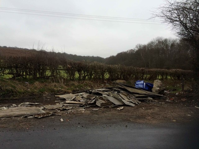
Asbestos cement sheeting fly tipped at Smithley Regrettably the area is blighted by fly tippers.
Asbestos cement sheeting fly tipped at Smithley
Regrettably the area is blighted by fly tippers.
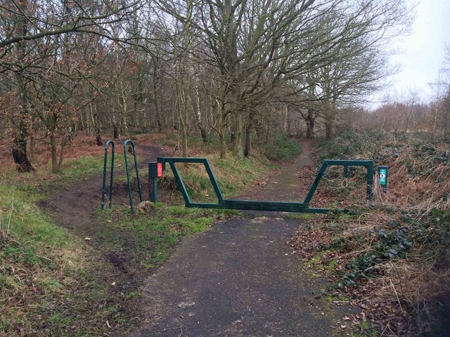
Access point to the Trans Pennine Trail Wombwell
Sandy Lane Wombwell Woods
The south-east edge of Worsbrough The back garden wall of a house in St Mary's Gardens.
The south-east edge of Worsbrough
The back garden wall of a house in St Mary's Gardens.
Rolling farmland south-east of Worsbrough The distant ridge, alongside the hedge, has a spot height of 111 metres above sea level.
Rolling farmland south-east of Worsbrough
The distant ridge, alongside the hedge, has a spot height of 111 metres above sea level.
Large field south-east of Worsbrough Alongside the public footpath towards Barrow Farm. The village on the horizon is Hoyland.
Large field south-east of Worsbrough
Alongside the public footpath towards Barrow Farm. The village on the horizon is Hoyland.
Public footpath through a fallen tree, Worsbrough Heading north to Worsbrough Road. Rather than moving the fallen tree, a slice has been sawn out of it.
Public footpath through a fallen tree, Worsbrough
Heading north to Worsbrough Road. Rather than moving the fallen tree, a slice has been sawn out of it.
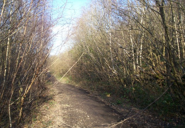
The Trans Pennine Trail, Worsbrough, looking west Also the Dove Valley Trail. This was built as a railway to Silkstone Moor End, and later became part of the electrified Woodhead line, closing in 1981.
The Trans Pennine Trail, Worsbrough, looking west
Also the Dove Valley Trail. This was built as a railway to Silkstone Moor End, and later became part of the electrified Woodhead line, closing in 1981.
Former crossing keeper's cottage, Worsbrough Bridge Seen from the former railway, immediately east of Bridge Crossing on the A61. This path was built as a railway to Silkstone Moor End, and later became part of the electrified Woodhead line, closing in 1981.
Former crossing keeper's cottage, Worsbrough Bridge
Seen from the former railway, immediately east of Bridge Crossing on the A61. This path was built as a railway to Silkstone Moor End, and later became part of the electrified Woodhead line, closing in 1981.
Footpath to Worsbrough Dale Heading north off the Trans Pennine / Dove Valley Trail to a road called Elmsdale. The main path was built as a railway to Silkstone Moor End, and later became part of the electrified Woodhead line, closing in 1981.
Footpath to Worsbrough Dale
Heading north off the Trans Pennine / Dove Valley Trail to a road called Elmsdale. The main path was built as a railway to Silkstone Moor End, and later became part of the electrified Woodhead line, closing in 1981.
Open space between Elmsdale and Bridge Street Seen from Glass House Crossing on the former railway line, skirting the southern edge of Worsbrough Dale.
Open space between Elmsdale and Bridge Street
Seen from Glass House Crossing on the former railway line, skirting the southern edge of Worsbrough Dale.
River Dove, upstream of Edmunds Road, Worsbrough The river once lopped northwards here, but was straightened between 1850 and 1880, hence the high retaining walls.
River Dove, upstream of Edmunds Road, Worsbrough
The river once lopped northwards here, but was straightened between 1850 and 1880, hence the high retaining walls.
Former Worsbrough branch of the Dearne & Dove Canal The clue is the pub through the trees - called the Boatman's Rest - and confirmed on old maps. The 2.5 mile long Worsbrough section of the Dearne and Dove Canal opened in 1804. It linked Worsbrough to the seaport of Goole.  The branch closed for navigation in 1906 and was abandoned in 1961.
Former Worsbrough branch of the Dearne & Dove Canal
The clue is the pub through the trees - called the Boatman's Rest - and confirmed on old maps. The 2.5 mile long Worsbrough section of the Dearne and Dove Canal opened in 1804. It linked Worsbrough to the seaport of Goole. The branch closed for navigation in 1906 and was abandoned in 1961.
Show me another place!

Lewden is located at Grid Ref: SE3603 (Lat: 53.527965, Lng: -1.4476051)

Division: West Riding

Unitary Authority: Barnsley

Police Authority: South Yorkshire

What 3 Words

///voted.puzzle.points. Near Birdwell, South Yorkshire

Related Wikis

Barnsley Academy

Barnsley Academy is a secondary school in Barnsley, South Yorkshire, England. The school opened in September 2006.The school has academy status, having...

Dovecliffe railway station

Dovecliffe railway station was situated on the South Yorkshire Railway's Blackburn Valley line between High Royds and Wombwell Main Junction. == History... ==

The Elmhirst School

The Elmhirst School was a comprehensive school on the B6100 (Ardsley Road) in Worsbrough Dale, south of Barnsley, South Yorkshire, England. == History... ==

Barrow Colliery

Barrow Colliery was a coal mine in Worsborough, South Yorkshire, England. It was first dug in 1873, with the first coal being brought to the surface in...

Nearby Amenities

Located within 500m of 53.527965,-1.4476051
Stop
Direction: forward
Stop: minor
Lat/Long: 53.5252779/-1.4435507
Barrier: stile
Lat/Long: 53.5282742/-1.4530327
Barrier: stile
Lat/Long: 53.5280744/-1.449641
Marker: aerial
Lat/Long: 53.5262812/-1.4453483
Dovecliffe
Historic Railway: station
Railway: site
Wikidata: Q5302417
Wikipedia: en:Dovecliffe railway station
Lat/Long: 53.5244111/-1.4450102
Lewden Crossing
Historic Railway: level_crossing
Lat/Long: 53.5272826/-1.4460704
The data included in this document is from www.openstreetmap.org. The data is made available under ODbL.

Have you been to Lewden?

Leave your review of Lewden below (or comments, questions and feedback).