Leidchruich

Settlement in Ross-shire

Scotland

Leidchruich

Sunset at the Neil M. Gunn memorial A memorial to the author Neil Miller Gunn.
Looking down towards Dingwall and the Cromarty Firth, with the Black Isle beyond. The setting sun is casting a yellow tint.
Sunset at the Neil M. Gunn memorial Credit: Craig Wallace

Leidchruich is a small village located in the county of Ross-shire, Scotland. Situated in the picturesque Highlands region, the village is surrounded by stunning natural landscapes, including rolling hills and vast moorlands. It is nestled between the towns of Dingwall and Beauly, and lies approximately 12 miles northwest of Inverness, the capital of the Highlands.

The village of Leidchruich has a population of around 300 residents, making it a close-knit and friendly community. The village is primarily residential, with a few small businesses and amenities catering to the local population. These include a convenience store, a post office, and a local pub, which serves as a popular social hub for villagers and visitors alike.

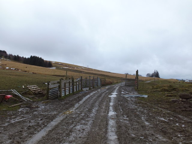
Leidchruich is renowned for its tranquil and idyllic setting, offering residents and visitors a peaceful escape from the hustle and bustle of city life. The surrounding area provides ample opportunities for outdoor activities, such as hiking, fishing, and birdwatching. The nearby Blackmuir Woodland is a popular spot for nature enthusiasts, with its diverse range of flora and fauna.

The village is well-connected to the rest of Ross-shire and the Highlands through a network of roads, making it easily accessible by car. Public transportation options include regular bus services that connect Leidchruich to neighboring towns and cities.

Overall, Leidchruich offers a serene and picturesque setting, making it an ideal place for those seeking a peaceful and rural lifestyle amidst the stunning Scottish Highlands.

If you have any feedback on the listing, please let us know in the comments section below.

Leidchruich Images

Images are sourced within 2km of 57.619349/-4.4658878 or Grid Reference NH5261. Thanks to Geograph Open Source API. All images are credited.

Sunset at the Neil M. Gunn memorial A memorial to the author Neil Miller Gunn.
Looking down towards Dingwall and the Cromarty Firth, with the Black Isle beyond. The setting sun is casting a yellow tint.
Sunset at the Neil M. Gunn memorial
A memorial to the author Neil Miller Gunn. Looking down towards Dingwall and the Cromarty Firth, with the Black Isle beyond. The setting sun is casting a yellow tint.
Caisteal Gòrach Caisteal Gòrach (the Foolish Castle) or Castle Gorach as it appears on the Ordnance Survey map is a folly associated with the nearby Tulloch Castle.   It was designed for the Davidsons of Tulloch by Robert Adam in 1789-90.
Caisteal Gòrach
Caisteal Gòrach (the Foolish Castle) or Castle Gorach as it appears on the Ordnance Survey map is a folly associated with the nearby Tulloch Castle. It was designed for the Davidsons of Tulloch by Robert Adam in 1789-90.
Neil M Gunn Memorial in the Heights of Docharty A Scottish novelist most famous for the story "The Silver Darlings" has a memorial in his honour at a viewpoint overlooking Dingwall and the Cromarty Firth.  This view of the Monument that takes the form of a rock boulder is towards Knock Farrel and the Catsback Ridge on the other side of Strath Peffer. There is a circular walk to the Memorial that traverses the edge of a large pond.
Neil M Gunn Memorial in the Heights of Docharty
A Scottish novelist most famous for the story "The Silver Darlings" has a memorial in his honour at a viewpoint overlooking Dingwall and the Cromarty Firth. This view of the Monument that takes the form of a rock boulder is towards Knock Farrel and the Catsback Ridge on the other side of Strath Peffer. There is a circular walk to the Memorial that traverses the edge of a large pond.
Part of the Neil M Gunn Monument in the Heights of Docharty There are a number of vertical slabs surrounding the rock boulder that forms the central feature of the monument.  There is a pair of slabs with faces of a young man and woman.
Part of the Neil M Gunn Monument in the Heights of Docharty
There are a number of vertical slabs surrounding the rock boulder that forms the central feature of the monument. There is a pair of slabs with faces of a young man and woman.
Plate at the Memorial Viewpoint to Neil M Gunn This plate is located in the car park before the short walk to the Memorial to Neil M Gunn - author of Highland River and other books.
Plate at the Memorial Viewpoint to Neil M Gunn
This plate is located in the car park before the short walk to the Memorial to Neil M Gunn - author of Highland River and other books.
Heading west on the track from Tulloch Castle
Dochcarty Brae
Dochcarty Brae
Ruin at Leidchruich
Ruin at Leidchruich
Wind break, Heights of Dochcarty
Old fence,  Heights of Dochcarty
Old fence, Heights of Dochcarty
Trackside stock handling equipment,Bog a` Bhreacaich
Old fence, Bog a` Bhreacaich An old and much overgrown track runs along the right (east) side of the fence.
Old fence, Bog a` Bhreacaich
An old and much overgrown track runs along the right (east) side of the fence.
Track on Cnoc a' Bhreacaich Heading down through rough moorland, with some scattered pine trees. A view towards Dingwall.
Track on Cnoc a' Bhreacaich
Heading down through rough moorland, with some scattered pine trees. A view towards Dingwall.
Caisteal Gòrach A folly on the hill behind Tulloch Castle. It was designed by Robert Adam, built 1789-90. It is a Category A listed building. <span class="nowrap"><a title="https://portal.historicenvironment.scot/designation/LB24520" rel="nofollow ugc noopener" href="https://portal.historicenvironment.scot/designation/LB24520">Link</a><img style="margin-left:2px;" alt="External link" title="External link - shift click to open in new window" src="https://s1.geograph.org.uk/img/external.png" width="10" height="10"/></span>

Caisteal Gòrach is Gaelic for 'foolish castle'.
Caisteal Gòrach
A folly on the hill behind Tulloch Castle. It was designed by Robert Adam, built 1789-90. It is a Category A listed building. LinkExternal link Caisteal Gòrach is Gaelic for 'foolish castle'.
Caisteal Gòrach A side view of the folly, on the hill behind Tulloch Castle. It was designed by Robert Adam, built 1789-90. It is a Category A listed building. <span class="nowrap"><a title="https://portal.historicenvironment.scot/designation/LB24520" rel="nofollow ugc noopener" href="https://portal.historicenvironment.scot/designation/LB24520">Link</a><img style="margin-left:2px;" alt="External link" title="External link - shift click to open in new window" src="https://s1.geograph.org.uk/img/external.png" width="10" height="10"/></span>

Caisteal Gòrach is Gaelic for 'foolish castle'.
Caisteal Gòrach
A side view of the folly, on the hill behind Tulloch Castle. It was designed by Robert Adam, built 1789-90. It is a Category A listed building. LinkExternal link Caisteal Gòrach is Gaelic for 'foolish castle'.
Caisteal Gòrach view Looking towards the back of the folly, with several tall pine trees next to it. A view of Dingwall and the Cromarty Firth beyond.
Caisteal Gòrach was designed by Robert Adam, built 1789-90. It is a Category A listed building. <span class="nowrap"><a title="https://portal.historicenvironment.scot/designation/LB24520" rel="nofollow ugc noopener" href="https://portal.historicenvironment.scot/designation/LB24520">Link</a><img style="margin-left:2px;" alt="External link" title="External link - shift click to open in new window" src="https://s1.geograph.org.uk/img/external.png" width="10" height="10"/></span>
Caisteal Gòrach view
Looking towards the back of the folly, with several tall pine trees next to it. A view of Dingwall and the Cromarty Firth beyond. Caisteal Gòrach was designed by Robert Adam, built 1789-90. It is a Category A listed building. LinkExternal link
Leaning pine trees, by Tulloch A couple of steeply leaning Scots pine trees, on the hill behind Tulloch Castle.
Leaning pine trees, by Tulloch
A couple of steeply leaning Scots pine trees, on the hill behind Tulloch Castle.
Track by Dochcarty Along the track from Tulloch Castle to Dochcarty. It is crossed by a couple of power lines, one on pylons and the other on smaller metal poles.
Track by Dochcarty
Along the track from Tulloch Castle to Dochcarty. It is crossed by a couple of power lines, one on pylons and the other on smaller metal poles.
Show me another place!

Leidchruich is located at Grid Ref: NH5261 (Lat: 57.619349, Lng: -4.4658878)

Unitary Authority: Highland

Police Authority: Highlands and Islands

What 3 Words

///savers.wound.dialect. Near Dingwall, Highland

Related Wikis

GlenWyvis distillery

Glenwyvis distillery is a Scotch whisky and gin distillery located in Dingwall, Scotland.The distillery is owned by a group of crowdfunders and is entirely...
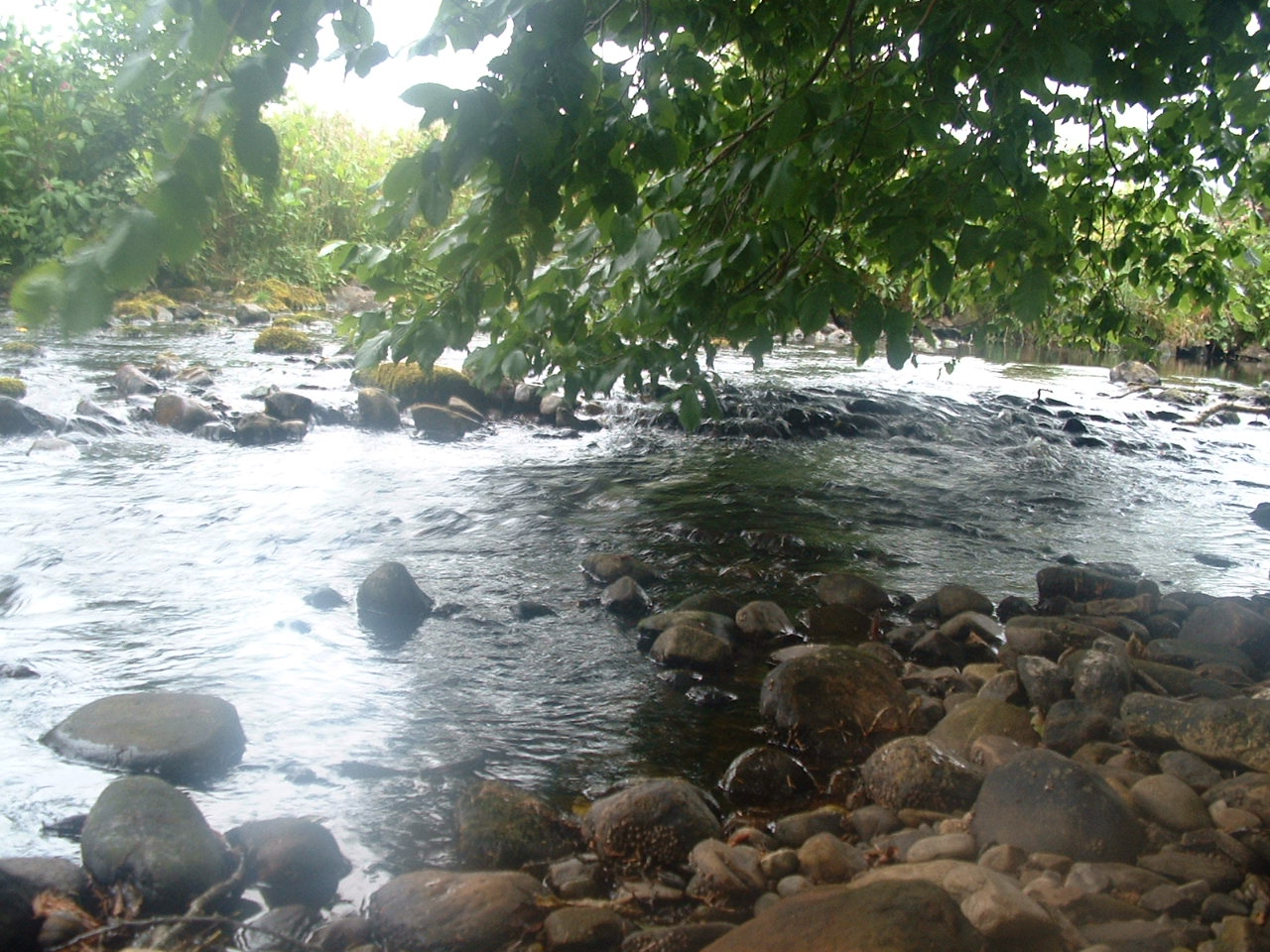
River Sgitheach

River Sgitheach also known as Skiach or Skiack, (Scottish Gaelic Abhainn Sgitheach, "Hawthorn River") (grid reference NH5162) is a river in Ross and Cromarty...

Tulloch Castle

Tulloch Castle is located in the town of Dingwall in the Highlands of Scotland. It dates at least to the late 14th century as the birthplace of Mariota...

Fodderty

Fodderty (Scottish Gaelic: Fodhraitidh) is a small hamlet, close to Dingwall, Ross-shire in the Scottish Highlands and is in the Scottish council area...
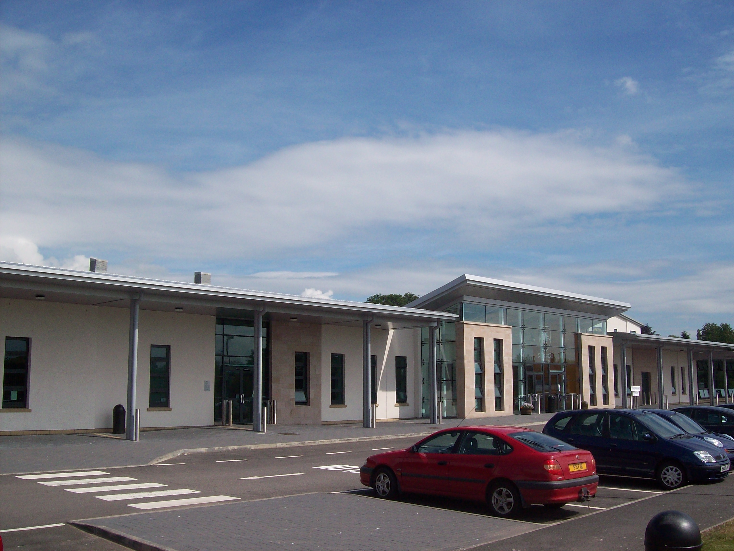
Dingwall Academy

Dingwall Academy is the largest secondary school in the Highlands of Scotland, with an enrolment of 1048 pupils as of August 2018. The Academy is situated...

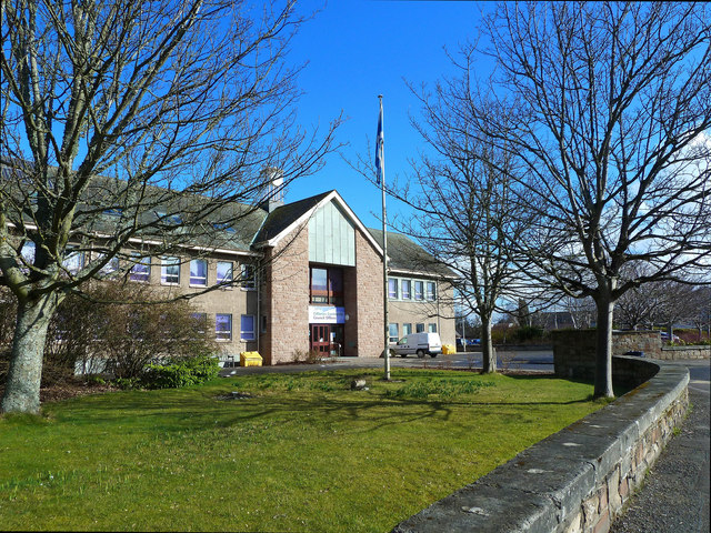
County Buildings, Dingwall

County Buildings is a municipal structure in the High Street, Dingwall, Highland, Scotland. The complex was the headquarters of Ross and Cromarty County...

Dingwall Stone

The Dingwall Stone is a Class I Pictish stone located in Dingwall, Easter Ross, Scotland. It is thought by some to be of Bronze Age origin, and contains...

Battle of Dingwall

The Battle of Dingwall was a Scottish clan battle said to have taken place in the year 1411, in Dingwall in the Scottish Highlands. It was fought between...

Nearby Amenities

Located within 500m of 57.619349,-4.4658878
Bus Stop
Heights of Docharty
Naptan AtcoCode: 6700712764
Naptan Bearing: SW
Naptan CommonName: Heights of Docharty
Naptan Indicator: Leidchruich Junction
Naptan Landmark: Junction
Naptan NaptanCode: 45328284
Naptan Street: Docharty Road
Naptan Verified: no
Source: naptan_import
Lat/Long: 57.6193694/-4.4658393
Heights of Docharty
Place: hamlet
Source: survey
Lat/Long: 57.6190725/-4.4683027
Power: pole
Lat/Long: 57.6236658/-4.4672675
Power: pole
Lat/Long: 57.6230855/-4.4675313
Power: pole
Lat/Long: 57.6226705/-4.4672919
Power: pole
Lat/Long: 57.6219011/-4.4668211
Power: pole
Lat/Long: 57.6214013/-4.4665452
Power: pole
Lat/Long: 57.6206319/-4.4660886
Power: pole
Lat/Long: 57.6198734/-4.4656361
Power: pole
Lat/Long: 57.6192583/-4.4652627
Power: pole
Lat/Long: 57.6187236/-4.4650456
Power: pole
Lat/Long: 57.6180607/-4.4648122
Power: pole
Lat/Long: 57.6175749/-4.4646336
Power: pole
Lat/Long: 57.6170956/-4.4644571
Power: pole
Lat/Long: 57.6166479/-4.4640168
Power: pole
Lat/Long: 57.6161653/-4.4635176
Power: pole
Lat/Long: 57.6155306/-4.4628926
Power: pole
Lat/Long: 57.6223323/-4.4708809
Power: pole
Lat/Long: 57.6221899/-4.471518
Power: pole
Lat/Long: 57.6225554/-4.4699038
Power: pole
Lat/Long: 57.6229096/-4.4683763
The data included in this document is from www.openstreetmap.org. The data is made available under ODbL.

Have you been to Leidchruich?

Leave your review of Leidchruich below (or comments, questions and feedback).