Lagg

Settlement in Ayrshire

Scotland

Lagg

Kyleston A farm park, complete with a dromedary. Handily placed next door to a holiday camp.
Kyleston Credit: Richard Webb

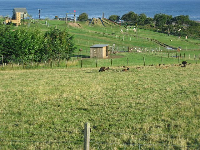
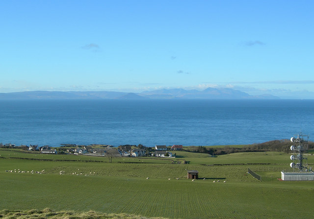
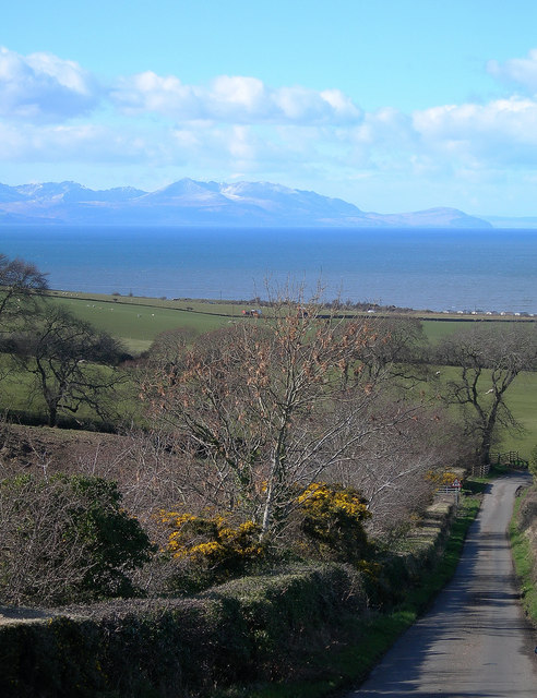
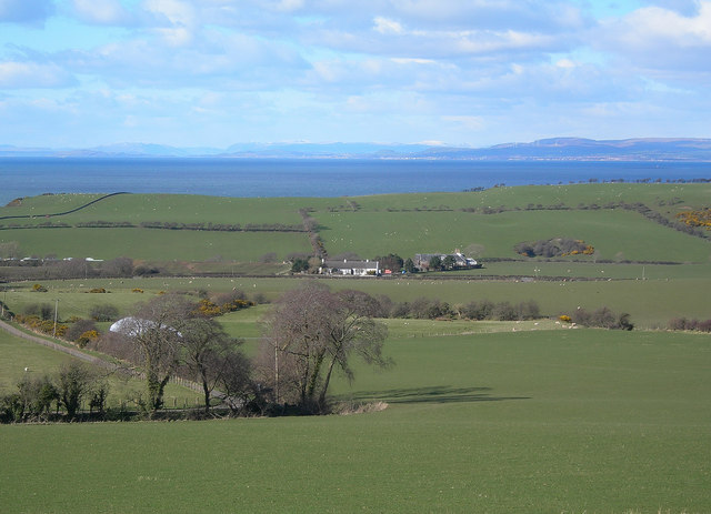
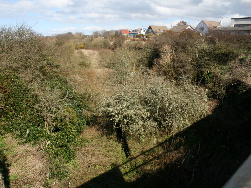
Lagg is a small village located in Ayrshire, Scotland. It is situated near the town of Cumnock and is known for its rural and picturesque surroundings. The village is surrounded by rolling hills and farmland, providing a peaceful and tranquil setting for residents and visitors alike.

Lagg has a small population, with many residents working in agriculture or commuting to nearby towns for employment. The village has a primary school, community hall, and a few local shops and businesses. There are also several historic buildings in the area, including Lagg House, which dates back to the 18th century.

The village is a popular destination for those seeking a quiet and idyllic escape from city life. Visitors to Lagg can enjoy scenic walks, cycling routes, and outdoor activities in the surrounding countryside. The village is also well-connected by road, making it easy to explore the wider Ayrshire region.

Overall, Lagg is a charming and peaceful village that offers a glimpse into rural Scottish life. Its stunning natural beauty and welcoming community make it a hidden gem in the Ayrshire countryside.

If you have any feedback on the listing, please let us know in the comments section below.

Lagg Images

Images are sourced within 2km of 55.422405/-4.7190102 or Grid Reference NS2817. Thanks to Geograph Open Source API. All images are credited.

Kyleston A farm park, complete with a dromedary. Handily placed next door to a holiday camp.
Kyleston
A farm park, complete with a dromedary. Handily placed next door to a holiday camp.
Heads of Ayr Heads of Ayr, viewed from the paddle steamer Waverley, showing Craig Tara holiday village in the background.  The headland is an ancient volcanic plug.
Heads of Ayr
Heads of Ayr, viewed from the paddle steamer Waverley, showing Craig Tara holiday village in the background. The headland is an ancient volcanic plug.
Bracken Bay and Heads of Ayr Viewed from the paddle steamer Waverley, with Ayr in the far distance.
Bracken Bay and Heads of Ayr
Viewed from the paddle steamer Waverley, with Ayr in the far distance.
Fisherton The village of Fisherton, viewed from the lower slopes of Blacktop Hill.  Arran is clear in the background, across the Firth of Clyde.
Fisherton
The village of Fisherton, viewed from the lower slopes of Blacktop Hill. Arran is clear in the background, across the Firth of Clyde.
Communications Mast at Fisherton This large mast is a prominent local landmark.
Communications Mast at Fisherton
This large mast is a prominent local landmark.
Dunduff Castle Dunduff Castle, viewed from the ancient Earthwork.  The three communication masts on Brown Carrick Hill are visible on the skyline.
Dunduff Castle
Dunduff Castle, viewed from the ancient Earthwork. The three communication masts on Brown Carrick Hill are visible on the skyline.
View from Lagg Looking from the coast road, across the farmland and the old railway line, to the Firth of Clyde at Bracken Bay.  Arran is clear in the background.
View from Lagg
Looking from the coast road, across the farmland and the old railway line, to the Firth of Clyde at Bracken Bay. Arran is clear in the background.
Firth of Clyde View Looking across the clifftop fields towards the Firth of Clyde and Arran on a beautiful February afternoon.
Firth of Clyde View
Looking across the clifftop fields towards the Firth of Clyde and Arran on a beautiful February afternoon.
Fisherton Farm
Fisherton Farm
Cliffs at Drumbain The spectacular cliff edge and small stony beach near Drumbain, south from Bracken Bay.
Cliffs at Drumbain
The spectacular cliff edge and small stony beach near Drumbain, south from Bracken Bay.
Wind-blasted Trees Wind-blasted trees at the clifftop near Drumbain, on the Firth of Clyde.
Wind-blasted Trees
Wind-blasted trees at the clifftop near Drumbain, on the Firth of Clyde.
Clifftop Field at Drumbain The last field before the cliff edge and the Firth of Clyde.  Arran is clear in the background.
Clifftop Field at Drumbain
The last field before the cliff edge and the Firth of Clyde. Arran is clear in the background.
Clifftop at Bracken Bay The edge of the farmland before the steep drop to the Firth of Clyde.  Arran is clear in the background.
Clifftop at Bracken Bay
The edge of the farmland before the steep drop to the Firth of Clyde. Arran is clear in the background.
Heads of Ayr Looking NE along Bracken Bay towards the Heads of Ayr, which is a volcanic plug.
Heads of Ayr
Looking NE along Bracken Bay towards the Heads of Ayr, which is a volcanic plug.
Fields and Caravans Looking along the edge of the old railway line, south of the Heads of Ayr.
Fields and Caravans
Looking along the edge of the old railway line, south of the Heads of Ayr.
Goat Fell View Looking across the Firth of Clyde towards Goat Fell from the Brown Carrick Hill Road on a glorious March afternoon.
Goat Fell View
Looking across the Firth of Clyde towards Goat Fell from the Brown Carrick Hill Road on a glorious March afternoon.
Largs and Largs Largs Farm is in the middle distance.  The air was so clear that it was nearly possible to see the town of Largs, in North Ayrshire.  Snow-covered highland mountains are visible on the skyline.
Largs and Largs
Largs Farm is in the middle distance. The air was so clear that it was nearly possible to see the town of Largs, in North Ayrshire. Snow-covered highland mountains are visible on the skyline.
Brown Carrick Hill Looking along the northern edge of Brown Carrick Hill, towards the three radio masts.
Brown Carrick Hill
Looking along the northern edge of Brown Carrick Hill, towards the three radio masts.
Show me another place!

Lagg is located at Grid Ref: NS2817 (Lat: 55.422405, Lng: -4.7190102)

Unitary Authority: South Ayrshire

Police Authority: Ayrshire

What 3 Words

///starch.nips.character. Near Ayr, South Ayrshire

Nearby Locations

Lagg

Related Wikis

Heads of Ayr railway station

Heads of Ayr railway station was a railway station serving the Heads of Ayr, South Ayrshire, Scotland. The station was part of the Maidens and Dunure Light...

Dunure railway station

Dunure railway station was a railway station serving the village of Dunure, South Ayrshire, Scotland. The station was part of the Maidens and Dunure Light...

Heads of Ayr Holiday Camp railway station

Heads of Ayr Holiday Camp railway station was a railway station serving the holiday camp and hotel at Heads of Ayr, South Ayrshire, Scotland. The station...

Craig Tara

Craig Tara is a holiday camp located near Ayr in South Ayrshire, Scotland. It is run by Haven Holidays, who took over and renamed the former Butlin's Ayr...

Nearby Amenities

Located within 500m of 55.422405,-4.7190102
Power: pole
Lat/Long: 55.4248436/-4.7250977
Power: pole
Lat/Long: 55.4245318/-4.7240964
Power: pole
Lat/Long: 55.4243687/-4.7224854
Power: pole
Lat/Long: 55.4243595/-4.7215073
Power: pole
Lat/Long: 55.4245016/-4.7205963
Power: pole
Lat/Long: 55.4246437/-4.7197434
Power: pole
Lat/Long: 55.4249094/-4.7186029
Power: pole
Lat/Long: 55.4251593/-4.7175251
Power: pole
Lat/Long: 55.4254/-4.716496
Power: pole
Lat/Long: 55.4255618/-4.7157264
Power: pole
Lat/Long: 55.4257762/-4.7146903
Power: pole
Lat/Long: 55.4236939/-4.7222374
Power: pole
Lat/Long: 55.4229783/-4.7226268
Power: pole
Lat/Long: 55.4223995/-4.721855
Power: pole
Lat/Long: 55.421872/-4.7211364
Power: pole
Lat/Long: 55.4218918/-4.7203483
Power: pole
Lat/Long: 55.4219536/-4.7196344
Power: pole
Lat/Long: 55.421997/-4.7189993
The data included in this document is from www.openstreetmap.org. The data is made available under ODbL.

Have you been to Lagg?

Leave your review of Lagg below (or comments, questions and feedback).