Ladysmill

Settlement in Stirlingshire

Scotland

Ladysmill

Rosebank Distillery Partial demolition of the old distillery taking place. A new complex is beginning to take shape to form a new Distillery incorporating Visitor Experience, Cafe, retail, associated landscaping and car park.
Rosebank Distillery Credit: Eirian Evans

Ladysmill is a small village located in the county of Stirlingshire, Scotland. Situated on the banks of the River Forth, it is nestled between the towns of Falkirk and Stirling. The village is known for its peaceful and picturesque surroundings, making it an ideal destination for those seeking tranquility away from the bustle of urban life.

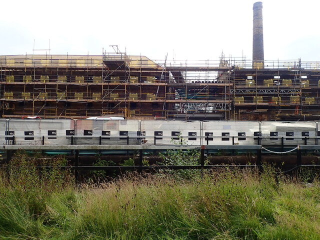
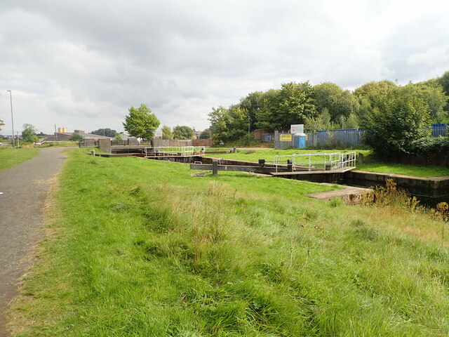
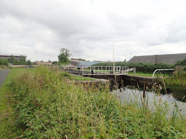
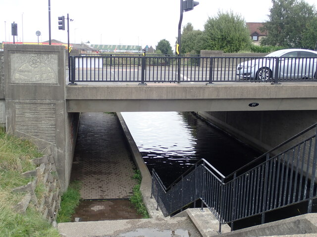
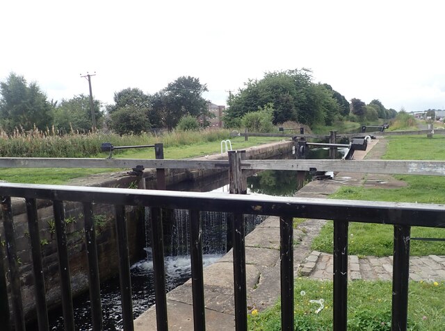
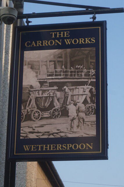
Historically, Ladysmill was a significant industrial area, with mills and factories playing a vital role in the local economy. The village derived its name from the Lady's Mill, which was a prominent textile mill in the 19th century. Today, the mill has been converted into residential properties, adding a touch of history to the village's architectural landscape.

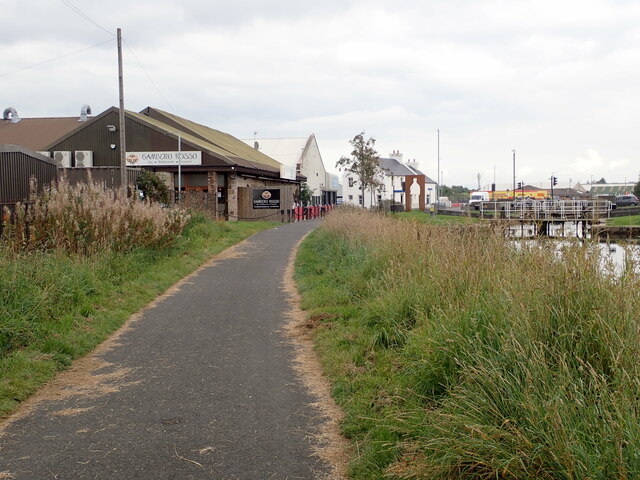
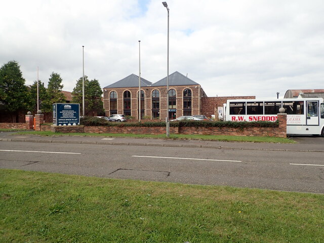
The village of Ladysmill is home to a close-knit community, with a population of approximately 500 residents. The community is known for its warm and friendly atmosphere, making it an inviting place for new residents and visitors alike. The village has a range of amenities, including a local shop, a primary school, and a community center, which hosts various events and activities throughout the year.

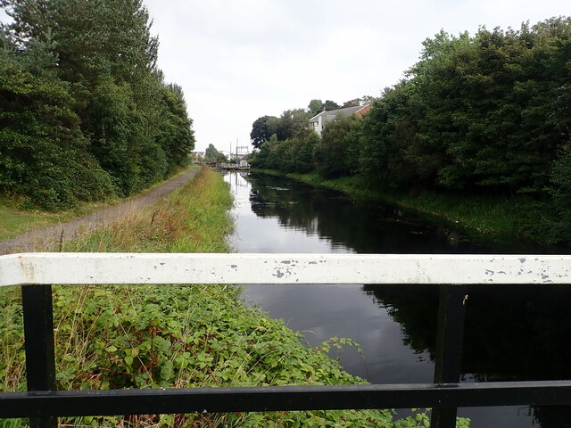
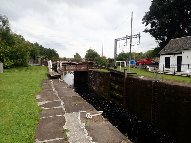
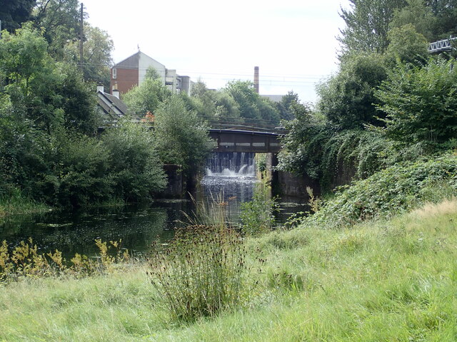
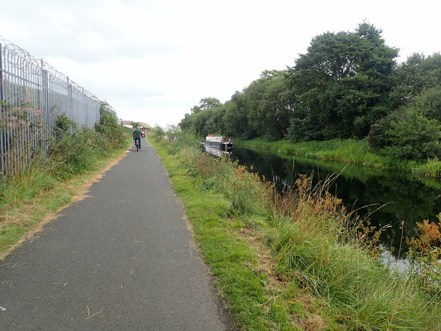
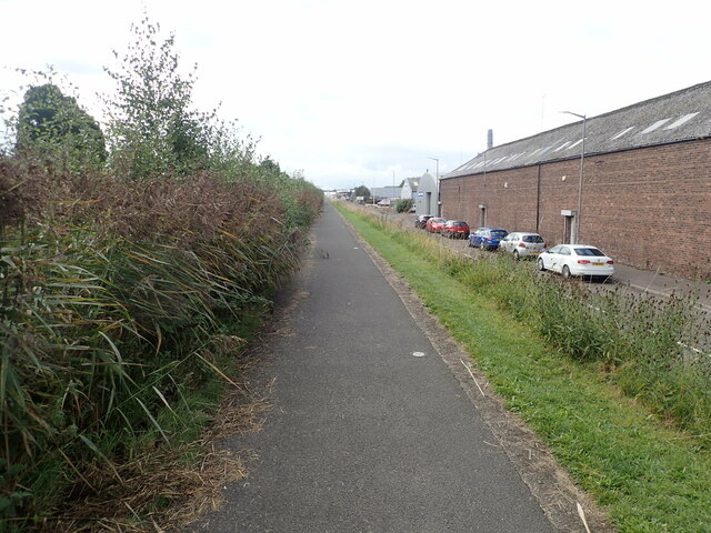
Ladysmill boasts stunning natural beauty, with the River Forth providing a picturesque backdrop for outdoor enthusiasts. The surrounding countryside offers ample opportunities for walking, cycling, and fishing, attracting nature lovers from near and far.

Overall, Ladysmill offers a harmonious blend of history, community spirit, and natural splendor, making it a hidden gem in the heart of Stirlingshire.

If you have any feedback on the listing, please let us know in the comments section below.

Ladysmill Images

Images are sourced within 2km of 56.003346/-3.772795 or Grid Reference NS8980. Thanks to Geograph Open Source API. All images are credited.

Rosebank Distillery Partial demolition of the old distillery taking place. A new complex is beginning to take shape to form a new Distillery incorporating Visitor Experience, Cafe, retail, associated landscaping and car park.
Rosebank Distillery
Partial demolition of the old distillery taking place. A new complex is beginning to take shape to form a new Distillery incorporating Visitor Experience, Cafe, retail, associated landscaping and car park.
Looking down the Forth and Clyde Canal from Lock No.10
Camelon Railway Lock, No. 9 The railway bridge carries the Edinburgh to Dundee railway line.
Camelon Railway Lock, No. 9
The railway bridge carries the Edinburgh to Dundee railway line.
Camelon Railway Lock, No. 9 Taken from the towpath on the north side of the Clyde & Forth Canal
Camelon Railway Lock, No. 9
Taken from the towpath on the north side of the Clyde & Forth Canal
Merers Lock Lock No.8 on the Forth and Clyde Canal. Merchiston Road crosses the canal east of the lock
Merers Lock
Lock No.8 on the Forth and Clyde Canal. Merchiston Road crosses the canal east of the lock
Merchiston Lock This is lock No.7 on the Forth and Clyde Canal
Merchiston Lock
This is lock No.7 on the Forth and Clyde Canal
Towpath beside the Forth and Clyde Canal The barbed wire topped fence on the left surrounds an industrial area.
Towpath beside the Forth and Clyde Canal
The barbed wire topped fence on the left surrounds an industrial area.
Forth and Clyde Canal towpath Near canal lock no.5, Bainsford Lock. The B905 crosses the canal on the east side of the lock.
Forth and Clyde Canal towpath
Near canal lock no.5, Bainsford Lock. The B905 crosses the canal on the east side of the lock.
Towpath underpassing Grahams Road bridge
Offices to let on Bankside
Bankside Industrial Estate
Abbotshaugh Lock Lock No.4 on the Forth and Clyde Canal
Abbotshaugh Lock
Lock No.4 on the Forth and Clyde Canal
Canal towpath near the Bankside Industrial Estate The canal is obscured by overgrown hedge
Canal towpath near the Bankside Industrial Estate
The canal is obscured by overgrown hedge
Boer War Memorial, Newmarket Street, Falkirk
Newmarket Street, Falkirk
Upper Newmarket Street, Falkirk
The Carron Works Public House A Wetherspoons pub on Bank Street, Falkirk.
The Carron Works Public House
A Wetherspoons pub on Bank Street, Falkirk.
The Carron Works Public House
Show me another place!

Ladysmill is located at Grid Ref: NS8980 (Lat: 56.003346, Lng: -3.772795)

Unitary Authority: Falkirk

Police Authority: Forth Valley

What 3 Words

///damp.kicks.olive. Near Falkirk

Nearby Locations

Middlefield Ladysmill

Related Wikis

Firs Park

Firs Park was a football stadium in Falkirk, Scotland, which was the home of East Stirlingshire F.C. between 1921 and 2008. It was located on Firs Street...

Falkirk bus station

Falkirk bus station is a disused bus station situated in Falkirk, Scotland. It is privately owned. == History == The station was built in the 1930s for...

Falkirk

Falkirk ( Scottish Gaelic: An Eaglais Bhreac, Scots: Fawkirk [ˈfɔːkɪrk]) is a town in the Central Lowlands of Scotland, historically within the county...

Falkirk Grahamston railway station

Falkirk Grahamston railway station is one of two railway stations serving the town of Falkirk in Scotland. It is located on the Edinburgh to Dunblane Line...

Graeme High School

Graeme High School is a non-denominational public secondary school located in Falkirk, Scotland. The school is operated by Falkirk Council on behalf of...

St Andrew's West

St. Andrew's West Parish Church is the largest church in Falkirk, Scotland, founded in 1843 and situated in the town centre on Upper Newmarket Street and...

Falkirk Old Parish Church

Falkirk Old & St. Modan's Parish Church, also known as "Falkirk Trinity Church", is a congregation of the Church of Scotland in Falkirk, central Scotland...

Falkirk Steeple

The Falkirk Steeple is a landmark which dominates the skyline of Falkirk in central Scotland. The present structure on the High Street was built in 1814...

Nearby Amenities

Located within 500m of 56.003346,-3.772795
Traffic Signals
Lat/Long: 56.0001888/-3.778437
Traffic Signals
Lat/Long: 56.0008855/-3.7762891
Traffic Signals
Traffic Signals: signal
Lat/Long: 56.0026704/-3.7711404
Turning Circle
Lat/Long: 56.001172/-3.775698
Barrier: kerb
Lat/Long: 56.0026497/-3.7714171
Mini Roundabout
Direction: clockwise
Lat/Long: 56.0041354/-3.7743892
Crossing
Crossing: zebra
Lat/Long: 56.003464/-3.777557
Give Way
Direction: backward
Lat/Long: 56.0014669/-3.7746614
Power: transformer
Lat/Long: 56.0020801/-3.7804368
Access: destination
Entrance: main
Foot: yes
Wheelchair: yes
Lat/Long: 56.0022614/-3.7771912
Access: destination
Entrance: main
Foot: yes
Lat/Long: 56.0022839/-3.7779985
Access: destination
Entrance: main
Foot: yes
Wheelchair: yes
Lat/Long: 56.0024894/-3.7801133
Access: destination
Entrance: main
Foot: yes
Wheelchair: yes
Lat/Long: 56.0027014/-3.7802729
Access: destination
Entrance: main
Foot: yes
Wheelchair: yes
Lat/Long: 56.0028473/-3.7775184
Access: destination
Entrance: main
Foot: yes
Wheelchair: yes
Lat/Long: 56.0036589/-3.7793819
Waste Basket
Lat/Long: 56.001462/-3.7720756
Waste Basket
Lat/Long: 56.0062736/-3.770695
Entrance: main
Lat/Long: 56.0068452/-3.7706704
Railway: switch
Lat/Long: 56.0012617/-3.7736571
Railway: switch
Lat/Long: 56.0015193/-3.7766708
Railway: switch
Lat/Long: 56.00156/-3.777177
Railway: switch
Lat/Long: 56.0015948/-3.7778735
Crossing
Crossing: uncontrolled
Crossing Ref: zebra
Supervised: no
Lat/Long: 56.0033363/-3.7804702
Crossing
Crossing: uncontrolled
Crossing Ref: zebra
Supervised: no
Lat/Long: 56.0035285/-3.7803208
Crossing
Crossing: uncontrolled
Crossing Ref: zebra
Supervised: no
Lat/Long: 56.0038771/-3.780623
Crossing
Crossing: uncontrolled
Crossing Ref: zebra
Supervised: no
Lat/Long: 56.0043407/-3.7804945
Crossing
Crossing: zebra
Lat/Long: 56.0033532/-3.7776678
Crossing
Crossing: zebra
Lat/Long: 56.0023876/-3.778155
Crossing
Crossing: zebra
Lat/Long: 56.0032076/-3.778552
Crossing
Crossing: zebra
Lat/Long: 56.0036344/-3.7787636
Crossing
Crossing: zebra
Lat/Long: 56.0024865/-3.7790382
Crossing
Crossing: zebra
Lat/Long: 56.0030804/-3.7793088
Crossing
Crossing: zebra
Lat/Long: 56.0035723/-3.7773406
Barrier: bollard
Lat/Long: 56.0038657/-3.7762922
Charging Station
Grangemouth Rd Charge Point
Motorcar: yes
Lat/Long: 56.004054/-3.7665658
Noexit: yes
Lat/Long: 56.0039183/-3.7720095
Post Box
Brand: Royal Mail
Brand Wikidata: Q638098
Operator: Royal Mail
Operator Wikidata: Q638098
Post Box Type: pillar
Lat/Long: 56.0008952/-3.7766774
Entrance: yes
Lat/Long: 56.0007642/-3.7776196
Entrance: yes
Lat/Long: 56.0006641/-3.7777948
Entrance: yes
Lat/Long: 56.0010879/-3.7778527
Entrance: yes
Lat/Long: 56.0010876/-3.777908
Entrance: yes
Lat/Long: 56.0009884/-3.77785
Entrance: yes
Lat/Long: 56.0009881/-3.7779028
Turning Circle
Lat/Long: 56.0040418/-3.7765612
Bus Stop
Lat/Long: 56.0043343/-3.7657121
Bus Stop
Lat/Long: 56.0038604/-3.7681019
Post Box
Collection Times: Mo-Fr 09:00; Sa 07:00
Operator: Royal Mail
Post Box Design: type_k
Post Box Type: pillar
Ref: FK2 33D
Royal Cypher: scottish_crown
Lat/Long: 56.0037615/-3.7679437
Crossing
Crossing: traffic_signals
Crossing Island: no
Tactile Paving: yes
Lat/Long: 56.0027657/-3.7710224
Bus Stop
Naptan AtcoCode: 66901500030
Naptan NaptanCode: 32525927
Lat/Long: 56.002033/-3.7729165
Bus Stop
Naptan AtcoCode: 66901500031
Naptan NaptanCode: 32525945
Lat/Long: 56.001796/-3.773182
Cafe
Murphey's Tea Rooms
Lat/Long: 56.0026164/-3.7716639
Social Facility
FDAMH (Falkirk's Mental Health Association)
Addr City: Falkirk
Addr Housename: Victoria Centre
Addr Housenumber: 173
Addr Postcode: FK2 7AU
Addr Street: Victoria Road
Description: Hours of service provision differ — please see individual service pages for details.
Healthcare: mental_health
Phone: +44 1324 671600
Service Times: Mo-Th 09:00-17:00; Fr 09:00-16:00
Social Facility: healthcare
Social Facility For: mental_health
Website: https://www.fdamh.org.uk/
Lat/Long: 56.0042603/-3.7771298
Addr City: Falkirk
Addr Housenumber: 74
Addr Postcode: FK1 1RB
Addr Street: Weir Street
Lat/Long: 56.0012936/-3.777675
Addr City: Falkirk
Addr Housenumber: 76
Addr Postcode: FK1 1RB
Addr Street: Weir Street
Lat/Long: 56.0013427/-3.7776733
Addr City: Falkirk
Addr Housenumber: 78
Addr Postcode: FK1 1RB
Addr Street: Weir Street
Lat/Long: 56.0012902/-3.7773013
Addr City: Falkirk
Addr Housenumber: 80
Addr Postcode: FK1 1RB
Addr Street: Weir Street
Lat/Long: 56.0013436/-3.7772993
Addr City: Falkirk
Addr Housenumber: 82
Addr Postcode: FK1 1RB
Addr Street: Weir Street
Lat/Long: 56.0012902/-3.7771834
Addr City: Falkirk
Addr Housenumber: 84
Addr Postcode: FK1 1RB
Addr Street: Weir Street
Lat/Long: 56.0013427/-3.777183
Addr City: Falkirk
Addr Housenumber: 86
Addr Postcode: FK1 1RB
Addr Street: Weir Street
Lat/Long: 56.0012912/-3.7768251
Addr City: Falkirk
Addr Housenumber: 88
Addr Postcode: FK1 1RB
Addr Street: Weir Street
Lat/Long: 56.0013436/-3.7768247
Grangemouth Junction
Railway: junction
Lat/Long: 56.0015457/-3.7766106
Post Box
Collection Times: Mo-Fr 09:00; Sa 07:00
Operator: Royal Mail
Post Box Design: type_b
Post Box Type: pillar
Ref: FK2 24D
Royal Cypher: GVIR
Royal Cypher Wikidata: Q33102169
Lat/Long: 56.0072344/-3.7745923
Post Box
Collection Times: Mo-Fr 16:30; Sa 11:15
Operator: Royal Mail
Post Box Type: pillar
Ref: FK2 54
Royal Cypher: GR
Royal Cypher Wikidata: Q33102273
Lat/Long: 56.0052231/-3.7759595
Morrisons Daily
Addr City: Falkirk
Addr Housenumber: 192
Addr Postcode: FK2 7AZ
Addr Street: Thornhill Road
Brand: Morrisons Daily
Brand Wikidata: Q99752411
Shop: convenience
Website: https://my.morrisons.com/storefinder/61378/morrisons-daily-falkirk-thornhill-road
Lat/Long: 56.0052238/-3.7760514
Crossing
Crossing: traffic_signals
Crossing Island: no
Tactile Paving: yes
Lat/Long: 56.0027544/-3.7713459
Crossing
Crossing: traffic_signals
Crossing Island: no
Tactile Paving: yes
Lat/Long: 56.0025616/-3.7712883
Give Way
Direction: backward
Lat/Long: 56.0022352/-3.7722221
Give Way
Direction: backward
Lat/Long: 56.0019291/-3.7727833
Crossing
Crossing: uncontrolled
Kerb: lowered
Lat/Long: 56.0016169/-3.7739093
Crossing
Crossing: uncontrolled
Kerb: lowered
Lat/Long: 56.0016573/-3.773952
Give Way
Direction: forward
Lat/Long: 56.0014996/-3.7748216
Noexit: yes
Lat/Long: 56.0040503/-3.7709619
Noexit: yes
Lat/Long: 56.0037886/-3.7706763
Post Box
Collection Times: Mo-Fr 09:00; Sa 07:00
Operator: Royal Mail
Post Box Type: pillar
Ref: FK1 21D
Royal Cypher: scottish_crown
Lat/Long: 55.9995479/-3.7705133
Holiday Flats
Addr Housenumber: 160-174
Addr Street: Thornhill Road
Tourism: hotel
Lat/Long: 56.0048316/-3.7755758
Bench
Material: wood
Lat/Long: 56.0049559/-3.7747019
Bench
Material: metal
Lat/Long: 56.0046201/-3.7744709
Bench
Material: wood
Lat/Long: 56.0047613/-3.7746466
Bench
Material: wood
Lat/Long: 56.0048924/-3.7747636
Bench
Material: metal
Lat/Long: 56.0046651/-3.7746104
Bench
Material: metal
Lat/Long: 56.0041982/-3.7733905
Bench
Material: stone
Lat/Long: 56.0049232/-3.7750208
Bench
Material: metal
Lat/Long: 56.0039285/-3.7729875
Another Football Ground
Sport: soccer
Lat/Long: 56.0051544/-3.772017
Bench
Material: stone
Lat/Long: 56.0048816/-3.774913
Bench
Material: metal
Lat/Long: 56.004359/-3.7736005
Bench
Material: metal
Lat/Long: 56.0056458/-3.7744292
Bench
Material: metal
Lat/Long: 56.0044312/-3.7737026
Football Ground
Sport: soccer
Lat/Long: 56.0050206/-3.7728426
Bench
Material: metal
Lat/Long: 56.0060585/-3.7725303
Sir John De Græme Memorial
Historic: memorial
Inscription Nw: This memorial fountain is erected near the spot where sir John de Græme fell
Inscription Se: presented by Robert Dollar Esq. of San Francisco to Falkirk his native town in honour of sir John de Græme and his men who fell in the battle of Falkirk 22nd July 1298
Inscription Sw: 1912
Material: stone
Lat/Long: 56.0049226/-3.7749177
Bench
Material: stone
Lat/Long: 56.0049581/-3.774897
Bench
Material: metal
Lat/Long: 56.0049898/-3.7744505
Bench
Material: metal
Lat/Long: 56.0038151/-3.7730316
Bench
Material: metal
Lat/Long: 56.003904/-3.7732289
Man Made: flagpole
Lat/Long: 56.0049662/-3.7747988
Bench
Material: metal
Lat/Long: 56.0039344/-3.7734544
Bench
Material: metal
Lat/Long: 56.0058002/-3.7710705
Bench
Material: metal
Lat/Long: 56.0045736/-3.7707842
Bench
Material: stone
Lat/Long: 56.0049282/-3.7748206
Man Made: flagpole
Lat/Long: 56.0049786/-3.7748555
Give Way
Direction: backward
Lat/Long: 56.0033866/-3.7806781
The data included in this document is from www.openstreetmap.org. The data is made available under ODbL.

Have you been to Ladysmill?

Leave your review of Ladysmill below (or comments, questions and feedback).