Kingswells

Settlement in Aberdeenshire

Scotland

Kingswells

Uprooted Trees, Brimmondside Trees blocking what would normally be a road track at Brimmondside, collectively uprooted during the destructive Storm Arwen in November 2021.
Uprooted Trees, Brimmondside Credit: Uamhair

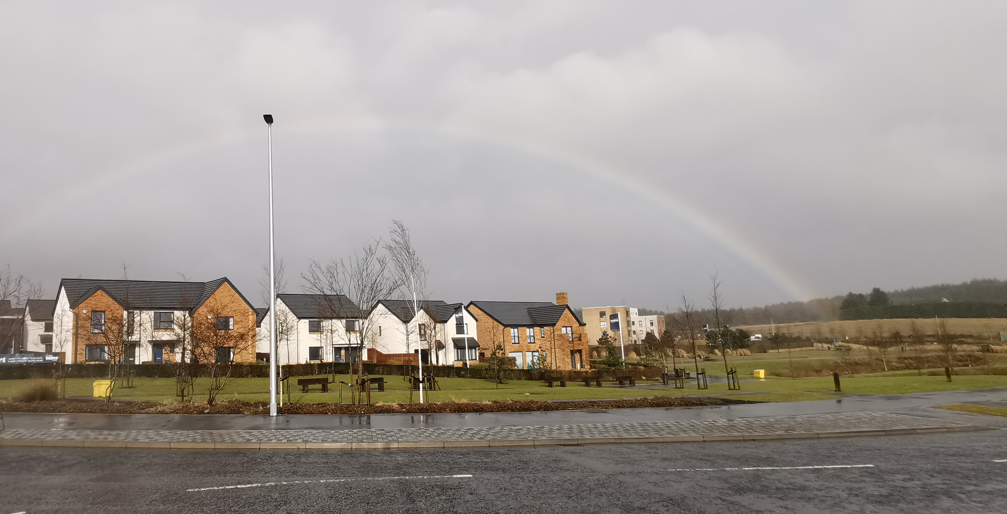
Kingswells is a small suburb located in Aberdeenshire, Scotland. It is situated approximately 6 miles west of the city of Aberdeen, making it an ideal residential area for those seeking a quieter lifestyle while still having easy access to urban amenities.

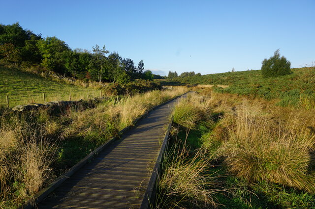
The area of Kingswells is known for its picturesque surroundings, with rolling hills and lush green spaces. It is bordered by the beautiful countryside of Aberdeenshire, offering residents the opportunity for outdoor activities such as hiking, cycling, and exploring nature trails. The nearby Brimmond Hill is a popular spot for walkers and provides stunning panoramic views of the surrounding area.

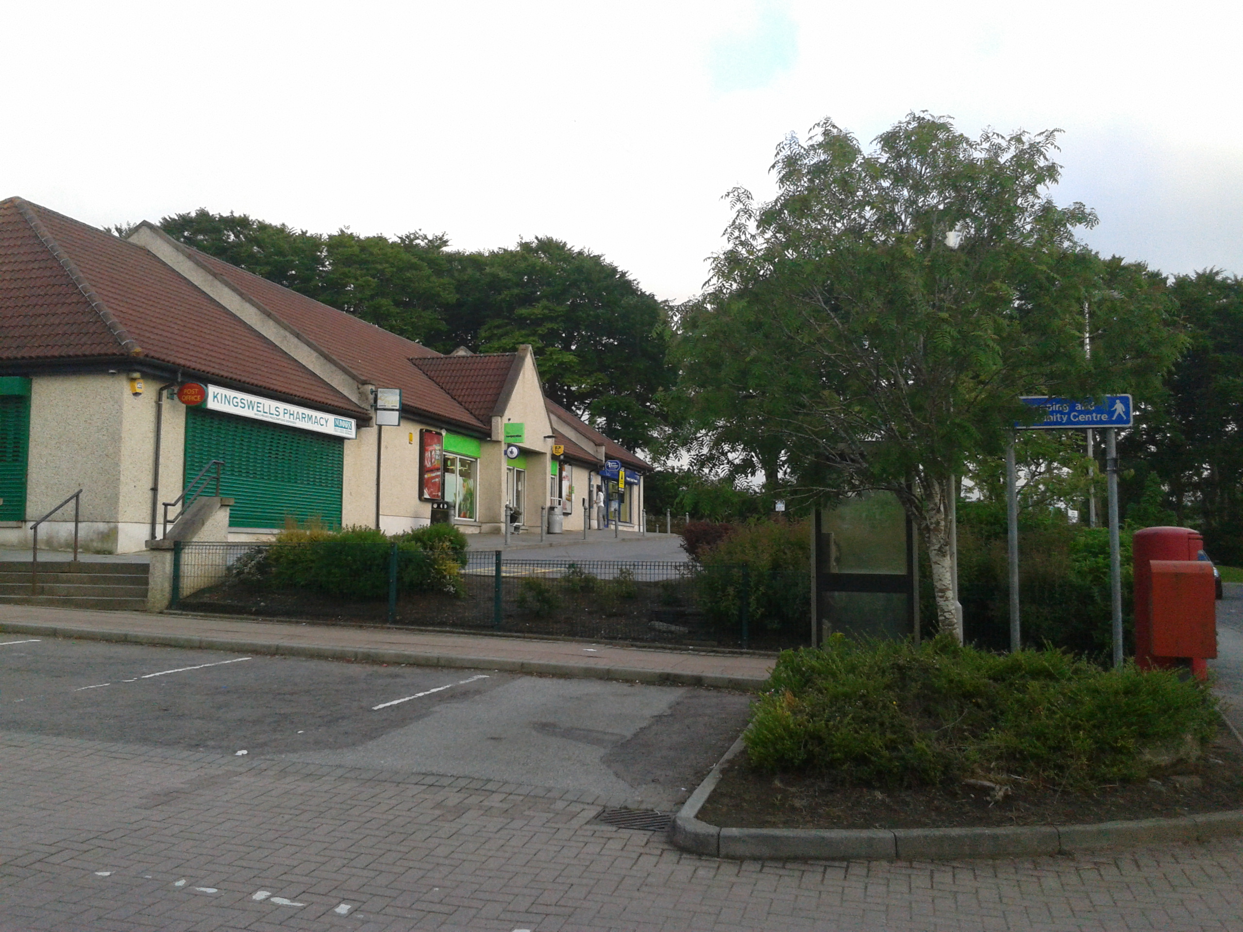
Kingswells itself has a close-knit community and offers a range of amenities to cater to its residents' needs. There are several local shops, including a supermarket, pharmacy, and a variety of small businesses. For those seeking entertainment and dining options, the area also boasts a few pubs and restaurants.

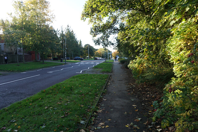
One of the key attractions of Kingswells is its excellent transport links. The suburb is well-connected to Aberdeen city center and other destinations via a reliable bus service. Additionally, the nearby AWPR (Aberdeen Western Peripheral Route) provides easy access to major roads, making commuting to other parts of Aberdeenshire and beyond convenient.

Overall, Kingswells offers a peaceful and scenic setting, combined with the convenience of nearby amenities and good transportation connections. It is an attractive location for individuals and families looking for a suburban lifestyle within easy reach of both nature and city life.

If you have any feedback on the listing, please let us know in the comments section below.

Kingswells Images

Images are sourced within 2km of 57.156016/-2.2255381 or Grid Reference NJ8607. Thanks to Geograph Open Source API. All images are credited.

Uprooted Trees, Brimmondside Trees blocking what would normally be a road track at Brimmondside, collectively uprooted during the destructive Storm Arwen in November 2021.
Uprooted Trees, Brimmondside
Trees blocking what would normally be a road track at Brimmondside, collectively uprooted during the destructive Storm Arwen in November 2021.
East Kingsford The landscape here has been significantly altered by the construction of the Aberdeen Western Peripheral Route, visible here on the left.
East Kingsford
The landscape here has been significantly altered by the construction of the Aberdeen Western Peripheral Route, visible here on the left.
Turf Zone "OverBucksBurn" Footbridge over Bucks Burn.
Turf Zone "OverBucksBurn"
Footbridge over Bucks Burn.
Fingerpost near Burnbrae Moss
Fingerpost on Burnbrae Moss
Turf Zone "BucksBurnStep" Steps on Burnbrae Moss.
Turf Zone "BucksBurnStep"
Steps on Burnbrae Moss.
Turf Zone "BBValleyWalk" Path on Burnbrae Moss.
Turf Zone "BBValleyWalk"
Path on Burnbrae Moss.
Path leading to Kingswells
Turf Zone "WithGraig" Path leading to Kingswells Crescent.
Turf Zone "WithGraig"
Path leading to Kingswells Crescent.
Turf Zone "KingsCrescent" Path off Kingswells Crescent, Kingswells.
Turf Zone "KingsCrescent"
Path off Kingswells Crescent, Kingswells.
Path leading to Wellside Avenue, Kingshills
Wellside Avenue, Kingswells
Wellside Avenue at Kingswells Crescent, Kingswells
Track at Den of Moss Side Off Kings Crescent, Kingswells.
Track at Den of Moss Side
Off Kings Crescent, Kingswells.
Turf Zone "BucksBurn" Track leading to Corse Wynd, Kingswells.
Turf Zone "BucksBurn"
Track leading to Corse Wynd, Kingswells.
Kingswells Crescent, Kingswells
Turf Zone "KingKingMeet" At the junction of Kingswells Crescent and Kingswood Drive, Kingswells.
Turf Zone "KingKingMeet"
At the junction of Kingswells Crescent and Kingswood Drive, Kingswells.
Kinkswood Drive, Kingswells
Show me another place!

Kingswells is located at Grid Ref: NJ8607 (Lat: 57.156016, Lng: -2.2255381)

Unitary Authority: City of Aberdeen

Police Authority: North East

What 3 Words

///fleet.recruiter.calm. Near Kingswells, Aberdeen

Nearby Locations

Kingswells

Related Wikis

Kingswells

Kingswells is a village and suburb of Aberdeen, Scotland, situated west of the city and to the east of Westhill. Kingswells has existed as a village for...

Brimmond Hill

Brimmond Hill is a hill in Aberdeen, Scotland. The summit is the highest point within the Aberdeen City council area, at an elevation of 266 m (873 ft...

Countesswells

Countesswells (Scottish Gaelic: Baile Cobhan an t-Eas) is an area of Aberdeen, Scotland. == Construction == In 2014, planning permission was granted for...

Aberdeen Western Peripheral Route

The Aberdeen Western Peripheral Route (AWPR), unofficially also the City of Aberdeen Bypass, is a major road that wraps around the city of Aberdeen, Scotland...
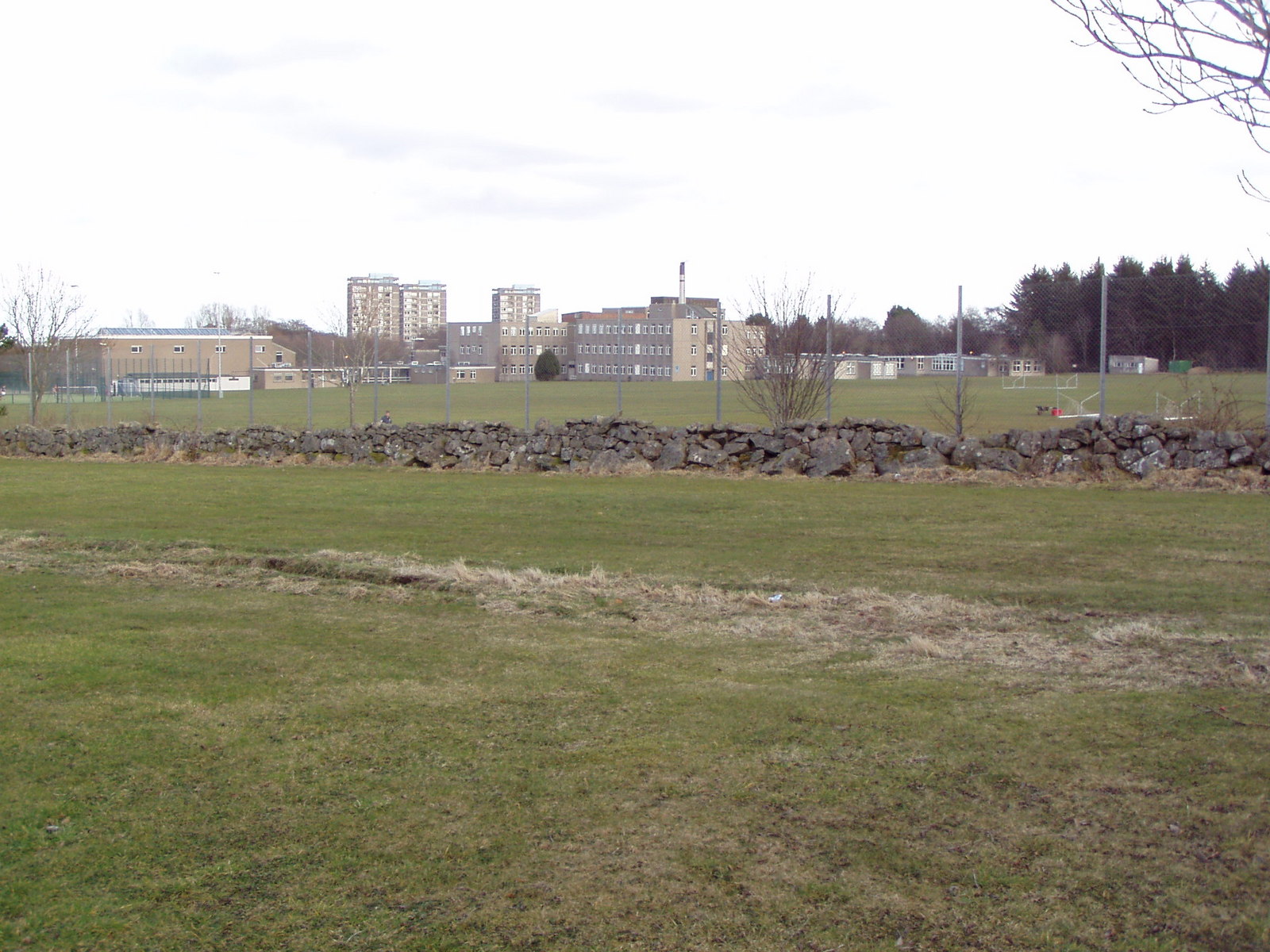
Hazlehead Academy

Hazlehead Academy, formerly known as Central School then Aberdeen Academy, is a comprehensive secondary school in Aberdeen, Scotland. It has five main...
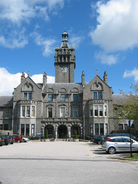
Woodend Hospital

Woodend Hospital is a health facility located in the Woodend area of Aberdeen, Scotland. It is managed by NHS Grampian. == History == The hospital, which...

Hazlehead

Hazlehead is an area to the west of Aberdeen. == Usage == Hazlehead comprises a mixture of flats, houses and residential tower blocks. It was originally...

Westhill Academy

Westhill Academy is an Aberdeenshire Council secondary school in Westhill, near Aberdeen, Scotland, serving the Westhill, Elrick and Skene areas of Aberdeenshire...

Related Videos

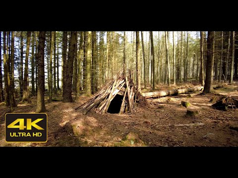
A Walk through Countesswells Forest, Aberdeen Scotland Countryside 4K

A walk through Countesswells forest, Aberdeen Scotland Countryside with no added music and ASMR nature sounds recorded ...

4K Virtual Forest Walk with Nature Sounds ASMR | Countesswells Forest | Cinematic Short Preview

Short 4K cinematic walk through Countesswells forest, Scotland with no added music and ASMR nature sounds recorded with DJI ...

Introduction to Walking Meditation

Dhamma practice: Walking Meditation.

Nearby Amenities

Located within 500m of 57.156016,-2.2255381
Crossing
Crossing: uncontrolled
Crossing Ref: zebra
Tactile Paving: yes
Lat/Long: 57.1563432/-2.2251692
Turning Circle
Lat/Long: 57.158881/-2.2228624
Kingswells
Is In: Aberdeen
Place: village
Population: 5210
Wikidata: Q1008692
Wikipedia: en:Kingswells
Lat/Long: 57.1575045/-2.2234447
Crossing
Crossing: uncontrolled
Crossing Island: no
Crossing Ref: zebra
Supervised: no
Tactile Paving: yes
Lat/Long: 57.1529547/-2.2201273
Post Box
Operator: Royal Mail
Lat/Long: 57.1532631/-2.2203729
Crossing
Crossing: unmarked
Crossing Island: yes
Traffic Calming: island
Lat/Long: 57.1551925/-2.226813
Traffic Calming: table
Lat/Long: 57.1547858/-2.2256631
Traffic Calming: table
Lat/Long: 57.1551909/-2.225583
Traffic Calming: table
Lat/Long: 57.1557619/-2.2253465
Crossing
Lat/Long: 57.154341/-2.2239862
Crossing
Crossing: uncontrolled
Crossing Ref: zebra
Tactile Paving: yes
Lat/Long: 57.1574967/-2.2248766
Crossing
Crossing: unmarked
Crossing Island: no
Tactile Paving: yes
Lat/Long: 57.1571721/-2.2250816
Bus Stop
Lat/Long: 57.157239/-2.2237074
Bus Stop
Migvie Grove
Bus: yes
Naptan AtcoCode: 639005691
Naptan CommonName: Migvie Grove
Naptan Indicator: opp
Naptan NaptanCode: 23235427
Naptan Verified: no
Public Transport: platform
Lat/Long: 57.1599598/-2.2239202
Bus Stop
Kingswells Drive
Bus: yes
Naptan AtcoCode: 639005672
Naptan CommonName: Kingswells Drive
Naptan Indicator: opp
Naptan NaptanCode: 23235283
Naptan Verified: no
Public Transport: platform
Shelter: yes
Lat/Long: 57.1548356/-2.226709
Bus Stop
Coull Gardens
Bus: yes
Naptan AtcoCode: 639005771
Naptan CommonName: Coull Gardens
Naptan Indicator: at
Naptan NaptanCode: 23235353
Naptan Verified: no
Public Transport: platform
Lat/Long: 57.1569805/-2.2289453
Traffic Signals
Traffic Signals: signal
Lat/Long: 57.1529712/-2.2267548
Information: guidepost
Source: survey
Tourism: information
Lat/Long: 57.1590408/-2.2241513
Information: guidepost
Source: survey
Tourism: information
Lat/Long: 57.1577504/-2.2221485
Waste Basket
Source: survey
Lat/Long: 57.1577514/-2.2221386
Bus Stop
Cromar Gardens
Bench: no
Bus: yes
Naptan AtcoCode: 639005722
Naptan CommonName: Cromar Gardens
Naptan Indicator: opp
Naptan NaptanCode: 23237439
Naptan Verified: no
Public Transport: platform
Shelter: no
Source: survey
Lat/Long: 57.1577765/-2.2221102
Information: guidepost
Source: survey
Tourism: information
Lat/Long: 57.1572797/-2.2206364
Turning Circle
Lat/Long: 57.1543022/-2.2200272
Bus Stop
Kingswells Drive
Bus: yes
Naptan AtcoCode: 639005671
Naptan CommonName: Kingswells Drive
Naptan Indicator: at
Naptan NaptanCode: 23237627
Naptan Verified: no
Public Transport: platform
Lat/Long: 57.1556515/-2.2263139
Bus Stop
Kingswells Crescent
Bus: yes
Naptan AtcoCode: 639008601
Naptan CommonName: Kingswells Crescent
Naptan Indicator: adj
Naptan NaptanCode: 23236897
Naptan Verified: no
Public Transport: platform
Lat/Long: 57.1585706/-2.2243799
Bus Stop
Kingswells Crescent
Bus: yes
Naptan AtcoCode: 639008602
Naptan CommonName: Kingswells Crescent
Naptan Indicator: opp
Naptan NaptanCode: 23236896
Naptan Verified: no
Public Transport: platform
Lat/Long: 57.1583229/-2.2246839
Bus Stop
Callum Wynd
Bus: yes
Naptan AtcoCode: 639008141
Naptan CommonName: Callum Wynd
Naptan Indicator: opp
Naptan NaptanCode: 23236932
Naptan Verified: no
Public Transport: platform
Shelter: yes
Lat/Long: 57.1585947/-2.2272293
Bus Stop
Midmar Crescent
Bus: yes
Naptan AtcoCode: 639008131
Naptan CommonName: Midmar Crescent
Naptan Indicator: opp
Naptan NaptanCode: 23236892
Naptan Verified: no
Public Transport: platform
Lat/Long: 57.1590985/-2.2204982
Bus Stop
Broaddykes Drive
Bus: yes
Naptan AtcoCode: 639005661
Naptan CommonName: Broaddykes Drive
Naptan Indicator: at
Naptan NaptanCode: 23235246
Naptan Verified: no
Public Transport: platform
Lat/Long: 57.1542973/-2.2239844
Bus Stop
Kingswood Gardens
Bus: yes
Naptan AtcoCode: 639005652
Naptan CommonName: Kingswood Gardens
Naptan Indicator: opp
Naptan NaptanCode: 23234974
Naptan Verified: no
Public Transport: platform
Lat/Long: 57.1531161/-2.2202808
Bus Stop
Kingswood Gardens
Bus: yes
Naptan AtcoCode: 639005651
Naptan CommonName: Kingswood Gardens
Naptan Indicator: at
Naptan NaptanCode: 23234959
Naptan Verified: no
Public Transport: platform
Lat/Long: 57.1528652/-2.2199487
Bus Stop
Callum Park
Bus: yes
Naptan AtcoCode: 639005781
Naptan CommonName: Callum Park
Naptan Indicator: opp
Naptan NaptanCode: 23235423
Naptan Verified: no
Public Transport: platform
Lat/Long: 57.1595998/-2.2271357
Bus Stop
Clova Park
Bus: yes
Naptan AtcoCode: 639005761
Naptan CommonName: Clova Park
Naptan Indicator: at
Naptan NaptanCode: 23235282
Naptan Verified: no
Public Transport: platform
Lat/Long: 57.1556275/-2.2274863
Bus Stop
Broaddykes Drive
Bus: yes
Naptan AtcoCode: 639005662
Naptan CommonName: Broaddykes Drive
Naptan Indicator: opp
Naptan NaptanCode: 23235248
Naptan Verified: no
Public Transport: platform
Shelter: yes
Lat/Long: 57.1543836/-2.224095
Co-op Food
Addr City: Aberdeen
Addr Postcode: AB15 8TG
Addr Street: Kingswells Avenue
Addr Unit: Unit 2 Kingswells Shopping Centre
Brand: Co-op Food
Brand Wikidata: Q3277439
Brand Wikipedia: en:Co-op Food
Fhrs Authority: Aberdeen City
Fhrs Id: 593275
Fhrs Local Authority Id: EHDC7661
Operator: The Co-operative Group
Operator Wikidata: Q117202
Shop: convenience
Website: https://www.coop.co.uk/store-finder/AB15-8TG/kingswells-avenue
Lat/Long: 57.156113/-2.2243774
Fast Food
Bill's Wok Inn
Addr City: Aberdeen
Addr Country: GB
Addr Postcode: AB15 8TG
Addr Street: Village Centre
Addr Unit: 2
Cuisine: chinese
Delivery: yes
Opening Hours: Mo-Su 16:30-22:30; Tu off
Phone: +44 1224 749333
Takeaway: yes
Website: https://www.bills-wok-inn.co.uk
Lat/Long: 57.1565566/-2.2243291
Veterinary
Town and Country Vet
Addr City: Aberdeen
Addr Country: GB
Addr Housename: Town and Country Vet
Addr Postcode: AB15 8TG
Addr Street: Village Centre
Email: kingswells@townandcountryvet.co.uk
Opening Hours: Mo-Fr 08:00-19:00; Sa 08:00-17:00
Phone: +44 1224 749191
Website: https://www.townandcountryvet.co.uk/
Lat/Long: 57.1566468/-2.2243291
Barrier: lift_gate
Lift Gate Type: single
Lat/Long: 57.1522525/-2.2284679
Barrier: lift_gate
Lift Gate Type: single
Lat/Long: 57.1522655/-2.228545
Noexit: yes
Lat/Long: 57.1549187/-2.223377
Noexit: yes
Lat/Long: 57.1556947/-2.2237471
Power: pole
Lat/Long: 57.1578189/-2.2327923
Power: pole
Lat/Long: 57.1582413/-2.2319427
Power: pole
Lat/Long: 57.158692/-2.2309818
Power: pole
Lat/Long: 57.1533005/-2.2285936
Power: pole
Lat/Long: 57.1539099/-2.2297513
Power: pole
Lat/Long: 57.1545947/-2.230999
Power: pole
Lat/Long: 57.1550961/-2.2319555
Power: pole
Lat/Long: 57.1557844/-2.2332352
Grit Bin
Lat/Long: 57.1547725/-2.2267234
Generator Method: photovoltaic
Generator Output Electricity: yes
Generator Source: solar
Generator Type: solar_photovoltaic_panel
Location: roof
Power: generator
Lat/Long: 57.1590916/-2.2294922
Generator Method: photovoltaic
Generator Output Electricity: yes
Generator Source: solar
Generator Type: solar_photovoltaic_panel
Location: roof
Power: generator
Lat/Long: 57.152511/-2.2248844
Generator Method: photovoltaic
Generator Output Electricity: yes
Generator Source: solar
Generator Type: solar_photovoltaic_panel
Location: roof
Power: generator
Lat/Long: 57.1537665/-2.2260603
Generator Method: photovoltaic
Generator Output Electricity: yes
Generator Source: solar
Generator Type: solar_photovoltaic_panel
Location: roof
Power: generator
Lat/Long: 57.1529218/-2.2227596
Generator Method: photovoltaic
Generator Output Electricity: yes
Generator Source: solar
Generator Type: solar_photovoltaic_panel
Location: roof
Power: generator
Lat/Long: 57.1528121/-2.2227077
Generator Method: photovoltaic
Generator Output Electricity: yes
Generator Source: solar
Generator Type: solar_photovoltaic_panel
Location: roof
Power: generator
Lat/Long: 57.1546957/-2.2181313
Generator Method: photovoltaic
Generator Output Electricity: yes
Generator Source: solar
Generator Type: solar_photovoltaic_panel
Location: roof
Power: generator
Lat/Long: 57.155886/-2.2197433
Grit Bin
Lat/Long: 57.1586645/-2.227137
Grit Bin
Lat/Long: 57.1575634/-2.2237824
Generator Method: photovoltaic
Generator Output Electricity: yes
Generator Source: solar
Generator Type: solar_photovoltaic_panel
Location: roof
Power: generator
Lat/Long: 57.15862/-2.2205145
Generator Method: photovoltaic
Generator Output Electricity: yes
Generator Source: solar
Generator Type: solar_photovoltaic_panel
Location: roof
Power: generator
Lat/Long: 57.1586734/-2.2199225
Generator Method: photovoltaic
Generator Output Electricity: yes
Generator Source: solar
Generator Type: solar_photovoltaic_panel
Location: roof
Power: generator
Lat/Long: 57.1585614/-2.2195451
Generator Method: photovoltaic
Generator Output Electricity: yes
Generator Source: solar
Generator Type: solar_photovoltaic_panel
Location: roof
Power: generator
Lat/Long: 57.1574425/-2.2218545
Generator Method: photovoltaic
Generator Output Electricity: yes
Generator Source: solar
Generator Type: solar_photovoltaic_panel
Location: roof
Power: generator
Lat/Long: 57.1574262/-2.2231179
Generator Method: photovoltaic
Generator Output Electricity: yes
Generator Source: solar
Generator Type: solar_photovoltaic_panel
Location: roof
Power: generator
Lat/Long: 57.1575033/-2.2230413
Generator Method: photovoltaic
Generator Output Electricity: yes
Generator Source: solar
Generator Type: solar_photovoltaic_panel
Location: roof
Power: generator
Lat/Long: 57.1598524/-2.2228034
Generator Method: photovoltaic
Generator Output Electricity: yes
Generator Source: solar
Generator Type: solar_photovoltaic_panel
Location: roof
Power: generator
Lat/Long: 57.1591637/-2.2212674
Post Box
Lat/Long: 57.1563853/-2.2247375
Generator Method: photovoltaic
Generator Output Electricity: yes
Generator Source: solar
Generator Type: solar_photovoltaic_panel
Location: roof
Power: generator
Lat/Long: 57.1573212/-2.2295977
Generator Method: photovoltaic
Generator Output Electricity: yes
Generator Source: solar
Generator Type: solar_photovoltaic_panel
Location: roof
Power: generator
Lat/Long: 57.1576211/-2.2307202
Generator Method: photovoltaic
Generator Output Electricity: yes
Generator Source: solar
Generator Type: solar_photovoltaic_panel
Location: roof
Power: generator
Lat/Long: 57.157824/-2.22161
Post Box
Lat/Long: 57.1563853/-2.2247375
Generator Method: photovoltaic
Generator Output Electricity: yes
Generator Source: solar
Generator Type: solar_photovoltaic_panel
Location: roof
Power: generator
Lat/Long: 57.1573212/-2.2295977
Generator Method: photovoltaic
Generator Output Electricity: yes
Generator Source: solar
Generator Type: solar_photovoltaic_panel
Location: roof
Power: generator
Lat/Long: 57.1576211/-2.2307202
Generator Method: photovoltaic
Generator Output Electricity: yes
Generator Source: solar
Generator Type: solar_photovoltaic_panel
Location: roof
Power: generator
Lat/Long: 57.1523038/-2.2217174
Generator Method: photovoltaic
Generator Output Electricity: yes
Generator Source: solar
Generator Type: solar_photovoltaic_panel
Location: roof
Power: generator
Lat/Long: 57.152217/-2.2236812
Generator Method: photovoltaic
Generator Output Electricity: yes
Generator Source: solar
Generator Type: solar_photovoltaic_panel
Location: roof
Power: generator
Lat/Long: 57.1539685/-2.2258894
Leisure: playground
Lat/Long: 57.1538639/-2.2236063
Perfect Beauty
Addr City: Aberdeen
Addr Country: GB
Addr Postcode: AB15 8TG
Addr Street: Village Centre
Addr Unit: 3A
Contact Facebook: https://www.facebook.com/Perfect-Beauty-879453282086434/
Email: perfectbeautyspa3a@aol.com
Phone: +44 1224 747982
Shop: beauty
Lat/Long: 57.1568196/-2.2240401
Fast Food
Snappy Tomato Pizza
Addr City: Aberdeen
Addr Country: GB
Addr Postcode: AB15 8TG
Addr Street: Village Centre
Addr Unit: 3B
Cuisine: pizza
Delivery: yes
Fax: +44 1224 740748
Opening Hours: Mo-Fr 15:00-22:00; We off; Sa 12:00-22:00; Su 12:00-21:00
Operator: Snappy Tomato Pizza Ltd
Phone: +44 1224 744992
Takeaway: yes
Website: https://snappytomatopizza.co.uk
Lat/Long: 57.1567501/-2.2240421
Post Office
Kingswells Post Office
Addr City: Aberdeen
Addr Postcode: AB15 8TB
Addr Street: Kingswood Drive
Addr Suburb: Kingswells
Brand: Post Office
Brand Wikidata: Q1783168
Opening Hours: Mo-Fr 09:00-13:00,14:00-17:30; We 09:00-13:00; Sa 09:00-12:30; Su off
Lat/Long: 57.1571782/-2.2253102
The data included in this document is from www.openstreetmap.org. The data is made available under ODbL.

Have you been to Kingswells?

Leave your review of Kingswells below (or comments, questions and feedback).