Kearby

Settlement in Yorkshire Harrogate

England

Kearby

Hedge View Looking through the hedge across the valley from the north-west corner of this square. The River Wharfe is just visible in the distance.
Hedge View Credit: Chris McLean

Kearby is a small village located in the county of Yorkshire, England. It is situated in the picturesque countryside, surrounded by rolling hills and lush green fields. The village is part of the Harrogate district and falls within the civil parish of Spofforth with Stockeld.

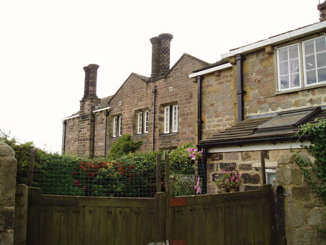
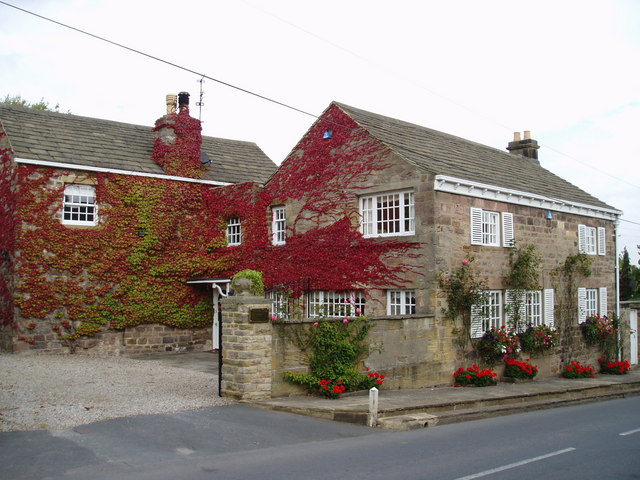
With a population of around 200 residents, Kearby is known for its tranquil and close-knit community. The village is characterized by its charming stone houses and traditional architecture, which add to its quaint and idyllic atmosphere. The local church, St. John the Baptist, stands as a prominent feature in the village, dating back to the 12th century.

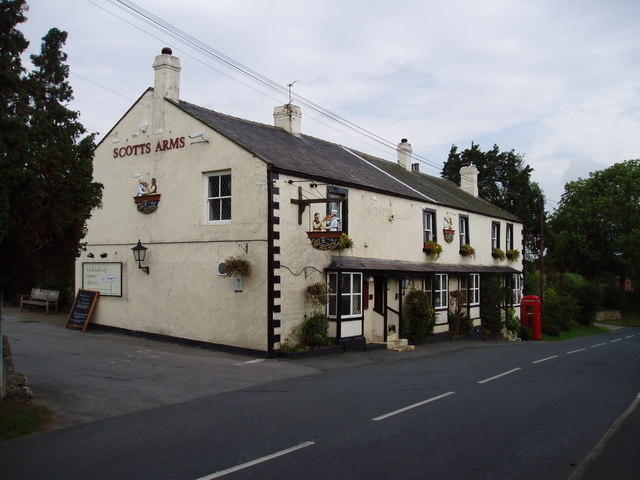
Despite its small size, Kearby offers a range of amenities to its residents. There is a local pub, The Kearby Bull, which serves as a popular gathering spot for both locals and visitors alike. The village also boasts a village hall, where various community events and activities are organized throughout the year.

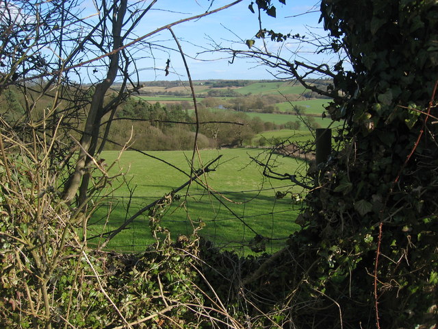
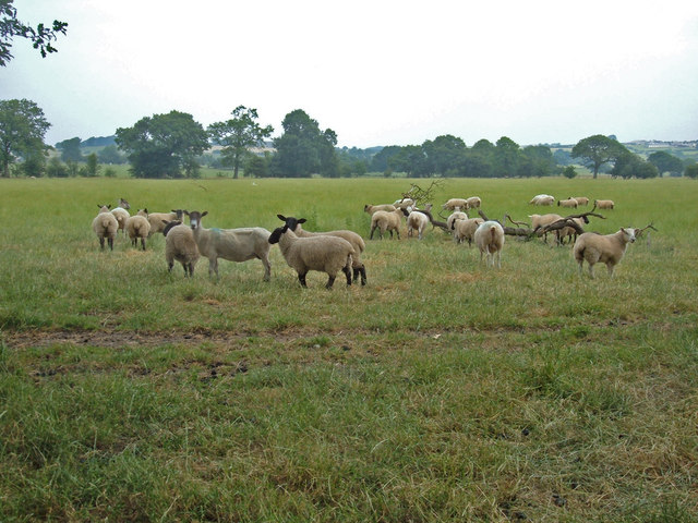
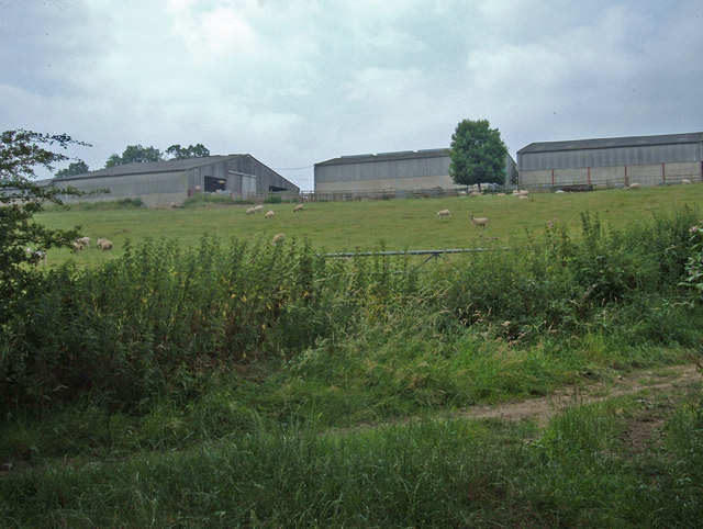
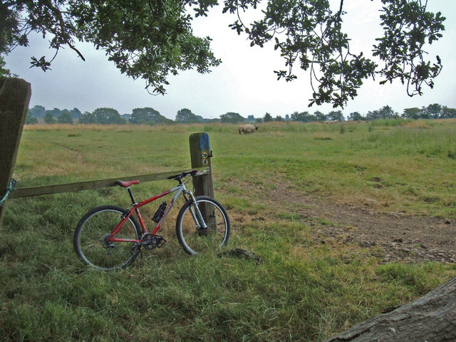
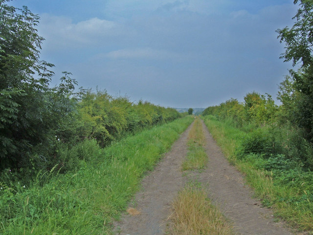
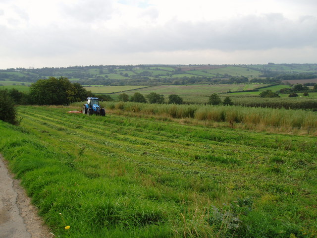
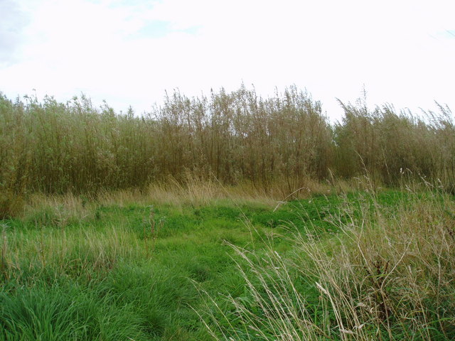
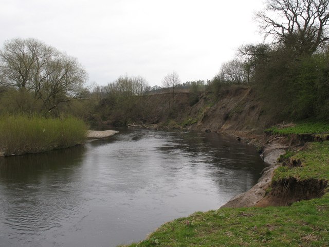
Kearby is ideally located for those who enjoy outdoor pursuits. The surrounding countryside provides ample opportunities for walking, cycling, and exploring the beautiful Yorkshire landscape. Additionally, the nearby River Wharfe offers fishing opportunities for those interested in angling.

Overall, Kearby is a tranquil and picturesque village that provides a peaceful and welcoming environment for its residents. Its charming architecture, close community, and access to the stunning Yorkshire countryside make it a desirable place to live or visit.

If you have any feedback on the listing, please let us know in the comments section below.
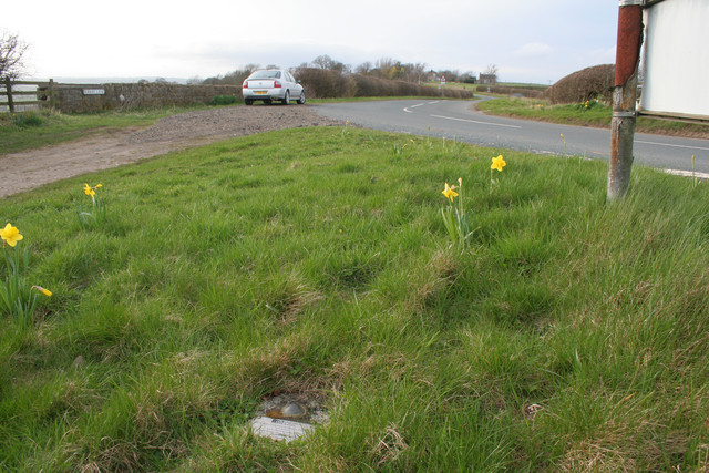
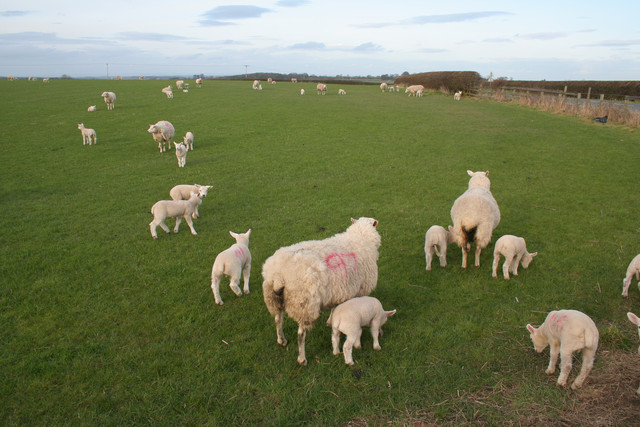
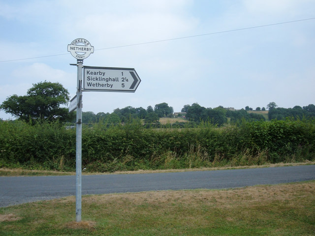
Kearby Images

Images are sourced within 2km of 53.921534/-1.4763352 or Grid Reference SE3447. Thanks to Geograph Open Source API. All images are credited.

Hedge View Looking through the hedge across the valley from the north-west corner of this square. The River Wharfe is just visible in the distance.
Hedge View
Looking through the hedge across the valley from the north-west corner of this square. The River Wharfe is just visible in the distance.
Sheep Pasture, Barrowby Looking northeast across grazing land from where the Keepers' Walk bridleway meets the Marsh Lane bridleway near Lund head farm, Barrowby.
Sheep Pasture, Barrowby
Looking northeast across grazing land from where the Keepers' Walk bridleway meets the Marsh Lane bridleway near Lund head farm, Barrowby.
Lund Head Farm, Barrowby View west from where the bridleways Marsh Lane and Keepers' Walk meet. Marsh Lane is the track in the foreground. Turn left onto it for a splendid half mile stretch of singletrack between hedgerows.
Lund Head Farm, Barrowby
View west from where the bridleways Marsh Lane and Keepers' Walk meet. Marsh Lane is the track in the foreground. Turn left onto it for a splendid half mile stretch of singletrack between hedgerows.
Which way? Here the Marsh Lane bridleway splits. Left to Addlethorpe Wood and Sicklinghall; right towards Beck View Farm and Clap Gate. Either way, just follow the blue-topped posts. I turned right.
Which way?
Here the Marsh Lane bridleway splits. Left to Addlethorpe Wood and Sicklinghall; right towards Beck View Farm and Clap Gate. Either way, just follow the blue-topped posts. I turned right.
Bridleway to Spofforth This shot looks back up the last stretch of a 3-mile length of bridleway from Spofforth. The route is a mixture of double-track (like this), singletrack and indistinct lines alongside field boundaries. Great fun. View looking north from the minor road near Clap Gate.
Bridleway to Spofforth
This shot looks back up the last stretch of a 3-mile length of bridleway from Spofforth. The route is a mixture of double-track (like this), singletrack and indistinct lines alongside field boundaries. Great fun. View looking north from the minor road near Clap Gate.
Maustin Caravan Park, Netherby This caravan-cum-holiday chalet site is on the north bank of the River Wharfe in the secluded hamlet of Netherby.
Maustin Caravan Park, Netherby
This caravan-cum-holiday chalet site is on the north bank of the River Wharfe in the secluded hamlet of Netherby.
Signpost at Spring Moor This signpost is at the crossroads of Spring Lane/Wharfe Lane/Moor Lane just to the north of Netherby. Note "Yorks WR" (West Riding of Yorkshire) on the top of the post. I think the land to the north of the River Wharfe hereabouts is now in North Yorkshire. The illegible arm of the signpost is pointing up Moor Lane to Barrowby.
Signpost at Spring Moor
This signpost is at the crossroads of Spring Lane/Wharfe Lane/Moor Lane just to the north of Netherby. Note "Yorks WR" (West Riding of Yorkshire) on the top of the post. I think the land to the north of the River Wharfe hereabouts is now in North Yorkshire. The illegible arm of the signpost is pointing up Moor Lane to Barrowby.
Low Barrowby Farm Situated on Spring Lane between Netherby and the A61. Looking west towards the A61.
Low Barrowby Farm
Situated on Spring Lane between Netherby and the A61. Looking west towards the A61.
Tractor at work The tractor is cutting an area of grass along the edge of plantation of willows being grown as a renewable energy crop.
Tractor at work
The tractor is cutting an area of grass along the edge of plantation of willows being grown as a renewable energy crop.
Willow Coppice on Paddock House Farm These willows are being grown to provide a source of renewable energy.
Willow Coppice on Paddock House Farm
These willows are being grown to provide a source of renewable energy.
Decorative chimneys at Paddock House Farm Each chimney on this farm house has a different pattern.
Decorative chimneys at Paddock House Farm
Each chimney on this farm house has a different pattern.
Restoration This old building is next to Poplar House on the outskirts of Sicklinghall. On the 1940 map it seems to be labelled Hospital.
Restoration
This old building is next to Poplar House on the outskirts of Sicklinghall. On the 1940 map it seems to be labelled Hospital.
Little Paddock Cottage, Sicklinghall One of many picturesque cottages in this small North Yorkshire village.
Little Paddock Cottage, Sicklinghall
One of many picturesque cottages in this small North Yorkshire village.
Scotts Arms, Sicklinghall The original name has been removed from the front of this pub, presumably to give more prominence to the chain it now belongs to.
Scotts Arms, Sicklinghall
The original name has been removed from the front of this pub, presumably to give more prominence to the chain it now belongs to.
The Wharfe, East Keswick parish. Taken from the south bank of the river at the point where it is eroding the steep bank. The river marks the boundary between North and West Yorkshire, although pre 1974 this was all West Riding.
The Wharfe, East Keswick parish.
Taken from the south bank of the river at the point where it is eroding the steep bank. The river marks the boundary between North and West Yorkshire, although pre 1974 this was all West Riding.
Wetherby Fundamental Bench Mark (close-up) Bench Marks Database: <span class="nowrap"><a title="http://www.bench-marks.org.uk/bm1177" rel="nofollow ugc noopener" href="http://www.bench-marks.org.uk/bm1177">Link</a><img style="margin-left:2px;" alt="External link" title="External link - shift click to open in new window" src="https://s1.geograph.org.uk/img/external.png" width="10" height="10"/></span>
Wetherby Fundamental Bench Mark (close-up)
Bench Marks Database: LinkExternal link
Wetherby Fundamental Bench Mark Looking along Kirkby Lane towards Barrowby. A closer view of the Bench Mark can be seen here: <a href="https://www.geograph.org.uk/photo/1793628">SE3447 : Wetherby Fundamental Bench Mark (close-up)</a>. Bench Marks Database: <span class="nowrap"><a title="http://www.bench-marks.org.uk/bm1177" rel="nofollow ugc noopener" href="http://www.bench-marks.org.uk/bm1177">Link</a><img style="margin-left:2px;" alt="External link" title="External link - shift click to open in new window" src="https://s1.geograph.org.uk/img/external.png" width="10" height="10"/></span>
Wetherby Fundamental Bench Mark
Looking along Kirkby Lane towards Barrowby. A closer view of the Bench Mark can be seen here: SE3447 : Wetherby Fundamental Bench Mark (close-up). Bench Marks Database: LinkExternal link
Sheep and Lambs
Sheep and Lambs
Show me another place!

Kearby is located at Grid Ref: SE3447 (Lat: 53.921534, Lng: -1.4763352)

Division: West Riding

Administrative County: North Yorkshire

District: Harrogate

Police Authority: North Yorkshire

What 3 Words

///belts.scribble.being. Near East Keswick, West Yorkshire

Nearby Locations

Kearby Town End Kearby

Related Wikis

Kearby with Netherby

Kearby with Netherby is a civil parish in North Yorkshire, England. The parish includes the hamlets of Barrowby, Netherby and Kearby Town End. The parish...

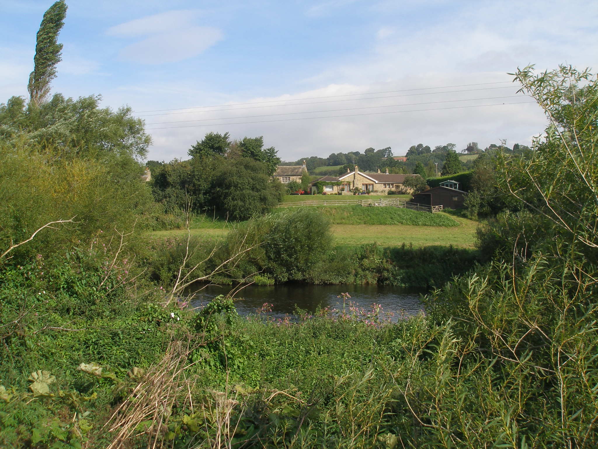
Netherby, North Yorkshire

Netherby is a village in the Harrogate district of North Yorkshire, England. It lies at grid reference SE333468, on the north bank of the River Wharfe...

Harewood speed Hillclimb

Harewood speed Hillclimb (the form with italics and a lower-case s is used officially) is a hillclimb near the village of Harewood, West Yorkshire, England...
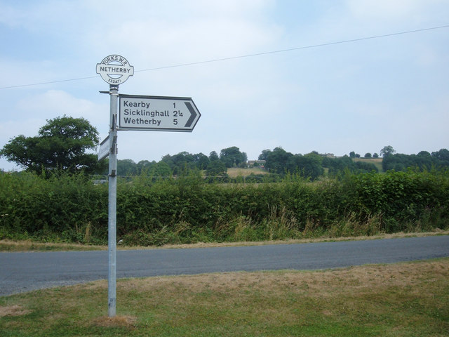
Sicklinghall

Sicklinghall is a village and civil parish in North Yorkshire, England that is situated between the town of Wetherby (3 miles (5 km) to the east) and the...

Nearby Amenities

Located within 500m of 53.921534,-1.4763352
Post Box
Operator: Royal Mail
Post Box Type: lamp
Ref: LS22 985
Lat/Long: 53.9217544/-1.4764832
Clap Gate
Place: hamlet
Lat/Long: 53.9214259/-1.476658
Cliff Top
Place: locality
Source: NLS-OS-NatGrid-110k-1940-60
Lat/Long: 53.9194108/-1.4827798
Kearby Town End
Place: locality
Source: NLS-OS-NatGrid-110k-1940-60
Lat/Long: 53.9185717/-1.4769025
Barrier: stile
Lat/Long: 53.9217386/-1.4779082
Bench
Source: survey
Lat/Long: 53.9197752/-1.4832015
mid-Wharfedale panorama
Source: survey
Tourism: viewpoint
Lat/Long: 53.9197297/-1.4831492
Barrier: stile
Lat/Long: 53.9221992/-1.4817951
Power: pole
Lat/Long: 53.9218306/-1.4827018
Power: pole
Lat/Long: 53.9217378/-1.4805493
Power: pole
Lat/Long: 53.9222371/-1.4786116
Power: pole
Lat/Long: 53.922482/-1.4776414
Barrier: stile
Lat/Long: 53.9221229/-1.4807942
The data included in this document is from www.openstreetmap.org. The data is made available under ODbL.

Have you been to Kearby?

Leave your review of Kearby below (or comments, questions and feedback).