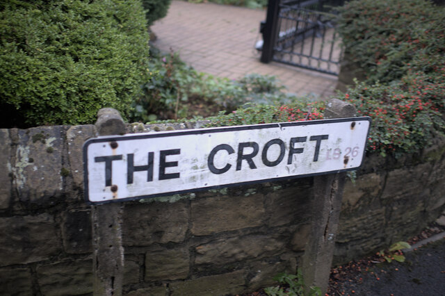
John o' Gaunts

Settlement in Yorkshire

England

John o' Gaunts

Road block on Bullough Lane, Rothwell There is a large unsurfaced car park for the Country Park down there, but the council decided to close it, apparently due to "unsocial behaviour". The locals can walk there but at busy times people from further away have to park in residential roads and other unsuitable places.
Road block on Bullough Lane, Rothwell Credit: Humphrey Bolton

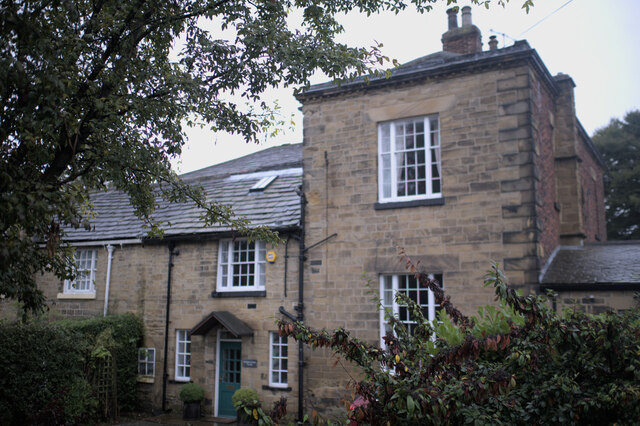
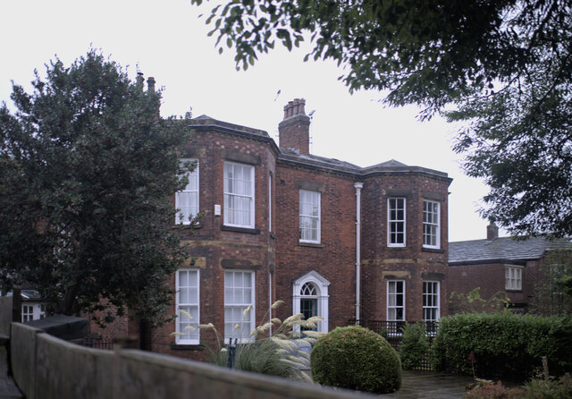
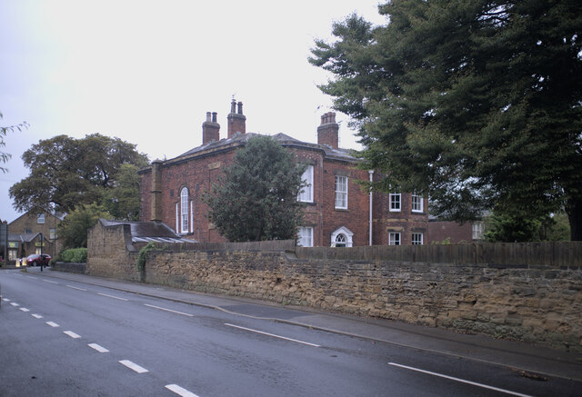
John o' Gaunts, Yorkshire, is a small village located in the Craven district of North Yorkshire, England. Situated approximately 6 miles southeast of Settle, the village lies on the southern edge of the Yorkshire Dales National Park, offering breathtaking views of the surrounding countryside.

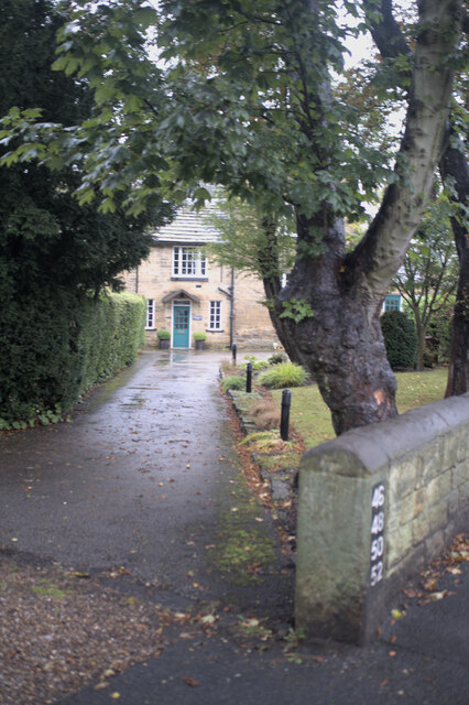
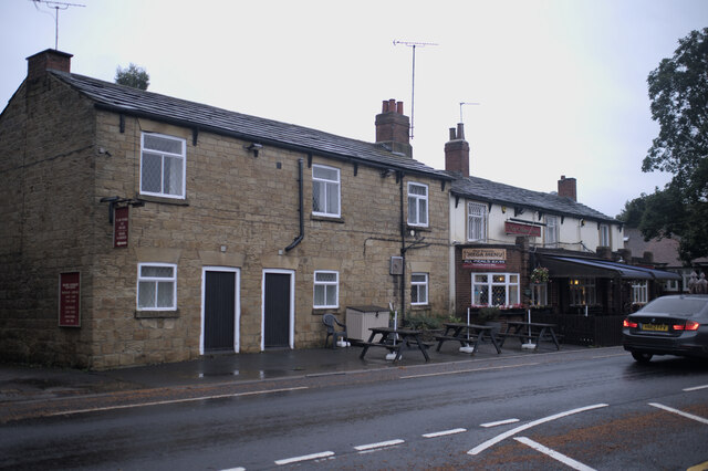
Named after John of Gaunt, Duke of Lancaster, the village has a rich history dating back to medieval times. Its picturesque charm and well-preserved stone buildings attract visitors who appreciate the area's traditional character. The village is home to a close-knit community, with a population of around 200 residents.

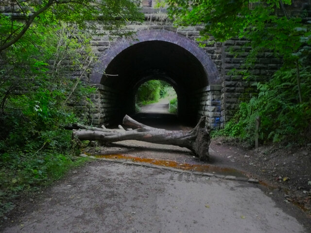
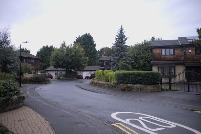
John o' Gaunts is renowned for its natural beauty, with rolling hills, green pastures, and meandering streams. The village is a popular base for outdoor enthusiasts, offering a range of activities such as hiking, cycling, and fishing. The nearby River Ribble provides opportunities for water sports and leisurely walks along its banks.

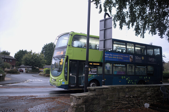
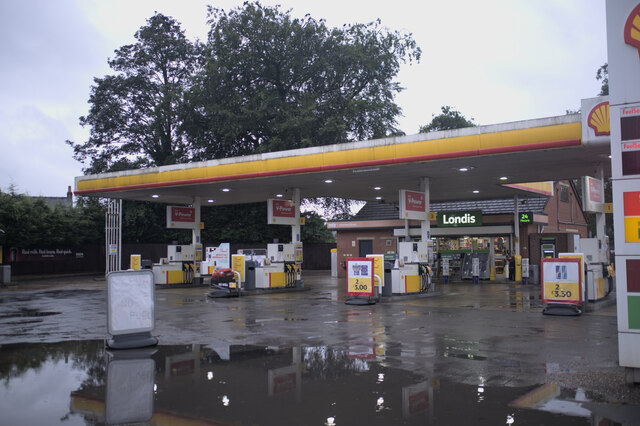
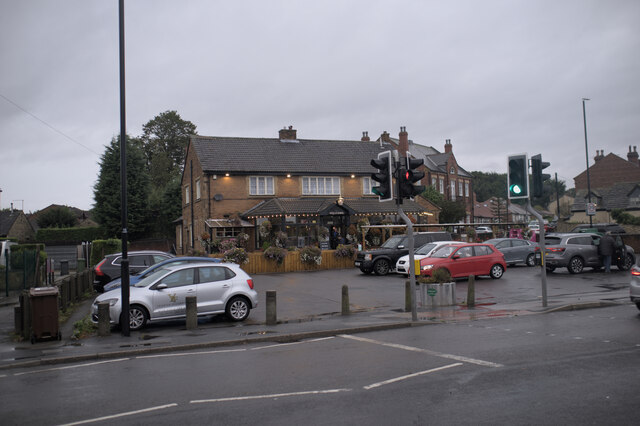
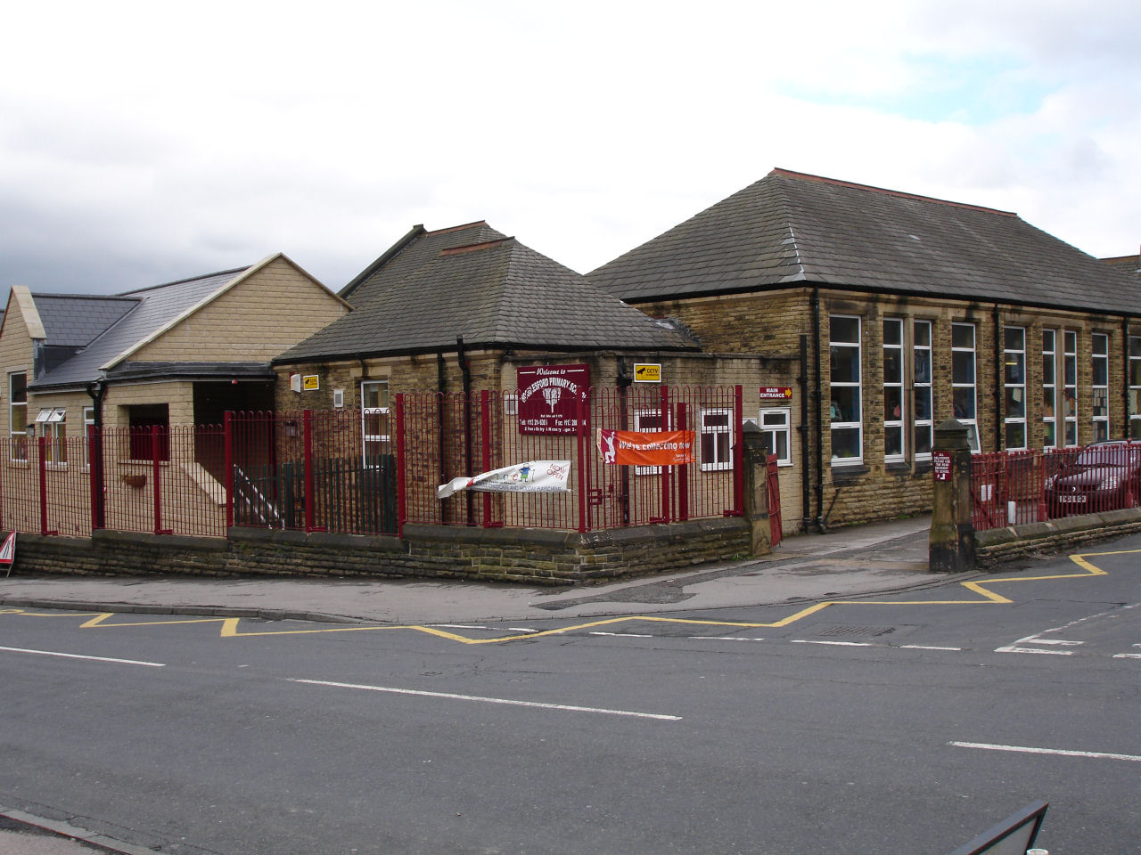
Despite its small size, John o' Gaunts offers essential amenities to both residents and visitors. The village has a primary school, a village hall, and a local pub that serves as a social hub for the community. Larger towns, such as Settle and Skipton, are within easy reach, providing additional services and amenities.

The tranquility and charm of John o' Gaunts make it an ideal destination for those seeking a peaceful retreat in the heart of the Yorkshire Dales. Whether exploring the picturesque landscapes, immersing in local history, or simply enjoying the sense of community, visitors to John o' Gaunts are sure to find solace in this idyllic Yorkshire village.

If you have any feedback on the listing, please let us know in the comments section below.

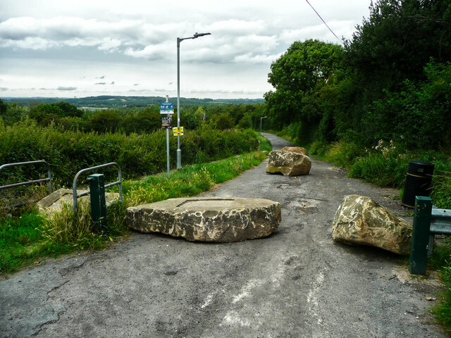
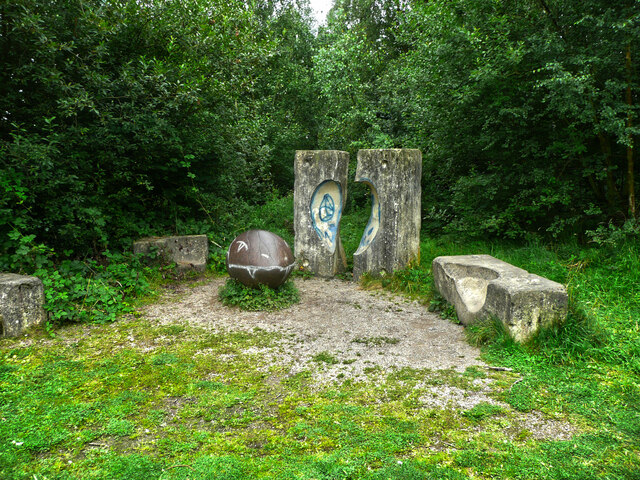
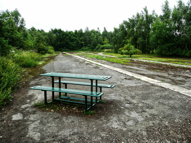
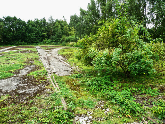
John o' Gaunts Images

Images are sourced within 2km of 53.758645/-1.4703995 or Grid Reference SE3529. Thanks to Geograph Open Source API. All images are credited.

Road block on Bullough Lane, Rothwell There is a large unsurfaced car park for the Country Park down there, but the council decided to close it, apparently due to "unsocial behaviour". The locals can walk there but at busy times people from further away have to park in residential roads and other unsuitable places.
Road block on Bullough Lane, Rothwell
There is a large unsurfaced car park for the Country Park down there, but the council decided to close it, apparently due to "unsocial behaviour". The locals can walk there but at busy times people from further away have to park in residential roads and other unsuitable places.
Sculptures in Rothwell Country Park This is the start of a short sculpture trail. You won't find Venus or Diana the Huntress here, but the sculptures are similar to some of the ones that you have to pay £6 to see in the Yorkshire Sculpture Park. I like the shiny monster's head with a toothy grin.
Sculptures in Rothwell Country Park
This is the start of a short sculpture trail. You won't find Venus or Diana the Huntress here, but the sculptures are similar to some of the ones that you have to pay £6 to see in the Yorkshire Sculpture Park. I like the shiny monster's head with a toothy grin.
Picnic table in Rothwell Country Park There are two of these in this area, which is where coal was transferred from wagons on the coal mine's narrow gauge (about 3ft) tracks (the one across the centre of the image) to wagons on a standard gauge track (to the right) ready to be taken away on the colliery's branch line.
Picnic table in Rothwell Country Park
There are two of these in this area, which is where coal was transferred from wagons on the coal mine's narrow gauge (about 3ft) tracks (the one across the centre of the image) to wagons on a standard gauge track (to the right) ready to be taken away on the colliery's branch line.
Disused rail track in Rothwell Country Park This is the end of the branch line that served the Fanny Pit of Rothwell Haigh Collieries. Here coal was transferred from wagons on the mine's narrow gauge tracks to those on the standard gauge track.
Disused rail track in Rothwell Country Park
This is the end of the branch line that served the Fanny Pit of Rothwell Haigh Collieries. Here coal was transferred from wagons on the mine's narrow gauge tracks to those on the standard gauge track.
Road block on Bullough Lane, Rothwell This prevents cars from reaching the disused car park from the lane that passes Fishpond Lock.
Road block on Bullough Lane, Rothwell
This prevents cars from reaching the disused car park from the lane that passes Fishpond Lock.
Catching the bus I had booked into my room at the pub, and set out to photograph Oulton in the dusk, and just managed to catch a shot of this bus.

This is a Volvo B5LH Wright Eclipse Gemini 2, YJ13FKF, a hybrid diesel-battery bus operating as Arriva fleet number 1706 from Wakefield, on the 446 service ro Leeds city square to Wakefield bus station.
Catching the bus
I had booked into my room at the pub, and set out to photograph Oulton in the dusk, and just managed to catch a shot of this bus. This is a Volvo B5LH Wright Eclipse Gemini 2, YJ13FKF, a hybrid diesel-battery bus operating as Arriva fleet number 1706 from Wakefield, on the 446 service ro Leeds city square to Wakefield bus station.
House numbers Numbers for 4 cottages that share an entrance.
House numbers
Numbers for 4 cottages that share an entrance.
Rear path Two of the properties that feature in <a href="https://www.geograph.org.uk/photo/6979619">SE3628 : House numbers</a> are here, and are described as the rear of a grade II listed building known as Dolphin Court. (<span class="nowrap"><a title="https://historicengland.org.uk/listing/the-list/list-entry/1300099" rel="nofollow ugc noopener" href="https://historicengland.org.uk/listing/the-list/list-entry/1300099">Link</a><img style="margin-left:2px;" alt="External link" title="External link - shift click to open in new window" src="https://s1.geograph.org.uk/img/external.png" width="10" height="10"/></span> )
Rear path
Two of the properties that feature in SE3628 : House numbers are here, and are described as the rear of a grade II listed building known as Dolphin Court. (LinkExternal link )
Dolphin Court Another view of the building seen in <a href="https://www.geograph.org.uk/photo/6979622">SE3628 : Rear path</a>, a grade II listed building - see <span class="nowrap"><a title="https://historicengland.org.uk/listing/the-list/list-entry/1300099" rel="nofollow ugc noopener" href="https://historicengland.org.uk/listing/the-list/list-entry/1300099">Link</a><img style="margin-left:2px;" alt="External link" title="External link - shift click to open in new window" src="https://s1.geograph.org.uk/img/external.png" width="10" height="10"/></span>
Dolphin Court
Another view of the building seen in SE3628 : Rear path, a grade II listed building - see LinkExternal link
The front of Dolphin Court According to the listing at <span class="nowrap"><a title="https://historicengland.org.uk/listing/the-list/list-entry/1300099" rel="nofollow ugc noopener" href="https://historicengland.org.uk/listing/the-list/list-entry/1300099">Link</a><img style="margin-left:2px;" alt="External link" title="External link - shift click to open in new window" src="https://s1.geograph.org.uk/img/external.png" width="10" height="10"/></span> this is the front of the building, and <a href="https://www.geograph.org.uk/photo/6979626">SE3628 : Dolphin Court</a> is the rear.
The front of Dolphin Court
According to the listing at LinkExternal link this is the front of the building, and SE3628 : Dolphin Court is the rear.
Stone wall and fence This stone wall has had a short wooden extension added on top.
Stone wall and fence
This stone wall has had a short wooden extension added on top.
The Croft A turn of the century development in Oulton.
The Croft
A turn of the century development in Oulton.
Road name The road name for <a href="https://www.geograph.org.uk/photo/6979636">SE3628 : The Croft</a>.  The postcode prefix LS26 has faded badly
Road name
The road name for SE3628 : The Croft. The postcode prefix LS26 has faded badly
Sign of the times The big news story this week was a shortage of fuel at filling stations.  The white sign reads "no fuel" but after an afternoon of torrential rain there was a huge, deep, puddle in front of it which prevented me getting a better view.
Sign of the times
The big news story this week was a shortage of fuel at filling stations. The white sign reads "no fuel" but after an afternoon of torrential rain there was a huge, deep, puddle in front of it which prevented me getting a better view.
The activities of metal thieves These marker posts should have labels for various types of water valve in adjacent manholes, but the labels have all gone, a sure sign that itinerant scrap metal enthusiasts passed this way at one time.
The activities of metal thieves
These marker posts should have labels for various types of water valve in adjacent manholes, but the labels have all gone, a sure sign that itinerant scrap metal enthusiasts passed this way at one time.
The Old Masons There are two pubs in Oulton called the Masons Arms.  The New Masons and the Old Masons.  This is the Old Masons, and is around 130 years newer than the New Masons.
The Old Masons
There are two pubs in Oulton called the Masons Arms. The New Masons and the Old Masons. This is the Old Masons, and is around 130 years newer than the New Masons.
The New Masons There are two pubs in Oulton called the Masons Arms.  The New Masons and the Old Masons.  This is the New Masons, and is around 130 years older  than the Old Masons.
The New Masons
There are two pubs in Oulton called the Masons Arms. The New Masons and the Old Masons. This is the New Masons, and is around 130 years older than the Old Masons.
My name is Rani Based on German technology introduced by DHL, this set of lockers can be used by Amazon to drop off parcels behind each door, which the customers can open with the code sent to them by email.  Each locker has a nickname, written on the front, to help identify them.  It doesn't matter much here, but if you are at a major railway hub where there are five or six lockers it is quite important
My name is Rani
Based on German technology introduced by DHL, this set of lockers can be used by Amazon to drop off parcels behind each door, which the customers can open with the code sent to them by email. Each locker has a nickname, written on the front, to help identify them. It doesn't matter much here, but if you are at a major railway hub where there are five or six lockers it is quite important
Show me another place!

John o' Gaunts is located at Grid Ref: SE3529 (Lat: 53.758645, Lng: -1.4703995)

Division: West Riding

Unitary Authority: Leeds

Police Authority: West Yorkshire

What 3 Words

///void.yards.scans. Near Swillington, West Yorkshire

Related Wikis

Springhead Park

Springhead Park is the premier park in Rothwell, West Yorkshire, England. == History == Springhead Park was originally called Rothwell Park and was created...

Wyke Beck

Wyke Beck is a stream that runs from Roundhay Park to the River Aire in east Leeds, West Yorkshire, England. Described as an Urban Beck, the stream flows...

Woodlesford

Woodlesford () is a suburban village in the City of Leeds, West Yorkshire, England, 6 miles (10 km) south-east of Leeds city centre. Formerly part of the...

Holy Trinity Church, Rothwell

The Holy Trinity Church in Rothwell, West Yorkshire, England is an active Anglican parish church in the archdeaconry of Leeds and the Diocese of Leeds...

Nearby Amenities

Located within 500m of 53.758645,-1.4703995
Crossing
Lat/Long: 53.7555794/-1.4687494
Bus Stop
John O Gaunts
Bus: yes
Local Ref: 45010629
Naptan AtcoCode: 450010629
Naptan Bearing: SE
Naptan CommonName: John O Gaunts
Naptan Crossing: Second Avenue
Naptan Indicator: Stop 45010629
Naptan PlusbusZoneRef: LEEDS
Naptan ShortCommonName: Second Avenue
Naptan Street: Leeds Road
Naptan Verified: yes
Public Transport: platform
Ref: 45010629
Shelter: yes
Source: naptan_import
Timetable: yes
Lat/Long: 53.7568664/-1.4725841
Turning Circle
Lat/Long: 53.7556673/-1.4757555
Turning Circle
Lat/Long: 53.7562615/-1.4722828
Turning Circle
Lat/Long: 53.7550715/-1.4686275
Barrier: cycle_barrier
Lat/Long: 53.754889/-1.4740735
Bus Stop
Haigh Road Kings Mead
Bus: yes
Local Ref: 45011596
Naptan AtcoCode: 450011596
Naptan Bearing: E
Naptan CommonName: Haigh Road Kings Mead
Naptan Crossing: Kings Mead
Naptan Indicator: Stop 45011596
Naptan PlusbusZoneRef: LEEDS
Naptan ShortCommonName: Kings Mead
Naptan Street: Haigh Road
Naptan Verified: yes
Public Transport: platform
Ref: 45011596
Source: naptan_import
Lat/Long: 53.7554952/-1.4701481
Bus Stop
Haigh Road Kings Mead
Bus: yes
Local Ref: 45011597
Naptan AtcoCode: 450011597
Naptan Bearing: W
Naptan CommonName: Haigh Road Kings Mead
Naptan Crossing: Kings Mead
Naptan Indicator: Stop 45011597
Naptan Landmark: PH
Naptan PlusbusZoneRef: LEEDS
Naptan ShortCommonName: Kings Mead
Naptan Street: Haigh Road
Naptan Verified: yes
Public Transport: platform
Ref: 45011597
Source: naptan_import
Lat/Long: 53.7553741/-1.4702348
Turning Circle
Lat/Long: 53.7583689/-1.4761369
Turning Circle
Lat/Long: 53.7584144/-1.4670332
Crossing
Crossing: traffic_signals
Lat/Long: 53.7555168/-1.46752
Turning Circle
Lat/Long: 53.7581724/-1.4646295
Noexit: yes
Lat/Long: 53.7585354/-1.4652535
Post Box
Operator: Royal Mail
Operator Wikidata: Q638098
Post Box Type: pillar
Ref: LS26 93
Royal Cypher: EIIR
Royal Cypher Wikidata: Q33102113
Lat/Long: 53.7565017/-1.4711475
Barrier: cycle_barrier
Bicycle: yes
Foot: yes
Motor Vehicle: no
Lat/Long: 53.7568315/-1.4637614
Bus Stop
Styebank Lane Haigh Road
Bus: yes
Local Ref: 45011617
Naptan AtcoCode: 450011617
Naptan Bearing: S
Naptan CommonName: Styebank Lane Haigh Road
Naptan Crossing: Haigh Road
Naptan Indicator: Stop 45011617
Naptan Landmark: Cemetery
Naptan PlusbusZoneRef: LEEDS
Naptan ShortCommonName: Haigh Road
Naptan Street: Styebank Lane
Naptan Verified: yes
Public Transport: platform
Source: naptan_import
Lat/Long: 53.7545608/-1.4734609
Bus Stop
Styebank Lane Leeds Road
Bus: yes
Local Ref: 45011618
Naptan AtcoCode: 450011618
Naptan Bearing: N
Naptan CommonName: Styebank Lane Leeds Road
Naptan Crossing: Leeds Road
Naptan Indicator: Stop 45011618
Naptan PlusbusZoneRef: LEEDS
Naptan ShortCommonName: Leeds Road
Naptan Street: Styebank Lane
Naptan Verified: no
Public Transport: platform
Source: naptan_import
Lat/Long: 53.7565397/-1.473785
Bus Stop
Styebank Lane Haigh Road
Bench: yes
Bin: no
Bus: yes
Check Date Shelter: 2024-01-13
Local Ref: 45010540
Naptan AtcoCode: 450010540
Naptan Bearing: N
Naptan CommonName: Styebank Lane Haigh Road
Naptan Crossing: Haigh Road
Naptan Indicator: Stop 45010540
Naptan Notes: Adrian requested YEDL to investigate faults 21/03/08
Naptan PlusbusZoneRef: LEEDS
Naptan ShortCommonName: Haigh Road
Naptan Street: Styebank Lane
Naptan Verified: yes
Public Transport: platform
Shelter: yes
Source: naptan_import
Timetable: yes
Lat/Long: 53.7550294/-1.473728
Bus Stop
Leeds Road Holmsley Lane
Bus: yes
Local Ref: 45010630
Naptan AtcoCode: 450010630
Naptan Bearing: SE
Naptan CommonName: Leeds Road Holmsley Lane
Naptan Crossing: Holmsley Lane
Naptan Indicator: Stop 45010630
Naptan PlusbusZoneRef: LEEDS
Naptan ShortCommonName: Holmsley Lane
Naptan Street: Leeds Road
Naptan Verified: yes
Public Transport: platform
Shelter: yes
Source: naptan_import
Timetable: yes
Lat/Long: 53.7550316/-1.4660839
Bus Stop
Leeds Road Haigh Road
Bench: yes
Bin: yes
Bus: yes
Check Date Shelter: 2024-01-13
Lit: yes
Local Ref: 45010638
Naptan AtcoCode: 450010638
Naptan Bearing: NW
Naptan CommonName: Leeds Road Haigh Road
Naptan Crossing: Haigh Road
Naptan Indicator: Stop 45010638
Naptan Landmark: Labour Club
Naptan PlusbusZoneRef: LEEDS
Naptan ShortCommonName: Haigh Road
Naptan Street: Leeds Road
Naptan Verified: yes
Public Transport: platform
Shelter: yes
Source: naptan_import
Tactile Paving: no
Timetable: yes
Lat/Long: 53.7553465/-1.4681881
Bus Stop
John O Gaunts
Bus: yes
Local Ref: 45010639
Naptan AtcoCode: 450010639
Naptan Bearing: NW
Naptan CommonName: John O Gaunts
Naptan Crossing: Styebank Lane
Naptan Indicator: Stop 45010639
Naptan Notes: Possible site for delap 17/03/09
Naptan PlusbusZoneRef: LEEDS
Naptan ShortCommonName: John O Gaunts
Naptan Street: Leeds Road
Naptan Verified: yes
Public Transport: platform
Shelter: yes
Source: naptan_import
Timetable: yes
Lat/Long: 53.75648/-1.4724662
Bus Stop
Leeds Road Temple Court
Bus: yes
Local Ref: 45010640
Naptan AtcoCode: 450010640
Naptan Bearing: W
Naptan CommonName: Leeds Road Temple Court
Naptan Crossing: Temple Court
Naptan Indicator: Stop 45010640
Naptan Landmark: John o Gaunts PH
Naptan PlusbusZoneRef: LEEDS
Naptan ShortCommonName: Temple Court
Naptan Street: Leeds Road
Naptan Verified: yes
Public Transport: platform
Shelter: yes
Source: naptan_import
Timetable: yes
Lat/Long: 53.7577966/-1.4775461
Traffic Signals
Traffic Signals: signal
Traffic Signals Direction: forward
Lat/Long: 53.7554908/-1.4673446
Addr City: Leeds
Addr Housenumber: 160
Addr Postcode: LS26 0JH
Addr Street: Leeds Road
Addr Suburb: Rothwell
Fhrs Id: 467337
Shop: convenience
Lat/Long: 53.7565325/-1.4711208
Fast Food
1Pizza1
Addr City: Leeds
Addr Housenumber: 160a
Addr Postcode: LS26 0JH
Addr Street: Leeds Road
Cuisine: pizza
Fhrs Id: 322167
Lat/Long: 53.7565689/-1.4712389
Traffic Signals
Traffic Signals: signal
Traffic Signals Direction: forward
Lat/Long: 53.7554749/-1.469055
Crossing
Lat/Long: 53.7554494/-1.4675667
Traffic Signals
Traffic Signals: signal
Traffic Signals Direction: forward
Lat/Long: 53.7553067/-1.4673749
Crossing
Lat/Long: 53.7554614/-1.468843
Crossing
Crossing Island: yes
Lat/Long: 53.7552453/-1.4738133
Noexit: yes
Lat/Long: 53.7551326/-1.4661796
Traffic Signals
Traffic Signals: signal
Traffic Signals Direction: forward
Lat/Long: 53.75575/-1.4689614
Noexit: yes
Lat/Long: 53.7569211/-1.4660336
Noexit: yes
Lat/Long: 53.7569749/-1.4659264
Turning Circle
Lat/Long: 53.7559732/-1.4722238
Facilities 24/7 Management Group
Addr City: Leeds
Addr Housename: EGM House
Addr Postcode: LS26 0JE
Addr Street: Leeds Road
Craft: caterer
Fhrs Id: 1155509
Lat/Long: 53.7569734/-1.4768779
Waste Basket
Ref UK Leedscc Bin: 1203
Lat/Long: 53.75517/-1.474643
Waste Basket
Ref UK Leedscc Bin: 3132
Lat/Long: 53.755821/-1.473561
Waste Basket
Ref UK Leedscc Bin: 1805
Lat/Long: 53.756109/-1.470936
Waste Basket
Ref UK Leedscc Bin: 3133
Lat/Long: 53.756495/-1.473711
Waste Basket
Ref UK Leedscc Bin: 1804
Lat/Long: 53.756028/-1.46961
Waste Basket
Ref UK Leedscc Bin: 1494
Lat/Long: 53.755206/-1.465704
Waste Basket
Ref UK Leedscc Bin: 1493
Lat/Long: 53.75541/-1.465291
Waste Basket
Ref UK Leedscc Bin: 2620
Lat/Long: 53.758169/-1.464668
Crossing
Lat/Long: 53.7552431/-1.4664305
Crossing
Crossing: traffic_signals
Lat/Long: 53.7571452/-1.4737027
Crossing
Button Operated: yes
Crossing: traffic_signals
Tactile Paving: yes
Traffic Signals Sound: no
Traffic Signals Vibration: yes
Lat/Long: 53.7572176/-1.4738954
Crossing
Button Operated: yes
Crossing: traffic_signals
Tactile Paving: yes
Traffic Signals Sound: no
Traffic Signals Vibration: yes
Lat/Long: 53.7569164/-1.4732343
Crossing
Lat/Long: 53.7567113/-1.4735097
Crossing
Lat/Long: 53.7568408/-1.4735391
Crossing
Lat/Long: 53.7567831/-1.4736878
Traffic Signals
Traffic Signals: signal
Traffic Signals Direction: forward
Lat/Long: 53.7571693/-1.4737041
Traffic Signals
Traffic Signals: signal
Traffic Signals Direction: forward
Lat/Long: 53.7570903/-1.4738897
Traffic Signals
Traffic Signals: signal
Traffic Signals Direction: forward
Lat/Long: 53.756825/-1.4734805
Traffic Signals
Traffic Signals: signal
Traffic Signals Direction: forward
Lat/Long: 53.7569312/-1.4732883
Give Way
Direction: forward
Lat/Long: 53.7572603/-1.4737943
Give Way
Direction: forward
Lat/Long: 53.7566537/-1.4736203
Traffic Signals
Traffic Signals: signal
Traffic Signals Direction: forward
Lat/Long: 53.7567545/-1.4736868
Traffic Signals
Traffic Signals: signal
Traffic Signals Direction: forward
Lat/Long: 53.7555171/-1.4675752
Crossing
Lat/Long: 53.75527/-1.467485
Crossing
Lat/Long: 53.7553585/-1.4675649
Traffic Signals
Traffic Signals: signal
Traffic Signals Direction: forward
Lat/Long: 53.7552602/-1.4674467
Traffic Signals
Traffic Signals: signal
Traffic Signals Direction: forward
Lat/Long: 53.7554724/-1.4676576
Traffic Signals
Traffic Signals: signal
Traffic Signals Direction: forward
Lat/Long: 53.7554692/-1.4686806
Traffic Signals
Traffic Signals: signal
Traffic Signals Direction: forward
Lat/Long: 53.7557883/-1.4689141
Barrier: cycle_barrier
Bicycle: yes
Foot: yes
Motor Vehicle: no
Lat/Long: 53.7549355/-1.467117
Barrier: cycle_barrier
Bicycle: dismount
Foot: yes
Motor Vehicle: no
Lat/Long: 53.7585082/-1.4686469
Bus Stop
Styebank Lane
Bench: no
Bin: yes
Bus: yes
Naptan AtcoCode: 450029109
Naptan NaptanCode: 45029109
Public Transport: platform
Ref: 45029109
Shelter: no
Tactile Paving: no
Lat/Long: 53.7551693/-1.4746854
Bus Stop
Styebank Lane
Bus: yes
Naptan AtcoCode: 450029107
Naptan NaptanCode: 45029107
Public Transport: platform
Ref: 45029107
Lat/Long: 53.755251/-1.4746952
Bench
Lat/Long: 53.7551813/-1.4739601
Information board for Rothwell Country Park
Leisure: park
Lat/Long: 53.7627477/-1.4712456
Bench
Backrest: yes
Colour: black
Material: metal
Lat/Long: 53.7623914/-1.4704066
Barrier: cycle_barrier
Lat/Long: 53.7628469/-1.4713087
The data included in this document is from www.openstreetmap.org. The data is made available under ODbL.

Have you been to John o' Gaunts?

Leave your review of John o' Gaunts below (or comments, questions and feedback).