John O'Gaunts

Settlement in Yorkshire

England

John O'Gaunts

Road block on Bullough Lane, Rothwell There is a large unsurfaced car park for the Country Park down there, but the council decided to close it, apparently due to "unsocial behaviour". The locals can walk there but at busy times people from further away have to park in residential roads and other unsuitable places.
Road block on Bullough Lane, Rothwell Credit: Humphrey Bolton

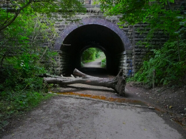
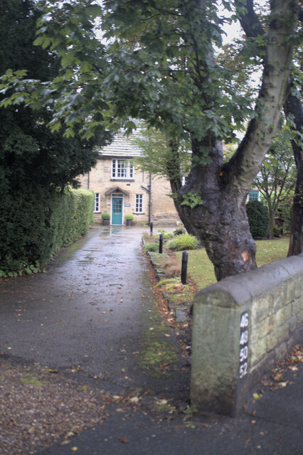
John O'Gaunts is a small village located in the county of Yorkshire, England. Situated near the town of Rothwell, John O'Gaunts is known for its picturesque countryside and historic buildings. The village is named after John of Gaunt, a prominent figure in English history who was the son of King Edward III.

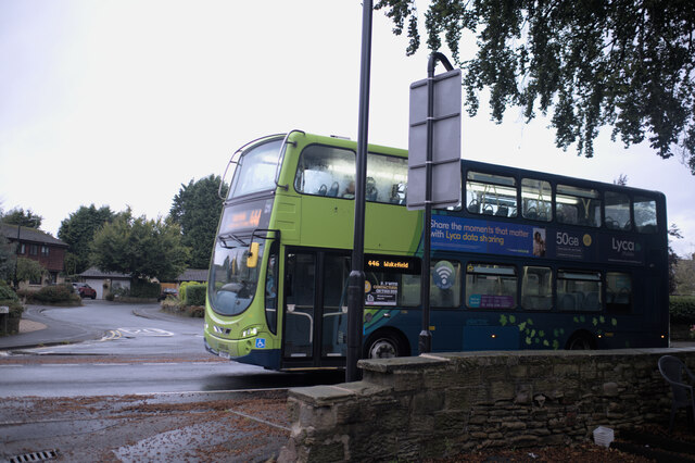
John O'Gaunts is a quiet and peaceful village, with a close-knit community of residents who take pride in their surroundings. The village is surrounded by rolling hills and lush green fields, making it an ideal location for those who enjoy outdoor activities such as hiking and cycling.

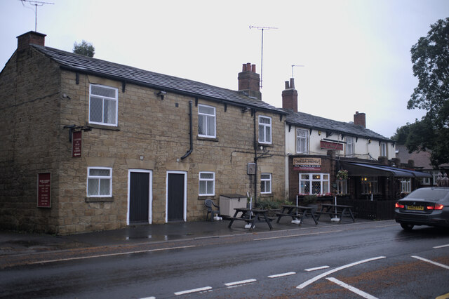
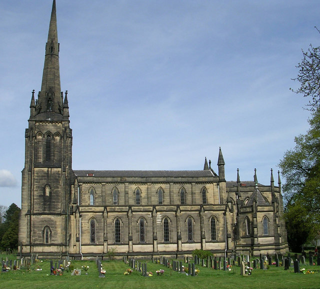
One of the notable landmarks in John O'Gaunts is the parish church, which dates back to the medieval period and features stunning architecture and intricate stained glass windows. The village also has a few quaint shops and pubs, where visitors can sample traditional Yorkshire cuisine and local ales.

Overall, John O'Gaunts offers a charming and idyllic setting for those looking to escape the hustle and bustle of city life and immerse themselves in the beauty of the English countryside.

If you have any feedback on the listing, please let us know in the comments section below.

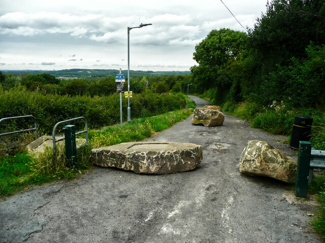
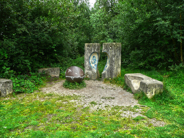
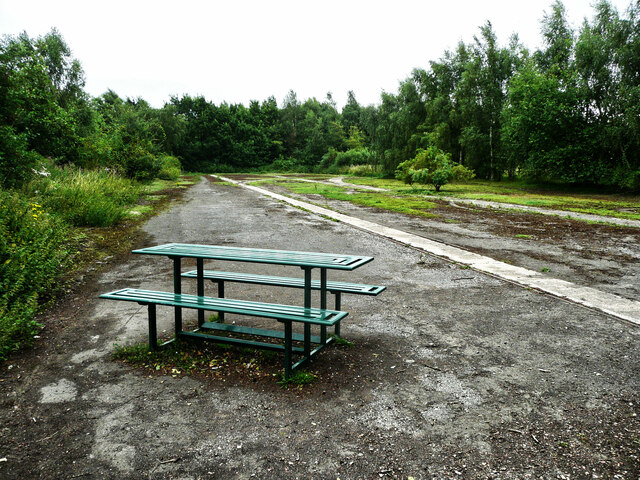
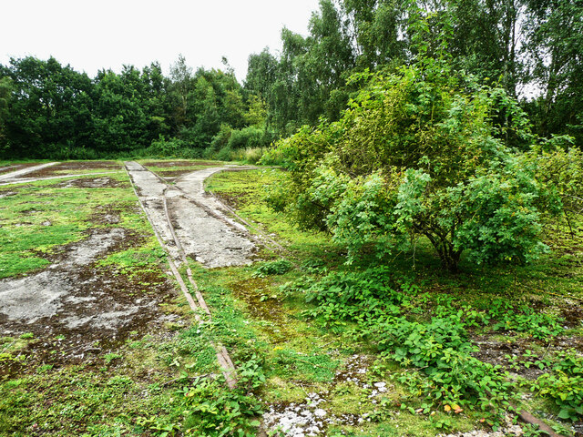
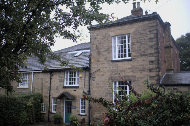
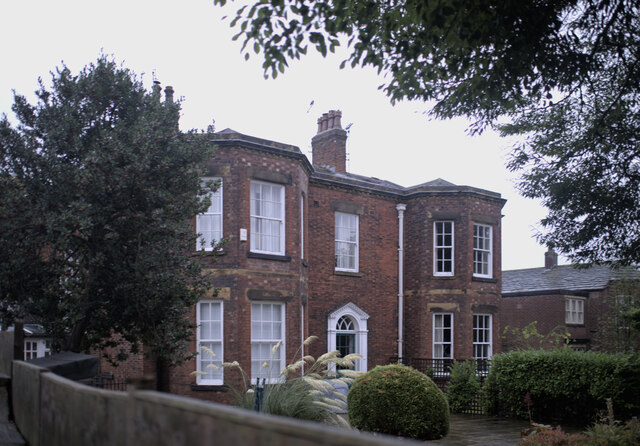
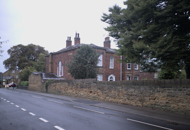
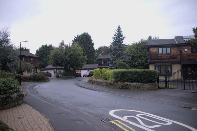
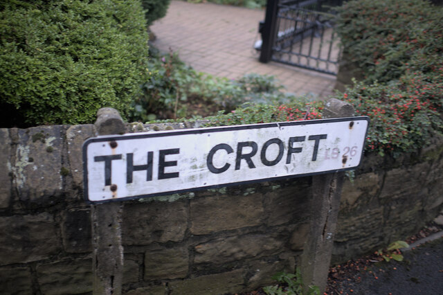
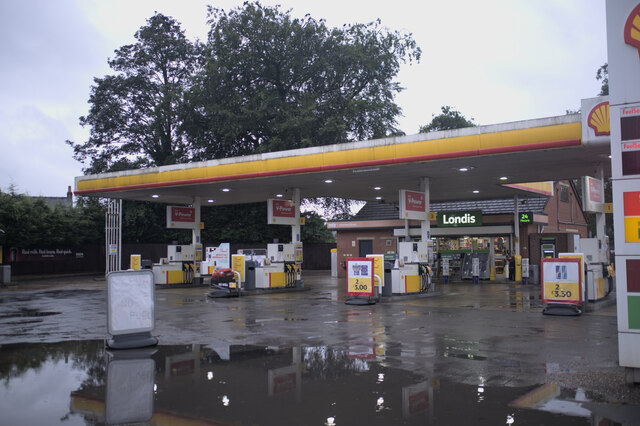
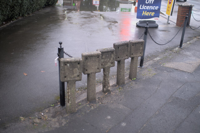
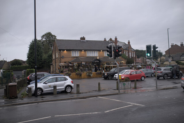
John O'Gaunts Images

Images are sourced within 2km of 53.757959/-1.464546 or Grid Reference SE3529. Thanks to Geograph Open Source API. All images are credited.

Road block on Bullough Lane, Rothwell There is a large unsurfaced car park for the Country Park down there, but the council decided to close it, apparently due to "unsocial behaviour". The locals can walk there but at busy times people from further away have to park in residential roads and other unsuitable places.
Road block on Bullough Lane, Rothwell
There is a large unsurfaced car park for the Country Park down there, but the council decided to close it, apparently due to "unsocial behaviour". The locals can walk there but at busy times people from further away have to park in residential roads and other unsuitable places.
Sculptures in Rothwell Country Park This is the start of a short sculpture trail. You won't find Venus or Diana the Huntress here, but the sculptures are similar to some of the ones that you have to pay £6 to see in the Yorkshire Sculpture Park. I like the shiny monster's head with a toothy grin.
Sculptures in Rothwell Country Park
This is the start of a short sculpture trail. You won't find Venus or Diana the Huntress here, but the sculptures are similar to some of the ones that you have to pay £6 to see in the Yorkshire Sculpture Park. I like the shiny monster's head with a toothy grin.
Picnic table in Rothwell Country Park There are two of these in this area, which is where coal was transferred from wagons on the coal mine's narrow gauge (about 3ft) tracks (the one across the centre of the image) to wagons on a standard gauge track (to the right) ready to be taken away on the colliery's branch line.
Picnic table in Rothwell Country Park
There are two of these in this area, which is where coal was transferred from wagons on the coal mine's narrow gauge (about 3ft) tracks (the one across the centre of the image) to wagons on a standard gauge track (to the right) ready to be taken away on the colliery's branch line.
Disused rail track in Rothwell Country Park This is the end of the branch line that served the Fanny Pit of Rothwell Haigh Collieries. Here coal was transferred from wagons on the mine's narrow gauge tracks to those on the standard gauge track.
Disused rail track in Rothwell Country Park
This is the end of the branch line that served the Fanny Pit of Rothwell Haigh Collieries. Here coal was transferred from wagons on the mine's narrow gauge tracks to those on the standard gauge track.
Road block on Bullough Lane, Rothwell This prevents cars from reaching the disused car park from the lane that passes Fishpond Lock.
Road block on Bullough Lane, Rothwell
This prevents cars from reaching the disused car park from the lane that passes Fishpond Lock.
Catching the bus I had booked into my room at the pub, and set out to photograph Oulton in the dusk, and just managed to catch a shot of this bus.

This is a Volvo B5LH Wright Eclipse Gemini 2, YJ13FKF, a hybrid diesel-battery bus operating as Arriva fleet number 1706 from Wakefield, on the 446 service ro Leeds city square to Wakefield bus station.
Catching the bus
I had booked into my room at the pub, and set out to photograph Oulton in the dusk, and just managed to catch a shot of this bus. This is a Volvo B5LH Wright Eclipse Gemini 2, YJ13FKF, a hybrid diesel-battery bus operating as Arriva fleet number 1706 from Wakefield, on the 446 service ro Leeds city square to Wakefield bus station.
House numbers Numbers for 4 cottages that share an entrance.
House numbers
Numbers for 4 cottages that share an entrance.
Rear path Two of the properties that feature in <a href="https://www.geograph.org.uk/photo/6979619">SE3628 : House numbers</a> are here, and are described as the rear of a grade II listed building known as Dolphin Court. (<span class="nowrap"><a title="https://historicengland.org.uk/listing/the-list/list-entry/1300099" rel="nofollow ugc noopener" href="https://historicengland.org.uk/listing/the-list/list-entry/1300099">Link</a><img style="margin-left:2px;" alt="External link" title="External link - shift click to open in new window" src="https://s1.geograph.org.uk/img/external.png" width="10" height="10"/></span> )
Rear path
Two of the properties that feature in SE3628 : House numbers are here, and are described as the rear of a grade II listed building known as Dolphin Court. (LinkExternal link )
Dolphin Court Another view of the building seen in <a href="https://www.geograph.org.uk/photo/6979622">SE3628 : Rear path</a>, a grade II listed building - see <span class="nowrap"><a title="https://historicengland.org.uk/listing/the-list/list-entry/1300099" rel="nofollow ugc noopener" href="https://historicengland.org.uk/listing/the-list/list-entry/1300099">Link</a><img style="margin-left:2px;" alt="External link" title="External link - shift click to open in new window" src="https://s1.geograph.org.uk/img/external.png" width="10" height="10"/></span>
Dolphin Court
Another view of the building seen in SE3628 : Rear path, a grade II listed building - see LinkExternal link
The front of Dolphin Court According to the listing at <span class="nowrap"><a title="https://historicengland.org.uk/listing/the-list/list-entry/1300099" rel="nofollow ugc noopener" href="https://historicengland.org.uk/listing/the-list/list-entry/1300099">Link</a><img style="margin-left:2px;" alt="External link" title="External link - shift click to open in new window" src="https://s1.geograph.org.uk/img/external.png" width="10" height="10"/></span> this is the front of the building, and <a href="https://www.geograph.org.uk/photo/6979626">SE3628 : Dolphin Court</a> is the rear.
The front of Dolphin Court
According to the listing at LinkExternal link this is the front of the building, and SE3628 : Dolphin Court is the rear.
Stone wall and fence This stone wall has had a short wooden extension added on top.
Stone wall and fence
This stone wall has had a short wooden extension added on top.
The Croft A turn of the century development in Oulton.
The Croft
A turn of the century development in Oulton.
Road name The road name for <a href="https://www.geograph.org.uk/photo/6979636">SE3628 : The Croft</a>.  The postcode prefix LS26 has faded badly
Road name
The road name for SE3628 : The Croft. The postcode prefix LS26 has faded badly
Sign of the times The big news story this week was a shortage of fuel at filling stations.  The white sign reads "no fuel" but after an afternoon of torrential rain there was a huge, deep, puddle in front of it which prevented me getting a better view.
Sign of the times
The big news story this week was a shortage of fuel at filling stations. The white sign reads "no fuel" but after an afternoon of torrential rain there was a huge, deep, puddle in front of it which prevented me getting a better view.
The activities of metal thieves These marker posts should have labels for various types of water valve in adjacent manholes, but the labels have all gone, a sure sign that itinerant scrap metal enthusiasts passed this way at one time.
The activities of metal thieves
These marker posts should have labels for various types of water valve in adjacent manholes, but the labels have all gone, a sure sign that itinerant scrap metal enthusiasts passed this way at one time.
The Old Masons There are two pubs in Oulton called the Masons Arms.  The New Masons and the Old Masons.  This is the Old Masons, and is around 130 years newer than the New Masons.
The Old Masons
There are two pubs in Oulton called the Masons Arms. The New Masons and the Old Masons. This is the Old Masons, and is around 130 years newer than the New Masons.
The New Masons There are two pubs in Oulton called the Masons Arms.  The New Masons and the Old Masons.  This is the New Masons, and is around 130 years older  than the Old Masons.
The New Masons
There are two pubs in Oulton called the Masons Arms. The New Masons and the Old Masons. This is the New Masons, and is around 130 years older than the Old Masons.
My name is Rani Based on German technology introduced by DHL, this set of lockers can be used by Amazon to drop off parcels behind each door, which the customers can open with the code sent to them by email.  Each locker has a nickname, written on the front, to help identify them.  It doesn't matter much here, but if you are at a major railway hub where there are five or six lockers it is quite important
My name is Rani
Based on German technology introduced by DHL, this set of lockers can be used by Amazon to drop off parcels behind each door, which the customers can open with the code sent to them by email. Each locker has a nickname, written on the front, to help identify them. It doesn't matter much here, but if you are at a major railway hub where there are five or six lockers it is quite important
Show me another place!

John O'Gaunts is located at Grid Ref: SE3529 (Lat: 53.757959, Lng: -1.464546)

Division: West Riding

Unitary Authority: Leeds

Police Authority: West Yorkshire

What 3 Words

///stable.wacky.driven. Near Swillington, West Yorkshire

Related Wikis

Woodlesford

Woodlesford () is a suburban village in the City of Leeds, West Yorkshire, England, 6 miles (10 km) south-east of Leeds city centre. Formerly part of the...

Springhead Park

Springhead Park is the premier park in Rothwell, West Yorkshire, England. == History == Springhead Park was originally called Rothwell Park and was created...

Wyke Beck

Wyke Beck is a stream that runs from Roundhay Park to the River Aire in east Leeds, West Yorkshire, England. Described as an Urban Beck, the stream flows...

St John the Evangelist's Church, Oulton

St John the Evangelist's Church, Oulton, West Yorkshire, England is an active Anglican parish church in the archdeaconry of Leeds and the Diocese of Leeds...

Nearby Amenities

Located within 500m of 53.757959,-1.464546
Crossing
Lat/Long: 53.7555794/-1.4687494
Turning Circle
Lat/Long: 53.7550715/-1.4686275
Turning Circle
Lat/Long: 53.7541257/-1.4683348
Bus Stop
Haigh Road Kings Mead
Bus: yes
Local Ref: 45011596
Naptan AtcoCode: 450011596
Naptan Bearing: E
Naptan CommonName: Haigh Road Kings Mead
Naptan Crossing: Kings Mead
Naptan Indicator: Stop 45011596
Naptan PlusbusZoneRef: LEEDS
Naptan ShortCommonName: Kings Mead
Naptan Street: Haigh Road
Naptan Verified: yes
Public Transport: platform
Ref: 45011596
Source: naptan_import
Lat/Long: 53.7554952/-1.4701481
Bus Stop
Haigh Road Kings Mead
Bus: yes
Local Ref: 45011597
Naptan AtcoCode: 450011597
Naptan Bearing: W
Naptan CommonName: Haigh Road Kings Mead
Naptan Crossing: Kings Mead
Naptan Indicator: Stop 45011597
Naptan Landmark: PH
Naptan PlusbusZoneRef: LEEDS
Naptan ShortCommonName: Kings Mead
Naptan Street: Haigh Road
Naptan Verified: yes
Public Transport: platform
Ref: 45011597
Source: naptan_import
Lat/Long: 53.7553741/-1.4702348
Bus Stop
Holmsley Lane Sixth Avenue
Bench: yes
Bin: yes
Bus: yes
Lit: yes
Local Ref: 45010259
Naptan AtcoCode: 450010259
Naptan Bearing: W
Naptan CommonName: Holmsley Lane Sixth Avenue
Naptan Crossing: Sixth Avenue
Naptan Indicator: Stop 45010259
Naptan PlusbusZoneRef: LEEDS
Naptan ShortCommonName: Sixth Avenue
Naptan Street: Holmsley Lane
Naptan Verified: yes
Public Transport: platform
Ref: 45010259
Shelter: yes
Source: naptan_import
Tactile Paving: no
Lat/Long: 53.755477/-1.4644648
Turning Circle
Lat/Long: 53.7584144/-1.4670332
Crossing
Crossing: traffic_signals
Lat/Long: 53.7555168/-1.46752
Turning Circle
Lat/Long: 53.7581724/-1.4646295
Turning Circle
Lat/Long: 53.7567955/-1.4629083
Turning Circle
Lat/Long: 53.756943/-1.4608624
Turning Circle
Lat/Long: 53.7588375/-1.4622307
Power: substation
Lat/Long: 53.7588895/-1.4620496
Noexit: yes
Lat/Long: 53.7585354/-1.4652535
Turning Circle
Lat/Long: 53.7583286/-1.4615871
Turning Circle
Lat/Long: 53.7579979/-1.4607721
Turning Circle
Lat/Long: 53.7565393/-1.4597215
Mr Smiths Barbershop
Addr City: Leeds
Addr Housenumber: 154a
Addr Postcode: LS26 8SF
Addr Street: Holmesly Lane
Addr Suburb: Woodlesford
Shop: hairdresser
Lat/Long: 53.7556447/-1.4646894
Post Box
Operator: Royal Mail
Operator Wikidata: Q638098
Post Box Type: pillar
Ref: LS26 93
Royal Cypher: EIIR
Royal Cypher Wikidata: Q33102113
Lat/Long: 53.7565017/-1.4711475
Barrier: cycle_barrier
Bicycle: yes
Foot: yes
Motor Vehicle: no
Lat/Long: 53.7568315/-1.4637614
Post Box
Collection Times: Mo-Fr 09:00; Sa 07:00
Operator: Royal Mail
Operator Wikidata: Q638098
Post Box Type: lamp
Ref: LS26 730
Royal Cypher: EIIR
Royal Cypher Wikidata: Q33102113
Lat/Long: 53.7558127/-1.4622
Turning Circle
Lat/Long: 53.7550077/-1.4604298
Noexit: yes
Lat/Long: 53.7540415/-1.4638833
Bus Stop
Holmsley Lane Gypsy Lane
Bench: yes
Bin: yes
Bus: yes
Lit: yes
Local Ref: 45010258
Naptan AtcoCode: 450010258
Naptan Bearing: W
Naptan CommonName: Holmsley Lane Gypsy Lane
Naptan Crossing: Gypsy Lane
Naptan Indicator: Stop 45010258
Naptan PlusbusZoneRef: LEEDS
Naptan ShortCommonName: Gypsy Lane
Naptan Street: Holmsley Lane
Naptan Verified: yes
Public Transport: platform
Ref: 45010258
Shelter: yes
Source: naptan_import
Tactile Paving: no
Lat/Long: 53.7559255/-1.4594268
Bus Stop
Holmsley Lane Gypsy Lane
Bench: no
Bin: no
Bus: yes
Lit: yes
Local Ref: 45011594
Naptan AtcoCode: 450011594
Naptan Bearing: E
Naptan CommonName: Holmsley Lane Gypsy Lane
Naptan Crossing: Gypsy Lane
Naptan Indicator: Stop 45011594
Naptan Notes: LC-23H639
Naptan PlusbusZoneRef: LEEDS
Naptan ShortCommonName: Gypsy Lane
Naptan Street: Holmsley Lane
Naptan Verified: yes
Public Transport: platform
Ref: 45011594
Shelter: no
Source: naptan_import
Tactile Paving: no
Lat/Long: 53.7559736/-1.4596865
Bus Stop
Holmsley Lane
Bench: no
Bin: no
Bus: yes
Lit: yes
Local Ref: 45011595
Naptan AtcoCode: 450011595
Naptan Bearing: E
Naptan CommonName: Holmsley Lane
Naptan Crossing: Sixth Avenue
Naptan Indicator: Stop 45011595
Naptan PlusbusZoneRef: LEEDS
Naptan ShortCommonName: Sixth Avenue
Naptan Street: Holmsley Lane
Naptan Verified: yes
Public Transport: platform
Shelter: no
Source: naptan_import
Tactile Paving: no
Lat/Long: 53.7556421/-1.4639224
Bus Stop
Leeds Road Holmsley Lane
Bus: yes
Local Ref: 45010630
Naptan AtcoCode: 450010630
Naptan Bearing: SE
Naptan CommonName: Leeds Road Holmsley Lane
Naptan Crossing: Holmsley Lane
Naptan Indicator: Stop 45010630
Naptan PlusbusZoneRef: LEEDS
Naptan ShortCommonName: Holmsley Lane
Naptan Street: Leeds Road
Naptan Verified: yes
Public Transport: platform
Shelter: yes
Source: naptan_import
Timetable: yes
Lat/Long: 53.7550316/-1.4660839
Bus Stop
Leeds Road Haigh Road
Bench: yes
Bin: yes
Bus: yes
Check Date Shelter: 2024-01-13
Lit: yes
Local Ref: 45010638
Naptan AtcoCode: 450010638
Naptan Bearing: NW
Naptan CommonName: Leeds Road Haigh Road
Naptan Crossing: Haigh Road
Naptan Indicator: Stop 45010638
Naptan Landmark: Labour Club
Naptan PlusbusZoneRef: LEEDS
Naptan ShortCommonName: Haigh Road
Naptan Street: Leeds Road
Naptan Verified: yes
Public Transport: platform
Shelter: yes
Source: naptan_import
Tactile Paving: no
Timetable: yes
Lat/Long: 53.7553465/-1.4681881
Traffic Signals
Traffic Signals: signal
Traffic Signals Direction: forward
Lat/Long: 53.7554908/-1.4673446
Addr City: Leeds
Addr Housenumber: 160
Addr Postcode: LS26 0JH
Addr Street: Leeds Road
Addr Suburb: Rothwell
Fhrs Id: 467337
Shop: convenience
Lat/Long: 53.7565325/-1.4711208
Fast Food
1Pizza1
Addr City: Leeds
Addr Housenumber: 160a
Addr Postcode: LS26 0JH
Addr Street: Leeds Road
Cuisine: pizza
Fhrs Id: 322167
Lat/Long: 53.7565689/-1.4712389
Traffic Signals
Traffic Signals: signal
Traffic Signals Direction: forward
Lat/Long: 53.7554749/-1.469055
Crossing
Lat/Long: 53.7554494/-1.4675667
Traffic Signals
Traffic Signals: signal
Traffic Signals Direction: forward
Lat/Long: 53.7553067/-1.4673749
Crossing
Lat/Long: 53.7554614/-1.468843
Noexit: yes
Lat/Long: 53.7551326/-1.4661796
Noexit: yes
Lat/Long: 53.7547723/-1.4661974
Traffic Signals
Traffic Signals: signal
Traffic Signals Direction: forward
Lat/Long: 53.75575/-1.4689614
Noexit: yes
Lat/Long: 53.7569211/-1.4660336
Noexit: yes
Lat/Long: 53.7569749/-1.4659264
Noexit: yes
Lat/Long: 53.7560489/-1.4624999
Turning Circle
Lat/Long: 53.7561642/-1.4597766
Turning Circle
Lat/Long: 53.7561799/-1.4594789
Traffic Calming: table
Lat/Long: 53.7564136/-1.4590935
Waste Basket
Ref UK Leedscc Bin: 1805
Lat/Long: 53.756109/-1.470936
Waste Basket
Ref UK Leedscc Bin: 1804
Lat/Long: 53.756028/-1.46961
Waste Basket
Ref UK Leedscc Bin: 1494
Lat/Long: 53.755206/-1.465704
Waste Basket
Ref UK Leedscc Bin: 1493
Lat/Long: 53.75541/-1.465291
Waste Basket
Ref UK Leedscc Bin: 1489
Lat/Long: 53.755435/-1.464703
Waste Basket
Ref UK Leedscc Bin: 1504
Lat/Long: 53.755699/-1.462528
Waste Basket
Ref UK Leedscc Bin: 1490
Lat/Long: 53.755833/-1.461761
Waste Basket
Ref UK Leedscc Bin: 1503
Lat/Long: 53.755861/-1.461441
Waste Basket
Ref UK Leedscc Bin: 2620
Lat/Long: 53.758169/-1.464668
Waste Basket
Ref UK Leedscc Bin: 1502
Lat/Long: 53.756023/-1.45961
Waste Basket
Ref UK Leedscc Bin: 1501
Lat/Long: 53.755897/-1.459355
Waste Basket
Ref UK Leedscc Bin: 2619
Lat/Long: 53.757949/-1.462161
Waste Basket
Ref UK Leedscc Bin: 2618
Lat/Long: 53.757845/-1.461661
Waste Basket
Ref UK Leedscc Bin: 2616
Lat/Long: 53.756504/-1.459029
Waste Basket
Ref UK Leedscc Bin: 2617
Lat/Long: 53.756956/-1.459451
Waste Basket
Ref UK Leedscc Bin: 1500
Lat/Long: 53.75609/-1.458396
Crossing
Lat/Long: 53.7552431/-1.4664305
Traffic Signals
Traffic Signals: signal
Traffic Signals Direction: forward
Lat/Long: 53.7555171/-1.4675752
Crossing
Lat/Long: 53.75527/-1.467485
Crossing
Lat/Long: 53.7553585/-1.4675649
Traffic Signals
Traffic Signals: signal
Traffic Signals Direction: forward
Lat/Long: 53.7552602/-1.4674467
Traffic Signals
Traffic Signals: signal
Traffic Signals Direction: forward
Lat/Long: 53.7554724/-1.4676576
Traffic Signals
Traffic Signals: signal
Traffic Signals Direction: forward
Lat/Long: 53.7554692/-1.4686806
Traffic Signals
Traffic Signals: signal
Traffic Signals Direction: forward
Lat/Long: 53.7557883/-1.4689141
Barrier: bollard
Bicycle: yes
Foot: yes
Horse: yes
Motor Vehicle: no
Lat/Long: 53.7541655/-1.4682177
Barrier: cycle_barrier
Bicycle: yes
Foot: yes
Motor Vehicle: no
Lat/Long: 53.7549355/-1.467117
Barrier: cycle_barrier
Bicycle: yes
Foot: yes
Motor Vehicle: no
Lat/Long: 53.7574666/-1.4625346
Access: no
Barrier: cycle_barrier
Bicycle: dismount
Foot: yes
Motor Vehicle: no
Lat/Long: 53.7573635/-1.4627405
Access: no
Barrier: cycle_barrier
Bicycle: dismount
Foot: yes
Motor Vehicle: no
Lat/Long: 53.7578486/-1.4620472
Barrier: cycle_barrier
Bicycle: dismount
Foot: yes
Motor Vehicle: no
Lat/Long: 53.7580384/-1.4620435
Barrier: cycle_barrier
Bicycle: dismount
Foot: yes
Motor Vehicle: no
Lat/Long: 53.758786/-1.4621046
Barrier: cycle_barrier
Bicycle: dismount
Foot: yes
Motor Vehicle: no
Lat/Long: 53.7585082/-1.4686469
Tourism: viewpoint
Lat/Long: 53.7615188/-1.4632039
The data included in this document is from www.openstreetmap.org. The data is made available under ODbL.

Have you been to John O'Gaunts?

Leave your review of John O'Gaunts below (or comments, questions and feedback).