Inverasdale

Settlement in Ross-shire

Scotland

Inverasdale

B8057 near Poolewe, Scottish Highlands
B8057 near Poolewe, Scottish Highlands Credit: Andrew Tryon

Inverasdale is a small coastal village located in the Ross-shire region of the Scottish Highlands. Situated on the western shore of Loch Ewe, it offers breathtaking views of the surrounding mountains and the tranquil waters of the loch. With a population of around 200 residents, Inverasdale is known for its peaceful and picturesque setting.

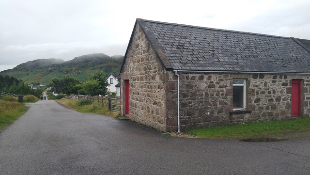
The village is primarily residential, with a scattering of traditional stone cottages and modern houses. The community is tightly knit, and its residents enjoy a quiet and friendly atmosphere. Inverasdale is a popular destination for those seeking a peaceful retreat away from the hustle and bustle of city life.

The area surrounding Inverasdale is rich in natural beauty and wildlife. The nearby Inverewe Garden, a renowned National Trust for Scotland property, is home to a stunning collection of plants from around the world. Visitors can explore the well-maintained gardens and enjoy panoramic views of Loch Ewe.

Outdoor enthusiasts are drawn to Inverasdale for its ample opportunities for hiking, fishing, and wildlife spotting. The nearby mountains and lochs provide an idyllic backdrop for exploring the great outdoors. The village also serves as a gateway to the rugged and remote landscape of Wester Ross, making it an ideal base for further adventures.

In terms of amenities, Inverasdale has a small shop for basic groceries, and a pub where locals and visitors can gather for a pint and a friendly chat. For more extensive facilities, the larger town of Poolewe is just a short drive away.

Overall, Inverasdale offers a tranquil and scenic setting, perfect for those seeking a peaceful escape amidst the natural beauty of the Scottish Highlands.

If you have any feedback on the listing, please let us know in the comments section below.

Inverasdale Images

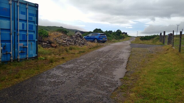
Images are sourced within 2km of 57.817421/-5.6698895 or Grid Reference NG8286. Thanks to Geograph Open Source API. All images are credited.

B8057 near Poolewe, Scottish Highlands
Former church at Midtown, Inverasdale
Cul-de-sac road in Inverasdale We are heading for the start of the path to the beach at Camas Mor.
Cul-de-sac road in Inverasdale
We are heading for the start of the path to the beach at Camas Mor.
The path to Camas Mor Heavy rain overnight and the path is very very wet!
The path to Camas Mor
Heavy rain overnight and the path is very very wet!
Burn by the path to Camas Mor Heavy rain overnight and this burn in spate should have been a warning.  We didn't have to cross this one, but the next one was to prove un-crossable!  See <a title="https://www.geograph.org.uk/photo/7544799" href="https://www.geograph.org.uk/photo/7544799">Link</a>
Burn by the path to Camas Mor
Heavy rain overnight and this burn in spate should have been a warning. We didn't have to cross this one, but the next one was to prove un-crossable! See Link
Loch Sguod from the path to Camas Mor Loch Ewe (sea loch) lies beyond.
Loch Sguod from the path to Camas Mor
Loch Ewe (sea loch) lies beyond.
The path to Camas Mor Heavy rain overnight and  burns in spate should have been a warning.  This is the path, not a burn, but the next burn was to prove un-crossable!  See <a title="https://www.geograph.org.uk/photo/7544799" href="https://www.geograph.org.uk/photo/7544799">Link</a>
The path to Camas Mor
Heavy rain overnight and burns in spate should have been a warning. This is the path, not a burn, but the next burn was to prove un-crossable! See Link
Derelict fank by the path to Camas Mor
Arriving at the Abhainn Ur on the path to Camas Mor Heavy rain overnight and burns in spate should have been a warning.  This one was un-crossable!  So we turned back and went to the beach instead.
Arriving at the Abhainn Ur on the path to Camas Mor
Heavy rain overnight and burns in spate should have been a warning. This one was un-crossable! So we turned back and went to the beach instead.
The Abhainn Ur by the path to Camas Mor After heavy overnight rain, in spate and un-crossable, blocking the path to Camus Mor.
The Abhainn Ur by the path to Camas Mor
After heavy overnight rain, in spate and un-crossable, blocking the path to Camus Mor.
Camas na Muic and the beach at Firemore
Uidh Chrò - the outflow from Loch Sguod
Lifebelt at Camas na Muic, Firemore
Buildings at Coast, Inverasdale In the distance, beyond Loch Ewe, the mountains of the Fisherfield Forest.
Buildings at Coast, Inverasdale
In the distance, beyond Loch Ewe, the mountains of the Fisherfield Forest.
Looking up Loch Ewe towards Inverewe Gardens
Monkey puzzle tree (Araucaria araucana) by Loch ewe at Inverasdale
Old Free Church of Scotland Mission House (changed to domestic use) This property is probably unique on the Scottish mainland. It consists of a first storey missionary's quarters, with a meeting house beneath. It is thought that a similar building once stood on the island of Mingulay
Old Free Church of Scotland Mission House (changed to domestic use)
This property is probably unique on the Scottish mainland. It consists of a first storey missionary's quarters, with a meeting house beneath. It is thought that a similar building once stood on the island of Mingulay
Show me another place!

Inverasdale is located at Grid Ref: NG8286 (Lat: 57.817421, Lng: -5.6698895)

Unitary Authority: Highland

Police Authority: Highlands and Islands

What 3 Words

///dimes.rejoiced.lunging. Near Gairloch, Highland

Nearby Locations

Coast Inverasdale

Related Wikis

Inverasdale

Inverasdale (Scottish Gaelic: Inbhir Àsdail) is a hamlet in the Northwest Highlands of Scotland, located by Loch Ewe, in the region of Wester Ross. �...

Isle of Ewe

The Isle of Ewe (Scottish Gaelic: Eilean Iùbh) is a small Scottish island on the west coast of Ross and Cromarty. The island is inhabited by a single family...

Cove, Highland

Cove is a remote hamlet located on the northwestern shore of the sea loch Loch Ewe, and 8 mi (13 km) northwest of Poolewe in Ross-shire, Scottish Highlands...

Loch Ewe

Loch Ewe (Scottish Gaelic: Loch Iùbh) is a sea loch in the region of Wester Ross in the Northwest Highlands of Scotland. The shores are inhabited by a...

Nearby Amenities

Located within 500m of 57.817421,-5.6698895
Source: PGS
Lat/Long: 57.8131628/-5.6676158
Source: PGS
Lat/Long: 57.8134181/-5.6675875
Source: PGS
Lat/Long: 57.8136797/-5.6674846
Source: PGS
Lat/Long: 57.8139205/-5.6675202
Source: PGS
Lat/Long: 57.814127/-5.6674196
Source: PGS
Lat/Long: 57.814429/-5.6672793
Source: PGS
Lat/Long: 57.8145906/-5.6671151
Source: PGS
Lat/Long: 57.8148516/-5.6671951
Source: PGS
Lat/Long: 57.815121/-5.6670849
Source: PGS
Lat/Long: 57.8154247/-5.6668278
Source: PGS
Lat/Long: 57.8157959/-5.6663774
Created By: almien_coastlines
Source: PGS
Lat/Long: 57.815878/-5.666273
Source: PGS
Lat/Long: 57.8163765/-5.6651084
Source: PGS
Lat/Long: 57.8165505/-5.6644948
Created By: almien_coastlines
Source: PGS
Lat/Long: 57.816686/-5.664413
Created By: almien_coastlines
Source: PGS
Lat/Long: 57.816819/-5.664183
Source: PGS
Lat/Long: 57.816987/-5.6639473
Created By: almien_coastlines
Source: PGS
Lat/Long: 57.817085/-5.663723
Source: PGS
Lat/Long: 57.8171406/-5.6634123
Source: PGS
Lat/Long: 57.8170814/-5.6631552
Source: PGS
Lat/Long: 57.8176773/-5.6625257
Source: PGS
Lat/Long: 57.8178677/-5.6622572
Source: PGS
Lat/Long: 57.8182878/-5.6619082
Power: pole
Lat/Long: 57.8133332/-5.6731064
Power: pole
Lat/Long: 57.8140496/-5.6729838
Power: pole
Lat/Long: 57.8147616/-5.6728639
Power: pole
Lat/Long: 57.8153459/-5.6726971
Power: pole
Lat/Long: 57.8157826/-5.6725704
Power: pole
Lat/Long: 57.8163169/-5.6723802
Power: pole
Lat/Long: 57.8168395/-5.6721735
Power: pole
Lat/Long: 57.8173724/-5.6719475
Power: pole
Lat/Long: 57.8179456/-5.6716926
Power: pole
Lat/Long: 57.8183808/-5.6715231
Power: pole
Lat/Long: 57.8188307/-5.6713453
Power: pole
Lat/Long: 57.8194127/-5.6716251
Power: pole
Lat/Long: 57.8200115/-5.6719213
Power: pole
Lat/Long: 57.8206339/-5.6722148
Power: pole
Lat/Long: 57.8212158/-5.6725097
Power: pole
Lat/Long: 57.8182251/-5.6639528
Power: pole
Lat/Long: 57.8188845/-5.6656986
Power: pole
Lat/Long: 57.8190977/-5.6662561
Power: pole
Lat/Long: 57.8191326/-5.6672297
Power: pole
Lat/Long: 57.819417/-5.6681039
Power: pole
Lat/Long: 57.8193877/-5.6688656
Power: pole
Lat/Long: 57.8192901/-5.6698575
Power: pole
Lat/Long: 57.818904/-5.669957
Power: pole
Lat/Long: 57.818522/-5.6700826
Power: pole
Lat/Long: 57.818108/-5.6702318
Power: pole
Lat/Long: 57.8176954/-5.6703574
Power: pole
Lat/Long: 57.8168813/-5.6704281
Power: pole
Lat/Long: 57.8172005/-5.6675072
Power: pole
Lat/Long: 57.8167809/-5.6699779
Power: pole
Lat/Long: 57.8154384/-5.6692608
Power: pole
Lat/Long: 57.8155666/-5.6702305
Power: pole
Lat/Long: 57.815743/-5.6714698
Power: pole
Lat/Long: 57.8130704/-5.670521
Power: pole
Lat/Long: 57.8140442/-5.6702096
The data included in this document is from www.openstreetmap.org. The data is made available under ODbL.

Have you been to Inverasdale?

Leave your review of Inverasdale below (or comments, questions and feedback).