Invercloy

Settlement in Buteshire

Scotland

Invercloy

West Glenshurig roadend
West Glenshurig roadend Credit: Gordon Brown

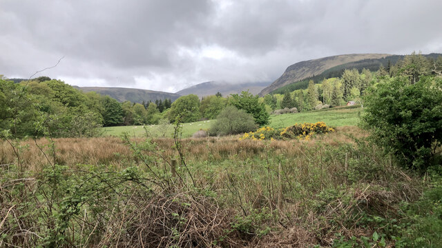
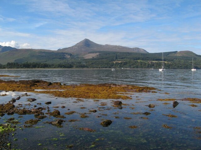
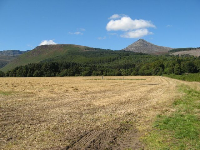
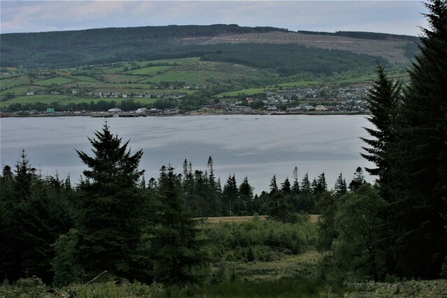
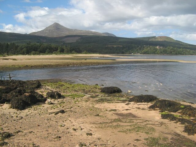
Invercloy is a small village located in the county of Buteshire, Scotland. Situated on the western coast of the Isle of Bute, it offers stunning views of the Firth of Clyde and is surrounded by picturesque landscapes.

The village of Invercloy is known for its tranquility and natural beauty. It has a population of around 500 residents and offers a peaceful retreat from the hustle and bustle of larger towns and cities. The community is tight-knit, with a strong sense of camaraderie and a welcoming atmosphere for locals and visitors alike.

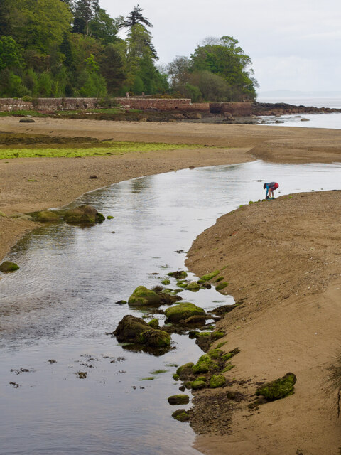
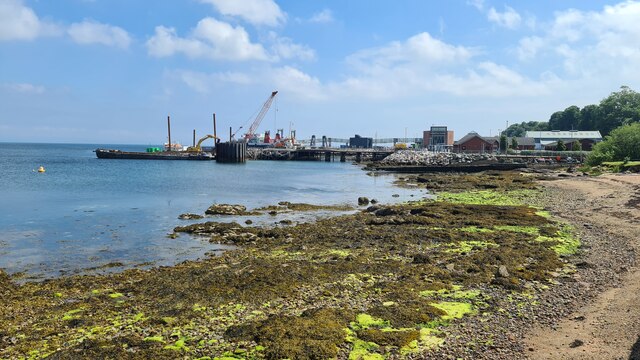
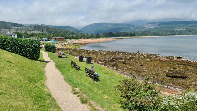
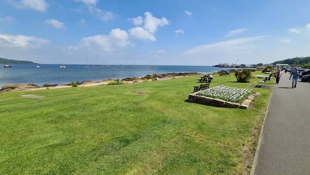
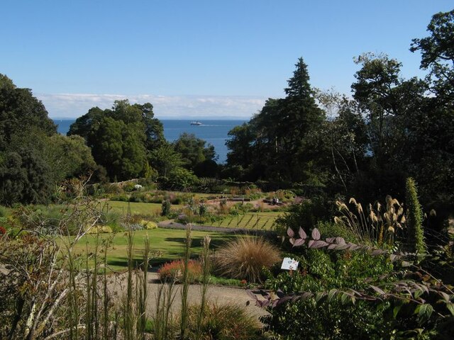
One of the main attractions of Invercloy is its stunning coastline. The village benefits from a sandy beach, which is popular among locals and tourists during the summer months. The beach provides an excellent spot for picnicking, swimming, and enjoying various water activities. The surrounding cliffs and rock formations offer opportunities for scenic walks and birdwatching.

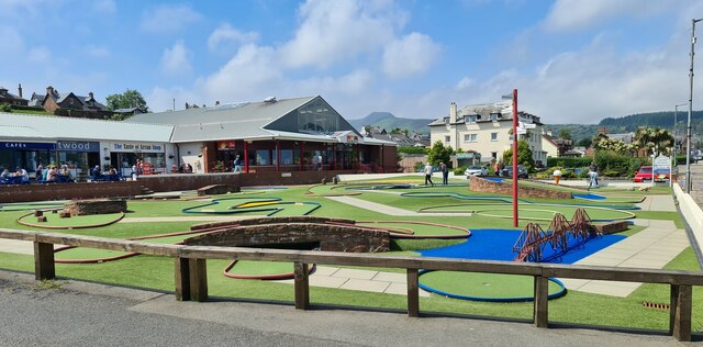
Invercloy also boasts a vibrant arts and culture scene. The village is home to several art galleries and craft shops, showcasing the work of local artists and artisans. There are also regular events and exhibitions held throughout the year, attracting visitors from all over.

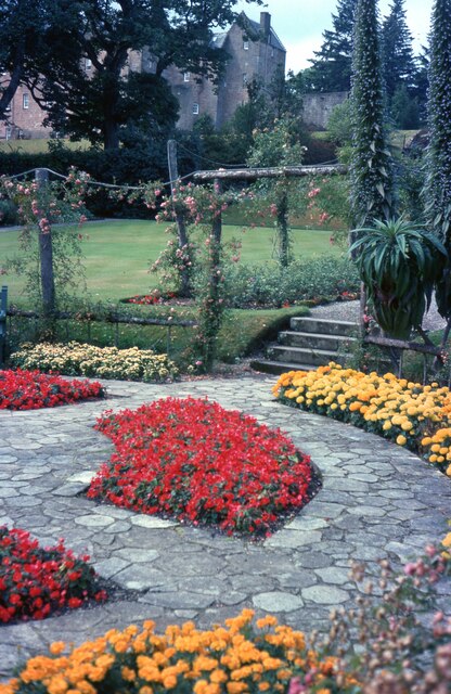
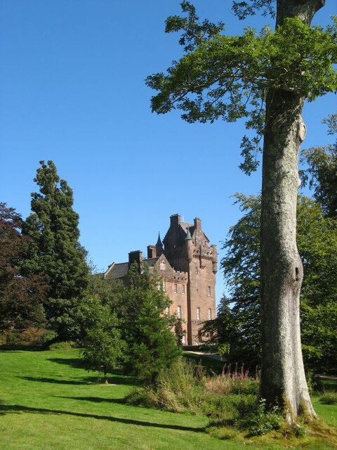
For those interested in history, Invercloy is home to a number of historic landmarks. The ruins of Invercloy Castle, a 16th-century fortress, are a significant attraction, offering a glimpse into the area's rich past. The village also has a small museum dedicated to preserving and showcasing the local history and heritage.

Overall, Invercloy is a charming coastal village that offers a peaceful and scenic getaway. With its stunning natural landscapes, vibrant arts scene, and rich history, it is a place that appeals to both nature lovers and culture enthusiasts.

If you have any feedback on the listing, please let us know in the comments section below.
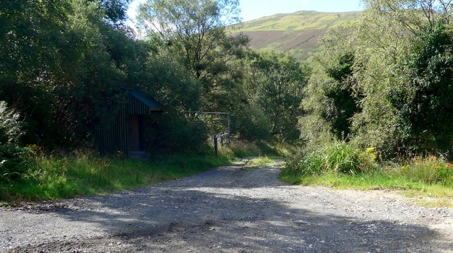
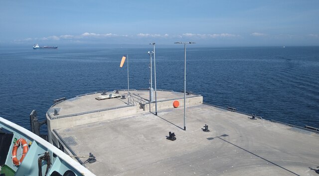
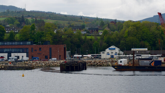
Invercloy Images

Images are sourced within 2km of 55.577232/-5.1519153 or Grid Reference NS0136. Thanks to Geograph Open Source API. All images are credited.

West Glenshurig roadend
The end of the Brodick ferry jetty Taken from the bow of the MV Isle of Arran while berthed.
The end of the Brodick ferry jetty
Taken from the bow of the MV Isle of Arran while berthed.
Approaching Brodick
Approaching Brodick
Glen Rosa
Glen Rosa
Cnocan Burn
Cnocan Burn
Brodick Ferry Terminal Being improved
Brodick Ferry Terminal
Being improved
The McLaren Hotel, Brodick Ready for redevelopment - a local eyesore.
The McLaren Hotel, Brodick
Ready for redevelopment - a local eyesore.
Invercloy beach, Brodick
Sea front, Invercloy, Brodick
Crazy golf, Brodick
Crazy golf, Brodick
Brodick Castle gardens Cared for by the National Trust of Scotland.
Brodick Castle gardens
Cared for by the National Trust of Scotland.
Brodick shore Nearly high tide at Brodick, where a low, seaweed-grown reef is about to be submerged.
Brodick shore
Nearly high tide at Brodick, where a low, seaweed-grown reef is about to be submerged.
Walled garden A view over the walled garden of Brodick Castle. MV Caledonian Isles is leaving Brodick Bay en-route to Ardrossan.
Walled garden
A view over the walled garden of Brodick Castle. MV Caledonian Isles is leaving Brodick Bay en-route to Ardrossan.
Brodick Castle A view from the grounds of the castle.
Brodick Castle
A view from the grounds of the castle.
Stubble field with standing stones The harvester has just finished work in this field, and the standing stones are still standing. Goatfell gave the appearance of a volcano with a plume of steam.
Stubble field with standing stones
The harvester has just finished work in this field, and the standing stones are still standing. Goatfell gave the appearance of a volcano with a plume of steam.
Harbour works The work being undertaken in this image relates to the removal of elements of the former pier and mooring dolphins from below the waterline. Parts of the old pier can be seen in the left of the image. Visitors will know that the landward end of the former link-span is now in use as a seating and viewing area, complete with lane markings!
Harbour works
The work being undertaken in this image relates to the removal of elements of the former pier and mooring dolphins from below the waterline. Parts of the old pier can be seen in the left of the image. Visitors will know that the landward end of the former link-span is now in use as a seating and viewing area, complete with lane markings!
View across Brodick Bay Looking across the bay towards the ferry terminal at Brodick. The Clauchland Hills are behind, much of which are forested.

Camera location is on the slopes above Brodick Castle.
View across Brodick Bay
Looking across the bay towards the ferry terminal at Brodick. The Clauchland Hills are behind, much of which are forested. Camera location is on the slopes above Brodick Castle.
Glenrosa estuary Part of the complex wetlands and distributary channels of Glenrosa Water meeting the sea in Brodick Bay.
Glenrosa estuary
Part of the complex wetlands and distributary channels of Glenrosa Water meeting the sea in Brodick Bay.
Show me another place!

Invercloy is located at Grid Ref: NS0136 (Lat: 55.577232, Lng: -5.1519153)

Unitary Authority: North Ayrshire

Police Authority: Ayrshire

What 3 Words

///tomato.issue.flown. Near Brodick, North Ayrshire

Nearby Locations

Brodick Invercloy

Related Wikis

Brodick

Brodick ( BROD-ik, Scottish Gaelic: Tràigh a' Chaisteil ("Castle Beach") or Breadhaig) is the main village on the Isle of Arran, in the Firth of Clyde...

Strathwhillan

Strathwhillan (Scottish Gaelic: Srath Chuilinn) is a tiny community on the Isle of Arran in the Firth of Clyde, Scotland. It is really a suburb of the...

Home Farm, Brodick

Home Farm was the estate farm for Brodick Castle. It now houses a series of tourist enterprises including a cheese shop and Arran Aromatics. This was the...

Cladach

Note: Cladach is a general Scottish Gaelic word for "beach" or "shore" and occurs in many Scottish placenames Cladach (Scottish Gaelic: An Cladach) is...

Nearby Amenities

Located within 500m of 55.577232,-5.1519153
Source: PGS
Lat/Long: 55.5804945/-5.1525098
Source: PGS
Lat/Long: 55.5799981/-5.1519674
Source: PGS
Lat/Long: 55.5795529/-5.1514676
Source: PGS
Lat/Long: 55.578136/-5.1500494
Source: PGS
Lat/Long: 55.5777567/-5.1492976
Source: PGS
Lat/Long: 55.5775804/-5.1478918
Source: PGS
Lat/Long: 55.5776159/-5.1474448
Source: PGS
Lat/Long: 55.5776313/-5.1469403
Source: PGS
Lat/Long: 55.5775243/-5.1469431
Source: PGS
Lat/Long: 55.5771319/-5.1442786
Source: PGS
Lat/Long: 55.5771597/-5.1441887
Brodick
Alt Name Gd: Tràigh a' Chaisteil
Name Gd: Breadhaig
Name Sco: Brudick
Place: village
Population: 848
Wikidata: Q924520
Wikipedia: en:Brodick
Lat/Long: 55.5775158/-5.1506858
Arran Active
Shop: outdoor
Website: https://arranactive.co.uk/
Lat/Long: 55.5765673/-5.1450723
The Arran Chocolate Factory
Addr City: Brodick
Shop: confectionery
Website: https://www.jamesofarran.com/
Lat/Long: 55.5773022/-5.1485916
Bus Stop
Bus: yes
Naptan AtcoCode: 6170595
Naptan NaptanCode: 62923472
Public Transport: platform
Shelter: yes
Lat/Long: 55.5771378/-5.1468846
Post Box
Collection Times: Mo-Fr 14:00; Sa 09:00
Post Box Mounting: brick_pillar
Post Box Type: wall
Ref: KA27 25
Royal Cypher: GVIR
Royal Cypher Wikidata: Q33102169
Lat/Long: 55.5797751/-5.157224
Post Box
Collection Times: Mo-Fr 15:45; Sa 12:45
Ref: KA27 1
Royal Cypher: no
Lat/Long: 55.5772192/-5.1509154
Bus Stop
Brodick Library
Bench: no
Naptan AtcoCode: 6170597
Naptan NaptanCode: 62923752
Operator: Stagecoach Scotland
Shelter: no
Lat/Long: 55.5775159/-5.1518106
Cafe
Good Food Shop
Lat/Long: 55.5777071/-5.1565175
Bus Stop
Main Street before Glencoy Road
Bench: no
Bin: no
Bus: yes
Check Date Shelter: 2022-06-02
Naptan AtcoCode: 6170781
Naptan NaptanCode: 62924358
Public Transport: platform
Shelter: no
Tactile Paving: no
Lat/Long: 55.5795818/-5.1570618
Bus Stop
Bench: no
Bin: no
Bus: yes
Check Date Shelter: 2022-06-02
Naptan AtcoCode: 6170599
Naptan NaptanCode: 62924842
Public Transport: platform
Shelter: no
Tactile Paving: no
Lat/Long: 55.579879/-5.1570994
Bar
Brodick Bar
Lat/Long: 55.5770153/-5.1503552
Fire Station
Brodick Community Fire Station
Operator: Scottish Fire and Rescue Service
Lat/Long: 55.5764508/-5.151172
Fast Food
Shanghai Chinese Takeaway
Addr City: Isle of Arran
Addr Suburb: Brodick
Cuisine: chinese
Lat/Long: 55.5774831/-5.1509103
Place Of Worship
Religion: christian
Lat/Long: 55.576321/-5.1563075
Bus Stop
Brodick Library
Naptan AtcoCode: 6170598
Naptan NaptanCode: 62925279
Operator: Stagecoach Scotland
Lat/Long: 55.5773626/-5.1526073
Pharmacy
Brodick Pharmacy
Addr City: Brodick
Healthcare: pharmacy
Operator: Vantage
Lat/Long: 55.5776437/-5.1510682
Boathouse Gifts
Shop: gift
Lat/Long: 55.5781553/-5.1504736
Atm
Bank of Scotland
Brand: Bank of Scotland
Brand Wikidata: Q627381
Brand Wikipedia: en:Bank of Scotland
Operator: Bank of Scotland
Operator Wikidata: Q627381
Lat/Long: 55.5774859/-5.150515
Toilets
Lat/Long: 55.5782148/-5.1514684
Recycling
Recycling Type: container
Lat/Long: 55.578356/-5.1513641
Cafe
Little Rock Cafe
Addr City: Isle of Arran
Addr Suburb: Brodick
Cuisine: regional
Lat/Long: 55.5764573/-5.144498
Wooley's of Arran Bakery
Addr City: Isle of Arran
Addr Suburb: Brodick
Phone: +44 1770 302280
Shop: bakery
Website: https://www.wooleys.co.uk/
Lat/Long: 55.5774898/-5.1498567
Pub
The Ormidale Bar
Addr City: Isle of Arran
Addr Postcode: KA27 8BY
Addr Suburb: Brodick
Opening Hours: Mo-Fr 16:00-24:00, Sa,Su 12:00-24:00
Phone: +44 1770 302293
Website: http://www.ormidale-hotel.co.uk
Lat/Long: 55.5750963/-5.1553775
Bench
Backrest: yes
Material: wood
Lat/Long: 55.5757739/-5.1448133
Bench
Backrest: yes
Material: wood
Lat/Long: 55.5757853/-5.1450591
Bench
Backrest: yes
Material: wood
Lat/Long: 55.5758049/-5.1453357
Bus Stop
Glencloye Road
Bench: no
Bin: no
Lit: no
Naptan AtcoCode: 61701186
Naptan NaptanCode: 62989628
Operator: Stagecoach Scotland
Shelter: no
Tactile Paving: no
Lat/Long: 55.5779318/-5.1559389
Bicycle Rental
Boathouse Gifts
Lat/Long: 55.5781234/-5.1504768
Restaurant
The Brodick Brasserie
Lat/Long: 55.5771244/-5.150505
Telephone
Booth: K6
Check Date: 2022-06-02
Covered: booth
Operator: British Telecom
Lat/Long: 55.5772468/-5.151111
Alexander
Shop: hairdresser
Lat/Long: 55.5774334/-5.1491244
Ice Cream
The Parlour
Opening Hours: Mo-Sa 10:00-17:00, Su 11:00-17:00
Lat/Long: 55.5774684/-5.1506766
Red Door
Opening Hours: Mo-Sa 10:00-17:00, Su 11:30-16:30
Shop: gift
Lat/Long: 55.5774681/-5.1507753
Atm
Operator: Royal Bank of Scotland
Lat/Long: 55.5770903/-5.1472754
Arran Estate Agents
Addr City: Brodick
Addr Postcode: KA27 8AJ
Office: estate_agent
Phone: +441770 302 310
Website: https://www.arranestateagents.co.uk
Lat/Long: 55.577423/-5.1490232
Telephone
Booth: KX100
Covered: booth
Lat/Long: 55.5791635/-5.1580571
Charging Station
Capacity: 2
Lat/Long: 55.5769755/-5.1439896
Ormidale hotel
Tourism: hotel
Lat/Long: 55.5750214/-5.1552595
Place Of Worship
Arran Baptist Church
Denomination: baptist
Religion: christian
Service Times: 11h00 Sunday mornings
Lat/Long: 55.580538/-5.1558912
Dunvegan House
Addr Postcode: KA27 8BD
Tourism: guest_house
Lat/Long: 55.5770902/-5.1462549
Source: PGS
Lat/Long: 55.5774829/-5.1496685
Source: PGS
Lat/Long: 55.5768855/-5.1470334
Source: PGS
Lat/Long: 55.5766709/-5.1452238
Source: PGS
Lat/Long: 55.5762824/-5.1453468
Doctors
Brodick Health Centre
Addr City: Isle of Arran
Addr Postcode: KA27 8AJ
Addr Suburb: Brodick
Contact Phone: +44 1770 600516
Contact Website: https://www.arranmedical.co.uk
Healthcare: doctor
Operator: Arran Medical Group
Lat/Long: 55.5769482/-5.1468466
The Co-operative Food
Brand: The Co-operative Food
Brand Wikidata: Q3277439
Brand Wikipedia: en:Co-op Food
Opening Hours: Mo-We 08:00-18:00; Th-Sa 08:00-20:00; Su 11:00-17:00
Operator: The Co-operative Group
Operator Wikidata: Q117202
Shop: convenience
Website: https://www.coop.co.uk/store-finder/KA27-8AN/main-street
Lat/Long: 55.577698/-5.1507734
The Old Post Office
Addr City: Brodick
Shop: laundry
Lat/Long: 55.5771765/-5.1510215
Advertising: board
Lat/Long: 55.5774039/-5.1511395
Leisure: picnic_table
Lat/Long: 55.5773357/-5.1510617
The data included in this document is from www.openstreetmap.org. The data is made available under ODbL.

Have you been to Invercloy?

Leave your review of Invercloy below (or comments, questions and feedback).