Inveraldie

Settlement in Angus

Scotland

Inveraldie

Minor road at Shielhill Looking westward.
Minor road at Shielhill Credit: Peter Wood

Inveraldie is a small rural village located in the county of Angus, Scotland. Situated in the eastern part of the country, Inveraldie is nestled amidst beautiful green rolling hills and picturesque landscapes. The village is positioned approximately 6 miles northeast of the town of Forfar, making it easily accessible for both residents and visitors.

With a population of around 200 people, Inveraldie exudes a charming and close-knit community atmosphere. The village is predominantly residential, with a scattering of traditional stone-built houses and cottages that add to its quaint appeal.

Inveraldie benefits from its proximity to the surrounding countryside, providing ample opportunities for outdoor activities such as hiking, cycling, and birdwatching. The area is also renowned for its rich agricultural heritage, with farming being an integral part of the local economy.

Despite its small size, Inveraldie is within a short distance of essential amenities. Nearby Forfar offers a range of shops, supermarkets, schools, and healthcare facilities, ensuring that residents have easy access to everyday necessities.

For those seeking cultural attractions and historical landmarks, Inveraldie is conveniently located within reach of several notable sites. The iconic Glamis Castle, childhood home of the Queen Mother, is just a short drive away, as is the picturesque Loch of Lintrathen, a popular spot for fishing and wildlife enthusiasts.

Overall, Inveraldie offers a peaceful and idyllic setting for those looking to escape the hustle and bustle of city life and enjoy the tranquility of the Scottish countryside.

If you have any feedback on the listing, please let us know in the comments section below.
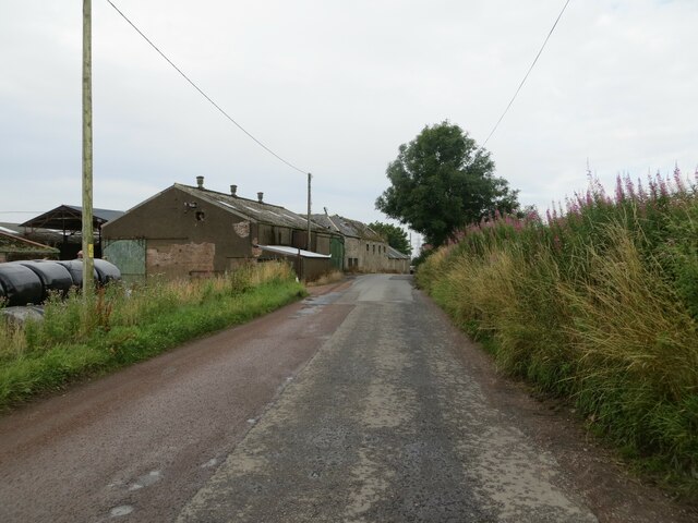
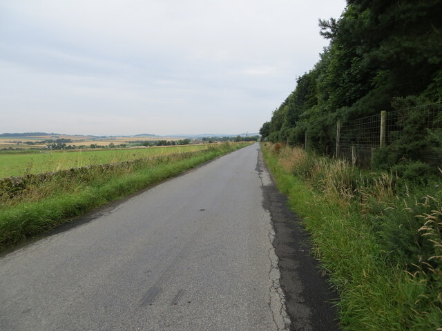
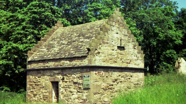
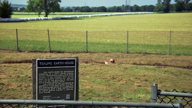
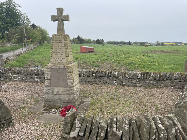
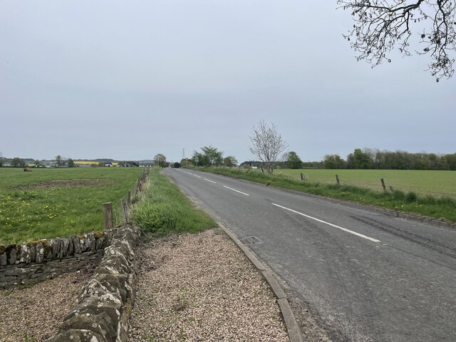
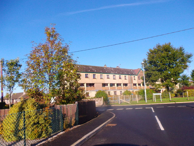
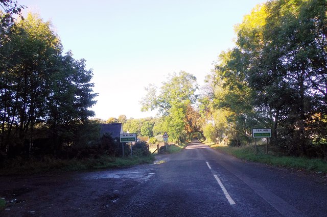
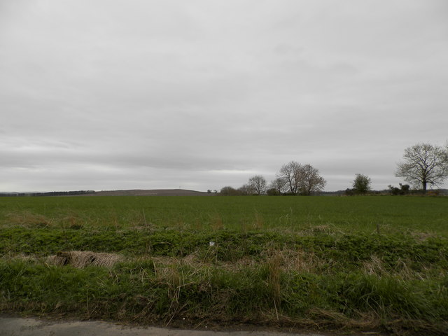
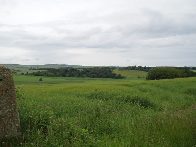
Inveraldie Images

Images are sourced within 2km of 56.522198/-2.9465536 or Grid Reference NO4137. Thanks to Geograph Open Source API. All images are credited.

Minor road at Shielhill Looking westward.
Minor road at Shielhill
Looking westward.
Minor road near to Woodside Looking north-westward.
Minor road near to Woodside
Looking north-westward.
Tealing Doocot in 1992
Tealing Earth House in 1992 The depth can be gauged in this view, which apart from the sign shows little
Tealing Earth House in 1992
The depth can be gauged in this view, which apart from the sign shows little
Tealing Memorial Geocaching is a type of global treasure hunt of people looking for caches, or hidden stashes of objects. Geocaching may also be described as a series of hide-and-seek games, where hiders provide online clues for seekers. Seekers use global positioning system (GPS) devices to find hidden caches
Tealing Memorial
Geocaching is a type of global treasure hunt of people looking for caches, or hidden stashes of objects. Geocaching may also be described as a series of hide-and-seek games, where hiders provide online clues for seekers. Seekers use global positioning system (GPS) devices to find hidden caches
Road into Tealing Geocaching is a type of global treasure hunt of people looking for caches, or hidden stashes of objects. Geocaching may also be described as a series of hide-and-seek games, where hiders provide online clues for seekers. Seekers use global positioning system (GPS) devices to find hidden caches
Road into Tealing
Geocaching is a type of global treasure hunt of people looking for caches, or hidden stashes of objects. Geocaching may also be described as a series of hide-and-seek games, where hiders provide online clues for seekers. Seekers use global positioning system (GPS) devices to find hidden caches
Terraced flats in Inveraldie Dalziel Place, seen from Inveraldie Crescent.
Terraced flats in Inveraldie
Dalziel Place, seen from Inveraldie Crescent.
Entrance into Tealing On minor road from A90; DRIVE SAFELY.
Entrance into Tealing
On minor road from A90; DRIVE SAFELY.
Tealing Home Farm Former Cattle and Stables court.
Tealing Home Farm
Former Cattle and Stables court.
Dovecote, Tealing See <span class="nowrap"><a title="http://canmore.org.uk/site/33373/tealing-dovecot" rel="nofollow ugc noopener" href="http://canmore.org.uk/site/33373/tealing-dovecot">Link</a><img style="margin-left:2px;" alt="External link" title="External link - shift click to open in new window" src="https://s1.geograph.org.uk/img/external.png" width="10" height="10"/></span>
Dovecote, Tealing
See LinkExternal link
Converted steadings, Tealing Home Farm With an old mill building beyond (left). See <span class="nowrap"><a title="http://canmore.org.uk/site/266209/tealing-home-farm-mill" rel="nofollow ugc noopener" href="http://canmore.org.uk/site/266209/tealing-home-farm-mill">Link</a><img style="margin-left:2px;" alt="External link" title="External link - shift click to open in new window" src="https://s1.geograph.org.uk/img/external.png" width="10" height="10"/></span>
Converted steadings, Tealing Home Farm
With an old mill building beyond (left). See LinkExternal link
Pylons and Power lines through Tealing Crossing a minor road, towards Tealing House.
Pylons and Power lines through Tealing
Crossing a minor road, towards Tealing House.
Huntingfaulds Rd junction, Tealing Minor road to  bears left.
Huntingfaulds Rd junction, Tealing
Minor road to bears left.
Tealing War Memorial At a junction of minor roads; ahead for Kirkton of Auchterhouse, right for Tealing Primary School.
Tealing War Memorial
At a junction of minor roads; ahead for Kirkton of Auchterhouse, right for Tealing Primary School.
Staggered crossroads West of Tealing. Right for Balcalk, left for Kirkton of Tealing.
Staggered crossroads
West of Tealing. Right for Balcalk, left for Kirkton of Tealing.
Farmland at Woodside
Grassland at North Powrie The distinctive yellow of oil seed rape can be seen in the fields in the middle distance.
Grassland at North Powrie
The distinctive yellow of oil seed rape can be seen in the fields in the middle distance.
Farmland near Middleton
Show me another place!

Inveraldie is located at Grid Ref: NO4137 (Lat: 56.522198, Lng: -2.9465536)

Unitary Authority: Angus

Police Authority: Tayside

What 3 Words

///burns.sofa.flats. Near Dundee, Dundee City

Nearby Locations

Inveraldie

Related Wikis

Inveraldie

Inveraldie is a village in Angus, Scotland. It lies on the north-bound side of the A90 road, two miles north of Dundee. == References ==

Tealing

Tealing (Scottish Gaelic: Tèalainn) is a village in Angus in eastern Scotland, nestled at the foot of the Sidlaw Hills. It is just 6 miles (9.7 km) north...

RAF Tealing

Royal Air Force Tealing or more simply RAF Tealing is a former Royal Air Force station located at Tealing, Angus, Scotland. == Overview == During the Second...

Powrie Castle

Powrie Castle is a ruined 16th-century castle located in the north of Dundee, Scotland. It was designated as a scheduled monument in 1971. The early 17th...

Nearby Amenities

Located within 500m of 56.522198,-2.9465536
Crossing
Crossing Markings: no
Crossing Signals: no
Lat/Long: 56.5236995/-2.9445275
Bus Stop
Shielhill Road End
Bench: yes
Bin: no
Lit: yes
Naptan AtcoCode: 6490IM1120
Naptan Bearing: S
Naptan CommonName: Shielhill Road End
Naptan Indicator: at Road End towards Dundee
Naptan Landmark: Shielhill Road End
Naptan NaptanCode: 26425687
Naptan Street: A90
Shelter: yes
Source: naptan_import
Tactile Paving: no
Lat/Long: 56.5178997/-2.9446415
Bus Stop
Shielhill Road End
Bench: yes
Bin: no
Lit: yes
Naptan AtcoCode: 6490IM1124
Naptan Bearing: N
Naptan CommonName: Shielhill Road End
Naptan Indicator: opp Road End towards Forfar
Naptan Landmark: Shielhill Road End
Naptan NaptanCode: 26425689
Naptan Street: A90
Shelter: yes
Source: naptan_import
Tactile Paving: no
Lat/Long: 56.5184658/-2.9451584
Bus Stop
A90 towards Forfar
Bench: yes
Bin: no
Lit: yes
Local Ref: AT
Naptan AtcoCode: 6490IM645
Naptan Bearing: N
Naptan CommonName: A90 towards Forfar
Naptan Indicator: at
Naptan NaptanCode: 26424675
Naptan Street: A90
Naptan Verified: no
Shelter: yes
Source: naptan_import
Tactile Paving: no
Lat/Long: 56.5217103/-2.9449153
Bus Stop
A90 towards Dundee
Bench: yes
Bin: no
Lit: yes
Local Ref: AT
Naptan AtcoCode: 6490IM646
Naptan Bearing: S
Naptan CommonName: A90 towards Dundee
Naptan Indicator: at
Naptan NaptanCode: 26424676
Naptan Street: A90
Naptan Verified: no
Shelter: yes
Source: naptan_import
Tactile Paving: no
Lat/Long: 56.521975/-2.9443693
Design: barrel
Power: tower
Lat/Long: 56.520291/-2.9440402
Inveraldie
Name Gd: Inbhir Alltaidh
Place: village
Wikidata: Q6059978
Wikipedia: en:Inveraldie
Lat/Long: 56.5216466/-2.9466279
Design: barrel
Power: tower
Lat/Long: 56.5192777/-2.9489066
Design: barrel
Power: tower
Lat/Long: 56.521274/-2.9389633
Shielhill Cottages
Place: isolated_dwelling
Lat/Long: 56.5199969/-2.9427463
The Shieling
Place: hamlet
Lat/Long: 56.5246545/-2.9436475
Bus Stop
Hall Place
Source: naptan_import
Lat/Long: 56.5221309/-2.9465298
Power: pole
Lat/Long: 56.5213201/-2.9443439
Power: pole
Lat/Long: 56.5219107/-2.9443328
Material: wood
Power: pole
Lat/Long: 56.5224891/-2.9443195
Material: wood
Power: pole
Lat/Long: 56.5230723/-2.9442974
Material: wood
Power: pole
Lat/Long: 56.5236995/-2.9443306
Power: pole
Lat/Long: 56.5243145/-2.9443639
Power: pole
Lat/Long: 56.5218508/-2.9439183
Power: pole
Lat/Long: 56.521687/-2.9426127
Power: pole
Lat/Long: 56.5217505/-2.9413781
Power: pole
Lat/Long: 56.5218068/-2.9400902
Power: pole
Lat/Long: 56.5218679/-2.9387159
Power: pole
Lat/Long: 56.5235161/-2.9463599
Power: pole
Lat/Long: 56.5236005/-2.9476522
Power: pole
Lat/Long: 56.5236555/-2.9486054
Power: pole
Lat/Long: 56.5237166/-2.9496981
Power: pole
Lat/Long: 56.5237643/-2.950802
Power: pole
Lat/Long: 56.5238059/-2.9519148
Power: pole
Lat/Long: 56.5238462/-2.9530386
Bus Stop
Bench: yes
Bin: no
Bus: yes
Lit: yes
Public Transport: platform
Shelter: yes
Tactile Paving: no
Lat/Long: 56.5257207/-2.9447546
Crossing
Crossing Markings: no
Crossing Signals: no
Lat/Long: 56.5238401/-2.9447537
Post Box
Collection Times: Mo-Fr 09:00; Sa 07:00
Manufacturer: Carron Company Stirlingshire
Operator: Royal Mail
Post Box Type: pillar
Ref: DD4 224D
Royal Cypher: GR
Source: survey
Lat/Long: 56.5220351/-2.9450472
The data included in this document is from www.openstreetmap.org. The data is made available under ODbL.

Have you been to Inveraldie?

Leave your review of Inveraldie below (or comments, questions and feedback).