Marjoriebanks

Settlement in Dumfriesshire

Scotland

Marjoriebanks

Lochmaben War Memorial Lochmaben’s War Memorial is a statue of a soldier of the King’s Own Scottish Borderers regiment with head bowed and inverted rifle and wearing Tam o'Shanter and puttees. The inscriptions read, “To the glory of God and in ever grateful remembrance of the men of this parish who gave their lives in the Great War 1914-1919”, “Their name liveth for evermore” and “Lo. These are they from suff’rings great.

The memorial stands on a three-stepped square base and plinth set in a memorial garden with raised flower beds at the south end of Main Street at the junction of Lockerbie Road.
Lochmaben War Memorial Credit: David Dixon

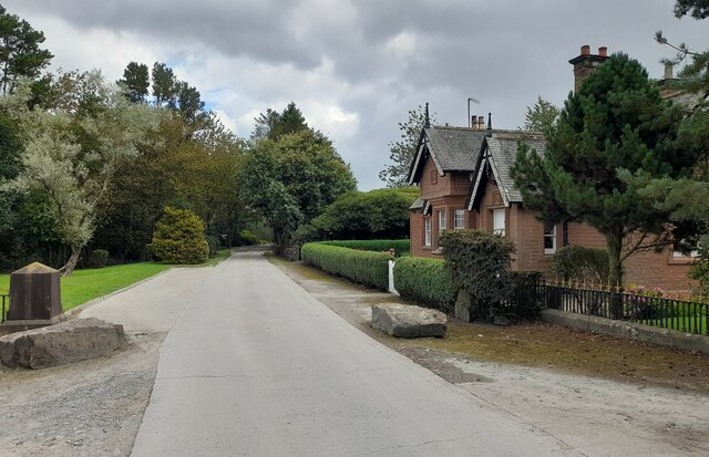
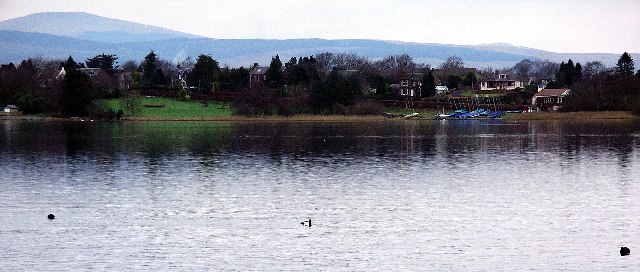
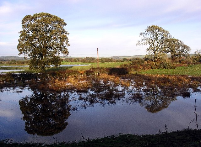
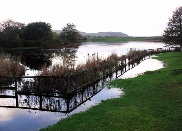
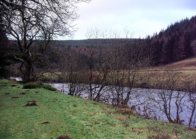
Marjoriebanks is a small village located in the Dumfriesshire region of Scotland. Situated in the southern part of the country, it is nestled within the beautiful countryside, offering stunning views of rolling hills and lush greenery. The village is part of the Nith Valley and lies near the banks of the River Nith, which adds to its scenic charm.

With a population of around 200 residents, Marjoriebanks exudes a peaceful and close-knit community atmosphere. The village primarily consists of traditional stone cottages, giving it a quaint and picturesque appearance. The locals take great pride in maintaining the village's character and preserving its historical heritage.

Despite its small size, Marjoriebanks boasts a few amenities for its residents. There is a local pub that serves as a gathering place for socializing and enjoying traditional Scottish cuisine. Additionally, a village hall hosts various community events and activities throughout the year, fostering a strong sense of community spirit.

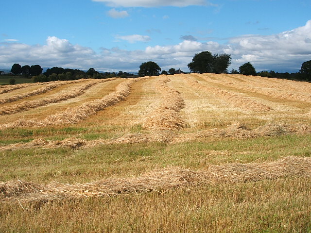
The surrounding area offers ample opportunities for outdoor activities and exploration. Residents and visitors can take advantage of the nearby walking trails, cycling routes, and fishing spots along the river. The stunning landscape also attracts nature enthusiasts and photographers, who can capture the beauty of the Scottish countryside.

Overall, Marjoriebanks provides a tranquil and idyllic setting for those seeking a peaceful retreat away from the hustle and bustle of city life. Its charm, natural beauty, and strong community ties make it a hidden gem in Dumfriesshire.

If you have any feedback on the listing, please let us know in the comments section below.

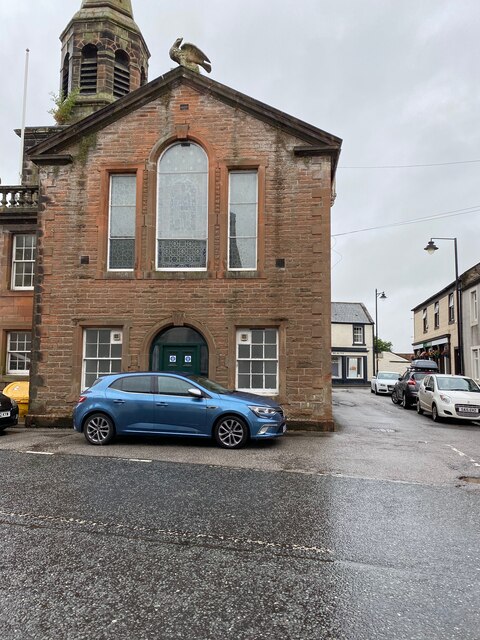
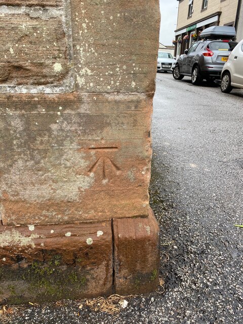
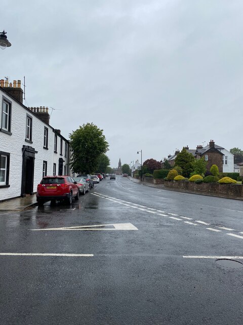
Marjoriebanks Images

Images are sourced within 2km of 55.136291/-3.441351 or Grid Reference NY0883. Thanks to Geograph Open Source API. All images are credited.

Lochmaben War Memorial Lochmaben’s War Memorial is a statue of a soldier of the King’s Own Scottish Borderers regiment with head bowed and inverted rifle and wearing Tam o'Shanter and puttees. The inscriptions read, “To the glory of God and in ever grateful remembrance of the men of this parish who gave their lives in the Great War 1914-1919”, “Their name liveth for evermore” and “Lo. These are they from suff’rings great.

The memorial stands on a three-stepped square base and plinth set in a memorial garden with raised flower beds at the south end of Main Street at the junction of Lockerbie Road.
Lochmaben War Memorial
Lochmaben’s War Memorial is a statue of a soldier of the King’s Own Scottish Borderers regiment with head bowed and inverted rifle and wearing Tam o'Shanter and puttees. The inscriptions read, “To the glory of God and in ever grateful remembrance of the men of this parish who gave their lives in the Great War 1914-1919”, “Their name liveth for evermore” and “Lo. These are they from suff’rings great. The memorial stands on a three-stepped square base and plinth set in a memorial garden with raised flower beds at the south end of Main Street at the junction of Lockerbie Road.
War Memorial and Garden, Lochmaben Lochmaben’s War Memorial is a statue of a soldier of the King’s Own Scottish Borderers regiment with head bowed and inverted rifle and wearing Tam o'Shanter and puttees. The inscriptions read, “To the glory of God and in ever grateful remembrance of the men of this parish who gave their lives in the Great War 1914-1919”, “Their name liveth for evermore” and “Lo. These are they from suff’rings great.

The memorial stands on a three-stepped square base and plinth set in a memorial garden with raised flower beds at the south end of Main Street at the junction of Lockerbie Road.
War Memorial and Garden, Lochmaben
Lochmaben’s War Memorial is a statue of a soldier of the King’s Own Scottish Borderers regiment with head bowed and inverted rifle and wearing Tam o'Shanter and puttees. The inscriptions read, “To the glory of God and in ever grateful remembrance of the men of this parish who gave their lives in the Great War 1914-1919”, “Their name liveth for evermore” and “Lo. These are they from suff’rings great. The memorial stands on a three-stepped square base and plinth set in a memorial garden with raised flower beds at the south end of Main Street at the junction of Lockerbie Road.
Lochmaben Church Rectangular-plan 4-bay Gothic church at the south end of High Street, built 1819-20

Category A listed building (LB37539 <span class="nowrap"><a title="http://portal.historicenvironment.scot/designation/LB37539" rel="nofollow ugc noopener" href="http://portal.historicenvironment.scot/designation/LB37539">Link</a><img style="margin-left:2px;" alt="External link" title="External link - shift click to open in new window" src="https://s1.geograph.org.uk/img/external.png" width="10" height="10"/></span> Historic Environment Scotland).
Lochmaben Church
Rectangular-plan 4-bay Gothic church at the south end of High Street, built 1819-20 Category A listed building (LB37539 LinkExternal link Historic Environment Scotland).
Lochmaben
Lochmaben
Lochmaben, Town Hall
OS Cut Mark - Lochmaben, Town Hall <span class="nowrap"><a title="https://www.bench-marks.org.uk/bm70198" rel="nofollow ugc noopener" href="https://www.bench-marks.org.uk/bm70198">Link</a><img style="margin-left:2px;" alt="External link" title="External link - shift click to open in new window" src="https://s1.geograph.org.uk/img/external.png" width="10" height="10"/></span>
OS Cut Mark - Lochmaben, Town Hall
Lochmaben looking towards the Town Hall
OS Cut Mark - Lochmaben, Parish Church <span class="nowrap"><a title="https://www.bench-marks.org.uk/bm69993" rel="nofollow ugc noopener" href="https://www.bench-marks.org.uk/bm69993">Link</a><img style="margin-left:2px;" alt="External link" title="External link - shift click to open in new window" src="https://s1.geograph.org.uk/img/external.png" width="10" height="10"/></span>
OS Cut Mark - Lochmaben, Parish Church
Gatehouse at Halleaths Gatehouse at Halleaths.
Gatehouse at Halleaths
Gatehouse at Halleaths.
Old Milestone by the B7020, Main Road, Lochmaben War Memorial By the B7020, in parish of Lochmaben (Annandale District), Lochmaben, just before junction with A709 by War Memorial.

Inscription once read:- : (Annan / 13) :

Surveyed

Milestone Society National ID: DG_ANLM13
Old Milestone by the B7020, Main Road, Lochmaben War Memorial
By the B7020, in parish of Lochmaben (Annandale District), Lochmaben, just before junction with A709 by War Memorial. Inscription once read:- : (Annan / 13) : Surveyed Milestone Society National ID: DG_ANLM13
Broadholm, Annandale View from the Applegarthtown-Broadholm lane over the flat waterside meadows to Broadholm Farm.
Broadholm, Annandale
View from the Applegarthtown-Broadholm lane over the flat waterside meadows to Broadholm Farm.
Annandale Sailing Club, Lochmaben and Lochmaben Church in the background Annandale Sailing Club sails and races on Castle Loch, the largest of several lochs in the area.
Annandale Sailing Club, Lochmaben and Lochmaben Church in the background
Annandale Sailing Club sails and races on Castle Loch, the largest of several lochs in the area.
Arable farming Harvesting of crops at farmland near Lochmaben
Arable farming
Harvesting of crops at farmland near Lochmaben
Lochmaben The town stands on the shore of Castle Loch. The area has been inhabited since c.4000BC. There were loch dwellers in crannogs on the loch, one of which has been dated to 630AD. Lochmaben became a Royal Burgh in 1447, and in 1579 James IV granted the town a Royal Charter at a cost of £40. The town hall was built in 1723 and still functions as the local government administration office. Famous residents have included Robert the Bruce, and William Paterson, founder of the Bank of England.
Lochmaben
The town stands on the shore of Castle Loch. The area has been inhabited since c.4000BC. There were loch dwellers in crannogs on the loch, one of which has been dated to 630AD. Lochmaben became a Royal Burgh in 1447, and in 1579 James IV granted the town a Royal Charter at a cost of £40. The town hall was built in 1723 and still functions as the local government administration office. Famous residents have included Robert the Bruce, and William Paterson, founder of the Bank of England.
Reflections in flooded fields near Lochmaben Heavy rain during the preceding week had caused quite severe flooding in the area, creating new temporary 'lakes'. The pond in the field in the foreground is a permanent feature, but on this occasion was much deeper than usual.
Reflections in flooded fields near Lochmaben
Heavy rain during the preceding week had caused quite severe flooding in the area, creating new temporary 'lakes'. The pond in the field in the foreground is a permanent feature, but on this occasion was much deeper than usual.
Tending the sheep, Christmas morning 2005 No Christmas morning lie-in for the shepherd (*), out with his quad bike & dog at Halleaths, near Lochmaben, on a very cold, frosty morning just as the sun was coming up above the hills. (*Or the photographer!)
Tending the sheep, Christmas morning 2005
No Christmas morning lie-in for the shepherd (*), out with his quad bike & dog at Halleaths, near Lochmaben, on a very cold, frosty morning just as the sun was coming up above the hills. (*Or the photographer!)
Mill Loch, Lochmaben Flooded after several days of heavy rain. One of the three lochs surrounding Lochmaben, the others being Castle Loch, the largest, and Kirk Loch.
Mill Loch, Lochmaben
Flooded after several days of heavy rain. One of the three lochs surrounding Lochmaben, the others being Castle Loch, the largest, and Kirk Loch.
Lochmaben town centre Showing the town hall, built in 1723, and the statue of Robert the Bruce, a local resident.
Lochmaben town centre
Showing the town hall, built in 1723, and the statue of Robert the Bruce, a local resident.
Show me another place!

Marjoriebanks is located at Grid Ref: NY0883 (Lat: 55.136291, Lng: -3.441351)

Unitary Authority: Dumfries and Galloway

Police Authority: Dumfries and Galloway

What 3 Words

///dice.opposites.daily. Near Lochmaben, Dumfries & Galloway

Nearby Locations

Marjoriebanks

Related Wikis

Lochmaben railway station

Lochmaben railway station was a station which served Lochmaben, in the Scottish county of Dumfries and Galloway. It was served by trains on a local line...

Lochmaben F.C.

Lochmaben Football Club is a Scottish football based in Lochmaben, Dumfries and Galloway. The club took on its current name after a merger with Crichton...
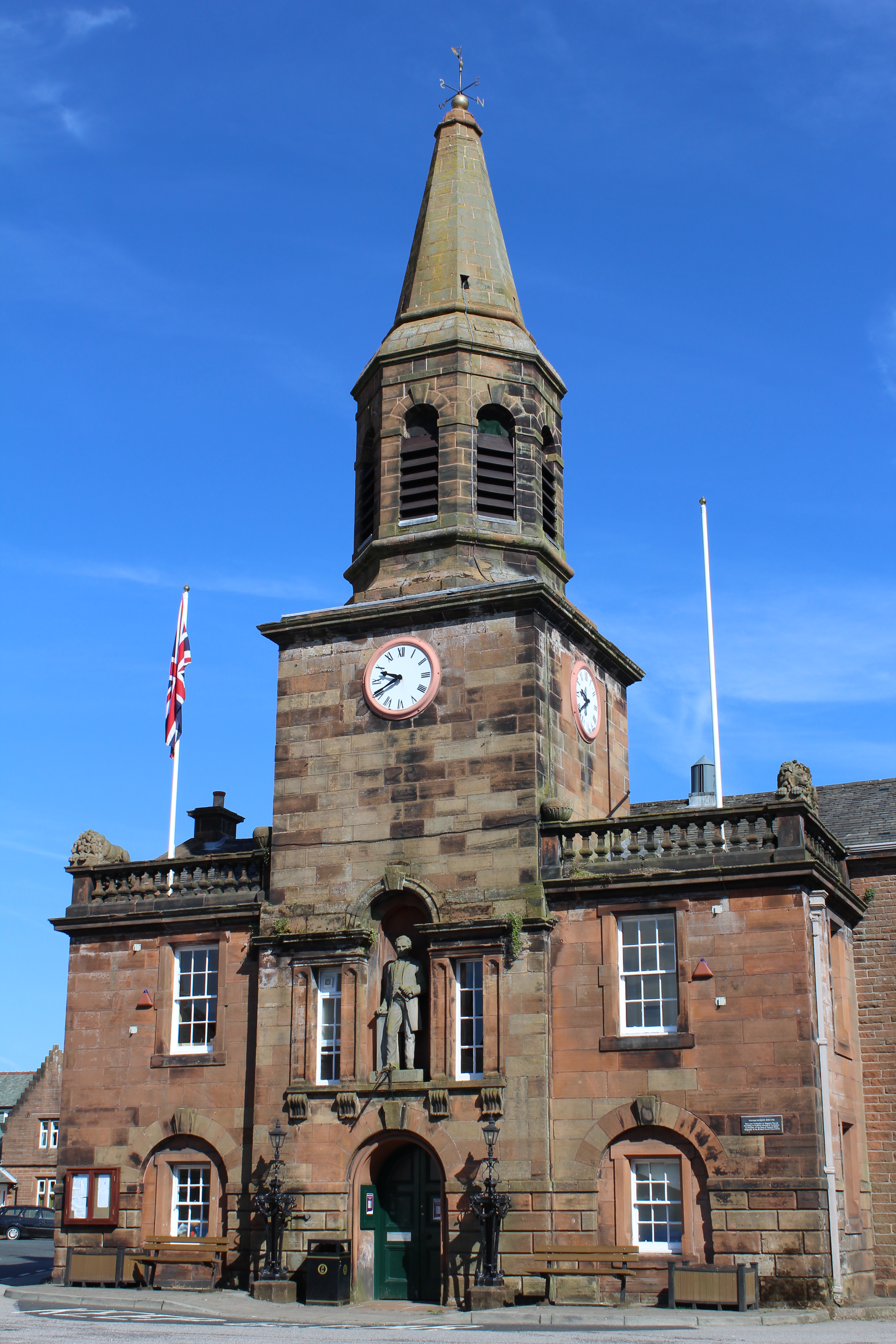
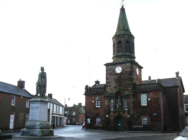
Lochmaben Town Hall

Lochmaben Town Hall is a municipal building in the High Street in Lochmaben, Dumfries and Galloway, Scotland. The structure, which accommodates a library...

Battle of Lochmaben Fair

The Battle of Lochmaben Fair was an engagement in Lochmaben, Scotland, on 22 July 1484 between Scottish loyalists to James III of Scotland and the rebels...

Lochmaben

Lochmaben (Gaelic: Loch Mhabain) is a small town and civil parish in Scotland, and site of a castle. It lies 4 miles (6 km) west of Lockerbie, in Dumfries...

Old Lochmaben Castle

Lochmaben Castle was a 12th-century castle on the spit of land between Loch Kirk and Loch Castle, in Lochmaben, Scotland.The motte and bailey castle was...

Lochmaben Hospital

Lochmaben Hospital is a health facility in Woodlands Drive, Lochmaben, Dumfries and Galloway, Scotland. It is managed by NHS Dumfries and Galloway. �...

Water of Ae

The Water of Ae is a tributary of the River Annan into which it flows west of Lockerbie in Dumfries and Galloway administrative county of South West Scotland...

Nearby Amenities

Located within 500m of 55.136291,-3.441351
Mossvale
Naptan AtcoCode: 680000183222
Naptan Bearing: SE
Naptan BusStopType: CUS
Naptan CommonName: Mossvale
Naptan Indicator: Turning Point
Naptan Landmark: Loch
Naptan NaptanCode: 34237282
Naptan Notes: none
Naptan Street: Mossvale
Naptan Verified: no
Source: naptan_import
Lat/Long: 55.1355152/-3.4459339
Bus Stop
Majoriebanks
Naptan AtcoCode: 680000592111
Naptan Bearing: N
Naptan CommonName: Majoriebanks
Naptan Indicator: North
Naptan Landmark: Broomhill Road
Naptan NaptanCode: 34237283
Naptan Notes: none
Naptan Street: B7020
Naptan Verified: no
Source: naptan_import
Lat/Long: 55.1375338/-3.4409239
Majoriebanks
Naptan AtcoCode: 680000592222
Naptan Bearing: S
Naptan BusStopType: CUS
Naptan CommonName: Majoriebanks
Naptan Indicator: South
Naptan Landmark: Broomhill Road
Naptan NaptanCode: 34237284
Naptan Notes: none
Naptan Street: B7020
Naptan Verified: no
Source: naptan_import
Lat/Long: 55.137318/-3.4409318
Lochmaben
Abandoned Railway: station
Railway: site
Source: NPE
Lat/Long: 55.1344477/-3.4420513
Shop: vacant
Source: survey
Lat/Long: 55.1334207/-3.4428622
Post Box
Brand: Royal Mail
Brand Wikidata: Q638098
Mapillary: 1414665065570336
Operator: Royal Mail
Operator Wikidata: Q638098
Post Box Mounting: pier
Post Box Type: lamp
Source: survey
Source Position: Mapillary 2020-08-27
Survey Date: 2020-08-27
Lat/Long: 55.1329574/-3.4432797
Power: pole
Lat/Long: 55.138362/-3.4404692
Power: pole
Lat/Long: 55.139135/-3.4397145
Power: pole
Lat/Long: 55.1399331/-3.4389365
Power: pole
Lat/Long: 55.1406508/-3.4417958
Power: pole
Lat/Long: 55.1365428/-3.4472826
Power: pole
Lat/Long: 55.1366135/-3.447566
Power: pole
Lat/Long: 55.1367416/-3.4480425
Power: pole
Lat/Long: 55.1372997/-3.4488926
The data included in this document is from www.openstreetmap.org. The data is made available under ODbL.

Have you been to Marjoriebanks?

Leave your review of Marjoriebanks below (or comments, questions and feedback).