Hutton Moor End

Settlement in Cumberland Eden

England

Hutton Moor End

Sheep grazing Sheep grazing on roughly grassed land on the south side of a minor road below Mousthwaite Comb.
Great Mell Fell is the distant hill.
Sheep grazing Credit: Trevor Littlewood

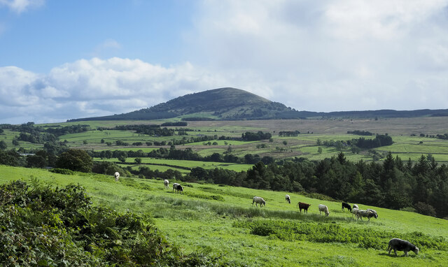
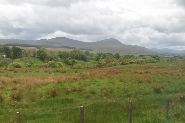
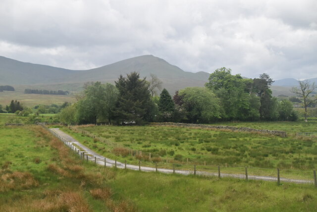
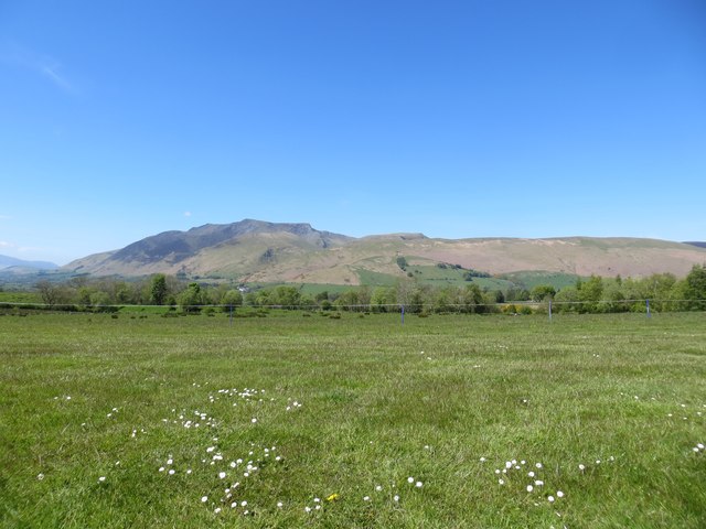
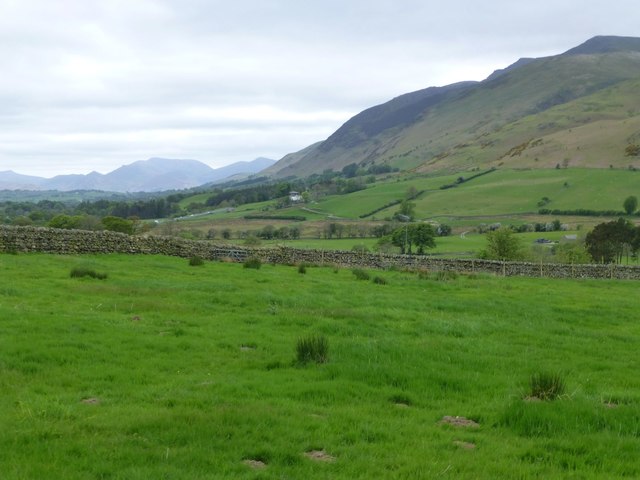
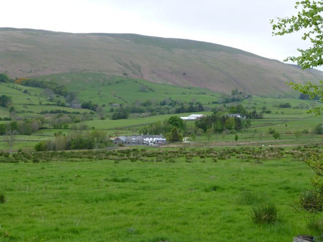
Hutton Moor End is a small hamlet located in the county of Cumberland, in the northwestern part of England. Situated in the picturesque Lake District National Park, Hutton Moor End offers stunning views of the surrounding countryside and is known for its natural beauty.

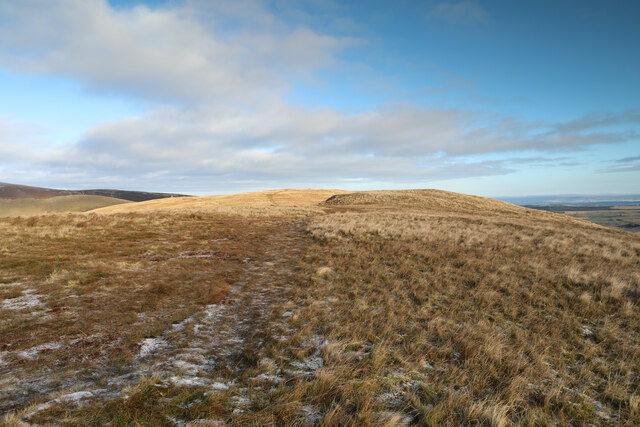
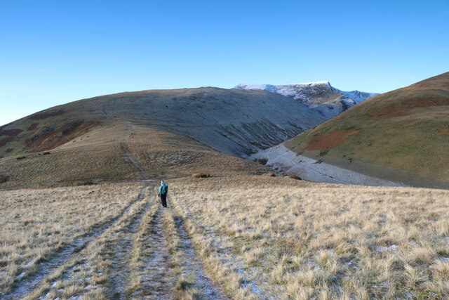
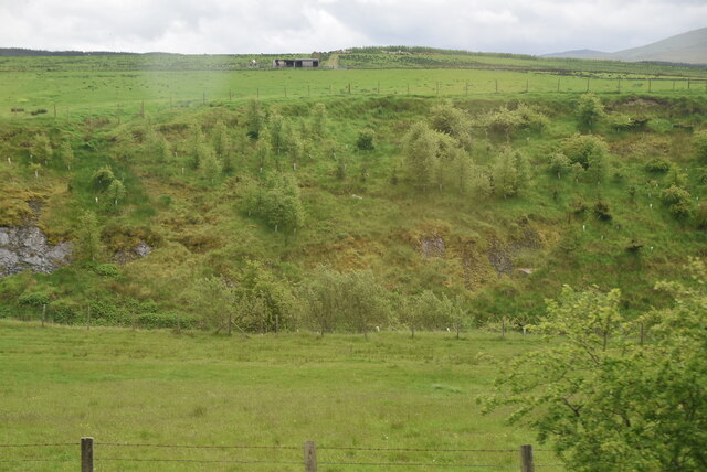
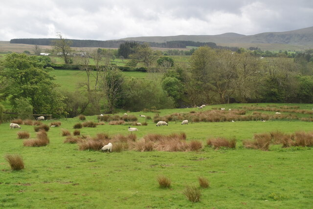
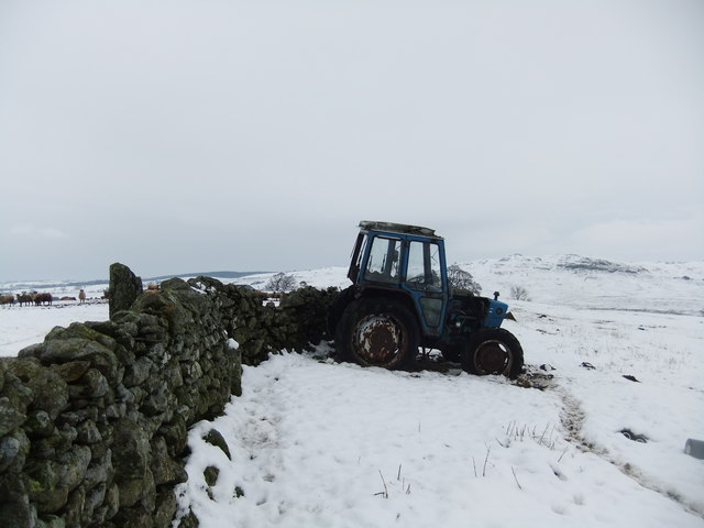
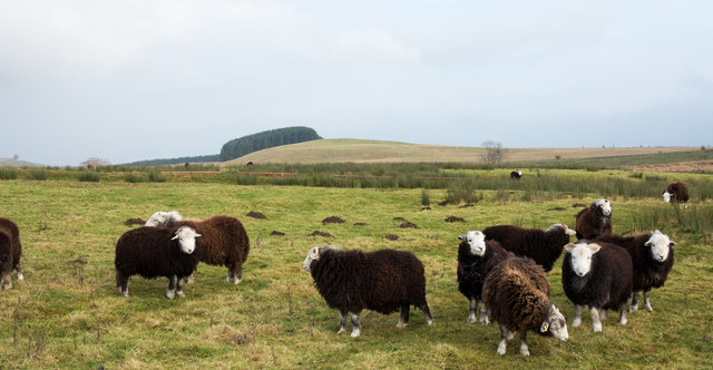
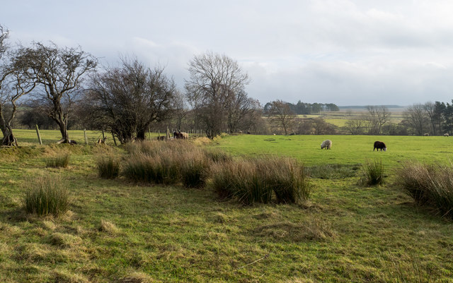
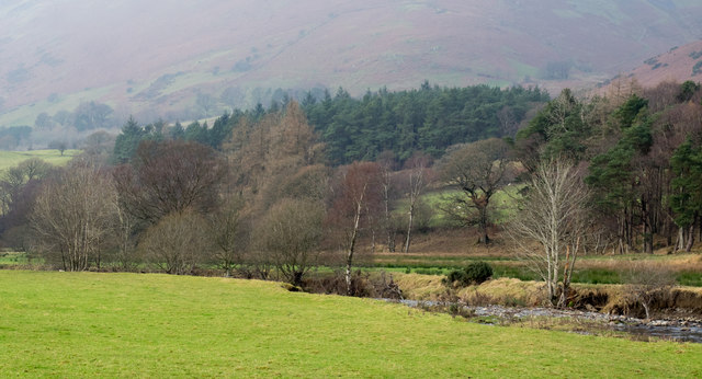
The hamlet is characterized by its peaceful and rural setting, with a small number of houses scattered across the area. The landscape is dominated by rolling hills, lush green meadows, and charming stone walls. Hutton Moor End is surrounded by dense forests, providing ample opportunities for outdoor activities such as hiking, cycling, and wildlife spotting.

Despite its small size, Hutton Moor End benefits from its proximity to nearby towns and villages. The market town of Penrith is approximately 10 miles away, providing residents with access to a range of amenities and services. The city of Carlisle is also within a reasonable distance, offering further opportunities for shopping, dining, and entertainment.

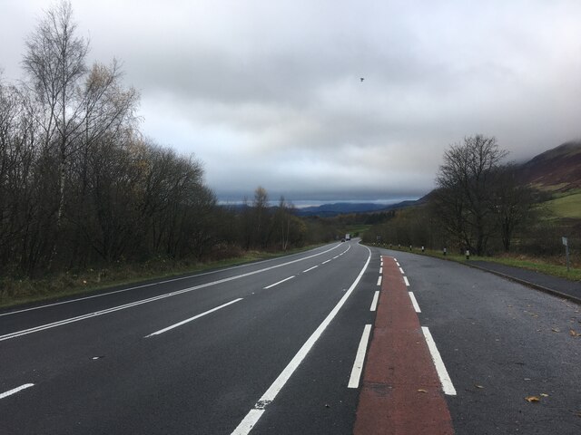
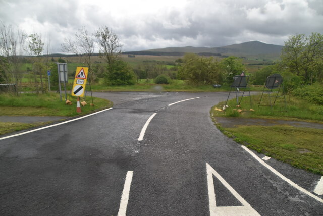
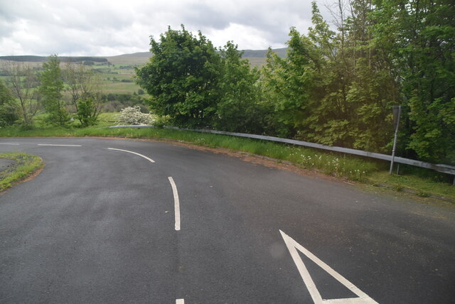
The community in Hutton Moor End is tight-knit and friendly, with a strong sense of community spirit. The hamlet is home to a small primary school, ensuring that families have access to education for their children. The area is well-connected by road, with the A66 and A686 providing easy access to surrounding areas.

Overall, Hutton Moor End is a tranquil and idyllic place to live, offering a peaceful retreat from the hustle and bustle of city life. Its natural beauty and close-knit community make it a desirable location for those seeking a rural lifestyle in the heart of the Lake District.

If you have any feedback on the listing, please let us know in the comments section below.

Hutton Moor End Images

Images are sourced within 2km of 54.635314/-2.985447 or Grid Reference NY3627. Thanks to Geograph Open Source API. All images are credited.

Sheep grazing Sheep grazing on roughly grassed land on the south side of a minor road below Mousthwaite Comb.
Great Mell Fell is the distant hill.
Sheep grazing
Sheep grazing on roughly grassed land on the south side of a minor road below Mousthwaite Comb. Great Mell Fell is the distant hill.
A66 near Hutton Moor End
Summit ridge of Souther Fell After a long gentle diagonal ascent, the path to Souther Fell from Low Beckside emerges onto the ridge, where a bit of backtracking would be needed to visit the very highest point. It's not a terribly distinguished peak, so those engaged on a circular walk with Blencathra or Bannerdale Crags as the high point will probably, as we did, simply bag the square and press on to the southwest.
Summit ridge of Souther Fell
After a long gentle diagonal ascent, the path to Souther Fell from Low Beckside emerges onto the ridge, where a bit of backtracking would be needed to visit the very highest point. It's not a terribly distinguished peak, so those engaged on a circular walk with Blencathra or Bannerdale Crags as the high point will probably, as we did, simply bag the square and press on to the southwest.
The col above Mousthwaite Cove A broad footpath descends from Souther Fell towards the col which falls steeply to the south into Mousthwaite Cove (to the left in this view). To the right, a path drops to cross the infant River Glenderamackin by a footbridge to ascend its left bank or climb White Horse Bent onto Bannerdale Crags (or return down-valley to Mungrisdale). Directly ahead, paths climb the ridge of Scales Fell in a direct assault on Blencathra, whilst another traverses above the River to reach Scales Tarn and a steeper path to the summit, or an exposed and exciting ridge - Sharp Edge which would be perhaps quite difficult in these conditions. We'd already decided that the snow would not be deep enough for ice axe braking in the event of a fall, whilst even the frozen turf was already treacherous enough without adding exposure and icy rocks, so our route was to be up the horizon line to the right.
The col above Mousthwaite Cove
A broad footpath descends from Souther Fell towards the col which falls steeply to the south into Mousthwaite Cove (to the left in this view). To the right, a path drops to cross the infant River Glenderamackin by a footbridge to ascend its left bank or climb White Horse Bent onto Bannerdale Crags (or return down-valley to Mungrisdale). Directly ahead, paths climb the ridge of Scales Fell in a direct assault on Blencathra, whilst another traverses above the River to reach Scales Tarn and a steeper path to the summit, or an exposed and exciting ridge - Sharp Edge which would be perhaps quite difficult in these conditions. We'd already decided that the snow would not be deep enough for ice axe braking in the event of a fall, whilst even the frozen turf was already treacherous enough without adding exposure and icy rocks, so our route was to be up the horizon line to the right.
Old Boundary Marker near Wolt Bridge Parish Boundary Marker on the north side of the former A66 immediately east of Wolt Bridge, between Scales and Hutton Moor End. On the border of Matterdale and Mungrisdale parishes. Inscribed MUNGRISDALE. See also <span class="nowrap"><a title="http://www.geog.port.ac.uk/webmap/thelakes/photos/bnk49.jpg" rel="nofollow ugc noopener" href="http://www.geog.port.ac.uk/webmap/thelakes/photos/bnk49.jpg">Link</a><img style="margin-left:2px;" alt="External link" title="External link - shift click to open in new window" src="https://s1.geograph.org.uk/img/external.png" width="10" height="10"/></span>.

Milestone Society National ID: CU_MATMUN01pb
Old Boundary Marker near Wolt Bridge
Parish Boundary Marker on the north side of the former A66 immediately east of Wolt Bridge, between Scales and Hutton Moor End. On the border of Matterdale and Mungrisdale parishes. Inscribed MUNGRISDALE. See also LinkExternal link. Milestone Society National ID: CU_MATMUN01pb
Trout Beck Valley
Trout Beck Valley
North Lakelands Scenery
Track to Lane Head
Track to Lane Head
Minor road off A66
Minor road off A66
Sheep grazing
Sheep grazing
Waithwaite
Waithwaite
Gill Head Farm campsite Bank holiday weekend before the crowds arrived with Blencathra in the background
Gill Head Farm campsite
Bank holiday weekend before the crowds arrived with Blencathra in the background
How Top
How Top
Pasture within dry-stone walls Blencathra looming over Threlkeld in the distance.
Pasture within dry-stone walls
Blencathra looming over Threlkeld in the distance.
Looking across the valley of the River Glenderamackin Towards Souther Fell.
Looking across the valley of the River Glenderamackin
Towards Souther Fell.
Sheep on site of Roman Fort The sheep are in occupation of the site of a Roman camp; there's another on Lofshaw Hill which is in the distance and a third nearby. The image was recorded from an old alignment of the A66 - in part, the route of a Roman road. The herdwick sheep are lambs of the spring crop.
Sheep on site of Roman Fort
The sheep are in occupation of the site of a Roman camp; there's another on Lofshaw Hill which is in the distance and a third nearby. The image was recorded from an old alignment of the A66 - in part, the route of a Roman road. The herdwick sheep are lambs of the spring crop.
Rough grazing in field corner The vegetation of the field corner which lies on the south side of an earlier alignment of the A66 is little better than moorland.
Rough grazing in field corner
The vegetation of the field corner which lies on the south side of an earlier alignment of the A66 is little better than moorland.
River Glenderamackin from beside Wolt Bridge The River Glenderamackin rises between Skiddaw and Blencathra flowing south before turning east below that last mountain; it's seen here on that part of its course with the mountain rising into mist, beyond.
River Glenderamackin from beside Wolt Bridge
The River Glenderamackin rises between Skiddaw and Blencathra flowing south before turning east below that last mountain; it's seen here on that part of its course with the mountain rising into mist, beyond.
Show me another place!

Hutton Moor End is located at Grid Ref: NY3627 (Lat: 54.635314, Lng: -2.985447)

Administrative County: Cumbria

District: Eden

Police Authority: Cumbria

What 3 Words

///slyly.garlic.spans. Near Keswick, Cumbria

Nearby Locations

Hutton Moor End

Related Wikis

Hutton Moor End

Hutton Moor End is a hamlet on the Hutton Moor Road in the north east of the Lake District in Cumbria, England. It lies within the civil parish of Mungrisdale...

Trout Beck (Glenderamackin)

Trout Beck is a 7.6 miles (12.3 km) long stream or beck in the English Lake District, Cumbria. It rises on the northwestern slopes of Great Dodd, with...

Highgate Platform railway station

Highgate Platform railway station served schoolchildren in the isolated area of Highgate between Keswick and Penrith, in the historical area of Cumberland...
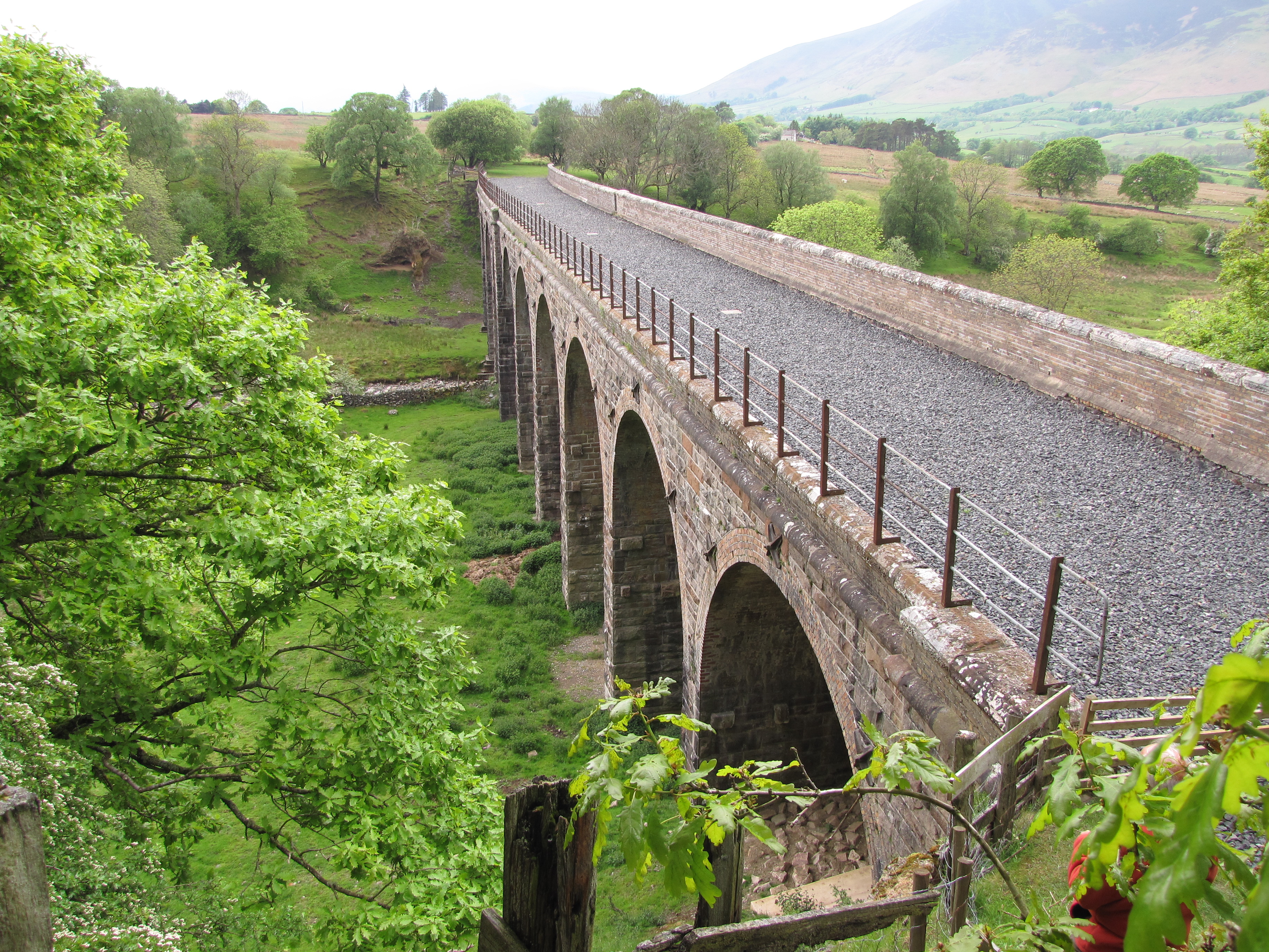
Mosedale Viaduct

The Mosedale Viaduct carried the Cockermouth, Keswick and Penrith Railway over Mosedale Beck until its closure in 1972. Building work on the viaduct...

Souther Fell

Souther Fell is a fell in the English Lake District. It stands to the south of Mungrisdale village in the Northern Fells. It is most famous for the appearance...

Mosedale Beck (Glenderamackin)

Mosedale Beck is a river in Cumbria, England, which rises on the northern slopes of Great Dodd and flows north east, to the south of Clough Head before...

Troutbeck, Hutton

Troutbeck is a hamlet within Cumbria, England, a few miles to the west of Penrith. It was previously in the county of Cumberland. It lies within the Lake...

Troutbeck railway station

Troutbeck railway station was situated on the Cockermouth, Keswick and Penrith Railway between Penrith and Cockermouth in Cumberland (now in Cumbria),...

Nearby Amenities

Located within 500m of 54.635314,-2.985447
Post Box
Collection Times: Mo-Fr 16:00, Sa 10:00
Ref: CA11 161
Royal Cypher: EIIR
Royal Cypher Wikidata: Q33102113
Lat/Long: 54.6367543/-2.9795983
Bus Stop
Mungrisdale Road end (W bound)
Bench: no
Bin: no
Covered: no
Lit: no
Naptan AtcoCode: 090074471678
Naptan Bearing: W
Naptan CommonName: Mungrisdale Road end (W bound)
Naptan Indicator: w/bound
Naptan Landmark: Mungrisdale Road junction with A66(T)
Naptan NaptanCode: cumdatga
Naptan Street: A66(T)
Naptan Verified: yes
Shelter: no
Source: naptan_import
Tactile Paving: no
Lat/Long: 54.6368618/-2.980133
Bus Stop
Mungrisdale Road end (E bound)
Bench: no
Bin: no
Covered: no
Lit: no
Local Ref: AT
Naptan AtcoCode: 090074471679
Naptan Bearing: E
Naptan CommonName: Mungrisdale Road end (E bound)
Naptan Indicator: at
Naptan Landmark: Mungrisdale Road junction with A66(T)
Naptan NaptanCode: cumdatgd
Naptan Street: A66(T)
Naptan Verified: no
Shelter: no
Source: naptan_import
Tactile Paving: no
Lat/Long: 54.6370944/-2.9789655
Parking
Parking: street_side
Lat/Long: 54.6365684/-2.9838642
Lisco Farm Bed & Breakfast
Addr City: Troutbeck
Addr Postcode: CA11 0SY
Phone: +44 17687 79645
Tourism: guest_house
Website: http://www.liscofarm.co.uk/
Lat/Long: 54.6363763/-2.9783321
Hutton Moor End
Place: locality
Wikidata: Q50741069
Lat/Long: 54.6353906/-2.9839906
Waterhouse
Place: locality
Lat/Long: 54.6386926/-2.9886796
Power: pole
Lat/Long: 54.6345376/-2.9778958
Power: pole
Lat/Long: 54.6343635/-2.9792005
Power: pole
Lat/Long: 54.6341497/-2.9805619
Power: pole
Lat/Long: 54.6345859/-2.9818726
Power: pole
Lat/Long: 54.6349756/-2.9829896
Power: pole
Lat/Long: 54.6353101/-2.9839846
Barrier: stile
Lat/Long: 54.6359568/-2.9779014
The data included in this document is from www.openstreetmap.org. The data is made available under ODbL.

Have you been to Hutton Moor End?

Leave your review of Hutton Moor End below (or comments, questions and feedback).