Marian-glas

Settlement in Anglesey

Wales

Marian-glas

Din Lligwy Romano-British Settlement One of the buildings in this well preserved 4th century AD defended settlement <span class="nowrap"><a title="https://www.megalithic.co.uk/article.php?sid=1494" rel="nofollow ugc noopener" href="https://www.megalithic.co.uk/article.php?sid=1494">Link</a><img style="margin-left:2px;" alt="External link" title="External link - shift click to open in new window" src="https://s1.geograph.org.uk/img/external.png" width="10" height="10"/></span>
Din Lligwy Romano-British Settlement Credit: Sandy Gerrard

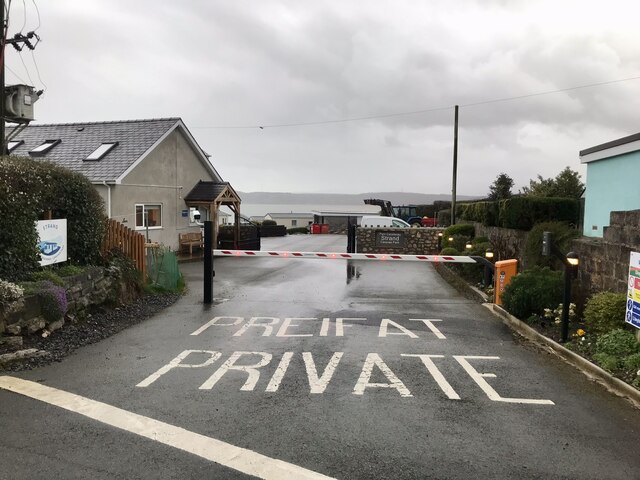
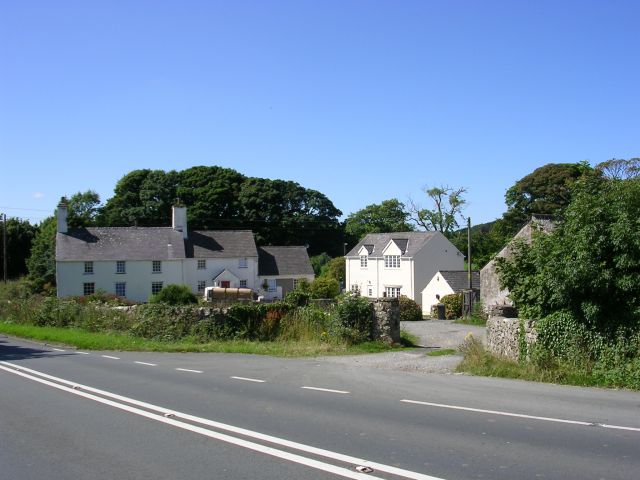
Marian-glas is a small village located on the Isle of Anglesey, in north-west Wales. Situated about 3 miles southeast of the town of Amlwch, Marian-glas is a rural community with a population of around 300 residents. It is surrounded by picturesque countryside, offering residents and visitors a tranquil and scenic environment.

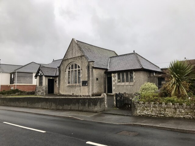
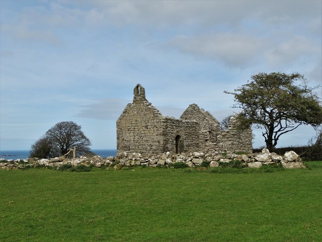
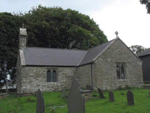
The village is known for its beautiful church, St. Gallgo's Church, which dates back to the 14th century. The church is a Grade II listed building and is well-preserved, attracting history enthusiasts and tourists alike. Its architecture showcases a mix of styles from different periods, including Romanesque and Gothic elements.

Marian-glas also boasts a vibrant community spirit, with various local events and activities taking place throughout the year. The village hall serves as a hub for social gatherings, meetings, and recreational activities, fostering a strong sense of camaraderie among the residents.

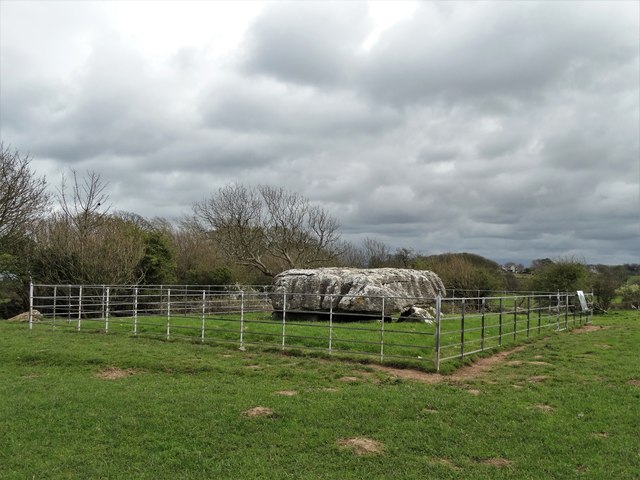
The surrounding area offers ample opportunities for outdoor pursuits, with rolling hills and stunning coastal walks nearby. The nearby Dingle Nature Reserve is a popular spot for nature lovers, boasting diverse flora and fauna, including rare orchids and an abundance of bird species.

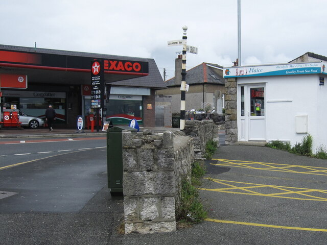
Although Marian-glas is a small village, it benefits from its proximity to larger towns on the island, such as Amlwch and Llangefni, which provide access to amenities such as shops, schools, and healthcare facilities.

Overall, Marian-glas offers a peaceful and idyllic setting, combining natural beauty with a rich historical heritage, making it an attractive place for those seeking a quiet and close-knit community.

If you have any feedback on the listing, please let us know in the comments section below.
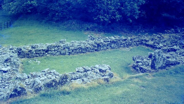
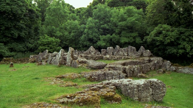
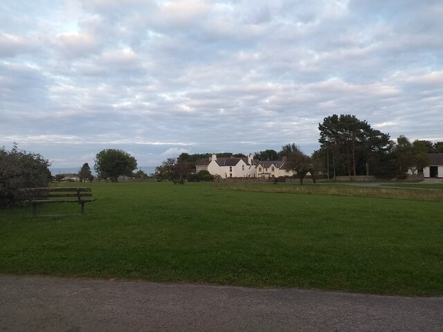
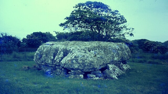
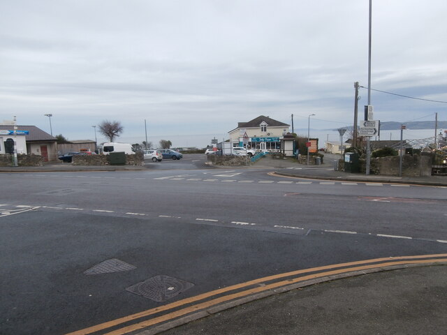
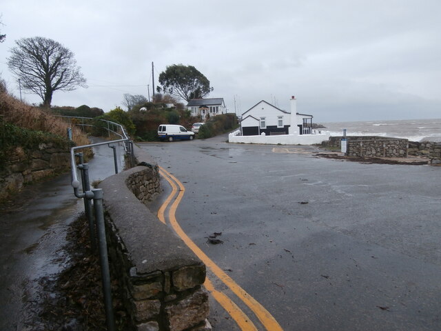
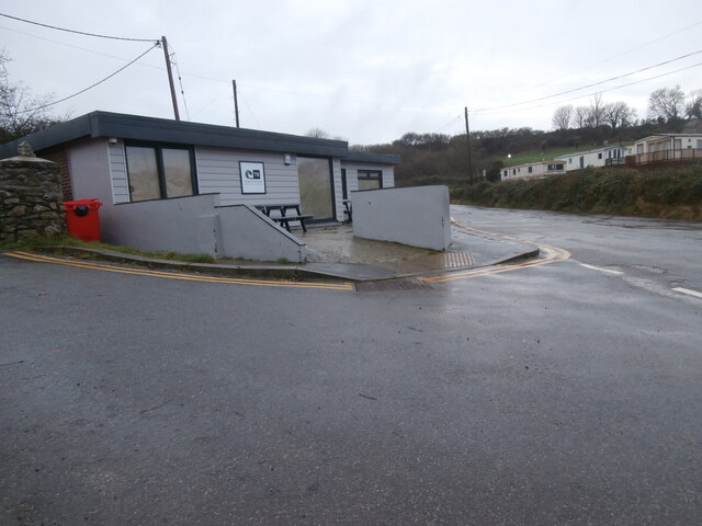
Marian-glas Images

Images are sourced within 2km of 53.336763/-4.241539 or Grid Reference SH5084. Thanks to Geograph Open Source API. All images are credited.

Din Lligwy Romano-British Settlement One of the buildings in this well preserved 4th century AD defended settlement <span class="nowrap"><a title="https://www.megalithic.co.uk/article.php?sid=1494" rel="nofollow ugc noopener" href="https://www.megalithic.co.uk/article.php?sid=1494">Link</a><img style="margin-left:2px;" alt="External link" title="External link - shift click to open in new window" src="https://s1.geograph.org.uk/img/external.png" width="10" height="10"/></span>
Din Lligwy Romano-British Settlement
One of the buildings in this well preserved 4th century AD defended settlement LinkExternal link
Din Lligwy Ancient Site in 1995 The round remains believed to be of a house
Din Lligwy Ancient Site in 1995
The round remains believed to be of a house
Din Lligwy Ancient Site in 1995 The remains of a rectangular structure believed to be for storage or workshops
Din Lligwy Ancient Site in 1995
The remains of a rectangular structure believed to be for storage or workshops
Marian Glas Village greens may be an English cliché, but it turns out there are some lovely ones in Wales too.
Marian Glas
Village greens may be an English cliché, but it turns out there are some lovely ones in Wales too.
Lligwy Burial Chamber The capstone on this chambered tomb is huge which may explain why it is lower than usual <span class="nowrap"><a title="https://www.megalithic.co.uk/article.php?sid=1495" rel="nofollow ugc noopener" href="https://www.megalithic.co.uk/article.php?sid=1495">Link</a><img style="margin-left:2px;" alt="External link" title="External link - shift click to open in new window" src="https://s1.geograph.org.uk/img/external.png" width="10" height="10"/></span>
Lligwy Burial Chamber
The capstone on this chambered tomb is huge which may explain why it is lower than usual LinkExternal link
Beach Road, Benllech Here Beach Road meets Bangor Road and Llangefni Road. An old-style fingerpost (on the left) and a modern direction sign (on the right) are both visible.  There is plenty of choice if you want to eat seafood in Benllech; including here the Jolly Fryer and far left Siop Y Cranc/The Crab Shop <span class="nowrap"><a title="https://www.visitanglesey.co.uk/en/things-to-do/activities/the-crab-shop-benllech/#.YdHl3mjP3IU" rel="nofollow ugc noopener" href="https://www.visitanglesey.co.uk/en/things-to-do/activities/the-crab-shop-benllech/#.YdHl3mjP3IU">Link</a><img style="margin-left:2px;" alt="External link" title="External link - shift click to open in new window" src="https://s1.geograph.org.uk/img/external.png" width="10" height="10"/></span>. Between them is the main car park for the village.
Beach Road, Benllech
Here Beach Road meets Bangor Road and Llangefni Road. An old-style fingerpost (on the left) and a modern direction sign (on the right) are both visible. There is plenty of choice if you want to eat seafood in Benllech; including here the Jolly Fryer and far left Siop Y Cranc/The Crab Shop LinkExternal link. Between them is the main car park for the village.
Traeth Bychan by the slipways The profile of the trees shows how they are put under pressure from the wind, and that was certainly happening on this Christmas Day afternoon.  The beach was presenting a very different aspect from the one seen here <span class="nowrap"><a title="https://www.thebeachguide.co.uk/north-wales/anglesey/traeth-bychan.htm" rel="nofollow ugc noopener" href="https://www.thebeachguide.co.uk/north-wales/anglesey/traeth-bychan.htm">Link</a><img style="margin-left:2px;" alt="External link" title="External link - shift click to open in new window" src="https://s1.geograph.org.uk/img/external.png" width="10" height="10"/></span> .
Traeth Bychan by the slipways
The profile of the trees shows how they are put under pressure from the wind, and that was certainly happening on this Christmas Day afternoon. The beach was presenting a very different aspect from the one seen here LinkExternal link .
Traeth Bychan beach shop and cafe Traeth Bychan beach shop seems to have been completely rebuilt since <a href="https://www.geograph.org.uk/photo/4387872">SH5185 : Traeth Bychan Beach Shop and Cafe</a>, apart from the wall outside, with a more subdued decorative palette.  Possibly this rebuilding has been done during the current winter, as the shop did not appear to have been fitted out yet.
Traeth Bychan beach shop and cafe
Traeth Bychan beach shop seems to have been completely rebuilt since SH5185 : Traeth Bychan Beach Shop and Cafe, apart from the wall outside, with a more subdued decorative palette. Possibly this rebuilding has been done during the current winter, as the shop did not appear to have been fitted out yet.
Eglwys Bresbyteraidd Cymru Benllech Twentieth century Welsh  Presbyterian church on Ffordd Amlwch at Benllech.
Eglwys Bresbyteraidd Cymru Benllech
Twentieth century Welsh Presbyterian church on Ffordd Amlwch at Benllech.
Strand Caravan Park, Benllech
Fingerpost by the A5025 in Benllech, Anglesey This fingerpost is at the crossroads where Beach Road meets the A5025 - Amlwch Road. For a wider view see <a href="https://www.geograph.org.uk/photo/7593034">SH5182 : Fingerpost by the A5025, Amlwch Road, Benllech</a>

Milestone Society National ID: ANG_SH5182
Fingerpost by the A5025 in Benllech, Anglesey
This fingerpost is at the crossroads where Beach Road meets the A5025 - Amlwch Road. For a wider view see SH5182 : Fingerpost by the A5025, Amlwch Road, Benllech Milestone Society National ID: ANG_SH5182
Fingerpost by the A5025, Amlwch Road, Benllech The fingerpost stands at the crossroads where Beach Road meets the A5025, Amlwch Road. For a closer view see <a href="https://www.geograph.org.uk/photo/7593019">SH5182 : Fingerpost by the A5025 in Benllech, Anglesey</a>

In 2021 the fish shop is still there, but the Texaco garage is now a Tesco Express.
Fingerpost by the A5025, Amlwch Road, Benllech
The fingerpost stands at the crossroads where Beach Road meets the A5025, Amlwch Road. For a closer view see SH5182 : Fingerpost by the A5025 in Benllech, Anglesey In 2021 the fish shop is still there, but the Texaco garage is now a Tesco Express.
1976 Din Lligwy Neolithic Stone Circle,  Anglesey, Wales Neolithic Stone Circle on the island of Anglesey in North Wales.
1976 Din Lligwy Neolithic Stone Circle, Anglesey, Wales
Neolithic Stone Circle on the island of Anglesey in North Wales.
Lligwy Burial Chamber Lligwy burial chamber is around 5,000 years old and dates to the Neolithic period or New Stone Age. It consists of eight low uprights supporting a massive capstone, some 5.5 metres by 4.6 metres. This great capstone is about 1.5 metres above the bottom of a natural fissure in the limestone rock, and the supporting uprights sit on the rock at the edge of the fissure or on rough stone walling.

The way the capstone, which weighs some 25 tons sits so low over a pit gives the tomb a very unusual, squat appearance.

Excavations at this tomb in 1908 revealed the bones of between 15 and 30 individuals – men, women and children. Animal bones and shells were also found, together with flint implements, a bone pin and pottery.
Lligwy Burial Chamber
Lligwy burial chamber is around 5,000 years old and dates to the Neolithic period or New Stone Age. It consists of eight low uprights supporting a massive capstone, some 5.5 metres by 4.6 metres. This great capstone is about 1.5 metres above the bottom of a natural fissure in the limestone rock, and the supporting uprights sit on the rock at the edge of the fissure or on rough stone walling. The way the capstone, which weighs some 25 tons sits so low over a pit gives the tomb a very unusual, squat appearance. Excavations at this tomb in 1908 revealed the bones of between 15 and 30 individuals – men, women and children. Animal bones and shells were also found, together with flint implements, a bone pin and pottery.
Hen Capel Lligwy Simple stone chapel, probably of early twelfth-century origin with the sea beyond it.
Hen Capel Lligwy
Simple stone chapel, probably of early twelfth-century origin with the sea beyond it.
Porth Moelfre
Porth Moelfre
Dog in a window at Moelfre
Dic Evans statue at Moelfre This bronze statue of lifeboat hero Richard Evans (1905-2001) was created by sculptor Sam Holland and unveiled by Prince Charles on 23 November 2004. Few lifeboat volunteers are awarded the RNLI’s gold medal for bravery, but he was awarded two.
Dic Evans statue at Moelfre
This bronze statue of lifeboat hero Richard Evans (1905-2001) was created by sculptor Sam Holland and unveiled by Prince Charles on 23 November 2004. Few lifeboat volunteers are awarded the RNLI’s gold medal for bravery, but he was awarded two.
Show me another place!

Marian-glas is located at Grid Ref: SH5084 (Lat: 53.336763, Lng: -4.241539)

Unitary Authority: Isle of Anglesey

Police Authority: North Wales

Also known as: Marianglas

What 3 Words

///curry.snowballs.inferior. Near Moelfre, Isle of Anglesey

Nearby Locations

Marian-glas Marianglas

Related Wikis

Marian-glas

Marian-glas or Marianglas () is a small village and post town in Anglesey, north-west Wales. It lies between the larger villages of Moelfre and Benllech...

St Gallgo's Church, Llanallgo

St Gallgo's Church, Llanallgo (; Welsh: [ɬanˈaɬgɔ]) is a small church near the village of Llanallgo, on the east coast of Anglesey, north Wales. The chancel...

Llanallgo

Llanallgo (; Welsh: [ɬanˈaɬɡɔ]) is a small village a mile from the coast of the island of Anglesey. The community is in the community of Moelfre, Anglesey...
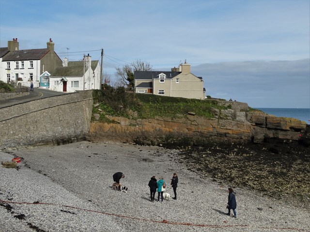
Traeth Bychan

Traeth Bychan (Traeth = 'beach', Bychan = 'small') is a beach on the isle of Anglesey, Wales. The beach is between the villages of Benllech and Moelfre...

St Eugrad's Church, Llaneugrad

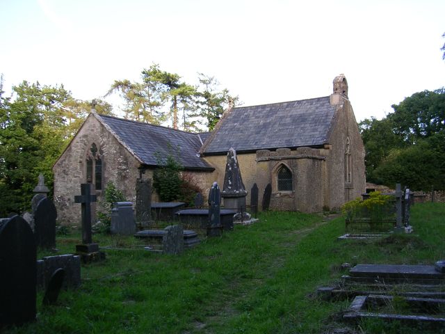
St Eugrad's Church, Llaneugrad is an isolated church near the village of Marian-glas, in Anglesey, north Wales. A church was supposedly founded here by...

Llaneugrad

Llaneugrad is a community in Anglesey, Wales. It is located on the east coast of the island, 7.2 miles (11.6 km) south east of Amlwch, 9.8 miles (15.8...
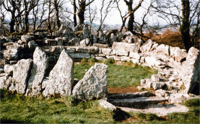
Parciau hill fort

Parciau hill fort is a hill fort on the Welsh island of Anglesey. It stands on the summit of Bryn Ddiôl, whose name means "trackless hill". == The... ==

Parciau

Parciau is a hamlet in the community of Llaneugrad, Anglesey, Wales, which is 136 miles (218.9 km) from Cardiff and 215 miles (346.1 km) from London....

Nearby Amenities

Located within 500m of 53.336763,-4.241539
Marian-glas
Is In: Anglesey
Place: village
Wikidata: Q6761826
Lat/Long: 53.3363497/-4.2469752
Historic: memorial
Lat/Long: 53.3361692/-4.2463939
Direction: SSW
Generator Solar Modules: 6
Generator Source: solar
Location: roof
Power: generator
Lat/Long: 53.336193/-4.2444295
Direction: SE
Generator Solar Modules: 10
Generator Source: solar
Location: roof
Power: generator
Lat/Long: 53.3363284/-4.2445408
Defibrillator
Booth: K6
Colour: red
Covered: booth
Defibrillator Location: inside red phone box, Marianglas
Disused Amenity: telephone
Emergency: defibrillator
Man Made: telephone_box
Ref: 183
Lat/Long: 53.3349436/-4.2479107
Bench
Lat/Long: 53.3355054/-4.2476894
Bench
Lat/Long: 53.3353748/-4.2477391
Post Box
Lat/Long: 53.3391338/-4.2416212
Direction: SE
Generator Method: photovoltaic
Generator Output Electricity: yes
Generator Solar Modules: 20
Generator Source: solar
Generator Type: solar_photovoltaic_panel
Location: roof
Power: generator
Lat/Long: 53.3352357/-4.2423548
Direction: SSE
Generator Method: photovoltaic
Generator Output Electricity: yes
Generator Solar Modules: 15
Generator Source: solar
Generator Type: solar_photovoltaic_panel
Location: roof
Power: generator
Lat/Long: 53.3338428/-4.2470537
Direction: SSE
Generator Method: photovoltaic
Generator Output Electricity: yes
Generator Solar Modules: 16
Generator Source: solar
Generator Type: solar_photovoltaic_panel
Location: roof
Power: generator
Lat/Long: 53.3343247/-4.2445421
Direction: 235
Generator Method: photovoltaic
Generator Output Electricity: yes
Generator Solar Modules: 18
Generator Source: solar
Generator Type: solar_photovoltaic_panel
Location: roof
Power: generator
Lat/Long: 53.3347315/-4.2431608
The data included in this document is from www.openstreetmap.org. The data is made available under ODbL.

Have you been to Marian-glas?

Leave your review of Marian-glas below (or comments, questions and feedback).