Hitchambury

Settlement in Buckinghamshire

England

Hitchambury

Huntercombe Lane Railway Bridge This square almost entirely contains housing in the Lent Rise / South Burnham area. This bridge carries the Paddington - Reading main line over it.
Huntercombe Lane Railway Bridge Credit: Darren Smith

Hitchambury is a small village located in the county of Buckinghamshire, England. Situated approximately 3 miles west of the town of Beaconsfield, it is nestled in the Chiltern Hills, an Area of Outstanding Natural Beauty.

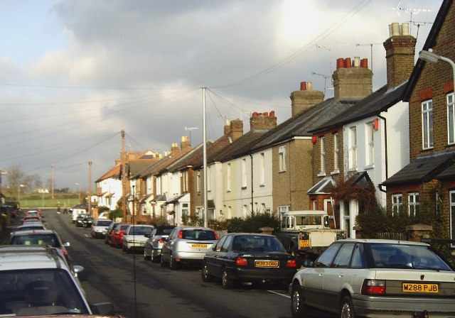
The village is known for its picturesque surroundings, with rolling countryside, charming cottages, and a tranquil atmosphere. It is primarily a residential area with a population of around 400 residents. The village is characterized by its close-knit community and friendly atmosphere.

Hitchambury is well-connected to nearby towns and cities, with good transport links. The M40 motorway is easily accessible, providing convenient connections to London and Birmingham. The nearby town of Beaconsfield offers a range of amenities, including shops, restaurants, and schools.

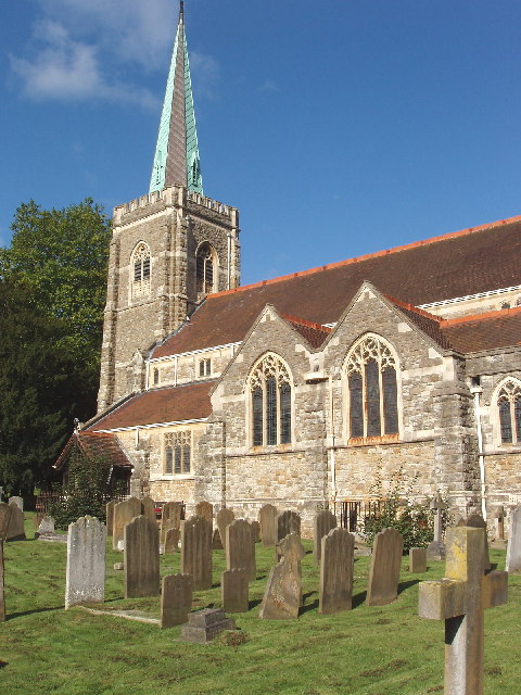
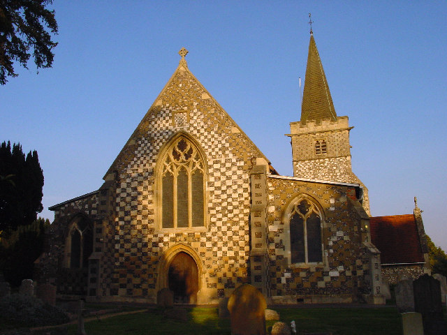
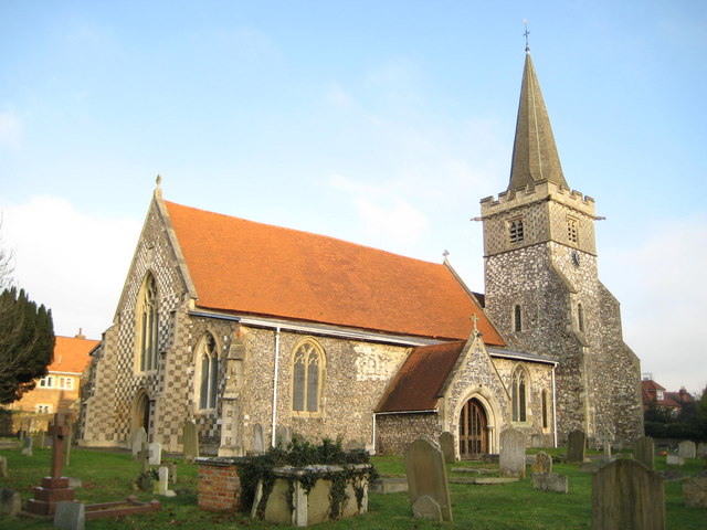
One of the notable landmarks in Hitchambury is the St. Mary and All Saints Church, a beautiful 12th-century church that has stood at the heart of the village for centuries. The church is known for its stunning architecture and holds regular services for the local community.

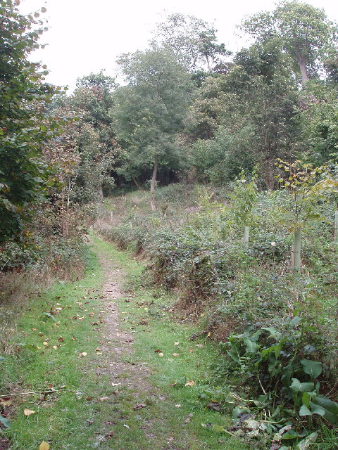
The village also benefits from its proximity to the Chiltern Hills, offering residents and visitors the opportunity to explore the scenic countryside through various walking and cycling routes. The nearby Chiltern Open Air Museum showcases the region's rich history and rural traditions, providing an educational and entertaining experience for all ages.

Overall, Hitchambury is a charming village that provides a peaceful and idyllic lifestyle for its residents, while also offering easy access to the amenities of nearby towns and the natural beauty of the Chiltern Hills.

If you have any feedback on the listing, please let us know in the comments section below.
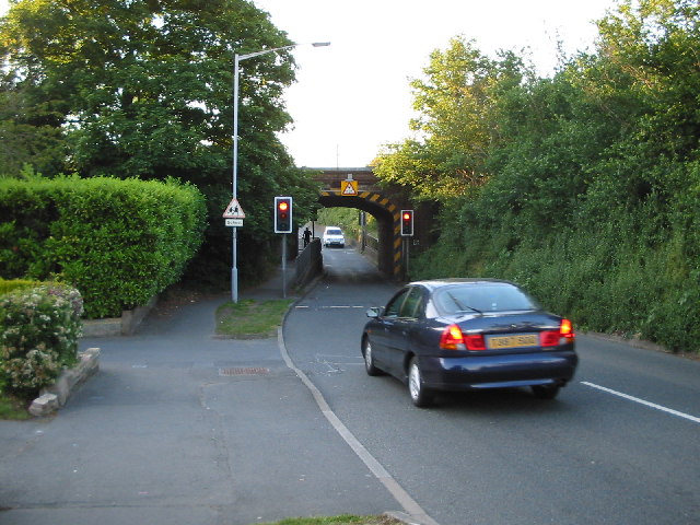
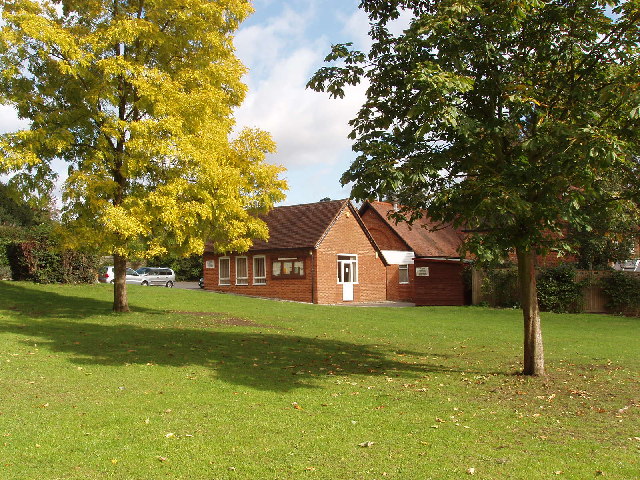
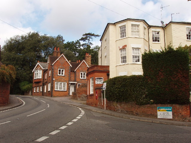
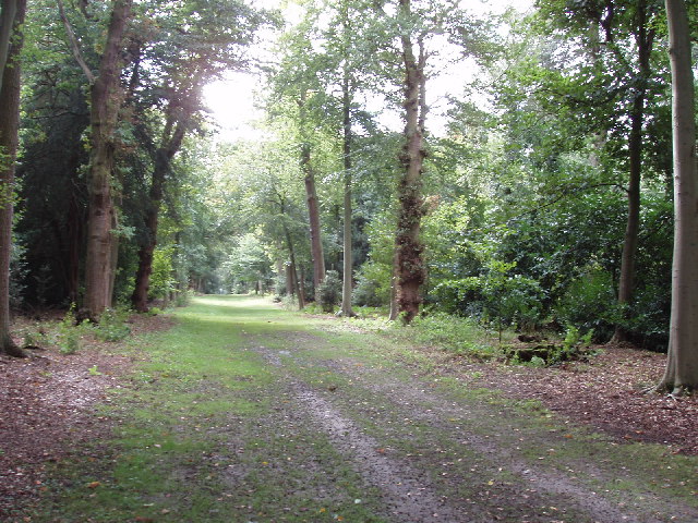
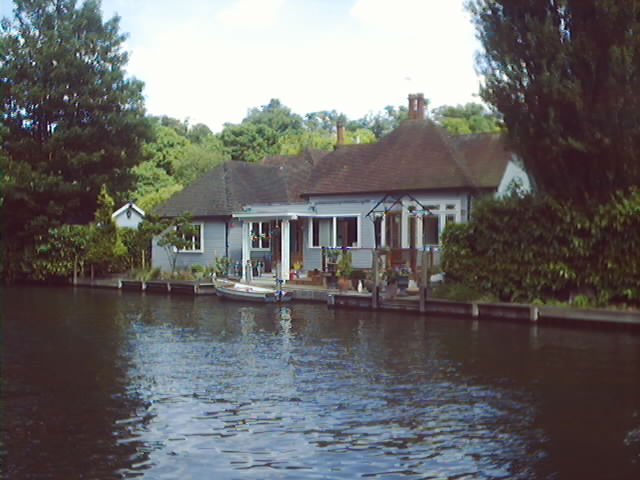
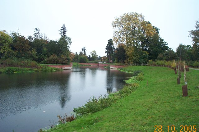
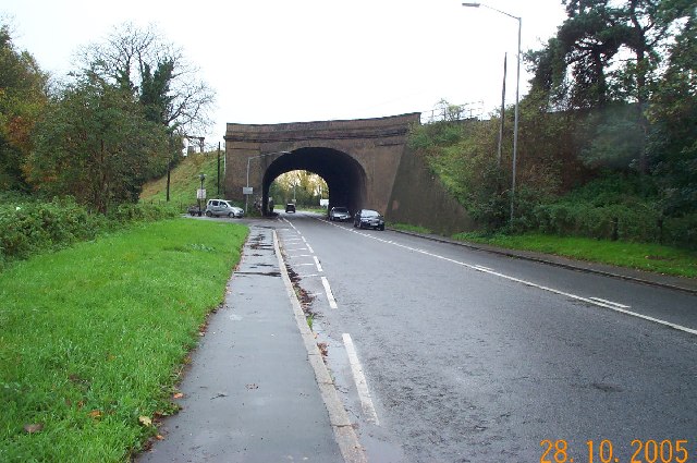
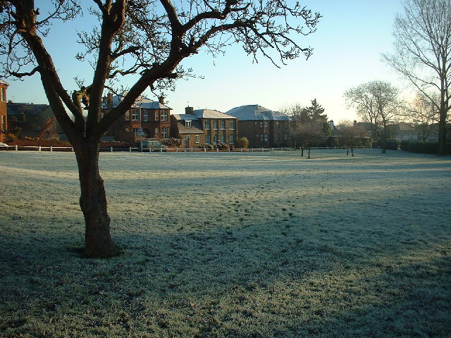
Hitchambury Images

Images are sourced within 2km of 51.53414/-0.67622042 or Grid Reference SU9182. Thanks to Geograph Open Source API. All images are credited.

Huntercombe Lane Railway Bridge This square almost entirely contains housing in the Lent Rise / South Burnham area. This bridge carries the Paddington - Reading main line over it.
Huntercombe Lane Railway Bridge
This square almost entirely contains housing in the Lent Rise / South Burnham area. This bridge carries the Paddington - Reading main line over it.
Taplow village hall and village green
Taplow village centre Houses on Cliveden Road, at the junction with Rectory Road
Taplow village centre
Houses on Cliveden Road, at the junction with Rectory Road
Green Drive, Cliveden Estate Much of the Cliveden Estate is woods of beech and oaks. This ride runs straight, almost North-South, for over a mile with a narrow belt of trees either side. The National Trust has a woodland carpark at the Southern end of the ride. A good area for walking dogs.
Green Drive, Cliveden Estate
Much of the Cliveden Estate is woods of beech and oaks. This ride runs straight, almost North-South, for over a mile with a narrow belt of trees either side. The National Trust has a woodland carpark at the Southern end of the ride. A good area for walking dogs.
Track above the Thames in Cliveden estate This track runs for over a mile through the woods above the Thames, with occasional views through the trees down to the river. The woods are mixed, large trees are mainly beech, but also yew and a variety of others. Parts of the track through National Trust land are available to horse riders.
Track above the Thames in Cliveden estate
This track runs for over a mile through the woods above the Thames, with occasional views through the trees down to the river. The woods are mixed, large trees are mainly beech, but also yew and a variety of others. Parts of the track through National Trust land are available to horse riders.
Taplow church St Nicholas church.
For a historic photo with tower but no spire, see English Heritage "viewfinder" and search for Taplow church <span class="nowrap"><a title="http://viewfinder.english-heritage.org.uk/home.asp" rel="nofollow ugc noopener" href="http://viewfinder.english-heritage.org.uk/home.asp">Link</a><img style="margin-left:2px;" alt="External link" title="External link - shift click to open in new window" src="https://s1.geograph.org.uk/img/external.png" width="10" height="10"/></span>
Taplow church
St Nicholas church. For a historic photo with tower but no spire, see English Heritage "viewfinder" and search for Taplow church LinkExternal link
Wooden sculpture of a bear, Cliveden If you go down in the woods today, you're sure of a big surprise! For every bear that ever there was . . 
This bear is carved from the trunk of a felled tree. It is in the picnic area near the woodland carpark at the south end of the National Trust Cliveden estate.
Wooden sculpture of a bear, Cliveden
If you go down in the woods today, you're sure of a big surprise! For every bear that ever there was . . This bear is carved from the trunk of a felled tree. It is in the picnic area near the woodland carpark at the south end of the National Trust Cliveden estate.
Yew berries Yew berries are soft - and poisonous. These are on the riverside walk above the Thames at Cliveden.
Yew berries
Yew berries are soft - and poisonous. These are on the riverside walk above the Thames at Cliveden.
Thames River near Maidenhead Bridge
Riverside Home Taken while on holiday in Maidenhead. Near Maidenhead Bridge. River Thames.
Riverside Home
Taken while on holiday in Maidenhead. Near Maidenhead Bridge. River Thames.
Jubilee River: Maidenhead This is the view looking downstream towards the A4 road bridge. The man-made Jubilee River was designed to provide flood protection for property in Maidenhead, Windsor, and Eton.
Jubilee River: Maidenhead
This is the view looking downstream towards the A4 road bridge. The man-made Jubilee River was designed to provide flood protection for property in Maidenhead, Windsor, and Eton.
Taplow: railway bridge over the A4 road A fine skewed bridge taking the main railway line from Paddington to Reading and the west over the A4 Bath Road. (NB The grid line between SU9081 and SU9181 absolutely bisects this bridge, but there were 5 images already in SU9081 and none in SU9181, so...!!)
Taplow: railway bridge over the A4 road
A fine skewed bridge taking the main railway line from Paddington to Reading and the west over the A4 Bath Road. (NB The grid line between SU9081 and SU9181 absolutely bisects this bridge, but there were 5 images already in SU9081 and none in SU9181, so...!!)
Gasometer & Boathouses on the Thames Not far north of Maidenhead Bridge
Gasometer & Boathouses on the Thames
Not far north of Maidenhead Bridge
Burnham Park Looking south-east from the bus-stop
Burnham Park
Looking south-east from the bus-stop
Burnham Parish Church - St Peters The village of Burnham was mentioned in the Domesday Book. And the first church was probably built about 500 AD. The present building was probably started in the 12th Century.
Burnham Parish Church - St Peters
The village of Burnham was mentioned in the Domesday Book. And the first church was probably built about 500 AD. The present building was probably started in the 12th Century.
Taplow Court Taplow Court, once the home of Lord and Lady Desborough, has been beautifully restored and is now the Headquarters of SGI UK - a lay Buddhist organisation.
Taplow Court
Taplow Court, once the home of Lord and Lady Desborough, has been beautifully restored and is now the Headquarters of SGI UK - a lay Buddhist organisation.
Taplow & Hitcham Women's Institute Taplow and Hitcham WI Hall was built in 1926.
Taplow & Hitcham Women's Institute
Taplow and Hitcham WI Hall was built in 1926.
Lent Rise, Burnham (Bucks) Terraced housing such as this was built towards the end of the nineteenth century and is fairly typical of the Lent Rise area of Burnham. This is Milner Road looking north.
Lent Rise, Burnham (Bucks)
Terraced housing such as this was built towards the end of the nineteenth century and is fairly typical of the Lent Rise area of Burnham. This is Milner Road looking north.
Show me another place!

Hitchambury is located at Grid Ref: SU9182 (Lat: 51.53414, Lng: -0.67622042)

Unitary Authority: Buckinghamshire

Police Authority: Thames Valley

What 3 Words

///blame.hers.boss. Near Maidenhead, Berkshire

Nearby Locations

Hitchambury

Related Wikis

Hitcham War Memorial

Hitcham War Memorial is located outside St Mary's Church, Hitcham Lane, Hitcham, Buckinghamshire, England. It is a grade II listed building with Historic...

Burnham F.C.

Burnham F.C. is a non-League football club based in Burnham in Buckinghamshire, near Slough. They currently compete in the Combined Counties League Premier...

Taplow

Taplow is a village and civil parish in the Unitary Authority of Buckinghamshire, England. It sits on the left bank of the River Thames, facing Maidenhead...

All Nations Bible College

All Nations Bible College was a missionary college in London, founded in 1892. By 1923 it was headed by F. B. Meyer, who also presided over the All Nations...

Taplow railway station

Taplow railway station serves the village of Taplow in Buckinghamshire, England. It is 22 miles 39 chains (36.2 km) down the line from London Paddington...

The E-ACT Burnham Park Academy

The E-ACT Burnham Park Academy was a co-educational academy in Burnham, Buckinghamshire, England until it closed in 2019 due to falling pupil numbers....

Burnham, Buckinghamshire

Burnham is a large village and civil parish that lies north of the River Thames in Buckinghamshire, between the towns of Maidenhead and Slough, about 24...
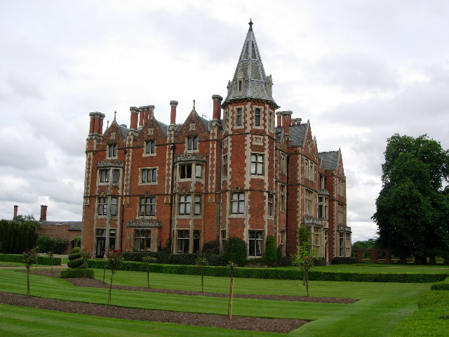
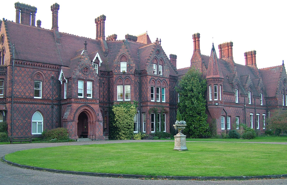
Taplow Court

Taplow Court is a Victorian house in the village of Taplow in Buckinghamshire, England. Its origins are an Elizabethan manor house, remodelled in the early...

Nearby Amenities

Located within 500m of 51.53414,-0.67622042
Kerb: no
Lat/Long: 51.5319916/-0.6754769
Barrier: kissing_gate
Lat/Long: 51.5319946/-0.675627
Barrier: kissing_gate
Lat/Long: 51.5325219/-0.6702038
Building: residential
Lat/Long: 51.5354092/-0.6720346
Direction: 200
Generator Method: photovoltaic
Generator Output Electricity: yes
Generator Solar Modules: 20
Generator Source: solar
Generator Type: solar_photovoltaic_panel
Location: roof
Power: generator
Lat/Long: 51.5338676/-0.677144
Fixme: solar panels?
Lat/Long: 51.5354817/-0.682786
The data included in this document is from www.openstreetmap.org. The data is made available under ODbL.

Have you been to Hitchambury?

Leave your review of Hitchambury below (or comments, questions and feedback).