Hillside

Settlement in Somerset Sedgemoor

England

Hillside

Axbridge, Somerset The main street in Axbridge, Somerset, looking west from the square. The timbered building is called King John's Hunting Lodge, although it was built much later than the time when Anglo-Saxon and Norman kings used Axbridge as a base for hunting.
Axbridge, Somerset Credit: Martin Clark

Hillside is a picturesque village located in Somerset, a county in the southwest of England. With a population of around 1,500 residents, it is a close-knit community that offers a tranquil and idyllic setting for those seeking a peaceful countryside lifestyle.

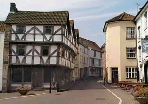
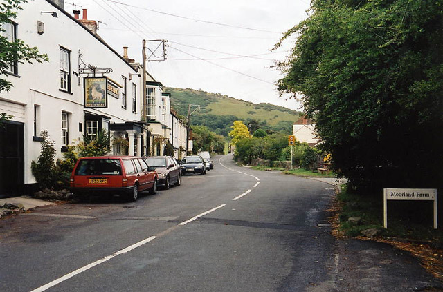
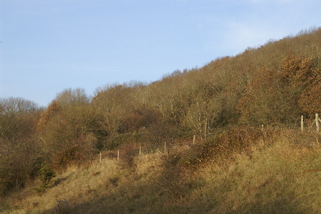
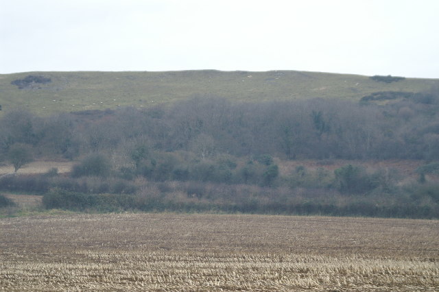
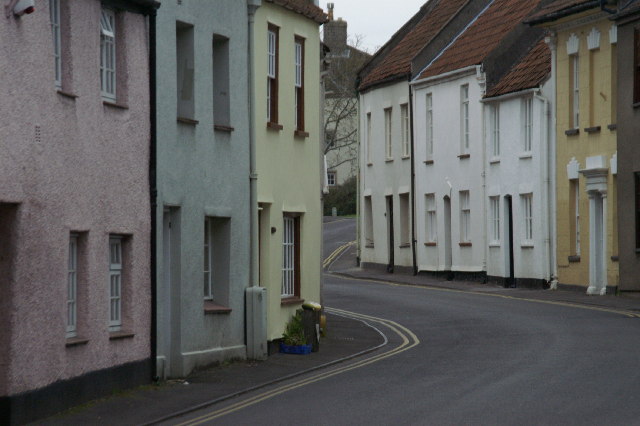
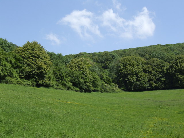
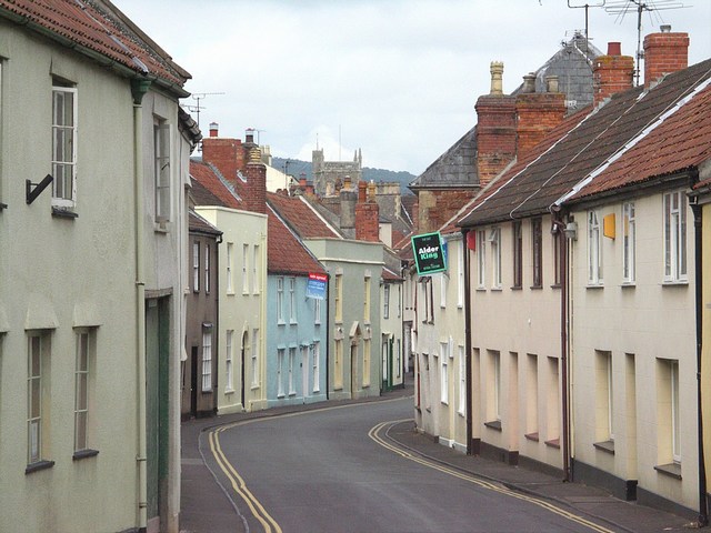
Situated on the southern slopes of the Mendip Hills, Hillside benefits from stunning views of the surrounding landscape, characterized by lush green meadows, rolling hills, and charming woodlands. The village is known for its beautiful stone-built houses, which give it a timeless and traditional feel.

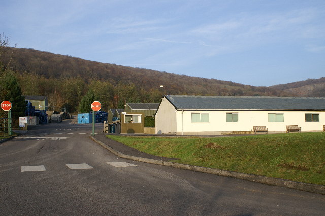
Despite its small size, Hillside boasts a range of amenities to cater to the needs of its residents. These include a local primary school, a church, a village hall, and a handful of shops and pubs. The village is well-connected to the nearby town of Wells, which is just a short drive away and offers a wider range of facilities such as supermarkets, healthcare services, and secondary schools.

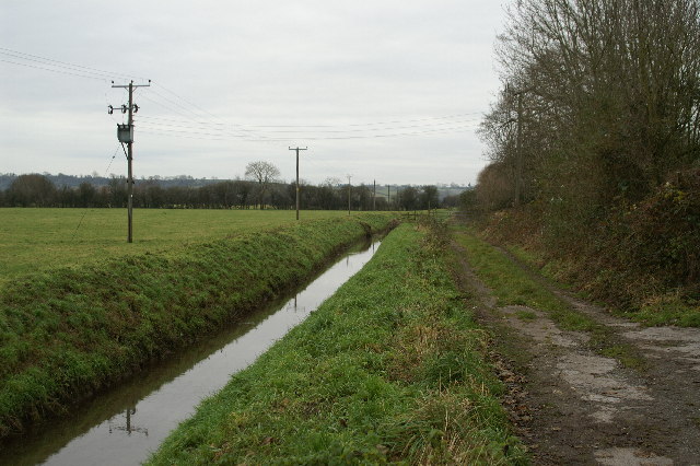
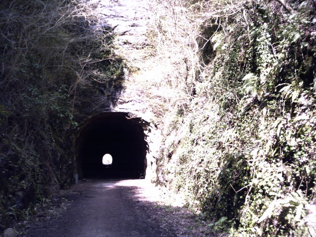
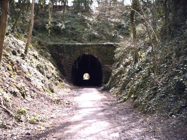
Hillside is also a fantastic base for outdoor enthusiasts, with plenty of opportunities for hiking, cycling, and exploring the nearby countryside. The Mendip Hills Area of Outstanding Natural Beauty, which surrounds the village, is home to a diverse range of flora and fauna, making it a haven for nature lovers.

Overall, Hillside, Somerset, is a peaceful and charming village that offers residents a picturesque countryside lifestyle, with stunning views, a close-knit community, and easy access to essential amenities and recreational activities.

If you have any feedback on the listing, please let us know in the comments section below.

Hillside Images

Images are sourced within 2km of 51.288827/-2.8189559 or Grid Reference ST4254. Thanks to Geograph Open Source API. All images are credited.

Axbridge, Somerset The main street in Axbridge, Somerset, looking west from the square. The timbered building is called King John's Hunting Lodge, although it was built much later than the time when Anglo-Saxon and Norman kings used Axbridge as a base for hunting.
Axbridge, Somerset
The main street in Axbridge, Somerset, looking west from the square. The timbered building is called King John's Hunting Lodge, although it was built much later than the time when Anglo-Saxon and Norman kings used Axbridge as a base for hunting.
Compton Bishop: Cross Cross was a key posting station in coaching days. Two inns survive – the White Hart, seen here, and the New Inn. The White Hart, but probably not this structure, was extant at the time of the Monmouth Rebellion in 1685 and the subsequent ‘Bloody Assizes’ and the inn is said to be haunted by one of Judge Jefferies’ victims. The A38 trunk road now bypasses the village
Compton Bishop: Cross
Cross was a key posting station in coaching days. Two inns survive – the White Hart, seen here, and the New Inn. The White Hart, but probably not this structure, was extant at the time of the Monmouth Rebellion in 1685 and the subsequent ‘Bloody Assizes’ and the inn is said to be haunted by one of Judge Jefferies’ victims. The A38 trunk road now bypasses the village
Rose Wood Photo taken from the A371
Rose Wood
Photo taken from the A371
Yeo Valley Factory Makers of dairy products ie yoghurt etc
Yeo Valley Factory
Makers of dairy products ie yoghurt etc
Cheddar Reservoir
Cheddar Reservoir
Hillside of Cross Plain
Cheddar Reservoir Birds
West Street Axbridge
'Strawberry Line' south entrance to Shute Shelve Hill tunnel The tunnel is fairly short at about 200 metres but is of interest because the geology changes half-way through from rock to soft earth, a feature that can be seen from inside with the aid of a torch.
'Strawberry Line' south entrance to Shute Shelve Hill tunnel
The tunnel is fairly short at about 200 metres but is of interest because the geology changes half-way through from rock to soft earth, a feature that can be seen from inside with the aid of a torch.
'Strawberry Line' north entrance to Shute Shelve Hill tunnel This entrance into the tunnel is under the 'soft' part of the hill and the first half is brick lined. After that the rock is strong enough to be self-supporting. Marks made by pickaxes during construction can still be seen.
'Strawberry Line' north entrance to Shute Shelve Hill tunnel
This entrance into the tunnel is under the 'soft' part of the hill and the first half is brick lined. After that the rock is strong enough to be self-supporting. Marks made by pickaxes during construction can still be seen.
Axbridge, The Town square Taken from King John's Hunting Lodge.
Axbridge, The Town square
Taken from King John's Hunting Lodge.
Skeleton of a Roman Soldier In the Museum of King John's Hunting Lodge, one of two skeletons believed to be Roman Soldiers.
Skeleton of a Roman Soldier
In the Museum of King John's Hunting Lodge, one of two skeletons believed to be Roman Soldiers.
Cheddar Wood On the lower slopes of Fry's Hill.
Cheddar Wood
On the lower slopes of Fry's Hill.
Blue roof at Axbridge church The roof of St. John the Baptist, Axbridge – the year 1636 is visible centre right of picture.
Blue roof at Axbridge church
The roof of St. John the Baptist, Axbridge – the year 1636 is visible centre right of picture.
War Memorial This memorial to the fallen in both World Wars is adjacent to the church.
War Memorial
This memorial to the fallen in both World Wars is adjacent to the church.
Mostly Blue This is in the High Street, just west of the square.  It is typical of the houses of all shapes and sizes along the High Street.
Mostly Blue
This is in the High Street, just west of the square. It is typical of the houses of all shapes and sizes along the High Street.
Houses on High Street This street twists and turns its way up the hill towards West Street.
Houses on High Street
This street twists and turns its way up the hill towards West Street.
Show me another place!

Hillside is located at Grid Ref: ST4254 (Lat: 51.288827, Lng: -2.8189559)

Administrative County: Somerset

District: Sedgemoor

Police Authority: Avon and Somerset

What 3 Words

///lakes.unzips.baker. Near Axbridge, Somerset

Nearby Locations

Hillside

Related Wikis

Axbridge railway station

Axbridge railway station was a station on the Bristol and Exeter Railway's Cheddar Valley line in Axbridge, Somerset. Axbridge was one of the principal...

King John's Hunting Lodge, Axbridge

King John's Hunting Lodge is a wool-merchant's house built c. 1460, long after the death of King John in 1216, in Axbridge, a town in the English county...

Axbridge Town Hall

Axbridge Town Hall is a municipal building in The Square in Axbridge, Somerset, England. The building, which is the meeting place of Axbridge Town Council...
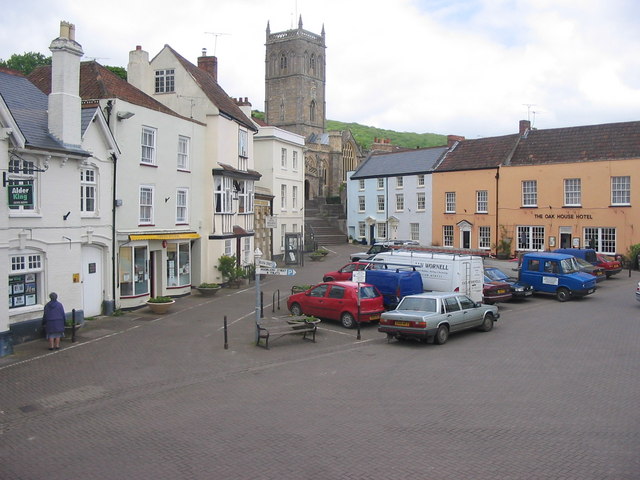
Axbridge

Axbridge is a town in Somerset, England, on the River Axe, near the southern edge of the Mendip Hills. Its population according to the 2011 census was...

Axbridge Hill and Fry's Hill

Axbridge Hill and Fry's Hill (grid reference ST433555) is a 64.8-hectare (160-acre) biological Site of Special Scientific Interest in the Mendip Hills...

Shute Shelve Cavern

Shute Shelve Cavern is a natural cave system located in Shute Shelve Hill, Somerset, England, above Axbridge in the Mendip Hills not far from Cheddar....
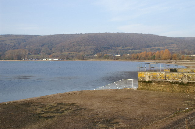
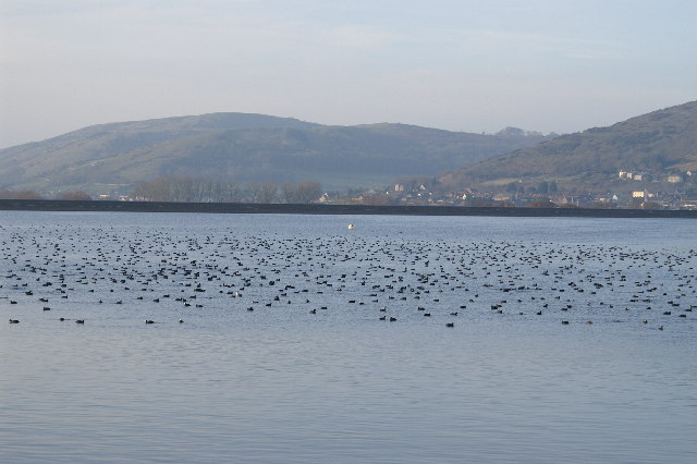
Cheddar Reservoir

Cheddar Reservoir is an artificial reservoir in Somerset, England, operated by Bristol Water. Dating from the 1930s it has a capacity of 1350 million gallons...

Cheddar Wood

Cheddar Wood (grid reference ST445552) is an 86.9-hectare (215-acre) biological Site of Special Scientific Interest at Cheddar in the Mendip Hills, Somerset...

Related Videos

Cheddar #shorts #travel

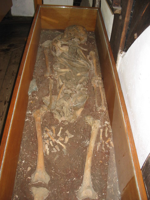
Cheddar #shorts #travel Nagy-Britannia legrégebbi, teljes csontvázát Cheddarban találták meg. A Cheddar Man abban az ...

Cheddar Reservoir Walk

It's a cold and windy day and we decide to face it head on with a walk around Cheddar Reservoir. It's a beautiful walk. I hope you ...

Cheddar & it’s Surrounding Hill’s

This walk takes me to Cheddar in Somerset where I visit Fry's Hill, Wavering Down and Crook Peak which are on or near to the ...

A Windy Walk Around Cheddar Reservoir

Cheddar Reservoir on a very cold and windy day. But still surrounded by beautiful nature and countryside. Let's walk around it.

Nearby Amenities

Located within 500m of 51.288827,-2.8189559
Axbridge
Historic Railway: station
Railway: site
Source: NPE
Wikidata: Q4830195
Wikipedia: en:Axbridge railway station
Lat/Long: 51.2885109/-2.8155705
King John's Hunting Lodge;King John's Hunting Lodge (Axbridge Museum)
HE Ref: 1059142
Historic: house
Listed Status: Grade II*
Operator: National Trust
Tourism: museum
Website: https://www.nationaltrust.org.uk/king-johns-hunting-lodge
Wikidata: Q15238528
Wikimedia Commons: Category:King John's Hunting Lodge, Axbridge
Lat/Long: 51.2871251/-2.817634
Place Of Worship
Axbridge Methodist Church
Denomination: methodist
Religion: christian
Lat/Long: 51.2875879/-2.8202759
Source: OS OpenData StreetView
Lat/Long: 51.286133/-2.8207572
Axbridge
Is In: Somerset, England, UK
Place: town
Population: 2057
Postal Code: BS26 2
Source: npe
Wikidata: Q651889
Wikipedia: en:Axbridge
Lat/Long: 51.2871232/-2.8172812
Post Office
Axbridge Post Office
Addr City: Axbridge
Addr Country: GB
Addr Postcode: BS26 2BN
Addr Street: St Mary Street
Brand: Post Office
Brand Wikidata: Q1783168
Contact Website: https://www.postoffice.co.uk/branch-finder/3665119/axbridge
Fhrs Id: 124147
Ref Pol Id: 13895
Lat/Long: 51.2870627/-2.8167117
Bus Stop
Bus: yes
Public Transport: platform
Lat/Long: 51.2882195/-2.8120831
Bus Stop
Town Hall
Bus: yes
Naptan AtcoCode: 3600SOB21206
Naptan Bearing: W
Naptan CommonName: Town Hall
Naptan Indicator: W-bound
Naptan NaptanCode: sotatwgm
Naptan Street: The Square
Naptan Verified: no
Public Transport: platform
Lat/Long: 51.2871124/-2.8172329
Bus Stop
Cross Lane
Bus: yes
Naptan AtcoCode: 3600SOB21202
Naptan Bearing: W
Naptan CommonName: Cross Lane
Naptan Indicator: W-bound
Naptan NaptanCode: sotatptm
Naptan Street: Cross Lane
Naptan Verified: no
Public Transport: platform
Lat/Long: 51.287978/-2.8250864
Bus Stop
Surgery
Bus: yes
Naptan AtcoCode: 3600SOB21204
Naptan Bearing: W
Naptan CommonName: Surgery
Naptan Indicator: W-bound
Naptan NaptanCode: sotatwdg
Naptan Street: Houlgate Way
Naptan Verified: no
Public Transport: platform
Lat/Long: 51.2860254/-2.820634
Pharmacy
Axbridge Pharmacy
Addr City: Axbridge
Addr Country: GB
Addr Postcode: BS26 2AR
Addr Street: The Square
Fhrs Id: 49704
Healthcare: pharmacy
Lat/Long: 51.2874278/-2.8166858
Post Box
Brand: Royal Mail
Brand Wikidata: Q638098
Brand Wikipedia: en:Royal Mail
Operator: Royal Mail
Operator Wikidata: Q638098
Lat/Long: 51.2871929/-2.8167823
Restaurant
Lat/Long: 51.2873473/-2.8166321
The Co-operative Food
Addr City: Axbridge
Addr Country: GB
Addr Housenumber: 2
Addr Postcode: BS26 2AR
Addr Street: The Square
Brand: The Co-operative Food
Brand Wikidata: Q107617274
Fhrs Id: 124193
Operator: The Co-operative Group
Operator Wikidata: Q117202
Shop: convenience
Website: https://www.coop.co.uk/store-finder/BS26-2AR/2-the-square
Lat/Long: 51.2870296/-2.8175351
Parking
Lat/Long: 51.2867836/-2.8172222
Telephone
Booth: KX100
Covered: booth
Lat/Long: 51.2874311/-2.8171167
Shop: convenience
Lat/Long: 51.2867299/-2.817072
Police
Lat/Long: 51.2862468/-2.8182629
Recycling
Lat/Long: 51.2864817/-2.8190676
Bar
Lat/Long: 51.2872734/-2.815452
Restaurant
Almshouse Tea Shop
HE Ref: 1059153
Addr City: Axbridge
Addr Country: GB
Addr Postcode: BS26 2AR
Addr Street: The Square
Delivery: no
Fhrs Id: 298479
Listed Status: Grade II
Takeaway: yes
Toilets: customers
Website: https://thealmshouseteashop.co.uk/
Lat/Long: 51.2870252/-2.8171605
Pub
The Lamb Inn
HE Ref: 1344884
Listed Status: Grade II
Tourism: hotel
Website: https://www.butcombe.com/pubs/the-lamb-hotel/
Wikidata: Q26628571
Lat/Long: 51.2872924/-2.817619
Tourism: hotel
Lat/Long: 51.2873271/-2.8167501
Bus Stop
Surgery
Bus: yes
Naptan AtcoCode: 3600SOB21205
Naptan Bearing: E
Naptan CommonName: Surgery
Naptan Indicator: E-bound
Naptan NaptanCode: sotatwdj
Naptan Street: Houlgate Way
Naptan Verified: no
Public Transport: platform
Lat/Long: 51.2861931/-2.8204623
Theatre
Lat/Long: 51.2878438/-2.8192285
Design: h-frame
Power: pole
Source: Bing
Lat/Long: 51.2845554/-2.8170276
Bench
Lat/Long: 51.2872755/-2.8173534
Bench
Lat/Long: 51.2872766/-2.8172779
Bicycle Parking
Bicycle Parking: stands
Capacity: 8
Covered: no
Lat/Long: 51.287275/-2.8173085
Power: pole
Lat/Long: 51.2897682/-2.8149301
Power: pole
Lat/Long: 51.2904711/-2.815209
Waste Basket
Lat/Long: 51.2863332/-2.8160056
Waste Basket
Waste: dog_excrement
Lat/Long: 51.2864425/-2.8151579
The data included in this document is from www.openstreetmap.org. The data is made available under ODbL.

Have you been to Hillside?

Leave your review of Hillside below (or comments, questions and feedback).