Margery

Settlement in Surrey Reigate and Banstead

England

Margery

Steps on Colley Hill These steps eventually lead to the open space on Colley Hill and in particular the Inglis memorial <a href="https://www.geograph.org.uk/gridref/TQ2552">TQ2552</a>
Steps on Colley Hill Credit: Richard Rogerson

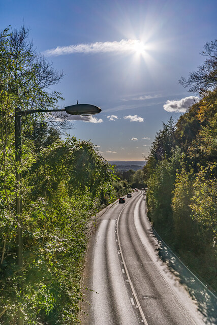
Margery is a small village located in the county of Surrey, England. Situated approximately 25 miles south of London, it falls within the administrative district of Reigate and Banstead. The village is surrounded by picturesque countryside, offering residents and visitors a tranquil setting away from the hustle and bustle of city life.

Margery dates back to at least the 12th century and has a rich history. The village is known for its charming thatched cottages and traditional architecture, which adds to its quaint and timeless appeal. It has managed to retain much of its original character over the years, making it a popular destination for tourists looking to experience an authentic English village atmosphere.

Despite its small size, Margery has a strong sense of community. The village is home to a close-knit population, and residents often come together to organize various social events and activities. The local church, St. Margaret's, plays a central role in community life and is a significant historical landmark in the area.

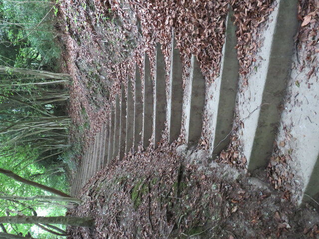
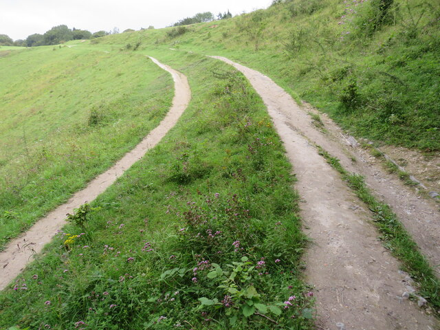
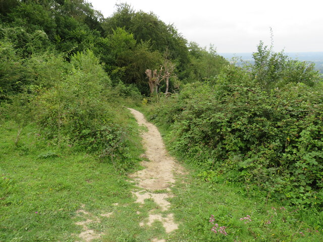
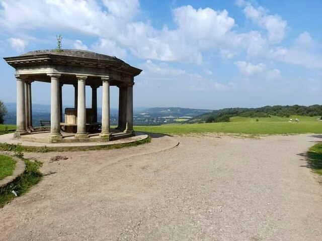
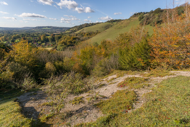
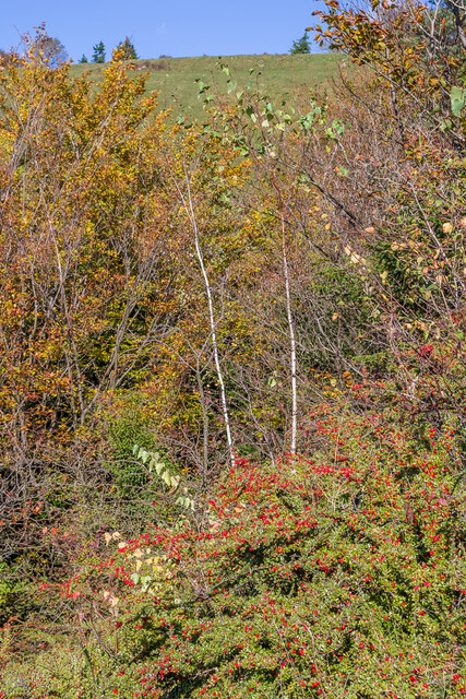
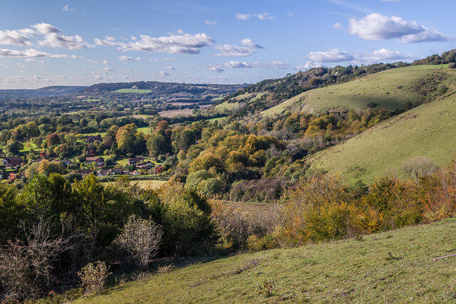
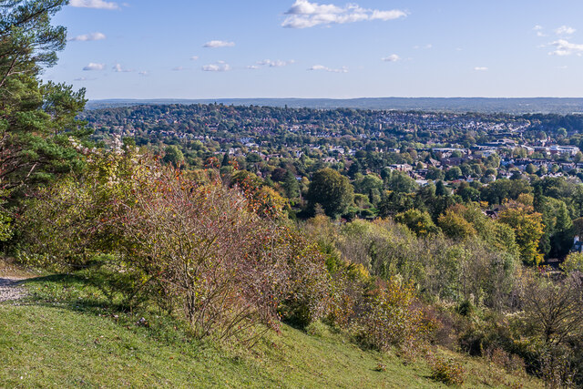
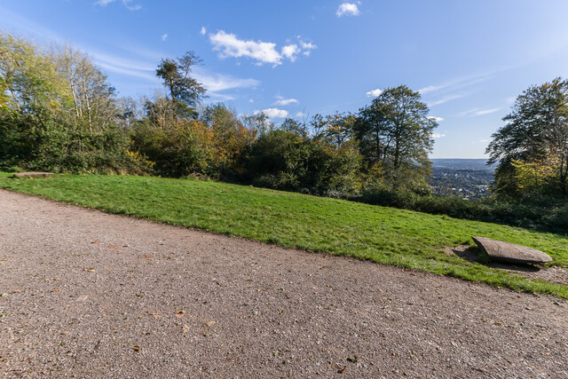
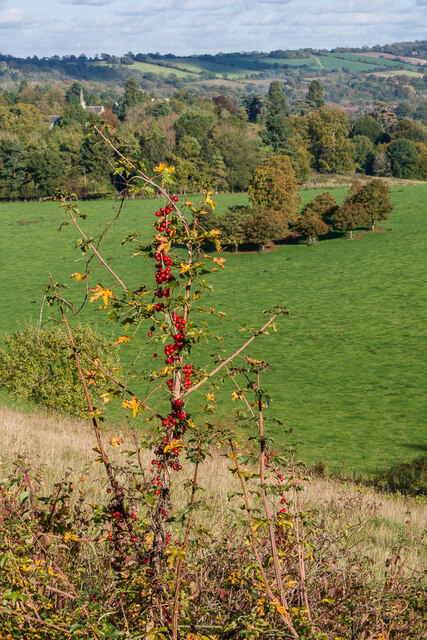
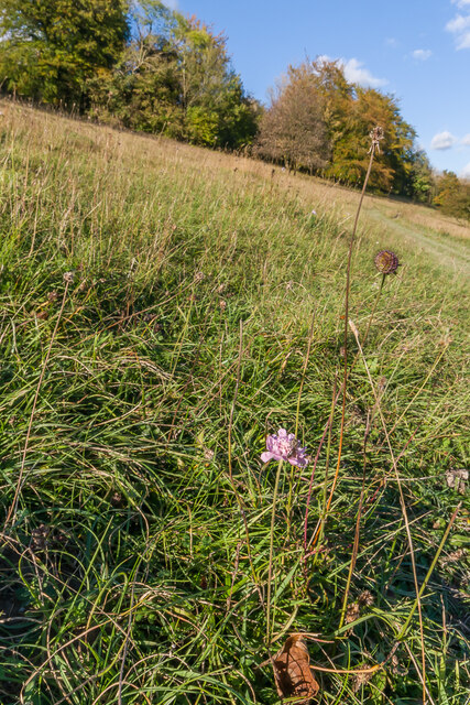
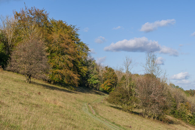
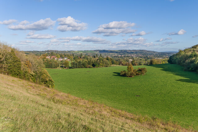
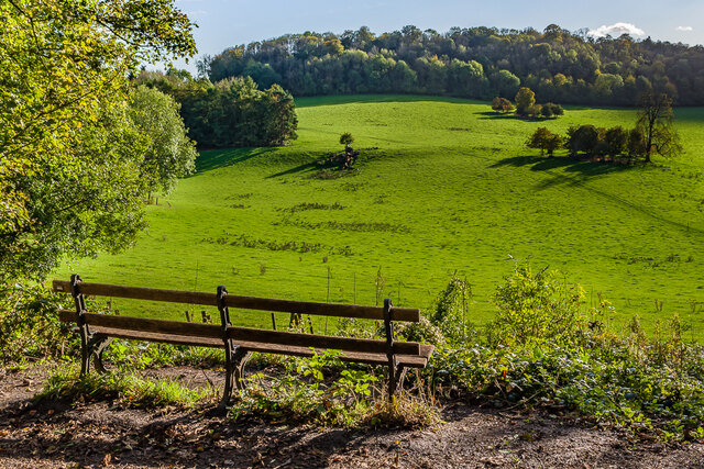
For those who enjoy outdoor pursuits, Margery offers access to beautiful natural surroundings. The village is surrounded by rolling hills and woodland, providing opportunities for walking, hiking, and exploring the countryside. Additionally, the nearby North Downs Way offers stunning views and is a popular route for avid walkers and nature enthusiasts.

Overall, Margery is a charming and idyllic village, offering a peaceful retreat for residents and visitors alike. Its rich history, stunning natural beauty, and strong sense of community make it a truly special place to visit or call home.

If you have any feedback on the listing, please let us know in the comments section below.

Margery Images

Images are sourced within 2km of 51.260446/-0.205322 or Grid Reference TQ2552. Thanks to Geograph Open Source API. All images are credited.

Steps on Colley Hill These steps eventually lead to the open space on Colley Hill and in particular the Inglis memorial <a href="https://www.geograph.org.uk/gridref/TQ2552">TQ2552</a>
Steps on Colley Hill
These steps eventually lead to the open space on Colley Hill and in particular the Inglis memorial TQ2552
Track/Path on Colley Hill This views shows the track just after it leaves woodland and reaches the open space at the top of Colley Hill on the North Downs near Reigate.
Track/Path on Colley Hill
This views shows the track just after it leaves woodland and reaches the open space at the top of Colley Hill on the North Downs near Reigate.
Path  from Colley Hill The path originates at the Inglis memorial; it leads down off the hill towards Reigate
Path from Colley Hill
The path originates at the Inglis memorial; it leads down off the hill towards Reigate
Inglis Memorial
Inglis Memorial
Old Milestone, A217, Reigate Hill, near M25 roundabout The milestone is located on the east side of the southern carriageway of Reigate Hill just off the M25 roundabout on the grass verge. Parish of Banstead (Reigate and Banstead district). Carved stone post, Surrey limestone pillar design, erected by the Reigate turnpike trust in the 19th century.

Inscription reads:-
LONDON / 19 / SUTTON / 8 : :  BRIGHTON / (  )2 / ( ) ON / 1(  )

Grade II listed, list entry number: 1480702  <span class="nowrap"><a title="https://historicengland.org.uk/listing/the-list/list-entry/1480702" rel="nofollow ugc noopener" href="https://historicengland.org.uk/listing/the-list/list-entry/1480702">Link</a><img style="margin-left:2px;" alt="External link" title="External link - shift click to open in new window" src="https://s1.geograph.org.uk/img/external.png" width="10" height="10"/></span>

The photograph was taken sometime between 2001 and 2005.

Milestone Society National ID: SY_LQR19
Old Milestone, A217, Reigate Hill, near M25 roundabout
The milestone is located on the east side of the southern carriageway of Reigate Hill just off the M25 roundabout on the grass verge. Parish of Banstead (Reigate and Banstead district). Carved stone post, Surrey limestone pillar design, erected by the Reigate turnpike trust in the 19th century. Inscription reads:- LONDON / 19 / SUTTON / 8 : : BRIGHTON / ( )2 / ( ) ON / 1( ) Grade II listed, list entry number: 1480702 LinkExternal link The photograph was taken sometime between 2001 and 2005. Milestone Society National ID: SY_LQR19
Aliens Cotoneaster and Buddleia plants, both aliens that have naturalised here, on a patch of bare chalk on Colley Hill, with the North Downs stretching on into the distance.
Aliens
Cotoneaster and Buddleia plants, both aliens that have naturalised here, on a patch of bare chalk on Colley Hill, with the North Downs stretching on into the distance.
Aliens A large patch of Cotoneaster, an alien that have naturalised here, on the south slope of Colley Hill.
Aliens
A large patch of Cotoneaster, an alien that have naturalised here, on the south slope of Colley Hill.
West along Colley Hill Looking along Colley Hill, with the North Downs stretching on into the distance.
West along Colley Hill
Looking along Colley Hill, with the North Downs stretching on into the distance.
Towards Reigate Looking over Reigate from the path up Colley Hill.
Towards Reigate
Looking over Reigate from the path up Colley Hill.
A217 Reigate Hill Looking down the A217 as it drops down from Reigate Hill, under an autumn sun.
A217 Reigate Hill
Looking down the A217 as it drops down from Reigate Hill, under an autumn sun.
B17 crash memorial, Reigate Hill  On 19 March 1945, a B17G Flying Fortress crewed by 9 men from the 384th Bombardment Group of the United States Army Air Corps crashed into Reigate Hill when returning to its base at Grafton Underwood in Northamptonshire from a raid near the German/Czech border.

This clearing in the trees is the site of the crash, as the Beech trees at the spot were destroyed by the impact.  Although the site has always been marked with a seat, a new memorial was unveiled in 2015 on the 70th anniversary of the crash.  It consists of two replica wingtips, carved by sculptor Roger Day. and placed 103 ft apart, being the aircraft's wingspan.

In the distance on the right is Reigate.
B17 crash memorial, Reigate Hill
On 19 March 1945, a B17G Flying Fortress crewed by 9 men from the 384th Bombardment Group of the United States Army Air Corps crashed into Reigate Hill when returning to its base at Grafton Underwood in Northamptonshire from a raid near the German/Czech border. This clearing in the trees is the site of the crash, as the Beech trees at the spot were destroyed by the impact. Although the site has always been marked with a seat, a new memorial was unveiled in 2015 on the 70th anniversary of the crash. It consists of two replica wingtips, carved by sculptor Roger Day. and placed 103 ft apart, being the aircraft's wingspan. In the distance on the right is Reigate.
Black Bryony Black Bryony (Dioscorea communis) in berry on Wingate Hill, with Gatton in the background and the North Downs beyond.
Black Bryony
Black Bryony (Dioscorea communis) in berry on Wingate Hill, with Gatton in the background and the North Downs beyond.
Wingate Hill A late flowering Field Scabious (Knautia arvensis) in grass downland on Wingate Hill.
Wingate Hill
A late flowering Field Scabious (Knautia arvensis) in grass downland on Wingate Hill.
Wingate Hill A path across grass downland on Wingate Hill.
Wingate Hill
A path across grass downland on Wingate Hill.
Gatton Park Looking across grass downland on Wingate Hill to Gatton Park with the North Downs in the background.
Gatton Park
Looking across grass downland on Wingate Hill to Gatton Park with the North Downs in the background.
Gatton Park A seat with a view across part of Gatton Park.
Gatton Park
A seat with a view across part of Gatton Park.
Road under railway
Road under railway
View over Reigate from Reigate Hill From by the car park and café, both of which were very busy.
View over Reigate from Reigate Hill
From by the car park and café, both of which were very busy.
Show me another place!

Margery is located at Grid Ref: TQ2552 (Lat: 51.260446, Lng: -0.205322)

Administrative County: Surrey

District: Reigate and Banstead

Police Authority: Surrey

What 3 Words

///ruins.crop.newest. Near Lower Kingswood, Surrey

Related Wikis

Margery

Margery is a heavily buffered, lightly populated hamlet in the Reigate and Banstead district in the English county of Surrey. It sits on the North Downs...

Reigate transmitting station

Reigate transmitting station is a television and radio transmitting tower in southeastern England. It is located on the North Downs at Reigate Hill about...

London Defence Positions

The London Defence Positions were a late 19th-century scheme of earthwork fortifications in the southeast of England, designed to protect London from foreign...

Colley Hill

Colley Hill is part of the North Downs escarpment in the North Downs, Surrey, England. It is about 1 km east of Buckland Hills and 1 km west of Reigate...

Mogador, Surrey

Mogador is a hamlet in the Reigate and Banstead district, in the English county of Surrey. It is at the edge of Banstead Heath, which provides it a green...

Reigate railway station

Reigate railway station serves the town of Reigate, Surrey, England, on the North Downs Line. It is 24 miles 27 chains (24.34 miles, 39.17 km) measured...

Royal Alexandra and Albert School

The Royal Alexandra and Albert School is an all-through co-educational boarding school near Reigate, Surrey. The headmaster as of 2022 is Morgan Thomas...

St Andrew's Church, Gatton

The Church of St Andrew, Gatton is a Church of England church in Gatton, near Reigate in Surrey, England. It is a Grade I listed. The earliest record of...

Nearby Amenities

Located within 500m of 51.260446,-0.205322
Traffic Signals
Traffic Signals: continuous_green
Traffic Signals Direction: forward
Lat/Long: 51.2596793/-0.1982822
Motorway Junction
Reigate Hill
Ref: 8
Lat/Long: 51.2581572/-0.2031916
Phone
Emergency: phone
Operator: National Highways
Operator Wikidata: Q5760006
Ref: 4519 B
Lat/Long: 51.2580558/-0.2055717
Phone
Emergency: phone
Operator: National Highways
Operator Wikidata: Q5760006
Ref: 4519 A
Lat/Long: 51.2577064/-0.2052287
Phone
Emergency: phone
Operator: National Highways
Operator Wikidata: Q5760006
Ref: 4523 B
Lat/Long: 51.2577862/-0.2105747
Bus Stop
Margery Lane
Naptan AtcoCode: 40004409090A
Naptan Bearing: NW
Naptan CommonName: Margery Lane
Naptan Indicator: adj
Naptan Landmark: Margery Lane
Naptan NaptanCode: surdgwpa
Naptan Street: Brighton Road
Naptan Verified: yes
Public Transport: platform
Source: naptan_import
Wheelchair: limited
Lat/Long: 51.2616486/-0.2002045
Bus Stop
Margery Lane
Naptan AtcoCode: 40004409090B
Naptan Bearing: S
Naptan CommonName: Margery Lane
Naptan Indicator: Just after
Naptan Landmark: Blackhorse Lane
Naptan NaptanCode: surdgwpd
Naptan Street: Brighton Road
Naptan Verified: yes
Public Transport: platform
Source: naptan_import
Lat/Long: 51.2605822/-0.1989043
Fire Hydrant
Emergency: fire_hydrant
Fire Hydrant Type: underground
Lat/Long: 51.2629275/-0.2007918
Traffic Signals
Traffic Signals: signal
Traffic Signals Direction: forward
Lat/Long: 51.2590287/-0.1990793
Traffic Signals
Traffic Signals: signal
Traffic Signals Direction: forward
Lat/Long: 51.2595331/-0.1983579
Traffic Signals
Traffic Signals: signal
Traffic Signals Direction: forward
Lat/Long: 51.2596274/-0.1983409
Traffic Signals
Traffic Signals: signal
Traffic Signals Direction: forward
Lat/Long: 51.2590671/-0.1992211
Margery Hall
Place: isolated_dwelling
Source Name: OS_OpenData_StreetView
Lat/Long: 51.2565188/-0.2028253
Margery
Place: hamlet
Wikidata: Q6760299
Lat/Long: 51.2610292/-0.2063479
Post Box
Collection Times: Mo-Fr 16:45; Sa 11:30; Su off
Drive Through: no
Operator: Royal Mail
Post Box Type: wall
Ref: KT20 104
Royal Cypher: VR
Royal Cypher Wikidata: Q33102356
Source: survey
Lat/Long: 51.261113/-0.2068345
Traffic Sign: variable_message
Variable Message Model: MS2
Lat/Long: 51.258398/-0.2018097
Traffic Sign: variable_message
Variable Message Model: AMI
Lat/Long: 51.2582677/-0.2017756
Traffic Sign: variable_message
Variable Message Model: AMI
Lat/Long: 51.2582978/-0.2017835
Traffic Sign: variable_message
Variable Message Model: AMI
Lat/Long: 51.2583242/-0.2017904
Traffic Sign: variable_message
Variable Message Model: AMI
Lat/Long: 51.2583578/-0.2017992
Traffic Sign: variable_message
Variable Message Model: AMI
Lat/Long: 51.2577786/-0.209203
Traffic Sign: variable_message
Variable Message Model: AMI
Lat/Long: 51.2577455/-0.209199
Traffic Sign: variable_message
Variable Message Model: AMI
Lat/Long: 51.2577123/-0.2091951
Traffic Sign: variable_message
Variable Message Model: AMI
Lat/Long: 51.2576791/-0.2091912
Traffic Sign: variable_message
Variable Message Model: AMI
Lat/Long: 51.2575188/-0.2091722
Traffic Sign: variable_message
Variable Message Model: AMI
Lat/Long: 51.2575485/-0.2091757
Traffic Sign: variable_message
Variable Message Model: AMI
Lat/Long: 51.2575847/-0.20918
Traffic Sign: variable_message
Variable Message Model: AMI
Lat/Long: 51.2576218/-0.2091844
Traffic Sign: variable_message
Variable Message Model: MS2
Lat/Long: 51.2574555/-0.2091647
Traffic Sign: variable_message
Variable Message Model: MS2
Lat/Long: 51.2578462/-0.209211
Camera Mount: pole
Camera Type: panning
Man Made: surveillance
Operator: National Highways
Operator Wikidata: Q5760006
Surveillance: outdoor
Surveillance Type: camera
Surveillance Zone: traffic
Lat/Long: 51.2575919/-0.2061693
The data included in this document is from www.openstreetmap.org. The data is made available under ODbL.

Have you been to Margery?

Leave your review of Margery below (or comments, questions and feedback).