Higher Rocombe

Settlement in Devon Teignbridge

England

Higher Rocombe

Stokeinteignhead : Forches Hill Looking down Forches Hill.
Stokeinteignhead : Forches Hill Credit: Lewis Clarke

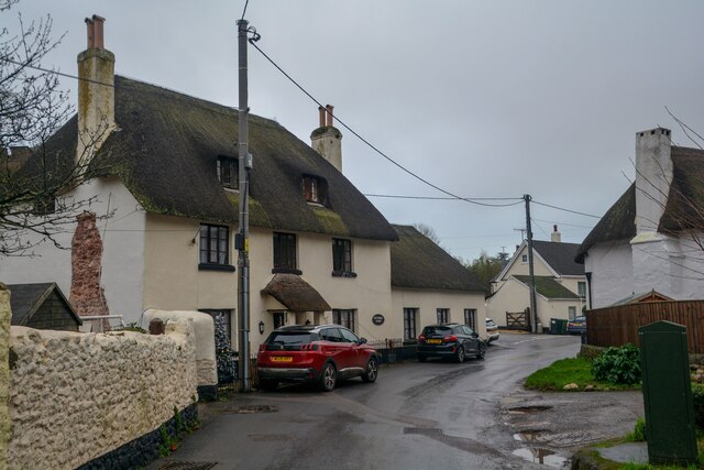
Higher Rocombe is a small rural hamlet located in the South Hams district of Devon, England. Situated approximately 4 miles northeast of the coastal town of Kingsbridge, it is nestled in the beautiful countryside of the South Hams Area of Outstanding Natural Beauty.

The hamlet is characterized by its picturesque surroundings, with rolling hills, lush green fields, and charming woodland areas. It is a popular destination for nature lovers and those seeking a peaceful retreat away from the hustle and bustle of city life.

The area is predominantly agricultural, with several farms dotting the landscape, contributing to the local economy. The hamlet itself consists of a cluster of traditional, stone-built cottages and a few modern houses, giving it a quaint and timeless appeal.

Although small in size, Higher Rocombe benefits from its close proximity to nearby amenities. The market town of Kingsbridge provides a range of services including shops, schools, and healthcare facilities. The stunning South Devon coastline is also within easy reach, offering opportunities for coastal walks, water sports, and relaxation on sandy beaches.

Overall, Higher Rocombe offers a tranquil and idyllic setting for those seeking a slice of rural life in the heart of Devon. Its natural beauty, combined with its convenient location, make it a desirable place to live or visit for both locals and tourists alike.

If you have any feedback on the listing, please let us know in the comments section below.

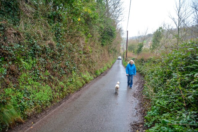
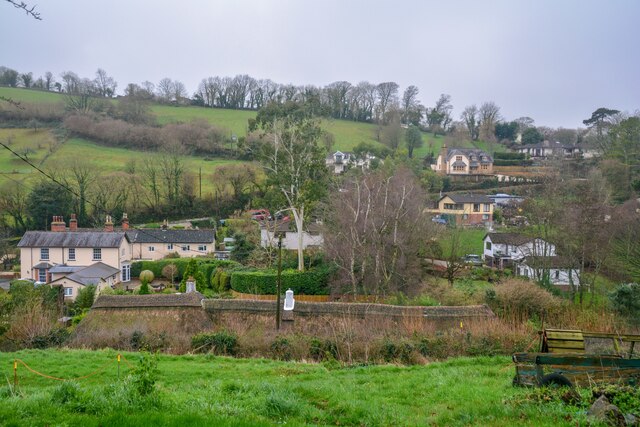
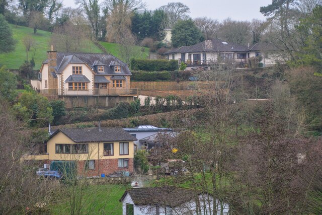
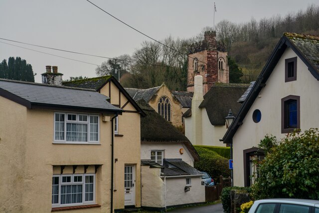
Higher Rocombe Images

Images are sourced within 2km of 50.508997/-3.5351042 or Grid Reference SX9168. Thanks to Geograph Open Source API. All images are credited.

Stokeinteignhead : Forches Hill Looking down Forches Hill.
Stokeinteignhead : Forches Hill
Looking down Forches Hill.
Stokeinteignhead : Village Scenery Looking across the village of Stokeinteignhead.
Stokeinteignhead : Village Scenery
Looking across the village of Stokeinteignhead.
Stokeinteignhead : Village Scenery Looking across the village of Stokeinteignhead.
Stokeinteignhead : Village Scenery
Looking across the village of Stokeinteignhead.
Stokeinteignhead : Church Lane Looking along Church Lane.
Stokeinteignhead : Church Lane
Looking along Church Lane.
Stokeinteignhead : Ivy Tree Hill Looking along the lane.
Stokeinteignhead : Ivy Tree Hill
Looking along the lane.
Stokeinteignhead : Ivy Tree Hill Looking down the road.
Stokeinteignhead : Ivy Tree Hill
Looking down the road.
Stokeinteignhead : Ivy Tree Hill An amusing scene as John the horse tries to catch a lift with the Dawlish Community Transport, which incidentally is being driven by John.
Stokeinteignhead : Ivy Tree Hill
An amusing scene as John the horse tries to catch a lift with the Dawlish Community Transport, which incidentally is being driven by John.
Stokeinteignhead : Ivy Tree Hill Looking towards John's Bus waiting for a horse to walk by.
Stokeinteignhead : Ivy Tree Hill
Looking towards John's Bus waiting for a horse to walk by.
Stokeinteignhead : Hillaway Looking across towards a house on Forches Hill.
Stokeinteignhead : Hillaway
Looking across towards a house on Forches Hill.
Stokeinteignhead : Ivy Tree Hill Passing Ivy Tree Cottage.
Stokeinteignhead : Ivy Tree Hill
Passing Ivy Tree Cottage.
Stokeinteignhead : Oaklands This property comes under Teignbridge local authority/council with G council tax band.
Stokeinteignhead : Oaklands
This property comes under Teignbridge local authority/council with G council tax band.
Farm buildings by Deane Lane Looking right from <a href="https://www.geograph.org.uk/photo/7071730">SX9270 : Sheep pasture, Stokeinteignhead</a>.
Farm buildings by Deane Lane
Farmland, Stokeinteignhead Looking right from <a href="https://www.geograph.org.uk/photo/7071734">SX9270 : Farm buildings by Deane Lane</a>, looking across the valley leading down to the village.
Farmland, Stokeinteignhead
Looking right from SX9270 : Farm buildings by Deane Lane, looking across the valley leading down to the village.
Spiked rollers, Deane Farm Reflected in a handy puddle.
Spiked rollers, Deane Farm
Reflected in a handy puddle.
Deane Road Junction near Stokeinteignhead.
Deane Road
Junction near Stokeinteignhead.
Leylandii Gardens Private track off Newton Hill.
Leylandii Gardens
Private track off Newton Hill.
Field Barns Field barns near Lower Rocombe.
Field Barns
Field barns near Lower Rocombe.
Above Lower Rocombe Fields above Lower Rocombe.
Above Lower Rocombe
Fields above Lower Rocombe.
Show me another place!

Higher Rocombe is located at Grid Ref: SX9168 (Lat: 50.508997, Lng: -3.5351042)

Administrative County: Devon

District: Teignbridge

Police Authority: Devon and Cornwall

Also known as: Higher Rocombe Barton

What 3 Words

///elects.ghosts.rugs. Near Kingskerswell, Devon

Related Wikis

Brunel Manor

Brunel Manor, previously known as Watcombe Park, is a mansion on the outskirts of the seaside resort of Torquay, Devon, England. == Ownership history... ==

Stokeinteignhead

Stokeinteignhead () is a village and civil parish in the Teignbridge district of Devon, England, above the southern bank of the estuary of the River Teign...

Haccombe

Haccombe is a village and former civil parish and historic manor, now in the parish of Haccombe with Combe, in the Teignbridge district, in the county...

Milber Down

Milber Down is an Iron Age hill fort on the hill above the suburb of Milber, Newton Abbot in Devon, England. The fort is situated on the north-western...

Nearby Amenities

Located within 500m of 50.508997,-3.5351042
Higher Rocombe
Is In: Devon, England, UK
Place: hamlet
Source: OS_OpenData_OpenNames
Lat/Long: 50.5089833/-3.5351189
Generator Method: photovoltaic
Generator Output Electricity: yes
Generator Source: solar
Generator Type: solar_photovoltaic_panel
Location: roof
Power: generator
Lat/Long: 50.5080039/-3.5326458
Generator Method: photovoltaic
Generator Output Electricity: yes
Generator Source: solar
Generator Type: solar_photovoltaic_panel
Location: roof
Power: generator
Lat/Long: 50.5082628/-3.5329328
Generator Method: photovoltaic
Generator Output Electricity: yes
Generator Source: solar
Generator Type: solar_photovoltaic_panel
Location: roof
Power: generator
Lat/Long: 50.5066058/-3.5296205
The data included in this document is from www.openstreetmap.org. The data is made available under ODbL.

Have you been to Higher Rocombe?

Leave your review of Higher Rocombe below (or comments, questions and feedback).