Higher Marston

Settlement in Cheshire

England

Higher Marston

Great Budworth
Great Budworth Credit: Paul Baxter

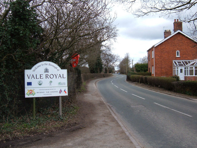
Higher Marston is a small village located in the county of Cheshire, in the northwest of England. Situated in the rural area of Vale Royal, it is part of the civil parish of Marston. The village is nestled amidst picturesque countryside, offering residents and visitors a tranquil and idyllic setting.

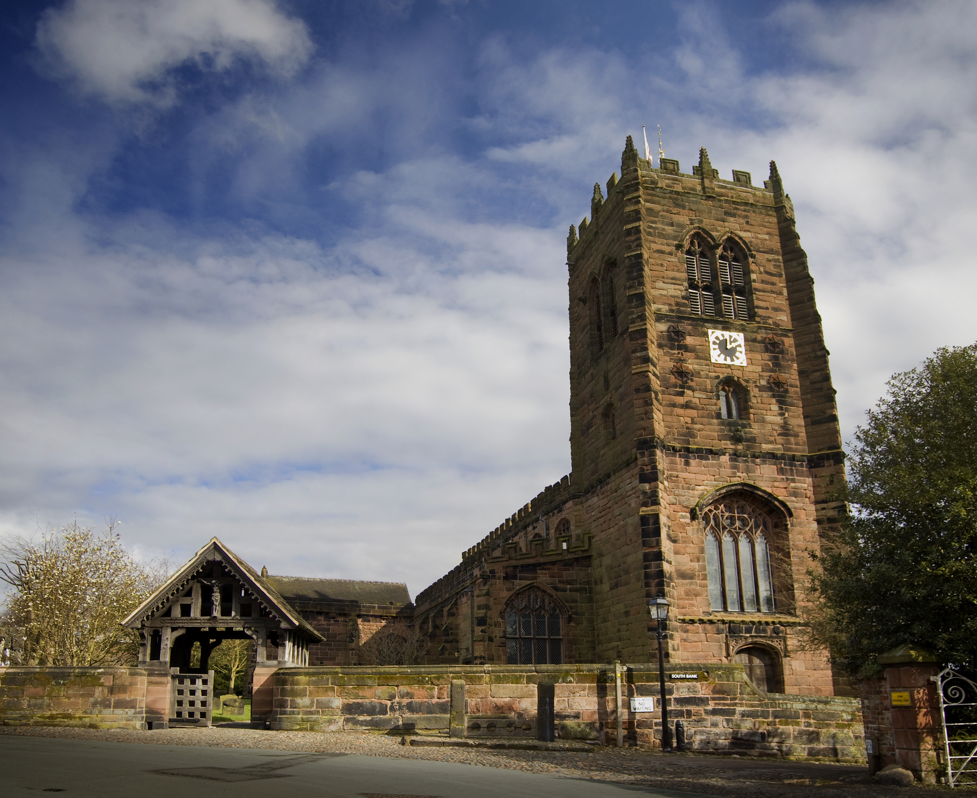
Higher Marston is known for its charming character and close-knit community. The village primarily consists of traditional stone-built houses, many of which date back several centuries, adding to the area's historical appeal. The local church, St. Stephen's, is a notable landmark and serves as a focal point for religious and community events.

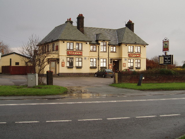
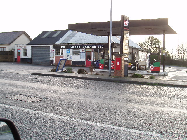
Although small in size, Higher Marston offers a range of amenities to cater to the needs of its residents. These include a village hall, where various social activities and gatherings take place, as well as a local pub that serves as a meeting spot for locals and visitors alike.

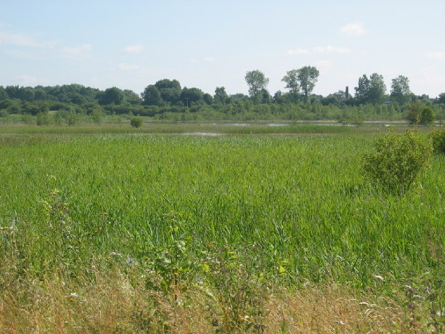
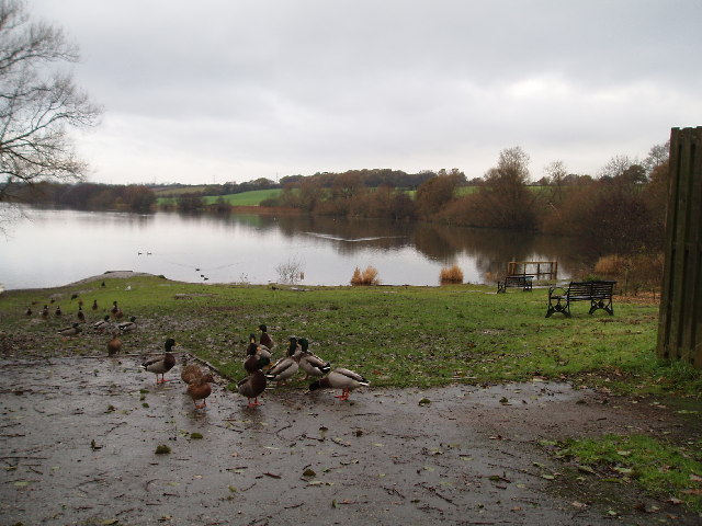
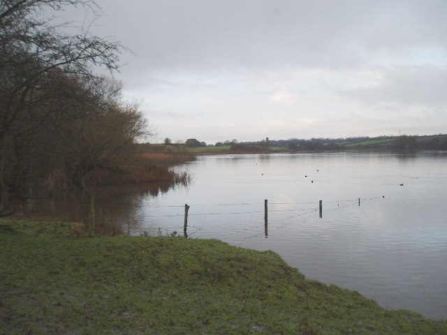
The village is surrounded by beautiful countryside, making it a desirable location for those who enjoy outdoor activities such as hiking, cycling, and horseback riding. The nearby Marston Flash, a large lake, provides opportunities for fishing and birdwatching.

Despite its tranquil setting, Higher Marston benefits from its proximity to larger towns and cities. The town of Northwich is just a short drive away and offers a wider range of amenities including shops, restaurants, and leisure facilities.

Overall, Higher Marston is a charming and peaceful village that appeals to those seeking a rural lifestyle while still having access to nearby amenities.

If you have any feedback on the listing, please let us know in the comments section below.

Higher Marston Images

Images are sourced within 2km of 53.285683/-2.4926833 or Grid Reference SJ6776. Thanks to Geograph Open Source API. All images are credited.

Great Budworth
Great Budworth
Great Budworth Church This church in the pretty village of Great Budworth, was used in the filming of the eighties series 'Hinge and Bracket's Dear Ladies'.
Great Budworth Church
This church in the pretty village of Great Budworth, was used in the filming of the eighties series 'Hinge and Bracket's Dear Ladies'.
Marbury Country Park Marbury Country Park is a beautiful place to go for a walk and this single picture, taken late last year, doesn't do it justice. This is the grassy green just a short distance from the main car park and I'm looking north-ish.
Marbury Country Park
Marbury Country Park is a beautiful place to go for a walk and this single picture, taken late last year, doesn't do it justice. This is the grassy green just a short distance from the main car park and I'm looking north-ish.
Carved Bench A bench carved from a single tree trunk along one of the footpaths in Marbury Country Park, Cheshire.
Carved Bench
A bench carved from a single tree trunk along one of the footpaths in Marbury Country Park, Cheshire.
Trent and Mersey Canal This is the Trent and Mersey Canal as seen from Marbury Lane bridge looking approx. north east.
Trent and Mersey Canal
This is the Trent and Mersey Canal as seen from Marbury Lane bridge looking approx. north east.
Neumann's Flash, Wincham/Marston One of many flashes in this area. Footpaths are well used by local people walking dogs and for recreation; a pleasant area.
Neumann's Flash, Wincham/Marston
One of many flashes in this area. Footpaths are well used by local people walking dogs and for recreation; a pleasant area.
Gt Budworth church
Gt Budworth church
Trent & Mersey Canal from Wincham lane bridge Looking NW, I think the factory in the background is BP nutrition.
Trent & Mersey Canal from Wincham lane bridge
Looking NW, I think the factory in the background is BP nutrition.
The Black Greyhound, Higher Wincham Situated at the crossroads of Hall Lane, Marston Lane, Wincham Lane & Church Street.
The Black Greyhound, Higher Wincham
Situated at the crossroads of Hall Lane, Marston Lane, Wincham Lane & Church Street.
Pick Mere, looking west A popular place in the summer, (and to think there used to be a small fair ground here and you could hire jetskis!!).
Pick Mere, looking west
A popular place in the summer, (and to think there used to be a small fair ground here and you could hire jetskis!!).
Pick Mere , looking west This southern end of the mere is just in SJ6876!!
Pick Mere , looking west
This southern end of the mere is just in SJ6876!!
"Pickmere Rough" A small wood midway along Park Lane (Looking East)
"Pickmere Rough"
A small wood midway along Park Lane (Looking East)
View from Pickmere Rough looking south The western end of Pick Mere can just be seen (centre)
View from Pickmere Rough looking south
The western end of Pick Mere can just be seen (centre)
Higher Marston from Hall Drive Looking NNW from Hall Drive (Which leads to Marston Hall) The church tower is at Great Budworth
Higher Marston from Hall Drive
Looking NNW from Hall Drive (Which leads to Marston Hall) The church tower is at Great Budworth
Four Lanes Garage, Higher Marston Situated at the crossroads of Dark Lane, Ollershaw Lane,& Marston Lane
Four Lanes Garage, Higher Marston
Situated at the crossroads of Dark Lane, Ollershaw Lane,& Marston Lane
Just the place for a quick one.... or two!
B5391, Higher Wincham, Cheshire The stream that runs under the road forms the boundary between Vale Royal and Macclesfield districts.
B5391, Higher Wincham, Cheshire
The stream that runs under the road forms the boundary between Vale Royal and Macclesfield districts.
George's Lane Farm, Moss End
Show me another place!

Higher Marston is located at Grid Ref: SJ6776 (Lat: 53.285683, Lng: -2.4926833)

Unitary Authority: Cheshire West and Chester

Police Authority: Cheshire

What 3 Words

///media.reply.vast. Near Marston, Cheshire

Nearby Locations

Higher Marston

Related Wikis

Goldmine House

Goldmine House and its attached cottage (Rose Cottage) are at No. 26 Southbank, Great Budworth, Cheshire, England, to the south of St Mary and All Saints...
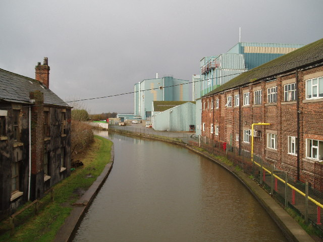
Lion Salt Works

The Lion Salt Works is the last remaining open pan salt works in Marston, near Northwich, Cheshire, England. It closed as a work in 1986 and is now preserved...

St Mary and All Saints' Church, Great Budworth

St Mary and All Saints Church is in the centre of the village of Great Budworth, Cheshire, England. It is an active Anglican parish church in the diocese...

Marston, Cheshire

Marston is a village and civil parish in the unitary authority of Cheshire West and Chester, in the northwest of England. The settlement is on the River...

Nearby Amenities

Located within 500m of 53.285683,-2.4926833
Bus Stop
Higher Marston, Marston Lane / Hall Drive
Bus: yes
Naptan AtcoCode: 0610VR17789
Naptan Bearing: NW
Naptan BusStopType: CUS
Naptan CommonName: Hall Drive
Naptan Crossing: Hall Drive
Naptan Indicator: cnr
Naptan Landmark: Hall Drive
Naptan LocalityName: Higher Marston
Naptan NaptanCode: chwpmpj
Naptan ShortCommonName: Hall Drive
Naptan Street: Marston Lane
Naptan Verified: no
Public Transport: platform
Source: naptan_import
Lat/Long: 53.2865838/-2.4961809
Bus Stop
Higher Marston, Marston Lane / Hall Drive
Bus: yes
Naptan AtcoCode: 0610VR199
Naptan Bearing: SE
Naptan CommonName: Hall Drive
Naptan Crossing: Hall Drive
Naptan Indicator: opp
Naptan Landmark: Fields
Naptan LocalityName: Higher Marston
Naptan NaptanCode: chwgtwm
Naptan ShortCommonName: Hall Drive
Naptan Street: Marston Lane
Naptan Verified: no
Public Transport: platform
Source: naptan_import
Lat/Long: 53.2867674/-2.4960558
Bus Stop
Higher Marston, Ollershaw Lane / Marston Lane
Bus: yes
Naptan AtcoCode: 0610VRIM602
Naptan Bearing: SE
Naptan BusStopType: CUS
Naptan CommonName: Marston Lane
Naptan Crossing: Marston Lane
Naptan Indicator: cnr
Naptan Landmark: Four Lanes Garage
Naptan LocalityName: Higher Marston
Naptan NaptanCode: chwadgad
Naptan ShortCommonName: Marston Lane
Naptan Street: Ollershaw Lane
Naptan Verified: no
Public Transport: platform
Source: naptan_import
Lat/Long: 53.2856379/-2.4924664
Give Way
Lat/Long: 53.2860133/-2.4930137
Information: guidepost
Tourism: information
Lat/Long: 53.2859183/-2.492762
Give Way
Direction: forward
Lat/Long: 53.28605/-2.492647
Give Way
Direction: backward
Lat/Long: 53.2859332/-2.4925866
The data included in this document is from www.openstreetmap.org. The data is made available under ODbL.

Have you been to Higher Marston?

Leave your review of Higher Marston below (or comments, questions and feedback).