Higher Holnest

Settlement in Dorset

England

Higher Holnest

Leigh: rich spring pasture along Bailey Ridge
Leigh: rich spring pasture along Bailey Ridge Credit: Keith Salvesen

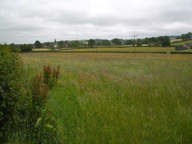
Higher Holnest is a small village located in the county of Dorset, England. Situated in the picturesque countryside, Higher Holnest is known for its tranquil and scenic surroundings. The village is characterized by its charming cottages, lush green fields, and rolling hills.

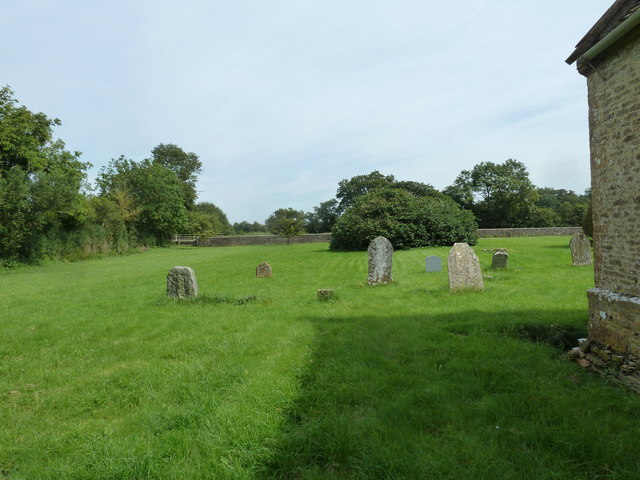
Higher Holnest is a close-knit community with a population of around 300 residents. The village has a primary school, a church, and a village hall where various community events are held throughout the year. The residents of Higher Holnest take pride in their village and work together to maintain its beauty and charm.

The village is surrounded by the stunning Dorset countryside, offering plenty of opportunities for outdoor activities such as hiking, cycling, and horseback riding. The nearby towns of Sherborne and Yeovil provide additional amenities and services for residents of Higher Holnest.

Overall, Higher Holnest is a peaceful and idyllic village that offers a high quality of life for its residents. Its natural beauty and strong sense of community make it a desirable place to live for those seeking a slower pace of life in the English countryside.

If you have any feedback on the listing, please let us know in the comments section below.

Higher Holnest Images

Images are sourced within 2km of 50.876/-2.5007989 or Grid Reference ST6408. Thanks to Geograph Open Source API. All images are credited.

Leigh: rich spring pasture along Bailey Ridge
Hermitage: gated woodland track and bridleway
Farm Road with Cattle Grid, near Holnest
Holnest Church, May evening
Bridge over stream, Holnest Park
Grassland, Holnest
Grassland, Holnest
Logging track, Middlemarsh
Gateway to forestry land, Middlemarsh
St Mary's church, Holnest
Dreamy days in Dorset 13: Hermitage Named after an Augustinian hermitage, the village church of St James puzzled the great Pevsner <span class="nowrap"><a title="http://en.wikipedia.org/wiki/Nikolaus_Pevsner" rel="nofollow ugc noopener" href="http://en.wikipedia.org/wiki/Nikolaus_Pevsner">Link</a><img style="margin-left:2px;" alt="External link" title="External link - shift click to open in new window" src="https://s1.geograph.org.uk/img/external.png" width="10" height="10"/></span> who dates it around 1800 despite its mid C17 feel.
Dreamy days in Dorset 13: Hermitage
Named after an Augustinian hermitage, the village church of St James puzzled the great Pevsner LinkExternal link who dates it around 1800 despite its mid C17 feel.
Dreamy days in Dorset 71: Holnest As Pevsner <span class="nowrap"><a title="http://en.wikipedia.org/wiki/Nikolaus_Pevsner" rel="nofollow ugc noopener" href="http://en.wikipedia.org/wiki/Nikolaus_Pevsner">Link</a><img style="margin-left:2px;" alt="External link" title="External link - shift click to open in new window" src="https://s1.geograph.org.uk/img/external.png" width="10" height="10"/></span> puts it "St Mary's is on its own, a nice picture with its variety of roofs"
Dreamy days in Dorset 71: Holnest
As Pevsner LinkExternal link puts it "St Mary's is on its own, a nice picture with its variety of roofs"
Holnest Church: sundial Allowing for BST <span class="nowrap"><a title="http://en.wikipedia.org/wiki/British_Summer_Time" rel="nofollow ugc noopener" href="http://en.wikipedia.org/wiki/British_Summer_Time">Link</a><img style="margin-left:2px;" alt="External link" title="External link - shift click to open in new window" src="https://s1.geograph.org.uk/img/external.png" width="10" height="10"/></span> pretty much accurate to the minute!
Holnest Church: sundial
Allowing for BST LinkExternal link pretty much accurate to the minute!
Holnest Churchyard (I)
Holnest Churchyard (II)
Saint James, Hermitage: churchyard (1)
Saint James, Hermitage: churchyard (2)
Saint James, Hermitage: churchyard (3)
Saint James, Hermitage: churchyard (4)
Show me another place!

Higher Holnest is located at Grid Ref: ST6408 (Lat: 50.876, Lng: -2.5007989)

Unitary Authority: Dorset

Police Authority: Dorset

What 3 Words

///limelight.swarm.worms. Near Yetminster, Dorset

Nearby Locations

Higher Holnest

Related Wikis

Holnest

Holnest is a village and civil parish in the county of Dorset in southern England. It lies in the Blackmore Vale 4 miles (6.4 km) south of Sherborne. It...

Hermitage, Dorset

Hermitage is a small village and civil parish in the county of Dorset in southern England. It is situated in the Blackmore Vale under the scarp of the...

Holnest SSSI, Dorset

Holnest SSSI, Dorset (grid reference ST667106) is a 54.83 hectare biological Site of Special Scientific Interest in Dorset, notified in 2004.The site has...

Glanvilles Wootton

Glanvilles Wootton, or Wootton Glanville, is a village and civil parish in the county of Dorset in southern England. It is situated in the Blackmore Vale...

Nearby Amenities

Located within 500m of 50.876,-2.5007989
Power: pole
Source: bing
Lat/Long: 50.8720191/-2.4977468
Power: pole
Source: bing
Lat/Long: 50.8729991/-2.4978179
Power: pole
Source: bing
Lat/Long: 50.8739267/-2.4978608
Power: pole
Source: bing
Lat/Long: 50.87469/-2.4972251
Power: pole
Source: bing
Lat/Long: 50.8761515/-2.4948983
Poles: bipole
Power: pole
Source: bing
Transformer: distribution
Lat/Long: 50.8760288/-2.4939394
Power: pole
Source: bing
Lat/Long: 50.8754245/-2.4966015
Power: pole
Source: bing
Lat/Long: 50.8762818/-2.4958719
Power: pole
Source: bing
Lat/Long: 50.8770586/-2.4952108
Power: pole
Source: bing
Lat/Long: 50.877684/-2.4946864
Direction: SW
Generator Method: photovoltaic
Generator Output Electricity: yes
Generator Solar Modules: 40
Generator Source: solar
Generator Type: solar_photovoltaic_panel
Location: roof
Power: generator
Lat/Long: 50.8757203/-2.502405
Direction: SW
Generator Method: photovoltaic
Generator Output Electricity: yes
Generator Solar Modules: 80
Generator Source: solar
Generator Type: solar_photovoltaic_panel
Location: roof
Power: generator
Lat/Long: 50.8757721/-2.5022195
Direction: 170
Generator Method: photovoltaic
Generator Output Electricity: yes
Generator Solar Modules: 40
Generator Source: solar
Generator Type: solar_photovoltaic_panel
Location: roof
Power: generator
Lat/Long: 50.878721/-2.4985866
The data included in this document is from www.openstreetmap.org. The data is made available under ODbL.

Have you been to Higher Holnest?

Leave your review of Higher Holnest below (or comments, questions and feedback).