Heron Hill

Settlement in Westmorland South Lakeland

England

Heron Hill

Milestone Marker 02-55 (between bridges 183-182), Lancaster Canal - Site of missing Natland Hall Milestone Of the 56 milestones on the Lancaster Canal five are missing.
This is the site of one of them.  This section of the canal has been filled in.

If the milestone was there the inscription would be 25 :: 2
It would be located 55 miles from the Centre of Preston and 2 miles from Kendal.

Any information about this milestone would be appreciated, please.
Milestone Marker 02-55 (between bridges 183-182), Lancaster Canal - Site of missing Natland Hall Milestone Credit: Cactus Chris

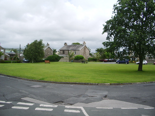
Heron Hill is a small village located in the county of Westmorland, England. Situated amidst the picturesque landscape of the Lake District National Park, this charming settlement offers a tranquil retreat for residents and visitors alike.

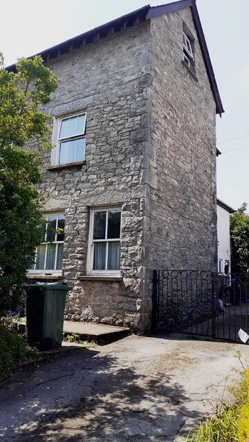
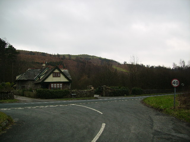
The village is characterized by its traditional stone buildings, which add to its quaint and idyllic atmosphere. It is home to a close-knit community, with a population of around 500 residents. The residents of Heron Hill take great pride in their village, and there is a strong sense of community spirit evident in the various local events and activities that take place throughout the year.

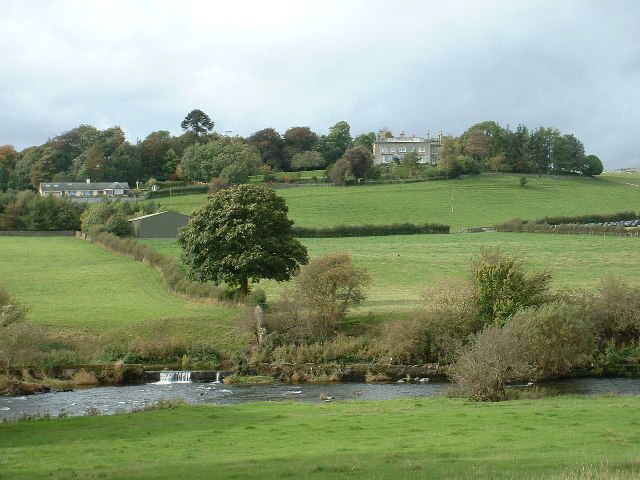
Nature enthusiasts are drawn to Heron Hill due to its proximity to the stunning natural beauty of the Lake District. The village is surrounded by rolling hills, expansive meadows, and serene lakes, making it an ideal base for those looking to explore the outdoors. Popular activities in the area include hiking, cycling, and birdwatching, with numerous trails and paths to discover.

Despite its rural location, Heron Hill offers convenient amenities for its residents. The village boasts a local shop, a post office, and a village hall, which serves as a hub for community gatherings and events. Additionally, the nearby town of Keswick provides further amenities, including supermarkets, schools, and healthcare facilities.

Overall, Heron Hill presents an enchanting blend of natural beauty and community spirit. Whether one seeks a peaceful retreat or an active outdoor adventure, this village in Westmorland offers a delightful setting to experience the best of the Lake District.

If you have any feedback on the listing, please let us know in the comments section below.
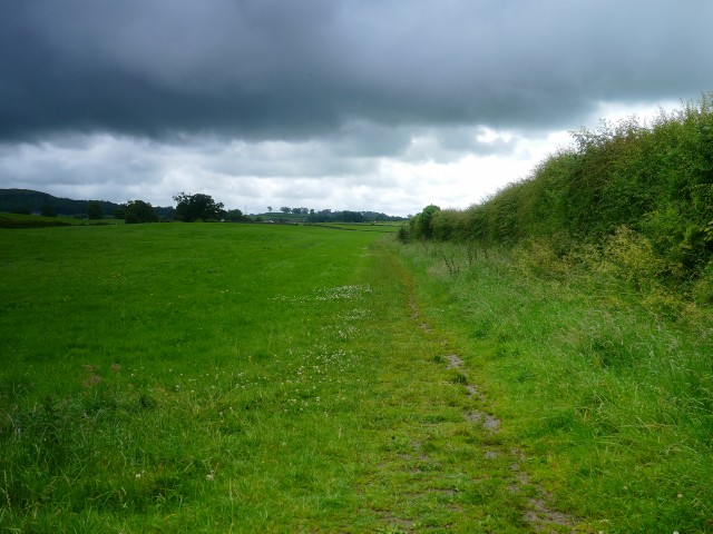
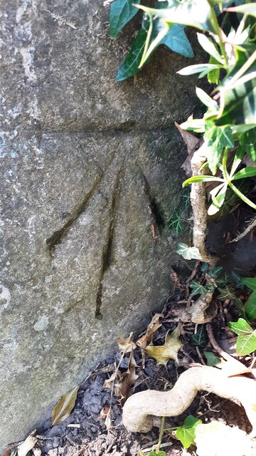
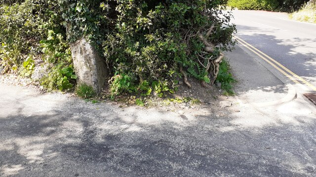
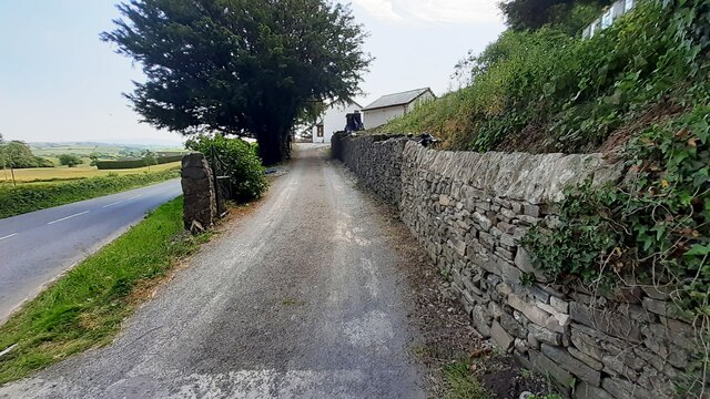
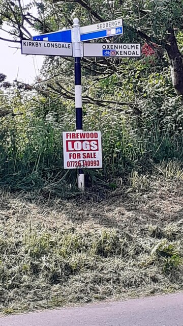
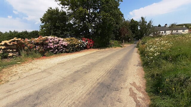
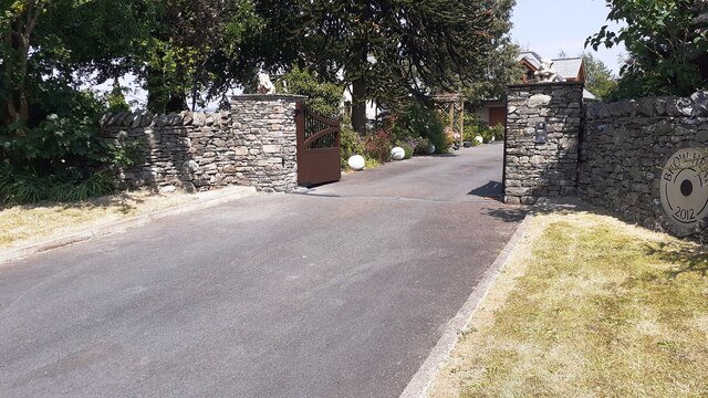
Heron Hill Images

Images are sourced within 2km of 54.312506/-2.735975 or Grid Reference SD5291. Thanks to Geograph Open Source API. All images are credited.

Milestone Marker 02-55 (between bridges 183-182), Lancaster Canal - Site of missing Natland Hall Milestone Of the 56 milestones on the Lancaster Canal five are missing.
This is the site of one of them.  This section of the canal has been filled in.

If the milestone was there the inscription would be 25 :: 2
It would be located 55 miles from the Centre of Preston and 2 miles from Kendal.

Any information about this milestone would be appreciated, please.
Milestone Marker 02-55 (between bridges 183-182), Lancaster Canal - Site of missing Natland Hall Milestone
Of the 56 milestones on the Lancaster Canal five are missing. This is the site of one of them. This section of the canal has been filled in. If the milestone was there the inscription would be 25 :: 2 It would be located 55 miles from the Centre of Preston and 2 miles from Kendal. Any information about this milestone would be appreciated, please.
Benchmark on gatepost beside minor road from B6254 to The Helm Ordnance Survey cut mark benchmark levelled at 125.064m above Newlyn Datum verified 1969
Benchmark on gatepost beside minor road from B6254 to The Helm
Ordnance Survey cut mark benchmark levelled at 125.064m above Newlyn Datum verified 1969
NW side of road to The Helm at B6254 junction There is an Ordnance Survey benchmark <a href="https://www.geograph.org.uk/photo/7509072">SD5389 : Benchmark on gatepost beside minor road from B6254 to The Helm</a> on the gatepost
NW side of road to The Helm at B6254 junction
There is an Ordnance Survey benchmark SD5389 : Benchmark on gatepost beside minor road from B6254 to The Helm on the gatepost
Entrance drive to Helm End from B6254 Ordnance Survey documents indicate that a benchmark levelled at 123.725m above Newlyn Datum was verified on a gatepost at the left hand side of the drive
Entrance drive to Helm End from B6254
Ordnance Survey documents indicate that a benchmark levelled at 123.725m above Newlyn Datum was verified on a gatepost at the left hand side of the drive
Finger signpost on south side of B6254 opposite Station Inn
Road from The Helm to junction with B6254 opposite the Station Inn Rhododendron in flower in hedge on left hand side of the road
Road from The Helm to junction with B6254 opposite the Station Inn
Rhododendron in flower in hedge on left hand side of the road
Footpath to Natland from Burton Road (A65) The path runs beside the West Coast Main Line railway
Footpath to Natland from Burton Road (A65)
The path runs beside the West Coast Main Line railway
Garage at Fas-na-Coile Ordnance Survey documents indicate that a benchmark levelled at 134.109m above Newlyn Datum was verified on the near corner of the building in 1970
Garage at Fas-na-Coile
Ordnance Survey documents indicate that a benchmark levelled at 134.109m above Newlyn Datum was verified on the near corner of the building in 1970
Benchmark on NE face of former shop Helm Garth on NW side of Helmsdale Road Ordnance Survey cut mark benchmark levelled at 94.575m above Newlyn Datum verified 1970.
Benchmark on NE face of former shop Helm Garth on NW side of Helmsdale Road
Ordnance Survey cut mark benchmark levelled at 94.575m above Newlyn Datum verified 1970.
Semi detached house (former shop) on NW side of Helmsdale Road There is an Ordnance Survey benchmark <a href="https://www.geograph.org.uk/photo/7519005">SD5289 : Benchmark on NE face of former shop Helm Garth on NW side of Helmsdale Road</a>  on the side of the house at its rear corner
Semi detached house (former shop) on NW side of Helmsdale Road
There is an Ordnance Survey benchmark SD5289 : Benchmark on NE face of former shop Helm Garth on NW side of Helmsdale Road on the side of the house at its rear corner
Entrance to Brow Head from NE side of Burton Road Ordnance Survey documents indicate that a benchmark levelled at 86.607m above Newlyn Datum was verified in 1970 on the wall  1m left of the entrance which appears to have been remodelled in 2012
Entrance to Brow Head from NE side of Burton Road
Ordnance Survey documents indicate that a benchmark levelled at 86.607m above Newlyn Datum was verified in 1970 on the wall 1m left of the entrance which appears to have been remodelled in 2012
River Kent Near Kendal, with Prizet Farm and Prizet in the background
River Kent
Near Kendal, with Prizet Farm and Prizet in the background
Road The Helm Road on the slopes of The Helm a small hill outside Oxenholme
Road The Helm
Road on the slopes of The Helm a small hill outside Oxenholme
Burton Road South of Kendal. Slopes of the Helm on the skyline
Burton Road
South of Kendal. Slopes of the Helm on the skyline
Redundant Bridge Bridge over a canal that no longer exists.
Redundant Bridge
Bridge over a canal that no longer exists.
Natland as seen from the Helm
Village Green, Natland
St Mark's Church, Natland
Show me another place!

Heron Hill is located at Grid Ref: SD5291 (Lat: 54.312506, Lng: -2.735975)

Administrative County: Cumbria

District: South Lakeland

Police Authority: Cumbria

What 3 Words

///steep.occupy.orchestra. Near Kendal, Cumbria

Nearby Locations

Aikrigg Heron Hill

Related Wikis

Westmorland County Football Association

The Westmorland County Football Association is the governing body of football in the county of Westmorland. The association was formed in 1897. ��2�...

Kirkbie Kendal School

Kirkbie Kendal School is an academy school and known as a Business and Enterprise College in Kendal, Cumbria, Northern England, and serves the area around...

Westmorland General Hospital

Westmorland General Hospital (WGH) is a hospital near Oxenholme in Kendal, Cumbria, England. It is managed by the University Hospitals of Morecambe Bay...

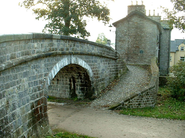
Change Bridge, Kendal

Change Bridge is a Grade II listed single-arch changeline bridge spanning what was formerly a section of the Lancaster Canal in the English market town...

Kendal Town F.C.

Kendal Town Football Club is a football club based in Kendal, Cumbria, England. The club are currently members of the North West Counties League Premier...

Alavana

Alavana was a name tentatively (and probably wrongly) applied to the ruins of a Roman fort at Watercrook about 2 mi (3.2 km) south of Kendal in Cumbria...

Kendal College

Kendal College is a further education college situated in Kendal on the edge of the Lake District National Park. The college provides a range of training...

Netherfield Cricket Club

Netherfield Cricket Club Ground is a cricket ground in Kendal, Cumbria (formerly part of Westmorland). The first recorded match on the ground was in 1893...

Nearby Amenities

Located within 500m of 54.312506,-2.735975
Crossing
Crossing: unmarked
Crossing Island: yes
Kerb: flush
Tactile Paving: yes
Lat/Long: 54.313242/-2.7368152
Crossing
Crossing: unmarked
Crossing Island: yes
Kerb: lowered
Tactile Paving: yes
Lat/Long: 54.3140535/-2.7376356
Bus Stop
Helme Chase
Bench: no
Covered: yes
Local Ref: AT
Naptan AtcoCode: 090079360115
Naptan Bearing: NW
Naptan CommonName: Helme Chase
Naptan Indicator: at
Naptan Landmark: Helme Chase Gardens
Naptan NaptanCode: cumdjgdm
Naptan Street: Burton Road
Naptan Verified: yes
Public Transport: platform
Shelter: yes
Source: naptan_import
Lat/Long: 54.3129429/-2.7367089
Bus Stop
Kendal Low Mills
Bus: yes
Naptan AtcoCode: 090079360878
Naptan Bearing: S
Naptan CommonName: Lowmills
Naptan Indicator: opp
Naptan Landmark: Lowmills Factory
Naptan NaptanCode: cumdjgwa
Naptan Street: Natland Road
Naptan Verified: yes
Public Transport: platform
Shelter: no
Source: naptan_import
Lat/Long: 54.3136237/-2.7416787
Bus Stop
Helme Chase
Bench: no
Covered: no
Naptan AtcoCode: 090079360901
Naptan Bearing: SE
Naptan CommonName: Helme Chase
Naptan Indicator: opp
Naptan Landmark: Helme Close
Naptan NaptanCode: cumdjmat
Naptan Street: Burton Road
Naptan Verified: yes
Public Transport: platform
Shelter: no
Source: naptan_import
Lat/Long: 54.313459/-2.7368792
Bus Stop
Esthwaite Avenue (N bound)
Bench: no
Naptan AtcoCode: 090079360912
Naptan Bearing: N
Naptan CommonName: Spar shop
Naptan Indicator: near
Naptan Landmark: junction with Esthwaite Avenue
Naptan NaptanCode: cumdjmdm
Naptan Street: Hayfell Avenue
Naptan Verified: yes
Public Transport: platform
Shelter: no
Source: naptan_import
Lat/Long: 54.3146168/-2.7350378
Lingmoor Rise at Wray Close
Bus: yes
Public Transport: stop_position
Lat/Long: 54.3158916/-2.7320198
Bus Stop
Kendal Parks Road at Oxenholme Road
Local Ref: AT
Naptan AtcoCode: 090079360929
Naptan Bearing: NE
Naptan CommonName: Kendal Parks Road at Oxenholme Road
Naptan Indicator: near
Naptan Landmark: junction with Oxenholme Road
Naptan NaptanCode: cumdjmja
Naptan Street: Kendal Parks Road
Naptan Verified: yes
Public Transport: platform
Shelter: no
Source: naptan_import
Lat/Long: 54.3107589/-2.7313782
Bus Stop
Kendal Low Mills
Bus: yes
Disused Highway: bus_stop
Disused Public Transport: platform
Naptan AtcoCode: 090079363249
Naptan Bearing: N
Naptan BusStopType: CUS
Naptan CommonName: Low Mills
Naptan Indicator: opp
Naptan Landmark: Rinkfield
Naptan NaptanCode: cumdjpwp
Naptan Street: Natland Road
Naptan Verified: yes
Note: January 2018: Still marked as active in Stops.csv, but no sign of it on the ground; will mark as disused until I add a bus route which uses it (if any do) Mar 2020: Still marked as active, not surveyed on ground. Now used by KLHC 551. Stop position added
Public Transport: platform
Source: naptan_import
Lat/Long: 54.3136399/-2.7419198
Bus Stop
Rinkfield near number 6
Naptan AtcoCode: 090079363992
Naptan Bearing: N
Naptan BusStopType: CUS
Naptan CommonName: Chip Shop
Naptan Indicator: near
Naptan Landmark: number 6
Naptan NaptanCode: cumdpdtg
Naptan Street: Rinkfield
Naptan Verified: yes
Public Transport: platform
Shelter: no
Source: naptan_import
Lat/Long: 54.3136596/-2.7406659
Bus Stop
Rinkfield at Burton Road
Bench: no
Naptan AtcoCode: 090079363993
Naptan Bearing: NE
Naptan CommonName: Burton Road
Naptan Indicator: at
Naptan Landmark: top end
Naptan NaptanCode: cumdpdtj
Naptan Street: Rinkfield
Naptan Verified: yes
Public Transport: platform
Shelter: no
Source: naptan_import
Lat/Long: 54.3146982/-2.7393178
Natland Road
Whitewater: put_in
Lat/Long: 54.3137339/-2.742748
Recycling
Recycling Cardboard: yes
Recycling Glass: yes
Recycling Paper: yes
Recycling Plastic: yes
Recycling Shoes: yes
Recycling Tin Cans: yes
Recycling Type: centre
Lat/Long: 54.3103772/-2.7361573
Kendal Parks Road at Oxenholme Road
Bus: yes
Public Transport: stop_position
Lat/Long: 54.3107146/-2.7313259
Spar
Addr City: Kendal
Addr Housenumber: 2
Addr Postcode: LA9 7JL
Addr Street: Hayfell Avenue
Brand: Spar
Brand Wikidata: Q610492
Brand Wikipedia: en:Spar (retailer)
Fhrs Id: 441572
Phone: +44 1539 720909
Shop: convenience
Website: https://www.spar.co.uk/store-locator/hal11240-spar-heron-hill
Wheelchair: yes
Lat/Long: 54.3144551/-2.7347912
Noexit: yes
Lat/Long: 54.3092922/-2.7324071
Noexit: yes
Lat/Long: 54.3131598/-2.7328319
Turning Circle
Lat/Long: 54.3141612/-2.741073
Turning Circle
Lat/Long: 54.3141685/-2.7387345
Turning Circle
Lat/Long: 54.3124981/-2.7404262
Crossing
Crossing: unmarked
Crossing Island: yes
Tactile Paving: yes
Lat/Long: 54.3124433/-2.7358911
Cycleway: asl
Direction: forward
Lat/Long: 54.312271/-2.7361829
Turning Circle
Lat/Long: 54.3116254/-2.740514
Barrier: kissing_gate
Lat/Long: 54.3111775/-2.7415552
Post Box
Ref: LA9 269
Lat/Long: 54.3098516/-2.7346652
Barrier: bollard
Lat/Long: 54.3111689/-2.7401882
Post Box
Ref: LA9 74
Source: survey
Lat/Long: 54.3121759/-2.735118
Post Box
Ref: LA9 256
Source: survey
Lat/Long: 54.3149433/-2.7330916
Noexit: yes
Lat/Long: 54.3130933/-2.7335313
Telephone
Booth: KX300
Covered: booth
Lat/Long: 54.3146919/-2.7386804
Post Box
Post Box Type: pillar
Ref: LA9 167
Royal Cypher: GR
Royal Cypher Wikidata: Q33102273
Lat/Long: 54.3149288/-2.7390448
Post Box
Drive Through: no
Post Box Type: lamp
Ref: LA9 166
Lat/Long: 54.311861/-2.7411125
Bench
Backrest: yes
Lat/Long: 54.3130192/-2.7367665
Waste Basket
Lat/Long: 54.3130361/-2.7367803
Barrier: bollard
Lat/Long: 54.3137205/-2.7371447
Pharmacy
Brand: Asda
Brand Wikidata: Q297410
Brand Wikipedia: en:Asda
Contact Phone: +44 1539 742410
Contact Website: https://storelocator.asda.com/north-west/kendal/burton-road/pharmacy
Healthcare: pharmacy
Operator: Asda Stores Ltd
Lat/Long: 54.3098596/-2.734475
Pharmacy
Well Pharmacy
Brand: Well Pharmacy
Brand Wikidata: Q7726524
Brand Wikipedia: en:Well Pharmacy
Healthcare: pharmacy
Opening Hours: Mo-Fr 07:00-23:00, Sa 08:00-18:00, Su 08:00-18:00
Website: https://finder.well.co.uk/store/kendal-helme-chase
Lat/Long: 54.3126114/-2.7371223
Kendal Driving Test Centre
Addr City: Kendal
Addr Housename: Wayfaring House
Addr Place: Murley Moss Business Park
Addr Postcode: LA9 7RL
Addr Street: Oxenholme Road
Government: yes
Office: government
Lat/Long: 54.3110638/-2.7353996
Rinkfield near number 6
Bus: yes
Public Transport: stop_position
Lat/Long: 54.3135705/-2.7406207
Atm
Lat/Long: 54.3149184/-2.7392713
Grit Bin
Access: yes
Lat/Long: 54.3147359/-2.7388183
Waste Basket
Lat/Long: 54.3140093/-2.7376789
Waste Basket
Lat/Long: 54.3106355/-2.7321174
Bench
Lat/Long: 54.3106175/-2.7320637
Barrier: entrance
Lat/Long: 54.312016/-2.73604
Barrier: entrance
Source: bing
Lat/Long: 54.3116701/-2.7360549
Barrier: entrance
Source: bing
Lat/Long: 54.311609/-2.736063
Barrier: entrance
Source: bing
Lat/Long: 54.3121607/-2.735472
Barrier: entrance
Source: bing
Lat/Long: 54.3120748/-2.7352431
KBA Natland Road Garage
Addr City: Kendal
Addr Housename: Unit 7a, Riverside Business Park
Addr Postcode: LA9 7SX
Addr Street: Natland Road
Opening Hours: Mo-Fr 08:30-17:30, Sa 09:00-12:30
Shop: car_repair
Lat/Long: 54.3129043/-2.7421404
Crossing
Crossing: unmarked
Crossing Island: no
Kerb: lowered
Tactile Paving: yes
Lat/Long: 54.3102622/-2.7370531
Crossing
Crossing: unmarked
Crossing Island: yes
Tactile Paving: yes
Lat/Long: 54.3159152/-2.7402009
Crossing
Crossing: unmarked
Crossing Island: no
Tactile Paving: yes
Lat/Long: 54.3156257/-2.7397574
Give Way
Direction: backward
Lat/Long: 54.3148562/-2.738846
Leisure: picnic_table
Lat/Long: 54.3153221/-2.7391185
Leisure: picnic_table
Lat/Long: 54.315302/-2.7389823
Leisure: picnic_table
Lat/Long: 54.315245/-2.7389742
Leisure: picnic_table
Lat/Long: 54.3152593/-2.739084
Entrance: main
Lat/Long: 54.3154516/-2.7388949
Waste Basket
Lat/Long: 54.3153672/-2.7391429
Give Way
Direction: forward
Lat/Long: 54.31209/-2.7362675
Give Way
Direction: backward
Lat/Long: 54.3128378/-2.7357133
Give Way
Direction: forward
Lat/Long: 54.3128938/-2.7366158
Give Way
Direction: forward
Lat/Long: 54.3134039/-2.7370132
Crossing
Crossing: marked
Crossing Island: yes
Crossing Markings: zebra
Crossing Ref: zebra
Tactile Paving: yes
Lat/Long: 54.3152883/-2.7393656
Give Way
Direction: backward
Lat/Long: 54.3142228/-2.7399545
Give Way
Direction: backward
Lat/Long: 54.3138857/-2.7404632
Give Way
Direction: backward
Lat/Long: 54.313394/-2.7406839
Give Way
Direction: forward
Lat/Long: 54.3132757/-2.7415649
Give Way
Direction: forward
Lat/Long: 54.3119116/-2.7412115
Give Way
Direction: backward
Lat/Long: 54.3114619/-2.7412691
Give Way
Direction: backward
Lat/Long: 54.3117731/-2.7413926
Bench
Backrest: yes
Lat/Long: 54.3117401/-2.7408041
Grit Bin
Lat/Long: 54.3117112/-2.7407572
Bench
Backrest: yes
Lat/Long: 54.3117578/-2.7403712
Access: private
Addr City: Kendal
Addr Flats: 97-98
Addr Postcode: LA9 7LP
Addr Street: Rinkfield
Entrance: yes
Lat/Long: 54.312658/-2.7406502
Access: private
Addr City: Kendal
Addr Flats: 95-96
Addr Postcode: LA9 7LP
Addr Street: Rinkfield
Entrance: yes
Lat/Long: 54.3125408/-2.7406429
Access: private
Addr City: Kendal
Addr Flats: 93-94
Addr Postcode: LA9 7LP
Addr Street: Rinkfield
Entrance: yes
Lat/Long: 54.3125172/-2.740635
Access: private
Addr City: Kendal
Addr Flats: 91-92
Addr Postcode: LA9 7LP
Addr Street: Rinkfield
Entrance: yes
Lat/Long: 54.3123966/-2.7406169
Give Way
Direction: forward
Lat/Long: 54.3110154/-2.7300261
Give Way
Direction: backward
Lat/Long: 54.3110287/-2.7295996
Give Way
Direction: forward
Lat/Long: 54.3108292/-2.7307315
Helme Chase
Bus: yes
Public Transport: stop_position
Lat/Long: 54.3134333/-2.7369795
Helme Chase
Bus: yes
Public Transport: stop_position
Lat/Long: 54.3129541/-2.7365707
Asda
Bus: yes
Public Transport: stop_position
Lat/Long: 54.3105005/-2.736573
Bus Stop
Asda (N bound)
Bench: no
Naptan AtcoCode: 090079363957
Naptan Bearing: N
Naptan CommonName: Asda
Naptan Indicator: opp
Naptan Landmark: Asda Supermarket
Naptan NaptanCode: cumdmwma
Naptan Street: Burton Road
Naptan Verified: yes
Public Transport: platform
Shelter: no
Lat/Long: 54.3105039/-2.7366056
Bus Stop
Asda (S bound)
Bench: no
Naptan AtcoCode: 090079363956
Naptan Bearing: S
Naptan CommonName: Asda
Naptan Indicator: o/s
Naptan Landmark: Asda Supermarket
Naptan NaptanCode: cumdmwjw
Naptan Street: Burton Road
Naptan Verified: yes
Public Transport: platform
Shelter: no
Lat/Long: 54.3104955/-2.7364864
Give Way
Direction: forward
Lat/Long: 54.3144282/-2.7420944
Give Way
Direction: forward
Lat/Long: 54.3146442/-2.7420485
Entrance: main
Lat/Long: 54.3149476/-2.7419939
Entrance: main
Lat/Long: 54.3147897/-2.7419343
Cafe
Asda Cafe
Addr City: Kendal
Addr Country: GB
Addr Housename: Asda
Addr Postcode: LA9 7JA
Addr Street: Burton Road
Brand: Asda
Brand Wikidata: Q297410
Brand Wikipedia: en:Asda
Contact Phone: +44 1539 741416
Contact Website: https://storelocator.asda.com/north-west/kendal/burton-road/cafe
Drinking Water Refill: yes
Drinking Water Refill Network: Refill
Fhrs Id: 298827
Internet Access: wlan
Internet Access Fee: no
Opening Hours Covid19: Mo-Su off
Operator: Asda Stores Ltd
Lat/Long: 54.3099492/-2.7342456
Give Way
Direction: backward
Lat/Long: 54.3138121/-2.7418837
Kendal Low Mills
Bus: yes
Public Transport: stop_position
Lat/Long: 54.31367/-2.7417728
Rinkfield at Burton Road
Bus: yes
Public Transport: stop_position
Lat/Long: 54.3146821/-2.7392215
Give Way
Direction: backward
Lat/Long: 54.3153279/-2.7352732
Give Way
Direction: backward
Lat/Long: 54.3146023/-2.734904
Give Way
Direction: forward
Lat/Long: 54.3141782/-2.7351573
Esthwaite Avenue (N bound)
Bus: yes
Public Transport: stop_position
Lat/Long: 54.314621/-2.7349539
Give Way
Direction: backward
Lat/Long: 54.3153105/-2.7320076
Give Way
Direction: forward
Lat/Long: 54.315678/-2.7319875
Bus Stop
Lingmoor Rise at Wray Close
Bench: no
Naptan AtcoCode: 090079360926
Naptan Bearing: N
Naptan CommonName: Wray Close
Naptan Indicator: opp
Naptan Landmark: junction with Wray Close
Naptan NaptanCode: cumdjmgp
Naptan Street: Lingmoor Rise
Naptan Verified: yes
Public Transport: platform
Shelter: no
Source: naptan_import
Wheelchair: yes
Lat/Long: 54.3158815/-2.7319358
Express Plumbing Supplies
Addr City: Kendal
Addr Housename: Riverside Business Park
Addr Postcode: LA9 7SX
Addr Street: Natland Road
Addr Unit: 5
Craft: plumber
Opening Hours: Mo-Fr 07:30-17:00
Phone: +44 1539 742530
Website: https://www.exps.co.uk/
Lat/Long: 54.3132879/-2.7419748
Absolute Digital Print
Addr City: Kendal
Addr Housename: Riverside Business Park
Addr Postcode: LA9 7LR
Addr Street: Natland Road
Addr Unit: 4
Email: info@absolutedigitalprint.com
Phone: +44 1539 738441
Shop: printing
Website: https://www.absolutedigitalprint.com/
Lat/Long: 54.3134283/-2.7419792
Veterinary
Westmorland Veterinary Group
Addr City: Kendal
Addr Housename: Riverside Business Park
Addr Postcode: LA9 7SX
Addr Street: Natland Road
Email: office@westmorland-vets.co.uk
Phone: +44 1539 722692
Website: https://www.westmorland-vets.co.uk/kendal-surgery
Lat/Long: 54.3135926/-2.7422349
Lancastrian Estates
Addr City: Kendal
Addr Housename: Riverside Business Park
Addr Postcode: LA9 7SX
Addr Street: Natland Road
Addr Unit: 1
Email: kendal@lancastrianestates.co.uk
Office: estate_agent
Phone: +44 1539 733373
Website: https://www.lancastrianestates.co.uk/
Lat/Long: 54.3136655/-2.7424291
Waste Basket
Lat/Long: 54.3145509/-2.7348423
Barrier: cycle_barrier
Source: survey
Lat/Long: 54.3139856/-2.7376649
Crossing
Crossing: unmarked
Crossing Island: yes
Kerb: flush
Tactile Paving: yes
Lat/Long: 54.3145872/-2.7383514
Heron Hill
Place: suburb
Lat/Long: 54.3146319/-2.7346425
Give Way
Direction: forward
Lat/Long: 54.3095066/-2.7315747
Noexit: yes
Lat/Long: 54.3087457/-2.7337015
Noexit: yes
Lat/Long: 54.3089977/-2.7326087
Barrier: entrance
Lat/Long: 54.3113273/-2.7410237
Barrier: entrance
Lat/Long: 54.3109868/-2.7412187
Crossing
Crossing: zebra
Kerb: flush
Tactile Paving: yes
Lat/Long: 54.310351/-2.7356831
Crossing
Crossing: unmarked
Crossing Island: yes
Kerb: flush
Tactile Paving: yes
Lat/Long: 54.3103738/-2.7366376
Give Way
Direction: backward
Lat/Long: 54.3110493/-2.7364366
Traffic Signals
Traffic Signals: signal
Traffic Signals Direction: forward
Lat/Long: 54.3122288/-2.7361801
Traffic Signals
Traffic Signals: signal
Traffic Signals Direction: backward
Lat/Long: 54.3123892/-2.7357649
Traffic Signals
Traffic Signals: signal
Traffic Signals Direction: forward
Lat/Long: 54.3126334/-2.7358542
Traffic Signals
Traffic Signals: signal
Traffic Signals Direction: backward
Lat/Long: 54.3127139/-2.736366
Give Way
Direction: forward
Lat/Long: 54.3137082/-2.7371213
Crossing
Button Operated: yes
Crossing: traffic_signals
Crossing Island: no
Crossing Markings: dots
Crossing Signals: yes
Crossing Ref: puffin
Kerb: flush
Tactile Paving: yes
Lat/Long: 54.3104254/-2.7318123
Give Way
Direction: backward
Lat/Long: 54.3104423/-2.7319248
Traffic Signals
Traffic Signals: signal
Traffic Signals Direction: backward
Lat/Long: 54.3104167/-2.7317952
Traffic Signals
Traffic Signals: signal
Traffic Signals Direction: forward
Lat/Long: 54.3105448/-2.7316905
Traffic Signals
Traffic Signals: signal
Traffic Signals Direction: forward
Lat/Long: 54.3105816/-2.7321674
Crossing
Crossing: unmarked
Crossing Island: no
Kerb: flush
Tactile Paving: yes
Lat/Long: 54.3105124/-2.7317618
Entrance: main
Lat/Long: 54.309883/-2.7347091
Crossing
Crossing: unmarked
Crossing Island: no
Kerb: lowered
Tactile Paving: yes
Lat/Long: 54.3110497/-2.7364752
Crossing
Crossing: unmarked
Crossing Island: yes
Kerb: lowered
Tactile Paving: yes
Lat/Long: 54.3112372/-2.7362941
Crossing
Crossing: unmarked
Crossing Island: no
Kerb: lowered
Tactile Paving: yes
Lat/Long: 54.312074/-2.7363121
Crossing
Crossing: unmarked
Crossing Island: no
Kerb: lowered
Tactile Paving: yes
Lat/Long: 54.3128889/-2.7366323
Crossing
Crossing: unmarked
Crossing Island: no
Kerb: lowered
Tactile Paving: yes
Lat/Long: 54.3133885/-2.7370536
Barrier: cycle_barrier
Bicycle: yes
Cycle Barrier: single
Description: Narrow barrier passable for 2 wheeled bikes but difficult for tandems and probably impassible for most tricycles.
Foot: yes
Lat/Long: 54.3103906/-2.7318535
Kendal Low Mills
Bus: yes
Public Transport: stop_position
Lat/Long: 54.3136223/-2.7417569
Direction: WSW
Generator Method: photovoltaic
Generator Output Electricity: yes
Generator Solar Modules: 12
Generator Source: solar
Generator Type: solar_photovoltaic_panel
Location: roof
Power: generator
Lat/Long: 54.3115152/-2.7297254
Direction: S
Generator Method: photovoltaic
Generator Output Electricity: yes
Generator Solar Modules: 3
Generator Source: solar
Generator Type: solar_photovoltaic_panel
Location: roof
Power: generator
Lat/Long: 54.3163825/-2.7335649
Direction: S
Generator Method: photovoltaic
Generator Output Electricity: yes
Generator Solar Modules: 8
Generator Source: solar
Generator Type: solar_photovoltaic_panel
Location: roof
Power: generator
Lat/Long: 54.316384/-2.733471
Direction: S
Generator Method: photovoltaic
Generator Output Electricity: yes
Generator Solar Modules: 12
Generator Source: solar
Generator Type: solar_photovoltaic_panel
Location: roof
Power: generator
Lat/Long: 54.3162996/-2.7329976
Direction: E
Generator Method: photovoltaic
Generator Output Electricity: yes
Generator Source: solar
Generator Type: solar_photovoltaic_panel
Location: roof
Power: generator
Lat/Long: 54.3162714/-2.7337955
Direction: W
Generator Method: photovoltaic
Generator Output Electricity: yes
Generator Source: solar
Generator Type: solar_photovoltaic_panel
Location: roof
Power: generator
Lat/Long: 54.3163269/-2.7338586
Direction: SSW
Generator Method: photovoltaic
Generator Output Electricity: yes
Generator Solar Modules: 18
Generator Source: solar
Generator Type: solar_photovoltaic_panel
Location: roof
Power: generator
Lat/Long: 54.3121321/-2.7335126
Direction: ESE
Generator Method: photovoltaic
Generator Output Electricity: yes
Generator Solar Modules: 16
Generator Source: solar
Generator Type: solar_photovoltaic_panel
Location: roof
Power: generator
Lat/Long: 54.3120347/-2.7324437
Direction: SSW
Generator Method: photovoltaic
Generator Output Electricity: yes
Generator Solar Modules: 14
Generator Source: solar
Generator Type: solar_photovoltaic_panel
Location: roof
Power: generator
Lat/Long: 54.3127464/-2.7303811
Direction: SW
Generator Method: photovoltaic
Generator Output Electricity: yes
Generator Solar Modules: 14
Generator Source: solar
Generator Type: solar_photovoltaic_panel
Location: roof
Power: generator
Lat/Long: 54.3122413/-2.7307552
Direction: WNW
Generator Method: photovoltaic
Generator Output Electricity: yes
Generator Source: solar
Generator Type: solar_photovoltaic_panel
Location: roof
Power: generator
Lat/Long: 54.3120872/-2.7300391
Direction: SW
Generator Method: photovoltaic
Generator Output Electricity: yes
Generator Solar Modules: 13
Generator Source: solar
Generator Type: solar_photovoltaic_panel
Location: roof
Power: generator
Lat/Long: 54.3118898/-2.73134
Direction: SSE
Generator Method: photovoltaic
Generator Output Electricity: yes
Generator Solar Modules: 12
Generator Source: solar
Generator Type: solar_photovoltaic_panel
Location: roof
Power: generator
Lat/Long: 54.3154336/-2.7366206
Generator Method: photovoltaic
Generator Output Electricity: yes
Generator Source: solar
Generator Type: solar_photovoltaic_panel
Location: roof
Power: generator
Lat/Long: 54.3146256/-2.7299799
Generator Method: photovoltaic
Generator Output Electricity: yes
Generator Source: solar
Generator Type: solar_photovoltaic_panel
Location: roof
Power: generator
Lat/Long: 54.3148337/-2.7304385
Generator Method: photovoltaic
Generator Output Electricity: yes
Generator Source: solar
Generator Type: solar_photovoltaic_panel
Location: roof
Power: generator
Lat/Long: 54.3150778/-2.7319808
Generator Method: photovoltaic
Generator Output Electricity: yes
Generator Source: solar
Generator Type: solar_photovoltaic_panel
Location: roof
Power: generator
Lat/Long: 54.3152484/-2.7332227
Generator Method: photovoltaic
Generator Output Electricity: yes
Generator Source: solar
Generator Type: solar_photovoltaic_panel
Location: roof
Power: generator
Lat/Long: 54.3155707/-2.7312807
Generator Method: photovoltaic
Generator Output Electricity: yes
Generator Source: solar
Generator Type: solar_photovoltaic_panel
Location: roof
Power: generator
Lat/Long: 54.3123178/-2.7367659
Generator Method: photovoltaic
Generator Output Electricity: yes
Generator Source: solar
Generator Type: solar_photovoltaic_panel
Location: roof
Power: generator
Lat/Long: 54.3112772/-2.7381284
Generator Method: photovoltaic
Generator Output Electricity: yes
Generator Source: solar
Generator Type: solar_photovoltaic_panel
Location: roof
Power: generator
Lat/Long: 54.3102387/-2.7328512
Generator Method: photovoltaic
Generator Output Electricity: yes
Generator Source: solar
Generator Type: solar_photovoltaic_panel
Location: roof
Power: generator
Lat/Long: 54.3103506/-2.7329343
Generator Method: photovoltaic
Generator Output Electricity: yes
Generator Source: solar
Generator Type: solar_photovoltaic_panel
Location: roof
Power: generator
Lat/Long: 54.3109118/-2.7385844
Generator Method: photovoltaic
Generator Output Electricity: yes
Generator Source: solar
Generator Type: solar_photovoltaic_panel
Location: roof
Power: generator
Lat/Long: 54.31117/-2.7372996
Generator Method: photovoltaic
Generator Output Electricity: yes
Generator Source: solar
Generator Type: solar_photovoltaic_panel
Location: roof
Power: generator
Lat/Long: 54.3111732/-2.7373586
Generator Method: photovoltaic
Generator Output Electricity: yes
Generator Source: solar
Generator Type: solar_photovoltaic_panel
Location: roof
Power: generator
Lat/Long: 54.3115753/-2.7372326
Generator Method: photovoltaic
Generator Output Electricity: yes
Generator Source: solar
Generator Type: solar_photovoltaic_panel
Location: roof
Power: generator
Lat/Long: 54.3115862/-2.7372996
Bicycle Parking
Lat/Long: 54.310045/-2.7340017
Crossing
Crossing: marked
Tactile Paving: no
Lat/Long: 54.3100042/-2.7348416
Crossing
Crossing: marked
Tactile Paving: no
Lat/Long: 54.3101274/-2.7349846
Crossing
Crossing: marked
Tactile Paving: no
Lat/Long: 54.310253/-2.7351277
Crossing
Crossing: marked
Tactile Paving: yes
Lat/Long: 54.3103796/-2.7352679
Generator Method: photovoltaic
Generator Orientation: south_east
Generator Output Electricity: yes
Generator Solar Modules: 15
Generator Source: solar
Generator Type: solar_photovoltaic_panel
Location: roof
Power: generator
Lat/Long: 54.3087853/-2.7330778
Lake District National Park Authority
Addr City: Kendal
Addr Housename: Wayfaring House
Addr Place: Murley Moss Business Park
Addr Postcode: LA9 7RL
Addr Street: Oxenholme Road
Office: government
Phone: +44 1539 724555
Website: https://www.lakedistrict.gov.uk/aboutus/contact-us
Lat/Long: 54.3112587/-2.73564
Bureau De Change
Asda Travel Money
Addr City: Kendal
Addr Housename: Asda
Addr Postcode: LA9 7JA
Addr Street: Burton Road
Lat/Long: 54.3099109/-2.734352
Give Way
Direction: backward
Lat/Long: 54.310426/-2.7318715
Crossing
Crossing: unmarked
Crossing Island: yes
Tactile Paving: yes
Lat/Long: 54.3103744/-2.736578
Cycleway: asl
Direction: backward
Lat/Long: 54.3126728/-2.7363333
Crossing
Crossing: unmarked
Crossing Island: yes
Tactile Paving: yes
Lat/Long: 54.3126382/-2.7363058
Cycleway: asl
Direction: backward
Lat/Long: 54.312425/-2.7358426
Cycleway: asl
Direction: forward
Lat/Long: 54.3125951/-2.735889
Crossing
Crossing: unmarked
Crossing Island: no
Tactile Paving: yes
Lat/Long: 54.3125769/-2.7359113
Man Made: mast
Tower Construction: freestanding
Tower Type: communication
Lat/Long: 54.3082225/-2.7367517
Bicycle Parking
Bicycle Parking: lockers
Capacity: 10
Lat/Long: 54.3155404/-2.7389795
Events Venue
Westmorland Hall
Addr City: Kendal
Addr Housename: Kendl Leisure Centre
Addr Postcode: LA9 7HX
Addr Street: Burton Road
Lat/Long: 54.3156541/-2.7386527
Recycling
Recycling Clothes: yes
Recycling Type: container
Lat/Long: 54.3149412/-2.7390949
Barrier: stile
Material: stone
Stile: squeezer
Lat/Long: 54.3107615/-2.7362599
The data included in this document is from www.openstreetmap.org. The data is made available under ODbL.

Have you been to Heron Hill?

Leave your review of Heron Hill below (or comments, questions and feedback).