Hellescott

Settlement in Devon

England

Hellescott

Lane heading to North Petherwin Lane at junction heading to North Petherwin
Lane heading to North Petherwin Credit: Shaun Ferguson

Hellescott is a small village located in the county of Devon, England. Situated on the northern coast of the county, it is part of the North Devon District. The village is nestled between the larger towns of Bideford and Barnstaple, with the Atlantic Ocean to the west.

With a population of around 500 residents, Hellescott maintains a charming and tranquil atmosphere. The village is surrounded by picturesque countryside, offering breathtaking views of rolling green hills and meandering rivers. The area is known for its stunning coastal walks, providing visitors and locals alike with opportunities to explore the natural beauty of the region.

Hellescott boasts a rich history, with evidence of settlements dating back to the medieval era. The village features several notable landmarks, including St. Mary's Church, a beautiful medieval church that has been a focal point of the community for centuries. The church's architecture and historical significance make it a popular attraction for history enthusiasts.

Despite its small size, Hellescott offers a range of amenities for its residents. There is a local pub that serves as a gathering place for the community, as well as a small convenience store for everyday needs. For more extensive shopping and leisure activities, the nearby towns of Bideford and Barnstaple provide additional options.

Overall, Hellescott is a charming village that offers a peaceful escape from the hustle and bustle of city life. With its stunning natural surroundings and rich historical heritage, it is a hidden gem in the heart of Devon.

If you have any feedback on the listing, please let us know in the comments section below.
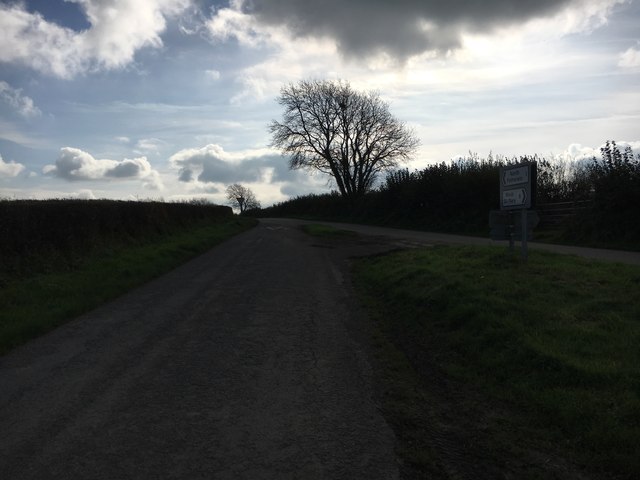
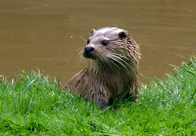
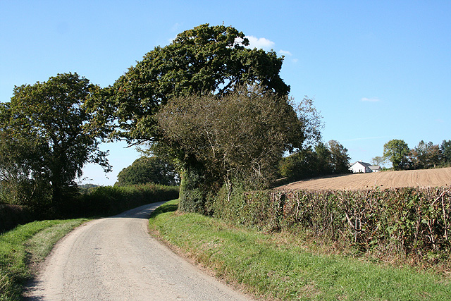
Hellescott Images

Images are sourced within 2km of 50.671924/-4.4319332 or Grid Reference SX2888. Thanks to Geograph Open Source API. All images are credited.

Lane heading to North Petherwin Lane at junction heading to North Petherwin
Lane heading to North Petherwin
Lane at junction heading to North Petherwin
Road fork northwest of North Petherwin The main lane left is for Brazacott; the right fork narrowly misses the village on the east, heading for Copthorne.
Road fork northwest of North Petherwin
The main lane left is for Brazacott; the right fork narrowly misses the village on the east, heading for Copthorne.
North Petherwin: south from Brazacott Looking north-north-west. The lane on the right leads to Copthorne. Late afternoon light, October 2007
North Petherwin: south from Brazacott
Looking north-north-west. The lane on the right leads to Copthorne. Late afternoon light, October 2007
Bodgate A rather grand farmhouse in an area transferred from Devon to Cornwall in 1974. Seen from the start of the footpath to Godcott Farm.
Bodgate
A rather grand farmhouse in an area transferred from Devon to Cornwall in 1974. Seen from the start of the footpath to Godcott Farm.
Valley side near Bodgate A view along the northern slopes of the valley of a tributary of Bolesbridge Water, seen from footpath 529/7/1 from North Petherwin to the nearby <a href="https://www.geograph.org.uk/photo/608149">SX2890 : Bodgate</a>. The house on the right is on the entrance road to Bodgate from Brazacott.
Valley side near Bodgate
A view along the northern slopes of the valley of a tributary of Bolesbridge Water, seen from footpath 529/7/1 from North Petherwin to the nearby SX2890 : Bodgate. The house on the right is on the entrance road to Bodgate from Brazacott.
In the Bolesbridge Water valley Footpath 529/4/1 passes a small copse as it crosses a tributary of the Bolesbridge Water, and heads upstream along the edge of the flood plain towards Forda Mill. Most of the mature trees visible are along the course of the stream.
In the Bolesbridge Water valley
Footpath 529/4/1 passes a small copse as it crosses a tributary of the Bolesbridge Water, and heads upstream along the edge of the flood plain towards Forda Mill. Most of the mature trees visible are along the course of the stream.
Bolesbridge Water The stream twists and turns its way in tight meanders across this level stretch of valley. Here it has formed a couple of miniature slip-off slopes while undermining the adjacent banks.
Bolesbridge Water
The stream twists and turns its way in tight meanders across this level stretch of valley. Here it has formed a couple of miniature slip-off slopes while undermining the adjacent banks.
Bolesbridge Water Unlike the nearby <a href="https://www.geograph.org.uk/photo/609009">SX2890 : Bolesbridge Water</a>, no slip-off slope is visible on the inside of this meander around a narrow neck of land. In the foreground, a barbed wire fence is gradually being left marooned in mid-air as the bank erodes.
Bolesbridge Water
Unlike the nearby SX2890 : Bolesbridge Water, no slip-off slope is visible on the inside of this meander around a narrow neck of land. In the foreground, a barbed wire fence is gradually being left marooned in mid-air as the bank erodes.
Ford across Bolesbridge Water This looks rather like a large puddle, but is actually the sizeable stream seen in <a href="https://www.geograph.org.uk/photo/609022">SX2990 : Bolesbridge Water</a>, being forded by a track that once provided access to <a href="https://www.geograph.org.uk/photo/608149">SX2890 : Bodgate</a> from the east. Seen from path 529/4/1 which remains firmly on this side of the Water. In the distance is the farm at Forda.
Ford across Bolesbridge Water
This looks rather like a large puddle, but is actually the sizeable stream seen in SX2990 : Bolesbridge Water, being forded by a track that once provided access to SX2890 : Bodgate from the east. Seen from path 529/4/1 which remains firmly on this side of the Water. In the distance is the farm at Forda.
Meadow near Forda Mill A wild meadow that looks a promising wildlife habitat. On the right behind the undergrowth flows Bolesbridge Water - the view is looking upstream. Footpath 529/4/1 makes its way across the meadow to cross a tributary which runs past the isolated oak left of centre, and continues to Forda Mill. Taken only a yard or two from <a href="https://www.geograph.org.uk/photo/609038">SX2990 : Ford across Bolesbridge Water</a>.
Meadow near Forda Mill
A wild meadow that looks a promising wildlife habitat. On the right behind the undergrowth flows Bolesbridge Water - the view is looking upstream. Footpath 529/4/1 makes its way across the meadow to cross a tributary which runs past the isolated oak left of centre, and continues to Forda Mill. Taken only a yard or two from SX2990 : Ford across Bolesbridge Water.
Tamar Otter Sanctuary An old quarry in the woods of the Tamar Otter Sanctuary.
Tamar Otter Sanctuary
An old quarry in the woods of the Tamar Otter Sanctuary.
Tamar Otter Sanctuary Definitely worth a visit.
Tamar Otter Sanctuary
Definitely worth a visit.
St Stephens by Launceston: approaching Cargentle On a side road to North Petherwin from Launceston
St Stephens by Launceston: approaching Cargentle
On a side road to North Petherwin from Launceston
St Stephens by Launceston: edge of wood Near Cargentle
St Stephens by Launceston: edge of wood
Near Cargentle
Egloskerry: in the Ottery valley Looking west-north-west on a lane between Launceston and North Petherwin
Egloskerry: in the Ottery valley
Looking west-north-west on a lane between Launceston and North Petherwin
Egloskerry: near Coombekeale Looking west over farmland
Egloskerry: near Coombekeale
Looking west over farmland
Egloskerry: Hellescott Bridge A crossing of the river Ottery between Egloskerry and North Petherwin. A causeway leads to the bridge on the southern approach, crossing the floodplain
Egloskerry: Hellescott Bridge
A crossing of the river Ottery between Egloskerry and North Petherwin. A causeway leads to the bridge on the southern approach, crossing the floodplain
North Petherwin: green at Hellescott Looking north-north-west towards Petherwin Gate
North Petherwin: green at Hellescott
Looking north-north-west towards Petherwin Gate
Show me another place!

Hellescott is located at Grid Ref: SX2888 (Lat: 50.671924, Lng: -4.4319332)

Unitary Authority: Cornwall

Police Authority: Devon and Cornwall

What 3 Words

///global.trickling.wiped. Near Werrington, Cornwall

Nearby Locations

Hellescott

Related Wikis

Petherwin Gate

Petherwin Gate is a hamlet in Cornwall, England. It is about half a mile south of North Petherwin. == References ==

North Petherwin

North Petherwin (Cornish: Paderwynn Gledh) is a civil parish and village that used to be in the historic county of Devon but today is situated in the ceremonial...

Penheale Manor

Penheale Manor is a Grade I listed manor house and historic building one mile north of Egloskerry, Cornwall. == History == The manor was mentioned as...

Bodgate

Bodgate is a farmstead in east Cornwall, England, United Kingdom. It is situated in North Petherwin civil parish about 0.5 miles (0.80 km) south of North...

Badharlick

Badharlick (Cornish: Bos Harlek, meaning Harlek's dwelling) is a hamlet in the parish of Egloskerry, Cornwall, England, United Kingdom, situated halfway...

Egloskerry

Egloskerry (Cornish: Egloskeri) is a village and civil parish in east Cornwall, England, United Kingdom. It is situated approximately five miles (8.0 km...

Langore

Langore (Cornish: Nansgover) is a village in Cornwall, England. It is in the parish of St Stephens by Launceston Rural (where the population of the 2011...

Trebeath

Trebeath is a hamlet in the parish of Egloskerry, Cornwall, England, United Kingdom. == References == == External links == Media related to Trebeath at...

Related Videos

Eynsford Circular: Exploring the Charming Kent Countryside | UK Hiking Trails 🇬🇧

Embark on a delightful journey through the picturesque Kent countryside with the Eynsford Circular walk. This scenic trail takes ...

Hidden Valley

What an Amazing Maze.

Hidden Valley Cornwall

Hi everyone! Today we visit Hidden Valley in Cornwall. Filled with puzzles, we attempt to solve them all 9 times in the Forbidden ...

Nearby Amenities

Located within 500m of 50.671924,-4.4319332
The data included in this document is from www.openstreetmap.org. The data is made available under ODbL.

Have you been to Hellescott?

Leave your review of Hellescott below (or comments, questions and feedback).