Haselour

Settlement in Staffordshire Lichfield

England

Haselour

St Matthews Church  (1) The above photograph shows the Gate and Main entrance to St Matthews Church.
St Matthews Church (1) Credit: Chris' Buet

Haselour is a small village located in the county of Staffordshire, in the West Midlands region of England. Situated approximately 5 miles north-west of the town of Tamworth, it falls within the local government district of Lichfield. The village is surrounded by picturesque countryside, with fields and farmland as far as the eye can see.

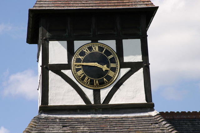
With a population of around 200 inhabitants, Haselour is known for its tranquil and idyllic setting. The village is characterized by a handful of traditional cottages and farmhouses, giving it a charming rural atmosphere. The centerpiece of the village is the beautiful St. Mary's Church, a Grade II listed building that dates back to the 13th century. This historic church attracts visitors from near and far, fascinated by its architecture and rich history.

Despite its small size, Haselour boasts a strong sense of community. The village has a close-knit population, and residents often come together to organize events and activities throughout the year. The village hall serves as a hub for various community gatherings, including local clubs, meetings, and social events.

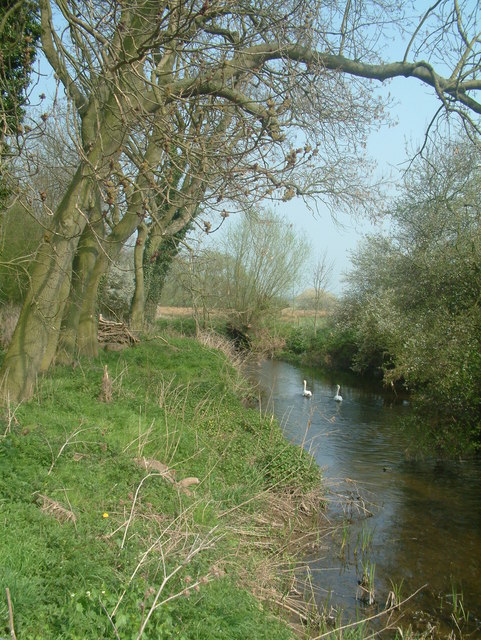
Surrounding Haselour, there are ample opportunities for outdoor activities such as hiking and cycling, with numerous footpaths and trails winding through the stunning Staffordshire countryside. The nearby National Forest provides additional recreational options, making Haselour an attractive destination for nature enthusiasts.

Overall, Haselour offers a peaceful and charming rural lifestyle, with its picturesque surroundings, historic landmarks, and strong community spirit.

If you have any feedback on the listing, please let us know in the comments section below.
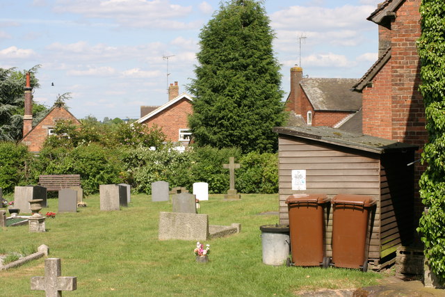
Haselour Images

Images are sourced within 2km of 52.691874/-1.6952631 or Grid Reference SK2010. Thanks to Geograph Open Source API. All images are credited.

St Matthews Church  (1) The above photograph shows the Gate and Main entrance to St Matthews Church.
St Matthews Church (1)
The above photograph shows the Gate and Main entrance to St Matthews Church.
St Matthews Church  (2) The above photograph shows a view of St Matthews Church, Clock Tower. This photograph <a href="https://www.geograph.org.uk/photo/2423117">SK2110 : St Matthews Church  (1)</a> shows another view of this Church.
St Matthews Church (2)
The above photograph shows a view of St Matthews Church, Clock Tower. This photograph SK2110 : St Matthews Church (1) shows another view of this Church.
St Matthews  Church  (3) The above photograph shows a Close up of the Clock face, seen in this photograph <a href="https://www.geograph.org.uk/photo/2423141">SK2110 : St Matthews Church  (2)</a>
St Matthews Church (3)
The above photograph shows a Close up of the Clock face, seen in this photograph SK2110 : St Matthews Church (2)
St Matthews Church  (4) The above photograph shows a Flower filled pot, at the entrance to the Church grounds. This photograph <a href="https://www.geograph.org.uk/photo/2423152">SK2110 : St Matthews  Church  (3)</a> shows another view of this Church.
St Matthews Church (4)
The above photograph shows a Flower filled pot, at the entrance to the Church grounds. This photograph SK2110 : St Matthews Church (3) shows another view of this Church.
St Matthew Church  (5) This photograph <a href="https://www.geograph.org.uk/photo/2423117">SK2110 : St Matthews Church  (1)</a> shows another view of this Church.
St Matthew Church (5)
This photograph SK2110 : St Matthews Church (1) shows another view of this Church.
St Matthews Church  (6) The above photograph shows a Close up of some of the Iron work, on the main entrance gate. This photograph <a href="https://www.geograph.org.uk/photo/2423117">SK2110 : St Matthews Church  (1)</a>  shows this gate in a wider context.
St Matthews Church (6)
The above photograph shows a Close up of some of the Iron work, on the main entrance gate. This photograph SK2110 : St Matthews Church (1) shows this gate in a wider context.
St Matthews Church  (7) This photograph <a href="https://www.geograph.org.uk/photo/2423141">SK2110 : St Matthews Church  (2)</a> shows a view of this Church.
St Matthews Church (7)
This photograph SK2110 : St Matthews Church (2) shows a view of this Church.
St Matthews Church  (8) This photograph <a href="https://www.geograph.org.uk/photo/2423192">SK2110 : St Matthew Church  (5)</a> shows a view of this Church.
St Matthews Church (8)
This photograph SK2110 : St Matthew Church (5) shows a view of this Church.
St Matthews Church  (9) This photograph <a href="https://www.geograph.org.uk/photo/2423322">SK2110 : St Matthews Church  (7)</a> shows another view of this Graveyard.
St Matthews Church (9)
This photograph SK2110 : St Matthews Church (7) shows another view of this Graveyard.
St Matthews Church  (10) The above photograph shows a close up view of the stone carved Angel, on this Headstone, located on the left handside of this photograph <a href="https://www.geograph.org.uk/photo/2423352">SK2110 : St Matthews Church  (9)</a>
St Matthews Church (10)
The above photograph shows a close up view of the stone carved Angel, on this Headstone, located on the left handside of this photograph SK2110 : St Matthews Church (9)
St Matthews Church  (11) The above photograph shows a view of one of the stained glass windows lining one side of this church. This photograph <a href="https://www.geograph.org.uk/photo/2423117">SK2110 : St Matthews Church  (1)</a> shows the location of this stained glass window, the above window is the one located between the main entrance and the two headstones.
St Matthews Church (11)
The above photograph shows a view of one of the stained glass windows lining one side of this church. This photograph SK2110 : St Matthews Church (1) shows the location of this stained glass window, the above window is the one located between the main entrance and the two headstones.
St  Matthews Church  (12) The above photograph shows a view the Church gates seen in this photograph <a href="https://www.geograph.org.uk/photo/2423117">SK2110 : St Matthews Church  (1)</a> but taken facing in the opposite direction.
St Matthews Church (12)
The above photograph shows a view the Church gates seen in this photograph SK2110 : St Matthews Church (1) but taken facing in the opposite direction.
St Matthews Church  (13) This photograph <a href="https://www.geograph.org.uk/photo/2423367">SK2110 : St Matthews Church  (10)</a> shows another view of this Graveyard.
St Matthews Church (13)
This photograph SK2110 : St Matthews Church (10) shows another view of this Graveyard.
St Matthews Church  (14) This photograph <a href="https://www.geograph.org.uk/photo/2423341">SK2110 : St Matthews Church  (8)</a> shows another view of this Church.
St Matthews Church (14)
This photograph SK2110 : St Matthews Church (8) shows another view of this Church.
St Matthews Church  (15) This photograph <a href="https://www.geograph.org.uk/photo/2423403">SK2110 : St Matthews Church  (11)</a> shows another view of this Church.
St Matthews Church (15)
This photograph SK2110 : St Matthews Church (11) shows another view of this Church.
Main Road The road in the above photograph is located outside the Church, in this photograph <a href="https://www.geograph.org.uk/photo/2423117">SK2110 : St Matthews Church  (1)</a>
Main Road
The road in the above photograph is located outside the Church, in this photograph SK2110 : St Matthews Church (1)
The Black Horse, Edingale
Across Road, Fence and Field to Edingale This is a view back to Edingale from the West, the old barn at Broadfields  farm SK2112 can be seen to the left of picture.
Across Road, Fence and Field to Edingale
This is a view back to Edingale from the West, the old barn at Broadfields farm SK2112 can be seen to the left of picture.
Show me another place!

Haselour is located at Grid Ref: SK2010 (Lat: 52.691874, Lng: -1.6952631)

Administrative County: Staffordshire

District: Lichfield

Police Authority: Staffordshire

What 3 Words

///dignify.duplicate.cowering. Near Whittington, Staffordshire

Nearby Locations

Cartersclose Pond Haselour

Related Wikis

Elford railway station

Elford railway station was a railway station serving the village of Elford and the manor of Haselour Hall in Staffordshire. == History == It was opened...

Harlaston

Harlaston is a village and civil parish in Staffordshire, England. It lies on the River Mease, about 5 miles (8 km) north of Tamworth. There is an Early...

Elford

Elford is a village and civil parish in Lichfield District, Staffordshire, England. It is on the east bank of the River Tame, about 5 miles (8 km) east...

Edingale

Edingale is a village and civil parish in Lichfield District, Staffordshire, England. It lies on the River Mease, around 7 miles (11 km) north of Tamworth...

St Peter's Church, Elford

St Peter's Church, Elford is a parish church in the village of Elford, Staffordshire in the United Kingdom. The church is situated on the eastern edge...

Haunton

Haunton is a village in Staffordshire, England. It lies on the River Mease, about 7 miles (11 km) north of Tamworth, 1½ miles east of Harlaston and 1 mile...

River Mease

The River Mease is a lowland clay river in the Midlands area of England. It flows through the counties of Leicestershire, Derbyshire and Staffordshire...

St John the Baptist's Church, Croxall

St John the Baptist's Church, Croxall is a Grade II* listed parish church in the Church of England in Croxall. == History == The earliest parts of the...

Nearby Amenities

Located within 500m of 52.691874,-1.6952631
Haselour
Place: hamlet
Lat/Long: 52.6940925/-1.6968047
Power: pole
Source: bing
Lat/Long: 52.6943332/-1.7003851
Crossing
Lat/Long: 52.6929009/-1.697681
Crossing
Lat/Long: 52.6931499/-1.6984564
Crossing
Lat/Long: 52.6930855/-1.6985732
Crossing
Lat/Long: 52.6927515/-1.6977407
Crossing
Lat/Long: 52.692778/-1.697691
Power: pole
Source: bing
Transformer: distribution
Lat/Long: 52.6911453/-1.7014901
Power: pole
Source: bing
Lat/Long: 52.6916557/-1.7010543
Power: pole
Source: bing
Lat/Long: 52.6922036/-1.7006077
Power: pole
Source: bing
Transformer: distribution
Lat/Long: 52.6934489/-1.7002818
Power: pole
Source: bing
Lat/Long: 52.6950736/-1.7004561
The data included in this document is from www.openstreetmap.org. The data is made available under ODbL.

Have you been to Haselour?

Leave your review of Haselour below (or comments, questions and feedback).