Harpsden Heights
Settlement in Oxfordshire South Oxfordshire
England
Harpsden Heights

Harpsden Heights is a picturesque village located in the southern region of Oxfordshire, England. Situated in the Chiltern Hills, this charming rural area is known for its stunning natural beauty and tranquil atmosphere. Harpsden Heights is surrounded by lush green fields, rolling hills, and dense woodlands, providing residents with ample opportunities for outdoor activities and exploration.
The village itself is relatively small, with a population of around 500 inhabitants. It is characterized by its traditional English architecture, featuring quaint cottages made of local stone, thatched roofs, and well-tended gardens. The community is tightly-knit, with a friendly and welcoming atmosphere that makes it appealing to both families and retirees.
Although Harpsden Heights may be small, it offers a range of amenities to cater to its residents' needs. The village has a local pub, which serves as a popular meeting spot for both locals and visitors. There is also a small convenience store, providing essentials and groceries to the community. For more extensive shopping and entertainment options, the nearby town of Henley-on-Thames is just a short drive away.
The village benefits from its close proximity to the River Thames, which offers opportunities for boating, fishing, and leisurely walks along its banks. Additionally, the surrounding countryside is crisscrossed by a network of footpaths and bridleways, allowing residents to fully immerse themselves in the area's natural beauty.
Overall, Harpsden Heights is a charming village nestled in the heart of the Oxfordshire countryside, offering a peaceful and idyllic setting for those seeking a slower pace of life.
If you have any feedback on the listing, please let us know in the comments section below.
Harpsden Heights Images
Images are sourced within 2km of 51.525552/-0.90078038 or Grid Reference SU7681. Thanks to Geograph Open Source API. All images are credited.


Harpsden Heights is located at Grid Ref: SU7681 (Lat: 51.525552, Lng: -0.90078038)
Administrative County: Oxfordshire
District: South Oxfordshire
Police Authority: Thames Valley
What 3 Words
///staple.aquatic.frostbite. Near Henley-on-Thames, Oxfordshire
Nearby Locations
Related Wikis
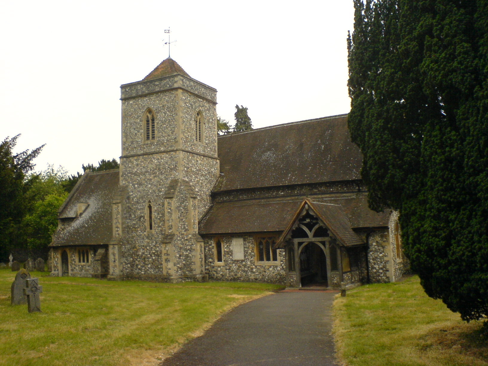
Harpsden
Harpsden is a rural and semi-rural village and civil parish immediately south of Henley-on-Thames in South Oxfordshire, Oxfordshire, England. Its scattered...

Henley Town F.C.
Henley Town Football Club is a football club based in Henley-on-Thames in Oxfordshire, England. They are currently members of the Thames Valley Premier...

River and Rowing Museum
The River & Rowing Museum in Henley-on-Thames, Oxfordshire, England, is located on a site at Mill Meadows by the River Thames. It has three main themes...
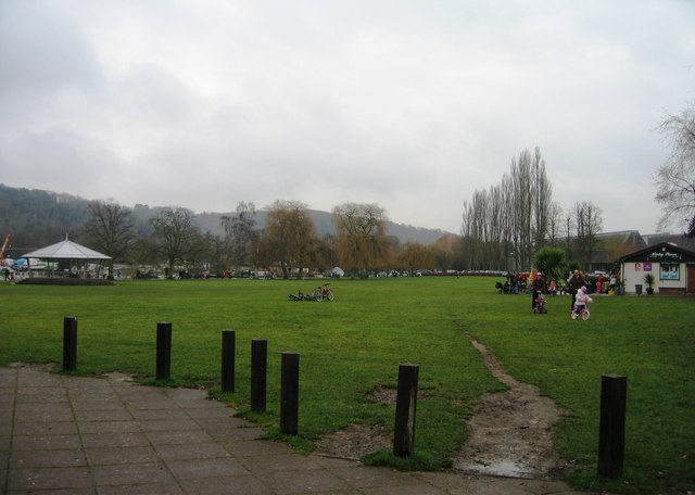
Mill Meadows, Henley-on-Thames
Mill Meadows is part of the flood plain of the River Thames at Henley-on-Thames, Oxfordshire, England. It is an area of natural beauty close to the town...
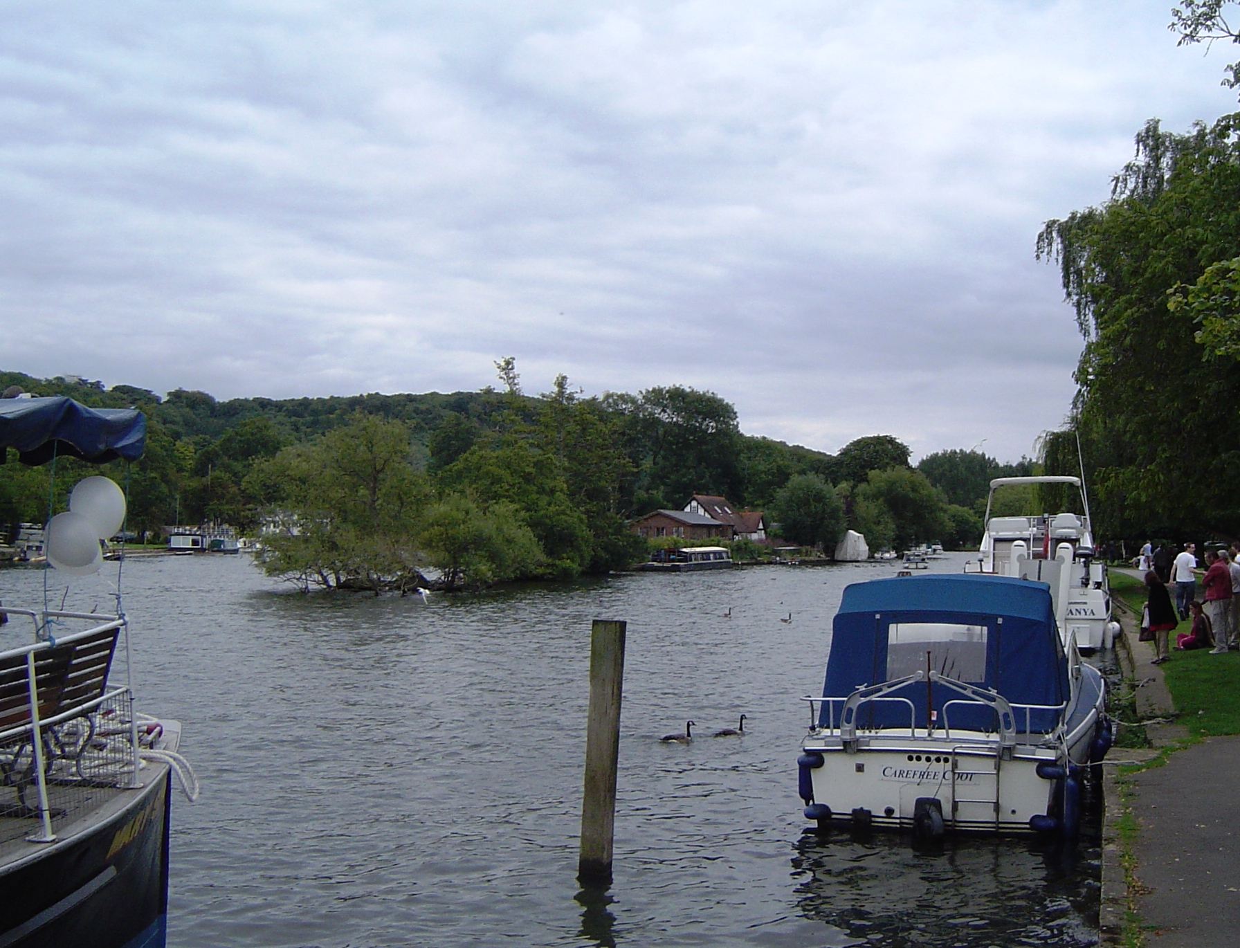
Rod Eyot
Rod Eyot or Rod Ait is an island in the River Thames in England near Henley-on-Thames on the reach above Hambledon Lock. It is close to Mill Meadows and...
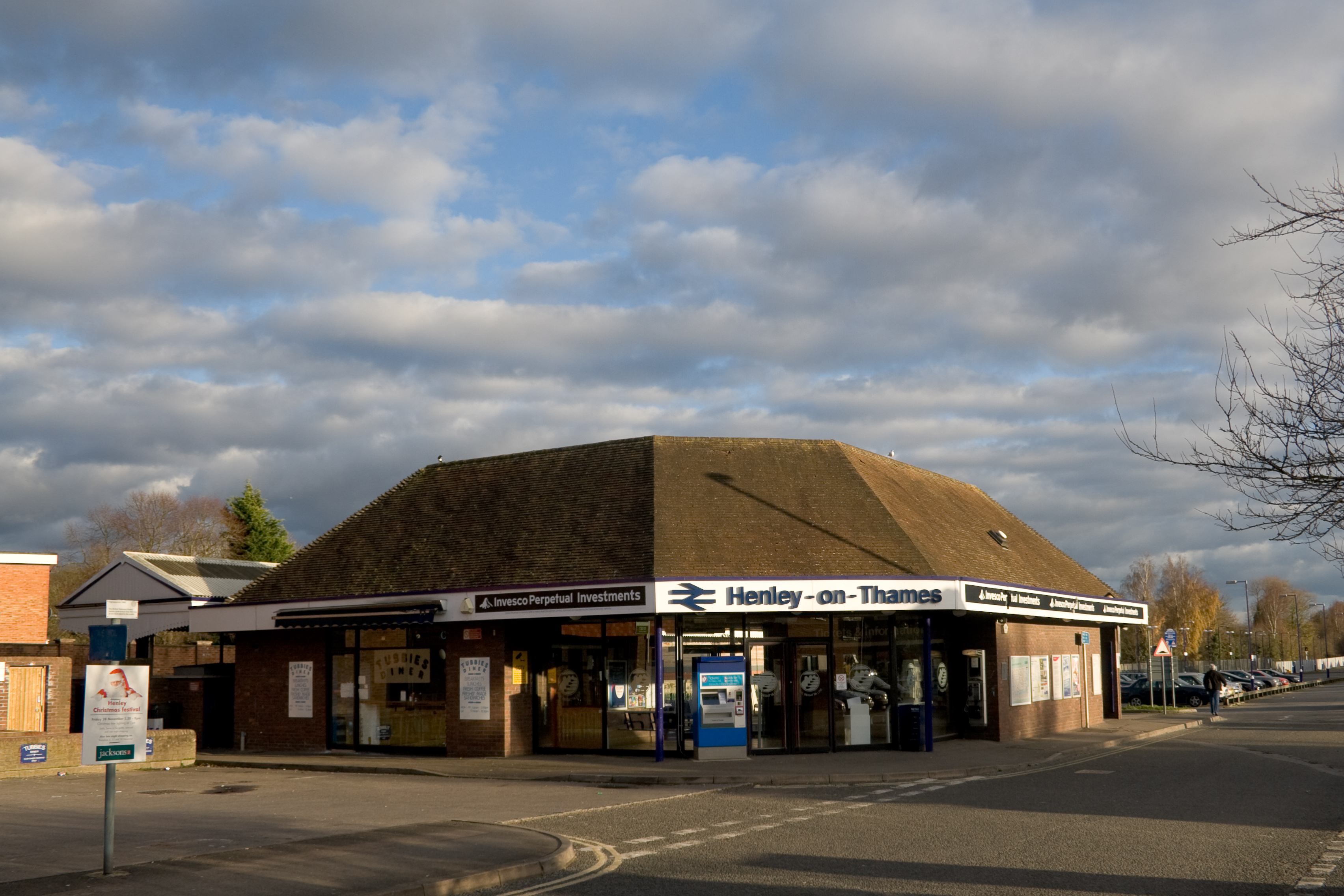
Henley-on-Thames railway station
Henley-on-Thames is a terminal railway station in the town of Henley-on-Thames in Oxfordshire, England. The station is on the Henley-on-Thames branch line...
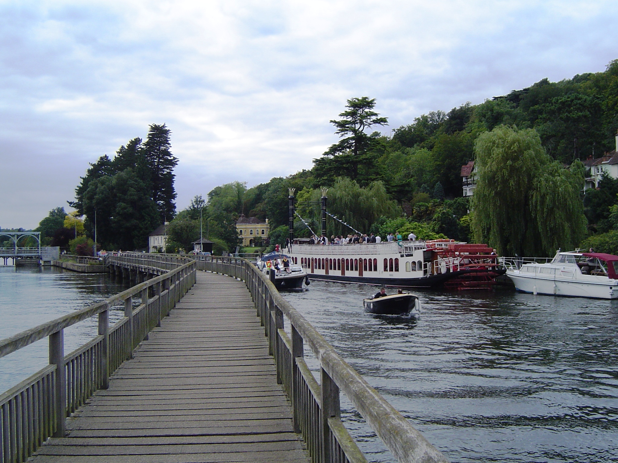
Marsh Lock
Marsh Lock is a lock and weir situated on the River Thames in England, about 1 mile upstream of Henley Bridge in Henley-on-Thames, Oxfordshire. The lock...
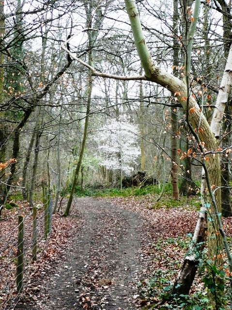
Harpsden Wood
Harpsden Wood is a 29.4-hectare (73-acre) biological Site of Special Scientific Interest south of Henley-on-Thames in Oxfordshire. It is owned by the Woodland...
Related Videos
![HENLEY-ON-THAMES, ENGLAND | WALKING TOUR [4K]](https://i.ytimg.com/vi/he53pVMg01k/hqdefault.jpg)
HENLEY-ON-THAMES, ENGLAND | WALKING TOUR [4K]
Join this channel to access its perks: https://www.youtube.com/channel/UC3_qdtTCsHa1uK4_cmianUA/join Check out my website ...

Walking Henley-on-Thames in 4K UHD 60FPS | Home of Henley Regatta | March 2023
Join us on a morning walk through the historic town of Henley-on-Thames in England. Henley is famous for its historic Henley ...

Henley-on-Thames, Most Beautiful Town in Oxfordshire, England #england #travel #travelvlog
Welcome to Henley-on-Thames, one of the most beautiful towns in England If you live outside of Henley and you would like help ...
Henley On Thames Bridge Travel in UK #travel #unitedkingdom #england
Follow us on Instagram @Acidental_ • INBETWEEN DAYS (The Cure Tribute) on: ...
Nearby Amenities
Located within 500m of 51.525552,-0.90078038Have you been to Harpsden Heights?
Leave your review of Harpsden Heights below (or comments, questions and feedback).