Harley Wood
Settlement in Lancashire
England
Harley Wood
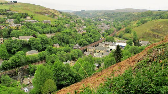
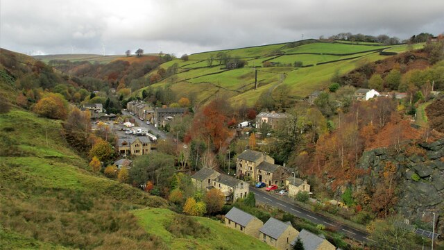
Harley Wood is a small village located in the county of Lancashire, in the northwest of England. Situated in the borough of Rossendale, it is nestled in a picturesque valley surrounded by rolling hills and lush green countryside. The village is part of the larger community of Helmshore, with which it shares amenities and services.
With a population of around 1,500 residents, Harley Wood has a tight-knit community that prides itself on its rural charm and friendly atmosphere. The village is primarily residential, consisting of a mix of traditional stone-built cottages and more modern houses. Many of the properties offer stunning views of the surrounding countryside, adding to the village's appeal.
Despite its small size, Harley Wood has a few amenities to cater to the needs of its residents. These include a local pub, a convenience store, and a primary school, providing essential services close to home. However, for more extensive shopping and entertainment options, residents can easily access nearby towns such as Rawtenstall and Ramsbottom.
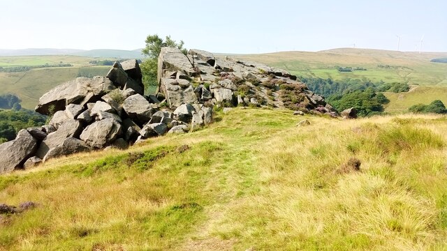
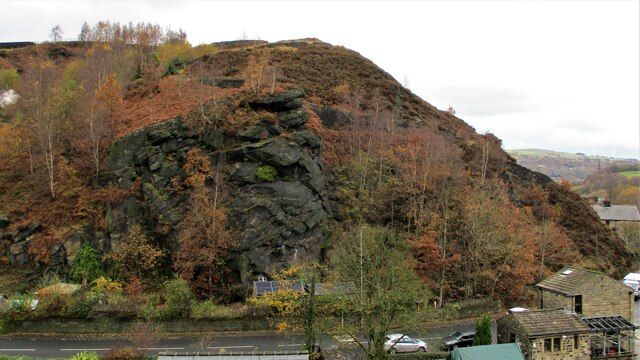
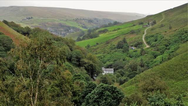
Harley Wood boasts an abundance of natural beauty and outdoor recreational opportunities. The village is surrounded by several parks and open spaces, offering residents and visitors plenty of opportunities for hiking, biking, and leisurely walks. The nearby Rossendale Valley also provides stunning scenery, with reservoirs, forests, and hills ready to be explored.
In summary, Harley Wood is a charming and idyllic village in Lancashire, offering a peaceful and rural lifestyle within close proximity to larger towns and beautiful natural landscapes.
If you have any feedback on the listing, please let us know in the comments section below.
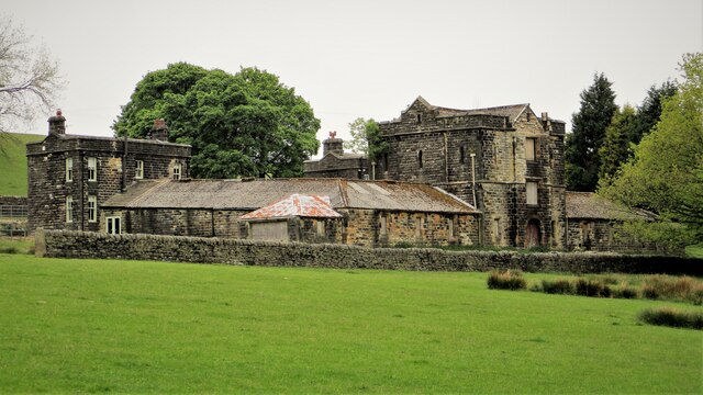
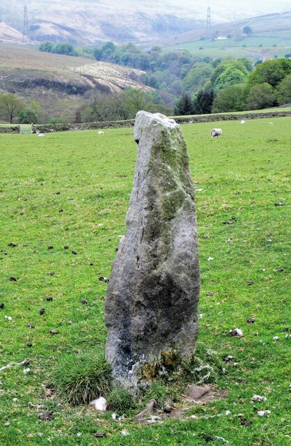
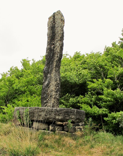
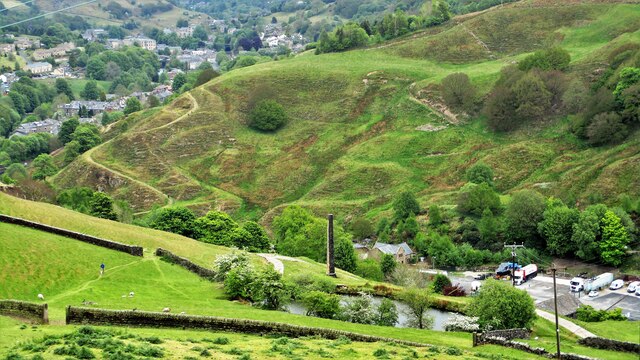
Harley Wood Images
Images are sourced within 2km of 53.720008/-2.1104027 or Grid Reference SD9224. Thanks to Geograph Open Source API. All images are credited.


Harley Wood is located at Grid Ref: SD9224 (Lat: 53.720008, Lng: -2.1104027)
Unitary Authority: Calderdale
Police Authority: West Yorkshire
What 3 Words
///firework.builds.poem. Near Todmorden, West Yorkshire
Nearby Locations
Related Wikis

Todmorden High School
Todmorden High School is a comprehensive school in the town of Todmorden, Calderdale LEA, West Yorkshire, England. == Admissions == Todmorden High School...

Todmorden War Memorial
Todmorden War Memorial is a war memorial located in Todmorden, West Yorkshire, England.The memorial is in the garden of remembrance in Centre Vale Park...
Mons Mill, Todmorden
Mons Mill, Todmorden, is a former cotton spinning mill in Todmorden, Calderdale, West Yorkshire, England built for the Hare Spinning Company Limited. It...
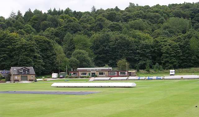
Todmorden Cricket Club
Todmorden Cricket Club is a cricket club in the Lancashire League, which plays its home games at Centre Vale in Todmorden, West Yorkshire. Until the administrative...

Todmorden railway station
Todmorden railway station serves the town of Todmorden in West Yorkshire, England, originally on the Yorkshire and Lancashire border. It was built by the...

Todmorden bus station
Todmorden bus station serves the town of Todmorden, West Yorkshire, England. The bus station is owned and managed by West Yorkshire Metro and was opened...

Stansfield Hall railway station
Stansfield Hall railway station (English: ) was the second station in Stansfield, Todmorden in West Yorkshire, England and was situated on the Copy Pit...

Dobroyd Castle
Dobroyd Castle is an important historic building above the town of Todmorden, West Yorkshire, England. It was built for John Fielden, local mill owner...
Related Videos

Summer Hiking: Gaddings Dam🧗🏻📍🚞
Hi guys!!! Glad to see you again. Enjoy this vlog and drop your comment below.

ABANDONING ROCHDALE #todmorden #tourism Canal Walks
It must've been OK there at some point I guess? Todmorden Tourism, get to Tod on Rochdale Canal. Music by @thefamousclive.

Lobb Mill Picnic Site -Todmorden Walks - #todmorden #tourism
A small wander you might be able to do. Some information may be invented. Music by @thefamousclive.

VISIT TODMORDEN - Wish You Were Here? #todmorden #tourism
Visit Todmorden today. Free parking somewhere, a Lidl and an Aldi. Wish you were here. Music by @UkeofCarl.
Nearby Amenities
Located within 500m of 53.720008,-2.1104027Have you been to Harley Wood?
Leave your review of Harley Wood below (or comments, questions and feedback).