Grimblethorpe

Settlement in Lincolnshire East Lindsey

England

Grimblethorpe

Burgh on Bain - St Helen's Church
Burgh on Bain - St Helen's Church Credit: Colin Park

Grimblethorpe is a small village located in the East Lindsey district of Lincolnshire, England. Situated approximately 5 miles northeast of Louth, it is nestled in the picturesque Lincolnshire Wolds, an Area of Outstanding Natural Beauty.

With a population of around 200 residents, Grimblethorpe boasts a tight-knit community that thrives on the region's rich agricultural heritage. The village is characterized by its charming, traditional cottages made from local stone, giving it a quintessentially English countryside feel.

The village is surrounded by rolling hills and lush green fields, making it an ideal destination for nature lovers and outdoor enthusiasts. The area offers numerous walking and cycling trails that allow visitors to explore the stunning landscapes and enjoy breathtaking views of the surrounding countryside.

While Grimblethorpe is primarily a residential area, it is within close proximity to larger towns and cities, providing easy access to amenities and services. Louth, the nearest town, offers a range of shops, pubs, and restaurants, as well as schools and healthcare facilities.

Grimblethorpe is also known for its annual village fete, where locals and visitors come together to celebrate community spirit and enjoy traditional games, music, and delicious local food.

Overall, Grimblethorpe is a tranquil and picturesque village that offers a peaceful retreat for those seeking a slower pace of life amidst the natural beauty of the Lincolnshire Wolds.

If you have any feedback on the listing, please let us know in the comments section below.

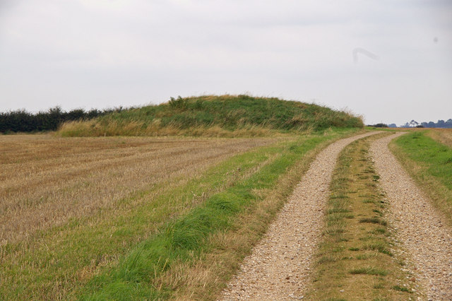
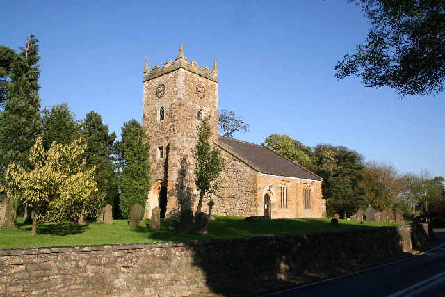
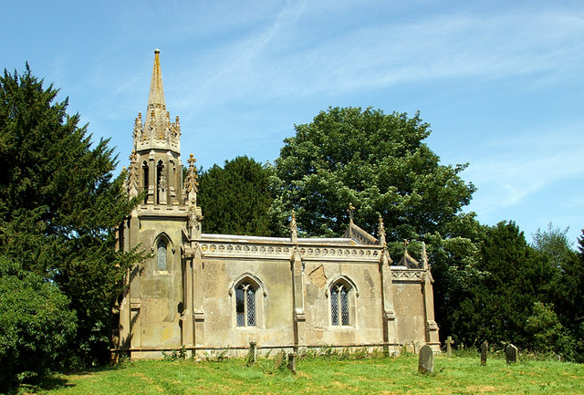
Grimblethorpe Images

Images are sourced within 2km of 53.36011/-0.14269056 or Grid Reference TF2386. Thanks to Geograph Open Source API. All images are credited.

Burgh on Bain - St Helen's Church
Field path leading northeast towards Gayton le Wold
Gayton le Wold - St Peter's Church
Ford over River Bain at Biscathorpe
Biscathorpe - St Helen's Church
Gently undulating fields SE of Biscathorpe Plantation, Lincs
Grim's Mound, Grimblethorpe, Lincs The monument includes the earthwork remains of a bowl barrow known as Grim's
Mound located 110m above sea level in a commanding position on the summit of a
spur between the River Bain and one of its tributaries. It is a grassy mound
some 19m in diameter and 2.6m high, situated adjacent to a trackway running
between the sites of the medieval villages of Biscathorpe and Calcethorpe.
This trackway, which is today known as the Viking Way, overlies the eastern
perimeter of the monument and it bends slightly at this point.
Chance finds of worked flint have been recovered from the plough soil around
the monument which itself is largely undisturbed. Although the encircling
ditch, from which material for the mound was quarried, is not visible, it is
thought to survive buried beneath the present ground surface. (source ancientmonuments.co.uk)
Grim's Mound, Grimblethorpe, Lincs
The monument includes the earthwork remains of a bowl barrow known as Grim's Mound located 110m above sea level in a commanding position on the summit of a spur between the River Bain and one of its tributaries. It is a grassy mound some 19m in diameter and 2.6m high, situated adjacent to a trackway running between the sites of the medieval villages of Biscathorpe and Calcethorpe. This trackway, which is today known as the Viking Way, overlies the eastern perimeter of the monument and it bends slightly at this point. Chance finds of worked flint have been recovered from the plough soil around the monument which itself is largely undisturbed. Although the encircling ditch, from which material for the mound was quarried, is not visible, it is thought to survive buried beneath the present ground surface. (source ancientmonuments.co.uk)
Soilmarks of old quarries east of Grimblethorpe: aerial 2023
Saint Helen's Church, Burgh on Bain The charming little church occupies an ancient  site where its  structure  evolved over a thousand years.
Saint Helen's Church, Burgh on Bain
The charming little church occupies an ancient site where its structure evolved over a thousand years.
On The Viking Way south of Little Gayton
Former chalk pit west of Gayton-le-Wold
Cattle at Gayton Manor
Gayton le Wold - St Peter's Church
Cracked pane of glass above the altar Gayton le Wold - St Peter's Church
Cracked pane of glass above the altar
Gayton le Wold - St Peter's Church
Farm track south of Gayton le Wold
Farm track south west of Grange Farm, Gayton le Wold
Path to Grange Farm, Gayton le Wold
Footbridge over The River Bain At Biscathorpe
Footbridge over The River Bain
At Biscathorpe
Show me another place!

Grimblethorpe is located at Grid Ref: TF2386 (Lat: 53.36011, Lng: -0.14269056)

Division: Parts of Lindsey

Administrative County: Lincolnshire

District: East Lindsey

Police Authority: Lincolnshire

What 3 Words

///cabbage.fizzle.moderated. Near Louth, Lincolnshire

Nearby Locations

Grimblethorpe Grims Mound

Related Wikis

Grimblethorpe

Grimblethorpe is a hamlet in the East Lindsey district of Lincolnshire, England. It is situated 6 miles (10 km) west from Louth and just north of the village...

Gayton le Wold

Gayton le Wold is a village and civil parish in the East Lindsey district of Lincolnshire, England. It lies 6 miles (10 km) west from Louth, 3 miles (5...

Burgh on Bain

Burgh on Bain is a village and civil parish in the East Lindsey district of Lincolnshire, England. It is situated on the A157 road, 7 miles (11 km) west...

Biscathorpe

Biscathorpe is an ecclesiastical parish, deserted medieval village and former civil parish, now in the parish of Gayton le Wold, in the East Lindsey district...

Nearby Amenities

Located within 500m of 53.36011,-0.14269056
Gayton le Wold
Is In: Lincolnshire, England, UK
Place: hamlet
Source: Bing
Lat/Long: 53.3583327/-0.1415952
Note: Farm traffic turning warning sign
Source: survey
Traffic Sign Forward: GB:553.1,553.2[Farm traffic turning]
Lat/Long: 53.3595703/-0.138681
Grimblethorpe
Place: hamlet
Source: Bing
Wikidata: Q5609231
Lat/Long: 53.3593408/-0.1431774
Bus Stop
Gayton Le Wold Lane End
Bus: yes
Naptan AtcoCode: 2700LGGW1696
Naptan Bearing: W
Naptan CommonName: Gayton Le Wold Lane End
Naptan Indicator: adj
Naptan Landmark: Gayton Le Wold Lane End
Naptan NaptanCode: linamjap
Naptan Street: Louth Road
Naptan Verified: no
Physically Present: no
Public Transport: platform
Source: naptan_import
Lat/Long: 53.3593729/-0.1418075
Bus Stop
Gayton Le Wold Lane End
Bus: yes
Naptan AtcoCode: 2700LGGW6499
Naptan Bearing: E
Naptan CommonName: Gayton Le Wold Lane End
Naptan Indicator: opp
Naptan Landmark: Gayton Le Wold Lane End
Naptan NaptanCode: lingdjtp
Naptan Street: Louth Road
Naptan Verified: yes
Physically Present: no
Public Transport: platform
Source: naptan_import
Lat/Long: 53.3595014/-0.1419823
Note: Farm traffic turning warning sign
Source: survey
Traffic Sign Backward: GB:553.1,553.2[Farm traffic turning]
Lat/Long: 53.3608117/-0.146739
Parking
Fee: no
Note: Layby
Parking: surface
Lat/Long: 53.3596019/-0.141071
Board Type: board
Information: board
Source: survey
Tourism: information
Lat/Long: 53.3596366/-0.1411623
Power: pole
Lat/Long: 53.3571129/-0.1473973
Power: pole
Lat/Long: 53.3577071/-0.1467941
Power: pole
Lat/Long: 53.3582856/-0.146216
Power: pole
Lat/Long: 53.3588751/-0.1456335
Power: pole
Lat/Long: 53.3595014/-0.1450131
Power: pole
Lat/Long: 53.3606692/-0.143832
Power: pole
Lat/Long: 53.3612687/-0.1432261
Power: pole
Lat/Long: 53.3617374/-0.1427517
Power: pole
Lat/Long: 53.3623369/-0.1422963
Power: pole
Lat/Long: 53.362925/-0.1418288
Power: pole
Lat/Long: 53.363512/-0.1413634
Power: pole
Lat/Long: 53.3640901/-0.140911
Power: pole
Lat/Long: 53.3600863/-0.1444216
Power: pole
Lat/Long: 53.3571107/-0.1381458
Power: pole
Lat/Long: 53.3568898/-0.1430563
Power: pole
Lat/Long: 53.3569963/-0.1427814
Power: pole
Lat/Long: 53.3613767/-0.1414711
Power: pole
Lat/Long: 53.361075/-0.1419861
Power: pole
Lat/Long: 53.3608701/-0.1423522
Power: pole
Lat/Long: 53.3607788/-0.1425031
Power: pole
Lat/Long: 53.3604443/-0.142841
Power: pole
Lat/Long: 53.3601438/-0.1431508
Power: pole
Lat/Long: 53.3598244/-0.1434828
Power: pole
Lat/Long: 53.3594667/-0.1431193
Power: pole
Lat/Long: 53.3590517/-0.1426613
Power: pole
Lat/Long: 53.3587127/-0.1422912
Power: pole
Lat/Long: 53.3582973/-0.1425473
Power: pole
Lat/Long: 53.3578451/-0.1428323
Power: pole
Lat/Long: 53.3576106/-0.1429752
Power: pole
Lat/Long: 53.3574117/-0.1429175
Power: pole
Lat/Long: 53.3586573/-0.1421126
Power: pole
Lat/Long: 53.3579844/-0.1399376
Power: pole
Lat/Long: 53.3586027/-0.1419365
Power: pole
Lat/Long: 53.3576686/-0.142263
Power: pole
Lat/Long: 53.3574817/-0.1416642
Power: pole
Lat/Long: 53.3577077/-0.139043
Power: pole
Lat/Long: 53.3583874/-0.1412406
Barrier: stile
Lat/Long: 53.3587559/-0.142037
Barrier: cattle_grid
Lat/Long: 53.3566472/-0.1412941
Barrier: stile
Lat/Long: 53.3587242/-0.1419354
Barrier: stile
Lat/Long: 53.3571077/-0.1441382
Barrier: stile
Lat/Long: 53.357031/-0.1429038
Post Box
Operator: Royal Mail
Post Box Type: lamp
Lat/Long: 53.3596372/-0.1411982
The data included in this document is from www.openstreetmap.org. The data is made available under ODbL.

Have you been to Grimblethorpe?

Leave your review of Grimblethorpe below (or comments, questions and feedback).