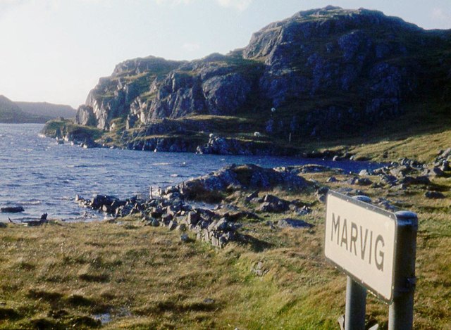
Marvig

Settlement in Ross-shire

Scotland

Marvig

Loch Chromor
Loch Chromor Credit: Alan Reid

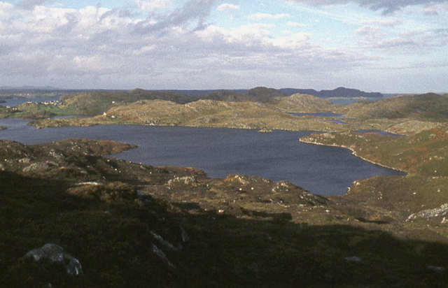
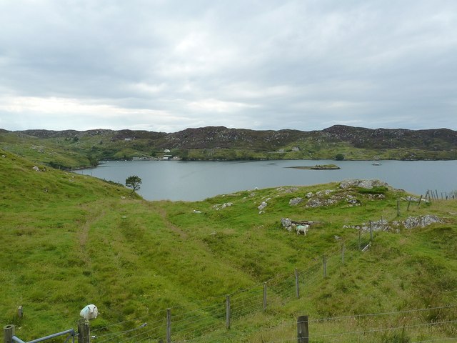
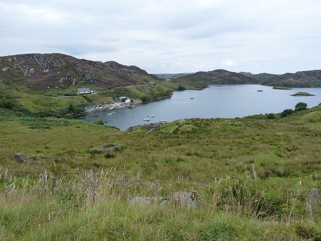
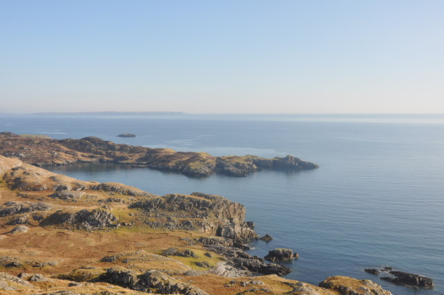
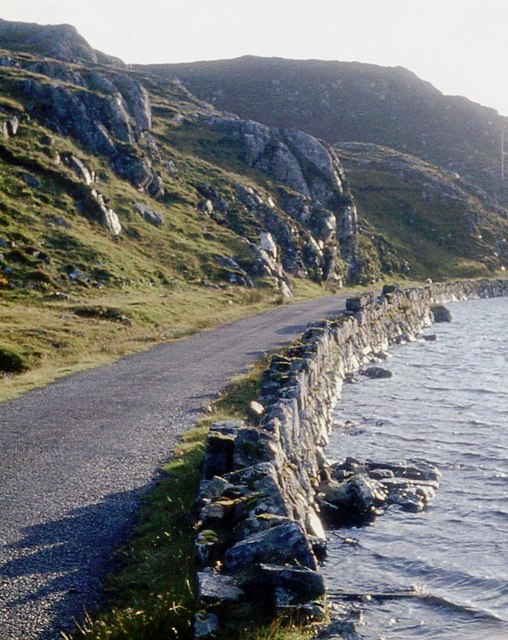
Marvig is a small village located in the county of Ross-shire, in the Highlands region of Scotland. Situated on the western coast of the country, Marvig is surrounded by picturesque landscapes, including rolling hills, lush green fields, and breathtaking views of the Atlantic Ocean.

With a population of around 300 residents, Marvig is known for its close-knit community and tranquil atmosphere. The village is predominantly residential, with a few local amenities such as a small convenience store, a post office, and a primary school. For more extensive shopping and entertainment options, residents often travel to nearby towns like Stornoway or Ullapool.

Marvig's economy is primarily based on agriculture, with many residents involved in farming and crofting activities. The village's fertile land and favorable climate make it ideal for cultivating crops and rearing livestock.

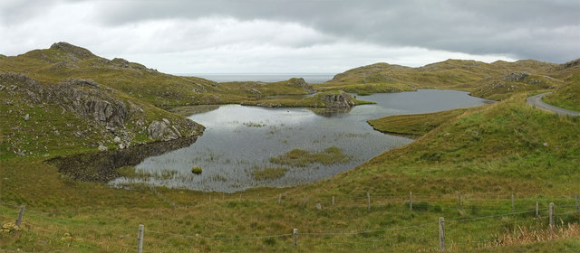
Nature enthusiasts and outdoor lovers are drawn to Marvig due to its proximity to stunning natural attractions. The village is surrounded by several beautiful beaches, including the popular Traigh na Berie, which offers opportunities for swimming, sunbathing, and coastal walks. The area is also renowned for its wildlife, with abundant bird species and the occasional sighting of seals and dolphins along the coastline.

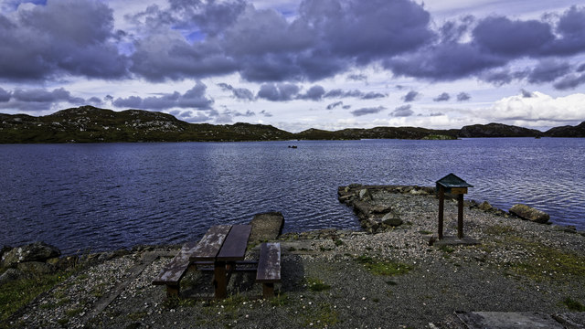
Marvig's location provides easy access to various outdoor activities, such as hiking, fishing, and cycling. The nearby mountains and lochs offer scenic trails and fishing spots, attracting both locals and tourists.

Overall, Marvig is a charming village that offers a peaceful retreat in the midst of Scotland's breathtaking natural beauty.

If you have any feedback on the listing, please let us know in the comments section below.
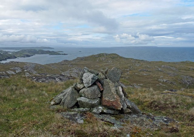
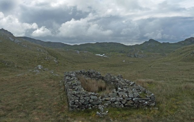
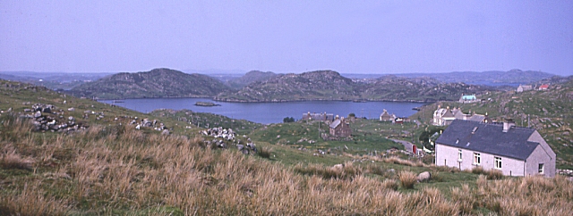
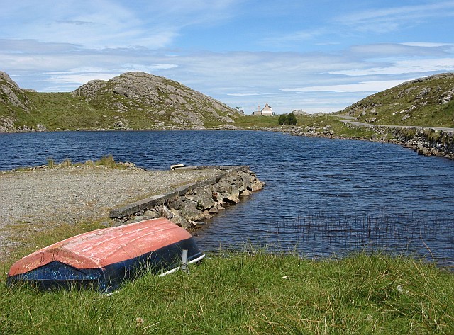
Marvig Images

Images are sourced within 2km of 58.083697/-6.3886044 or Grid Reference NB4118. Thanks to Geograph Open Source API. All images are credited.

Loch Chromor
Loch Chromor
Loch na Buaile Duibhe The sea can just be seen in the distance.
Loch na Buaile Duibhe
The sea can just be seen in the distance.
Telephone Box, Marvig (Marbhig) In case you don't recognize the classic bright red K6 telephone box for what it is, there is a splendid enamelled sign with a wrought iron frame to make sure you do !
Telephone Box, Marvig (Marbhig)
In case you don't recognize the classic bright red K6 telephone box for what it is, there is a splendid enamelled sign with a wrought iron frame to make sure you do !
Loch Mharabhig from Rubha na h-Easgainn, Marvig Loch Mharabhig forms a natural harbour for the community of Marvig (Marbhig), the "capital" of the Lochs area of southeastern Lewis. The little islet which can be seen in the loch is Sgeir a' Bhuic.
Loch Mharabhig from Rubha na h-Easgainn, Marvig
Loch Mharabhig forms a natural harbour for the community of Marvig (Marbhig), the "capital" of the Lochs area of southeastern Lewis. The little islet which can be seen in the loch is Sgeir a' Bhuic.
Loch Mharabhig from the south This view into Loch Mharabhig is effectively out to sea, though there are various islands, islets and channels to navigate around to exit this natural harbour.
The nearest islet is Sgeir a'Bhuic while the slightly more distant one is Sgeir Ghlas
Loch Mharabhig from the south
This view into Loch Mharabhig is effectively out to sea, though there are various islands, islets and channels to navigate around to exit this natural harbour. The nearest islet is Sgeir a'Bhuic while the slightly more distant one is Sgeir Ghlas
Islet with purple flowers I thought at first that the purple flowers adding a dash of colour to this tiny islet in the middle of Loch a' Ghruagaich just south of Marvig (Marbhig) were rhododendrons - but on closer inspection I'm not so sure. They almost look like giant heather ... [Edit] Now confirmed - they are heather ... very healthy specimens !
Islet with purple flowers
I thought at first that the purple flowers adding a dash of colour to this tiny islet in the middle of Loch a' Ghruagaich just south of Marvig (Marbhig) were rhododendrons - but on closer inspection I'm not so sure. They almost look like giant heather ... [Edit] Now confirmed - they are heather ... very healthy specimens !
Mol nam Braithrean Looking towards the South Entrance of Loch Marvig. "Mol" is Gaelic for shingle and "braithrean" is brothers. People in the village talk of "going for a walk to the mol".
Mol nam Braithrean
Looking towards the South Entrance of Loch Marvig. "Mol" is Gaelic for shingle and "braithrean" is brothers. People in the village talk of "going for a walk to the mol".
Ruins above Calbost
Ruins above Calbost
Loch na Buaile Duibhe
Bench and pier on Loch Chaitiosbhal
West boundary of Marvig at Loch Caitiosbhal
Loch side road outside Marvig
Rough moor above Loch Mharabhig
Cairn, Sidhean Rubha na Creige Mòire, Isle of Lewis Under the cairn is an OS bolt.  It is marked with the triangulation pillar symbol on the OS 1:25,000 map, but is not shown on the 1:50,000.
Cairn, Sidhean Rubha na Creige Mòire, Isle of Lewis
Under the cairn is an OS bolt. It is marked with the triangulation pillar symbol on the OS 1:25,000 map, but is not shown on the 1:50,000.
Coastline, Rubha na Creige Mòire, Isle of Lewis Looking along the east coast of Lewis as far as the Raerinis peninsula.
Coastline, Rubha na Creige Mòire, Isle of Lewis
Looking along the east coast of Lewis as far as the Raerinis peninsula.
Ruined farmstead below Sidhean Rubha na Creige Mòire, Isle of Lewis The island in <a href="https://www.geograph.org.uk/photo/926371">NB4118 : Loch na Buaile Duibhe</a> can just be seen in the distance.
Ruined farmstead below Sidhean Rubha na Creige Mòire, Isle of Lewis
The island in NB4118 : Loch na Buaile Duibhe can just be seen in the distance.
Marbhig A sheltered sea-loch on the east coast of Lewis.
Marbhig
A sheltered sea-loch on the east coast of Lewis.
Loch Chaitiosbhal A freshwater loch near Marbhig.
Loch Chaitiosbhal
A freshwater loch near Marbhig.
Show me another place!

Marvig is located at Grid Ref: NB4118 (Lat: 58.083697, Lng: -6.3886044)

Unitary Authority: Na h-Eileanan an Iar

Police Authority: Highlands and Islands

Also known as: Marbhig

What 3 Words

///somewhere.orange.itself. Near Leurbost, Na h-Eileanan Siar

Related Wikis

Calbost

Calbost (Scottish Gaelic: Calabost) is a village on the Isle of Lewis in the Outer Hebrides, Scotland. Calbost is within the parish of Lochs, and within...

Cromore

Cromore (Scottish Gaelic: Crò Mòr) is a crofting township on the Isle of Lewis in the district of Pairc, in the Outer Hebrides, Scotland. The settlement...

Eilean Chaluim Chille

Eilean Chaluim Chille (Gaelic: island of Saint Columba, Calum Cille) is an unpopulated island in the Outer Hebrides. It lies off the east coast of Lewis...

Cabharstadh

Cabharstadh or Caversta (Scottish Gaelic: Cabharstaigh) is a village on the Isle of Lewis in the Outer Hebrides, Scotland. Caversta is situated in the...

Gravir

Gravir (Scottish Gaelic: Grabhair), is a village on the shore of Loch Odhairn (a sea loch) in the Park district of the Isle of Lewis. Gravir is within...

Crossbost

Crossbost is a village on the Isle of Lewis in the parish of North Lochs, in the Outer Hebrides, Scotland. It is located approximately ten miles away...

Loch Erisort

Loch Erisort (Scottish Gaelic: Èireasort) is an 8-mile-long narrow sea inlet on the east coast of the Isle of Lewis in the Outer Hebrides off the west...

North Lochs

North Lochs, (Scottish Gaelic: Ceann a Tuath nan Loch), an area in eastern Lewis, Outer Hebrides, Scotland, is named for the many lochans (small lochs...

Nearby Amenities

Located within 500m of 58.083697,-6.3886044
Bus Stop
Marvig South Lochs
Bus: yes
Naptan AtcoCode: 6010731747
Naptan Bearing: W
Naptan CommonName: Marvig South Lochs
Naptan Indicator: Village
Naptan Landmark: Village
Naptan NaptanCode: 94723729
Naptan Street: Village
Naptan Verified: no
Public Transport: platform
Source: naptan_import
Lat/Long: 58.0813982/-6.3883611
Barrier: cattle_grid
Lat/Long: 58.0810572/-6.3891928
Passing Place
Lat/Long: 58.0829481/-6.3883057
Passing Place
Lat/Long: 58.0830315/-6.3960943
Passing Place
Lat/Long: 58.0833216/-6.3938654
Passing Place
Lat/Long: 58.0833475/-6.3901714
Passing Place
Lat/Long: 58.0871292/-6.3873836
Barrier: cattle_grid
Lat/Long: 58.0830048/-6.3947483
Marbhaig
Alt Name Gd: Marbhig
Name En: Marvig
Name Gd: Marbhaig
Place: village
Lat/Long: 58.0825674/-6.3919583
Passing Place
Lat/Long: 58.0811669/-6.3948159
Passing Place
Lat/Long: 58.0808083/-6.3940889
Passing Place
Lat/Long: 58.0810724/-6.3930481
Passing Place
Lat/Long: 58.0813742/-6.3917838
Barrier: cattle_grid
Lat/Long: 58.0814059/-6.391097
Passing Place
Lat/Long: 58.0798784/-6.3892812
Power: pole
Lat/Long: 58.0808341/-6.3893608
Power: pole
Lat/Long: 58.0804574/-6.3903796
Power: pole
Lat/Long: 58.0795163/-6.3896456
Power: pole
Lat/Long: 58.0808895/-6.387705
Power: pole
Lat/Long: 58.0813856/-6.3866037
Power: pole
Lat/Long: 58.0813091/-6.38747
Power: pole
Lat/Long: 58.0814429/-6.3857331
Power: pole
Lat/Long: 58.0818236/-6.3853012
Power: pole
Lat/Long: 58.0879891/-6.3864248
Power: pole
Lat/Long: 58.0876839/-6.3863697
Power: pole
Lat/Long: 58.0871636/-6.3858858
Generator Type: horizontal_axis
Power: pole
Lat/Long: 58.0870302/-6.3867292
Power: pole
Lat/Long: 58.0861603/-6.386944
Power: pole
Lat/Long: 58.0858593/-6.3872529
Power: pole
Lat/Long: 58.0854728/-6.3876691
Power: pole
Lat/Long: 58.0851564/-6.3880021
Power: pole
Lat/Long: 58.0846659/-6.3880932
Power: pole
Lat/Long: 58.084256/-6.3882038
Power: pole
Lat/Long: 58.0838967/-6.3882488
Power: pole
Lat/Long: 58.0833392/-6.3880351
Power: pole
Lat/Long: 58.083189/-6.3887962
Power: pole
Lat/Long: 58.0820863/-6.3913204
Power: pole
Lat/Long: 58.0820374/-6.3921178
Power: pole
Lat/Long: 58.0819444/-6.3929752
Power: pole
Lat/Long: 58.0814645/-6.3927447
Power: pole
Lat/Long: 58.0810101/-6.3918599
Power: pole
Lat/Long: 58.0807894/-6.3934596
Power: pole
Lat/Long: 58.0825588/-6.3954144
Power: pole
Lat/Long: 58.0839496/-6.3927089
Power: pole
Lat/Long: 58.083708/-6.3918355
Power: pole
Lat/Long: 58.0834928/-6.3905223
Power: pole
Lat/Long: 58.0842642/-6.3899722
Power: pole
Lat/Long: 58.0850464/-6.3894124
Power: pole
Lat/Long: 58.0856053/-6.3889874
Power: pole
Lat/Long: 58.0850757/-6.3888728
Power: pole
Lat/Long: 58.0867182/-6.3863457
Power: pole
Lat/Long: 58.083011/-6.3896123
Power: pole
Lat/Long: 58.0827548/-6.391326
Power: pole
Lat/Long: 58.0814891/-6.3897841
Power: pole
Lat/Long: 58.0815991/-6.3873187
Power: pole
Lat/Long: 58.082103/-6.3875171
Power: pole
Lat/Long: 58.0825344/-6.3876957
Power: pole
Lat/Long: 58.0829942/-6.3878982
Power: pole
Lat/Long: 58.082218/-6.3880168
Power: pole
Lat/Long: 58.0806188/-6.3947403
Power: pole
Lat/Long: 58.0852446/-6.3890038
Telephone
Booth: K6
Covered: booth
Lat/Long: 58.0828775/-6.3882883
Power: pole
Lat/Long: 58.0821731/-6.3938627
Power: pole
Lat/Long: 58.0811659/-6.3884893
Bus Stop
Marvig Jetty Rd End
Bus: yes
Public Transport: platform
Lat/Long: 58.0836279/-6.3886477
Power: pole
Lat/Long: 58.086549/-6.3878927
Power: pole
Lat/Long: 58.0862229/-6.3886759
The data included in this document is from www.openstreetmap.org. The data is made available under ODbL.

Have you been to Marvig?

Leave your review of Marvig below (or comments, questions and feedback).