Great Thorness

Settlement in Hampshire

England

Great Thorness

Thorness Bay on the Isle of Wight This quiet beach is a short walk from Thorness Bay Holiday Park <a title="https://www.geograph.org.uk/stuff/list.php?title=Thorness+Bay+Holiday+Park&gridref=SZ4592" href="https://www.geograph.org.uk/stuff/list.php?title=Thorness+Bay+Holiday+Park&gridref=SZ4592">Link</a>
Thorness Bay on the Isle of Wight Credit: grenville chaganis

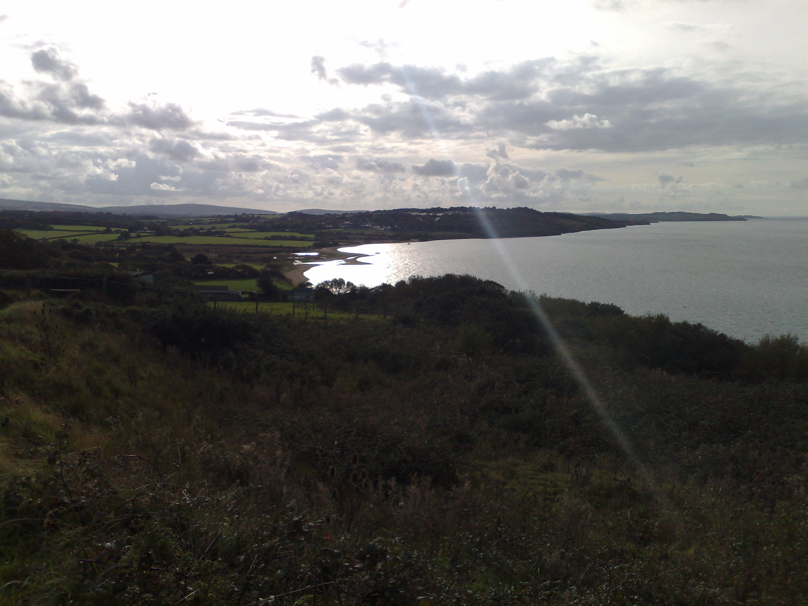
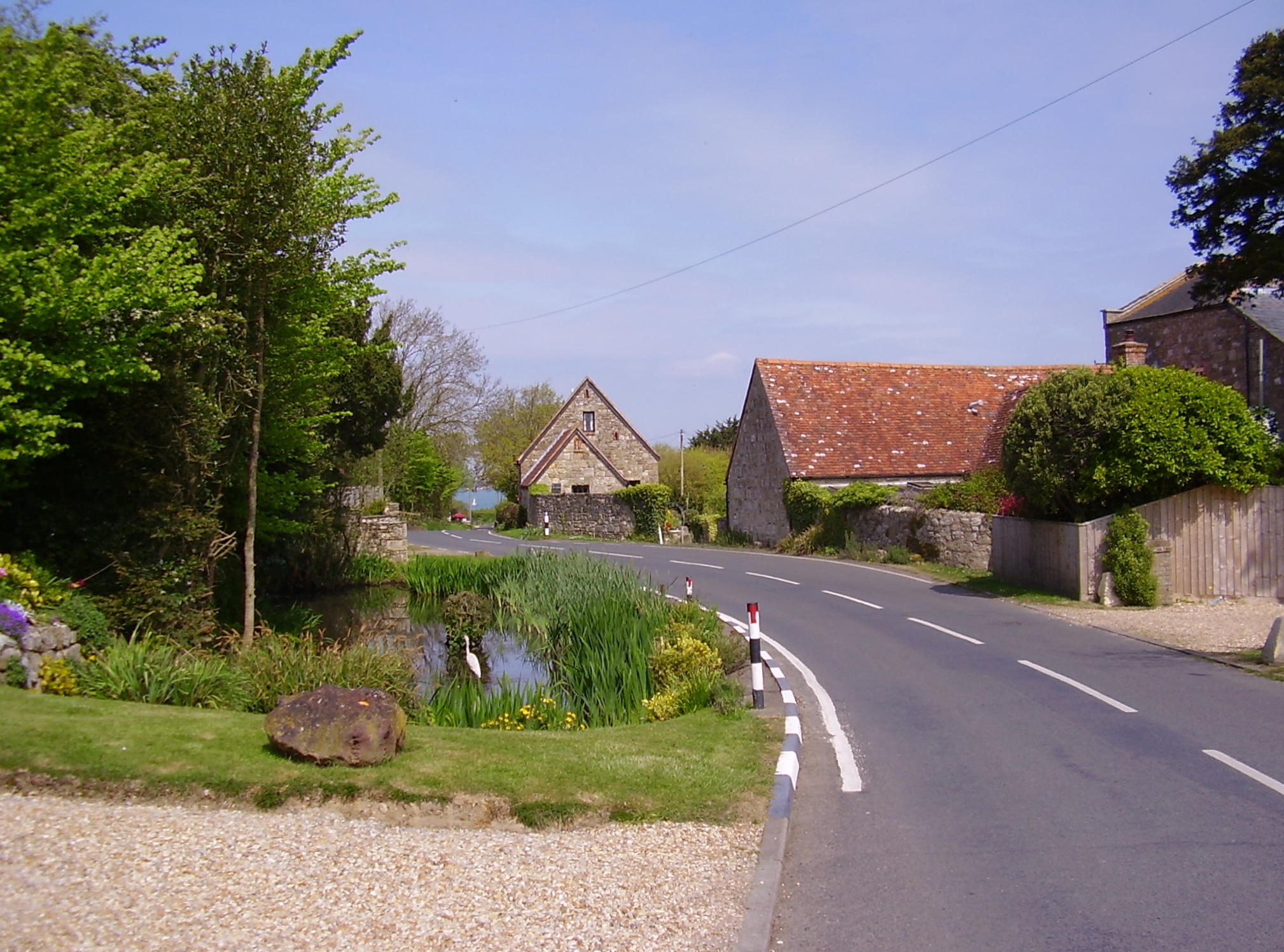
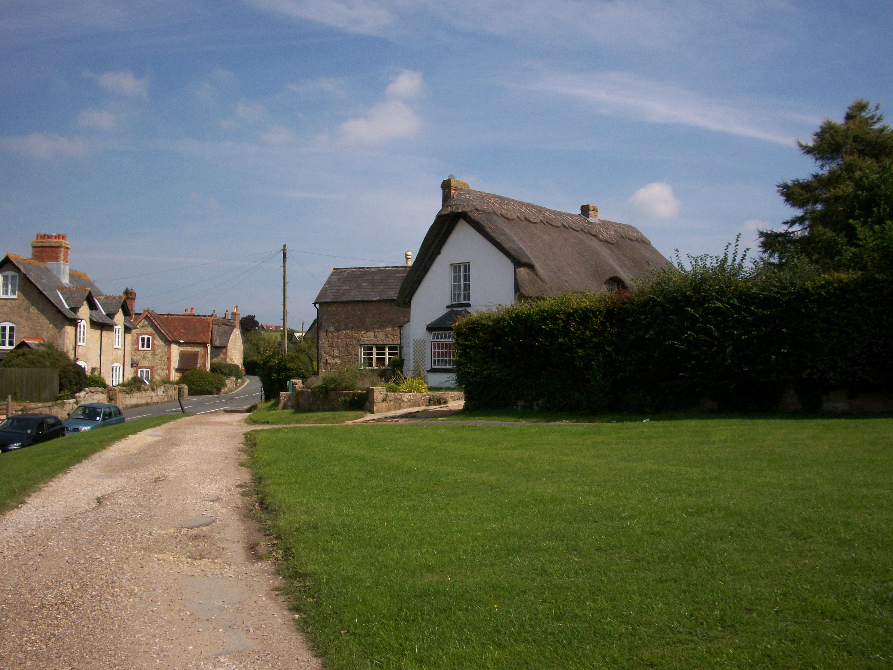
Great Thorness is a small village located in the county of Hampshire, England. Situated on the western coast of the Isle of Wight, it is part of the wider parish of Thorness. The village is surrounded by picturesque countryside, with rolling hills and stunning views of the Solent.

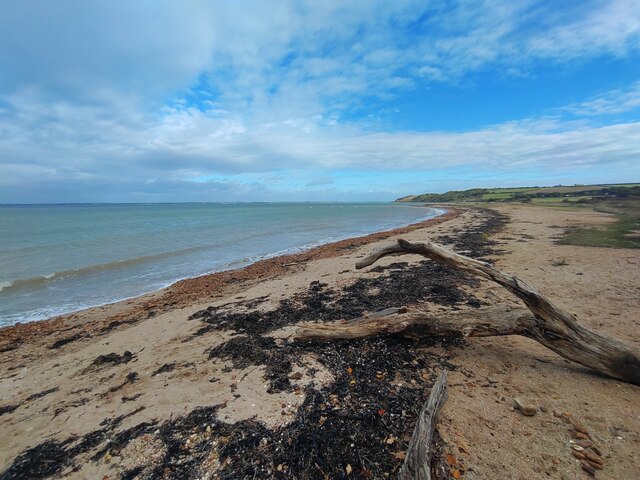
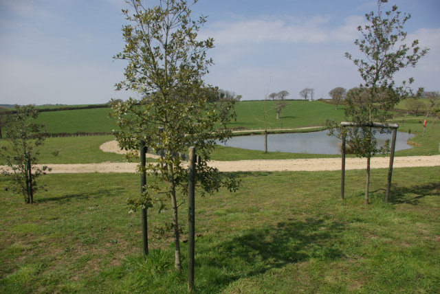
Great Thorness is best known for its natural beauty and tranquility. It boasts a diverse landscape that includes lush green fields, meadows, and dense woodlands. The area is a haven for wildlife, with an abundance of bird species, deer, and other fauna.

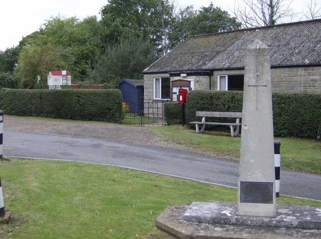
The village itself is characterized by its charming cottages and traditional architecture, which adds to its idyllic atmosphere. There is a sense of community among the residents, who take pride in maintaining the village's charm and preserving its heritage.

In terms of amenities, Great Thorness offers a range of facilities for its residents and visitors. There is a local pub, where people can unwind and enjoy a drink or a meal. The village also has a small convenience store for everyday essentials.

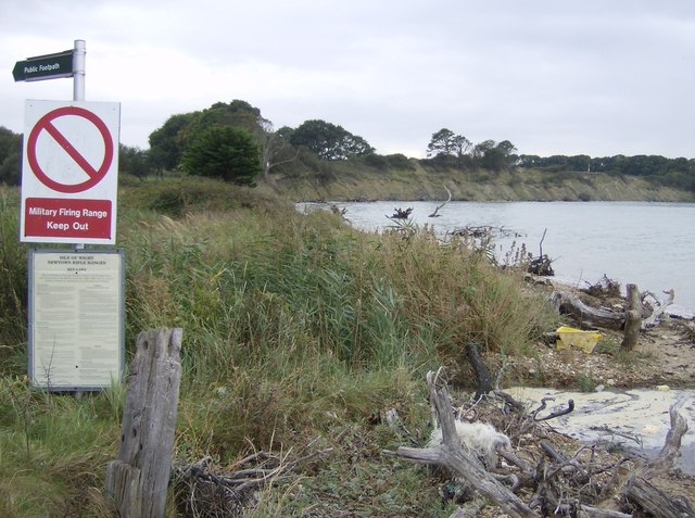
For those seeking outdoor activities, Great Thorness is surrounded by numerous walking and cycling trails, allowing visitors to explore the stunning countryside. The nearby coast provides opportunities for water sports such as sailing and fishing.

Overall, Great Thorness offers a peaceful retreat from the hustle and bustle of city life, with its natural beauty and sense of community making it a desirable place to visit or call home.

If you have any feedback on the listing, please let us know in the comments section below.

Great Thorness Images

Images are sourced within 2km of 50.730665/-1.3612681 or Grid Reference SZ4592. Thanks to Geograph Open Source API. All images are credited.

Thorness Bay on the Isle of Wight This quiet beach is a short walk from Thorness Bay Holiday Park <a title="https://www.geograph.org.uk/stuff/list.php?title=Thorness+Bay+Holiday+Park&gridref=SZ4592" href="https://www.geograph.org.uk/stuff/list.php?title=Thorness+Bay+Holiday+Park&gridref=SZ4592">Link</a>
Thorness Bay on the Isle of Wight
This quiet beach is a short walk from Thorness Bay Holiday Park Link
High tide at Thorness Bay IOW Although passable on this occasion, the coastal path follows the shore at this point and may by impassable at the highest tides meaning a lenghty detour inland.
High tide at Thorness Bay IOW
Although passable on this occasion, the coastal path follows the shore at this point and may by impassable at the highest tides meaning a lenghty detour inland.
Ford on IOW Coast Path, Thorness Bay There is no footbridge at this point on the coastal path, so you will need to leap across this stream to keep your feet dry.
Ford on IOW Coast Path, Thorness Bay
There is no footbridge at this point on the coastal path, so you will need to leap across this stream to keep your feet dry.
Farmland near Great Thorness
Hillis Farm This pond, part of the Hillis Farm site, has clearly been laid out with a purpose in mind - there was, however, nothing at the location to indicate what this might be.
Hillis Farm
This pond, part of the Hillis Farm site, has clearly been laid out with a purpose in mind - there was, however, nothing at the location to indicate what this might be.
Chalkclose Copse A footpath runs down the side of the copse to the stile at the bottom.
Chalkclose Copse
A footpath runs down the side of the copse to the stile at the bottom.
Footpath to Porchfield This footpath runs through an attractive avenue of trees next to Whitehouse Farm, towards Porchfield.
Footpath to Porchfield
This footpath runs through an attractive avenue of trees next to Whitehouse Farm, towards Porchfield.
Little Thorness Farm Cottage.  Solent in the background A holiday cottage a few hundred yards from the sea.
Little Thorness Farm Cottage. Solent in the background
A holiday cottage a few hundred yards from the sea.
The path from Little Thorness Farm to the beach
Path through Parkhurst Forest In the north-western section of the forest a clear path runs through a more open area, flanked by light mixed woodland.  A less significant path heads north to the right.
Path through Parkhurst Forest
In the north-western section of the forest a clear path runs through a more open area, flanked by light mixed woodland. A less significant path heads north to the right.
Scrub land above The Solent Between the holiday village and the sea a number of paths have been created through the woodland.  Many end abruptly at the edge of an area of scrub land which slopes steeply towards the sea.  There is no access to the beach from here.
Scrub land above The Solent
Between the holiday village and the sea a number of paths have been created through the woodland. Many end abruptly at the edge of an area of scrub land which slopes steeply towards the sea. There is no access to the beach from here.
Holiday village This part of the holiday village consists of a series of permanent bungalows, more substantial than caravans but cheaply built of breeze block and lacking any architectural niceties.  Many seem to be derelict, but this group seem to be well used.
Holiday village
This part of the holiday village consists of a series of permanent bungalows, more substantial than caravans but cheaply built of breeze block and lacking any architectural niceties. Many seem to be derelict, but this group seem to be well used.
On the danger beach A well-marked footpath leads to the coast through the danger area, a military firing range.  The path is clearly marked from Porchfield, the only access point.  Shortly after high tide, the beach is limited, about 5 feet of shingle covered in flotsam.
On the danger beach
A well-marked footpath leads to the coast through the danger area, a military firing range. The path is clearly marked from Porchfield, the only access point. Shortly after high tide, the beach is limited, about 5 feet of shingle covered in flotsam.
Porchfield war memorial and village hall At the west end of the village and of the more modest variety in both cases.
Porchfield war memorial and village hall
At the west end of the village and of the more modest variety in both cases.
Forest colours The autumn colours are just starting to appear in Parkhurst Forest.  Here the beech and birch leaves are turning and the bracken is losing its green-ness.  The pines remain aloof to the process.
Forest colours
The autumn colours are just starting to appear in Parkhurst Forest. Here the beech and birch leaves are turning and the bracken is losing its green-ness. The pines remain aloof to the process.
Entrance to Parkhurst Forest This is the entrance from Mark's Corner near the north-west corner of the forest.
Entrance to Parkhurst Forest
This is the entrance from Mark's Corner near the north-west corner of the forest.
This way or that way? The signs are correct; the footpath heads left or right.  Straight on is not an option.  The 1:50K map does not show this path clearly, but it skirts exactly along the northern edge of the forest
This way or that way?
The signs are correct; the footpath heads left or right. Straight on is not an option. The 1:50K map does not show this path clearly, but it skirts exactly along the northern edge of the forest
Forest entrance Someone has made a bit of a feature of this entrance, with a simple wooden construction but the two specific pieces of wood must have been hard to find.
Forest entrance
Someone has made a bit of a feature of this entrance, with a simple wooden construction but the two specific pieces of wood must have been hard to find.
Show me another place!

Great Thorness is located at Grid Ref: SZ4592 (Lat: 50.730665, Lng: -1.3612681)

Unitary Authority: Isle of Wight

Police Authority: Hampshire

What 3 Words

///flashing.archduke.watched. Near Northwood, Isle of Wight

Nearby Locations

Great Thorness

Related Wikis

Great Thorness

Great Thorness is a settlement in the civil parish of Calbourne, Newtown and Porchfield, on the Isle of Wight, off the south coast of England. The hamlet...

Thorness Bay

Thorness Bay is an 86.2-hectare (213-acre) Site of special scientific interest which is located on the north-west coast of the Isle of Wight, England,...

Porchfield

Porchfield is a village in the civil parish of Calbourne, Newtown and Porchfield, on the Isle of Wight between Cowes and Yarmouth. It is located 4+1⁄4...

Locks Farm Meadow

Locks Farm Meadow is a 2.3-hectare (5.7-acre) Site of special scientific interest which just east of Porchfield, England. The site was notified in 1988...

Unknown Wreck off Thorness Bay

The wreck of a wooden sailing vessel was discovered in Thorness Bay, Isle of Wight, England in 2010. The site was designated under the Protection of Wrecks...
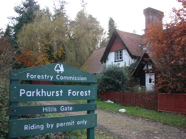
Parkhurst Forest

Parkhurst Forest is a woodland to the north-west of Newport, Isle of Wight, England. The site is partly a site of special scientific interest. It consists...

Rew Street

Rew Street is a village on the Isle of Wight. It is located three kilometres southwest of Cowes in the north of the island. The village lies along the...

Calbourne, Newtown and Porchfield

Calbourne, Newtown and Porchfield (formerly just Calbourne) is a civil parish on the Isle of Wight, in the county of the Isle of Wight, England. The parish...

Nearby Amenities

Located within 500m of 50.730665,-1.3612681
Source: Bing
Lat/Long: 50.7334322/-1.3664271
Source: Bing
Lat/Long: 50.7333532/-1.3663764
Source: Bing
Lat/Long: 50.7332942/-1.3662339
Source: Bing
Lat/Long: 50.7315746/-1.3626633
Source: Bing
Lat/Long: 50.7315735/-1.3624176
Traffic Calming: bump
Lat/Long: 50.731256/-1.3618008
Source: Bing
Lat/Long: 50.7315666/-1.3622076
Source: Locally rectified NPE map
Lat/Long: 50.7302418/-1.3622757
Source: Locally rectified NPE map
Lat/Long: 50.7306863/-1.3613926
Bus Stop
Thorness Bay Lodge Bar
Bus: yes
Naptan AtcoCode: 230000010960
Naptan Bearing: S
Naptan CommonName: Thorness Bay Lodge Bar
Naptan NaptanCode: iowjdwa
Naptan Verified: no
Public Transport: platform
Shelter: no
Lat/Long: 50.7310524/-1.3602044
Bus Stop
Thorness Bay
Bus: yes
Naptan AtcoCode: 230000010970
Naptan Bearing: NW
Naptan CommonName: Thorness Bay
Naptan NaptanCode: iowjdwd
Naptan Verified: no
Public Transport: platform
Shelter: no
Lat/Long: 50.734156/-1.3607164
Traffic Calming: bump
Lat/Long: 50.7337254/-1.3609313
Source: Bing
Lat/Long: 50.7318916/-1.364547
Traffic Calming: bump
Lat/Long: 50.7347236/-1.3641179
Great Thorness
Place: hamlet
Wikidata: Q5600086
Lat/Long: 50.7306568/-1.360071
Barrier: stile
Foot: yes
Lat/Long: 50.7306778/-1.3614065
Traffic Calming: bump
Lat/Long: 50.7347593/-1.3620901
Traffic Calming: bump
Lat/Long: 50.734104/-1.365754
Traffic Calming: bump
Lat/Long: 50.733576/-1.3653597
Traffic Calming: bump
Lat/Long: 50.7314599/-1.3602528
Traffic Calming: bump
Lat/Long: 50.732453/-1.3604419
Traffic Calming: bump
Lat/Long: 50.7330854/-1.360682
The data included in this document is from www.openstreetmap.org. The data is made available under ODbL.

Have you been to Great Thorness?

Leave your review of Great Thorness below (or comments, questions and feedback).