Great Haywood

Settlement in Staffordshire Stafford

England

Great Haywood

Cottage by Colwich Lock in Staffordshire Colwich Lock (No 21) is on the Trent and Mersey Canal near Little Haywood. A public footpath crosses the bridge here.
Cottage by Colwich Lock in Staffordshire Credit: Roger D Kidd

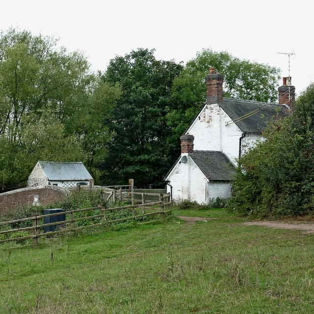
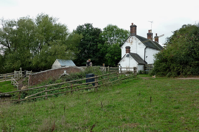
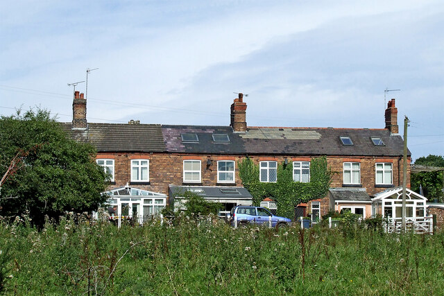
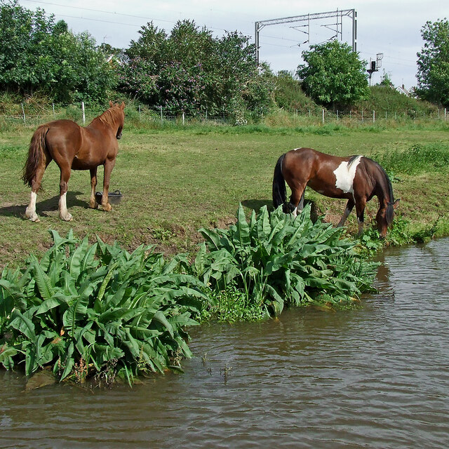
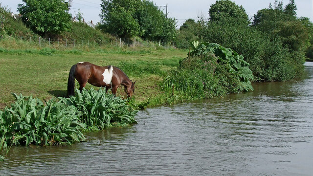
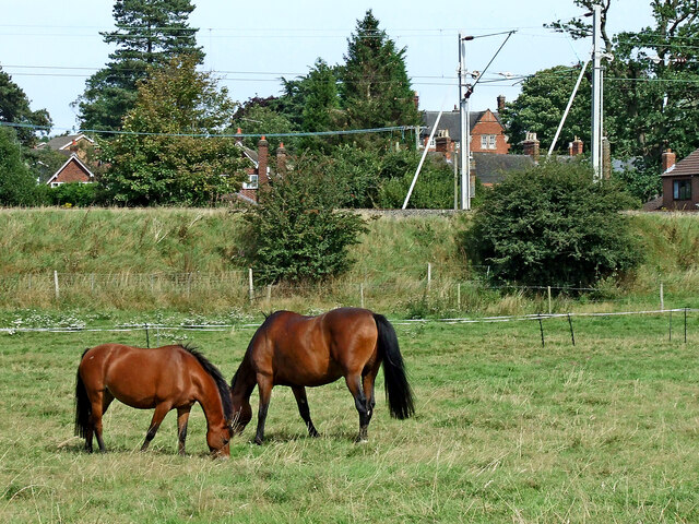
Great Haywood is a small village located in the county of Staffordshire, England. Situated approximately 9 miles north-west of Stafford, it lies on the banks of the picturesque Trent and Mersey Canal. With a population of around 1,400 residents, it is known for its tranquil and idyllic setting.

The village has a rich history, with evidence of human habitation dating back to the Roman era. Today, it retains much of its charm and character, with a range of period buildings and traditional cottages lining its streets. The All Saints Church, a Grade II listed building, is a prominent feature in the village and dates back to the 13th century.

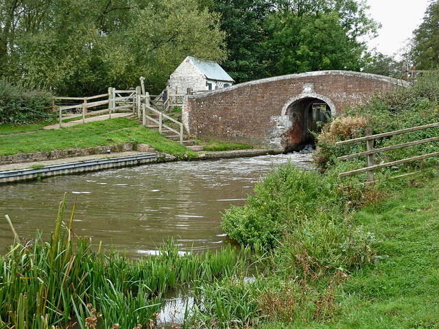
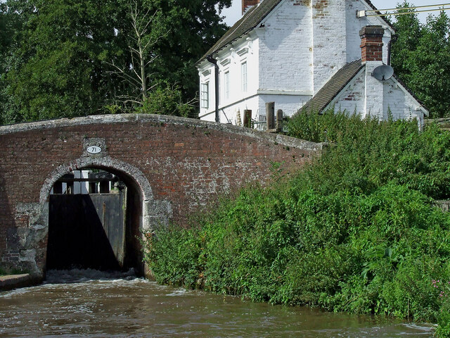
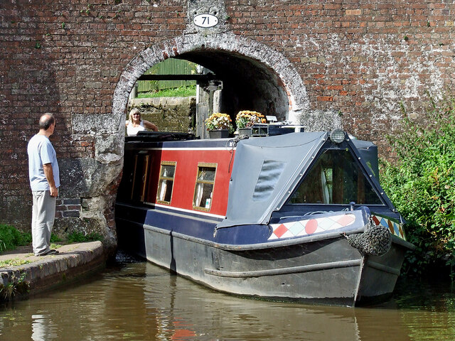
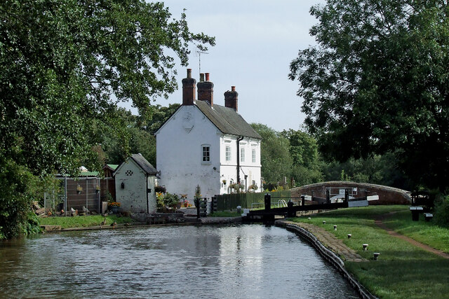
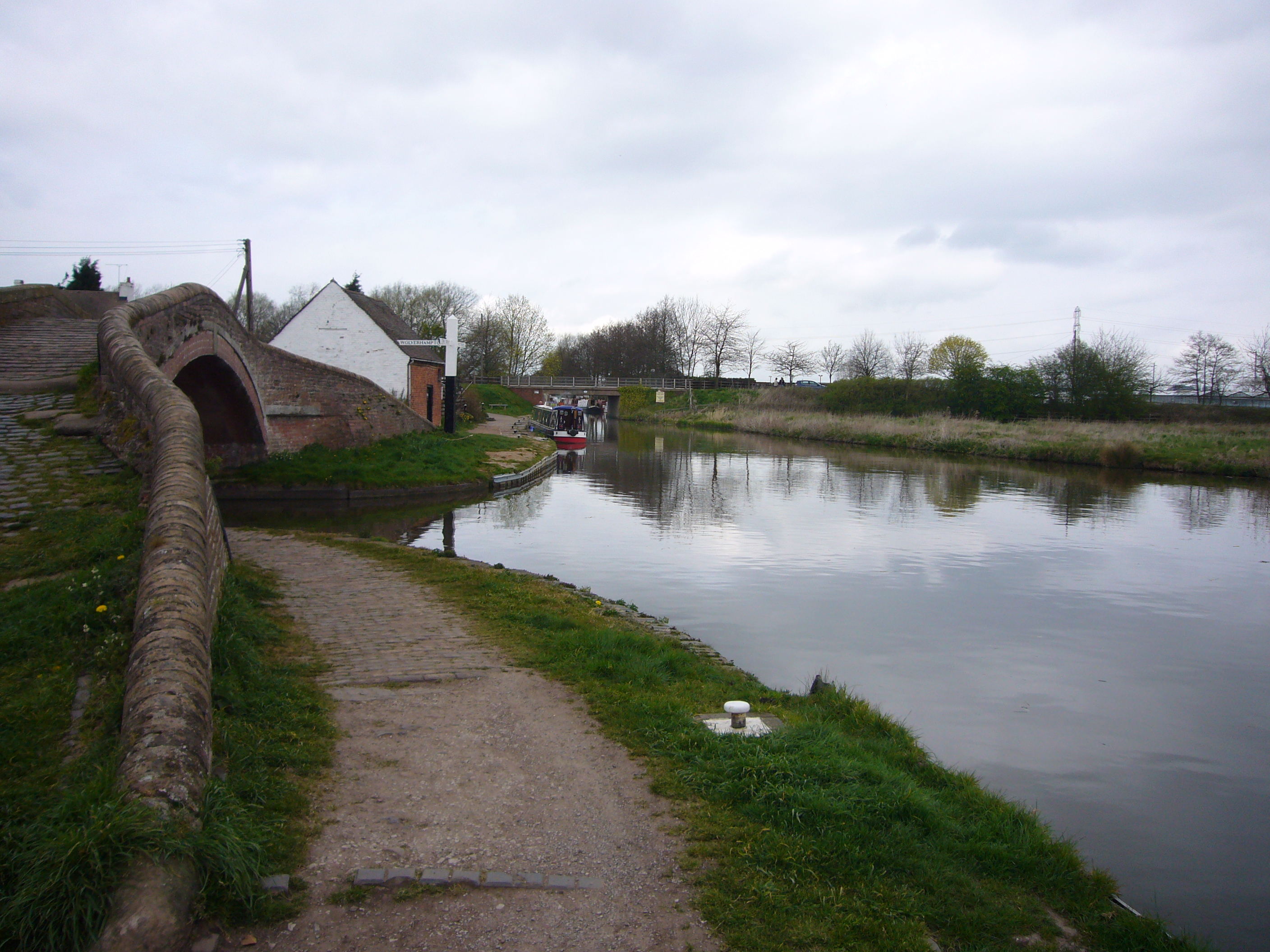
Great Haywood is a popular destination for boating enthusiasts, offering easy access to the canal network. The nearby Great Haywood Marina provides moorings and services for both leisure and residential boats. The canal also attracts visitors seeking leisurely walks or bike rides along its towpaths, with stunning views of the surrounding countryside.

Amenities in the village include a primary school, a post office, a village store, and a pub, which serves as a gathering place for locals and visitors alike. Great Haywood is also home to Shugborough Estate, a National Trust property that encompasses a stately home with beautiful gardens and parkland. The estate offers a glimpse into the region's history and provides a range of activities and events throughout the year.

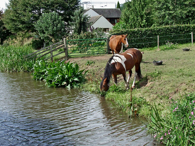
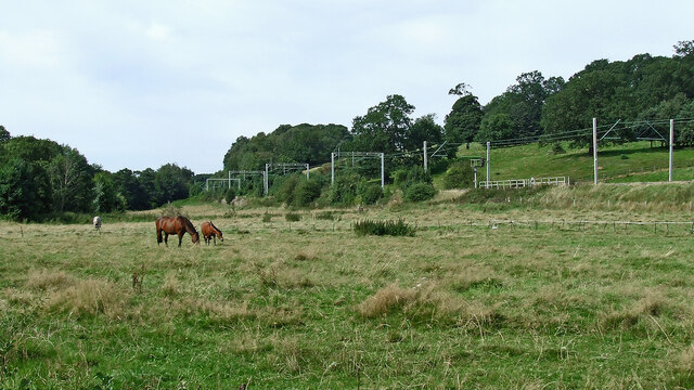
Overall, Great Haywood is a picturesque and peaceful village, offering a perfect blend of rural beauty and historical significance. Its proximity to the canal and the stunning Staffordshire countryside makes it a popular destination for those seeking a tranquil retreat.

If you have any feedback on the listing, please let us know in the comments section below.

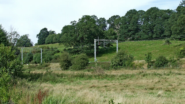
Great Haywood Images

Images are sourced within 2km of 52.801704/-2.005876 or Grid Reference SJ9922. Thanks to Geograph Open Source API. All images are credited.

Cottage by Colwich Lock in Staffordshire Colwich Lock (No 21) is on the Trent and Mersey Canal near Little Haywood. A public footpath crosses the bridge here.
Cottage by Colwich Lock in Staffordshire
Colwich Lock (No 21) is on the Trent and Mersey Canal near Little Haywood. A public footpath crosses the bridge here.
Cottage and canal bridge near Colwich in Staffordshire Colwich Lock (No 21) is on the Trent and Mersey Canal near Little Haywood. A public footpath crosses the bridge here.
Cottage and canal bridge near Colwich in Staffordshire
Colwich Lock (No 21) is on the Trent and Mersey Canal near Little Haywood. A public footpath crosses the bridge here.
Colwich Bridge near Little Haywood in Staffordshire Bridge No 72 across the Trent and Mersey Canal is immediately below Colwich Lock.
Notice the turbulence in the water below the bridge. The lock paddles have bee raised, and water is gushing through. A narrowboat will emerge very soon.

<a href="https://www.geograph.org.uk/photo/2662653">SK0021 : Colwich Bridge near Little Haywood in Staffordshire</a>

The Trent and Mersey Canal is 93.5 miles in length from Derwent Mouth to Preston Brook. The first sod was cut by Josiah Wedgwood in July 1766 at Middleport (Stoke-on-Trent). The eastern section between Derwent Mouth and Shugborough (the junction with the Staffordshire and Worcestershire Canal) was already operational by 1770 and the whole canal through to Preston Brook, where it linked with the Bridgewater Canal was open for business by 1777. James Brindley was the engineer until his death in 1772.
Colwich Bridge near Little Haywood in Staffordshire
Bridge No 72 across the Trent and Mersey Canal is immediately below Colwich Lock. Notice the turbulence in the water below the bridge. The lock paddles have bee raised, and water is gushing through. A narrowboat will emerge very soon. SK0021 : Colwich Bridge near Little Haywood in Staffordshire The Trent and Mersey Canal is 93.5 miles in length from Derwent Mouth to Preston Brook. The first sod was cut by Josiah Wedgwood in July 1766 at Middleport (Stoke-on-Trent). The eastern section between Derwent Mouth and Shugborough (the junction with the Staffordshire and Worcestershire Canal) was already operational by 1770 and the whole canal through to Preston Brook, where it linked with the Bridgewater Canal was open for business by 1777. James Brindley was the engineer until his death in 1772.
Colwich Lock and Bridge in Staffordshire Colwich Bridge is No 71 across the Trent and Mersey Canal. It carries a farm track and public footpath. The Lock is No 21 and provides a rise (or fall) of 6ft 6in (two metres).
There is turbulence below the bridge because the paddles have been raised to drain the lock. An approaching boat is in the lock, and a boat is waiting to use it.
Colwich Lock and Bridge in Staffordshire
Colwich Bridge is No 71 across the Trent and Mersey Canal. It carries a farm track and public footpath. The Lock is No 21 and provides a rise (or fall) of 6ft 6in (two metres). There is turbulence below the bridge because the paddles have been raised to drain the lock. An approaching boat is in the lock, and a boat is waiting to use it.
Terraced cottages in Little Haywood, Staffordshire The cottages are by Main Street, and are seen here from the canal below Colwich Lock.
Terraced cottages in Little Haywood, Staffordshire
The cottages are by Main Street, and are seen here from the canal below Colwich Lock.
Narrowboat leaving Colwich Lock in Staffordshire Colwich Bridge is No 71 across the Trent and Mersey Canal near Little Haywood. It carries a farm track and public footpath. The Lock is No 21 and provides a rise (or fall) of 6ft 6in (two metres).
'Just Heaven' is leaving the lock very carefully.
Narrowboat leaving Colwich Lock in Staffordshire
Colwich Bridge is No 71 across the Trent and Mersey Canal near Little Haywood. It carries a farm track and public footpath. The Lock is No 21 and provides a rise (or fall) of 6ft 6in (two metres). 'Just Heaven' is leaving the lock very carefully.
Canal at Colwich Lock in Staffordshire Looking south-east towards Rugeley, this is the Trent and Mersey Canal at Colwich Lock (No 21) and Colwich Lock Bridge (No 71).
Canal at Colwich Lock in Staffordshire
Looking south-east towards Rugeley, this is the Trent and Mersey Canal at Colwich Lock (No 21) and Colwich Lock Bridge (No 71).
Canalside grazing near Little Haywood in Staffordshire Trent and Mersey Canal.
Canalside grazing near Little Haywood in Staffordshire
Trent and Mersey Canal.
Canalside grazing near Little Haywood in Staffordshire Trent and Mersey Canal.
Canalside grazing near Little Haywood in Staffordshire
Trent and Mersey Canal.
Canalside pasture near Little Haywood in Staffordshire This is the Trent and Mersey Canal, looking east-south-east towards Rugeley and Fradley Junction.
Canalside pasture near Little Haywood in Staffordshire
This is the Trent and Mersey Canal, looking east-south-east towards Rugeley and Fradley Junction.
Pasture south-west of Little Haywood in Staffordshire Looking north-west from the canal near Meadow Lane Bridge, No 72. The West Coast Main Line (Trent Valley) is on an embankment, heading for Stoke-on-Trent.
Pasture south-west of Little Haywood in Staffordshire
Looking north-west from the canal near Meadow Lane Bridge, No 72. The West Coast Main Line (Trent Valley) is on an embankment, heading for Stoke-on-Trent.
Grazing near Little Haywood in Staffordshire A long stretch of pasture is between the canal and the railway embankment.
Grazing near Little Haywood in Staffordshire
A long stretch of pasture is between the canal and the railway embankment.
Pasture and railway near Little Haywood in Staffordshire Looking north-north-west from the canal. A long stretch of pasture is between the canal and the railway embankment, with more on the slopes beyond.
Pasture and railway near Little Haywood in Staffordshire
Looking north-north-west from the canal. A long stretch of pasture is between the canal and the railway embankment, with more on the slopes beyond.
Trent & Mersey Canal at Bridge #71
Lock Cottages at Colwich Lock, lock #21 Trent & Mersey Canal.
Lock Cottages at Colwich Lock, lock #21
Trent & Mersey Canal.
Trent & Mersey Canal at Bridge #72A
Trent & Mersey Canal towards Bridge #72
Show me another place!

Great Haywood is located at Grid Ref: SJ9922 (Lat: 52.801704, Lng: -2.005876)

Administrative County: Staffordshire

District: Stafford

Police Authority: Staffordshire

What 3 Words

///talking.steers.dustbin. Near Great Haywood, Staffordshire

Related Wikis

Great Haywood railway station

Great Haywood railway station is a disused railway station in Staffordshire, England. The railway line between Stone and Colwich, England, was opened by...

Essex Bridge, Staffordshire

Essex Bridge (grid reference SJ995225) is a Grade I listed packhorse bridge over the River Trent near Great Haywood, Staffordshire, England. Spanning the...

River Sow

The River Sow is a tributary of the River Trent in Staffordshire, England, and is the river that flows through Stafford. == Course == The river rises...

Haywood Junction

Haywood Junction (grid reference SJ994229), or Great Haywood Junction, is the name of the canal junction where the Staffordshire and Worcestershire Canal...

Nearby Amenities

Located within 500m of 52.801704,-2.005876
Great Haywood Junction
Alt Name: Haywood Junction
Canal: junction
Lat/Long: 52.8041108/-2.0087883
Seamark Type: gate
Waterway: lock_gate
Lat/Long: 52.8014014/-2.0073593
Mini Roundabout
Direction: clockwise
Lat/Long: 52.8033841/-2.003437
Operator: Anglo-Welsh
Waterway: boatyard
Lat/Long: 52.8043424/-2.0092573
Bus Stop
Clifford Arms PH
Bench: no
Bus: yes
Check Date Shelter: 2021-06-10
Naptan AtcoCode: 3800C704200
Naptan Bearing: NE
Naptan CommonName: Clifford Arms PH
Naptan Indicator: Adj
Naptan Landmark: Clifford Arms PH
Naptan Street: Main Rd
Public Transport: platform
Shelter: no
Source: naptan_import;survey
Tactile Paving: no
Lat/Long: 52.8017413/-2.0059652
Bus Stop
Trent Close
Bus: yes
Naptan AtcoCode: 3800C704201
Naptan Bearing: SE
Naptan CommonName: Trent Close
Naptan Indicator: Adj
Naptan Landmark: Trent Close
Naptan Street: Main Road
Public Transport: platform
Shelter: no
Source: naptan_import;survey
Lat/Long: 52.8012163/-2.0051632
Bus Stop
Abbeyfields
Bench: no
Bus: yes
Check Date Shelter: 2021-06-10
Naptan AtcoCode: 3800C716200
Naptan Bearing: NW
Naptan CommonName: Abbeyfields
Naptan Indicator: Opp
Naptan Landmark: Abbeyfields
Naptan Street: Mill Lane
Public Transport: platform
Shelter: yes
Source: naptan_import;survey
Tactile Paving: no
Lat/Long: 52.8035757/-2.0040644
Bus Stop
Abbeyfields
Bus: yes
Naptan AtcoCode: 3800C716201
Naptan Bearing: SE
Naptan CommonName: Abbeyfields
Naptan Indicator: Adj
Naptan Landmark: Abbeyfields
Naptan Street: Mill Lane
Public Transport: platform
Shelter: no
Source: naptan_import;survey
Lat/Long: 52.8037106/-2.0040496
Bus Stop
The Abbey
Bus: yes
Naptan AtcoCode: 3800C716203
Naptan Bearing: SW
Naptan BusStopType: CUS
Naptan CommonName: The Abbey
Naptan Indicator: Adj
Naptan Landmark: The Abbey
Naptan Street: Main Rd
Naptan Verified: no
Public Transport: platform
Source: naptan_import
Lat/Long: 52.803322/-2.0033804
Bus Stop
Rockhouse Drive
Bus: yes
Naptan AtcoCode: 3800C745501
Naptan Bearing: SE
Naptan CommonName: Rockhouse Drive
Naptan Indicator: Adj
Naptan Landmark: Rockhouse Drive
Naptan Street: Main Road
Naptan Verified: no
Public Transport: platform
Source: naptan_import
Lat/Long: 52.7994674/-2.003708
Bus Stop
Rockhouse Drive
Bus: yes
Naptan AtcoCode: 3800C745502
Naptan Bearing: NW
Naptan CommonName: Rockhouse Drive
Naptan Indicator: Opp
Naptan Landmark: Rockhouse Drive
Naptan Street: Main Road
Naptan Verified: no
Public Transport: platform
Source: naptan_import
Lat/Long: 52.7994494/-2.0038267
Noexit: yes
Lat/Long: 52.800624/-2.0040265
Great Haywood
Power: substation
Ref: 8001
Lat/Long: 52.8015841/-2.0048074
Noexit: yes
Lat/Long: 52.800369/-2.0040848
Kindergarten
Gt Haywood Under Fives Pre-School Playgroup
Lat/Long: 52.800951/-2.0041216
Doctors
Hazeldene House Surgery
Healthcare: doctor
Lat/Long: 52.8014463/-2.0049987
Power: substation
Lat/Long: 52.7996576/-1.9997689
Barrier: bollard
Lat/Long: 52.8011212/-2.0074375
Barrier: bollard
Lat/Long: 52.8005816/-2.0053144
Rockhouse Drive
Power: substation
Ref: 8671
Lat/Long: 52.7996192/-2.0028846
Post Box
Ref: ST18 320
Lat/Long: 52.8016292/-2.0062466
Noexit: yes
Lat/Long: 52.8036613/-2.0062124
Barrier: lift_gate
Lift Gate Type: single
Lat/Long: 52.8053347/-2.0080175
Post Box
Ref: ST18 1806
Lat/Long: 52.8026473/-2.0009631
Crossing
Crossing: uncontrolled
Crossing Ref: zebra
Source: Bing
Lat/Long: 52.8055377/-2.0078383
Noexit: yes
Lat/Long: 52.8041722/-2.0048811
Post Box
Ref: ST18 1803
Lat/Long: 52.8045796/-2.0025304
Dentist
Great Haywood Dental Practice
Healthcare: dentist
Lat/Long: 52.8025798/-2.003627
Noexit: yes
Lat/Long: 52.8033948/-2.0014042
Noexit: yes
Lat/Long: 52.8036292/-2.0022089
Seamark Type: gate
Waterway: lock_gate
Lat/Long: 52.8011658/-2.007361
Passing Place
Lat/Long: 52.7988395/-2.0098355
Information: board
Tourism: information
Lat/Long: 52.8010038/-2.0075433
Bench
Lat/Long: 52.8006012/-2.0074561
Pharmacy
Numark Pharmacy
Addr Housenumber: 3
Addr Postcode: ST18 0SS
Addr Street: Trent Close
Fhrs Id: 1196044
Healthcare: pharmacy
Source Addr: FHRS Open Data
Lat/Long: 52.8016677/-2.0052031
Haywood Hall
Historic: archaeological_site
Lat/Long: 52.8023479/-2.0073519
Water Point
Great Haywood Junction Water Point
Access: permissive
Centralkey: crt_watermate
Drinking Water: yes
Man Made: water_tap
Operator: Canal and River Trust
Source: survey
Url: http://canalrivertrust.org.uk/
Waterway: water_point
Lat/Long: 52.8045404/-2.0089486
Water Point
Great Haywood Junction Water Point
Access: permissive
Centralkey: crt_watermate
Drinking Water: yes
Man Made: water_tap
Operator: Canal and River Trust
Source: survey
Url: http://canalrivertrust.org.uk/
Waterway: water_point
Lat/Long: 52.8046339/-2.0089397
Noexit: yes
Lat/Long: 52.8020069/-1.9993672
Noexit: yes
Lat/Long: 52.8020605/-1.9995354
Crossing
Crossing: uncontrolled
Crossing Ref: zebra
Source: Bing
Lat/Long: 52.8052707/-2.0081028
Crossing
Crossing: uncontrolled
Crossing Ref: zebra
Source: Bing
Lat/Long: 52.8050786/-2.0082262
Crossing
Crossing: uncontrolled
Crossing Ref: zebra
Source: Bing
Lat/Long: 52.805358/-2.0080126
Crossing
Crossing: uncontrolled
Crossing Ref: zebra
Source: Bing
Lat/Long: 52.8056048/-2.0080455
Noexit: yes
Lat/Long: 52.8049789/-2.0104744
Noexit: yes
Lat/Long: 52.804362/-2.0101321
Cat's Monument
Heritage: 2
Heritage Operator: Historic England
Listed Status: Grade II
Source: estimate
Tourism: artwork
Wikidata: Q26641023
Lat/Long: 52.8021322/-2.0115683
Shepherd's Monument
Heritage: 2
Heritage Operator: Historic England
Listed Status: Grade II*
Source: survey
Tourism: artwork
Lat/Long: 52.8014147/-2.0125084
Waste Disposal
Great Haywood Junction Rubbish Disposal
Access: permissive
Centralkey: no
Operator: Canal and River Trust
Waste: trash
Lat/Long: 52.8047314/-2.0090577
Access: yes
Barrier: stile
Bicycle: no
Foot: permissive
Horse: no
Motor Vehicle: no
Lat/Long: 52.7989065/-2.0047631
Noexit: yes
Lat/Long: 52.8028238/-1.999104
Leisure: picnic_table
Material: wood
Lat/Long: 52.8041646/-2.010946
Information: board
Tourism: information
Lat/Long: 52.8046825/-2.0089496
Bench
Material: wood
Lat/Long: 52.8048955/-2.0088405
Addr City: Great Haywood
Addr Housename: Robin's Nest
Addr Street: Main Road
Lat/Long: 52.8022703/-2.0049499
Addr Housename: Trent House
Addr Street: Trent Lane
Lat/Long: 52.8016112/-2.0060137
The data included in this document is from www.openstreetmap.org. The data is made available under ODbL.

Have you been to Great Haywood?

Leave your review of Great Haywood below (or comments, questions and feedback).