Gorthleck

Settlement in Inverness-shire

Scotland

Gorthleck

Field and Loch Garth Loch Garth is part of the Loch Mhòr hydroelectric reservoir which once powered the Foyers aluminium smelter - one of the first electrochemical smelters. The smelter has gone, but there is still a hydroelectric power station.
Field and Loch Garth Credit: Richard Webb

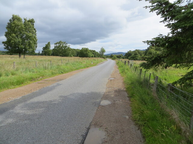
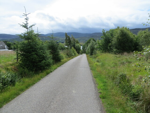
Gorthleck is a small village located in the county of Inverness-shire, Scotland. Situated in the northern part of the country, it lies approximately 20 miles south of Inverness, the capital city of the Highlands. Gorthleck is nestled amidst the scenic Scottish countryside, surrounded by rolling hills and picturesque landscapes.

The village is home to a relatively small population and offers a peaceful and idyllic setting for its residents. It is known for its close-knit community and friendly locals who take pride in their heritage. Gorthleck maintains a sense of tranquility and provides an escape from the hustle and bustle of larger towns and cities.

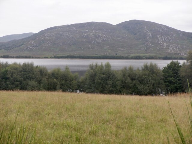
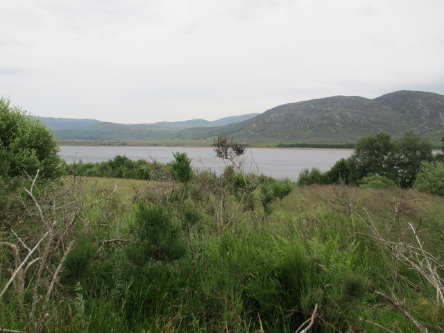
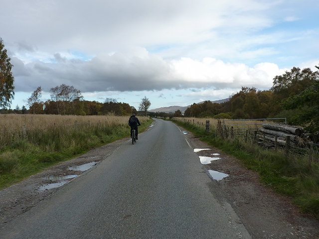
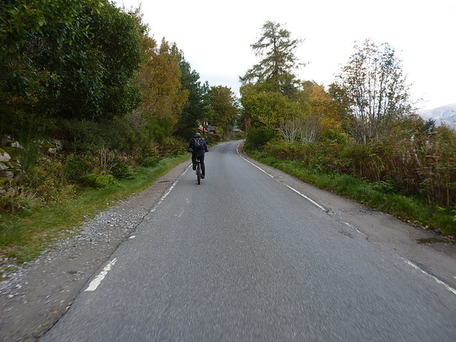
The nearby area offers several outdoor recreational opportunities, with numerous walking trails and cycle paths that allow residents and visitors to explore the beautiful highland scenery. Loch Duntelchaig, a freshwater lake, is located just a short distance from Gorthleck, providing opportunities for fishing and boating.

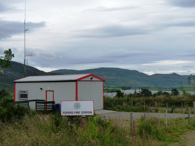
Facilities within the village include a primary school, a village hall, and a small local shop. For additional amenities, residents often travel to nearby towns such as Inverness or Fort Augustus, where they can find a wider range of services and amenities.

Overall, Gorthleck is a charming and peaceful village that offers a retreat from the busyness of modern life. With its stunning surroundings and friendly community, it is a delightful place to visit or call home for those seeking a slower pace of life in the Scottish Highlands.

If you have any feedback on the listing, please let us know in the comments section below.
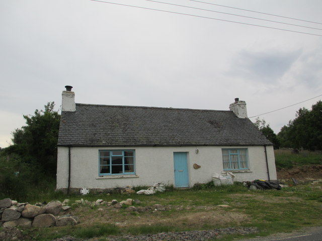
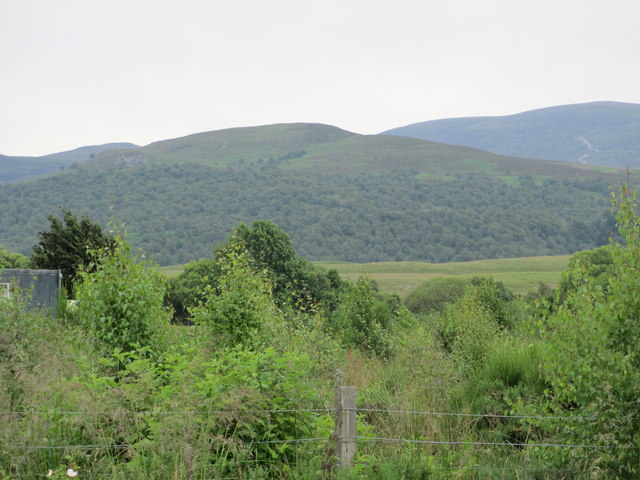
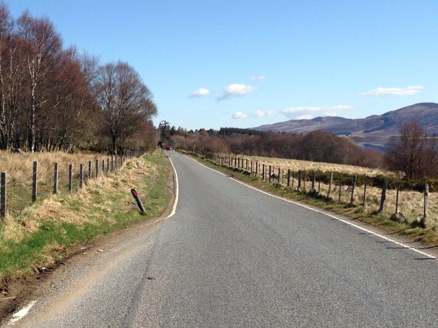
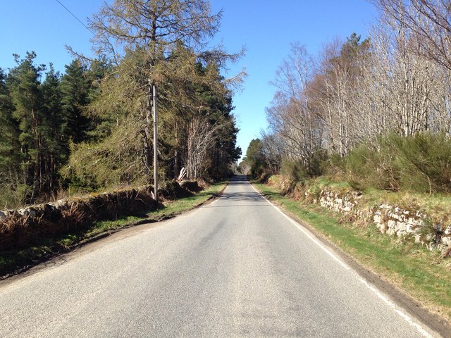
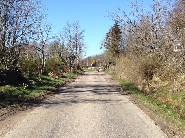
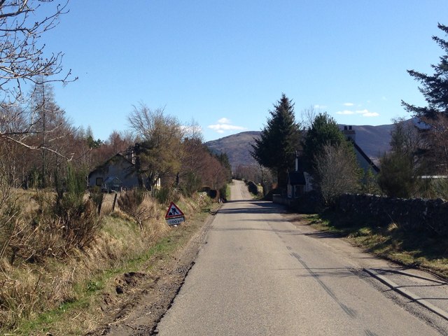
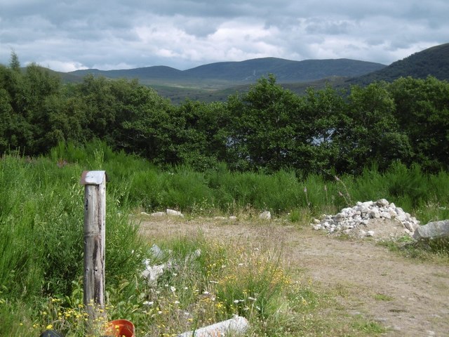
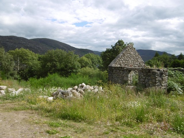
Gorthleck Images

Images are sourced within 2km of 57.242723/-4.4406064 or Grid Reference NH5219. Thanks to Geograph Open Source API. All images are credited.

Field and Loch Garth Loch Garth is part of the Loch Mhòr hydroelectric reservoir which once powered the Foyers aluminium smelter - one of the first electrochemical smelters. The smelter has gone, but there is still a hydroelectric power station.
Field and Loch Garth
Loch Garth is part of the Loch Mhòr hydroelectric reservoir which once powered the Foyers aluminium smelter - one of the first electrochemical smelters. The smelter has gone, but there is still a hydroelectric power station.
B862, Lochgarth
B862, Lochgarth
New house
New house
Overgrown fields in Stratherrick
Road (B862) at Craigview Looking north-eastward in the direction of Lochgarthside.
Road (B862) at Craigview
Looking north-eastward in the direction of Lochgarthside.
Minor road at Lochgartside Looking south-eastward towards its junction with the B862.
Minor road at Lochgartside
Looking south-eastward towards its junction with the B862.
Fire station in Stratherrick This station serves a wide rural community east of Loch Ness
Fire station in Stratherrick
This station serves a wide rural community east of Loch Ness
Loch Mhor
Loch Mhor
Croft house at Lochgarthside
Scrub land at Lochmhòr Carn Liath in the distance.
Scrub land at Lochmhòr
Carn Liath in the distance.
B862 near Gorthleck
B862 near Gorthleck
B862 near Gorthleck
B862 near Gorthleck
B862 at Gorthleck
B862 at Gorthleck
B862 at Gorthleck
B862 at Gorthleck
Plot, Lochgarthside Disturbed land which will no doubt be sprouting a house soon. The view is towards Loch Mhòr which is an enlarged loch built to provide electricity to the pioneering aluminium smelter at Foyers.   Previously there were two small lochs here quite far apart.  One of the lochs, Loch Garth was here, beyond the trees. The Ordnance Survey have preserved the name Loch Garth on their maps.
Plot, Lochgarthside
Disturbed land which will no doubt be sprouting a house soon. The view is towards Loch Mhòr which is an enlarged loch built to provide electricity to the pioneering aluminium smelter at Foyers. Previously there were two small lochs here quite far apart. One of the lochs, Loch Garth was here, beyond the trees. The Ordnance Survey have preserved the name Loch Garth on their maps.
Ruin, Lochgarthside Beside the site of Loch Garth which is now under the aluminium smelting hydro electric loch Loch Mhòr.
Ruin, Lochgarthside
Beside the site of Loch Garth which is now under the aluminium smelting hydro electric loch Loch Mhòr.
Heading along the B862 near Glebe
Along the B862 near Lochgarthside Riding back along the valley after a good day on the hills to the south.
Along the B862 near Lochgarthside
Riding back along the valley after a good day on the hills to the south.
Show me another place!

Gorthleck is located at Grid Ref: NH5219 (Lat: 57.242723, Lng: -4.4406064)

Unitary Authority: Highland

Police Authority: Highlands and Islands

What 3 Words

///sediment.number.relished. Near Drumnadrochit, Highland

Nearby Locations

Lochgarthside Gorthleck

Related Wikis

Loch Mhòr

Loch Mhòr is a loch in the traditional county of Inverness-shire in the Scottish Highlands. Its name literally translates to "Big Loch". It occupies much...

Stratherrick

Stratherrick (Scottish Gaelic: Srath Fhairgeag / Srath Fharragaig) is a strath situated above the south-eastern shore of Loch Ness, in the Scottish Highlands...

Wester Aberchalder

Wester Aberchalder is a small village, situated on the south shore of Loch Mhòr, lying on the Aberchalder Burn, which flows into the loch, in Gorthleck...

Gorthleck

Gorthleck (Scottish Gaelic: Goirtlig) is a small hamlet on the north shore Loch Mhòr in Inverness-shire, Scottish Highlands and is in the Scottish council...

Nearby Amenities

Located within 500m of 57.242723,-4.4406064
Bus Stop
Loch Mhor Cottages
Naptan AtcoCode: 6700713369
Naptan Bearing: NE
Naptan CommonName: Loch Mhor Cottages
Naptan Indicator: o/s Cottages
Naptan Landmark: Loch Mhor Cottages
Naptan NaptanCode: 45325674
Naptan Street: B862
Naptan Verified: no
Source: naptan_import
Lat/Long: 57.2442693/-4.4359376
Bus Stop
Loch Mhor Cottages
Naptan AtcoCode: 6700713369A
Naptan Bearing: SW
Naptan CommonName: Loch Mhor Cottages
Naptan Indicator: opp Cottages
Naptan Landmark: Loch Mhor Cottages
Naptan NaptanCode: 45329583
Naptan Street: B862
Naptan Verified: no
Source: naptan_import
Lat/Long: 57.2438262/-4.4370741
Power: pole
Lat/Long: 57.2454587/-4.4429952
Power: pole
Lat/Long: 57.2431986/-4.4479899
Power: pole
Lat/Long: 57.2469644/-4.4396866
Power: pole
Lat/Long: 57.2461832/-4.4413944
Power: pole
Lat/Long: 57.2447238/-4.4446514
Power: pole
Lat/Long: 57.2439538/-4.4463307
Power: pole
Lat/Long: 57.2469005/-4.4398284
Telephone
Booth: KX100
Covered: booth
Source: survey
Lat/Long: 57.2442947/-4.4354047
Noexit: yes
Lat/Long: 57.2440621/-4.4353077
Noexit: yes
Lat/Long: 57.2441542/-4.4352961
Noexit: yes
Lat/Long: 57.2438924/-4.4355752
Power: pole
Lat/Long: 57.2462772/-4.4451576
Power: pole
Lat/Long: 57.2458776/-4.444113
Power: pole
Lat/Long: 57.2447497/-4.4417489
Power: pole
Lat/Long: 57.2440666/-4.4405356
Power: pole
Lat/Long: 57.2433545/-4.439291
Power: pole
Lat/Long: 57.2434706/-4.4384419
Power: pole
Lat/Long: 57.2436773/-4.4377425
Power: pole
Lat/Long: 57.2432143/-4.4401445
Power: pole
Lat/Long: 57.243068/-4.4409936
Power: pole
Lat/Long: 57.2425034/-4.4423567
Power: pole
Lat/Long: 57.2438369/-4.4372085
Power: pole
Lat/Long: 57.2441113/-4.4376721
Power: pole
Lat/Long: 57.2444305/-4.438205
Power: pole
Lat/Long: 57.2447086/-4.4386854
Power: pole
Lat/Long: 57.245006/-4.4391871
Lochgarthside
Place: hamlet
Wikidata: Q122811312
Lat/Long: 57.243114/-4.4396886
Defibrillator
Defibrillator Location: outside Stratherrick Public Hall
Emergency: defibrillator
Indoor: no
Lat/Long: 57.2439612/-4.4369479
The data included in this document is from www.openstreetmap.org. The data is made available under ODbL.

Have you been to Gorthleck?

Leave your review of Gorthleck below (or comments, questions and feedback).