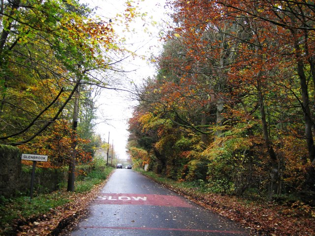
Glenbrook

Settlement in Midlothian

Scotland

Glenbrook

A sad site/sight Property at Balerno, on the 'bends' on the A70, as one leaves Balerno, which has appeared to have been abandoned for some years, looks as if something is happening at last.
A sad site/sight Credit: M J Richardson

Glenbrook is a charming residential area located in Midlothian, Scotland. Situated just 8 miles south of the capital city of Edinburgh, Glenbrook offers residents a peaceful and idyllic setting while still providing easy access to the amenities and attractions of a major city.

The area is known for its beautiful surroundings, with rolling green hills, dense woodlands, and picturesque views of the nearby Pentland Hills. Glenbrook is a popular choice for families and professionals looking to escape the hustle and bustle of city life while still maintaining a convenient commute.

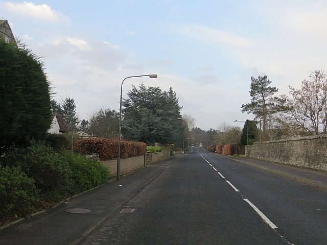
The housing in Glenbrook consists primarily of detached and semi-detached homes, which are often spacious and modern, catering to a range of budgets. The neighborhood is well-maintained, with manicured gardens and tree-lined streets adding to its overall appeal.

Residents of Glenbrook benefit from a range of local amenities, including shops, supermarkets, and restaurants in nearby towns such as Loanhead and Penicuik. The area is also home to several schools, making it an attractive choice for families with children.

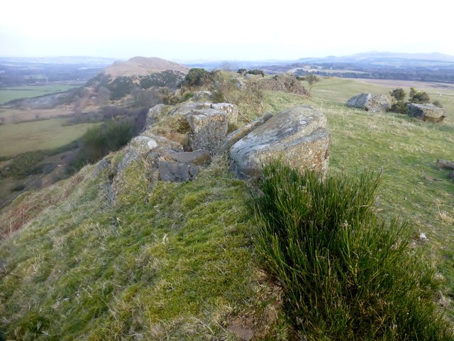
For outdoor enthusiasts, Glenbrook offers plenty of opportunities for recreation. The nearby Pentland Hills Regional Park provides ample hiking and biking trails, while the Midlothian Snowsports Centre offers skiing and snowboarding during the winter months.

Overall, Glenbrook is a delightful residential area offering a peaceful and scenic lifestyle with easy access to the amenities of nearby towns and the vibrant city of Edinburgh.

If you have any feedback on the listing, please let us know in the comments section below.
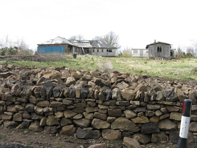
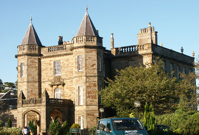
Glenbrook Images

Images are sourced within 2km of 55.877157/-3.3712815 or Grid Reference NT1465. Thanks to Geograph Open Source API. All images are credited.

A sad site/sight Property at Balerno, on the 'bends' on the A70, as one leaves Balerno, which has appeared to have been abandoned for some years, looks as if something is happening at last.
A sad site/sight
Property at Balerno, on the 'bends' on the A70, as one leaves Balerno, which has appeared to have been abandoned for some years, looks as if something is happening at last.
Dalmahoy Hill Looking south from Long Dalmahoy Road, with heaps of 'road metal' from the quarry at the base.
Dalmahoy Hill
Looking south from Long Dalmahoy Road, with heaps of 'road metal' from the quarry at the base.
Dalmahoy Hill and Tarmac Quarry buildings The quarry is identified as Ravelrig Quarry on the current OS 1:25000 map, and is in the next square to the SE. It is a huge hole <a href="https://www.geograph.org.uk/photo/887642">NT1466 : Dalmahoy Quarry</a> and was not there when I last went up the hill in the 1970s; it is also not on the 2001 edition of the map.
Dalmahoy Hill and Tarmac Quarry buildings
The quarry is identified as Ravelrig Quarry on the current OS 1:25000 map, and is in the next square to the SE. It is a huge hole NT1466 : Dalmahoy Quarry and was not there when I last went up the hill in the 1970s; it is also not on the 2001 edition of the map.
Autumn colours, Glenbrook
Cock Burn, Glenbrook
Water of Leith, Glenbrook
Dalmahoy Hill trig pillar At 246 metres above sea level on the edge of the Pentland Hills. Black Hill (one of the Pentland hills) can be seen right of shot.
Dalmahoy Hill trig pillar
At 246 metres above sea level on the edge of the Pentland Hills. Black Hill (one of the Pentland hills) can be seen right of shot.
Strip wood, Dalmahoy Roadside strip, one of several in the area.
Strip wood, Dalmahoy
Roadside strip, one of several in the area.
Johnsburn Road, Balerno
Wood, Cockburnhill Road A small wood on the edge of Balerno.
Wood, Cockburnhill Road
A small wood on the edge of Balerno.
Cock Burn Tributary of the Water of Leith.
Cock Burn
Tributary of the Water of Leith.
Fencing in progress New fence being built near Buteland. Templehill House in the background was built around 2005.
Fencing in progress
New fence being built near Buteland. Templehill House in the background was built around 2005.
Strip wood Birches beside the A70.
Strip wood
Birches beside the A70.
Minor road, Haughhead
Strip wood, Cock Burn A neat gate, flush with the fence at the end of a very long strip.
Strip wood, Cock Burn
A neat gate, flush with the fence at the end of a very long strip.
Minor road, Buteland Descending towards the Water of Leith.
Minor road, Buteland
Descending towards the Water of Leith.
Kaimes Hill Parked to the north on the quarry road, path alongside wall to col and then summit ridge to trig then to back east end of hill before going to bag Kaimes Hill and complete the 23 TUMPs of Edinburgh.
Name: Kaimes Hill
Hill number: 14177
Height: 259m / 850ft
Parent (Ma/M): 1809  East Cairn Hill
Section: 28A: Firth of Forth to the River Tweed
County/UA: Edinburgh (UA)
Hill area: Pentland Hills
Class: Tump (200-299m)
Grid ref: NT130665 (est)
Drop: 71m
Col: 188m
Kaimes Hill
Parked to the north on the quarry road, path alongside wall to col and then summit ridge to trig then to back east end of hill before going to bag Kaimes Hill and complete the 23 TUMPs of Edinburgh. Name: Kaimes Hill Hill number: 14177 Height: 259m / 850ft Parent (Ma/M): 1809 East Cairn Hill Section: 28A: Firth of Forth to the River Tweed County/UA: Edinburgh (UA) Hill area: Pentland Hills Class: Tump (200-299m) Grid ref: NT130665 (est) Drop: 71m Col: 188m
Cockburn Crescent, Balerno
Show me another place!

Glenbrook is located at Grid Ref: NT1465 (Lat: 55.877157, Lng: -3.3712815)

Unitary Authority: City of Edinburgh

Police Authority: Edinburgh

What 3 Words

///marginal.blackbird.mimes. Near Balerno, Edinburgh

Nearby Locations

Glenbrook

Related Wikis

RAF Kirknewton

Royal Air Force Kirknewton, otherwise known as RAF Kirknewton, is a Royal Air Force station at Whitemoss, a mile south east of Kirknewton, West Lothian...

Ravelrig Junction Platform railway station

Ravelrig Junction Platform railway station or Ravelrig Halt was originally opened in 1884 as a two platform station on the Shotts line on the edge of the...

Water of Leith Walkway

The Water of Leith Walkway is a public footpath and cycleway that runs alongside the river of the same name through Edinburgh, Scotland, from Balerno to...

Balerno

Balerno (; Scottish Gaelic: Baile Àirneag, Scottish Gaelic pronunciation [ˈpaləˈaːrˠnək];; Scots: Balerno or Balernie) is a village on the outskirts of...

Nearby Amenities

Located within 500m of 55.877157,-3.3712815
Frequency: 50
Location Transition: yes
Material: wood
Power: pole
Transformer: distribution
Voltage Primary: 11000
Voltage Secondary: 400
Lat/Long: 55.8781994/-3.3765647
Power: pole
Lat/Long: 55.8781018/-3.3790254
Power: pole
Lat/Long: 55.8781515/-3.3777712
Material: wood
Power: pole
Switch: disconnector
Lat/Long: 55.8781932/-3.3767198
Glenbrook
Place: hamlet
Lat/Long: 55.877198/-3.3716507
Addr Housenumber: 2
Addr Place: Glenbrook
Addr Postcode: EH14 7JE
Lat/Long: 55.8770504/-3.3717752
Addr Housenumber: 17
Addr Place: Glenbrook
Addr Postcode: EH14 7JE
Lat/Long: 55.8773768/-3.371756
Addr Housenumber: 9
Addr Place: Glenbrook
Addr Postcode: EH14 7JE
Lat/Long: 55.8772555/-3.3724782
Addr Housenumber: 3
Addr Place: Glenbrook
Addr Postcode: EH14 7JE
Lat/Long: 55.87726/-3.3727377
The data included in this document is from www.openstreetmap.org. The data is made available under ODbL.

Have you been to Glenbrook?

Leave your review of Glenbrook below (or comments, questions and feedback).