Glen Dowlin

Settlement in Westmorland Eden

England

Glen Dowlin

Old Boundary Marker between Sockbridge and Celleron Township Boundary Marker to the right of a field gate on the east side of the road between Sockbridge and Celleron. In raised lettering, TOWNSH / IP OF / SOCKBRI / DGE and TOWNSH / IP OF / BARTON on adjacent faces, and dated 1847 above the Barton face. On the boundary of Barton and Sockbridge and Tirril parishes. Sockbridge was a township in Barton parish until 1866 when it became a separate parish. Grade II Listed details <span class="nowrap"><a title="https://historicengland.org.uk/listing/the-list/list-entry/1326835" rel="nofollow ugc noopener" href="https://historicengland.org.uk/listing/the-list/list-entry/1326835">Link</a><img style="margin-left:2px;" alt="External link" title="External link - shift click to open in new window" src="https://s1.geograph.org.uk/img/external.png" width="10" height="10"/></span>. See also <span class="nowrap"><a title="http://www.geog.port.ac.uk/webmap/thelakes/photos/bqf19.jpg" rel="nofollow ugc noopener" href="http://www.geog.port.ac.uk/webmap/thelakes/photos/bqf19.jpg">Link</a><img style="margin-left:2px;" alt="External link" title="External link - shift click to open in new window" src="https://s1.geograph.org.uk/img/external.png" width="10" height="10"/></span>.

Milestone Society National ID: WE_BASOTI01pb
Old Boundary Marker between Sockbridge and Celleron Credit: Colin Smith

Glen Dowlin is a small village located in the county of Westmorland, in the northwestern region of England. Situated amidst picturesque countryside, this rural community offers a tranquil and idyllic setting for its residents and visitors alike.

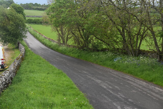
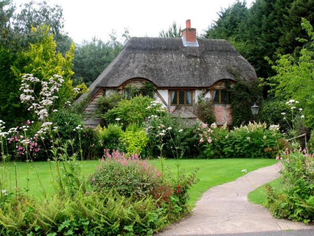
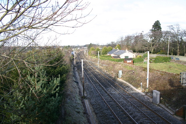
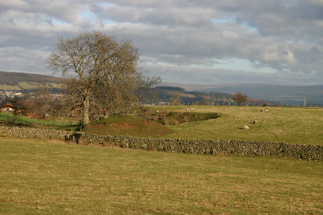
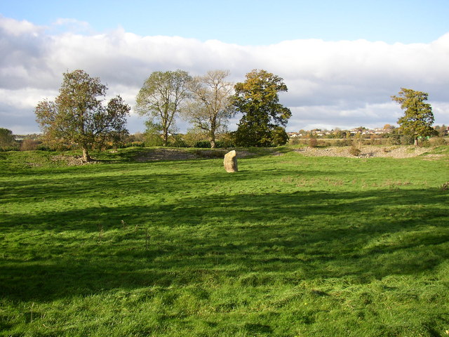
The village of Glen Dowlin is known for its stunning natural beauty, with rolling hills, lush green fields, and charming stone houses dotting the landscape. It is a popular destination for outdoor enthusiasts, as it offers numerous opportunities for activities such as hiking, cycling, and horseback riding. The nearby Lake District National Park provides additional options for exploring the great outdoors.

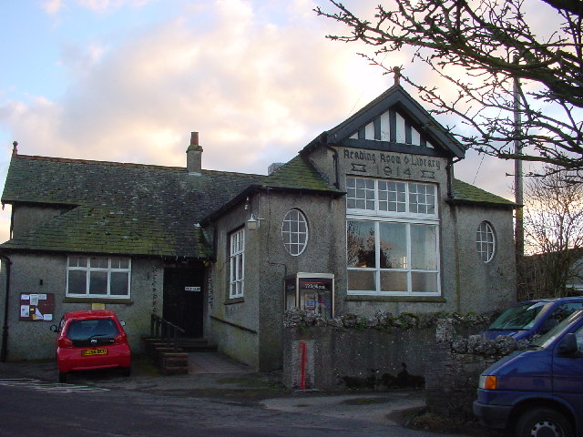
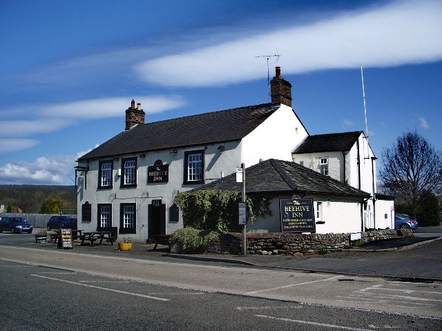
Despite its small size, Glen Dowlin boasts a strong sense of community. The village is home to a close-knit population, with friendly and welcoming residents. Local amenities include a village hall, a primary school, and a couple of quaint pubs serving traditional English fare.

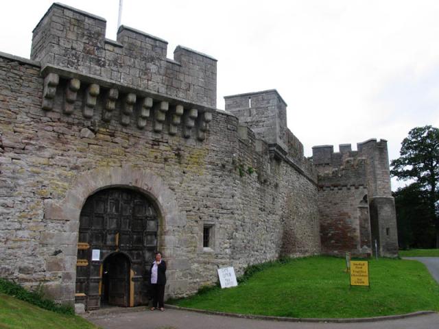
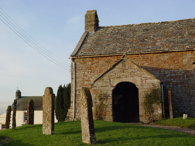
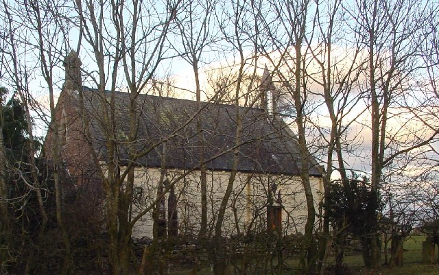
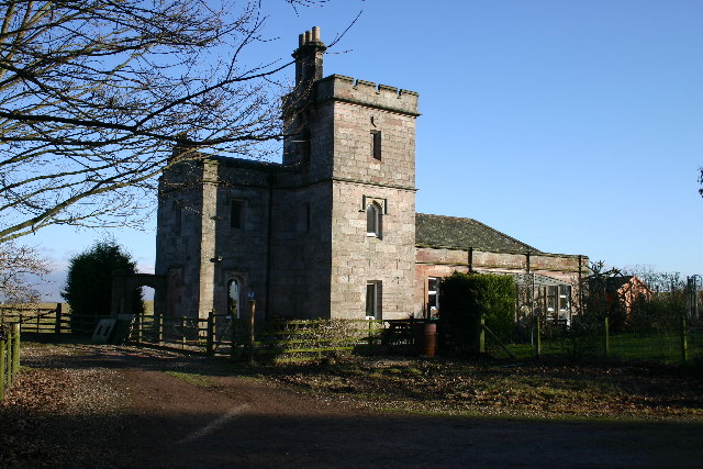
The history of Glen Dowlin can be traced back centuries, as evidenced by the presence of several historical landmarks in the area. These include a medieval church, which is a testament to the village's long-standing religious heritage.

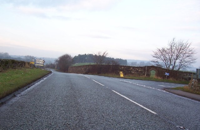
Access to Glen Dowlin is primarily by road, with the village being well-connected to nearby towns and cities. The closest major town is Kendal, located approximately 6 miles to the southeast, offering a wider range of amenities and services.

In summary, Glen Dowlin is a charming and picturesque village nestled in the heart of Westmorland. With its natural beauty, strong community spirit, and historical significance, it is an appealing destination for those seeking a peaceful and quintessentially English experience.

If you have any feedback on the listing, please let us know in the comments section below.
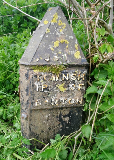
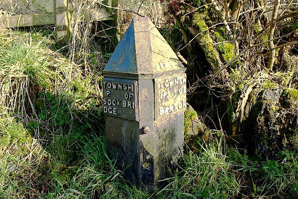
Glen Dowlin Images

Images are sourced within 2km of 54.635229/-2.7559997 or Grid Reference NY5126. Thanks to Geograph Open Source API. All images are credited.

Old Boundary Marker between Sockbridge and Celleron Township Boundary Marker to the right of a field gate on the east side of the road between Sockbridge and Celleron. In raised lettering, TOWNSH / IP OF / SOCKBRI / DGE and TOWNSH / IP OF / BARTON on adjacent faces, and dated 1847 above the Barton face. On the boundary of Barton and Sockbridge and Tirril parishes. Sockbridge was a township in Barton parish until 1866 when it became a separate parish. Grade II Listed details <span class="nowrap"><a title="https://historicengland.org.uk/listing/the-list/list-entry/1326835" rel="nofollow ugc noopener" href="https://historicengland.org.uk/listing/the-list/list-entry/1326835">Link</a><img style="margin-left:2px;" alt="External link" title="External link - shift click to open in new window" src="https://s1.geograph.org.uk/img/external.png" width="10" height="10"/></span>. See also <span class="nowrap"><a title="http://www.geog.port.ac.uk/webmap/thelakes/photos/bqf19.jpg" rel="nofollow ugc noopener" href="http://www.geog.port.ac.uk/webmap/thelakes/photos/bqf19.jpg">Link</a><img style="margin-left:2px;" alt="External link" title="External link - shift click to open in new window" src="https://s1.geograph.org.uk/img/external.png" width="10" height="10"/></span>.

Milestone Society National ID: WE_BASOTI01pb
Old Boundary Marker between Sockbridge and Celleron
Township Boundary Marker to the right of a field gate on the east side of the road between Sockbridge and Celleron. In raised lettering, TOWNSH / IP OF / SOCKBRI / DGE and TOWNSH / IP OF / BARTON on adjacent faces, and dated 1847 above the Barton face. On the boundary of Barton and Sockbridge and Tirril parishes. Sockbridge was a township in Barton parish until 1866 when it became a separate parish. Grade II Listed details LinkExternal link. See also LinkExternal link. Milestone Society National ID: WE_BASOTI01pb
Slapstones
Slapstones
Brougham Hall This Manor House situated in the south eastern corner of the square, has seen all sorts of troubled times. It is now a craft centre and produces delicious smoked cheese.
Brougham Hall
This Manor House situated in the south eastern corner of the square, has seen all sorts of troubled times. It is now a craft centre and produces delicious smoked cheese.
One of a pair This photograph of the knocker on the door at Brougham Hall, is submitted as a supplementary photo, as it is of some interest. Its partner is to be found on the door of Durham Cathedral <a title="https://www.geograph.org.uk/photo/2532705" href="https://www.geograph.org.uk/photo/2532705">Link</a>.
One of a pair
This photograph of the knocker on the door at Brougham Hall, is submitted as a supplementary photo, as it is of some interest. Its partner is to be found on the door of Durham Cathedral Link.
Honeysuckle Cottage Visitor Centre This is a photograph of the visitors' centre for Lilliput Lane Miniature Cottages. The exact grid reference is NY510288.
Honeysuckle Cottage Visitor Centre
This is a photograph of the visitors' centre for Lilliput Lane Miniature Cottages. The exact grid reference is NY510288.
Old Church, Clifton, Penrith I think this could be a private house? There are no signs outside and I saw a man take his dog into the building.
Old Church, Clifton, Penrith
I think this could be a private house? There are no signs outside and I saw a man take his dog into the building.
A6 to Cliburn Junction.
Train Line Yanwath Looking North, from B5230 road bridge at Yanwath
Train Line Yanwath
Looking North, from B5230 road bridge at Yanwath
Small Quarry in Farmland The area is dotted with these small excavations - usually for stone or clay.
Small Quarry in Farmland
The area is dotted with these small excavations - usually for stone or clay.
Mini Reservoir Not on the scale of Kielder Water, this one measures about 10m across and still holds water, even though long disused.
Mini Reservoir
Not on the scale of Kielder Water, this one measures about 10m across and still holds water, even though long disused.
Stubble Field The Ullswater Fells are in the far distance.
Stubble Field
The Ullswater Fells are in the far distance.
Reading Room and Library In Tirril
Reading Room and Library
In Tirril
Wesleyan Chapel, Tirril Built 1877
Wesleyan Chapel, Tirril
Built 1877
Farmland at Tirril A strip of legumes has been left whilst the rest of the field is being replanted
Farmland at Tirril
A strip of legumes has been left whilst the rest of the field is being replanted
The Hag This odd-shaped plantation shows clearly on map and ground. Deciduous trees on left, coniferous on right with the odd one ....
The Hag
This odd-shaped plantation shows clearly on map and ground. Deciduous trees on left, coniferous on right with the odd one ....
Buckholme Lodge On the Lowther Estate, reached only by a private drive.
Buckholme Lodge
On the Lowther Estate, reached only by a private drive.
Redhills Now bypassed by the A66 dual carriageway, a few metres away, and next to a main railway line, there are few dwellings left in this old hamlet
Redhills
Now bypassed by the A66 dual carriageway, a few metres away, and next to a main railway line, there are few dwellings left in this old hamlet
Mayburgh Henge, northern part with standing-stone, Yanwath and Eamont Bridge Mayburgh Henge consists of a single circular bank, up to 6.5 metres high, and 50m across its base, with a single entrance and enclosing a level area 90m dia. It contains a single monolith 2.8m high, one of eight that existed in the 18C, four in the centre and four at the entrance. The other seven were destroyed using gunpowder.  The henge probably dates from between 2000 and 1000BC, and may have been a meeting place or refuge for a large prehistoric community.
Mayburgh Henge, northern part with standing-stone, Yanwath and Eamont Bridge
Mayburgh Henge consists of a single circular bank, up to 6.5 metres high, and 50m across its base, with a single entrance and enclosing a level area 90m dia. It contains a single monolith 2.8m high, one of eight that existed in the 18C, four in the centre and four at the entrance. The other seven were destroyed using gunpowder. The henge probably dates from between 2000 and 1000BC, and may have been a meeting place or refuge for a large prehistoric community.
Show me another place!

Glen Dowlin is located at Grid Ref: NY5126 (Lat: 54.635229, Lng: -2.7559997)

Administrative County: Cumbria

District: Eden

Police Authority: Cumbria

What 3 Words

///minerals.pairings.flesh. Near Penrith, Cumbria

Nearby Locations

Glen Dowlin

Related Wikis

Yanwath

Yanwath is a village in the Westmorland and Furness District of Cumbria, England, 1 mile south of Penrith. There is a primary school at Yanwath, with 192...

Sockbridge and Tirril

Sockbridge and Tirril is a small civil parish in Eden District, Cumbria. It had a population of 397 in 2001, increasing to 415 at the 2011 Census. It comprises...

Yanwath and Eamont Bridge

Yanwath and Eamont Bridge is a civil parish in the Eden District of Cumbria, England, consisting of the small village of Yanwath and most of the neighbouring...

Yanwath Hall

Yanwath Hall is a 14th-century and later tower house in Yanwath, Cumbria, England. It is a grade I listed building.Early owners included the Salkeld family...

River Lowther

The River Lowther is a small river which flows through limestone rock in Cumbria, England. It is a tributary of the River Eamont which in turn is a tributary...
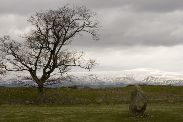
Mayburgh Henge

Mayburgh Henge is a large prehistoric monument in the county of Cumbria in northern England. The henge is in the care of English Heritage and is a Scheduled...

Eamont Bridge

Eamont Bridge is a small village immediately to the south of Penrith, Cumbria, England. The village is named after the bridge over the River Eamont and...

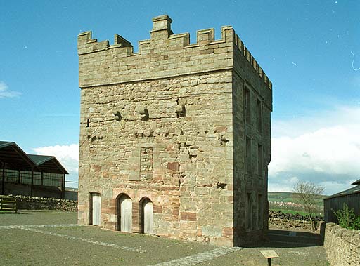
Clifton Hall, Cumbria

Clifton Hall was a fortified manor house in the village of Clifton, Cumbria. Dating from around 1400, it was constructed by either Elianor Engaine or her...

Nearby Amenities

Located within 500m of 54.635229,-2.7559997
Direction: ESE
Generator Method: photovoltaic
Generator Output Electricity: yes
Generator Source: solar
Generator Type: solar_photovoltaic_panel
Location: roof
Power: generator
Lat/Long: 54.6337989/-2.7572084
Direction: S
Generator Method: photovoltaic
Generator Output Electricity: yes
Generator Source: solar
Generator Type: solar_photovoltaic_panel
Location: roof
Power: generator
Lat/Long: 54.6348344/-2.756393
Power: pole
Lat/Long: 54.6341728/-2.7629355
Power: pole
Lat/Long: 54.6349824/-2.7618183
Power: pole
Lat/Long: 54.6356507/-2.7609399
Power: pole
Lat/Long: 54.6317665/-2.7517292
Power: pole
Lat/Long: 54.6324216/-2.7526814
Power: pole
Lat/Long: 54.6327554/-2.7532098
Power: pole
Lat/Long: 54.6338127/-2.7548191
Power: pole
Lat/Long: 54.6344841/-2.7558129
Power: pole
Lat/Long: 54.6351672/-2.7568643
Power: pole
Lat/Long: 54.6356585/-2.7582738
Power: pole
Lat/Long: 54.6361778/-2.7596605
Power: pole
Lat/Long: 54.6363074/-2.7600601
Power: pole
Lat/Long: 54.6365527/-2.7608031
Power: pole
Lat/Long: 54.636933/-2.761986
Power: pole
Lat/Long: 54.639179/-2.7576981
Power: pole
Lat/Long: 54.6383467/-2.7571345
Power: pole
Lat/Long: 54.6375275/-2.7564994
Power: pole
Lat/Long: 54.636703/-2.7559112
The data included in this document is from www.openstreetmap.org. The data is made available under ODbL.

Have you been to Glen Dowlin?

Leave your review of Glen Dowlin below (or comments, questions and feedback).