Glen Barry

Settlement in Banffshire

Scotland

Glen Barry

View towards Knock Distillery From B9022 near Ternemny.
View towards Knock Distillery Credit: Stanley Howe

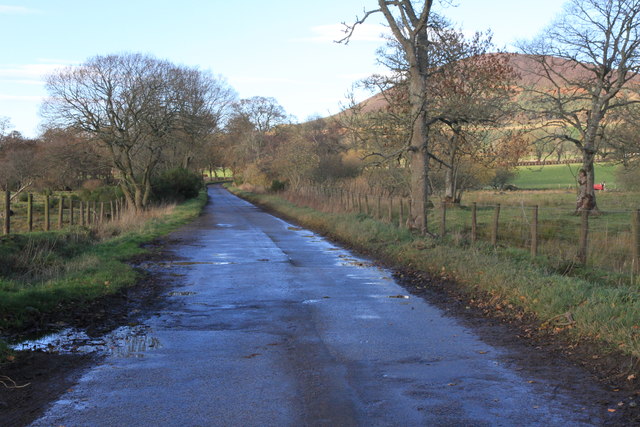
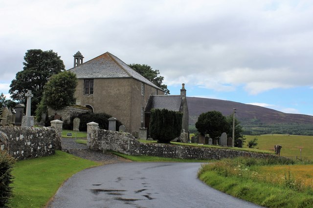
Glen Barry is a picturesque village located in Banffshire, a historic county in the northeastern part of Scotland. Nestled amidst rolling hills and stunning landscapes, this charming settlement is renowned for its natural beauty and tranquility.

The village is surrounded by lush greenery, with a mix of forests, meadows, and farmland, making it a perfect destination for nature lovers and outdoor enthusiasts. Hikers and walkers are drawn to Glen Barry for its network of scenic trails that offer breathtaking views of the surrounding countryside.

Historically, Glen Barry has been an agricultural community, with farming playing a significant role in the local economy. The village is dotted with traditional stone cottages and farmhouses, adding to its rustic charm and giving visitors a glimpse into its rich heritage.

The nearby River Deveron, one of Scotland's finest salmon rivers, runs through Glen Barry, providing opportunities for fishing enthusiasts to test their skills. The river is also a popular spot for leisurely walks along its banks, where visitors can enjoy the peaceful sounds of flowing water and spot various wildlife species.

While Glen Barry is a small village, it exudes a strong sense of community spirit. The locals are known for their warm hospitality, and there are a few amenities available, including a village hall and a small shop catering to the basic needs of residents and visitors alike.

Overall, Glen Barry in Banffshire offers a serene escape from the hustle and bustle of city life, with its natural beauty, historical charm, and welcoming community making it a delightful destination for those seeking a tranquil Scottish experience.

If you have any feedback on the listing, please let us know in the comments section below.

Glen Barry Images

Images are sourced within 2km of 57.578511/-2.7459492 or Grid Reference NJ5554. Thanks to Geograph Open Source API. All images are credited.

View towards Knock Distillery From B9022 near Ternemny.
View towards Knock Distillery
From B9022 near Ternemny.
Ordnance Survey  Flush Bracket G4215 This can be found on a building at Ternemny.
For more detail see : <span class="nowrap"><a title="http://www.bench-marks.org.uk/bm2517" rel="nofollow ugc noopener" href="http://www.bench-marks.org.uk/bm2517">Link</a><img style="margin-left:2px;" alt="External link" title="External link - shift click to open in new window" src="https://s1.geograph.org.uk/img/external.png" width="10" height="10"/></span>
Ordnance Survey Flush Bracket G4215
This can be found on a building at Ternemny. For more detail see : LinkExternal link
Ordnance Survey  Flush Bracket G939 This partially buried bracket can be found on a building at Glen Barry.
For more detail see : <span class="nowrap"><a title="http://www.bench-marks.org.uk/bm622" rel="nofollow ugc noopener" href="http://www.bench-marks.org.uk/bm622">Link</a><img style="margin-left:2px;" alt="External link" title="External link - shift click to open in new window" src="https://s1.geograph.org.uk/img/external.png" width="10" height="10"/></span>
Ordnance Survey Flush Bracket G939
This partially buried bracket can be found on a building at Glen Barry. For more detail see : LinkExternal link
Ordiquhill Kirk
Ordiquhill Kirk
Minor road near Ordiquhill
A95, Glenbarry
A95, Glenbarry
A95 crossing into Moray
Knock Hill summit A modern stone circle at the summit.
Knock Hill a Marilyn at 430m
Knock Hill summit
A modern stone circle at the summit. Knock Hill a Marilyn at 430m
Car park for Knock Hill An area for several cars at the start of the path for Knock Hill
Car park for Knock Hill
An area for several cars at the start of the path for Knock Hill
Knockdhu Distillery The Knockdhu Distillery
Knockdhu Distillery
The Knockdhu Distillery
Road towards Swilebog
Road near Swilebog
Road near Swilebog
Eroded path in Knock Hill
Trig point on Knock Hill
Knochdhu Distillery
Knochdhu Distillery
Minor road near Knock With Knock Hill behind the trees.
Minor road near Knock
With Knock Hill behind the trees.
Ordiquhill Kirk The church and churchyard of Ordiquhill.
Ordiquhill Kirk
The church and churchyard of Ordiquhill.
Glenbarry The white house was until recently a pub, but has been converted to a dwellinghouse. It is situated at the junction of the A95 Keith to Banff and B9022 Glenbarry to Huntly roads.
Glenbarry
The white house was until recently a pub, but has been converted to a dwellinghouse. It is situated at the junction of the A95 Keith to Banff and B9022 Glenbarry to Huntly roads.
Show me another place!

Glen Barry is located at Grid Ref: NJ5554 (Lat: 57.578511, Lng: -2.7459492)

Unitary Authority: Aberdeenshire

Police Authority: North East

What 3 Words

///whiplash.lightbulb.profited. Near Aberchirder, Aberdeenshire

Nearby Locations

Glenbarry Glen Barry

Related Wikis

Glenbarry railway station

Glenbarry railway station, previously known as Barry was an intermediate stop with a passing loop situated on the Great North of Scotland Railway (GNoSR...

Knock railway station (Scotland)

Knock railway station was an intermediate stop situated on the Great North of Scotland Railway (GNoSR) line from Grange and Cairnie Junction to Tillynaught...
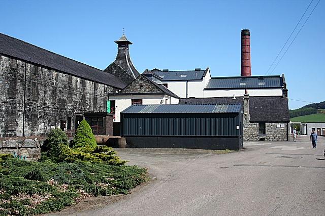
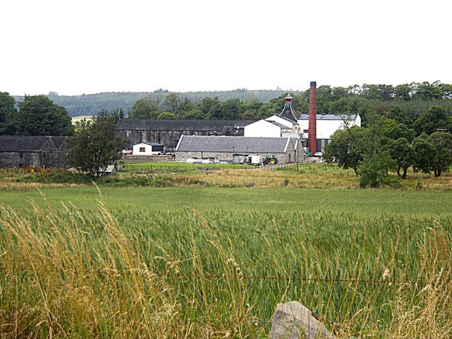
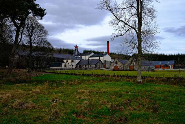
Knockdhu distillery

Knockdhu distillery is a whisky distillery situated in Knock, Banffshire and owned by Inver House Distillers Limited. == History == The distillery was...

Castle of Park (Aberdeenshire)

Park or Castle of Park, is an A-listed rambling baronial mansion incorporating a 16th-century tower house. It is 4 miles (6.4 km) north-west of Aberchirder...

Cornhill, Aberdeenshire

Cornhill (Scottish Gaelic: Cnoc an Arbhair) is a small village close to Banff, Aberdeenshire, Scotland. It lies 5 miles (8.0 km) to the south of Portsoy...

Cornhill railway station

Cornhill railway station was an intermediate stop situated on the Great North of Scotland Railway (GNoSR) line from Cairnie Junction to Tillynaught. There...

Millegin railway station

Millegin railway station, Millagan railway station or later Millegin Siding was briefly an intermediate stop situated on what became the Great North of...

Farmtown

Farmtown is a village in the Moray council area of Scotland. Farmtown lies on the junction of the A95 and B9117 roads east of the town of Keith.

Nearby Amenities

Located within 500m of 57.578511,-2.7459492
Glenbarry
Historic Railway: station
Wikidata: Q20713227
Wikipedia: en:Glenbarry railway station
Lat/Long: 57.5804458/-2.7469347
Power: pole
Lat/Long: 57.5826902/-2.7429914
Power: pole
Lat/Long: 57.5809018/-2.7400338
Power: pole
Lat/Long: 57.5805858/-2.7409003
Power: pole
Lat/Long: 57.5802426/-2.7419155
Power: pole
Lat/Long: 57.5798876/-2.7429255
Power: pole
Lat/Long: 57.5795371/-2.7439458
Power: pole
Lat/Long: 57.5788579/-2.7443275
Power: pole
Lat/Long: 57.5797037/-2.7446586
Power: pole
Lat/Long: 57.5798378/-2.7452954
Power: pole
Lat/Long: 57.5781733/-2.7447025
Power: pole
Lat/Long: 57.5774932/-2.7450977
Power: pole
Lat/Long: 57.5768185/-2.7454744
Power: pole
Lat/Long: 57.5762443/-2.7458004
Power: pole
Lat/Long: 57.5757271/-2.7460825
Power: pole
Lat/Long: 57.5750723/-2.7464575
Power: pole
Lat/Long: 57.5744293/-2.7463392
Power: pole
Lat/Long: 57.5774787/-2.7522825
Power: pole
Lat/Long: 57.5772378/-2.7509918
Power: pole
Lat/Long: 57.5769726/-2.749612
Power: pole
Lat/Long: 57.5767501/-2.748454
Power: pole
Lat/Long: 57.5764808/-2.747006
The data included in this document is from www.openstreetmap.org. The data is made available under ODbL.

Have you been to Glen Barry?

Leave your review of Glen Barry below (or comments, questions and feedback).