Gateside of Trench

Settlement in Dumfriesshire

Scotland

Gateside of Trench

Entrance to Craigs Moss The entrance to Craigs Moss an area of native woodlan on the outskirts of Dumfries managed by Scottish Woodlands Ltd.
Entrance to Craigs Moss Credit: Colin Kinnear

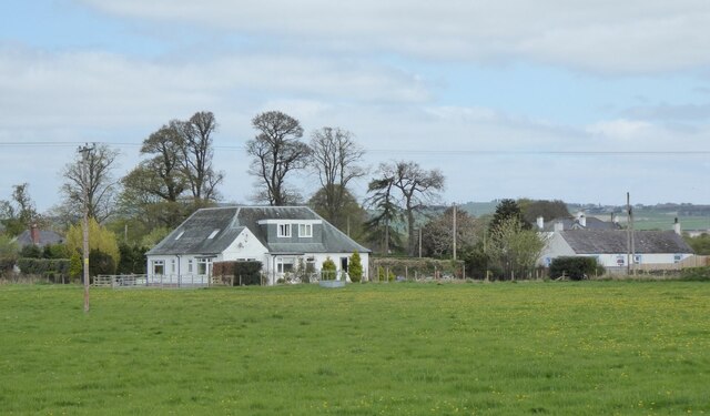
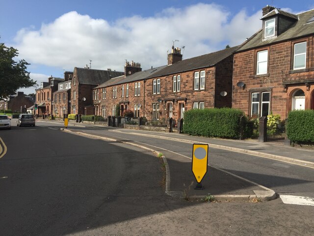
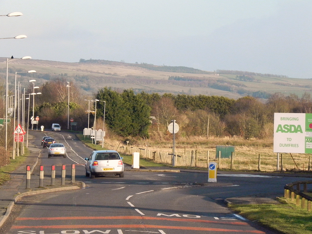
Gateside of Trench is a small village located in the region of Dumfriesshire, Scotland. Situated in the southeastern part of the country, it is nestled amidst picturesque rolling hills and lush green valleys. The village is set in a rural landscape, characterized by its tranquil atmosphere and stunning natural beauty.

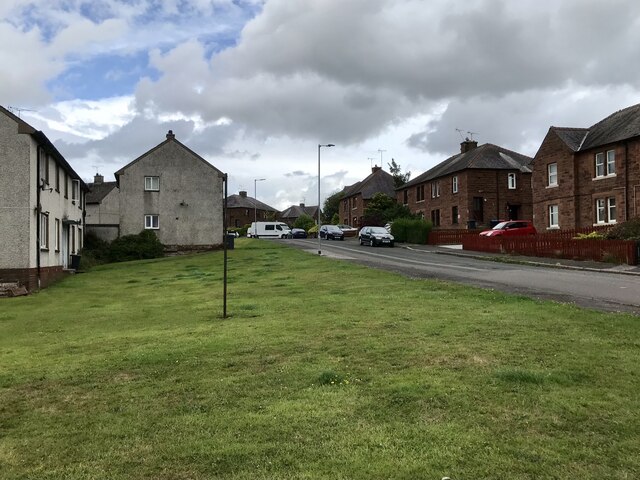
With a population of approximately 200 residents, Gateside of Trench is a close-knit community where neighbors are familiar faces and a sense of community spirit prevails. The village is predominantly residential, with charming cottages and traditional stone houses dotting its streets. The architecture reflects the village's rich history, giving it a timeless and nostalgic ambiance.

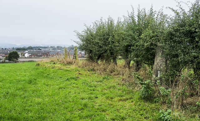
The village is surrounded by vast farmlands, which contribute to the local economy and add to the idyllic countryside surroundings. Agriculture plays a significant role in the area, with farming being the primary occupation for many residents. The fertile soil and favorable climate provide ideal conditions for cultivating crops and rearing livestock.

Although small in size, Gateside of Trench offers basic amenities to cater to the needs of its residents. The village has a primary school, ensuring that children have access to education within their community. Additionally, there are a few local businesses, including a small grocery store and a cozy pub, providing essential goods and a gathering place for locals.

Gateside of Trench's location in Dumfriesshire allows residents to enjoy the tranquility of rural living while still being within a reasonable distance from larger towns and cities. The village's picturesque landscapes and tight-knit community make it an appealing place for those seeking a peaceful and close community connection.

If you have any feedback on the listing, please let us know in the comments section below.

Gateside of Trench Images

Images are sourced within 2km of 55.070067/-3.5703903 or Grid Reference NX9976. Thanks to Geograph Open Source API. All images are credited.

Entrance to Craigs Moss The entrance to Craigs Moss an area of native woodlan on the outskirts of Dumfries managed by Scottish Woodlands Ltd.
Entrance to Craigs Moss
The entrance to Craigs Moss an area of native woodlan on the outskirts of Dumfries managed by Scottish Woodlands Ltd.
Filling station on approach to Dumfries With adjacent Starbucks!
Filling station on approach to Dumfries
With adjacent Starbucks!
Houses north of the A75 On the outskirts of Dumfries.
Houses north of the A75
On the outskirts of Dumfries.
Cresswell Gardens, Grierson Avenue
Boundary Stone, Graigs Road Parliamentary & Police Burgh boundary in 1900.

Milestone Society National ID: DF_DUMF02pb
Boundary Stone, Graigs Road
Parliamentary & Police Burgh boundary in 1900. Milestone Society National ID: DF_DUMF02pb
Houses on Annan Road, Dumfries
Hedge with embedded trig point The trig point is on Clumpton Hill in the line of an incomplete hedge dividing two grassed fields. It lies close to the north-eastern edge of Dumfries and houses of that part of the town can be seen in the distance.
Hedge with embedded trig point
The trig point is on Clumpton Hill in the line of an incomplete hedge dividing two grassed fields. It lies close to the north-eastern edge of Dumfries and houses of that part of the town can be seen in the distance.
Old milestone The road into Dumfries was once the A75 but now that is the by-pass.   The road where this milestone stands on the north side of Annan Road by a small park is now the A780.   The milestone could do with some tlc and then the cut benchmark on the front would be more visible.
Old milestone
The road into Dumfries was once the A75 but now that is the by-pass. The road where this milestone stands on the north side of Annan Road by a small park is now the A780. The milestone could do with some tlc and then the cut benchmark on the front would be more visible.
Old milestone Looking towards the centre of Dumfries along Annan Road with the milestone on the north side of the road.
Old milestone
Looking towards the centre of Dumfries along Annan Road with the milestone on the north side of the road.
A75 approaching Dumfries from the east Taken from close to Douievale. The first roundabout signs can be seen in the distance
A75 approaching Dumfries from the east
Taken from close to Douievale. The first roundabout signs can be seen in the distance
A75 Dumfries by pass at the lay bys at east end These lie between the A780 and the A709 roundabouts. There is a telephone on each side shown on the map
A75 Dumfries by pass at the lay bys at east end
These lie between the A780 and the A709 roundabouts. There is a telephone on each side shown on the map
Solway Gate Inn From Premier Inn car park
Solway Gate Inn
From Premier Inn car park
Approaching Dumfries Newfield Caravan Park can just be seen through the trees on the left.
Approaching Dumfries
Newfield Caravan Park can just be seen through the trees on the left.
"Reduce Speed" roundabout ahead
Approaching the Dumfries ring road
Little Chef, Travelodge and filling station
Roundabout at the junction of the A75 and the A780
A780 near Dumfries Annan Road (A780) on the eastern outskirts of Dumfries.
A780 near Dumfries
Annan Road (A780) on the eastern outskirts of Dumfries.
Show me another place!

Gateside of Trench is located at Grid Ref: NX9976 (Lat: 55.070067, Lng: -3.5703903)

Unitary Authority: Dumfries and Galloway

Police Authority: Dumfries and Galloway

What 3 Words

///storms.fault.lives. Near Dumfries, Dumfries & Galloway

Related Wikis

Dumfries High School

Dumfries High School is situated in a residential area of Marchmount in Dumfries, Scotland. It has been on this site since 1961, and has been expanded...

Loaningfoot

Loaningfoot is a hamlet in the parish of Kirkbean in Dumfries and Galloway, Scotland. It is 10 miles ESE of the town of Dalbeattie. == References ==

Dumfries

Dumfries ( dum-FREESS; Scots: Dumfries; from Scottish Gaelic: Dùn Phris [ˌt̪un ˈfɾʲiʃ]) is a market town and former royal burgh in Dumfries and Galloway...

St Joseph's College, Dumfries

St Joseph's College in Dumfries, South West Scotland, is a Roman Catholic secondary school. It began as a Catholic boys' boarding school run by Marist...

Dumfries railway station

Dumfries railway station serves the town of Dumfries in Dumfries and Galloway, Scotland. It is located on the Glasgow South Western Line. The station is...

Greyfriars, Dumfries

Greyfriars, Dumfries, was a friary of the Friars Minor, commonly known as the Franciscans, established in Dumfries, Scotland. Following dissolution the...

County Buildings, Dumfries

County Buildings is a municipal structure in English Street, Dumfries, Scotland. The structure, which is the headquarters of Dumfries and Galloway Council...

Dumfries and Galloway Aviation Museum

The Dumfries and Galloway Aviation Museum is a volunteer-operated aviation museum located in and around the World War II-era watch tower (control tower...

Nearby Amenities

Located within 500m of 55.070067,-3.5703903
Bus Stop
Annan Road
Bus: yes
Naptan AtcoCode: 680000168333
Naptan Bearing: W
Naptan CommonName: Annan Road
Naptan Indicator: opp Roads Depot
Naptan Landmark: Haytons
Naptan NaptanCode: 34235323
Naptan Notes: none
Naptan PlusbusZoneRef: DUMFRES
Naptan Street: Annan Road
Naptan Verified: no
Public Transport: platform
Source: naptan_import
Lat/Long: 55.0689312/-3.5670374
Bus Stop
Annan Road
Bus: yes
Naptan AtcoCode: 680000168444
Naptan Bearing: E
Naptan CommonName: Annan Road
Naptan Indicator: Roads Depot
Naptan Landmark: Haytons
Naptan NaptanCode: 34235298
Naptan Notes: none
Naptan Street: Annan Road
Naptan Verified: no
Public Transport: platform
Source: naptan_import
Lat/Long: 55.0689701/-3.5654102
Bus Stop
Annan Road
Bus: yes
Naptan AtcoCode: 680000430333
Naptan Bearing: W
Naptan CommonName: Annan Road
Naptan Indicator: no 300
Naptan Landmark: Brownrigg Loaning
Naptan NaptanCode: 34235324
Naptan Notes: none
Naptan PlusbusZoneRef: DUMFRES
Naptan Street: Annan Road
Naptan Verified: no
Public Transport: platform
Source: naptan_import
Lat/Long: 55.0690126/-3.5704862
Bus Stop
Annan Road
Bus: yes
Naptan AtcoCode: 680000430444
Naptan Bearing: E
Naptan CommonName: Annan Road
Naptan Indicator: no 369
Naptan Landmark: Brownrigg Loaning
Naptan NaptanCode: 34235325
Naptan Notes: none
Naptan PlusbusZoneRef: DUMFRES
Naptan Street: Annan Road
Naptan Verified: no
Public Transport: platform
Source: naptan_import
Lat/Long: 55.0691217/-3.5710856
Bus Stop
Annan Road
Bus: yes
Naptan AtcoCode: 680000634333
Naptan Bearing: W
Naptan CommonName: Annan Road
Naptan Indicator: no 284
Naptan Landmark: The Crescent
Naptan NaptanCode: 34235326
Naptan Notes: none
Naptan PlusbusZoneRef: DUMFRES
Naptan Street: Annan Road
Naptan Verified: no
Public Transport: platform
Source: naptan_import
Lat/Long: 55.0686204/-3.5757957
Bus Stop
Annan Road
Bus: yes
Naptan AtcoCode: 680000634444
Naptan Bearing: E
Naptan CommonName: Annan Road
Naptan Indicator: opp no 276
Naptan Landmark: The Crescent
Naptan NaptanCode: 34235327
Naptan Notes: none
Naptan PlusbusZoneRef: DUMFRES
Naptan Street: Annan Road
Naptan Verified: no
Public Transport: platform
Source: naptan_import
Lat/Long: 55.0687024/-3.5764097
Mini Roundabout
Direction: clockwise
Source: survey
Lat/Long: 55.0687422/-3.5631004
Post Box
Brand: Royal Mail
Brand Wikidata: Q638098
Mapillary: 401055435528032
Operator: Royal Mail
Operator Wikidata: Q638098
Post Box Mounting: wooden_post
Post Box Type: lamp
Ref: DG1 56
Survey Date: 2022-09-03
Lat/Long: 55.0685572/-3.5763827
Power: pole
Lat/Long: 55.0703378/-3.576624
Power: pole
Lat/Long: 55.0701682/-3.5750088
Power: pole
Lat/Long: 55.0700015/-3.5734401
Power: pole
Lat/Long: 55.0699344/-3.5734774
Power: pole
Lat/Long: 55.0701026/-3.5750385
Power: pole
Lat/Long: 55.0702427/-3.5763831
Power: pole
Lat/Long: 55.0703297/-3.5772641
Power: pole
Lat/Long: 55.0697161/-3.5627344
Power: pole
Lat/Long: 55.067629/-3.5747847
Power: pole
Lat/Long: 55.06748/-3.573708
Power: pole
Lat/Long: 55.0673045/-3.5724174
Power: pole
Lat/Long: 55.0670656/-3.5707843
Power: pole
Lat/Long: 55.0669549/-3.5688471
Power: pole
Lat/Long: 55.0668768/-3.5675772
Power: pole
Lat/Long: 55.0667868/-3.5661759
The data included in this document is from www.openstreetmap.org. The data is made available under ODbL.

Have you been to Gateside of Trench?

Leave your review of Gateside of Trench below (or comments, questions and feedback).