Noblehill

Settlement in Dumfriesshire

Scotland

Noblehill

Filling station on approach to Dumfries With adjacent Starbucks!
Filling station on approach to Dumfries Credit: Russel Wills

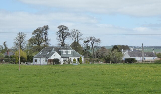
Noblehill is a small rural village located in Dumfriesshire, Scotland. Situated approximately 4 miles northeast of Dumfries, the village is surrounded by picturesque countryside and offers a tranquil setting for its residents.

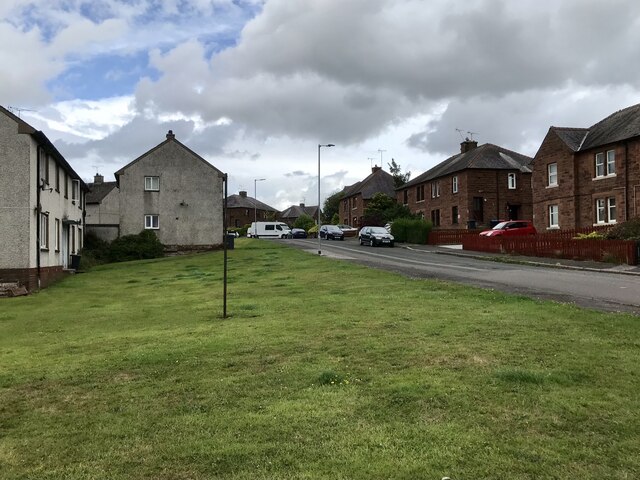
The village is primarily residential, with a population of around 500 people. The houses in Noblehill are predominantly traditional stone-built properties, adding to the charm and character of the area. The village boasts a close-knit community, with a friendly and welcoming atmosphere.

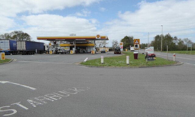
Noblehill benefits from its proximity to Dumfries, where residents can access a wider range of amenities and services. Dumfries provides excellent shopping facilities, including supermarkets, independent retailers, and a variety of restaurants and cafes. The town also offers several primary and secondary schools, making it an ideal location for families.

For those seeking outdoor activities, Noblehill is surrounded by stunning countryside, with numerous walking trails and cycling routes to explore. The nearby Dumfries and Galloway region is renowned for its natural beauty, including the Solway Coast, the Galloway Forest Park, and the Southern Uplands.

Transportation links in Noblehill are convenient, with regular bus services connecting the village to Dumfries and other nearby towns. The A75 road is easily accessible, providing connections to major cities such as Glasgow and Carlisle.

Overall, Noblehill offers a peaceful and scenic setting, combined with easy access to amenities and outdoor recreational opportunities. It is an ideal place to live for those seeking a rural lifestyle with the convenience of nearby urban centers.

If you have any feedback on the listing, please let us know in the comments section below.
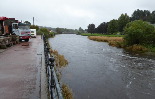
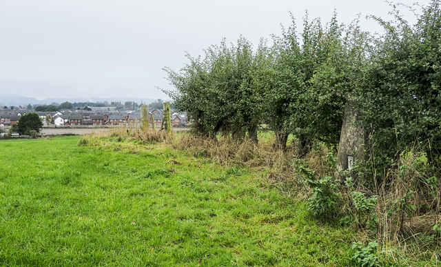
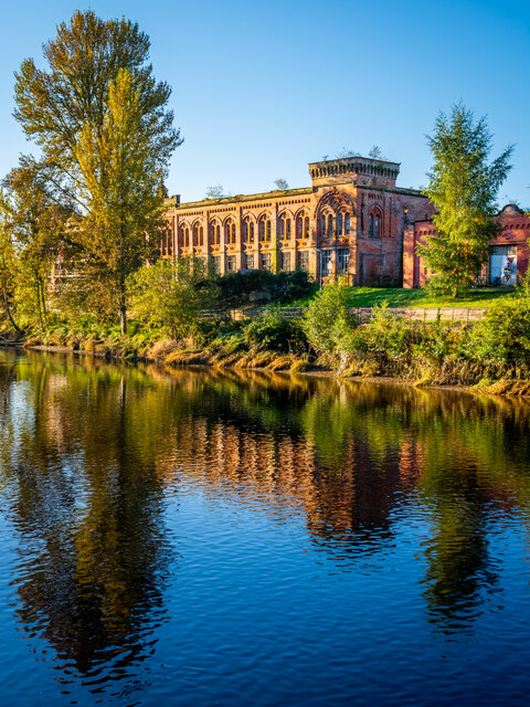
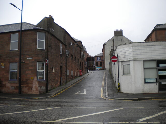
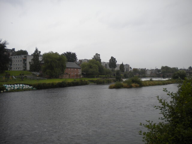
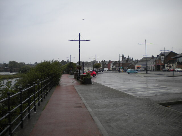
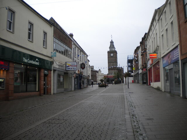
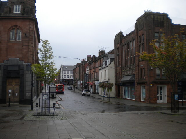
Noblehill Images

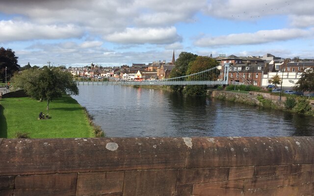
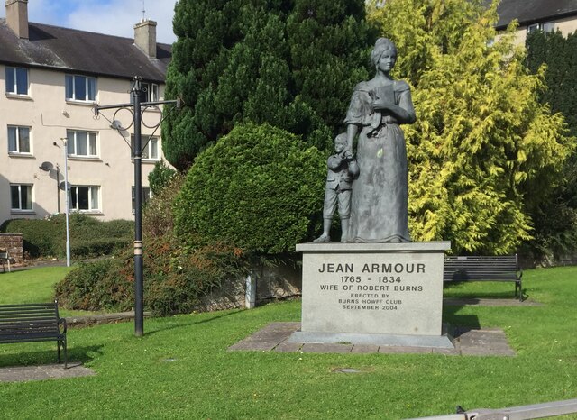
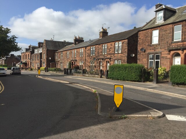
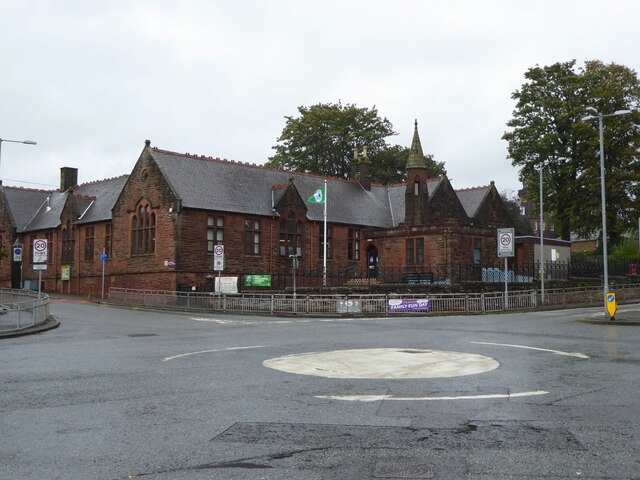
Images are sourced within 2km of 55.070173/-3.5823286 or Grid Reference NX9976. Thanks to Geograph Open Source API. All images are credited.

Filling station on approach to Dumfries With adjacent Starbucks!
Filling station on approach to Dumfries
With adjacent Starbucks!
Houses north of the A75 On the outskirts of Dumfries.
Houses north of the A75
On the outskirts of Dumfries.
Cresswell Gardens, Grierson Avenue
Boundary Stone, Graigs Road Parliamentary & Police Burgh boundary in 1900.

Milestone Society National ID: DF_DUMF02pb
Boundary Stone, Graigs Road
Parliamentary & Police Burgh boundary in 1900. Milestone Society National ID: DF_DUMF02pb
River Nith at Dumfries A beautiful suspension bridge provides a footbridge for pedestrians
River Nith at Dumfries
A beautiful suspension bridge provides a footbridge for pedestrians
Statue of Jean Armour Statue to Robert Burns' wife, standing in Dumfries between her home and her church. Mother to nine of his children, including two sets of twins, while he also had four more children by other women. <span class="nowrap"><a title="https://en.wikipedia.org/wiki/Jean_Armour" rel="nofollow ugc noopener" href="https://en.wikipedia.org/wiki/Jean_Armour">Link</a><img style="margin-left:2px;" alt="External link" title="External link - shift click to open in new window" src="https://s1.geograph.org.uk/img/external.png" width="10" height="10"/></span>
Statue of Jean Armour
Statue to Robert Burns' wife, standing in Dumfries between her home and her church. Mother to nine of his children, including two sets of twins, while he also had four more children by other women. LinkExternal link
Houses on Annan Road, Dumfries
St Michael's Primary School Originally, the school began as a Church School attached to the South Free Territorial Church. The school opened in 1865 and provided a general education - including Latin, for some pupils.

'At St Michael’s Primary we aim to provide a secure, supportive and friendly environment in which the children will develop skills and experiences, which will allow them to reach their full potential.' <span class="nowrap"><a title="https://stmichaelsdumfries.dumgal.sch.uk/" rel="nofollow ugc noopener" href="https://stmichaelsdumfries.dumgal.sch.uk/">Link</a><img style="margin-left:2px;" alt="External link" title="External link - shift click to open in new window" src="https://s1.geograph.org.uk/img/external.png" width="10" height="10"/></span>
St Michael's Primary School
Originally, the school began as a Church School attached to the South Free Territorial Church. The school opened in 1865 and provided a general education - including Latin, for some pupils. 'At St Michael’s Primary we aim to provide a secure, supportive and friendly environment in which the children will develop skills and experiences, which will allow them to reach their full potential.' LinkExternal link
Advert at St Michael's Services garage Nith Inshore Rescue is an independent lifeboat serving the Dumfries area. We are based in Glencaple, 5 miles south of Dumfries in south-west Scotland, on the estuary of the River Nith close to where it joins the Solway Firth.
Advert at St Michael's Services garage
Nith Inshore Rescue is an independent lifeboat serving the Dumfries area. We are based in Glencaple, 5 miles south of Dumfries in south-west Scotland, on the estuary of the River Nith close to where it joins the Solway Firth.
The River Nith in Dumfries The lorry is unloading the components of the fair being erected beside the river.
The River Nith in Dumfries
The lorry is unloading the components of the fair being erected beside the river.
Hedge with embedded trig point The trig point is on Clumpton Hill in the line of an incomplete hedge dividing two grassed fields. It lies close to the north-eastern edge of Dumfries and houses of that part of the town can be seen in the distance.
Hedge with embedded trig point
The trig point is on Clumpton Hill in the line of an incomplete hedge dividing two grassed fields. It lies close to the north-eastern edge of Dumfries and houses of that part of the town can be seen in the distance.
Derelict Mill, Dumfries
Signwriters at the Dougie Signwriters at work at the Douglas Arms Dumfries, known by the locals as The Dougie.
Signwriters at the Dougie
Signwriters at work at the Douglas Arms Dumfries, known by the locals as The Dougie.
Assembly Street, Dumfries Off Whitesands.
Assembly Street, Dumfries
Off Whitesands.
River Nith, Dumfries Looking upstream from Whitesands, with Maxwelltown on the far bank.
River Nith, Dumfries
Looking upstream from Whitesands, with Maxwelltown on the far bank.
Footpath alongside Whitesands, Dumfries (1) Between a car park and the River Nith (left and below).
Footpath alongside Whitesands, Dumfries (1)
Between a car park and the River Nith (left and below).
High Street, Dumfries Largely deserted on a wet Sunday after the shops closed for the evening.
High Street, Dumfries
Largely deserted on a wet Sunday after the shops closed for the evening.
Great King Street, Dumfries Seen from Queensberry Square.
Great King Street, Dumfries
Seen from Queensberry Square.
Show me another place!

Noblehill is located at Grid Ref: NX9976 (Lat: 55.070173, Lng: -3.5823286)

Unitary Authority: Dumfries and Galloway

Police Authority: Dumfries and Galloway

What 3 Words

///gifts.also.gasp. Near Dumfries, Dumfries & Galloway

Related Wikis

Dumfries High School

Dumfries High School is situated in a residential area of Marchmount in Dumfries, Scotland. It has been on this site since 1961, and has been expanded...

Dumfries

Dumfries ( dum-FREESS; Scots: Dumfries; from Scottish Gaelic: Dùn Phris [ˌt̪un ˈfɾʲiʃ]) is a market town and former royal burgh in Dumfries and Galloway...

St Joseph's College, Dumfries

St Joseph's College in Dumfries, South West Scotland, is a Roman Catholic secondary school. It began as a Catholic boys' boarding school run by Marist...

Dumfries railway station

Dumfries railway station serves the town of Dumfries in Dumfries and Galloway, Scotland. It is located on the Glasgow South Western Line. The station is...

Greyfriars, Dumfries

Greyfriars, Dumfries, was a friary of the Friars Minor, commonly known as the Franciscans, established in Dumfries, Scotland. Following dissolution the...

County Buildings, Dumfries

County Buildings is a municipal structure in English Street, Dumfries, Scotland. The structure, which is the headquarters of Dumfries and Galloway Council...

Theatre Royal, Dumfries

The Theatre Royal in Dumfries, Scotland is the oldest working theatre in Scotland. The Theatre is owned by the Guild of Players who bought it in 1959,...

Loreburn Hall

The Loreburn Hall is a military installation in Dumfries, Scotland. == History == The building was designed by Alan Burgess Crombie as the headquarters...

Nearby Amenities

Located within 500m of 55.070173,-3.5823286
Traffic Signals
Lat/Long: 55.0685096/-3.5857924
Traffic Signals
Lat/Long: 55.0688753/-3.5861968
Mini Roundabout
Direction: clockwise
Lat/Long: 55.0695866/-3.5871613
Bus Stop
Annan Road
Bus: yes
Naptan AtcoCode: 680000004333
Naptan Bearing: W
Naptan CommonName: Annan Road
Naptan Indicator: no 190
Naptan Landmark: Georgetown Road
Naptan NaptanCode: 34235345
Naptan Notes: none
Naptan PlusbusZoneRef: DUMFRES
Naptan Street: Annan Road
Naptan Verified: no
Public Transport: platform
Source: naptan_import
Lat/Long: 55.0696751/-3.5880064
Georgetown Road
Naptan AtcoCode: 680000017506
Naptan Bearing: NW
Naptan BusStopType: CUS
Naptan CommonName: Georgetown Road
Naptan Indicator: no 42
Naptan Landmark: Gillbrae
Naptan NaptanCode: 34238596
Naptan Notes: none
Naptan PlusbusZoneRef: DUMFRES
Naptan Street: Georgetown Road
Naptan Verified: no
Source: naptan_import
Lat/Long: 55.0671276/-3.5841782
Bus Stop
Lockerbie Road
Bus: yes
Naptan AtcoCode: 680000552333
Naptan Bearing: SW
Naptan CommonName: Lockerbie Road
Naptan Indicator: Stoop
Naptan Landmark: Stoop Loaning
Naptan NaptanCode: 34234578
Naptan Notes: none
Naptan PlusbusZoneRef: DUMFRES
Naptan Street: Lockerbie Road
Naptan Verified: no
Public Transport: platform
Source: naptan_import
Lat/Long: 55.0730478/-3.5878267
Bus Stop
Lockerbie Road
Bus: yes
Naptan AtcoCode: 680000552444
Naptan Bearing: NE
Naptan CommonName: Lockerbie Road
Naptan Indicator: opp Stoop
Naptan Landmark: Stoop Loaning
Naptan NaptanCode: 34234579
Naptan Notes: none
Naptan PlusbusZoneRef: DUMFRES
Naptan Street: Lockerbie Road
Naptan Verified: no
Public Transport: platform
Source: naptan_import
Lat/Long: 55.0732836/-3.5876638
Bus Stop
Annan Road
Bus: yes
Naptan AtcoCode: 680000632333
Naptan Bearing: NW
Naptan CommonName: Annan Road
Naptan Indicator: opp Aldi
Naptan Landmark: Aldi
Naptan NaptanCode: 34235343
Naptan Notes: none
Naptan PlusbusZoneRef: DUMFRES
Naptan Street: Annan Road
Naptan Verified: no
Public Transport: platform
Source: naptan_import
Lat/Long: 55.0693076/-3.5851727
Bus Stop
Annan Road
Bus: yes
Naptan AtcoCode: 680000632444
Naptan Bearing: SE
Naptan CommonName: Annan Road
Naptan Indicator: at Aldi
Naptan Landmark: Aldi
Naptan NaptanCode: 34238658
Naptan Notes: none
Naptan PlusbusZoneRef: DUMFRES
Naptan Street: Annan Road
Naptan Verified: no
Public Transport: platform
Source: naptan_import
Lat/Long: 55.0695785/-3.5864521
Bus Stop
Annan Road
Bus: yes
Naptan AtcoCode: 680000634333
Naptan Bearing: W
Naptan CommonName: Annan Road
Naptan Indicator: no 284
Naptan Landmark: The Crescent
Naptan NaptanCode: 34235326
Naptan Notes: none
Naptan PlusbusZoneRef: DUMFRES
Naptan Street: Annan Road
Naptan Verified: no
Public Transport: platform
Source: naptan_import
Lat/Long: 55.0686204/-3.5757957
Bus Stop
Annan Road
Bus: yes
Naptan AtcoCode: 680000634444
Naptan Bearing: E
Naptan CommonName: Annan Road
Naptan Indicator: opp no 276
Naptan Landmark: The Crescent
Naptan NaptanCode: 34235327
Naptan Notes: none
Naptan PlusbusZoneRef: DUMFRES
Naptan Street: Annan Road
Naptan Verified: no
Public Transport: platform
Source: naptan_import
Lat/Long: 55.0687024/-3.5764097
Bus Stop
Annan Road
Bus: yes
Naptan AtcoCode: 680000634501
Naptan Bearing: W
Naptan CommonName: Annan Road
Naptan Indicator: no 254
Naptan Landmark: Noblehill Place
Naptan NaptanCode: 34235328
Naptan Notes: none
Naptan PlusbusZoneRef: DUMFRES
Naptan Street: Annan Road
Naptan Verified: no
Public Transport: platform
Source: naptan_import
Lat/Long: 55.0686692/-3.5803551
Bus Stop
Annan Road
Bus: yes
Naptan AtcoCode: 680000634502
Naptan Bearing: E
Naptan CommonName: Annan Road
Naptan Indicator: no 257
Naptan Landmark: Noblehill Place
Naptan NaptanCode: 34235329
Naptan Notes: none
Naptan PlusbusZoneRef: DUMFRES
Naptan Street: Annan Road
Naptan Verified: no
Public Transport: platform
Source: naptan_import
Lat/Long: 55.0690529/-3.5826412
Bus Stop
Lockerbie Road
Bus: yes
Naptan AtcoCode: 680005007333
Naptan Bearing: SW
Naptan CommonName: Lockerbie Road
Naptan Indicator: Matalan
Naptan Landmark: Peel Centre
Naptan NaptanCode: 34234575
Naptan Notes: none
Naptan PlusbusZoneRef: DUMFRES
Naptan Street: A709
Naptan Verified: no
Public Transport: platform
Source: naptan_import
Lat/Long: 55.0742946/-3.5854761
Bus Stop
Lockerbie Road
Bus: yes
Naptan AtcoCode: 680005007444
Naptan Bearing: NE
Naptan CommonName: Lockerbie Road
Naptan Indicator: opp Matalan
Naptan Landmark: Peel Centre
Naptan NaptanCode: 34234567
Naptan Notes: none
Naptan PlusbusZoneRef: DUMFRES
Naptan Street: A709
Naptan Verified: no
Public Transport: platform
Source: naptan_import
Lat/Long: 55.0739838/-3.5863445
Turning Circle
Lat/Long: 55.070517/-3.5841993
Crossing
Crossing: traffic_signals
Crossing Island: no
Tactile Paving: yes
Lat/Long: 55.0741484/-3.5858535
Turning Circle
Noexit: yes
Lat/Long: 55.0675625/-3.5882218
Noblehill
Place: suburb
Lat/Long: 55.0710109/-3.5796716
Turning Circle
Lat/Long: 55.0694488/-3.5874152
Post Box
Brand: Royal Mail
Brand Wikidata: Q638098
Operator: Royal Mail
Operator Wikidata: Q638098
Post Box Mounting: pier
Post Box Type: lamp
Ref: DG1 18
Lat/Long: 55.0694327/-3.5872683
Post Box
Brand: Royal Mail
Brand Wikidata: Q638098
Mapillary: 401055435528032
Operator: Royal Mail
Operator Wikidata: Q638098
Post Box Mounting: wooden_post
Post Box Type: lamp
Ref: DG1 56
Survey Date: 2022-09-03
Lat/Long: 55.0685572/-3.5763827
Crossing
Crossing: marked
Lat/Long: 55.0741005/-3.5851047
Matalan
Brand: Matalan
Brand Wikidata: Q12061509
Brand Wikipedia: en:Matalan
Shop: clothes
Lat/Long: 55.0735882/-3.585599
Pets at Home
Brand: Pets at Home
Brand Wikidata: Q7179258
Brand Wikipedia: en:Pets at Home
Shop: pet
Website: https://community.petsathome.com/store/dumfries/
Lat/Long: 55.0737499/-3.5841475
Poundworld
Addr Housename: Peel Centre
Addr Street: Lockerbie Road
Addr Unit: 2
Brand: Poundworld
Brand Wikidata: Q16967516
Brand Wikipedia: en:Poundworld
Fhrs Id: 1025987
Shop: variety_store
Lat/Long: 55.0737073/-3.584793
Baby: no
Capacity: 2
Playground: swing
Lat/Long: 55.0719646/-3.5867735
Baby: yes
Capacity: 2
Playground: swing
Lat/Long: 55.0719694/-3.586695
Power: pole
Lat/Long: 55.0730139/-3.5830613
Power: pole
Lat/Long: 55.0730405/-3.5829363
Power: pole
Lat/Long: 55.0731725/-3.5831167
Power: pole
Lat/Long: 55.0723341/-3.5819639
Power: pole
Lat/Long: 55.0716055/-3.5809516
Power: pole
Lat/Long: 55.0710546/-3.5795992
Power: pole
Lat/Long: 55.0705133/-3.5782932
Power: pole
Lat/Long: 55.0703378/-3.576624
Power: pole
Lat/Long: 55.0701682/-3.5750088
Power: pole
Lat/Long: 55.0701026/-3.5750385
Power: pole
Lat/Long: 55.0702427/-3.5763831
Power: pole
Lat/Long: 55.0703297/-3.5772641
Power: pole
Lat/Long: 55.0704433/-3.5783589
Power: pole
Lat/Long: 55.0710037/-3.5797009
Power: pole
Lat/Long: 55.071548/-3.5810173
Power: pole
Lat/Long: 55.0722898/-3.5820554
Power: pole
Lat/Long: 55.0731371/-3.5832313
Crossing
Crossing: marked
Lat/Long: 55.0738326/-3.5858881
The data included in this document is from www.openstreetmap.org. The data is made available under ODbL.

Have you been to Noblehill?

Leave your review of Noblehill below (or comments, questions and feedback).