Gate Burton

Settlement in Lincolnshire West Lindsey

England

Gate Burton

Bench Mark Marton White Swan Bench Mark Marton White Swan, Stow Park Rd 30m up from junction with A156.
Bench Mark Marton White Swan Credit: Mike Price

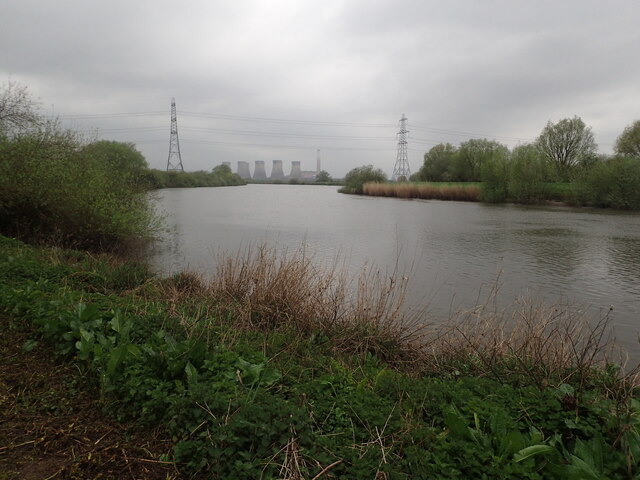
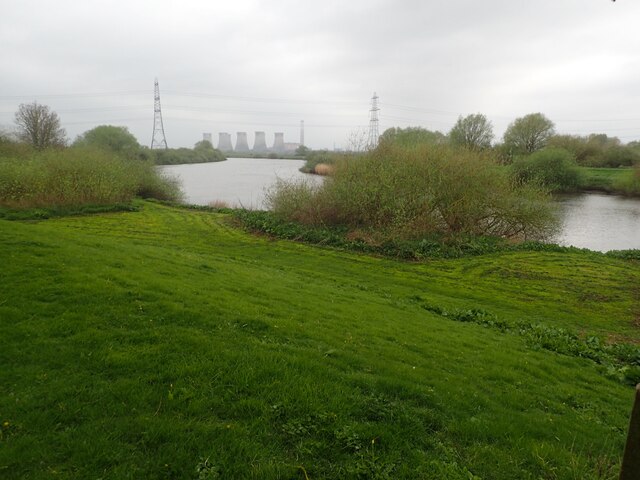
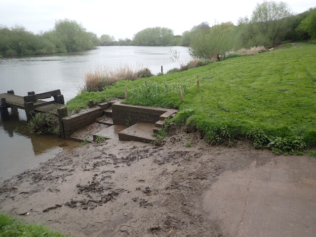
Gate Burton is a picturesque village located in the county of Lincolnshire, England. Situated in the North Kesteven district, it lies approximately 9 miles north of the historic city of Lincoln. The village is nestled along the banks of the River Trent and offers stunning views of the surrounding countryside.

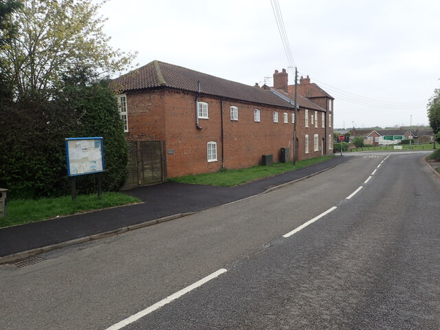
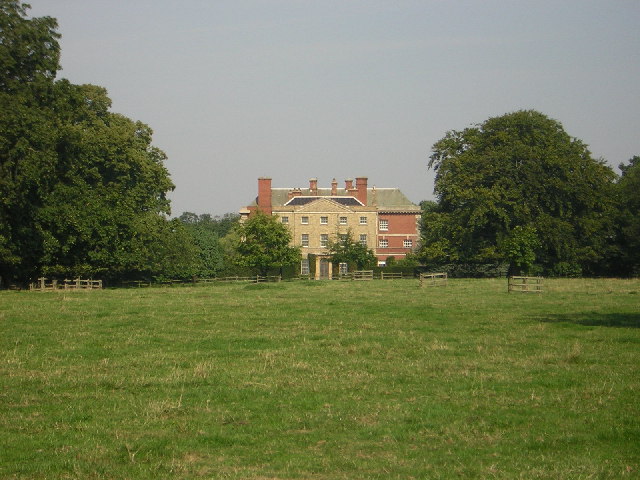
Gate Burton is known for its charming and idyllic setting, with traditional stone cottages and well-maintained gardens dotting the landscape. The village has a small population, contributing to its peaceful and close-knit community atmosphere.

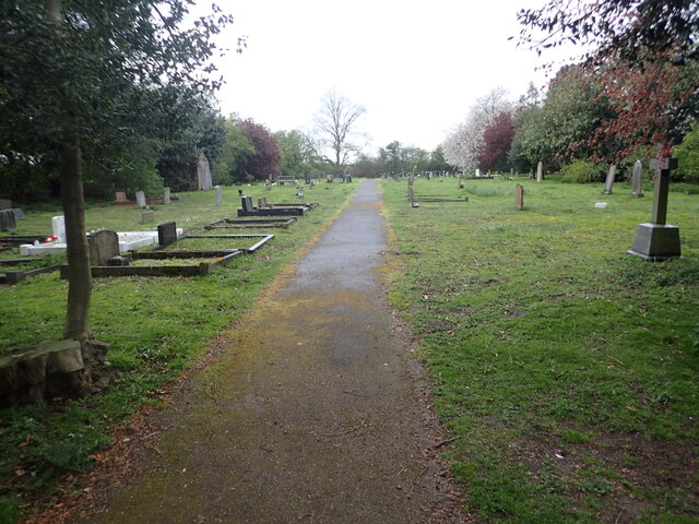
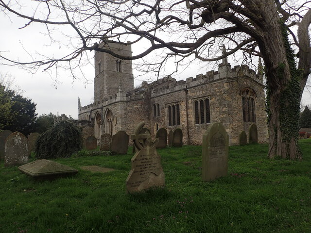
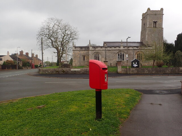
One of the notable landmarks in Gate Burton is the All Saints Church, a Grade I listed building that dates back to the 12th century. This historic church features unique architectural elements, including a Norman tower and stunning stained glass windows.

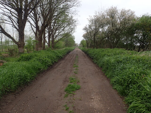
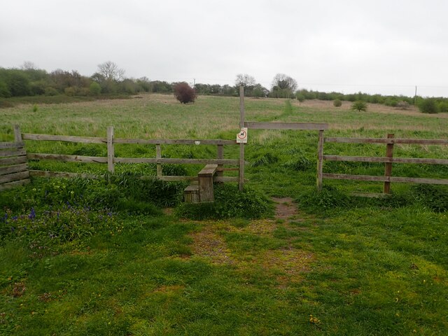
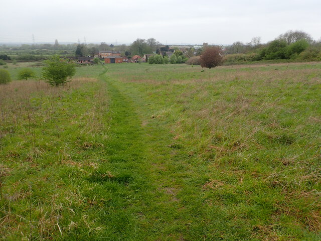
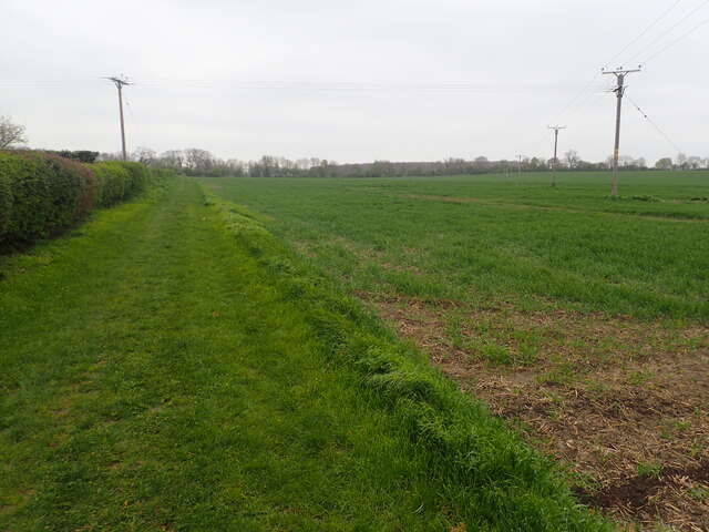
The village also benefits from its proximity to the River Trent, which provides opportunities for outdoor activities such as fishing, boating, and walking along its scenic banks. The surrounding countryside offers numerous footpaths and trails, making it an attractive destination for nature lovers and hikers.

Although Gate Burton is primarily a residential area, it is conveniently located near larger towns and cities, providing easy access to amenities and services. The nearby city of Lincoln offers a wide range of shops, restaurants, and cultural attractions, including the famous Lincoln Cathedral and Lincoln Castle.

Overall, Gate Burton offers a tranquil and picturesque setting, making it an ideal place for those seeking a peaceful village lifestyle with easy access to larger urban areas.

If you have any feedback on the listing, please let us know in the comments section below.
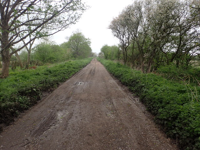
Gate Burton Images

Images are sourced within 2km of 53.333677/-0.74242732 or Grid Reference SK8382. Thanks to Geograph Open Source API. All images are credited.

Bench Mark Marton White Swan Bench Mark Marton White Swan, Stow Park Rd 30m up from junction with A156.
Bench Mark Marton White Swan
Bench Mark Marton White Swan, Stow Park Rd 30m up from junction with A156.
Littleborough Lane Littleborough Lane starts off as a normal road in the village of Marton but beyond the last house, as seen here, it becomes a rough track on its way to the River Trent. For more about Littleborough Lane see <a title="www.geograph.org.uk/photo/6686918" href="https://www.geograph.org.uk/photo/6686918">Link</a>
Littleborough Lane
Littleborough Lane starts off as a normal road in the village of Marton but beyond the last house, as seen here, it becomes a rough track on its way to the River Trent. For more about Littleborough Lane see Link
River Trent at Trent Port This view looks upriver with the cooling towers of Cottam Power Station in the distance.
River Trent at Trent Port
This view looks upriver with the cooling towers of Cottam Power Station in the distance.
Looking north from the site of the old Stow Park station On 9th April 1849 a single-track line was built by the Great Northern Railway (GNR) from Lincoln to Gainsborough. The GNR was keen to extend their line from Gainsborough to Doncaster and parliamentary approval for this line was received on 25th July 1864. As part of this scheme the existing Lincoln to Gainsborough line was also to be upgraded. On 1st December that year the line from Lincoln to Doncaster was closed and doubling took place.

Behind where I am standing is the site of the old Stow Park station - see <a title="www.geograph.org.uk/photo/7470133" href="https://www.geograph.org.uk/photo/7470133">Link</a>  the next station in this direction is Gainsborough Lea Road.
Looking north from the site of the old Stow Park station
On 9th April 1849 a single-track line was built by the Great Northern Railway (GNR) from Lincoln to Gainsborough. The GNR was keen to extend their line from Gainsborough to Doncaster and parliamentary approval for this line was received on 25th July 1864. As part of this scheme the existing Lincoln to Gainsborough line was also to be upgraded. On 1st December that year the line from Lincoln to Doncaster was closed and doubling took place. Behind where I am standing is the site of the old Stow Park station - see Link the next station in this direction is Gainsborough Lea Road.
Marton Cemetery Marton Cemetery is seen here from Trent Port Road which leads from Marton Church to Trent Port.
Marton Cemetery
Marton Cemetery is seen here from Trent Port Road which leads from Marton Church to Trent Port.
Marton Cemetery Marton Cemetery is on Trent Port Road which leads from Marton Church to Trent Port.
Marton Cemetery
Marton Cemetery is on Trent Port Road which leads from Marton Church to Trent Port.
River Trent at Trent Port This view looks upriver with the cooling towers of Cottam Power Station in the distance.
River Trent at Trent Port
This view looks upriver with the cooling towers of Cottam Power Station in the distance.
River Trent at Trent Port This view looks downriver. The view in the other direction with the cooling towers of Cottam Power Station in the distance can be seen at <a title="www.geograph.org.uk/photo/7470163" href="https://www.geograph.org.uk/photo/7470163">Link</a>
River Trent at Trent Port
This view looks downriver. The view in the other direction with the cooling towers of Cottam Power Station in the distance can be seen at Link
St Margaret's Church, Marton St Margaret's Church has a Saxon tower with herring-bone masonry and a Norman Arcade. There is an unusual collection of Anglo-Scandinavian stone sculptures built into the fabric of the church, including a cross-head, a cross base and fragments of grave covers which all date from between 920 AD and 970 AD.
St Margaret's Church, Marton
St Margaret's Church has a Saxon tower with herring-bone masonry and a Norman Arcade. There is an unusual collection of Anglo-Scandinavian stone sculptures built into the fabric of the church, including a cross-head, a cross base and fragments of grave covers which all date from between 920 AD and 970 AD.
Littleborough Lane Littleborough Lane starts off as a normal road in the village of Marton but beyond the last house, as seen here, it becomes a rough track on its way to the River Trent. For more about Littleborough Lane see <a title="www.geograph.org.uk/photo/6686918" href="https://www.geograph.org.uk/photo/6686918">Link</a>
Littleborough Lane
Littleborough Lane starts off as a normal road in the village of Marton but beyond the last house, as seen here, it becomes a rough track on its way to the River Trent. For more about Littleborough Lane see Link
St Mary's Church, Marton St Margaret's Church has a Saxon tower with herring-bone masonry and a Norman Arcade. There is an unusual collection of Anglo-Scandinavian stone sculptures built into the fabric of the church, including a cross-head, a cross base and fragments of grave covers which all date from between 920 AD and 970 AD.
St Mary's Church, Marton
St Margaret's Church has a Saxon tower with herring-bone masonry and a Norman Arcade. There is an unusual collection of Anglo-Scandinavian stone sculptures built into the fabric of the church, including a cross-head, a cross base and fragments of grave covers which all date from between 920 AD and 970 AD.
Stow Park Road Just ahead is the junction with High Street in the centre of Marton.
Stow Park Road
Just ahead is the junction with High Street in the centre of Marton.
View across the Trent Valley A footpath leads uphill from the southern end of the village of Marton to Stow Park Road. At the top of the hill there is a good view back across the Trent Valley with the cooling towers of Cottam Power Station prominent in the distance beyond the Trent.
View across the Trent Valley
A footpath leads uphill from the southern end of the village of Marton to Stow Park Road. At the top of the hill there is a good view back across the Trent Valley with the cooling towers of Cottam Power Station prominent in the distance beyond the Trent.
Footpath to Stow Park Road A footpath leads uphill from the southern end of the village of Marton here to Stow Park Road. At the top of the hill there is a good view back across the Trent Valley with the cooling towers of Cottam Power Station prominent in the distance beyond the Trent - see <a title="www.geograph.org.uk/photo/7488579" href="https://www.geograph.org.uk/photo/7488579">Link</a>
Footpath to Stow Park Road
A footpath leads uphill from the southern end of the village of Marton here to Stow Park Road. At the top of the hill there is a good view back across the Trent Valley with the cooling towers of Cottam Power Station prominent in the distance beyond the Trent - see Link
Footpath at Marton A footpath leads uphill from the southern end of the village of Marton to Stow Park Road. At the top of the hill there is a good view back across the Trent Valley with the cooling towers of Cottam Power Station prominent in the distance beyond the Trent - see <a title="www.geograph.org.uk/photo/7488579" href="https://www.geograph.org.uk/photo/7488579">Link</a>  This is part way up the hill looking back to Marton.
Footpath at Marton
A footpath leads uphill from the southern end of the village of Marton to Stow Park Road. At the top of the hill there is a good view back across the Trent Valley with the cooling towers of Cottam Power Station prominent in the distance beyond the Trent - see Link This is part way up the hill looking back to Marton.
Footpath to Willingham Road This footpath leads the short distance from Stow Park Road past a new housing development to reach Willingham Road, just beyond the trees in the distance.
Footpath to Willingham Road
This footpath leads the short distance from Stow Park Road past a new housing development to reach Willingham Road, just beyond the trees in the distance.
Footpath to Willingham Road This footpath leads the short distance from Stow Park Road past a new housing development to reach Willingham Road, just beyond the trees in the distance. Beyond those, Burton Wood can be seen.
Footpath to Willingham Road
This footpath leads the short distance from Stow Park Road past a new housing development to reach Willingham Road, just beyond the trees in the distance. Beyond those, Burton Wood can be seen.
St.Margaret's church, Marton, Lincs. Anglo-Saxon tower with lots of herringbone coursing, an ancient feel to the whole church
St.Margaret's church, Marton, Lincs.
Anglo-Saxon tower with lots of herringbone coursing, an ancient feel to the whole church
Show me another place!

Gate Burton is located at Grid Ref: SK8382 (Lat: 53.333677, Lng: -0.74242732)

Division: Parts of Lindsey

Administrative County: Lincolnshire

District: West Lindsey

Police Authority: Lincolnshire

What 3 Words

///fighters.registers.gullible. Near Willingham, Lincolnshire

Related Wikis

Gate Burton

Gate Burton (sometimes called Burton Gate), is a village and civil parish in the West Lindsey district of Lincolnshire, England. It is situated 4 miles...

A156 road

The A156 is an 11 miles (18 km) long road that runs from the A57 near Saxilby and heads north to Gainsborough. The road runs entirely within Lincolnshire...

Marton, Lincolnshire

Marton is a village and civil parish in the West Lindsey district of Lincolnshire, England. It is situated at the junction between the A156 and the A1500...

Littleborough, Nottinghamshire

Littleborough is a village and former civil parish, now in the parish of Sturton le Steeple, in the Bassetlaw district, in the county of Nottinghamshire...

Nearby Amenities

Located within 500m of 53.333677,-0.74242732
Gate Burton
Is In: Lincolnshire, England, UK
Place: hamlet
Source: NPE
Lat/Long: 53.3351387/-0.7422838
Bus Stop
Clay Lane
Naptan AtcoCode: 2700LGB01595
Naptan Bearing: N
Naptan CommonName: Clay Lane
Naptan Indicator: opp
Naptan Landmark: Clay Lane
Naptan NaptanCode: linamdma
Naptan Street: Gainsborough Road
Naptan Verified: no
Source: naptan_import
Lat/Long: 53.33338/-0.7435512
Bus Stop
Clay Lane
Naptan AtcoCode: 2700LGB01615
Naptan Bearing: S
Naptan CommonName: Clay Lane
Naptan Indicator: adj
Naptan Landmark: Clay Lane
Naptan NaptanCode: linamdtj
Naptan Street: Gainsborough Road
Naptan Verified: no
Source: naptan_import
Lat/Long: 53.3333585/-0.7432214
Prospect Farm
Place: farm
Source: Bing
Lat/Long: 53.3343045/-0.7422935
The Cedars
Place: isolated_dwelling
Lat/Long: 53.3319994/-0.7397346
Generator Method: photovoltaic
Generator Output Electricity: yes
Generator Source: solar
Generator Type: solar_photovoltaic_panel
Location: roof
Power: generator
Lat/Long: 53.3292337/-0.7426926
Generator Method: photovoltaic
Generator Output Electricity: yes
Generator Source: solar
Generator Type: solar_photovoltaic_panel
Location: roof
Power: generator
Lat/Long: 53.3292105/-0.7425585
The data included in this document is from www.openstreetmap.org. The data is made available under ODbL.

Have you been to Gate Burton?

Leave your review of Gate Burton below (or comments, questions and feedback).