Gas Hill

Settlement in Norfolk Norwich

England

Gas Hill

The Rosebery, New Catton Light is rapidly fading on this December afternoon but the fine old Victorian pub looks inviting. It was formerly known as the Lord Rosebery, named after Archibald Primrose who was Liberal Prime Minister between 1894 and 1895.
The Rosebery, New Catton Credit: Stephen McKay

Gas Hill is a prominent landmark located in the city of Norwich, Norfolk, England. Rising to a height of 30 meters, it offers panoramic views of the surrounding area and is a popular destination for locals and tourists alike. Situated in the western part of the city, Gas Hill has become an iconic symbol of Norwich.

The name "Gas Hill" originated from the gasworks that were once located on the site during the 19th and early 20th centuries. These gasworks supplied the city with gas for heating, lighting, and cooking. Although the gasworks closed many years ago, the name has endured and become synonymous with the hill.

The hill itself is a grassy mound, providing a natural vantage point to admire the city's skyline and landmarks such as Norwich Cathedral and the Castle. It is easily accessible by foot or bicycle, with several pathways leading to the top.

Due to its elevated position, Gas Hill has also become a popular spot for activities such as kite flying and picnicking. During annual events like Guy Fawkes Night, it offers an ideal location to watch firework displays across the city.

Gas Hill is not only a picturesque attraction but also holds historical significance. It serves as a reminder of Norwich's industrial past and its transition to a modern urban center. Whether for leisurely walks, stunning views, or cultural appreciation, Gas Hill remains an integral part of Norwich's landscape.

If you have any feedback on the listing, please let us know in the comments section below.
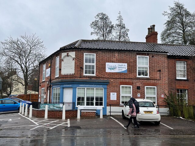
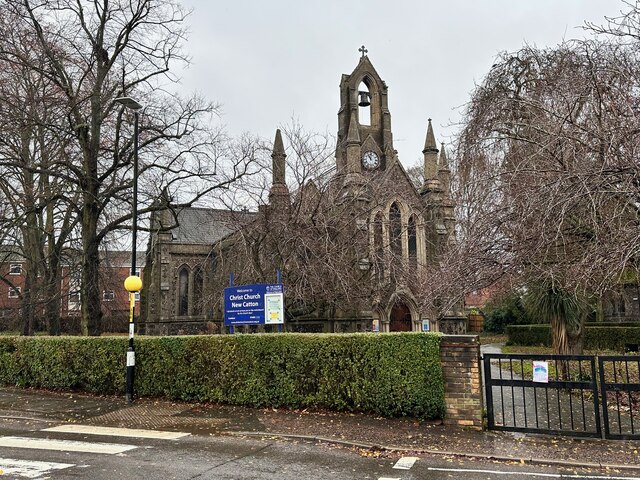
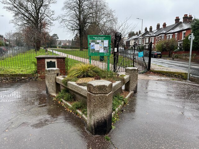
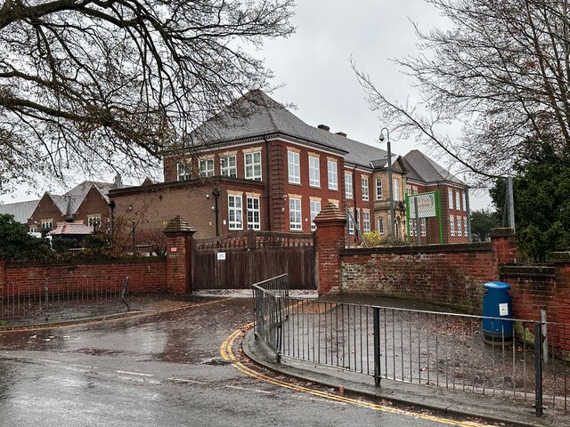
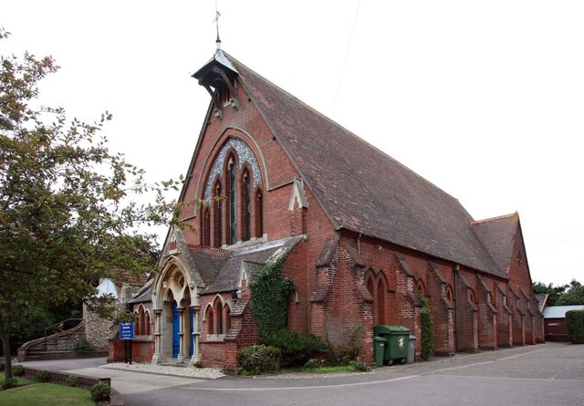
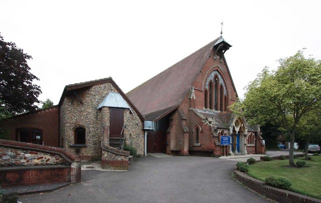
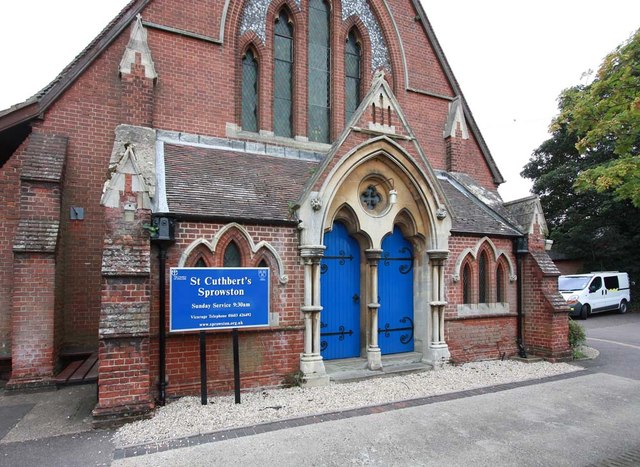
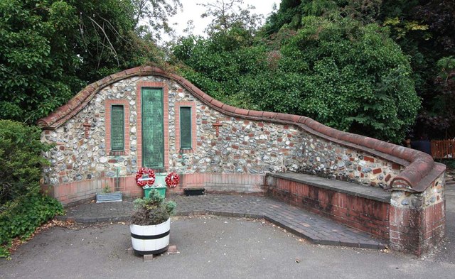
Gas Hill Images

Images are sourced within 2km of 52.634138/1.3117081 or Grid Reference TG2409. Thanks to Geograph Open Source API. All images are credited.

The Rosebery, New Catton Light is rapidly fading on this December afternoon but the fine old Victorian pub looks inviting. It was formerly known as the Lord Rosebery, named after Archibald Primrose who was Liberal Prime Minister between 1894 and 1895.
The Rosebery, New Catton
Light is rapidly fading on this December afternoon but the fine old Victorian pub looks inviting. It was formerly known as the Lord Rosebery, named after Archibald Primrose who was Liberal Prime Minister between 1894 and 1895.
Gurney Road through Mousehold Heath
Works at Sprowston Retail Park
Alderford Terrace, Magdalen Road, Norwich Some early 19th century cottages along Magdalen Road, Norwich. An OS Map from the 1880s tells me this row is called Alderford Terrace but I am not sure if the name is still in use today.
Alderford Terrace, Magdalen Road, Norwich
Some early 19th century cottages along Magdalen Road, Norwich. An OS Map from the 1880s tells me this row is called Alderford Terrace but I am not sure if the name is still in use today.
The Dyers Arms, Magdalen Road, Norwich Sadly no longer a PH having closed around 2019. The former Dyers Arms has become a "health and wellbeing clinic". In 1986 the Norwich Society described it as an "unremarkable local".

<span class="nowrap"><a title="https://www.norfolkpubs.co.uk/norwich/gnorwich/ncgld.htm" rel="nofollow ugc noopener" href="https://www.norfolkpubs.co.uk/norwich/gnorwich/ncgld.htm">Link</a><img style="margin-left:2px;" alt="External link" title="External link - shift click to open in new window" src="https://s1.geograph.org.uk/img/external.png" width="10" height="10"/></span>
The Dyers Arms, Magdalen Road, Norwich
Sadly no longer a PH having closed around 2019. The former Dyers Arms has become a "health and wellbeing clinic". In 1986 the Norwich Society described it as an "unremarkable local". LinkExternal link
Christ Church, New Catton, Norwich A view across to Christ Church, New Catton in Norwich on a wet December morning. A rather striking church dating from 1842 and, apparently, pre-dating all of the housing which surrounds it. Simon Knott's excellent Norfolk Churches site seems to suggest it has a similarly striking mint green interior which I sadly did not get to see.

<span class="nowrap"><a title="http://www.norfolkchurches.co.uk/newcatton/newcatton.htm" rel="nofollow ugc noopener" href="http://www.norfolkchurches.co.uk/newcatton/newcatton.htm">Link</a><img style="margin-left:2px;" alt="External link" title="External link - shift click to open in new window" src="https://s1.geograph.org.uk/img/external.png" width="10" height="10"/></span>
Christ Church, New Catton, Norwich
A view across to Christ Church, New Catton in Norwich on a wet December morning. A rather striking church dating from 1842 and, apparently, pre-dating all of the housing which surrounds it. Simon Knott's excellent Norfolk Churches site seems to suggest it has a similarly striking mint green interior which I sadly did not get to see. LinkExternal link
Sewell Park, New Catton, Norwich The southern entrance to Sewell Park in New Catton. The handsome triangular drinking trough here can be seen on an OS Map from the late-19th century. A final stopping place before heading into the city centre perhaps.

A similarly handsome bronze plaque can be seen behind it describing how this open space was once used and loved by Philip Edward Sewell and is now dedicated to his memory.
Sewell Park, New Catton, Norwich
The southern entrance to Sewell Park in New Catton. The handsome triangular drinking trough here can be seen on an OS Map from the late-19th century. A final stopping place before heading into the city centre perhaps. A similarly handsome bronze plaque can be seen behind it describing how this open space was once used and loved by Philip Edward Sewell and is now dedicated to his memory.
Sewell Park Academy, Norwich As with many schools in Norfolk, this one has a long history of changing with the educational winds. It was opened in 1929 as Blyth Grammar School, it became a comprehensive school in 1971 and merged with Alderman Jex School to become Blyth-Jex School in 1972. In 2008, it became Sewell Park College and, in 2015, it became Sewell Park Academy. 

Apparently a whalebone, donated by a former student, stands in the grounds.
<a href="https://www.geograph.org.uk/photo/166094">TG2310 : Whale's Jawbone Arch in the grounds of Blyth Jex School</a>
Sewell Park Academy, Norwich
As with many schools in Norfolk, this one has a long history of changing with the educational winds. It was opened in 1929 as Blyth Grammar School, it became a comprehensive school in 1971 and merged with Alderman Jex School to become Blyth-Jex School in 1972. In 2008, it became Sewell Park College and, in 2015, it became Sewell Park Academy. Apparently a whalebone, donated by a former student, stands in the grounds. TG2310 : Whale's Jawbone Arch in the grounds of Blyth Jex School
St Cuthbert, Sprowston, Norwich
St Cuthbert, Sprowston, Norwich - War Memorial
St Cuthbert, Sprowston, Norwich - East end
St Cuthbert, Sprowston, Norwich - West end
St Cuthbert, Sprowston, Norwich - Mothers' Union Banner
St Cuthbert, Sprowston, Norwich - Font
Norwich Motor Group Great Wall, Wroxham Road, Norwich
The Whalebone Public House Norwich A freehouse on the Magdalen Road in north Norwich
The Whalebone Public House Norwich
A freehouse on the Magdalen Road in north Norwich
Show me another place!

Gas Hill is located at Grid Ref: TG2409 (Lat: 52.634138, Lng: 1.3117081)

Administrative County: Norfolk

District: Norwich

Police Authority: Norfolk

What 3 Words

///toward.brass.obey. Near Thorpe Hamlet, Norfolk

Nearby Locations

Gas Hill St James Hill

Related Wikis

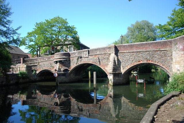
Bishop Bridge, Norwich

Bishop Bridge is a medieval bridge across the River Wensum located to the east of Norwich, England. It was built in 1340 and is still in use in the twenty...

St Helen's Church, Norwich

St Helen's Church, Norwich is a Grade I listed parish church in the Church of England in Norwich. == History == The church was medieval and in 1270 given...

Great Hospital

The Great Hospital is a medieval hospital that has been serving the people of Norwich in Norfolk, UK, since the 13th century. It is situated on a 7-acre...

The Nest (football ground)

The Nest was the former home ground of Norwich City F.C., used for 27 years between 1908 and 1935. Before The Nest, the team played at a ground in Newmarket...

Nearby Amenities

Located within 500m of 52.634138,1.3117081
Source: landsat
Lat/Long: 52.6304586/1.3076719
Source: landsat
Lat/Long: 52.6310254/1.3079682
Source: landsat
Lat/Long: 52.6324142/1.3085794
Source: landsat
Lat/Long: 52.6329495/1.3088912
Source: landsat
Lat/Long: 52.634291/1.3085301
Source: landsat
Lat/Long: 52.6343884/1.3078837
Source: landsat
Lat/Long: 52.6343539/1.3071561
Source: landsat
Lat/Long: 52.6343154/1.3064383
Source: landsat
Lat/Long: 52.6342456/1.3056249
Source: landsat
Lat/Long: 52.6342232/1.3050767
Source: landsat
Lat/Long: 52.6343426/1.3044057
Post Box
Collection Times: Mo-Fr 09:00; Sa 07:00
Operator: Royal Mail
Post Box Type: pillar
Ref: NR1 136D
Royal Cypher: EIIR
Royal Cypher Wikidata: Q33102113
Lat/Long: 52.6325475/1.3066921
Post Box
Collection Times: Mo-Fr 09:00; Sa 07:00
Operator: Royal Mail
Post Box Type: pillar
Ref: NR1 140D
Royal Cypher: EIIR
Royal Cypher Wikidata: Q33102113
Lat/Long: 52.6336174/1.3095376
Post Box
Collection Times: Mo-Fr 16:00; Sa 12:45
Operator: Royal Mail
Post Box Type: pillar
Ref: NR1 138
Royal Cypher: EIIR
Royal Cypher Wikidata: Q33102113
Lat/Long: 52.6336011/1.3161895
Post Box
Collection Times: Mo-Fr 17:45; Sa 11:00
Operator: Royal Mail
Postal Code: NR1
Ref: NR1 139
Lat/Long: 52.6317116/1.3126715
Post Box
Collection Times: Mo-Fr 09:00; Sa 07:00
Operator: Royal Mail
Post Box Type: wall
Ref: NR1 107D
Royal Cypher: EIIR
Royal Cypher Wikidata: Q33102113
Lat/Long: 52.630316/1.3080275
Post Box
Collection Times: Mo-Fr 09:00; Sa 07:00
Operator: Royal Mail
Post Box Type: pillar
Ref: NR3 303D
Lat/Long: 52.6366065/1.3063869
Post Box
Collection Times: Mo-Fr 18:15; Sa 11:00
Operator: Royal Mail
Postal Code: NR3
Ref: NR3 304
Lat/Long: 52.6368341/1.3095886
Traffic Calming: bump
Lat/Long: 52.6329099/1.3082091
Traffic Calming: bump
Lat/Long: 52.6328456/1.3082045
Barrier: bollard
Lat/Long: 52.6324613/1.3083271
Recycling
William IV PH, Quebec Road
Recycling Glass Bottles: yes
Url: http://www.norwich.gov.uk/intranet_docs/A-Z/Recycling/Recycling_Centres.pdf
Lat/Long: 52.630342/1.315071
Bus Stop
Quebec Road opp Primrose Road
Bus: yes
Naptan AtcoCode: 2900N12142
Naptan Bearing: NE
Naptan CommonName: Quebec road
Naptan Indicator: opp
Naptan Landmark: Primrose Road
Naptan Locality: Thorpe Hamlet
Naptan NaptanCode: nfodjadm
Naptan PlusbusZoneRef: NRCH
Naptan ShortCommonName: Quebec road
Naptan Street: Quebec road
Public Transport: platform
Source: naptan_import;survey
Lat/Long: 52.6300731/1.312681
Bus Stop
Bishopsgate / Cotman Fields
Bus: yes
Naptan AtcoCode: 2900N12160
Naptan Bearing: E
Naptan CommonName: Cotman Fields
Naptan Indicator: adj
Naptan Landmark: Cotman Fields
Naptan Locality: Norwich
Naptan NaptanCode: nfodjagw
Naptan PlusbusZoneRef: NRCH
Naptan Street: Bishopgate
Note: Bearing should be 'S'
Public Transport: platform
Shelter: no
Source: naptan_import;survey
Lat/Long: 52.6326762/1.3060976
Heathgate, adj
Naptan AtcoCode: 2900N12163
Naptan Bearing: E
Naptan BusStopType: CUS
Naptan CommonName: Heathgate
Naptan Indicator: adj
Naptan Landmark: Heathgate
Naptan Locality: Norwich
Naptan NaptanCode: nfodjajd
Naptan PlusbusZoneRef: NRCH
Naptan Street: Mousehold Street
Naptan Verified: no
Source: naptan_import
Lat/Long: 52.6368139/1.3096106
Bus Stop
Quebec Road Primrose Road
Bus: yes
Naptan AtcoCode: 2900N12257
Naptan Bearing: SW
Naptan BusStopType: CUS
Naptan CommonName: Quebec road
Naptan Indicator: adj
Naptan Landmark: Primrose Road
Naptan Locality: Thorpe Hamlet
Naptan NaptanCode: nfodjdwm
Naptan PlusbusZoneRef: NRCH
Naptan ShortCommonName: Quebec road
Naptan Street: Quebec road
Public Transport: platform
Source: naptan_import;survey
Lat/Long: 52.6300363/1.3128103
Bus Stop
Riverside
Bench: no
Bin: no
Bus: yes
Lit: yes
Naptan AtcoCode: 2900N12552
Naptan Bearing: SW
Naptan CommonName: Ferry Road
Naptan Indicator: adj
Naptan Landmark: Ferry Road
Naptan Locality: Norwich
Naptan NaptanCode: nfodmdgj
Naptan PlusbusZoneRef: NRCH
Naptan Street: Riverside Road
Public Transport: platform
Route Ref: 19;20;24;24A
Shelter: no
Source: naptan_import;survey
Tactile Paving: yes
Lat/Long: 52.6304583/1.3081427
Bus Stop
Bishop Bridge Road
Bus: yes
Naptan AtcoCode: 2900N12553
Naptan Bearing: NE
Naptan CommonName: Bishopgate
Naptan Indicator: adj
Naptan Locality: Norwich
Naptan NaptanCode: nfodmdgm
Naptan PlusbusZoneRef: NRCH
Naptan Street: Bishop Bridge Road
Operator: First Eastern Counties
Public Transport: platform
Shelter: no
Source: naptan_import;survey
Lat/Long: 52.6334785/1.309506
Bus Stop
Bishop Bridge Road
Bus: yes
Naptan AtcoCode: 2900N12554
Naptan Bearing: SW
Naptan CommonName: Bishopgate
Naptan Indicator: opp
Naptan Latitude: 52.6333245
Naptan Locality: Norwich
Naptan Longitude: 1.3095983
Naptan NaptanCode: nfodmdgp
Naptan PlusbusZoneRef: NRCH
Naptan Street: Bishop Bridge Road
Operator: Norfolk County Council
Public Transport: platform
Route Ref: 19;20;24;24A
Shelter: no
Source: naptan_import;survey
Lat/Long: 52.6332168/1.3095623
Vincent Road, opp
Naptan AtcoCode: 2900N12556
Naptan Bearing: SW
Naptan BusStopType: CUS
Naptan CommonName: Vincent Road
Naptan Indicator: opp
Naptan Landmark: Vincent Road
Naptan Locality: Norwich
Naptan NaptanCode: nfodmdgw
Naptan PlusbusZoneRef: NRCH
Naptan Street: Plumstead Road
Naptan Verified: no
Source: naptan_import
Lat/Long: 52.633809/1.3173514
Bus Stop
Wolfe Road
Bus: yes
Naptan AtcoCode: 2900N12630
Naptan Bearing: NE
Naptan BusStopType: CUS
Naptan CommonName: Wolfe Road
Naptan Indicator: opp
Naptan Landmark: Thorpe Middle School
Naptan Locality: Norwich
Naptan NaptanCode: nfodmgtw
Naptan PlusbusZoneRef: NRCH
Naptan ShortCommonName: Wolfe Road
Naptan Street: Wolfe Road
Public Transport: platform
Shelter: no
Source: naptan_import;survey
Lat/Long: 52.6329482/1.3187958
Bus Stop
Wolfe Road
Bus: yes
Naptan AtcoCode: 2900N12631
Naptan Bearing: SW
Naptan BusStopType: CUS
Naptan CommonName: Wolfe Road
Naptan Indicator: adj
Naptan Landmark: Wolf Road Middle School
Naptan Locality: Norwich
Naptan NaptanCode: nfodmgwa
Naptan PlusbusZoneRef: NRCH
Naptan ShortCommonName: Wolfe Road
Naptan Street: Wolfe Road
Public Transport: platform
Shelter: no
Source: naptan_import;survey
Lat/Long: 52.6327985/1.3184748
Zaks, adj
Naptan AtcoCode: 2900N12740
Naptan Bearing: NW
Naptan BusStopType: CUS
Naptan CommonName: Zaks
Naptan Indicator: adj
Naptan Landmark: Zaks
Naptan Locality: Norwich
Naptan NaptanCode: nfodmtdg
Naptan PlusbusZoneRef: NRCH
Naptan Street: Barrack Street
Naptan Verified: no
Source: naptan_import
Lat/Long: 52.6349535/1.3082726
Zaks, opp
Naptan AtcoCode: 2900N12741
Naptan Bearing: SE
Naptan BusStopType: CUS
Naptan CommonName: Zaks
Naptan Indicator: opp
Naptan Landmark: Zaks
Naptan Locality: Norwich
Naptan NaptanCode: nfodmtdj
Naptan PlusbusZoneRef: NRCH
Naptan Street: Barrack Street
Naptan Verified: no
Source: naptan_import
Lat/Long: 52.6351167/1.3082258
Bus Stop
Waterworks
Bus: yes
Naptan AtcoCode: 2900N12771
Naptan Bearing: SW
Naptan CommonName: Waterworks
Naptan Indicator: adj
Naptan Landmark: Waterworks
Naptan Latitude: 52.6313938
Naptan Locality: Thorpe Hamlet
Naptan Longitude: 1.3152765
Naptan NaptanCode: nfogmwap
Naptan PlusbusZoneRef: NRCH
Naptan Street: Quebec Road
Public Transport: platform
Shelter: no
Source: naptan_import;survey
Lat/Long: 52.6312167/1.3152046
Bus Stop
Waterworks
Bus: yes
Naptan AtcoCode: 2900N12772
Naptan Bearing: NE
Naptan CommonName: Waterworks
Naptan Indicator: opp
Naptan Landmark: Waterworks
Naptan Locality: Thorpe Hamlet
Naptan NaptanCode: nfogmwat
Naptan PlusbusZoneRef: NRCH
Naptan Street: Quebec Road
Public Transport: platform
Shelter: no
Source: naptan_import;survey
Lat/Long: 52.6313265/1.3151289
Bus Stop
HM Prison, adj
Bus: yes
Naptan AtcoCode: 2900N32519
Naptan Bearing: SE
Naptan CommonName: HM Prison
Naptan Indicator: adj
Naptan Landmark: H M Prison
Naptan Locality: Norwich
Naptan NaptanCode: nfogpapd
Naptan PlusbusZoneRef: NRCH
Naptan Street: Britannia Road
Naptan Verified: no
Public Transport: platform
Source: naptan_import
Lat/Long: 52.6359444/1.31451
Give Way
Lat/Long: 52.6299084/1.3124208
Crossing
Crossing: unmarked
Crossing Island: yes
Tactile Paving: yes
Lat/Long: 52.6317236/1.3089697
Crossing
Crossing: unmarked
Lat/Long: 52.6343765/1.3102386
Crossing
Crossing: unmarked
Lat/Long: 52.6342899/1.3101887
Give Way
Lat/Long: 52.6307002/1.3145898
Tourism: viewpoint
Viewpoint: Saint James' Hill
Lat/Long: 52.6350765/1.3123324
Crossing
Crossing: traffic_signals
Crossing Island: no
Crossing Ref: toucan
Tactile Paving: yes
Lat/Long: 52.6352147/1.307865
Crossing
Crossing: unmarked
Lat/Long: 52.6344618/1.3094641
Crossing
Crossing: unmarked
Lat/Long: 52.6345961/1.3098189
Crossing
Crossing: unmarked
Lat/Long: 52.6345959/1.3099117
Noexit: yes
Lat/Long: 52.6346166/1.3101241
Crossing
Crossing: unmarked
Lat/Long: 52.6345193/1.3095374
Vincent Road, adj
Naptan AtcoCode: 2900N12555
Naptan Bearing: NE
Naptan BusStopType: CUS
Naptan CommonName: Vincent Road
Naptan Indicator: adj
Naptan Landmark: Vincent Road
Naptan Locality: Norwich
Naptan NaptanCode: nfodmdgt
Naptan PlusbusZoneRef: NRCH
Naptan Street: Plumstead Road
Naptan Verified: no
Source: naptan_import
Lat/Long: 52.6339403/1.3174796
Crossing
Crossing: uncontrolled
Lat/Long: 52.6342956/1.3181345
Check Date: 2021-05-23
Traffic Calming: hump
Lat/Long: 52.6385858/1.3119188
Parking
St James' Hill Scenic Point
Access: yes
Lat/Long: 52.635845/1.314343
Crossing
Crossing: uncontrolled
Lat/Long: 52.6361299/1.3165795
Crossing
Bicycle: yes
Button Operated: yes
Crossing: traffic_signals
Crossing Island: no
Crossing Ref: toucan
Tactile Paving: yes
Traffic Signals Sound: yes
Lat/Long: 52.6324996/1.3091483
Crossing
Crossing: unmarked
Lat/Long: 52.6341911/1.3097299
Crossing
Crossing: unmarked
Lat/Long: 52.6341782/1.3099055
Barrier: bollard
Lat/Long: 52.6328145/1.308294
Bench
Backrest: yes
Lat/Long: 52.6339889/1.3083898
Tourism: viewpoint
Lat/Long: 52.6329547/1.3116007
Bench
Lat/Long: 52.6329477/1.311662
Historic: ruins
Lat/Long: 52.6329308/1.3118786
Barrier: bollard
Lat/Long: 52.6311362/1.3150031
Barrier: bollard
Lat/Long: 52.6314794/1.3136976
Traffic Calming: cushion
Lat/Long: 52.6365898/1.3062925
Crossing
Crossing Island: yes
Tactile Paving: yes
Lat/Long: 52.6336369/1.3096802
Barrier: bollard
Lat/Long: 52.6347271/1.309885
Barrier: bollard
Bollard: removable
Lat/Long: 52.6299965/1.3094864
Give Way
Lat/Long: 52.6297834/1.3122425
Crossing
Crossing: uncontrolled
Crossing Island: no
Lat/Long: 52.6323347/1.3092121
Barrier: bollard
Lat/Long: 52.6323691/1.3088966
Give Way
Lat/Long: 52.6324383/1.3155029
Note: Spontaneous City at Cow Tower
Tourism: artwork
Lat/Long: 52.6342471/1.3081286
Bench
Backrest: no
Check Date: 2024-02-17
Lat/Long: 52.634079/1.304989
Waste Basket
Check Date: 2024-02-17
Lat/Long: 52.6340769/1.3049499
Bench
Backrest: no
Check Date: 2024-02-17
Lat/Long: 52.634083/1.304727
Crossing
Crossing: uncontrolled
Tactile Paving: yes
Lat/Long: 52.6355043/1.3064335
Crossing
Crossing: uncontrolled
Tactile Paving: yes
Lat/Long: 52.6355313/1.3063398
Crossing
Crossing: island
Tactile Paving: yes
Lat/Long: 52.6358297/1.305976
Barrier: bollard
Lat/Long: 52.6323514/1.3090181
Life Ring
Check Date: 2024-02-17
Emergency: life_ring
Ref: 20
Lat/Long: 52.6305753/1.3075457
Bench
Backrest: no
Check Date: 2024-02-17
Material: wood
Lat/Long: 52.6308715/1.3075861
Waste Basket
Lat/Long: 52.6308993/1.3076495
Bench
Backrest: no
Material: wood
Lat/Long: 52.6309302/1.3075984
Bench
Backrest: no
Check Date: 2024-02-17
Material: wood
Lat/Long: 52.6309633/1.3077612
Bench
Backrest: no
Material: wood
Lat/Long: 52.6312401/1.3077103
Life Ring
Emergency: life_ring
Ref: 21
Lat/Long: 52.6312779/1.3077103
Waste Basket
Lat/Long: 52.6315354/1.3077924
Addr City: Norwich
Addr Housenumber: 3
Addr Postcode: NR1 4JD
Addr Street: St Leonards Terrace
Lat/Long: 52.6316703/1.3118687
Addr City: Norwich
Addr Housenumber: 2
Lat/Long: 52.6314962/1.3117982
Addr City: Norwich
Addr Housenumber: 1
Lat/Long: 52.6315389/1.3117226
Lifebuoy
Life Ring
Check Date: 2024-02-17
Emergency: life_ring
Operator: Norwich City Council
Lat/Long: 52.6333912/1.3087504
Lifebuoy
Life Ring
Check Date: 2024-02-17
Emergency: life_ring
Operator: Norwich City Council
Lat/Long: 52.6340813/1.3058726
Lifebuoy
Life Ring
Check Date: 2024-02-17
Emergency: life_ring
Operator: Norwich City Council
Lat/Long: 52.6341889/1.3084019
Waste Basket
Lat/Long: 52.633137/1.3083366
Bench
Backrest: no
Lat/Long: 52.6334987/1.3086417
Bench
Backrest: no
Lat/Long: 52.6336689/1.3086165
Waste Basket
Lat/Long: 52.6341481/1.3075824
Bench
Backrest: yes
Check Date: 2024-02-17
Material: wood
Lat/Long: 52.6341487/1.3077808
Board Type: history
Check Date: 2024-02-17
Information: board
Tourism: information
Lat/Long: 52.6341493/1.3084163
Bench
Backrest: yes
Check Date: 2024-02-17
Material: wood
Lat/Long: 52.6341655/1.3083931
Bench
Backrest: no
Check Date: 2024-02-17
Lat/Long: 52.6341742/1.3069735
Bench
Backrest: no
Check Date: 2024-02-17
Lat/Long: 52.634184/1.3075543
Speed Camera
Maxspeed: 30 mph
Speed Camera Type: Truvelo D-Cam
Lat/Long: 52.6325786/1.3092862
Stop
Lat/Long: 52.63483/1.3085039
Limit of Navigation for Hire Boats
Information: Limit of Navigation for Hire Boats
Tourism: information
Lat/Long: 52.6323751/1.3085552
Crossing
Crossing: unmarked
Lat/Long: 52.6359781/1.3057424
Entrance: yes
Lat/Long: 52.6328238/1.3049155
Entrance: yes
Lat/Long: 52.6327294/1.304753
Bench
Backrest: yes
Lat/Long: 52.6327764/1.3052756
Entrance: yes
Lat/Long: 52.631319/1.313608
Entrance: main
Lat/Long: 52.6312956/1.3136941
Historic: memorial
Memorial: war_memorial
Lat/Long: 52.631124/1.313687
Barrier: lift_gate
Lat/Long: 52.635223/1.3063504
Thorpe Hamlet
Colour: black
Man Made: village_sign
Material: metal
Lat/Long: 52.6342244/1.3102524
Barrier: bollard
Lat/Long: 52.6309596/1.3138667
Recycling
Recycling Type: container
Lat/Long: 52.6328909/1.3081607
Bicycle Rental
Britannia Road
Capacity: 6
Email: support@beryl.cc
Fee: yes
Name Signed: no
Network: Beryl - Norwich
Official Name: Britannia Road
Operator: Beryl
Operator Wikidata: Q106575369
Payment App: yes
Payment App Android: cc.beryl.basis
Payment App Ios: 1386768364
Payment Cash: no
Payment Credit Cards: no
Payment Cryptocurrencies: no
Payment Debit Cards: no
Payment Electronic Purses: no
Phone: +44 20 3003 5044
Ref Gbfs: beryl_norwich:2047
Rental: city_bike;ebike;escooter
Website: https://beryl.cc/scheme/norwich
Lat/Long: 52.6334534/1.316327
Traffic Calming: bump
Lat/Long: 52.633399/1.3060583
Traffic Calming: bump
Lat/Long: 52.6334111/1.3061892
Traffic Calming: bump
Lat/Long: 52.6335349/1.3058874
Bench
Lat/Long: 52.6334834/1.3075478
Bench
Lat/Long: 52.6335285/1.3077874
Bench
Lat/Long: 52.6334846/1.3077903
Playground: basketswing
Lat/Long: 52.6335014/1.3079437
Leisure: pitch
Sport: soccer
Lat/Long: 52.6335627/1.3081595
Playground: structure
Lat/Long: 52.6336035/1.3077072
Playground: structure
Lat/Long: 52.6334798/1.3076399
Waste Basket
Lat/Long: 52.6312058/1.3084183
Waste Basket
Colour: green
Material: plastic
Lat/Long: 52.6323708/1.3083765
Waste Basket
Colour: green
Material: plastic
Lat/Long: 52.6324783/1.3145198
Waste Basket
Colour: green
Material: plastic
Lat/Long: 52.6357537/1.3073033
Waste Basket
Colour: green
Material: plastic
Lat/Long: 52.6355156/1.3084599
Waste Basket
Colour: green
Material: plastic
Lat/Long: 52.6297528/1.312141
Waste Basket
Lat/Long: 52.6378575/1.3143396
Waste Basket
Lat/Long: 52.6305563/1.3072575
Waste Basket
Colour: green
Material: plastic
Lat/Long: 52.633607/1.3095498
Waste Basket
Lat/Long: 52.6317737/1.308714
Waste Basket
Colour: green
Material: plastic
Lat/Long: 52.6369704/1.310098
Waste Basket
Lat/Long: 52.6361045/1.3141123
Waste Basket
Colour: green
Material: plastic
Lat/Long: 52.6373013/1.3072025
Waste Basket
Lat/Long: 52.6324098/1.30886
Waste Basket
Colour: green
Material: plastic
Lat/Long: 52.63403/1.3126977
Waste Basket
Lat/Long: 52.6310718/1.3083542
Waste Basket
Lat/Long: 52.6333855/1.3121909
Waste Basket
Lat/Long: 52.6334004/1.3094368
Waste Basket
Colour: green
Material: plastic
Lat/Long: 52.6374078/1.3069496
Waste Basket
Colour: green
Material: plastic
Lat/Long: 52.6328657/1.3187503
Waste Basket
Colour: green
Material: plastic
Lat/Long: 52.6361637/1.3060404
Waste Basket
Lat/Long: 52.6355941/1.3144788
Waste Basket
Colour: green
Material: plastic
Lat/Long: 52.6369437/1.3104423
Waste Basket
Lat/Long: 52.6364799/1.3109925
Waste Basket
Lat/Long: 52.6331717/1.3118592
Waste Basket
Lat/Long: 52.6358573/1.314265
Waste Basket
Lat/Long: 52.6342954/1.3089692
Give Way
Lat/Long: 52.6354391/1.3100721
Give Way
Lat/Long: 52.6361057/1.3102859
Give Way
Lat/Long: 52.6370144/1.3066985
Give Way
Lat/Long: 52.6368226/1.3065541
Give Way
Lat/Long: 52.6361778/1.3059709
Give Way
Lat/Long: 52.6359528/1.3057216
Give Way
Lat/Long: 52.6324411/1.315417
Give Way
Lat/Long: 52.6338454/1.3134914
Give Way
Lat/Long: 52.6368697/1.3104453
Give Way
Lat/Long: 52.6365976/1.310358
Give Way
Lat/Long: 52.6307267/1.3092928
Give Way
Lat/Long: 52.6317329/1.308914
Give Way
Lat/Long: 52.6296612/1.3122573
Colour: yellow
Inscription: GAS PIPELINE CP
Marker: post
Material: concrete
Note: Seen in https://www.geograph.org.uk/photo/6202797
Utility: gas
Lat/Long: 52.6337503/1.3131633
Communication Mobile Phone: yes
Layer: 1
Man Made: mast
Material: metal
Operator: Three UK;EE;O2-UK;Vodafone UK
Tower Construction: guyed_tube
Tower Type: communication
Lat/Long: 52.6309514/1.3165622
Give Way
Lat/Long: 52.6318737/1.3153821
The data included in this document is from www.openstreetmap.org. The data is made available under ODbL.

Have you been to Gas Hill?

Leave your review of Gas Hill below (or comments, questions and feedback).