Fox Hill

Settlement in Wiltshire

England

Fox Hill

M4 westbound Travelling westbound on the M4 motorway.
M4 westbound Credit: Oscar Taylor

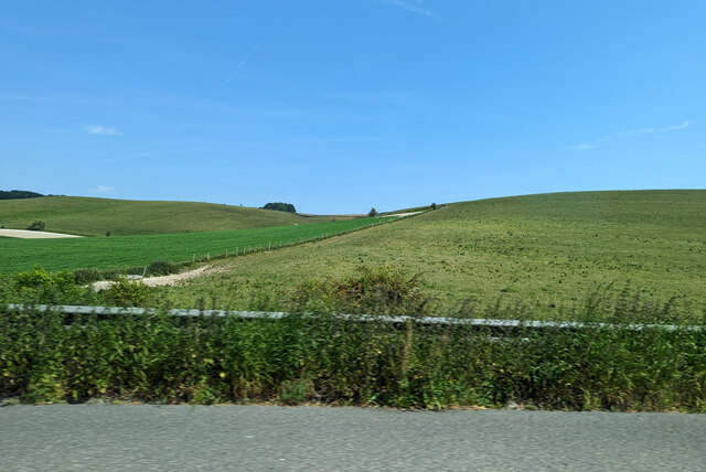
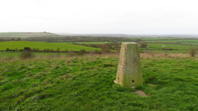
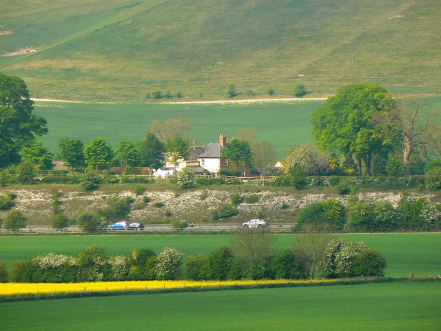
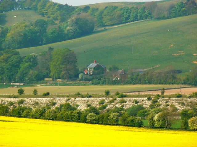
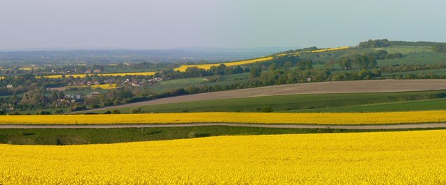
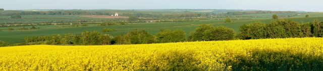
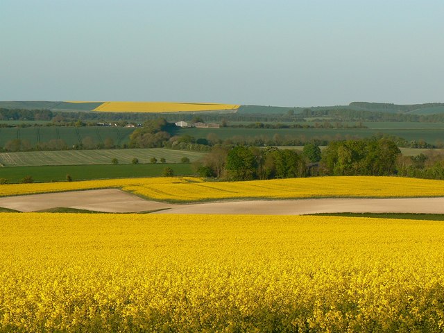
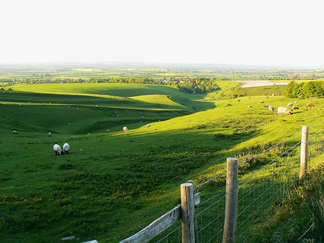
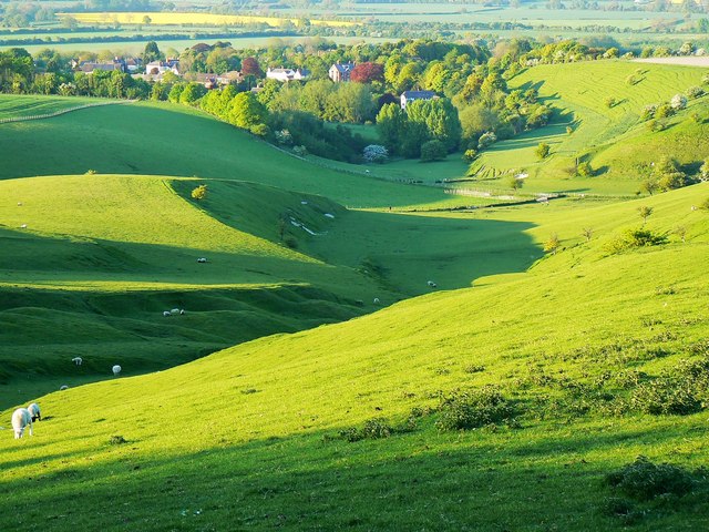
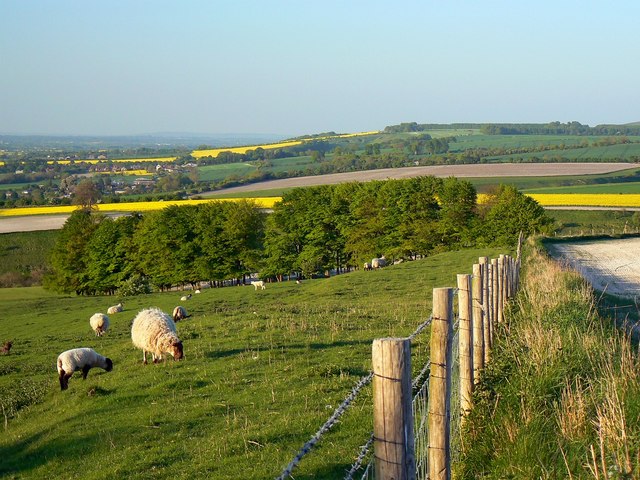
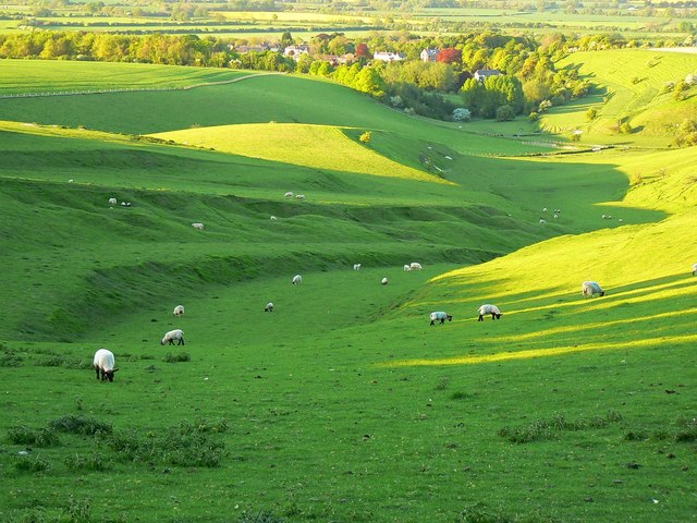
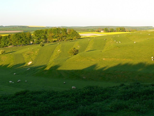
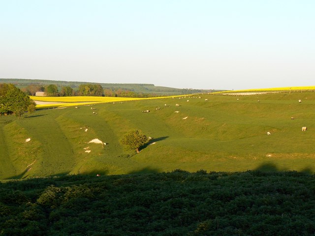
Fox Hill is a small village located in the county of Wiltshire, England. Situated approximately 3 miles northwest of the town of Chippenham, Fox Hill is nestled within the picturesque countryside of this rural county. The village is surrounded by rolling hills and lush green fields, offering residents and visitors a tranquil and idyllic setting.

Despite its small size, Fox Hill boasts a strong sense of community and a rich history. The village is home to a close-knit population of around 500 people, who take pride in their rural heritage. The local community is supported by a range of amenities, including a village hall, a primary school, and a small post office.

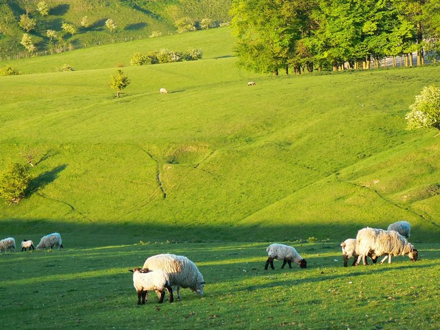
Fox Hill is also known for its stunning natural beauty, with many scenic walking trails and countryside views. The village is a popular destination for outdoor enthusiasts, who can explore the nearby Cotswold Area of Outstanding Natural Beauty, which is just a short distance away.

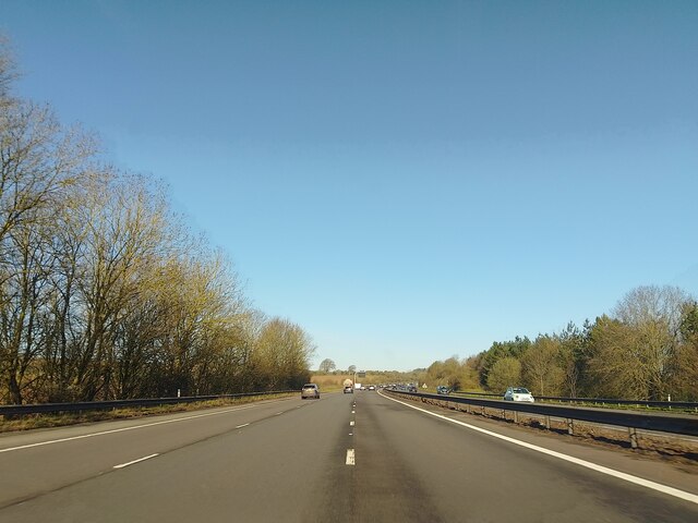
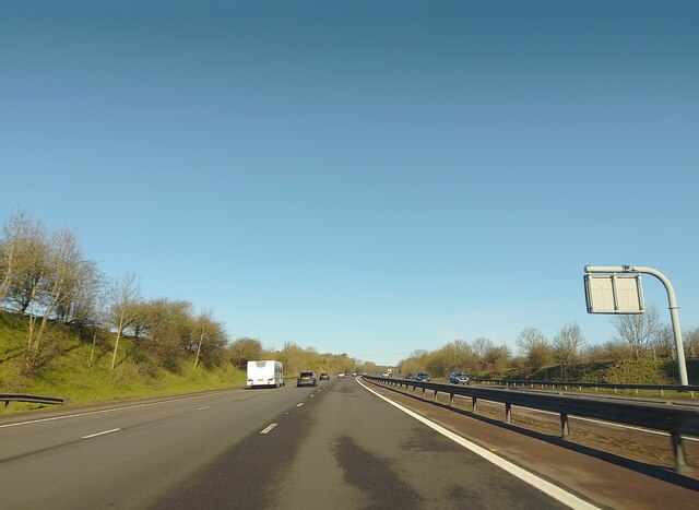
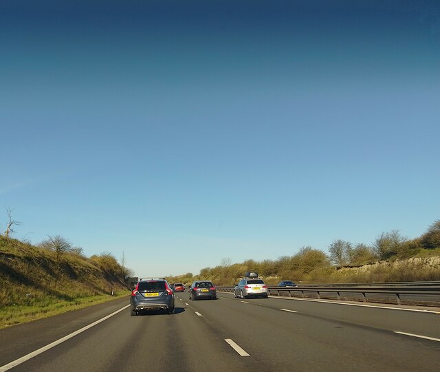
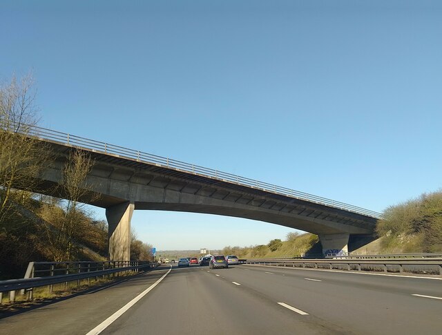
In terms of transportation, Fox Hill is well-connected to the surrounding areas. The nearby town of Chippenham provides access to mainline train services, with regular connections to London and other major cities. Additionally, the village is easily accessible by road, with the A350 passing nearby, providing convenient links to the wider road network.

In summary, Fox Hill is a charming and peaceful village in Wiltshire, offering a close community, beautiful surroundings, and easy access to amenities and transportation. It is a place where residents can enjoy the best of rural living while still being within reach of larger towns and cities.

If you have any feedback on the listing, please let us know in the comments section below.

Fox Hill Images

Images are sourced within 2km of 51.527912/-1.665524 or Grid Reference SU2381. Thanks to Geograph Open Source API. All images are credited.

M4 westbound Travelling westbound on the M4 motorway.
M4 westbound
Travelling westbound on the M4 motorway.
Hinton Downs Looking north from the M4.
Hinton Downs
Looking north from the M4.
On Charlbury Hill - view towards Liddington Hill
M4 westbound Travelling westbound on the M4 motorway.
M4 westbound
Travelling westbound on the M4 motorway.
M4 westbound Travelling westbound on the M4 motorway.
M4 westbound
Travelling westbound on the M4 motorway.
B4192 bridge over M4 The bridge carrying the B4192 over the M4 motorway.
B4192 bridge over M4
The bridge carrying the B4192 over the M4 motorway.
Plain Farm, Foxhill, Swindon The maps show this as Wanborough Plain Farm whilst Royal Mail and the Valuation Office both have it listed as plain Plain Farm. It is situated on the eastern edge of Wanborough Plain with the higher ground of Hinton Downs rising behind it. The M4 motorway can be seen beneath the farm buildings.
Plain Farm, Foxhill, Swindon
The maps show this as Wanborough Plain Farm whilst Royal Mail and the Valuation Office both have it listed as plain Plain Farm. It is situated on the eastern edge of Wanborough Plain with the higher ground of Hinton Downs rising behind it. The M4 motorway can be seen beneath the farm buildings.
Hillside Farm, Foxhill, Swindon The farm lies just off the old Roman road, the Ermin Way, that runs between Foxhill and Baydon. Fox Hill is the high ground behind the farm. Almost hidden between the yellow oilseed rape crop and the farm is the M4 motorway.
Hillside Farm, Foxhill, Swindon
The farm lies just off the old Roman road, the Ermin Way, that runs between Foxhill and Baydon. Fox Hill is the high ground behind the farm. Almost hidden between the yellow oilseed rape crop and the farm is the M4 motorway.
View from east of Charlbury Hill, near Bishopstone, Swindon (1 of 2) The viewpoint is just above a coombe and ancient field system. The southern edge of the picturesque village of Bishopstone is visible at the left.
View from east of Charlbury Hill, near Bishopstone, Swindon (1 of 2)
The viewpoint is just above a coombe and ancient field system. The southern edge of the picturesque village of Bishopstone is visible at the left.
View from east of Charlbury Hill, near Bishopstone, Swindon (2 of 2) The viewpoint is just above a coombe and ancient field system. Visible in the distance about 4 kilometres east is the National Trust property Ashdown House <a title="https://www.geograph.org.uk/search.php?i=21092833&displayclass=thumbs" href="https://www.geograph.org.uk/search.php?i=21092833&displayclass=thumbs">Link</a>
View from east of Charlbury Hill, near Bishopstone, Swindon (2 of 2)
The viewpoint is just above a coombe and ancient field system. Visible in the distance about 4 kilometres east is the National Trust property Ashdown House Link
Farmland between Bishopstone, Swindon and Lammy Down This is chalk downland typical of this part of Swindon. The buildings in the distance are part of Ridgeway Farm, about a kilometre away.
Farmland between Bishopstone, Swindon and Lammy Down
This is chalk downland typical of this part of Swindon. The buildings in the distance are part of Ridgeway Farm, about a kilometre away.
Coombe south of Bishopstone, Swindon The coombe as it is now is the result of both natural and human influences. There are a series of strip lynchets here forming an ancient field system, probably Anglo-Saxon. The topography is similar to that found a couple of kilometres west at Hinton Parva <a title="https://www.geograph.org.uk/photo/338730" href="https://www.geograph.org.uk/photo/338730">Link</a> In the distance is Bishopstone.
Coombe south of Bishopstone, Swindon
The coombe as it is now is the result of both natural and human influences. There are a series of strip lynchets here forming an ancient field system, probably Anglo-Saxon. The topography is similar to that found a couple of kilometres west at Hinton Parva Link In the distance is Bishopstone.
A closer look at a coombe south of Bishopstone, Swindon The viewpoint is the same as for this one <a href="https://www.geograph.org.uk/photo/2382393">SU2482 : Coombe south of Bishopstone, Swindon</a> On the other side of the coombe at the upper right the terracing effects that hundreds of sheep over hundreds of years have wrought can be discerned.
A closer look at a coombe south of Bishopstone, Swindon
The viewpoint is the same as for this one SU2482 : Coombe south of Bishopstone, Swindon On the other side of the coombe at the upper right the terracing effects that hundreds of sheep over hundreds of years have wrought can be discerned.
Pasture and arable land, south of Bishopstone, Swindon The fence is to keep the sheep out of the arable crop that is growing out of view to the right. Also out of shot is a stile across the fence. The maps do not show this as being access land but in practice it is.
Pasture and arable land, south of Bishopstone, Swindon
The fence is to keep the sheep out of the arable crop that is growing out of view to the right. Also out of shot is a stile across the fence. The maps do not show this as being access land but in practice it is.
At the head of the coombe south of Bishopstone, Swindon At the upper left beyond the fence is arable land. The coombe however is never cultivated. The complex topography means that modern arable techniques wouldn't work so it remains pastoral. In days past there was cultivation on the strip lynchets just out of sight to the right but visible here <a href="https://www.geograph.org.uk/photo/2382594">SU2482 : Strip Lynchets in the evening sun, Bishopstone, Swindon</a>
At the head of the coombe south of Bishopstone, Swindon
At the upper left beyond the fence is arable land. The coombe however is never cultivated. The complex topography means that modern arable techniques wouldn't work so it remains pastoral. In days past there was cultivation on the strip lynchets just out of sight to the right but visible here SU2482 : Strip Lynchets in the evening sun, Bishopstone, Swindon
Strip Lynchets in the evening sun, Bishopstone, Swindon These are part of a mediaeval field system that may date back to Saxon times. They were constructed to make it easier to cultivate the land on the side of the coombe. They are too regular to be a natural phenomenon. Today the land in the coombe is pastoral with a nice environment for sheep. The building at the upper right is part of Ridgeway Farm.
Strip Lynchets in the evening sun, Bishopstone, Swindon
These are part of a mediaeval field system that may date back to Saxon times. They were constructed to make it easier to cultivate the land on the side of the coombe. They are too regular to be a natural phenomenon. Today the land in the coombe is pastoral with a nice environment for sheep. The building at the upper right is part of Ridgeway Farm.
Strip lynchets and sheep in the evening sun, Bishopstone, Swindon The sun is sinking in the sky and the shadows are starting to lengthen. They haven't yet reached the lynchets on the south-west face of the coombe which our Saxon forebears cultivated. There is much information on strip lynchets in general and these in particular out there. Search for 'strip lynchets bishopstone' and all will be revealed.
Strip lynchets and sheep in the evening sun, Bishopstone, Swindon
The sun is sinking in the sky and the shadows are starting to lengthen. They haven't yet reached the lynchets on the south-west face of the coombe which our Saxon forebears cultivated. There is much information on strip lynchets in general and these in particular out there. Search for 'strip lynchets bishopstone' and all will be revealed.
Sheep and the coombe south of Bishopstone, Swindon There are a few mother and child groups visible in this evening shot in the south-eastern extremity of Swindon.
Sheep and the coombe south of Bishopstone, Swindon
There are a few mother and child groups visible in this evening shot in the south-eastern extremity of Swindon.
Show me another place!

Fox Hill is located at Grid Ref: SU2381 (Lat: 51.527912, Lng: -1.665524)

Unitary Authority: Swindon

Police Authority: Wiltshire

What 3 Words

///rich.however.cookbooks. Near Wanborough, Wiltshire

Nearby Locations

Fox Hill

Related Wikis

King Edward's Place

King Edward's Place is a country house at Foxhill near Wanborough and Liddington in Wiltshire. It is currently known as PGL Liddington and is owned and...

Foxhill motocross circuit

Foxhill motocross circuit is a well-known motocross circuit situated near to the small village of Foxhill, around six miles south east of Swindon, Wiltshire...

RAF Wanborough

Royal Air Force Wanborough or more simply RAF Wanborough is a former Royal Air Force satellite airfield near Swindon, Wiltshire, England. The following...

The Coombes, Hinton Parva

The Coombes (grid reference SU228826) is a 15.9 hectare biological Site of Special Scientific Interest at Hinton Parva in the Borough of Swindon, England...

Hinton Parva, Wiltshire

Hinton Parva, also known as Little Hinton, is a village in the Borough of Swindon in Wiltshire, England. It lies about 2 miles (3.2 km) from the eastern...

Liddington

Liddington is a village and civil parish near Swindon in Wiltshire, England. The settlement lies southeast of Swindon town, close to junction 15 of the...

Liddington Castle

Liddington Castle, locally called Liddington Camp, is a late Bronze Age and early Iron Age univallate hillfort in Liddington parish in the English county...

Bishopstone, Swindon

Bishopstone is a village and civil parish in the Borough of Swindon, England, about 6 miles (10 km) east of Swindon, and on the county border with Oxfordshire...

Nearby Amenities

Located within 500m of 51.527912,-1.665524
Foxhill
Place: hamlet
Lat/Long: 51.5301079/-1.6684374
Post Box
Post Box Type: lamp
Postal Code: SN4
Ref: SN4 129
Lat/Long: 51.5302893/-1.6681278
Restaurant
The Burj
Addr Postcode: SN4 0DR
Cuisine: indian
Old Name: The Shepherd's Rest
Website: https://www.theburj.co.uk/
Lat/Long: 51.5303746/-1.6682785
Defibrillator
Access: yes
Booth: K6
Covered: booth
Defibrillator Location: inside old red phone box in Foxhill
Disused Amenity: telephone
Emergency: defibrillator
Man Made: telephone_box
Lat/Long: 51.5298374/-1.6687873
Parking
Charlbury Hill
Lat/Long: 51.5317107/-1.6661287
Communication Microwave: yes
Communication Mobile Phone: yes
Height: 40
Man Made: tower
Tower Construction: lattice_steel
Tower Type: communication
Lat/Long: 51.5306262/-1.6625855
Grit Bin
Lat/Long: 51.5302525/-1.6682107
Bus Stop
Shepherds Rest
Bus: yes
Naptan AtcoCode: 4680SWA10902
Naptan Bearing: SW
Naptan CommonName: Shepherds Rest
Naptan Indicator: SW-bound
Naptan NaptanCode: swimagj
Naptan Verified: no
Public Transport: platform
Shelter: yes
Lat/Long: 51.5298154/-1.6688294
Bus Stop
Shepherds Rest
Bus: yes
Naptan AtcoCode: 4680SWA10901
Naptan Bearing: NE
Naptan CommonName: Shepherds Rest
Naptan Indicator: NE-bound
Naptan NaptanCode: swimagd
Naptan Verified: no
Public Transport: platform
Lat/Long: 51.5298812/-1.6690054
Give Way
Direction: forward
Lat/Long: 51.5301285/-1.668476
Give Way
Direction: forward
Lat/Long: 51.5300801/-1.6683101
The data included in this document is from www.openstreetmap.org. The data is made available under ODbL.

Have you been to Fox Hill?

Leave your review of Fox Hill below (or comments, questions and feedback).