Four Lane Ends

Settlement in Cheshire

England

Four Lane Ends

Church of St Jude at Tilstone Fearnall
Church of St Jude at Tilstone Fearnall Credit: Mat Fascione

Four Lane Ends is a small village located in Cheshire, a county in North West England. Situated approximately 4 miles east of the town of Congleton and 9 miles west of Macclesfield, Four Lane Ends is nestled amidst the picturesque countryside of the Cheshire Plain.

The village gets its name from the crossroads where the A536 Congleton to Macclesfield road intersects with the A34 Manchester to Congleton road, forming a four-way junction. This junction serves as a focal point for the village, with several local businesses and amenities located nearby.

Four Lane Ends is primarily a residential area, with a mix of housing types ranging from traditional stone cottages to more modern developments. The village boasts a close-knit community, with a village hall that hosts various events and gatherings throughout the year, fostering a sense of community spirit.

The surrounding landscape offers ample opportunities for outdoor activities, with numerous walking trails and nature reserves nearby. Just a short drive away is the Peak District National Park, a popular destination for hiking, cycling, and exploring the stunning countryside.

Despite its tranquil rural setting, Four Lane Ends benefits from good transport links. The nearby A34 and A536 provide convenient access to neighboring towns and cities, while the M6 motorway is within easy reach.

In summary, Four Lane Ends offers a peaceful and idyllic village lifestyle, surrounded by beautiful countryside and a strong sense of community.

If you have any feedback on the listing, please let us know in the comments section below.

Four Lane Ends Images

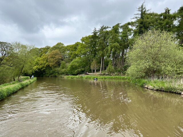
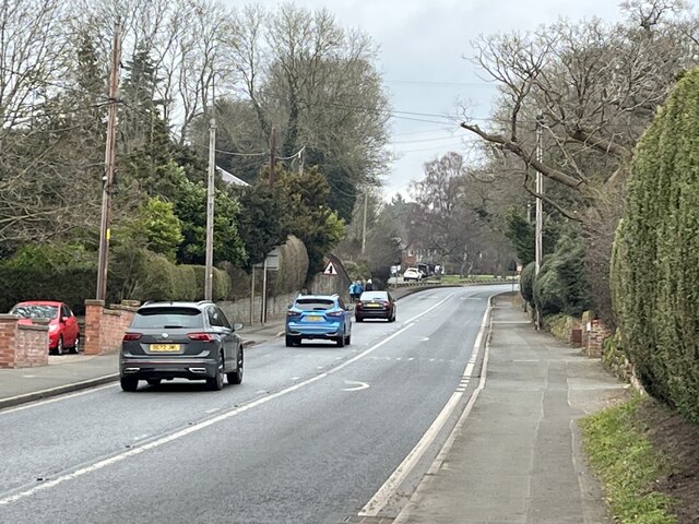
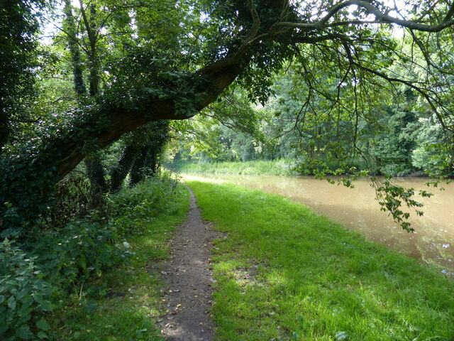
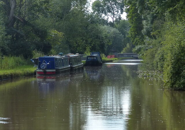
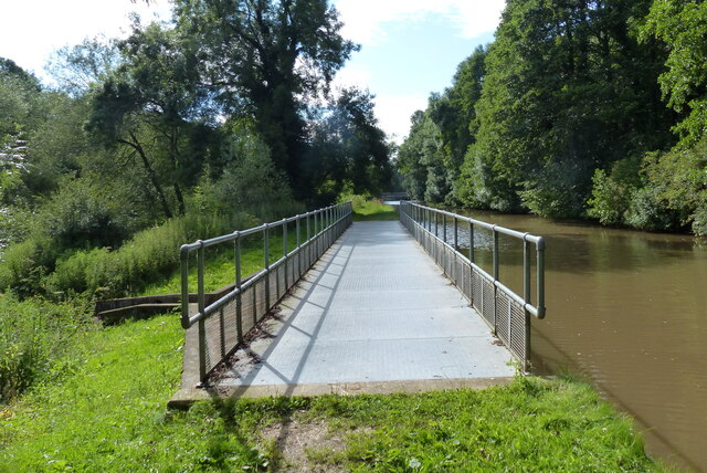
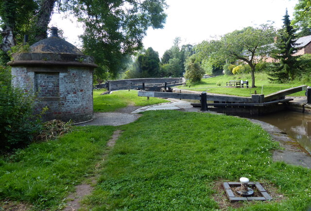
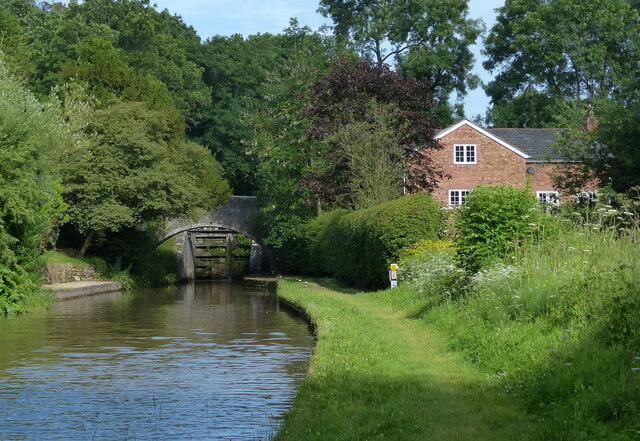
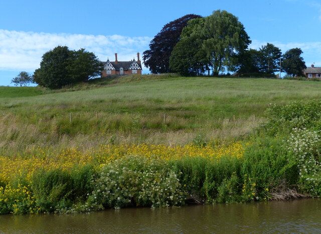
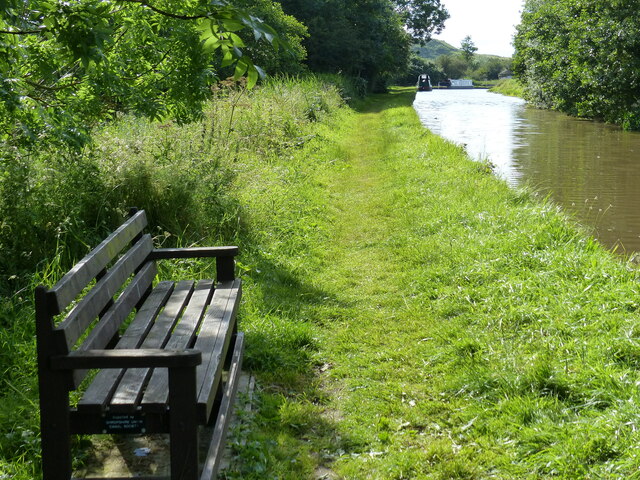
Images are sourced within 2km of 53.143376/-2.6555641 or Grid Reference SJ5660. Thanks to Geograph Open Source API. All images are credited.

Church of St Jude at Tilstone Fearnall
Path through maize, Tiverton Leaving the A49 at a layby.
Path through maize, Tiverton
Leaving the A49 at a layby.
Sheep Pasture near Springfield Farm
Shropshire Union Canal Near Simpon's Rough Wood.
Shropshire Union Canal
Near Simpon's Rough Wood.
Fields by the Shropshire Union Canal Near Tiverton.
Fields by the Shropshire Union Canal
Near Tiverton.
Traffic on the A49 Heading North up the hill in Tiverton.
Traffic on the A49
Heading North up the hill in Tiverton.
Fields and trees, Tiverton Just west of Beeston-Brook, rising up from the Shropshire Union canal.
Fields and trees, Tiverton
Just west of Beeston-Brook, rising up from the Shropshire Union canal.
Large benchmark on the corner of Birch Heath Road, Tarporley Large Ordnance Survey benchmark on the corner of Birch Heath Road at its junction with Nantwich Road, Tarporley. For a wider view see <a href="https://www.geograph.org.uk/photo/7533890">SJ5562 : Nantwich Road junction with Birch Heath Road, Tarporley</a>

Benchmark Database: <span class="nowrap"><a title="https://www.bench-marks.org.uk/bm196532" rel="nofollow ugc noopener" href="https://www.bench-marks.org.uk/bm196532">Link</a><img style="margin-left:2px;" alt="External link" title="External link - shift click to open in new window" src="https://s1.geograph.org.uk/img/external.png" width="10" height="10"/></span>
Large benchmark on the corner of Birch Heath Road, Tarporley
Large Ordnance Survey benchmark on the corner of Birch Heath Road at its junction with Nantwich Road, Tarporley. For a wider view see SJ5562 : Nantwich Road junction with Birch Heath Road, Tarporley Benchmark Database: LinkExternal link
Nantwich Road junction with Birch Heath Road, Tarporley Looking across the junction of Birch Heath Road with Nantwich Road towards St. Thomas Becket's Church. There is an Ordnance Survey benchmark on the corner of the nearest building, just to the left of the black pipes <a href="https://www.geograph.org.uk/photo/7533884">SJ5562 : Large benchmark on the corner of Birch Heath Road, Tarporley</a>
Nantwich Road junction with Birch Heath Road, Tarporley
Looking across the junction of Birch Heath Road with Nantwich Road towards St. Thomas Becket's Church. There is an Ordnance Survey benchmark on the corner of the nearest building, just to the left of the black pipes SJ5562 : Large benchmark on the corner of Birch Heath Road, Tarporley
Towpath along the Shropshire Union Canal The Shropshire Union Canal (from Autherley to Nantwich) was engineered by Thomas Telford and opened in 1835. There are long straight sections of this canal which required either embankments or cuttings to avoid the need for locks. Although this was a more difficult procedure, the end route was shorter and the progress for horse drawn working boats could be maintained with (hopefully) no stoppages. The canal (formerly the Birmingham and Liverpool Junction Canal) was opened at a time when railways were making serious inroads into the canal companies' businesses. 

The current Shroppie north of Nantwich was formerly the Chester Canal, opened in 1779, and has wider locks and bridges. Boats up to nine feet in beam can still navigate this section; Telford's canal accommodates only narrowboats up to seven feet in beam.
Towpath along the Shropshire Union Canal
The Shropshire Union Canal (from Autherley to Nantwich) was engineered by Thomas Telford and opened in 1835. There are long straight sections of this canal which required either embankments or cuttings to avoid the need for locks. Although this was a more difficult procedure, the end route was shorter and the progress for horse drawn working boats could be maintained with (hopefully) no stoppages. The canal (formerly the Birmingham and Liverpool Junction Canal) was opened at a time when railways were making serious inroads into the canal companies' businesses. The current Shroppie north of Nantwich was formerly the Chester Canal, opened in 1779, and has wider locks and bridges. Boats up to nine feet in beam can still navigate this section; Telford's canal accommodates only narrowboats up to seven feet in beam.
Narrowboats moored along the Shropshire Union Canal The Shropshire Union Canal (from Autherley to Nantwich) was engineered by Thomas Telford and opened in 1835. There are long straight sections of this canal which required either embankments or cuttings to avoid the need for locks. Although this was a more difficult procedure, the end route was shorter and the progress for horse drawn working boats could be maintained with (hopefully) no stoppages. The canal (formerly the Birmingham and Liverpool Junction Canal) was opened at a time when railways were making serious inroads into the canal companies' businesses. 

The current Shroppie north of Nantwich was formerly the Chester Canal, opened in 1779, and has wider locks and bridges. Boats up to nine feet in beam can still navigate this section; Telford's canal accommodates only narrowboats up to seven feet in beam.
Narrowboats moored along the Shropshire Union Canal
The Shropshire Union Canal (from Autherley to Nantwich) was engineered by Thomas Telford and opened in 1835. There are long straight sections of this canal which required either embankments or cuttings to avoid the need for locks. Although this was a more difficult procedure, the end route was shorter and the progress for horse drawn working boats could be maintained with (hopefully) no stoppages. The canal (formerly the Birmingham and Liverpool Junction Canal) was opened at a time when railways were making serious inroads into the canal companies' businesses. The current Shroppie north of Nantwich was formerly the Chester Canal, opened in 1779, and has wider locks and bridges. Boats up to nine feet in beam can still navigate this section; Telford's canal accommodates only narrowboats up to seven feet in beam.
Crossing the canal overflow The overflow drains into the River Gowy.
Crossing the canal overflow
The overflow drains into the River Gowy.
Tilstone Lock No 32 The Shropshire Union Canal (from Autherley to Nantwich) was engineered by Thomas Telford and opened in 1835. There are long straight sections of this canal which required either embankments or cuttings to avoid the need for locks. Although this was a more difficult procedure, the end route was shorter and the progress for horse drawn working boats could be maintained with (hopefully) no stoppages. The canal (formerly the Birmingham and Liverpool Junction Canal) was opened at a time when railways were making serious inroads into the canal companies' businesses. 

The current Shroppie north of Nantwich was formerly the Chester Canal, opened in 1779, and has wider locks and bridges. Boats up to nine feet in beam can still navigate this section; Telford's canal accommodates only narrowboats up to seven feet in beam.
Tilstone Lock No 32
The Shropshire Union Canal (from Autherley to Nantwich) was engineered by Thomas Telford and opened in 1835. There are long straight sections of this canal which required either embankments or cuttings to avoid the need for locks. Although this was a more difficult procedure, the end route was shorter and the progress for horse drawn working boats could be maintained with (hopefully) no stoppages. The canal (formerly the Birmingham and Liverpool Junction Canal) was opened at a time when railways were making serious inroads into the canal companies' businesses. The current Shroppie north of Nantwich was formerly the Chester Canal, opened in 1779, and has wider locks and bridges. Boats up to nine feet in beam can still navigate this section; Telford's canal accommodates only narrowboats up to seven feet in beam.
The Mill next to Tilstone Mill Bridge No 106 The Shropshire Union Canal (from Autherley to Nantwich) was engineered by Thomas Telford and opened in 1835. There are long straight sections of this canal which required either embankments or cuttings to avoid the need for locks. Although this was a more difficult procedure, the end route was shorter and the progress for horse drawn working boats could be maintained with (hopefully) no stoppages. The canal (formerly the Birmingham and Liverpool Junction Canal) was opened at a time when railways were making serious inroads into the canal companies' businesses. 

The current Shroppie north of Nantwich was formerly the Chester Canal, opened in 1779, and has wider locks and bridges. Boats up to nine feet in beam can still navigate this section; Telford's canal accommodates only narrowboats up to seven feet in beam.
The Mill next to Tilstone Mill Bridge No 106
The Shropshire Union Canal (from Autherley to Nantwich) was engineered by Thomas Telford and opened in 1835. There are long straight sections of this canal which required either embankments or cuttings to avoid the need for locks. Although this was a more difficult procedure, the end route was shorter and the progress for horse drawn working boats could be maintained with (hopefully) no stoppages. The canal (formerly the Birmingham and Liverpool Junction Canal) was opened at a time when railways were making serious inroads into the canal companies' businesses. The current Shroppie north of Nantwich was formerly the Chester Canal, opened in 1779, and has wider locks and bridges. Boats up to nine feet in beam can still navigate this section; Telford's canal accommodates only narrowboats up to seven feet in beam.
Tilstone Bank Farmhouse Viewed from the towpath of the Shropshire Union Canal.
Tilstone Bank Farmhouse
Viewed from the towpath of the Shropshire Union Canal.
Seat along the Shropshire Union Canal towpath The Shropshire Union Canal (from Autherley to Nantwich) was engineered by Thomas Telford and opened in 1835. There are long straight sections of this canal which required either embankments or cuttings to avoid the need for locks. Although this was a more difficult procedure, the end route was shorter and the progress for horse drawn working boats could be maintained with (hopefully) no stoppages. The canal (formerly the Birmingham and Liverpool Junction Canal) was opened at a time when railways were making serious inroads into the canal companies' businesses. 

The current Shroppie north of Nantwich was formerly the Chester Canal, opened in 1779, and has wider locks and bridges. Boats up to nine feet in beam can still navigate this section; Telford's canal accommodates only narrowboats up to seven feet in beam.
Seat along the Shropshire Union Canal towpath
The Shropshire Union Canal (from Autherley to Nantwich) was engineered by Thomas Telford and opened in 1835. There are long straight sections of this canal which required either embankments or cuttings to avoid the need for locks. Although this was a more difficult procedure, the end route was shorter and the progress for horse drawn working boats could be maintained with (hopefully) no stoppages. The canal (formerly the Birmingham and Liverpool Junction Canal) was opened at a time when railways were making serious inroads into the canal companies' businesses. The current Shroppie north of Nantwich was formerly the Chester Canal, opened in 1779, and has wider locks and bridges. Boats up to nine feet in beam can still navigate this section; Telford's canal accommodates only narrowboats up to seven feet in beam.
Beeston Stone Lock No 33 The Shropshire Union Canal (from Autherley to Nantwich) was engineered by Thomas Telford and opened in 1835. There are long straight sections of this canal which required either embankments or cuttings to avoid the need for locks. Although this was a more difficult procedure, the end route was shorter and the progress for horse drawn working boats could be maintained with (hopefully) no stoppages. The canal (formerly the Birmingham and Liverpool Junction Canal) was opened at a time when railways were making serious inroads into the canal companies' businesses. 

The current Shroppie north of Nantwich was formerly the Chester Canal, opened in 1779, and has wider locks and bridges. Boats up to nine feet in beam can still navigate this section; Telford's canal accommodates only narrowboats up to seven feet in beam.
Beeston Stone Lock No 33
The Shropshire Union Canal (from Autherley to Nantwich) was engineered by Thomas Telford and opened in 1835. There are long straight sections of this canal which required either embankments or cuttings to avoid the need for locks. Although this was a more difficult procedure, the end route was shorter and the progress for horse drawn working boats could be maintained with (hopefully) no stoppages. The canal (formerly the Birmingham and Liverpool Junction Canal) was opened at a time when railways were making serious inroads into the canal companies' businesses. The current Shroppie north of Nantwich was formerly the Chester Canal, opened in 1779, and has wider locks and bridges. Boats up to nine feet in beam can still navigate this section; Telford's canal accommodates only narrowboats up to seven feet in beam.
Narrowboats moored along the Shropshire Union Canal This stretch of the canal is between locks 33 and 34.
Narrowboats moored along the Shropshire Union Canal
This stretch of the canal is between locks 33 and 34.
Show me another place!

Four Lane Ends is located at Grid Ref: SJ5660 (Lat: 53.143376, Lng: -2.6555641)

Unitary Authority: Cheshire West and Chester

Police Authority: Cheshire

What 3 Words

///requires.pranced.shakes. Near Tiverton, Cheshire

Related Wikis

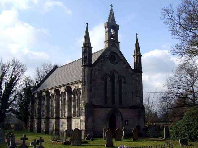
St Jude's Church, Tilstone Fearnall

St Jude's Church is on Nantwich Road (the A51) in Tilstone Fearnall, in the civil parish of Tiverton and Tilstone Fearnall, Cheshire, England. It is an...

Tilstone Fearnall

Tilstone Fearnall is a village and former civil parish, now in the parishes of Tiverton and Tilstone Fearnall, in the Cheshire West and Chester district...

Tilstone Lodge

Tilstone Lodge is a country house in the parish of Tiverton and Tilstone Fearnall, Cheshire, England. It was built between 1821 and 1825 for Admiral John...

Brook Farm School

Brook Farm School was a state run 'special' boarding school in the village of Tarporley in the English county of Cheshire. It opened in 1975 and closed...

Nearby Amenities

Located within 500m of 53.143376,-2.6555641
Traffic Signals
Traffic Signals: signal
Traffic Signals Direction: forward
Lat/Long: 53.1456972/-2.6605456
Barrier: stile
Foot: yes
Lat/Long: 53.1447/-2.6542031
Barrier: stile
Foot: yes
Lat/Long: 53.1445222/-2.655429
Barrier: stile
Foot: yes
Lat/Long: 53.1437982/-2.6575084
Barrier: stile
Lat/Long: 53.1426499/-2.6602077
Barrier: stile
Foot: yes
Lat/Long: 53.1433421/-2.6582653
Barrier: stile
Foot: yes
Lat/Long: 53.143478/-2.657942
Barrier: stile
Foot: yes
Lat/Long: 53.1445224/-2.6556376
Barrier: stile
Foot: yes
Lat/Long: 53.1446122/-2.652451
Barrier: stile
Foot: yes
Lat/Long: 53.144574/-2.6517435
Barrier: stile
Foot: yes
Lat/Long: 53.1450008/-2.6506391
Barrier: stile
Foot: yes
Lat/Long: 53.1392876/-2.6551517
Barrier: stile
Foot: yes
Lat/Long: 53.1392658/-2.6552588
Bus Stop
Tiverton, Whitchurch Road / Red Fox
Bench: no
Bus: yes
Naptan AtcoCode: 0610CH1268
Naptan Bearing: NE
Naptan CommonName: Red Fox
Naptan Crossing: Nantwich Road
Naptan Indicator: by
Naptan Landmark: Red Fox
Naptan LocalityName: Tiverton
Naptan NaptanCode: chwdtwd
Naptan ShortCommonName: Red Fox
Naptan Street: Whitchurch Road
Naptan Verified: no
Public Transport: platform
Shelter: no
Source: naptan_import
Lat/Long: 53.1454864/-2.6610683
Bus Stop
Tilstone Fearnall, Nantwich Road / Tiverton Heath Cottage
Bus: yes
Naptan AtcoCode: 0610CH465
Naptan Bearing: NW
Naptan CommonName: Tiverton Heath Cottage
Naptan Indicator: o/s
Naptan Landmark: Tiverton Heath Cottage
Naptan LocalityName: Tilstone Fearnall
Naptan NaptanCode: chwgmpm
Naptan ShortCommonName: Tiverton Heath Cott
Naptan Street: Nantwich Road
Naptan Verified: no
Public Transport: platform
Source: naptan_import
Lat/Long: 53.1424519/-2.6571197
Bus Stop
Tilstone Fearnall, Nantwich Road / Tiverton Heath Cottage
Bus: yes
Naptan AtcoCode: 0610CH466
Naptan Bearing: SE
Naptan BusStopType: CUS
Naptan CommonName: Tiverton Heath Cottage
Naptan Indicator: opp
Naptan Landmark: Tiverton Heath Cottage
Naptan LocalityName: Tilstone Fearnall
Naptan NaptanCode: chwgmpt
Naptan ShortCommonName: Tiverton Heath Cott
Naptan Street: Nantwich Road
Naptan Verified: no
Public Transport: platform
Source: naptan_import
Lat/Long: 53.1425908/-2.656837
Post Box
Brand: Royal Mail
Brand Wikidata: Q638098
Operator: Royal Mail
Operator Wikidata: Q638098
Post Box Type: wall
Royal Cypher: VR
Royal Cypher Wikidata: Q33102356
Lat/Long: 53.1458575/-2.6605754
Man Made: mast
Tower Type: communication
Lat/Long: 53.1476583/-2.6567763
Power: pole
Lat/Long: 53.1419826/-2.6564223
Power: pole
Lat/Long: 53.1415562/-2.6567978
Power: pole
Lat/Long: 53.1414734/-2.6606508
Power: pole
Lat/Long: 53.1405587/-2.6564196
Power: pole
Lat/Long: 53.1409641/-2.6574656
Power: pole
Lat/Long: 53.1414822/-2.6587504
Power: pole
Lat/Long: 53.1420067/-2.6600567
Power: pole
Lat/Long: 53.1425891/-2.6615694
Material: wood
Power: pole
Lat/Long: 53.1429205/-2.6625082
Material: wood
Power: pole
Lat/Long: 53.1430846/-2.6629856
Traffic Signals
Traffic Signals: signal
Traffic Signals Direction: backward
Lat/Long: 53.1459211/-2.6602502
Traffic Signals
Traffic Signals: signal
Traffic Signals Direction: backward
Lat/Long: 53.1460247/-2.660697
Traffic Signals
Traffic Signals: signal
Traffic Signals Direction: backward
Lat/Long: 53.1456019/-2.6600861
The data included in this document is from www.openstreetmap.org. The data is made available under ODbL.

Have you been to Four Lane Ends?

Leave your review of Four Lane Ends below (or comments, questions and feedback).