Forest Fields

Settlement in Nottinghamshire

England

Forest Fields

New student apartments on site of Odeon cinema
New student apartments on site of Odeon cinema Credit: SK53

Forest Fields is a vibrant and diverse neighborhood located in Nottinghamshire, England. Situated just north of the city center, it covers an area of approximately one square mile. The community is bordered by Hyson Green to the west, New Basford to the north, Radford to the east, and Lenton to the south.

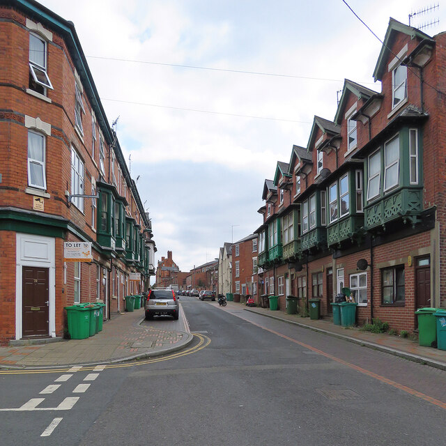
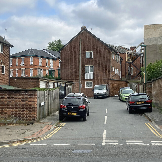
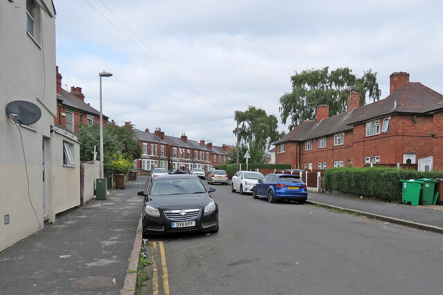
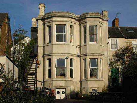
Originally developed in the late 19th century, Forest Fields was primarily a residential area, with rows of terraced houses built to accommodate the growing population of Nottingham. Over the years, the neighborhood has evolved to become a melting pot of cultures, attracting a diverse range of residents from various backgrounds.

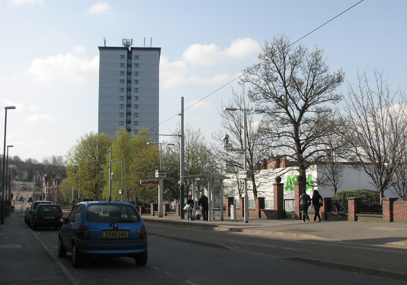
One of the notable features of Forest Fields is its close proximity to the University of Nottingham and Nottingham Trent University, making it a popular choice for students seeking off-campus accommodation. The area is well-served by public transportation, with regular bus services connecting it to the city center and surrounding areas.

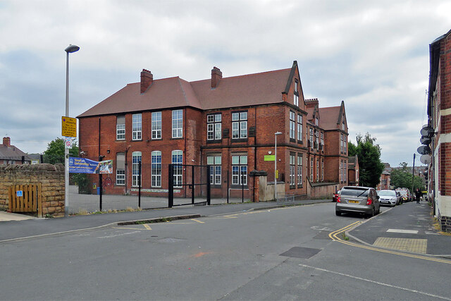
Forest Fields also boasts a range of amenities and facilities. The neighborhood has several schools, including primary and secondary schools, catering to families with children. There are also numerous shops, supermarkets, and local businesses, providing residents with easy access to daily necessities.

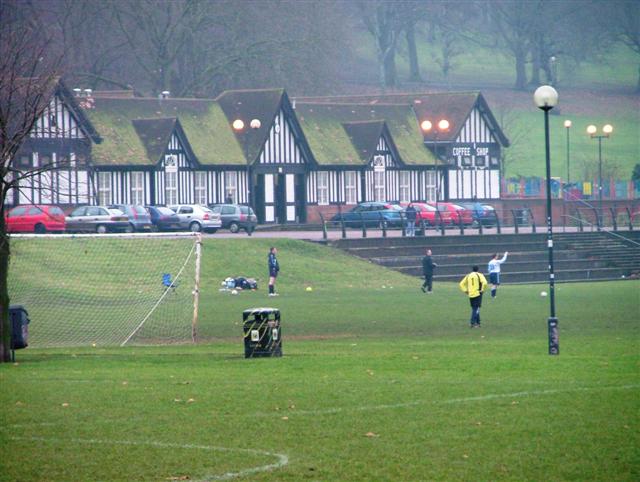
Green spaces are scattered throughout the area, providing opportunities for outdoor activities and relaxation. Forest Recreation Ground, a large park located nearby, offers expansive green spaces, sports facilities, and hosts various events throughout the year.

If you have any feedback on the listing, please let us know in the comments section below.

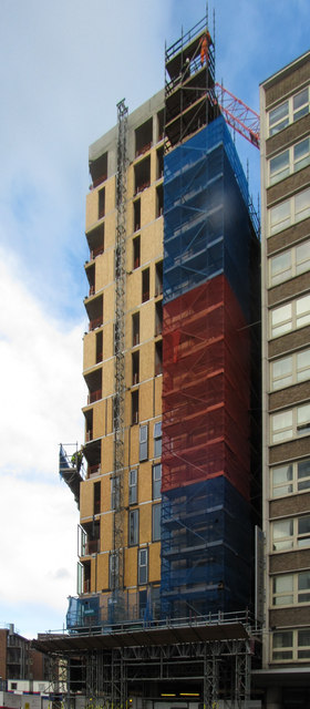
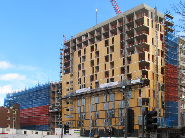
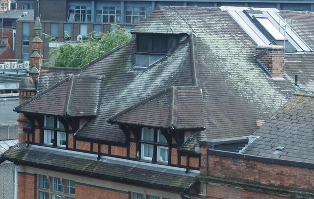
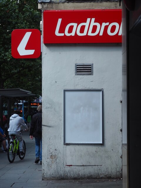
Forest Fields Images

Images are sourced within 2km of 52.968511/-1.1651677 or Grid Reference SK5641. Thanks to Geograph Open Source API. All images are credited.

New student apartments on site of Odeon cinema
A Watson Fothergill roof An 1896 design for Furley & Co., provision merchants.

Taken from the café windows of John Lewis in the Victoria Centre.

<span class="nowrap"><a title="https://historicengland.org.uk/listing/the-list/list-entry/1254750" rel="nofollow ugc noopener" href="https://historicengland.org.uk/listing/the-list/list-entry/1254750">Link</a><img style="margin-left:2px;" alt="External link" title="External link - shift click to open in new window" src="https://s1.geograph.org.uk/img/external.png" width="10" height="10"/></span>
A Watson Fothergill roof
An 1896 design for Furley & Co., provision merchants. Taken from the café windows of John Lewis in the Victoria Centre. LinkExternal link
Side of a Ladbrokes Betting shop on Milton Street, on the outside of the "Vikki" centre.
Side of a Ladbrokes
Betting shop on Milton Street, on the outside of the "Vikki" centre.
Radford: up Peveril Street Looking towards Alfreton Road on a cloudy August afternoon. Though Victorian three-storey terraces are common, the wooden first-floor oriel windows are unusual for Nottingham.
Radford: up Peveril Street
Looking towards Alfreton Road on a cloudy August afternoon. Though Victorian three-storey terraces are common, the wooden first-floor oriel windows are unusual for Nottingham.
Radford: Aspley Place Looking from Bentinck Road towards the backs of Victorian and twentieth-century houses on Peveril Street.
Radford: Aspley Place
Looking from Bentinck Road towards the backs of Victorian and twentieth-century houses on Peveril Street.
Radford: The Alma and Alfreton Road A view from the corner of Bentinck Road (left) and Alfreton Road. The early 19th-century house next to the closed pub has third-floor frame-knitter's windows.
Radford: The Alma and Alfreton Road
A view from the corner of Bentinck Road (left) and Alfreton Road. The early 19th-century house next to the closed pub has third-floor frame-knitter's windows.
Radford contrast These flats and houses, seen from Norton Street, replaced Victorian terraces late in the twentieth century.
Radford contrast
These flats and houses, seen from Norton Street, replaced Victorian terraces late in the twentieth century.
Radford: rebuilding the burnt-out Player's factory The former Player's No 1 Factory on Player Street was destroyed by fire on 30 March 2015. The adapted Victorian factory designed by R C Sutton (1881-2) was four storeys high and 387ft/119m by 38ft/12m. Until 1902 it was shared with lace manufacturers. After Player’s moved to a new factory it became Player’s Court, housing various businesses, before becoming student accommodation.

<a href="https://www.geograph.org.uk/photo/4443855">SK5540 : The former Player's cigarette factory after the fire</a> was taken from further down Norton Street shortly after the fire.
Radford: rebuilding the burnt-out Player's factory
The former Player's No 1 Factory on Player Street was destroyed by fire on 30 March 2015. The adapted Victorian factory designed by R C Sutton (1881-2) was four storeys high and 387ft/119m by 38ft/12m. Until 1902 it was shared with lace manufacturers. After Player’s moved to a new factory it became Player’s Court, housing various businesses, before becoming student accommodation. SK5540 : The former Player's cigarette factory after the fire was taken from further down Norton Street shortly after the fire.
Radford: steelwork on the burnt-out Player's factory The former Player's No 1 Factory on Player Street was destroyed by fire on 30 March 2015. The adapted Victorian factory designed by R C Sutton (1881-2) was four storeys high and 387ft/119m by 38ft/12m. Until 1902 it was shared with lace manufacturers. After Player’s moved to a new factory it became Player’s Court, housing various businesses, before becoming student accommodation.

For comparison, see <a href="https://www.geograph.org.uk/photo/4443873">SK5540 : Former Player's factory destroyed by fire</a>, taken soon after the fire.
Radford: steelwork on the burnt-out Player's factory
The former Player's No 1 Factory on Player Street was destroyed by fire on 30 March 2015. The adapted Victorian factory designed by R C Sutton (1881-2) was four storeys high and 387ft/119m by 38ft/12m. Until 1902 it was shared with lace manufacturers. After Player’s moved to a new factory it became Player’s Court, housing various businesses, before becoming student accommodation. For comparison, see SK5540 : Former Player's factory destroyed by fire, taken soon after the fire.
Radford: rebuilding the former Player's cigarette factory The former Player's No 1 Factory on Player Street was destroyed by fire on 30 March 2015. The adapted Victorian factory designed by R C Sutton (1881-2) was four storeys high and 387ft/119m by 38ft/12m. Until 1902 it was shared with lace manufacturers. After Player’s moved to a new factory it became Player’s Court, housing various businesses, before becoming student accommodation.

For comparison, see <a href="https://www.geograph.org.uk/photo/4444398">SK5540 : Osborne Street and the remains of the former Player's factory</a>, taken shortly after the fire from further down the street.
Radford: rebuilding the former Player's cigarette factory
The former Player's No 1 Factory on Player Street was destroyed by fire on 30 March 2015. The adapted Victorian factory designed by R C Sutton (1881-2) was four storeys high and 387ft/119m by 38ft/12m. Until 1902 it was shared with lace manufacturers. After Player’s moved to a new factory it became Player’s Court, housing various businesses, before becoming student accommodation. For comparison, see SK5540 : Osborne Street and the remains of the former Player's factory, taken shortly after the fire from further down the street.
Radford: rebuilding work on Player Street The former Player's No 1 Factory on Player Street was destroyed by fire on 30 March 2015. The adapted Victorian factory designed by R C Sutton (1881-2) was four storeys high and 387ft/119m by 38ft/12m. Until 1902 it was shared with lace manufacturers. After Player’s moved to a new factory it became Player’s Court, housing various businesses, before becoming student accommodation.

<a href="https://www.geograph.org.uk/photo/4444449">SK5540 : Player Street after the fire</a> gives an idea of the devastation.
Radford: rebuilding work on Player Street
The former Player's No 1 Factory on Player Street was destroyed by fire on 30 March 2015. The adapted Victorian factory designed by R C Sutton (1881-2) was four storeys high and 387ft/119m by 38ft/12m. Until 1902 it was shared with lace manufacturers. After Player’s moved to a new factory it became Player’s Court, housing various businesses, before becoming student accommodation. SK5540 : Player Street after the fire gives an idea of the devastation.
Berridge Primary and Nursery School I don't have much time for the pronouncements of Ofsted, but I was pleased to read that Berridge is considered "good" with "outstanding" features, just as it was by local people when I was a pupil here in the 1950s.
Berridge Primary and Nursery School
I don't have much time for the pronouncements of Ofsted, but I was pleased to read that Berridge is considered "good" with "outstanding" features, just as it was by local people when I was a pupil here in the 1950s.
Up Berridge Road West Looking north from the corner of Oakland Street, with Victorian villas on the left and council-built houses on the right.
Up Berridge Road West
Looking north from the corner of Oakland Street, with Victorian villas on the left and council-built houses on the right.
Masjid Umar Mosque, Alfreton Road This mosque at the corner of Alfreton Road and Berridge Road West was originally a public house, and its name, Le Grand, can still be made out on the black panel between the first-floor windows. It seems a long time since the publican's son was a classmate of mine at nearby Berridge Junior School.
Masjid Umar Mosque, Alfreton Road
This mosque at the corner of Alfreton Road and Berridge Road West was originally a public house, and its name, Le Grand, can still be made out on the black panel between the first-floor windows. It seems a long time since the publican's son was a classmate of mine at nearby Berridge Junior School.
Up Churchfield Lane Much of this part of Nottingham was built between the wars as the city started to expand westwards - a process which accelerated after the war.
Up Churchfield Lane
Much of this part of Nottingham was built between the wars as the city started to expand westwards - a process which accelerated after the war.
Radford: up Hartley Road Looking towards Radford Boulevard from the corner of Churchfield Lane. The former Boulevard Works, now student accommodation, dominates the skyline.
Radford: up Hartley Road
Looking towards Radford Boulevard from the corner of Churchfield Lane. The former Boulevard Works, now student accommodation, dominates the skyline.
Old Radford: down Hartley Road St Peter's Church Hall, on the left, has seen better days.
Old Radford: down Hartley Road
St Peter's Church Hall, on the left, has seen better days.
Show me another place!

Forest Fields is located at Grid Ref: SK5641 (Lat: 52.968511, Lng: -1.1651677)

Unitary Authority: Nottingham

Police Authority: Nottinghamshire

What 3 Words

///garage.intervals.tilt. Near New Basford, Nottinghamshire

Related Wikis

Forest Fields

Forest Fields is an inner-city area of the City of Nottingham, in the county of Nottinghamshire, England. == Geography == Forest Fields is slightly north...

Djanogly City Academy

Djanogly City Academy City Academy secondary school in Nottingham, England. It has been open since 2003, when it replaced the oversubscribed Djanogly CTC...

Noel Street tram stop

Noel Street is a tram stop on Nottingham Express Transit (NET), in the city of Nottingham suburb of Hyson Green. The tram stop opened on 9 March 2004,...

Sumac Centre

The Sumac Centre is a self-managed social centre in Nottingham, UK. It provides resources, meeting spaces and workshops for groups and individuals, and...
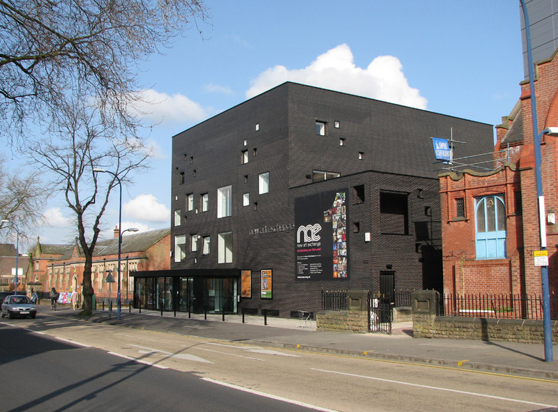
New Art Exchange

New Art Exchange is a contemporary art gallery in Nottingham's Hyson Green neighborhood representing contexts of Black, Asian, and minority ethnic artists...

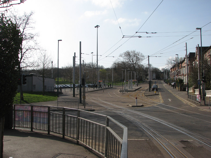
The Forest tram stop

The Forest is a tram stop on Nottingham Express Transit (NET) in the city of Nottingham. It takes its name from the nearby Forest Recreation Ground, the...

Forest New Ground

The Forest New Ground at Nottingham was a first-class cricket venue used by Nottingham Cricket Club in the late 18th and early 19th centuries.Forest New...

Beaconsfield Street tram stop

Beaconsfield Street is a tram stop on Nottingham Express Transit (NET), in the city of Nottingham suburb of Hyson Green. The tram stop opened on 9 March...

Nearby Amenities

Located within 500m of 52.968511,-1.1651677
Railway: tram_level_crossing
Lat/Long: 52.9666619/-1.1685953
Traffic Signals
Railway: tram_level_crossing
Traffic Signals Direction: forward
Lat/Long: 52.9665492/-1.1681751
Railway: switch
Lat/Long: 52.9648531/-1.166947
Railway: tram_level_crossing
Lat/Long: 52.9693235/-1.1698933
The Forest
Local Ref: NET13
Naptan AtcoCode: 3390NET13
Naptan Bearing: S
Naptan CommonName: The Forest Tram Stop
Naptan Indicator: Stop NET13
Naptan Landmark: Forest Park& Ride Site
Naptan NaptanCode: ntmamtja
Naptan PlusbusZoneRef: NTNG
Naptan Street: Noel Street
Naptan Verified: no
Network: Nottingham Express Transit
Operator: Tramlink Nottingham Ltd.
Public Transport: stop_position
Railway: tram_stop
Source: naptan_import
Tram: yes
Wheelchair: yes
Wikidata: Q21061482
Lat/Long: 52.9651616/-1.1670093
The Forest
Alternate: yes
Public Transport: stop_position
Railway: tram_stop
Tram: yes
Lat/Long: 52.9651495/-1.1670838
Crossing
Crossing: traffic_signals
Lat/Long: 52.9659674/-1.1678108
Railway: tram_level_crossing
Lat/Long: 52.9666878/-1.1682603
Traffic Calming: yes
Lat/Long: 52.9711546/-1.1626147
Traffic Calming: yes
Lat/Long: 52.9682891/-1.1601652
Traffic Calming: yes
Lat/Long: 52.969356/-1.160822
Traffic Calming: yes
Lat/Long: 52.9671372/-1.1618168
Traffic Calming: yes
Lat/Long: 52.9665381/-1.1672602
Traffic Calming: yes
Lat/Long: 52.9673584/-1.1677704
Traffic Calming: yes
Lat/Long: 52.9690128/-1.1688066
Source: survey
Traffic Calming: table
Lat/Long: 52.9695079/-1.1691014
Traffic Calming: yes
Lat/Long: 52.966382/-1.1661209
Source: survey
Traffic Calming: table
Lat/Long: 52.9697098/-1.1682116
Traffic Calming: yes
Lat/Long: 52.9679811/-1.1676042
Source: survey
Traffic Calming: table
Lat/Long: 52.9700066/-1.1668855
Source: survey
Traffic Calming: table
Lat/Long: 52.9698595/-1.167541
Traffic Calming: bump
Lat/Long: 52.9695159/-1.1601825
Traffic Calming: yes
Lat/Long: 52.969787/-1.1596337
Hyson Green Market
Local Ref: NET17
Naptan AtcoCode: 3390NET17
Naptan Bearing: W
Naptan CommonName: Hyson Green Market Tram Stop
Naptan Indicator: Stop NET17
Naptan Landmark: St Paul's Avenue
Naptan NaptanCode: ntmamtjp
Naptan PlusbusZoneRef: NTNG
Naptan Street: Radford Road
Naptan Verified: no
Network: Nottingham Express Transit
Operator: Tramlink Nottingham Ltd.
Public Transport: stop_position
Railway: tram_stop
Source: naptan_import
Tram: yes
Wheelchair: yes
Wikidata: Q24993380
Lat/Long: 52.966405/-1.1710216
Noel Street
Local Ref: NET14
Naptan AtcoCode: 3390NET14
Naptan Bearing: S
Naptan CommonName: Noel Street Tram Stop
Naptan Indicator: Stop NET14
Naptan Landmark: Noel Street
Naptan NaptanCode: ntmamtjd
Naptan PlusbusZoneRef: NTNG
Naptan Street: Noel Street
Naptan Verified: no
Network: Nottingham Express Transit
Operator: Tramlink Nottingham Ltd.
Public Transport: stop_position
Railway: tram_stop
Source: naptan_import
Tram: yes
Wikidata: Q24884890
Lat/Long: 52.9673043/-1.1686609
Give Way
Direction: backward
Lat/Long: 52.9677647/-1.1714618
Railway: tram_level_crossing
Lat/Long: 52.9670235/-1.1715282
Barrier: bollard
Bollard: rising
Lat/Long: 52.9640779/-1.1662561
Old Amenity: bank
Old Name: NatWest
Source: survey
Lat/Long: 52.9655078/-1.170636
Addr City: Nottingham
Addr Housenumber: 43
Addr Postcode: NG7 6BE
Addr Street: Gregory Boulevard
Brand Wikipedia: en:Lloyds Bank
Disused Amenity: bank
Old Name: Lloyds TSB;Lloyds Bank
Source: survey
Source Addr: NCC Open Data Planning
Lat/Long: 52.9656376/-1.1699318
Place Of Worship
Shah Jahan Mosque
Addr City: Nottingham
Addr Housenumber: 2-4
Addr Postcode: NG7 6BG
Addr Street: Gregory Boulevard
Religion: muslim
Source: survey;Yahoo
Lat/Long: 52.9656038/-1.1680699
Post Box
Collection Times: Mo-Fr 17:30; Sa 10:00
Post Box Type: pillar
Ref: NG7 139
Ref GB Uprn: 10015443261
Royal Cypher: GVIR
Royal Cypher Wikidata: Q33102169
Source: survey
Lat/Long: 52.9661656/-1.1662695
Bus Stop
Arno Avenue
Bus: yes
Local Ref: FF06
Naptan AtcoCode: 3390FF06
Naptan Bearing: W
Naptan CommonName: Arno Avenue
Naptan Indicator: Stop FF06
Naptan Landmark: Sherwood Rise
Naptan NaptanCode: ntmamgdg
Naptan PlusbusZoneRef: NTNG
Naptan Street: Berridge Road East
Naptan Verified: yes
Public Transport: platform
Shelter: no
Source: naptan_import
Lat/Long: 52.9703953/-1.1590479
Bus Stop
Foxhall Road
Bus: yes
Local Ref: FF07
Naptan AtcoCode: 3390FF07
Naptan Bearing: W
Naptan CommonName: Foxhall Road
Naptan Indicator: Stop FF07
Naptan Landmark: Cedar Road
Naptan NaptanCode: ntmamgdj
Naptan PlusbusZoneRef: NTNG
Naptan Street: Berridge Road East
Naptan Verified: yes
Public Transport: platform
Shelter: no
Source: naptan_import
Lat/Long: 52.9702547/-1.160997
Bus Stop
Sturton Street
Bus: yes
Local Ref: FF08
Naptan AtcoCode: 3390FF08
Naptan Bearing: W
Naptan CommonName: Sturton Street
Naptan Indicator: Stop FF08
Naptan Landmark: New College Stanley Rd
Naptan NaptanCode: ntmamgdm
Naptan PlusbusZoneRef: NTNG
Naptan Street: Berridge Road Central
Naptan Verified: yes
Public Transport: platform
Shelter: no
Source: naptan_import
Lat/Long: 52.9702888/-1.1654192
Bus Stop
Ewart Road
Bus: yes
Local Ref: FF09
Naptan AtcoCode: 3390FF09
Naptan Bearing: W
Naptan CommonName: Ewart Road
Naptan Indicator: Stop FF09
Naptan Landmark: New College Stanley Rd
Naptan NaptanCode: ntmamgdp
Naptan PlusbusZoneRef: NTNG
Naptan Street: Berridge Road Central
Naptan Verified: yes
Public Transport: platform
Shelter: no
Source: naptan_import
Lat/Long: 52.9697571/-1.167797
Bus Stop
Ewart Road
Bus: yes
Local Ref: FF12
Naptan AtcoCode: 3390FF12
Naptan Bearing: E
Naptan CommonName: Ewart Road
Naptan Indicator: Stop FF12
Naptan Landmark: New College Stanley Rd
Naptan NaptanCode: ntmamgja
Naptan PlusbusZoneRef: NTNG
Naptan Street: Berridge Road Central
Naptan Verified: yes
Public Transport: platform
Shelter: no
Source: naptan_import
Lat/Long: 52.9699254/-1.1674364
Bus Stop
Sturton Street
Bus: yes
Local Ref: FF13
Naptan AtcoCode: 3390FF13
Naptan Bearing: E
Naptan CommonName: Sturton Street
Naptan Indicator: Stop FF13
Naptan Landmark: New College Stanley Rd
Naptan NaptanCode: ntmamgjd
Naptan PlusbusZoneRef: NTNG
Naptan Street: Berridge Road Central
Naptan Verified: yes
Public Transport: platform
Shelter: no
Source: naptan_import
Lat/Long: 52.9704952/-1.1648912
Bus Stop
Foxhall Road
Bus: yes
Local Ref: FF14
Naptan AtcoCode: 3390FF14
Naptan Bearing: E
Naptan CommonName: Foxhall Road
Naptan Indicator: Stop FF14
Naptan Landmark: Foxhall Road
Naptan NaptanCode: ntmamgjg
Naptan PlusbusZoneRef: NTNG
Naptan Street: Berridge Road East
Naptan Verified: yes
Public Transport: platform
Shelter: no
Source: naptan_import
Lat/Long: 52.9703196/-1.1610049
Bus Stop
ASDA
Bus: yes
Local Ref: HG03
Naptan AtcoCode: 3390HG03
Naptan Bearing: NW
Naptan CommonName: ASDA
Naptan Indicator: Stop HG03
Naptan Landmark: Hyson Green District Centre
Naptan NaptanCode: ntmamjat
Naptan PlusbusZoneRef: NTNG
Naptan Street: Radford Road
Naptan Verified: yes
Public Transport: platform
Shelter: no
Source: naptan_import
Lat/Long: 52.9663284/-1.1711386
Bus Stop
Selhurst Street
Bus: yes
Local Ref: HG04
Naptan AtcoCode: 3390HG04
Naptan Bearing: NW
Naptan CommonName: Selhurst Street
Naptan Indicator: Stop HG04
Naptan Landmark: Berridge Road West
Naptan NaptanCode: ntmamjaw
Naptan PlusbusZoneRef: NTNG
Naptan Street: Radford Road
Naptan Verified: yes
Public Transport: platform
Shelter: no
Source: naptan_import
Lat/Long: 52.9679221/-1.172476
Bus Stop
ASDA
Bus: yes
Local Ref: HG07
Naptan AtcoCode: 3390HG07
Naptan Bearing: SE
Naptan CommonName: Asda
Naptan Indicator: Stop HG07
Naptan Landmark: ASDA
Naptan NaptanCode: ntmamjdj
Naptan PlusbusZoneRef: NTNG
Naptan Street: Radford Road
Naptan Verified: yes
Public Transport: platform
Shelter: no
Source: naptan_import
Lat/Long: 52.9680209/-1.1723772
Bus Stop
Radford Road
Bus: yes
Local Ref: HG12
Naptan AtcoCode: 3390HG12
Naptan Bearing: E
Naptan CommonName: Radford Road
Naptan Indicator: Stop HG12
Naptan Landmark: Radford Road
Naptan NaptanCode: ntmamjdt
Naptan PlusbusZoneRef: NTNG
Naptan Street: Berridge Road Central
Naptan Verified: no
Public Transport: platform
Source: naptan_import
Lat/Long: 52.9688782/-1.1719535
Bus Stop
Radford Road
Bus: yes
Local Ref: HG13
Naptan AtcoCode: 3390HG13
Naptan Bearing: E
Naptan CommonName: Radford Road
Naptan Indicator: Stop HG13
Naptan Landmark: Radford Road
Naptan NaptanCode: ntmamjdw
Naptan PlusbusZoneRef: NTNG
Naptan Street: Berridge Road Central
Naptan Verified: no
Public Transport: platform
Source: naptan_import
Lat/Long: 52.9692276/-1.1704875
The Forest
Local Ref: NET12
Naptan AtcoCode: 3390NET12
Naptan Bearing: N
Naptan CommonName: The Forest Tram Stop
Naptan Indicator: Stop NET12
Naptan Landmark: Forest Park& Ride Site
Naptan NaptanCode: ntmamtgw
Naptan PlusbusZoneRef: NTNG
Naptan Street: Noel Street
Naptan Verified: no
Public Transport: stop_position
Railway: tram_stop
Source: naptan_import
Tram: yes
Wheelchair: yes
Lat/Long: 52.9654149/-1.1673412
Beaconsfield Street
Local Ref: NET15
Naptan AtcoCode: 3390NET15
Naptan Bearing: N
Naptan CommonName: Beaconsfield Street Tram Stop
Naptan Indicator: Stop NET15
Naptan Landmark: Beaconsfield Street
Naptan NaptanCode: ntmamtjg
Naptan PlusbusZoneRef: NTNG
Naptan Street: Noel Street
Naptan Verified: no
Network: Nottingham Express Transit
Operator: Tramlink Nottingham Ltd.
Public Transport: stop_position
Railway: tram_stop
Source: naptan_import
Tram: yes
Wikidata: Q24886431
Lat/Long: 52.9701621/-1.1704038
Railway: switch
Lat/Long: 52.9645943/-1.1669592
Railway: switch
Lat/Long: 52.9650785/-1.1670451
Railway: switch
Lat/Long: 52.9657332/-1.1675939
Railway: switch
Lat/Long: 52.9654644/-1.1672553
Entrance: service
Wheelchair: no
Lat/Long: 52.9666921/-1.1688027
Crossing
Crossing: traffic_signals
Crossing Island: yes
Crossing Ref: toucan
Lat/Long: 52.9660886/-1.1664467
Turning Circle
Source: Yahoo
Lat/Long: 52.9647549/-1.1685064
7th Nottingham Scouts Trafalgar Lodge
Polling Station: yes
Post: NG7 6AW
Ref Polling District: ARBB
Ref Polling Station: 10
Source: Nottingham Council List
Verified: no
Lat/Long: 52.966922/-1.168161
Scotholme Primary School
Polling Station: yes
Post: NG7 6FJ
Ref Polling District: BERE
Ref Polling Station: 30
Source: Nottingham Council List
Verified: no
Lat/Long: 52.9696434/-1.171384
Sharif & Sons Superstore
Addr City: Nottingham
Addr Housenumber: 106-110
Addr Postcode: NG7 5FU
Addr Street: Radford Road
Fhrs Id: 624093
Shop: supermarket
Source: survey
Source Addr: NCC Open Data
Lat/Long: 52.9652847/-1.1699381
Bicycle Parking
NET Forest Fields
Bicycle Parking: anchors
Capacity: 50
Covered: no
Lat/Long: 52.9645406/-1.1663679
Turning Circle
Lat/Long: 52.9668294/-1.1612601
Dame Laura Knight
Historic: memorial_plaque
Inscription: Dame Laura Knight, artist, lived here (1877-1970)
Landmark: memorial_plaque
Openplaques Id: 1887
Operator: Nottingham City Council
Source: survey
Lat/Long: 52.9645649/-1.1671183
Crossing
Crossing: unmarked
Crossing Markings: no
Tactile Paving: yes
Lat/Long: 52.9692396/-1.169851
Railway: tram_level_crossing
Lat/Long: 52.9666596/-1.1683115
Railway: railway_crossing
Lat/Long: 52.9666284/-1.1682247
Traffic Signals
Traffic Signals Direction: forward
Lat/Long: 52.9667848/-1.1682477
Crossing
Crossing: unmarked
Crossing Markings: no
Tactile Paving: yes
Lat/Long: 52.9692477/-1.1698067
Crossing
Tactile Paving: yes
Lat/Long: 52.9693814/-1.1699301
Crossing
Crossing: traffic_signals
Crossing Island: no
Lat/Long: 52.9659032/-1.1674837
Railway: tram_level_crossing
Lat/Long: 52.967656/-1.172106
The Forest
Alternate: yes
Public Transport: stop_position
Railway: tram_stop
Tram: yes
Lat/Long: 52.9654271/-1.1672338
Cafe
Desi Cafe
Addr City: Nottingham
Addr Housenumber: 34
Addr Postcode: NG7 7LL
Addr Street: Beech Avenue
Old Fhrs Id: 1277299;1320183;1386864
Old Name: Beech Cafe
Source: survey
Source Addr: NCC Open Data
Lat/Long: 52.9718835/-1.1617965
Hyson Green
Place: suburb
Wikidata: Q5962294
Wikipedia: en:Hyson Green
Lat/Long: 52.9664862/-1.170734
Londis
Addr City: Nottingham
Addr Housenumber: 16-18
Addr Postcode: NG7 7LL
Addr Street: Beech Avenue
Alcohol: off_site_only
Brand: Londis
Brand Wikidata: Q21008564
Brand Wikipedia: en:Londis (United Kingdom)
Fhrs Id: 218656
Shop: convenience
Source: survey
Source Addr: NCC Open Data
Lat/Long: 52.9718751/-1.1611656
Rex Launderette
Addr City: Nottingham
Addr Housenumber: 43
Addr Postcode: NG7 7LJ
Addr Street: Beech Avenue
Self Service: yes
Shop: laundry
Source: survey
Lat/Long: 52.9717258/-1.1611164
Traffic Signals
Lat/Long: 52.9654071/-1.1703136
Traffic Calming: yes
Lat/Long: 52.9712402/-1.1619654
Telephone
Booth: KX100
Covered: booth
Source: survey
Lat/Long: 52.9713836/-1.1621708
Telephone
Booth: KX100
Covered: booth
Source: survey
Lat/Long: 52.9714499/-1.162053
Post Office
Sherwood Rise Post Office
Addr City: Nottingham
Addr Housenumber: 41
Addr Postcode: NG7 7LJ
Addr Street: Beech Avenue
Branch: Sherwood Rise
Brand: Post Office
Brand Wikidata: Q1783168
Check Date: 2020-02-20
Ref Pol Id: 12590
Source: survey
Website: https://www.postoffice.co.uk/branch-finder/3162273/sherwood-rise
Lat/Long: 52.9717271/-1.1610403
Atm
Source: survey
Lat/Long: 52.9717719/-1.1610063
Post Box
Collection Times: Mo-Fr 17:00; Sa 11:30
Operator: Royal Mail
Operator Wikidata: Q638098
Post Box Type: pillar
Ref: NG7 33
Royal Cypher: EIIR
Royal Cypher Wikidata: Q33102113
Source: survey
Lat/Long: 52.971862/-1.160974
Barrier: bollard
Lat/Long: 52.968437/-1.1626321
Traffic Calming: yes
Lat/Long: 52.9680284/-1.1612035
Traffic Calming: yes
Lat/Long: 52.969489/-1.1657583
Traffic Calming: yes
Lat/Long: 52.9700164/-1.1635921
Traffic Calming: yes
Lat/Long: 52.9690755/-1.1613553
Traffic Calming: yes
Lat/Long: 52.9677506/-1.1669998
Traffic Calming: yes
Lat/Long: 52.9683302/-1.1660121
Traffic Calming: yes
Lat/Long: 52.9688044/-1.1653408
Traffic Calming: yes
Lat/Long: 52.9688749/-1.1635275
Traffic Calming: yes
Lat/Long: 52.9686105/-1.1647336
Traffic Calming: yes
Lat/Long: 52.9677423/-1.1622108
Traffic Calming: yes
Lat/Long: 52.9673591/-1.1607708
Traffic Calming: yes
Lat/Long: 52.9687843/-1.1628434
Traffic Calming: yes
Lat/Long: 52.9670532/-1.1665526
Traffic Calming: yes
Lat/Long: 52.9693186/-1.1631749
Traffic Calming: yes
Lat/Long: 52.9701452/-1.1628745
Traffic Calming: yes
Lat/Long: 52.9703941/-1.1607212
Traffic Calming: yes
Lat/Long: 52.9676217/-1.1597516
Traffic Calming: yes
Lat/Long: 52.9686882/-1.1660726
Traffic Calming: yes
Lat/Long: 52.96964/-1.1681669
Traffic Calming: yes
Lat/Long: 52.9695358/-1.1689757
Traffic Calming: yes
Lat/Long: 52.9702579/-1.1627672
Traffic Calming: yes
Lat/Long: 52.9681363/-1.1682597
Traffic Calming: yes
Lat/Long: 52.969427/-1.1690498
Traffic Calming: yes
Lat/Long: 52.9705311/-1.1647548
Traffic Calming: yes
Lat/Long: 52.9700653/-1.1626516
Traffic Calming: yes
Lat/Long: 52.9689147/-1.1677285
Traffic Calming: yes
Lat/Long: 52.9699444/-1.1675876
Note: two cycle gutters, slight choker
Traffic Calming: hump
Lat/Long: 52.9702439/-1.1615536
Source: survey
Traffic Calming: table
Lat/Long: 52.9703589/-1.1640274
Traffic Calming: yes
Lat/Long: 52.9703476/-1.1614208
Traffic Calming: yes
Lat/Long: 52.9699126/-1.1650067
Traffic Calming: yes
Lat/Long: 52.9700878/-1.1669459
Traffic Calming: yes
Lat/Long: 52.9695943/-1.169158
Traffic Calming: yes
Lat/Long: 52.968376/-1.1673915
Traffic Calming: yes
Lat/Long: 52.9703413/-1.1646394
Traffic Calming: yes
Lat/Long: 52.9690303/-1.1620377
Traffic Calming: yes
Lat/Long: 52.9700528/-1.1660957
Traffic Calming: yes
Lat/Long: 52.9697861/-1.1682597
Traffic Calming: yes
Lat/Long: 52.9697808/-1.1674913
Traffic Calming: yes
Lat/Long: 52.9700769/-1.1619767
Traffic Calming: yes
Lat/Long: 52.9702723/-1.1620907
Source: survey
Traffic Calming: hump
Lat/Long: 52.9704078/-1.1654228
Traffic Calming: yes
Lat/Long: 52.9703988/-1.1650899
Traffic Calming: yes
Lat/Long: 52.9694756/-1.1692518
Traffic Calming: yes
Lat/Long: 52.9701773/-1.1613289
Traffic Calming: yes
Lat/Long: 52.9691359/-1.1639164
Traffic Calming: yes
Lat/Long: 52.9699281/-1.1668183
Traffic Calming: yes
Lat/Long: 52.9700093/-1.1583835
Traffic Calming: yes
Lat/Long: 52.9701918/-1.1605974
Traffic Calming: yes
Lat/Long: 52.9702707/-1.1599264
Traffic Calming: yes
Lat/Long: 52.9703496/-1.1601194
Traffic Calming: yes
Lat/Long: 52.9702752/-1.1592378
Crossing
Crossing: traffic_signals
Lat/Long: 52.9669676/-1.1614382
Traffic Calming: yes
Lat/Long: 52.9713584/-1.1675713
Traffic Calming: yes
Lat/Long: 52.971515/-1.1669977
Traffic Calming: yes
Lat/Long: 52.9711359/-1.1642879
Traffic Calming: yes
Lat/Long: 52.970549/-1.1693287
Traffic Calming: yes
Lat/Long: 52.971051/-1.165071
Traffic Calming: yes
Lat/Long: 52.9713954/-1.1619743
Traffic Calming: yes
Lat/Long: 52.9710024/-1.1690395
Traffic Calming: yes
Lat/Long: 52.9710393/-1.1682646
Traffic Calming: yes
Lat/Long: 52.9713667/-1.168553
Traffic Calming: yes
Lat/Long: 52.9713723/-1.1696124
Traffic Calming: yes
Lat/Long: 52.9711657/-1.1701552
Crossing
Crossing: unmarked
Crossing Island: no
Crossing Markings: no
Tactile Paving: yes
Lat/Long: 52.9703164/-1.1706072
Vision Care Opticians
Addr City: Nottingham
Addr Housenumber: 143
Addr Postcode: NG7 5EH
Addr Street: Radford Road
Operator: D.I. Blow
Shop: optician
Source: survey
Source Addr: interpolation
Lat/Long: 52.966955/-1.1717724
Fast Food
Brrgrr Co Handmade Burgers
Addr City: Nottingham
Addr Housenumber: 120
Addr Postcode: NG7 5FW
Addr Street: Radford Road
Old Fhrs Id: 217470;1066248;1485911
Old Name: Royal Chicken and Pizza
Source: survey
Source Addr: NCC Open Data
Lat/Long: 52.9657888/-1.1702398
Mac's Mini Market
Addr City: Nottingham
Addr Housenumber: 122
Addr Postcode: NG7 5FW
Addr Street: Radford Road
Fhrs Id: 1629771
Shop: convenience
Source: survey
Source Addr: interpolation
Lat/Long: 52.9658446/-1.1702907
Crossing
Crossing: traffic_signals
Source: survey
Lat/Long: 52.9660019/-1.1707678
Addr Housenumber: 22
Addr Street: Maples Street
Source: survey
Lat/Long: 52.9644606/-1.1675593
Addr Housenumber: 40
Source: survey
Lat/Long: 52.9653517/-1.1695501
Veterinary
Forest Vets
Addr Housenumber: 8-10
Addr Street: Gregory Boulevard
Source: survey
Lat/Long: 52.9655489/-1.1684076
Addr Housenumber: 19a,19b
Addr Street: Maples Street
Source: survey
Lat/Long: 52.9645326/-1.1679569
Addr Housenumber: 41
Addr Street: Belper Road
Source: survey
Lat/Long: 52.9644891/-1.1679355
Addr Housenumber: 41
Addr Street: Patterson Road
Source: survey
Lat/Long: 52.9648897/-1.1681527
Addr Housenumber: 40
Addr Street: Patterson Road
Source: survey
Lat/Long: 52.9647605/-1.1680937
Addr Housenumber: 34
Addr Street: Belper Road
Source: survey
Lat/Long: 52.9643663/-1.1678711
Addr Housenumber: 2
Addr Street: Saint Paul's Avenue
Source: survey
Lat/Long: 52.9664615/-1.1716046
Addr Housenumber: 8
Addr Street: Saint Paul's Avenue
Source: survey
Lat/Long: 52.9664195/-1.1717601
Railway: tram_crossing
Lat/Long: 52.9661988/-1.1679543
Doctors
Mandala Centre
Addr City: Nottingham
Addr Postcode: NG7 6LB
Addr Street: Gregory Boulevard
Healthcare: doctor
Operator: Nottingham Healthcare
Wheelchair: limited
Wheelchair Description: Single disabled parking space, very steep ramp to building only ground floor accessible and no accessible toilets.
Lat/Long: 52.9678609/-1.1586779
Family Entertainment Center
Addr City: Nottingham
Addr Housenumber: 98
Addr Postcode: NG7 5FU
Addr Street: Radford Road
Leisure: amusement_arcade
Old Name: Silver Dollar
Source: survey
Source Addr: interpolation
Lat/Long: 52.9650991/-1.1700011
Betfred
Addr City: Nottingham
Addr Housenumber: 100-104
Addr Postcode: NG7 5FU
Addr Street: Radford Road
Brand: Betfred
Brand Wikidata: Q4897425
Brand Wikipedia: en:Betfred
Shop: bookmaker
Source: survey
Source Addr: interpolation
Lat/Long: 52.9651509/-1.1700266
Fast Food
Greggs
Addr City: Nottingham
Addr Housenumber: 111
Addr Postcode: NG7 5DU
Addr Street: Radford Road
Brand: Greggs
Brand Wikidata: Q3403981
Brand Wikipedia: en:Greggs
Cuisine: sandwich;bakery
Old Fhrs Id: 217080
Shop: bakery
Source: survey
Source Postcode: NCC Open Data
Takeaway: yes
Lat/Long: 52.9656636/-1.1707023
Ladbrokes
Addr City: Nottingham
Addr Housenumber: 123
Addr Postcode: NG7 5DU
Addr Street: Radford Road
Brand: Ladbrokes
Brand Wikidata: Q1799875
Brand Wikipedia: en:Ladbrokes Coral
Shop: bookmaker
Source: survey
Source Postcode: ONS
Lat/Long: 52.9665002/-1.1713929
Fast Food
Bombay Sweet Centre & Curry House
Addr City: Nottingham
Addr Housenumber: 133
Addr Postcode: NG7 5DU
Addr Street: Radford Road
Cuisine: indian
Fhrs Id: 1013989
Shop: confectionery
Source: survey
Source Postcode: ONS
Website: https://www.bombaysweetcentre.co.uk/
Lat/Long: 52.9667208/-1.1715484
Fast Food
Desi Express
Addr City: Nottingham
Addr Housenumber: 113
Addr Postcode: NG7 5DU
Addr Street: Radford Road
Cuisine: indian
Fhrs Id: 1409378
Old Fhrs Id: 1000176
Source: survey
Source Postcode: NCC Open Data
Lat/Long: 52.9657026/-1.1707307
Peter's Convenience Store
Addr City: Nottingham
Addr Housenumber: 141
Addr Postcode: NG7 5DU
Addr Street: Radford Road
Brand: Premier
Brand Wikidata: Q7240340
Brand Wikipedia: en:Premier Stores
Fhrs Id: 216691
Shop: convenience
Source: survey
Source Postcode: ONS
Website: https://www.premier-stores.co.uk/our-stores/petes-convenience-store
Lat/Long: 52.966846/-1.171657
Staddons Nottingham Bed Centre
Addr City: Nottingham
Addr Housenumber: 112-114
Addr Postcode: NG7 5FW
Addr Street: Radford Road
Furniture: beds
Shop: furniture
Source: survey
Source Addr: survey
Lat/Long: 52.9656189/-1.1700676
Haroon Halal Meat Centre
Addr City: Nottingham
Addr Housenumber: 118
Addr Postcode: NG7 5FW
Addr Street: Radford Road
Fhrs Id: 1501210
Halal: yes
Old Fhrs Id: 217420
Shop: butcher
Source: survey
Source Addr: survey
Lat/Long: 52.965746/-1.1702037
Fast Food
Yumi
Addr City: Nottingham
Addr Housenumber: 116
Addr Postcode: NG7 5FW
Addr Street: Radford Road
Fhrs Id: 218260
Source: survey
Source Addr: survey
Lat/Long: 52.9656912/-1.1701554
RSPCA
Addr City: Nottingham
Addr Housenumber: 135-137
Addr Postcode: NG7 5DU
Addr Street: Radford Road
Brand: RSPCA
Brand Wikidata: Q584819
Brand Wikipedia: en:Royal Society for the Prevention of Cruelty to Animals
Shop: charity
Source: survey
Source Postcode: ONS
Lat/Long: 52.9667717/-1.1715887
Jobcentre Plus
Addr City: Nottingham
Addr Housenumber: 124-126
Addr Postcode: NG7 5FW
Addr Street: Radford Road
Brand: Jobcentre Plus
Brand Wikidata: Q6206793
Office: employment_agency
Source: survey
Source Addr: NCC open data planning
Lat/Long: 52.9659214/-1.1703459
ZK Accountants
Addr City: Nottingham
Addr Housenumber: 115
Addr Postcode: NG7 5DU
Addr Street: Radford Road
Alt Name: Ace Accident Compensation Experts
Office: accountant
Old Name: Sania Collection
Old Shop: clothes
Source: survey
Source Addr: Companies House Registered Companies
Lat/Long: 52.9657492/-1.1707648
GC Fashions
Addr Housenumber: 115A
Addr Street: Radford Road
Old Name: Craig and Gina Fashions
Shop: clothes
Source: survey
Lat/Long: 52.965789/-1.1707938
Restaurant
Mahmoods
Addr City: Nottingham
Addr Housenumber: 117a-119a
Addr Postcode: NG7 5DU
Addr Street: Radford Road
Cuisine: grill
Fhrs Id: 1216193
Old Fhrs Id: 836323
Old Fhrs Id 2: 1066244
Old Name: Auto Box
Old Name 2: Zengo
Old Name 3: Perilicious
Old Shop: car_parts
Source: survey
Lat/Long: 52.9658966/-1.1708724
Camera Mount: pole
Camera Type: dome
Contact Webcam: http://data.nottinghamtravelwise.org.uk/images240.jpg
Man Made: surveillance
Surveillance: public
Surveillance Type: camera
Surveillance Zone: traffic
Lat/Long: 52.9655035/-1.1704971
Recycling
Muslim Aid
Recycling Clothes: yes
Recycling Type: container
Lat/Long: 52.9656629/-1.1681374
Addr Housenumber: 37
Addr Street: Gregory Boulevard
Source: survey
Lat/Long: 52.9660346/-1.1676224
Addr Housenumber: 83
Addr Street: Noel Street
Source: survey
Lat/Long: 52.968338/-1.1694994
Addr Housenumber: 6
Addr Street: Noel Street
Source: survey
Lat/Long: 52.9664415/-1.1678531
Addr Housenumber: 2
Addr Street: Noel Street
Source: survey
Lat/Long: 52.9662832/-1.1677565
Addr Housenumber: 61
Addr Street: Noel Street
Source: survey
Lat/Long: 52.9675691/-1.1690274
Addr Housenumber: 8
Addr Street: Noel Street
Source: survey
Lat/Long: 52.9664803/-1.1678799
Addr Housenumber: 4
Addr Street: Noel Street
Source: survey
Lat/Long: 52.9663737/-1.1678155
Addr Housenumber: 2a
Addr Street: Noel Street
Source: survey
Lat/Long: 52.9663254/-1.1677941
Addr Housenumber: 4a
Addr Street: Noel Street
Source: survey
Lat/Long: 52.9664062/-1.1678316
Addr Housenumber: 80
Addr Street: Noel Street
Source: survey
Lat/Long: 52.9680089/-1.1688401
Addr Housename: Tynewald
Addr Street: Noel Street
Note: name really difficult to read
Source: survey
Lat/Long: 52.9661836/-1.1676869
Addr Housenumber: 48
Addr Street: Noel Street
Source: survey
Lat/Long: 52.9674226/-1.1684948
Addr Housenumber: 148
Addr Street: Noel Street
Source: survey
Lat/Long: 52.9696791/-1.1698755
Addr Housenumber: 64
Addr Street: Noel Street
Source: survey
Lat/Long: 52.9677957/-1.1686926
Crossing
Crossing: uncontrolled
Source: Bing
Lat/Long: 52.9678365/-1.1711444
Addr Housename: Beech Villa
Addr Housenumber: 80
Addr Street: Noel Street
Source: survey
Start Date: 1884
Lat/Long: 52.9681656/-1.1689541
Noor Fabrics
Addr Housenumber: 136
Addr Street: Noel Street
Check Date Opening Hours: 2022-07-31
Old Name: Ramisha's
Opening Hours Signed: no
Shop: clothes
Source: survey
Lat/Long: 52.9694577/-1.1697387
Addr Housenumber: 50
Addr Street: Noel Street
Source: survey
Lat/Long: 52.9674646/-1.1685129
Addr Housenumber: 74
Addr Street: Noel Street
Source: survey
Lat/Long: 52.9678555/-1.1687463
Crossing
Crossing: uncontrolled
Source: Bing
Lat/Long: 52.9672369/-1.1707684
Addr Housenumber: 60
Addr Street: Noel Street
Source: survey
Lat/Long: 52.9676632/-1.1686282
Addr Housenumber: 82
Addr Street: Noel Street
Source: survey
Lat/Long: 52.9680541/-1.1688721
Entrance: yes
Lat/Long: 52.9693453/-1.1701512
Addr Housenumber: 150
Addr Street: Noel Street
Source: survey
Lat/Long: 52.9697179/-1.1698995
Addr Housenumber: 108
Addr Street: Noel Street
Source: survey
Lat/Long: 52.9687332/-1.1692954
Addr Housenumber: 106
Addr Street: Noel Street
Source: survey
Lat/Long: 52.9687159/-1.1692902
NK Cloth Shop
Addr City: Nottingham
Addr Housenumber: 134
Addr Postcode: NG7 6AU
Addr Street: Noel Street
Check Date Opening Hours: 2022-07-31
Halal: yes
Opening Hours Signed: no
Shop: clothes
Source: survey
Source Postcode: NCC Open Data
Lat/Long: 52.9693088/-1.1696325
Addr Housenumber: 62
Addr Street: Noel Street
Source: survey
Lat/Long: 52.9677505/-1.1686658
Addr Housenumber: 176
Addr Street: Noel Street
Source: survey
Lat/Long: 52.9702763/-1.1702315
Addr Housenumber: 108a
Addr Street: Noel Street
Source: survey
Lat/Long: 52.9687584/-1.1692934
Addr Housenumber: 377
Addr Street: Berridge Road
Source: survey
Lat/Long: 52.9688424/-1.1711574
Addr Housenumber: 115
Addr Street: Burford Road
Source: survey
Lat/Long: 52.9693398/-1.1691781
Addr Housenumber: 362
Addr Street: Berridge Road
Source: survey
Lat/Long: 52.9692575/-1.170704
Addr Housenumber: 20
Addr Street: Noel Street
Source: survey
Lat/Long: 52.9667547/-1.1680682
Addr Housenumber: 122
Addr Street: Russell Road
Source: survey
Lat/Long: 52.9695159/-1.1679282
Addr Housenumber: 363
Addr Street: Berridge Road
Source: survey
Lat/Long: 52.9689991/-1.1705431
Addr Street: Ewart Road
Source: survey
Lat/Long: 52.96965/-1.167271
Addr Housenumber: 112
Addr Street: Burford Road
Source: survey
Lat/Long: 52.969314/-1.1687972
Addr Housename: Tynewald
Addr Street: Noel Street
Note: name really difficult to read
Source: survey
Lat/Long: 52.9662271/-1.1677082
Addr Housenumber: 171
Addr Street: Noel Street
Source: survey
Lat/Long: 52.9695724/-1.1702215
Addr Housenumber: 18
Addr Street: Noel Street
Source: survey
Lat/Long: 52.9667424/-1.1680485
Addr Housenumber: 352
Addr Street: Berridge Road
Source: survey
Lat/Long: 52.9693366/-1.1703553
Addr Housenumber: 164
Addr Street: Burford Road
Source: survey
Lat/Long: 52.9702687/-1.1697414
Chaudhry Jewellers
Addr Housenumber: 121
Addr Street: Burford Road
Shop: jewelry
Source: survey
Lat/Long: 52.9695499/-1.1693227
Addr Housenumber: 174
Addr Street: Burford Road
Source: survey
Lat/Long: 52.970322/-1.169457
Addr Housenumber: 1
Addr Street: Bradgate Road
Source: survey
Lat/Long: 52.9700943/-1.1670658
Addr Housenumber: 48
Addr Street: Beaconsfield Street
Source: survey
Lat/Long: 52.9703253/-1.1700257
Addr Housenumber: 178a
Addr Street: Noel Street
Source: survey
Lat/Long: 52.9703253/-1.1701678
Addr Housenumber: 199
Addr Street: Noel Street
Source: survey
Lat/Long: 52.9702172/-1.1706392
Addr Housenumber: 178
Addr Street: Noel Street
Source: survey
Lat/Long: 52.9703106/-1.1702668
Addr Housenumber: 162
Addr Street: Noel Street
Source: survey
Lat/Long: 52.9699718/-1.1700564
Addr Housenumber: 54
Addr Street: Beaconsfield Street
Source: survey
Lat/Long: 52.970385/-1.1697789
Addr Housenumber: 140
Addr Street: Burford Road
Source: survey
Lat/Long: 52.9696631/-1.1690544
Anarkali Collection
Addr City: Nottingham
Addr Housenumber: 206-208
Addr Postcode: NG7 6GY
Addr Street: Berridge Road
Note: saris
Old Name: UK Fashions
Shop: clothes
Lat/Long: 52.9696678/-1.168824
Addr Housenumber: 210
Addr Street: Noel Street
Source: survey
Lat/Long: 52.9712621/-1.1708649
Addr Housenumber: 160
Addr Street: Noel Street
Source: survey
Lat/Long: 52.969922/-1.1700256
SK Beauty
Addr Housenumber: 201
Addr Street: Noel Street
Beauty: nails
Shop: beauty
Source: survey
Lat/Long: 52.970356/-1.1707041
Pound Stop Plus
Addr City: Nottingham
Addr Postcode: NG7 6HR
Addr Street: Berridge Road
Shop: discount
Source: survey
Lat/Long: 52.9694773/-1.1689058
Bobby's Convenience store
Addr City: Nottingham
Addr Housenumber: 210-214
Addr Postcode: NG7 6GY
Addr Street: Berridge Road
Brand: Premier
Brand Wikidata: Q7240340
Brand Wikipedia: en:Premier Stores
Fhrs Id: 218422
Shop: convenience
Source: survey
Website: https://www.premier-stores.co.uk/our-stores/bobbys-convenience-store
Lat/Long: 52.9696307/-1.168985
Barrier: bollard
Source: survey
Lat/Long: 52.9691862/-1.1707399
Fruit and Veg Corner
Addr City: Nottingham
Addr Housenumber: 119
Addr Postcode: NG7 6BA
Addr Street: Burford Road
Fhrs Id: 1170911
Old Name: Al-Ameen Tours and Travel
Old Name 2: Interpal
Old Shop: travel_agency
Shop: greengrocer
Source: survey
Lat/Long: 52.9694125/-1.1692345
Fast Food
Classic Chicken
Addr City: Nottingham
Addr Housenumber: 180
Addr Postcode: NG7 6GY
Addr Street: Berridge Road
Fhrs Id: 1019351
Halal: yes
Old Fhrs Id: 217629
Old Name: George's Fish Bar
Old Name 2: Adam's Fish a& Chips
Source: survey
Lat/Long: 52.9699537/-1.1674585
Post Box
Brand: Royal Mail
Brand Wikidata: Q638098
Brand Wikipedia: en:Royal Mail
Collection Times: Mo-Fr 09:00; Sa 07:00
Note: narrowed_letter_slot
Operator: Royal Mail
Operator Wikidata: Q638098
Post Box Type: pillar
Ref: NG7 91D
Ref GB Uprn: 10015283670
Royal Cypher: GVIR
Royal Cypher Wikidata: Q33102169
Source: survey
Lat/Long: 52.9690798/-1.1705484
Cycle Gutter: yes
Source: survey
Traffic Calming: hump
Lat/Long: 52.9692277/-1.1702829
Telephone
Booth: KX100
Operator: BT
Operator Wikidata: Q593786
Source: survey
Lat/Long: 52.9692204/-1.1700013
Khan's Halal Meats
Addr City: Nottingham
Addr Housenumber: 191
Addr Postcode: NG7 6HR
Addr Street: Berridge Road
Fhrs Id: 218667
Halal: yes
Shop: butcher
Source: survey
Lat/Long: 52.9695983/-1.1682903
Zoya
Addr City: Nottingham
Addr Housenumber: 132
Addr Postcode: NG7 6AU
Addr Street: Noel Street
Check Date Opening Hours: 2022-07-31
Opening Hours Signed: no
Shop: clothes
Source: survey
Source Postcode: NCC Open Data
Lat/Long: 52.9692752/-1.1696153
Kaufland
Addr City: Nottingham
Addr Housenumber: 193-195
Addr Postcode: NG7 6HR
Addr Street: Berridge Road
Fhrs Id: 1036148
Old Fhrs Id: 842251
Old Name: Click Tech
Old Name 2: Biedronka Mini Market
Old Shop: computer
Shop: convenience
Source: survey
Lat/Long: 52.9695781/-1.1683936
Cafe
Leandra Mediterran
Addr City: Nottingham
Addr Housenumber: 179
Addr Postcode: NG7 6HR
Addr Street: Berridge Road
Fhrs Id: 1530429
Halal: yes
Old Fhrs Id: 217530
Old Name: Umar Halal Meat and Food Store
Source: survey
Lat/Long: 52.9697567/-1.167609
Entrance: main
Lat/Long: 52.9698551/-1.1672726
Fast Food
Lajawab Delight
Addr City: Nottingham
Addr Housenumber: 201
Addr Postcode: NG7 6HR
Addr Street: Berridge Road
Cuisine: kebab;burger;curry;chicken
Fhrs Id: 1558181
Not Nccod Fhra Name: Lahori Grill
Old Fhrs Id: 664841;1246144
Old Name: Paradise Food
Old Name 2: Nafees Spice
Source: survey
Source Postcode: NCC Open Data
Lat/Long: 52.9695314/-1.1686336
Hair Quarters
Addr Housenumber: 189
Addr Street: Berridge Road
Shop: hairdresser
Source: survey
Lat/Long: 52.9696451/-1.1680435
NG7
Addr City: Nottingham
Addr Housenumber: 199
Addr Postcode: NG7 6GY
Addr Street: Berridge Road
Note: computer training too
Shop: employment_agency
Lat/Long: 52.9695426/-1.1685692
Entrance: main
Lat/Long: 52.9699016/-1.1670663
Addr Housenumber: 113
Addr Street: Russell Road
Source: survey
Lat/Long: 52.9694465/-1.1682018
Seehra Saree Centre
Addr City: Nottingham
Addr Housenumber: 197
Addr Postcode: NG7 6HR
Addr Street: Berridge Road
Note: saris
Shop: clothes
Lat/Long: 52.9695595/-1.1685021
Money Transfer
Paradise Enterprises
Addr Housenumber: 182
Addr Street: Berridge Road
Note: Also mobile top-up, "calling cards" and "air travelling"
Source: survey
Lat/Long: 52.9699068/-1.1676734
Rana & Co. Accountants
Addr Housenumber: 178A
Addr Street: Berridge Road
Office: accountant
Source: survey
Lat/Long: 52.9700313/-1.1671691
Old Name: Falcon Travel
Old Shop: travel_agency
Source: survey
Lat/Long: 52.9695645/-1.1683276
Addr Housenumber: 128x
Addr Street: Noel Street
Source: survey
Lat/Long: 52.9691977/-1.1695977
Fast Food
Wafflebox
Addr City: Nottingham
Addr Housenumber: 130
Addr Postcode: NG7 6AU
Addr Street: Noel Street
Check Date Opening Hours: 2022-07-31
Fhrs Id: 1219627
Old Fhrs Id: 216386
Old Name: Forest Internet Cafe
Opening Hours Signed: no
Source: survey
Source Postcode: NCC Open Data
Lat/Long: 52.9692414/-1.1695992
Addr Street: Berridge Road
Old Name: Kashmir Jewellers and Goldsmith
Old Shop: jewelry
Shop: vacant
Source: survey
Lat/Long: 52.9700482/-1.1670431
Entrance: main
Step Count: 1
Lat/Long: 52.969913/-1.1670145
Eastern Fashions
Addr City: Nottingham
Addr Housenumber: 205-207
Addr Postcode: NG7 6HR
Addr Street: Berridge Road
Note: saris
Shop: clothes
Lat/Long: 52.9694901/-1.1687932
Arshad's Inspirations
Addr City: Nottingham
Addr Housenumber: 203
Addr Postcode: NG7 6HR
Addr Street: Berridge Road
Note: saris
Shop: clothes
Lat/Long: 52.9695127/-1.168702
Addr Housenumber: 73
Addr Street: Beaconsfield Street
Source: survey
Lat/Long: 52.9705166/-1.1701221
Addr Housenumber: 79
Addr Street: Beaconsfield Street
Source: survey
Lat/Long: 52.9705617/-1.1698858
Fast Food
Five Star Curry King
Addr City: Nottingham
Addr Housenumber: 187-189
Addr Postcode: NG7 5GT
Addr Street: Radford Road
Alt Name: Chappati Junction
Cuisine: indian
Fhrs Id: 217179
Halal: yes
Source: survey
Source Postcode: ONS
Takeaway: yes
Lat/Long: 52.9678947/-1.1725464
Halabja Hair Dresser
Addr City: Nottingham
Addr Housenumber: 177
Addr Postcode: NG7 5GT
Addr Street: Radford Road
Shop: hairdresser
Source: survey
Source Addr: survey
Lat/Long: 52.9676411/-1.1723321
Remar Furniture
Addr City: Nottingham
Addr Housenumber: 171-175
Addr Postcode: NG7 5GT
Addr Street: Radford Road
Shop: furniture
Source: survey
Source Addr: survey
Website: http://www.remar.uk.com/
Lat/Long: 52.9675831/-1.1722862
Multi Express
Addr City: Nottingham
Addr Housenumber: 181
Addr Postcode: NG7 5GT
Addr Street: Radford Road
Shop: variety_store
Source: survey
Source Postcode: ONS
Lat/Long: 52.9676928/-1.1723589
Addr City: Nottingham
Addr Housenumber: 169
Addr Postcode: NG7 5GT
Addr Street: Radford Road
Shop: disused
Source: survey
Source Addr: survey
Lat/Long: 52.9674334/-1.172151
Cafe
Aflax Internet Cafe & Travel Agency
Addr City: Nottingham
Addr Housenumber: 183
Addr Postcode: NG7 5GT
Addr Street: Radford Road
Old Name: Speed Internet Cafe
Shop: yes
Source: survey
Source Postcode: ONS
Takeaway: yes
Lat/Long: 52.9677332/-1.1723938
OK Food Store
Addr City: Nottingham
Addr Housenumber: 185
Addr Postcode: NG7 5EH
Addr Street: Radford Road
Fhrs Id: 971889
Not Brand Wikidata: Q3268010
Shop: convenience
Source: survey
Source Addr: NCC Open Data
Lat/Long: 52.9677631/-1.1724257
Place Of Worship
Body of Christ Church
Addr City: Nottingham
Addr Postcode: NG7 5EH
Addr Street: Randal Street
Fhrs Id: 1226499
Religion: christian
Source: survey
Lat/Long: 52.9675151/-1.1724096
Nutan Jewellers
Addr City: Nottingham
Addr Housenumber: 165-167
Addr Postcode: NG7 5GT
Addr Street: Radford Road
Shop: jewelry
Source: survey
Source Addr: survey
Lat/Long: 52.9673763/-1.1720984
Ultimate Barbers
Addr City: Nottingham
Addr Housenumber: 131
Addr Postcode: NG7 5DU
Addr Street: Radford Road
Shop: hairdresser
Source: survey
Source Postcode: ONS
Lat/Long: 52.9666801/-1.1715163
Fast Food
Grillicious
Addr City: Nottingham
Addr Housenumber: 151
Addr Postcode: NG7 5EH
Addr Street: Radford Road
Cuisine: pizza;chicken
Old Name: Laziz
Old Name 2: Flamingo Pizza
Old Name 3: Disney Land Chicken & Pizza
Source: survey
Source Addr: NCC Open Data
Lat/Long: 52.9670872/-1.1718728
Farah Hair Cuts & Eyebrow Threading
Addr City: Nottingham
Addr Housenumber: 153
Addr Postcode: NG7 5GT
Addr Street: Radford Road
Alt Name: Farah Tailoring Services
Alt Shop: clothing_alterations
Shop: hairdresser
Source: survey
Source Addr: survey
Lat/Long: 52.967125/-1.1719025
Zain Satellite
Addr City: Nottingham
Addr Housenumber: 139
Addr Postcode: NG7 5DU
Addr Street: Radford Road
Electrical: satellite_tv
Shop: electrical
Source: survey
Source Postcode: ONS
Lat/Long: 52.9668068/-1.1716155
Car Wash
Addr Street: Radford Road
Car Wash: hand
Source: survey
Lat/Long: 52.9665537/-1.1707978
Techdotcom
Addr City: Nottingham
Addr Housenumber: 125
Addr Postcode: NG7 5DU
Addr Street: Radford Road
Shop: computer
Source: survey
Source Postcode: ONS
Lat/Long: 52.9665727/-1.1714398
Delta Love Adult Shop
Addr City: Nottingham
Addr Housenumber: 147
Addr Postcode: NG7 5EH
Addr Street: Radford Road
Shop: erotic
Source: survey
Source Addr: interpolation
Website: http://www.deltalove.co.uk/
Lat/Long: 52.967017/-1.1718168
Nottingham Travel
Addr City: Nottingham
Addr Housenumber: 161
Addr Postcode: NG7 5GT
Addr Street: Radford Road
Shop: travel_agency
Source: survey
Source Addr: survey
Lat/Long: 52.967272/-1.1720229
Addr City: Nottingham
Addr Housenumber: 157
Addr Postcode: NG7 5GT
Addr Street: Radford Road
Shop: vacant
Source: survey
Source Addr: survey
Lat/Long: 52.9671912/-1.1719615
Fast Food
Shawarma Grill
Addr City: Nottingham
Addr Housenumber: 149
Addr Postcode: NG7 5EH
Addr Street: Radford Road
Cuisine: middle_eastern;shawarma
Old Fhrs Id: 656890
Old Name: Salt 'n Pepper
Source: survey
Source Addr: NCC Open Data
Lat/Long: 52.9670638/-1.1718436
Thakur Press
Addr City: Nottingham
Addr Housenumber: 129
Addr Postcode: NG7 5DU
Addr Street: Radford Road
Shop: copyshop
Source: survey
Source Postcode: ONS
Website: http://thakurpress.co.uk/
Lat/Long: 52.9666477/-1.1714855
Visage
Addr City: Nottingham
Addr Housenumber: 155
Addr Postcode: NG7 5GT
Addr Street: Radford Road
Shop: hairdresser
Source: survey
Source Addr: survey
Lat/Long: 52.9671573/-1.171921
Money Transfer
Swiss Global Finance
Addr City: Nottingham
Addr Housenumber: 163
Addr Postcode: NG7 5GT
Addr Street: Radford Road
Source: survey
Source Addr: survey
Lat/Long: 52.9673092/-1.1720551
Get Connected
Addr City: Nottingham
Addr Housenumber: 127
Addr Postcode: NG7 5DU
Addr Street: Radford Road
Shop: mobile_phone
Source: survey
Source Postcode: ONS
Lat/Long: 52.9666057/-1.17146
Addr City: Nottingham
Addr Housenumber: 159
Addr Postcode: NG7 5GT
Addr Street: Radford Road
Old Name: Phone Unlock Repair World
Old Shop: mobile_phone
Shop: vacant
Source: survey
Source Addr: survey
Lat/Long: 52.9672325/-1.171991
NG7 Food Bank
Addr City: Nottingham
Addr Postcode: NG7 6HX
Fhrs Id: 1691824
Opening Hours: Fr 09:00-18:00
Social Facility: food_bank
Source: local_knowledge
Lat/Long: 52.9717018/-1.1630809
Man Made: school_sentry
Source: survey
Source Image: http://openstreetview.org/available/39cdf3c01c74fac336bde7fc931ad00a60904644-large.jpg
Lat/Long: 52.9690841/-1.1709948
Man Made: school_sentry
Source: survey
Source Image: http://openstreetview.org/available/39cdf3c01c74fac336bde7fc931ad00a60904644-large.jpg
Lat/Long: 52.9690622/-1.1710216
Barrier: entrance
Source: survey
Source Image: http://openstreetview.org/available/39cdf3c01c74fac336bde7fc931ad00a60904644-large.jpg
Lat/Long: 52.9690881/-1.1712339
Man Made: school_sentry
Source: survey
Source Image: http://openstreetview.org/available/39cdf3c01c74fac336bde7fc931ad00a60904644-large.jpg
Lat/Long: 52.9690453/-1.1710981
Addr Housenumber: 24
Source: survey
Lat/Long: 52.9706486/-1.1616915
M Suleman & Son
Addr City: Nottingham
Addr Housenumber: 2
Addr Postcode: NG7 6HZ
Addr Street: Cedar Road
Fhrs Id: 945123
Shop: convenience
Source: survey
Source Addr: NCC Open Data Food Hygiene
Source Name: survey
Lat/Long: 52.9712317/-1.1613078
Forest Fields Off Licence General Store
Addr City: Nottingham
Addr Housenumber: 40
Addr Postcode: NG7 6NA
Addr Street: Foxhall Road
Alcohol: off_site_only
Fhrs Id: 1024345
Opening Hours: Mo-Su 07:00-23:00
Payment Cash: yes
Payment Credit Cards: yes
Payment Debit Cards: yes
Shop: convenience
Source: survey;local knowledge
Source Addr: NCC Open Data Licensed Premises
Lat/Long: 52.9703295/-1.1615278
Addr Housenumber: 272
Source: survey
Lat/Long: 52.97123/-1.1613937
U.G. General Store and Off Licence
Addr City: Nottingham
Addr Housenumber: 9
Addr Postcode: NG7 6NA
Addr Street: Foxhall Road
Alcohol: off_site_only
Fhrs Id: 1024351
Shop: convenience
Source: survey
Source Addr: NCC Open Data Licensed Premises
Lat/Long: 52.97123/-1.1618094
Addr Housenumber: 18
Source: survey
Lat/Long: 52.9714448/-1.1596985
Motylek
Addr City: Nottingham
Addr Housenumber: 99-101
Addr Postcode: NG7 6PQ
Addr Street: Leslie Road
Fhrs Id: 1662566
Old Name: Leslie Road General Store
Shop: convenience
Source: survey
Source Addr: NCC Open Data Licensed Premises
Lat/Long: 52.9701292/-1.1638131
AL-Ain International Trust
Addr City: Nottingham
Addr Housenumber: 45
Addr Postcode: NG7 6LW
Addr Street: Berridge Road
Shop: charity
Source: survey
Source Addr Postcode: Registered Charities
Lat/Long: 52.9700783/-1.162775
The Students Global Accomodation
Fixme: not obbious if housing or property agent
Phone: +44 115 978 5634
Source: survey
Lat/Long: 52.9702318/-1.1604576
Post Box
Brand: Royal Mail
Brand Wikidata: Q638098
Brand Wikipedia: en:Royal Mail
Collection Times: Mo-Fr 16:15; Sa 10:00
Operator: Royal Mail
Operator Wikidata: Q638098
Post Box Type: pillar
Ref: NG7 183
Ref GB Uprn: 10015287128
Royal Cypher: EVIIR
Royal Cypher Wikidata: Q33102324
Source: survey
Lat/Long: 52.9701035/-1.1627228
Addr Housenumber: 64
Source: survey
Lat/Long: 52.9697173/-1.1611605
Addr Housenumber: 80
Source: survey
Lat/Long: 52.9693797/-1.160954
AK Stores
Addr City: Nottingham
Addr Housenumber: 56-58
Addr Postcode: NG7 6NT
Addr Street: Wiverton Road
Alcohol: off_site_only
Fhrs Id: 1409381
Old Fhrs Id: 218623
Opening Hours: 08:00-23:00
Shop: convenience
Source: survey
Source Addr: NCC Open Data Licensed Premises
Source Addr Postcode: OS OpenData Codepoint
Lat/Long: 52.9688983/-1.1613695
Addr Housenumber: 82
Addr Street: Foxhall Road
Source: survey
Lat/Long: 52.9693458/-1.1609326
Addr Housenumber: 92
Addr Street: Foxhall Road
Source: survey
Lat/Long: 52.9690446/-1.1607285
Nottingham Vietnamese Centre
Addr City: Nottingham
Addr Housenumber: 30
Addr Postcode: NG7 6NP
Addr Street: Wiverton Road
Old Fhrs Id: 216969
Old Shop: yes
Source: survey
Source Addr: NCC Open Data Food Hygiene
Lat/Long: 52.9693143/-1.1601891
Addr Housenumber: 88
Addr Street: Foxhall Road
Source: survey
Lat/Long: 52.9691705/-1.160809
Addr Housenumber: 130
Source: survey
Lat/Long: 52.9680018/-1.1602203
Crossing
Crossing: traffic_signals
Crossing Ref: pelican
Source: survey
Lat/Long: 52.9674829/-1.1586049
Barrier: bollard
Bollard Count: 7
Source: survey
Lat/Long: 52.9674711/-1.1581365
Cafe
Sumac Cafe
Addr City: Nottingham
Addr Housenumber: 245
Addr Place: Sumac Centre
Addr Postcode: NG7 6HX
Addr Street: Gladstone Street
Diet Vegan: only
Diet Vegetarian: no
Source: local_knowledge
Lat/Long: 52.9717207/-1.1631432
Addr Housenumber: 15
Addr Street: Alma Street
Source: survey
Lat/Long: 52.9723595/-1.161753
Addr City: Nottingham
Addr Housenumber: 13
Addr Postcode: NG7 7LY
Addr Street: Alma Street
Source: survey
Lat/Long: 52.9722577/-1.1615706
Man Made: surveillance
Source: survey
Surveillance: outdoor
Lat/Long: 52.9713676/-1.1620646
Addr Housenumber: 180
Addr Street: Noel Street
Source: survey
Lat/Long: 52.9706719/-1.1704904
Addr Housenumber: 4
Source: survey
Lat/Long: 52.9689493/-1.1618469
Addr Housenumber: 72
Source: survey
Lat/Long: 52.9687498/-1.1619503
Addr Housenumber: 25
Source: survey
Lat/Long: 52.9681625/-1.162665
Addr Housenumber: 15
Source: survey
Lat/Long: 52.967728/-1.1624156
Addr Housenumber: 17
Source: survey
Lat/Long: 52.9678121/-1.1624773
Addr Housenumber: 19
Source: survey
Lat/Long: 52.9678977/-1.1625309
Addr Housenumber: 31
Lat/Long: 52.9695517/-1.1590306
Addr Housenumber: 18
Source: survey
Lat/Long: 52.9678508/-1.161973
Addr Housenumber: 27
Source: survey
Lat/Long: 52.9682562/-1.162716
Addr Housenumber: 36
Source: survey
Lat/Long: 52.9683031/-1.1622734
Addr Housenumber: 40
Source: survey
Lat/Long: 52.9683888/-1.1623458
Addr Housenumber: 18
Lat/Long: 52.969941/-1.1588335
Addr Housenumber: 34
Addr Street: Myrtle Avenue
Lat/Long: 52.9695986/-1.1596677
Corner Shop
Addr City: Nottingham
Addr Housenumber: 24
Addr Postcode: NG7 6NP
Addr Street: Wiverton Road
Fhrs Id: 1229680
Old Fhrs Id: 446951
Shop: alcohol
Source Addr: FHRS Open Data
Lat/Long: 52.9695517/-1.1596338
Addr Housenumber: 102
Addr Street: Foxhall Road
Source: survey
Lat/Long: 52.9688232/-1.1606507
Addr Housenumber: 23
Source: survey
Lat/Long: 52.9680786/-1.1626194
Addr Housenumber: 25
Lat/Long: 52.9696922/-1.1594196
Addr Housenumber: 3
Source: survey
Lat/Long: 52.9690252/-1.1614366
Addr Housenumber: 24
Source: survey
Lat/Long: 52.9680334/-1.1620803
Addr Housenumber: 74
Source: survey
Lat/Long: 52.9687432/-1.1620173
Addr Housenumber: 5
Source: survey
Lat/Long: 52.9672628/-1.162142
Addr Housenumber: 70
Source: survey
Lat/Long: 52.968804/-1.1617477
Addr Housenumber: 7
Source: survey
Lat/Long: 52.9673678/-1.162209
Addr Housenumber: 31
Lat/Long: 52.9695291/-1.1590977
Addr Housenumber: 10
Source: survey
Lat/Long: 52.9690833/-1.1612327
Addr Housenumber: 6
Source: survey
Lat/Long: 52.968988/-1.1618818
Addr Housenumber: 22
Source: survey
Lat/Long: 52.9679945/-1.1620562
Addr Housenumber: 5
Source: survey
Lat/Long: 52.9690672/-1.161458
Addr Housenumber: 25
Lat/Long: 52.9696001/-1.1589528
Addr Housenumber: 103
Source: survey
Lat/Long: 52.9689492/-1.1603098
Addr Housenumber: 34
Source: survey
Lat/Long: 52.9682709/-1.162252
Addr Housenumber: 23
Source: survey
Lat/Long: 52.9696761/-1.1587839
Addr Housenumber: 2
Source: survey
Lat/Long: 52.9689865/-1.1611576
Addr Housenumber: 16
Source: survey
Lat/Long: 52.9677942/-1.1619408
Addr Housenumber: 32
Source: survey
Lat/Long: 52.9682159/-1.1622117
Addr Housenumber: 14
Source: survey
Lat/Long: 52.9677329/-1.1618872
Addr Housenumber: 1
Source: survey
Lat/Long: 52.9689492/-1.1611308
Addr Housenumber: 11
Source: survey
Lat/Long: 52.9676343/-1.1623458
Addr Housenumber: 21
Source: survey
Lat/Long: 52.9680108/-1.1625899
Addr Housenumber: 16
Source: survey
Lat/Long: 52.9692159/-1.1612971
Addr Housenumber: 26
Source: survey
Lat/Long: 52.968085/-1.1621125
Addr Housenumber: 48
Source: survey
Lat/Long: 52.9684355/-1.1623804
Addr Housenumber: 30
Source: survey
Lat/Long: 52.9681755/-1.1621795
Addr Housenumber: 28
Source: survey
Lat/Long: 52.9681238/-1.1621393
Addr Housenumber: 50
Source: survey
Lat/Long: 52.9684807/-1.1624126
Addr Housenumber: 12
Source: survey
Lat/Long: 52.9691286/-1.1612488
Addr Housenumber: 14
Source: survey
Lat/Long: 52.969169/-1.1612649
Addr Housenumber: 38
Source: survey
Lat/Long: 52.9683515/-1.1623217
Addr Housenumber: 25
Lat/Long: 52.9696292/-1.1588643
Addr Housenumber: 86
Lat/Long: 52.9694693/-1.1602913
Addr Housenumber: 88
Lat/Long: 52.9694355/-1.1602859
Addr Housenumber: 9
Source: survey
Lat/Long: 52.9675422/-1.1623029
Addr Housenumber: 54
Source: survey
Lat/Long: 52.9689897/-1.1610423
Addr Housenumber: 12
Source: survey
Lat/Long: 52.967686/-1.1618657
Addr City: Nottingham
Addr Housenumber: 14
Addr Postcode: NG7 6JJ
Addr Street: Second Avenue
Source: survey
Lat/Long: 52.9685998/-1.1594523
Addr City: Nottingham
Addr Housenumber: 12
Addr Postcode: NG7 6JJ
Addr Street: Second Avenue
Source: survey
Lat/Long: 52.9685289/-1.159624
Post Box
Brand: Royal Mail
Brand Wikidata: Q638098
Brand Wikipedia: en:Royal Mail
Collection Times: Mo-Fr 17:00; Sa 12:00
Note: Inside lobby of Asda Hyson Green
Operator: Royal Mail
Operator Wikidata: Q638098
Post Box Type: indoor_pillar
Ref: NG7 343
Royal Cypher: EIIR
Royal Cypher Wikidata: Q33102113
Source: survey
Lat/Long: 52.9673486/-1.1692269
Addr City: Nottingham
Addr Housenumber: 2
Addr Postcode: NG7 7BJ
Addr Street: Regent Street
Source: survey
Source Postcode: Land Registry Prices Paid Open Data
Lat/Long: 52.9727799/-1.1649642
Addr City: Nottingham
Addr Housenumber: 6
Addr Postcode: NG7 7BJ
Addr Street: Regent Street
Source: interpolation from NCC Streetlights Open Data
Source Postcode: Land Registry Prices Paid Open Data
Lat/Long: 52.9728348/-1.1647576
Addr City: Nottingham
Addr Housenumber: 16
Addr Postcode: NG7 7BJ
Addr Street: Regent Street
Source: interpolation from NCC Streetlights Open Data
Source Postcode: Land Registry Prices Paid Open Data
Lat/Long: 52.9729641/-1.16413
Addr City: Nottingham
Addr Housenumber: 14
Addr Postcode: NG7 7BJ
Addr Street: Regent Street
Source: NCC Streetlights Open Data
Source Postcode: Land Registry Prices Paid Open Data
Lat/Long: 52.9729398/-1.1642078
Addr City: Nottingham
Addr Housenumber: 12
Addr Postcode: NG7 7BJ
Addr Street: Regent Street
Source: interpolation from NCC Streetlights Open Data
Source Postcode: Land Registry Prices Paid Open Data
Lat/Long: 52.9728962/-1.1644733
Addr Housenumber: 9
Addr Street: Albany Road
Source: survey
Lat/Long: 52.9723805/-1.1628862
Addr City: Nottingham
Addr Housenumber: 4
Addr Postcode: NG7 7BJ
Addr Street: Regent Street
Source: NCC Streetlights Open Data
Source Postcode: Land Registry Prices Paid Open Data
Lat/Long: 52.9728074/-1.1648837
Addr City: Nottingham
Addr Housenumber: 8
Addr Postcode: NG7 7BJ
Addr Street: Regent Street
Source: interpolation from NCC Streetlights Open Data
Source Postcode: Land Registry Prices Paid Open Data
Lat/Long: 52.9728478/-1.1646825
Addr City: Nottingham
Addr Housenumber: 1
Addr Postcode: NG7 7BJ
Addr Street: Regent Street
Source: interpolation from NCC Streetlights Open Data
Source Postcode: Land Registry Prices Paid Open Data
Lat/Long: 52.9730076/-1.1651251
Addr City: Nottingham
Addr Housenumber: 10
Addr Postcode: NG7 7BJ
Addr Street: Regent Street
Source: interpolation from NCC Streetlights Open Data
Source Postcode: Land Registry Prices Paid Open Data
Lat/Long: 52.972872/-1.1645538
Old Public Toilets(Not in Use)
Disused: yes
Old Amenity: toilets
Source: survey
Start Date: 2010
Lat/Long: 52.9657332/-1.1694324
Bus Stop
Foxhall Road
Bench: no
Bus: yes
Naptan AtcoCode: 3390FO21
Naptan NaptanCode: ntmajtdp
Note: No services
Public Transport: platform
Ref: FO21
Shelter: no
Source: survey
Lat/Long: 52.9673426/-1.1590548
Bus Stop
Foxhall Road
Bus: yes
Naptan AtcoCode: 3390FO18
Naptan NaptanCode: ntmajtdg
Note: No services
Public Transport: platform
Ref: FO18
Shelter: no
Source: survey
Lat/Long: 52.9674023/-1.159311
Bus Stop
Park & Ride Site
Bench: no
Bin: no
Bus: yes
Note: No services
Public Transport: platform
Ref: FO23
Shelter: no
Source: survey
Tactile Paving: no
Lat/Long: 52.9661893/-1.1655549
Railway: tram_level_crossing
Lat/Long: 52.9658573/-1.1677263
Railway: tram_level_crossing
Lat/Long: 52.9658665/-1.1676628
Post Box
Brand: Royal Mail
Brand Wikidata: Q638098
Brand Wikipedia: en:Royal Mail
Collection Times: Mo-Fr 17:00; Sa 10:00
Operator: Royal Mail
Operator Wikidata: Q638098
Post Box Type: pillar
Ref: NG7 198
Ref GB Uprn: 10015404900
Royal Cypher: GR
Royal Cypher Wikidata: Q33102273
Source: survey
Lat/Long: 52.9684647/-1.1650351
Addr Housenumber: 13
Addr Street: Leslie Avenue
Source: survey
Lat/Long: 52.9710537/-1.1637121
Addr City: Nottingham
Addr Housenumber: 87
Addr Postcode: NG7 6PQ
Addr Street: Leslie Road
Source: survey
Lat/Long: 52.9698327/-1.1636639
Addr Housenumber: 3
Addr Street: Poyser Close
Source: survey
Lat/Long: 52.9729758/-1.166078
Addr Housenumber: 8
Addr Street: Stanley Avenue
Source: survey
Lat/Long: 52.9706031/-1.1636236
Addr Housenumber: 12
Addr Street: St Augustines Close
Source: survey
Lat/Long: 52.9726786/-1.166145
Addr Housenumber: 2
Addr Street: St Augustines Close
Source: survey
Lat/Long: 52.9728046/-1.1657615
Addr Housenumber: 6
Addr Street: Stanley Avenue
Source: survey
Lat/Long: 52.9705934/-1.1636639
Addr Housenumber: 4
Addr Street: St Augustines Close
Source: survey
Lat/Long: 52.9727755/-1.1657347
Addr Housenumber: 7
Addr Street: Leslie Avenue
Source: survey
Lat/Long: 52.9710166/-1.1638757
Addr Housenumber: 12
Addr Street: Leslie Avenue
Source: survey
Lat/Long: 52.9709164/-1.163696
Addr Housenumber: 16
Addr Street: Stanley Avenue
Source: survey
Lat/Long: 52.9706515/-1.1634144
Addr Housenumber: 6
Addr Street: Leslie Avenue
Source: survey
Lat/Long: 52.9708777/-1.1638489
Addr Housenumber: 16
Addr Street: Leslie Avenue
Source: survey
Lat/Long: 52.9709374/-1.1635861
Addr Housenumber: 5
Addr Street: Leslie Avenue
Source: survey
Lat/Long: 52.9710021/-1.1639321
Addr Housenumber: 8
Addr Street: Leslie Avenue
Source: survey
Lat/Long: 52.9712957/-1.162967
Addr Housenumber: 12
Addr Street: Stanley Avenue
Source: survey
Lat/Long: 52.9706258/-1.1635137
Addr Housenumber: 1
Addr Street: Leslie Avenue
Source: survey
Lat/Long: 52.9709858/-1.1640288
Addr City: Nottingham
Addr Housenumber: 89
Addr Postcode: NG7 6PQ
Addr Street: Leslie Road
Source: survey
Lat/Long: 52.9698715/-1.1636799
Addr Housenumber: 14
Addr Street: Stanley Avenue
Source: survey
Lat/Long: 52.9706403/-1.1634546
Addr Housenumber: 14
Addr Street: Leslie Avenue
Source: survey
Lat/Long: 52.9709294/-1.1636317
Unique Insurance Services
Office: insurance
Source: survey
Lat/Long: 52.9700815/-1.1634788
Note: Unit probably conbined with Motylek convenience store
Old Name: Professional Clip 'n Trim
Old Shop: hairdresser
Source: survey
Lat/Long: 52.9701542/-1.1638167
Fast Food
Mr Chips
Addr City: Nottingham
Addr Housenumber: 103
Addr Postcode: NG7 6PQ
Addr Street: Leslie Road
Fhrs Id: 217777
Source: survey
Source Addr: FHRS Open Data
Lat/Long: 52.9702009/-1.1638664
Addr Housenumber: 4
Addr Street: Leslie Avenue
Source: survey
Lat/Long: 52.9708664/-1.1639133
Addr Housenumber: 1
Addr Street: Stanley Avenue
Source: survey
Lat/Long: 52.9706905/-1.1638487
Addr City: Nottingham
Addr Housenumber: 93
Addr Postcode: NG7 6PQ
Addr Street: Leslie Road
Source: survey
Lat/Long: 52.9699457/-1.1637229
Addr Housenumber: 2
Addr Street: Leslie Avenue
Source: survey
Lat/Long: 52.9708566/-1.1639537
Addr Housenumber: 15
Addr Street: Leslie Avenue
Source: survey
Lat/Long: 52.971065/-1.1636665
Addr Housenumber: 3
Addr Street: Leslie Avenue
Source: survey
Lat/Long: 52.970994/-1.1639884
Addr Housenumber: 2
Addr Street: Stanley Avenue
Source: survey
Lat/Long: 52.9705675/-1.1637793
Addr Housenumber: 6
Addr Street: St Augustines Close
Source: survey
Lat/Long: 52.9727272/-1.1656864
Source: survey
Traffic Calming: hump
Lat/Long: 52.9710105/-1.1657918
Addr Housenumber: 9
Addr Street: Leslie Avenue
Source: survey
Lat/Long: 52.9710312/-1.1638167
Unique
Addr City: Nottingham
Addr Housenumber: 97
Addr Postcode: NG7 6PQ
Addr Street: Leslie Road
Operator: Everlasting Impression Ltd
Shop: hairdresser
Source: survey
Source Addr: survey
Lat/Long: 52.9700604/-1.1637524
Addr Housenumber: 11
Addr Street: Leslie Avenue
Source: survey
Lat/Long: 52.9710424/-1.1637711
Addr Housenumber: 8
Addr Street: St Augustines Close
Source: survey
Lat/Long: 52.9726013/-1.1660776
Addr Housenumber: 18
Addr Street: St Augustines Close
Source: survey
Lat/Long: 52.9728096/-1.1662466
Addr Housenumber: 4
Addr Street: Stanley Avenue
Source: survey
Lat/Long: 52.9705772/-1.163739
Addr City: Nottingham
Addr Housenumber: 91
Addr Postcode: NG7 6PQ
Addr Street: Leslie Road
Source: survey
Lat/Long: 52.9699151/-1.1637095
Addr Housenumber: 14
Addr Street: St Augustines Close
Source: survey
Lat/Long: 52.9727337/-1.1661849
Addr Housenumber: 10
Addr Street: Stanley Avenue
Source: survey
Lat/Long: 52.9706161/-1.1635619
Addr Housenumber: 16
Addr Street: St Augustines Close
Source: survey
Lat/Long: 52.9727708/-1.1662201
Addr Housenumber: 10
Addr Street: St Augustines Close
Source: survey
Lat/Long: 52.97264/-1.1661151
Addr Housenumber: 10
Addr Street: Leslie Avenue
Source: survey
Lat/Long: 52.9709036/-1.1637497
Addr Housenumber: 18
Addr Street: Gibson Road
Source: survey
Lat/Long: 52.9696776/-1.1636156
Addr Housenumber: 43
Addr Street: Harcourt Road
Source: survey
Lat/Long: 52.9695614/-1.1643022
Addr Housenumber: 12
Addr Street: Gibson Road
Source: survey
Lat/Long: 52.9696437/-1.1637711
Addr Housenumber: 47
Addr Street: Harcourt Road
Source: survey
Lat/Long: 52.9696195/-1.1643237
Addr Housenumber: 1
Addr Street: Harcourt Road
Source: survey
Lat/Long: 52.9688748/-1.1638838
Addr Housenumber: 6
Addr Street: Gibson Road
Source: survey
Lat/Long: 52.9696065/-1.1639267
Addr Housenumber: 35
Addr Street: Harcourt Road
Source: survey
Lat/Long: 52.9694224/-1.1642218
Addr Housenumber: 49
Addr Street: Harcourt Road
Source: survey
Lat/Long: 52.969655/-1.1643505
Addr Housenumber: 4
Addr Street: Gibson Road
Source: survey
Lat/Long: 52.9695952/-1.1639938
Addr Housenumber: 8
Addr Street: Gibson Road
Source: survey
Lat/Long: 52.9696163/-1.1638784
Addr Housenumber: 10
Addr Street: Gibson Road
Source: survey
Lat/Long: 52.9696324/-1.1638167
Addr Housenumber: 41
Addr Street: Harcourt Road
Source: survey
Lat/Long: 52.9695323/-1.1642888
Addr Housenumber: 20
Addr Street: Gibson Road
Source: survey
Lat/Long: 52.9696905/-1.1635456
Addr Housenumber: 51
Addr Street: Harcourt Road
Source: survey
Lat/Long: 52.9696889/-1.1643746
Addr Housenumber: 2
Addr Street: Gibson Road
Source: survey
Lat/Long: 52.969584/-1.164042
Addr Housenumber: 45
Addr Street: Harcourt Road
Source: survey
Lat/Long: 52.9695937/-1.1643156
Addr Housenumber: 39
Addr Street: Harcourt Road
Source: survey
Lat/Long: 52.9694871/-1.1642674
Addr Housenumber: 37
Addr Street: Harcourt Road
Source: survey
Lat/Long: 52.9694595/-1.1642459
Addr Housenumber: 16
Addr Street: Gibson Road
Source: survey
Lat/Long: 52.969668/-1.1636612
Addr Housenumber: 14
Addr Street: Gibson Road
Source: survey
Lat/Long: 52.969655/-1.1637175
Addr Housenumber: 144
Addr Street: Laurie Avenue
Source: survey
Lat/Long: 52.9688167/-1.1633795
Iced Fire
Addr City: Nottingham
Addr Housenumber: 41
Addr Postcode: NG7 6PG
Addr Street: Laurie Avenue
Fhrs Id: 1633911
Shop: convenience
Source: survey
Source Addr: NCC Food Hygiene Open Data
Lat/Long: 52.9685889/-1.1653349
Addr Housenumber: 146
Addr Street: Laurie Avenue
Source: survey
Lat/Long: 52.9688328/-1.1633232
Addr Housenumber: 140
Addr Street: Laurie Avenue
Source: survey
Lat/Long: 52.9687828/-1.1635083
Addr Housenumber: 136
Addr Street: Laurie Avenue
Source: survey
Lat/Long: 52.9687569/-1.1636451
Addr Housenumber: 138
Addr Street: Laurie Avenue
Source: survey
Lat/Long: 52.9687682/-1.1635888
Addr Housenumber: 142
Addr Street: Laurie Avenue
Source: survey
Lat/Long: 52.9687973/-1.1634573
Place Of Worship
Karimia Masjid & Institute
Addr City: Nottingham
Addr Housenumber: 141-143
Addr Postcode: NG7 6HR
Addr Street: Berridge Road
Alt Name: Karimia Institute
Religion: muslim
Source: survey
Source Addr: NCC Places of Worship Open Data
Lat/Long: 52.97002/-1.1662228
Sharp Cutz
Addr Street: Berridge Road East
Shop: hairdresser
Source: survey
Lat/Long: 52.9703816/-1.1608203
Addr Housenumber: 156
Addr Street: Stanley Street
Source: survey
Lat/Long: 52.9702819/-1.1660887
Addr City: Nottingham
Addr Housenumber: 38
Addr Postcode: NG7 6PY
Addr Street: Tissington Road
Source: survey
Source Postcode: NROSH Open Data
Lat/Long: 52.9697552/-1.1648574
Addr Housenumber: 159
Addr Street: Stanley Street
Source: survey
Lat/Long: 52.9709891/-1.1668181
Addr City: Nottingham
Addr Housenumber: 20
Addr Postcode: NG7 6PY
Addr Street: Tissington Road
Source: survey
Source Postcode: NROSH Open Data
Lat/Long: 52.9693578/-1.1649567
Addr Housenumber: 167
Addr Street: Stanley Street
Source: survey
Lat/Long: 52.97112/-1.1668986
Addr City: Nottingham
Addr Housenumber: 24
Addr Postcode: NG7 6PY
Addr Street: Tissington Road
Source: survey
Source Postcode: NROSH Open Data
Lat/Long: 52.9693917/-1.1648199
Addr City: Nottingham
Addr Housenumber: 22
Addr Postcode: NG7 6PY
Addr Street: Tissington Road
Source: survey
Source Postcode: NROSH Open Data
Lat/Long: 52.9693739/-1.1648923
Addr City: Nottingham
Addr Housenumber: 7
Addr Postcode: NG7 6PY
Addr Street: Tissington Road
Source: survey
Source Postcode: NRSOH Open Data
Lat/Long: 52.9699312/-1.1654422
Addr City: Nottingham
Addr Housenumber: 12
Addr Postcode: NG7 6PY
Addr Street: Tissington Road
Source: survey
Source Postcode: NROSH Open Data
Lat/Long: 52.9695597/-1.1651927
Addr City: Nottingham
Addr Housenumber: 3
Addr Postcode: NG7 6PY
Addr Street: Tissington Road
Source: survey
Source Postcode: NRSOH Open Data
Lat/Long: 52.969902/-1.165568
Addr City: Nottingham
Addr Housenumber: 42
Addr Postcode: NG7 6PY
Addr Street: Tissington Road
Source: survey
Source Postcode: NRSOH Open Data
Lat/Long: 52.9698424/-1.1649245
Addr City: Nottingham
Addr Housenumber: 18
Addr Postcode: NG7 6PY
Addr Street: Tissington Road
Source: survey
Source Postcode: NROSH Open Data
Lat/Long: 52.9694418/-1.1651096
Addr City: Nottingham
Addr Housenumber: 10
Addr Postcode: NG7 6PY
Addr Street: Tissington Road
Source: survey
Source Postcode: NROSH Open Data
Lat/Long: 52.9696292/-1.1652222
Addr Housenumber: 171
Addr Street: Stanley Street
Source: survey
Lat/Long: 52.9712153/-1.16696
Addr City: Nottingham
Addr Housenumber: 30
Addr Postcode: NG7 6PY
Addr Street: Tissington Road
Source: survey
Source Postcode: NROSH Open Data
Lat/Long: 52.9695694/-1.1647475
Addr City: Nottingham
Addr Housenumber: 28
Addr Postcode: NG7 6PY
Addr Street: Tissington Road
Source: survey
Source Postcode: NROSH Open Data
Lat/Long: 52.9695242/-1.1647341
Addr City: Nottingham
Addr Housenumber: 40
Addr Postcode: NG7 6PY
Addr Street: Tissington Road
Source: survey
Source Postcode: NROSH Open Data
Lat/Long: 52.9697987/-1.164895
Addr Housenumber: 161
Addr Street: Stanley Street
Source: survey
Lat/Long: 52.9710182/-1.166845
Addr Housenumber: 169
Addr Street: Stanley Street
Source: survey
Lat/Long: 52.9711653/-1.1669362
Addr Housenumber: 163
Addr Street: Stanley Street
Source: survey
Lat/Long: 52.9710553/-1.1668557
Addr City: Nottingham
Addr Housenumber: 26
Addr Postcode: NG7 6PY
Addr Street: Tissington Road
Source: survey
Source Postcode: NROSH Open Data
Lat/Long: 52.9694046/-1.1647501
Addr Housenumber: 157
Addr Street: Stanley Street
Source: survey
Lat/Long: 52.9709441/-1.1667857
Addr Housenumber: 173
Addr Street: Stanley Street
Source: survey
Lat/Long: 52.9712767/-1.1670086
Addr City: Nottingham
Addr Housenumber: 9
Addr Postcode: NG7 6PY
Addr Street: Tissington Road
Source: survey
Source Postcode: NROSH Open Data
Lat/Long: 52.9699345/-1.1653992
Addr City: Nottingham
Addr Housenumber: 8
Addr Postcode: NG7 6PY
Addr Street: Tissington Road
Source: survey
Source Postcode: NROSH Open Data
Lat/Long: 52.969668/-1.1652544
Addr City: Nottingham
Addr Housenumber: 36
Addr Postcode: NG7 6PY
Addr Street: Tissington Road
Source: survey
Source Postcode: NROSH Open Data
Lat/Long: 52.9697213/-1.164844
Addr City: Nottingham
Addr Housenumber: 4
Addr Postcode: NG7 6PY
Addr Street: Tissington Road
Source: survey
Source Postcode: NRSOH Open Data
Lat/Long: 52.9697503/-1.1652973
Addr City: Nottingham
Addr Housenumber: 34
Addr Postcode: NG7 6PY
Addr Street: Tissington Road
Source: survey
Source Postcode: NROSH Open Data
Lat/Long: 52.9696454/-1.1648011
Addr City: Nottingham
Addr Housenumber: 6
Addr Postcode: NG7 6PY
Addr Street: Tissington Road
Source: survey
Source Postcode: NROSH Open Data
Lat/Long: 52.9697213/-1.1652785
Addr City: Nottingham
Addr Housenumber: 5
Addr Postcode: NG7 6PY
Addr Street: Tissington Road
Source: survey
Source Postcode: NRSOH Open Data
Lat/Long: 52.9699102/-1.1655116
Addr City: Nottingham
Addr Housenumber: 16
Addr Postcode: NG7 6PY
Addr Street: Tissington Road
Source: survey
Source Postcode: NROSH Open Data
Lat/Long: 52.9694838/-1.1651444
Addr Housenumber: 165
Addr Street: Stanley Street
Source: survey
Lat/Long: 52.9710861/-1.1668718
Addr City: Nottingham
Addr Housenumber: 11
Addr Postcode: NG7 6PY
Addr Street: Tissington Road
Source: survey
Source Postcode: NROSH Open Data
Lat/Long: 52.9699539/-1.1653376
Addr City: Nottingham
Addr Housenumber: 14
Addr Postcode: NG7 6PY
Addr Street: Tissington Road
Source: survey
Source Postcode: NROSH Open Data
Lat/Long: 52.9695242/-1.1651632
Addr City: Nottingham
Addr Housenumber: 32
Addr Postcode: NG7 6PY
Addr Street: Tissington Road
Source: survey
Source Postcode: NROSH Open Data
Lat/Long: 52.9696033/-1.1647662
Addr City: Nottingham
Addr Housenumber: 13
Addr Postcode: NG7 6PY
Addr Street: Tissington Road
Source: survey
Source Postcode: NROSH Open Data
Lat/Long: 52.9699603/-1.1652839
Addr City: Nottingham
Addr Housenumber: 19
Addr Postcode: NG7 6PY
Addr Street: Tissington Road
Source: survey
Source Postcode: NROSH Open Data
Lat/Long: 52.9700039/-1.1651042
Addr City: Nottingham
Addr Housenumber: 15
Addr Postcode: NG7 6PY
Addr Street: Tissington Road
Source: survey
Source Postcode: NROSH Open Data
Lat/Long: 52.9699829/-1.1652142
Addr Housenumber: 46
Addr Street: Harourt Road
Source: survey
Lat/Long: 52.9701121/-1.1643076
Addr City: Nottingham
Addr Housenumber: 17
Addr Postcode: NG7 6PY
Addr Street: Tissington Road
Source: survey
Source Postcode: NROSH Open Data
Lat/Long: 52.9699959/-1.1651578
Addr Housenumber: 42
Addr Street: Harourt Road
Source: survey
Lat/Long: 52.9700314/-1.1642861
Addr City: Nottingham
Addr Housenumber: 25
Addr Postcode: NG7 6PY
Addr Street: Tissington Road
Source: survey
Source Postcode: NROSH Open Data
Lat/Long: 52.9700379/-1.1649379
Addr City: Nottingham
Addr Housenumber: 23
Addr Postcode: NG7 6PY
Addr Street: Tissington Road
Source: survey
Source Postcode: NROSH Open Data
Lat/Long: 52.970033/-1.1649915
Addr Housenumber: 48
Addr Street: Harourt Road
Source: survey
Lat/Long: 52.9701638/-1.1643505
Addr City: Nottingham
Addr Housenumber: 27
Addr Postcode: NG7 6PY
Addr Street: Tissington Road
Source: survey
Source Postcode: NROSH Open Data
Lat/Long: 52.9700573/-1.1648789
Addr City: Nottingham
Addr Housenumber: 21
Addr Postcode: NG7 6PY
Addr Street: Tissington Road
Source: survey
Source Postcode: NROSH Open Data
Lat/Long: 52.9700184/-1.1650506
Addr Housenumber: 44
Addr Street: Harourt Road
Source: survey
Lat/Long: 52.9700621/-1.1643049
Addr City: Nottingham
Addr Housenumber: 7
Addr Postcode: NG7 6PJ
Addr Street: Laurie Close
Source: survey
Source Postcode: NROSH Open Data
Lat/Long: 52.9690056/-1.164844
Addr City: Nottingham
Addr Housenumber: 6
Addr Postcode: NG7 6PJ
Addr Street: Laurie Close
Source: survey
Source Postcode: NROSH Open Data
Lat/Long: 52.9689701/-1.1648253
Addr City: Nottingham
Addr Housenumber: 8
Addr Postcode: NG7 6PJ
Addr Street: Laurie Close
Source: survey
Source Postcode: NROSH Open Data
Lat/Long: 52.9690444/-1.1648735
Addr City: Nottingham
Addr Housenumber: 9
Addr Postcode: NG7 6PJ
Addr Street: Laurie Close
Source: survey
Source Postcode: NROSH Open Data
Lat/Long: 52.9691591/-1.1648548
Addr City: Nottingham
Addr Housenumber: 3
Addr Postcode: NG7 6PJ
Addr Street: Laurie Close
Source: survey
Source Postcode: NROSH Open Data
Lat/Long: 52.9688182/-1.1647287
Addr City: Nottingham
Addr Housenumber: 11
Addr Postcode: NG7 6PJ
Addr Street: Laurie Close
Source: survey
Source Postcode: NROSH Open Data
Lat/Long: 52.9691898/-1.1646992
Addr City: Nottingham
Addr Housenumber: 19
Addr Postcode: NG7 6PJ
Addr Street: Laurie Close
Source: survey
Source Postcode: NROSH Open Data
Lat/Long: 52.9688522/-1.1643076
Addr City: Nottingham
Addr Housenumber: 14
Addr Postcode: NG7 6PJ
Addr Street: Laurie Close
Source: survey
Source Postcode: NROSH Open Data
Lat/Long: 52.9690913/-1.1644551
Khushboo
Addr City: Nottingham
Addr Housenumber: 58
Addr Postcode: NG7 6LZ
Addr Street: Berridge Road East
Fhrs Id: 1246199
Shop: perfumery
Source: survey
Lat/Long: 52.9703019/-1.1619218
Addr City: Nottingham
Addr Housenumber: 16
Addr Postcode: NG7 6PJ
Addr Street: Laurie Close
Source: survey
Source Postcode: NROSH Open Data
Lat/Long: 52.9690089/-1.1644015
Addr City: Nottingham
Addr Housenumber: 4
Addr Postcode: NG7 6PJ
Addr Street: Laurie Close
Source: survey
Source Postcode: NROSH Open Data
Lat/Long: 52.9688571/-1.1647582
Addr City: Nottingham
Addr Housenumber: 18
Addr Postcode: NG7 6PJ
Addr Street: Laurie Close
Source: survey
Source Postcode: NROSH Open Data
Lat/Long: 52.9688926/-1.1643344
Addr City: Nottingham
Addr Housenumber: 12
Addr Postcode: NG7 6PJ
Addr Street: Laurie Close
Source: survey
Source Postcode: NROSH Open Data
Lat/Long: 52.9692043/-1.1646295
Addr City: Nottingham
Addr Housenumber: 10
Addr Postcode: NG7 6PJ
Addr Street: Laurie Close
Source: survey
Source Postcode: NROSH Open Data
Lat/Long: 52.9691753/-1.1647797
Addr City: Nottingham
Addr Housenumber: 13
Addr Postcode: NG7 6PJ
Addr Street: Laurie Close
Source: survey
Source Postcode: NROSH Open Data
Lat/Long: 52.9691349/-1.1644792
Addr City: Nottingham
Addr Housenumber: 1
Addr Postcode: NG7 6PJ
Addr Street: Laurie Close
Source: survey
Source Postcode: NROSH Open Data
Lat/Long: 52.9687311/-1.164675
Addr City: Nottingham
Addr Housenumber: 20
Addr Postcode: NG7 6PJ
Addr Street: Laurie Close
Source: survey
Source Postcode: NROSH Open Data
Lat/Long: 52.968815/-1.1642808
Addr City: Nottingham
Addr Housenumber: 5
Addr Postcode: NG7 6PJ
Addr Street: Laurie Close
Source: survey
Source Postcode: NROSH Open Data
Lat/Long: 52.9689233/-1.1648065
Fast Food
Indulge In
Addr City: Nottingham
Addr Housenumber: 59
Addr Postcode: NG7 6LU
Addr Street: Birrell Road
Old Fhrs Id: 805905;1131410
Old Name: Chicken Hut
Old Name 2: Sweet Jamaica
Source: survey
Lat/Long: 52.9702753/-1.1622262
Addr City: Nottingham
Addr Housenumber: 15
Addr Postcode: NG7 6PJ
Addr Street: Laurie Close
Source: survey
Source Postcode: NROSH Open Data
Lat/Long: 52.9690492/-1.1644283
Addr City: Nottingham
Addr Housenumber: 17
Addr Postcode: NG7 6PJ
Addr Street: Laurie Close
Source: survey
Source Postcode: NROSH Open Data
Lat/Long: 52.9689378/-1.1643585
Addr City: Nottingham
Addr Housenumber: 2
Addr Postcode: NG7 6PJ
Addr Street: Laurie Close
Source: survey
Source Postcode: NROSH Open Data
Lat/Long: 52.9687746/-1.1647072
Addr Housenumber: 127
Addr Street: Gawthorne Street
Source: survey
Lat/Long: 52.9724212/-1.1649795
Addr Housenumber: 113
Addr Street: Gawthorne Street
Source: survey
Lat/Long: 52.972741/-1.1652557
Addr Housenumber: 111
Addr Street: Gawthorne Street
Source: survey
Lat/Long: 52.9728767/-1.1653871
Addr Housenumber: 100
Addr Street: Gawthorne Street
Source: survey
Lat/Long: 52.972531/-1.1655347
Addr Housenumber: 131
Addr Street: Gawthorne Street
Source: survey
Lat/Long: 52.9722726/-1.1648935
Addr Housenumber: 106
Addr Street: Gawthorne Street
Source: survey
Lat/Long: 52.9723324/-1.1653576
Addr Housenumber: 121
Addr Street: Gawthorne Street
Source: survey
Lat/Long: 52.9725472/-1.1650894
Addr Housenumber: 98
Addr Street: Gawthorne Street
Source: survey
Lat/Long: 52.9725665/-1.1655642
Addr Housenumber: 115
Addr Street: Gawthorne Street
Source: survey
Lat/Long: 52.9726812/-1.1652155
Barrier: lift_gate
Source: Bing
Lat/Long: 52.9721516/-1.1668048
Addr Housenumber: 137
Addr Street: Mount Street
Source: survey
Lat/Long: 52.9714376/-1.1667873
Addr Housenumber: 1;2;3;6;7;8;9;15;16
Addr Street: Althea Court
Entrance: main
Source: survey
Lat/Long: 52.9729348/-1.1663194
Addr Housenumber: 123
Addr Street: Gawthorne Street
Source: survey
Lat/Long: 52.9725035/-1.1650519
Addr Housenumber: 119
Addr Street: Gawthorne Street
Source: survey
Lat/Long: 52.9725892/-1.1651377
Addr Housenumber: 105
Addr Street: Gawthorne Street
Source: survey
Lat/Long: 52.97298/-1.1655078
Addr Housenumber: 129
Addr Street: Gawthorne Street
Source: survey
Lat/Long: 52.9723227/-1.1649419
Addr Housenumber: 107
Addr Street: Gawthorne Street
Source: survey
Lat/Long: 52.9729445/-1.1654676
Addr Housenumber: 109
Addr Street: Gawthorne Street
Source: survey
Lat/Long: 52.9729057/-1.1654247
Addr Housenumber: 125
Addr Street: Gawthorne Street
Source: survey
Lat/Long: 52.9724632/-1.165017
Addr Housenumber: 102
Addr Street: Gawthorne Street
Source: survey
Lat/Long: 52.9724099/-1.1653979
Libris
Craft: bookbinder
Source: survey
Lat/Long: 52.971255/-1.1672324
Addr Housenumber: 104
Addr Street: Gawthorne Street
Source: survey
Lat/Long: 52.9723808/-1.1653576
Addr Housenumber: 117
Addr Street: Gawthorne Street
Source: survey
Lat/Long: 52.9726264/-1.1651699
Addr Housenumber: 119
Addr Street: Leslie Street
Source: survey
Lat/Long: 52.9708591/-1.1642619
Forest Fields
Place: suburb
Source: local_knowledge
Wikidata: Q5468856
Wikipedia: en:Forest Fields
Lat/Long: 52.9686247/-1.1633159
Playground: slide
Source: survey
Lat/Long: 52.9725566/-1.1636643
Addr Housenumber: 33
Addr Street: Albany Road
Source: interpolation
Lat/Long: 52.9726341/-1.1622213
Addr Housenumber: 27
Addr Street: Albany Road
Source: interpolation
Lat/Long: 52.9725647/-1.1623715
Addr Housenumber: 19
Addr Street: Albany Road
Source: survey
Lat/Long: 52.972479/-1.1626689
Addr Housenumber: 23
Addr Street: Albany Road
Source: interpolation
Lat/Long: 52.9725178/-1.1624653
Addr Housenumber: 17
Addr Street: Albany Road
Source: survey
Lat/Long: 52.9724548/-1.1627199
Entrance: yes
Lat/Long: 52.9726612/-1.1639654
Addr Housenumber: 31
Addr Street: Albany Road
Source: interpolation
Lat/Long: 52.9726066/-1.1622749
Addr Housenumber: 25
Addr Street: Albany Road
Source: interpolation
Lat/Long: 52.972542/-1.1624117
Addr Housenumber: 98
Addr Street: Gawthorne Street
Source: interpolation
Lat/Long: 52.9726179/-1.1656706
Addr Housenumber: 15
Addr Street: Albany Road
Source: survey
Lat/Long: 52.9724387/-1.1627658
Addr Housenumber: 11
Addr Street: Albany Road
Source: interpolation
Lat/Long: 52.9724047/-1.1628462
Addr Housenumber: 13
Addr Street: Albany Road
Source: interpolation
Lat/Long: 52.9724192/-1.1628087
College
Cambridge Regional College
Addr City: Nottingham
Addr Postcode: NG7 7HA
Addr Street: Mount Street
Source: survey
Lat/Long: 52.9724661/-1.1678646
Playground: climbingframe
Source: survey
Lat/Long: 52.9725049/-1.1637608
Assembly Point
Emergency: assembly_point
Source: survey
Lat/Long: 52.9725973/-1.1676276
Addr Housenumber: 29
Addr Street: Albany Road
Source: interpolation
Lat/Long: 52.9725841/-1.1623205
Crossing
Crossing: unmarked
Crossing Markings: no
Kerb: lowered
Traffic Calming: choker
Lat/Long: 52.9724824/-1.1677156
Check Date: 2022-07-31
Source: survey
Traffic Calming: choker
Lat/Long: 52.9713645/-1.1703616
Addr Housenumber: 119
Addr Street: Berridge Road
Source: survey
Lat/Long: 52.9702467/-1.165337
Addr Housenumber: 117
Addr Street: Berridge Road
Source: survey
Lat/Long: 52.9702612/-1.1652726
Addr Housenumber: 61
Addr Street: Harcourt Road
Source: interpolation
Lat/Long: 52.9698526/-1.1644683
Addr Housenumber: 38
Addr Street: Harcourt Road
Source: interpolation
Lat/Long: 52.9699591/-1.1642537
Addr Housenumber: 107
Addr Street: Berridge Road
Source: interpolation
Lat/Long: 52.9703371/-1.1649427
Addr Housenumber: 40
Addr Street: Harcourt Road
Source: interpolation
Lat/Long: 52.9699898/-1.1642671
Addr Housenumber: 57
Addr Street: Harcourt Road
Source: interpolation
Lat/Long: 52.9697879/-1.1644361
Addr Housenumber: 67
Addr Street: Harcourt Road
Note: former corner shop
Source: interpolation
Lat/Long: 52.9699495/-1.1645353
Addr Housenumber: 34
Addr Street: Harcourt Road
Source: interpolation
Lat/Long: 52.9698849/-1.1642215
Addr Housenumber: 105
Addr Street: Berridge Road
Source: interpolation
Lat/Long: 52.9703419/-1.1648864
Addr Housenumber: 111
Addr Street: Berridge Road
Source: interpolation
Lat/Long: 52.9703048/-1.1650661
Addr Housenumber: 113
Addr Street: Berridge Road
Source: interpolation
Lat/Long: 52.9702951/-1.1651466
Addr Housenumber: 115
Addr Street: Berridge Road
Source: interpolation
Lat/Long: 52.9702757/-1.1652029
Addr Housenumber: 109
Addr Street: Berridge Road
Source: interpolation
Lat/Long: 52.9703178/-1.1650098
Addr Housenumber: 65
Addr Street: Harcourt Road
Source: interpolation
Lat/Long: 52.9699122/-1.1645192
Addr Housenumber: 36
Addr Street: Harcourt Road
Source: interpolation
Lat/Long: 52.9699171/-1.1642349
Addr Housenumber: 103
Addr Street: Berridge Road
Source: interpolation
Lat/Long: 52.9703645/-1.164822
Addr Housenumber: 101
Addr Street: Berridge Road
Source: interpolation
Lat/Long: 52.9703711/-1.164755
Addr Housenumber: 55
Addr Street: Harcourt Road
Source: interpolation
Lat/Long: 52.9697605/-1.16442
Addr Housenumber: 53
Addr Street: Harcourt Road
Source: interpolation
Lat/Long: 52.9697379/-1.1644012
Addr Housenumber: 63
Addr Street: Harcourt Road
Source: interpolation
Lat/Long: 52.9698783/-1.1644897
Addr Housenumber: 59
Addr Street: Harcourt Road
Source: interpolation
Lat/Long: 52.9698251/-1.1644548
Addr Housenumber: 1
Addr Street: East Grove
Source Addr: survey
Lat/Long: 52.9719391/-1.1623456
Addr Housenumber: 1
Addr Street: East Grove
Source Addr: survey
Lat/Long: 52.9719743/-1.1623887
Man Made: surveillance
Surveillance: public
Lat/Long: 52.9646236/-1.1644562
Barrier: bollard
Removable: yes
Lat/Long: 52.9646447/-1.1644569
Atm
Capacity: 3
Operator: ASDA
Source: survey
Lat/Long: 52.967393/-1.1694836
Entrance: main
Lat/Long: 52.9674231/-1.1693487
Railway: tram_crossing
Lat/Long: 52.9641564/-1.1667097
Barrier: bollard
Lat/Long: 52.9641626/-1.1662987
Railway: tram_crossing
Lat/Long: 52.9641678/-1.1666507
Barrier: bollard
Lat/Long: 52.9642158/-1.1663239
Cafe
Duas Panini & Shakes
Addr City: Nottingham
Addr Housenumber: 70
Addr Postcode: NG7 6LS
Addr Street: Exeter Road
Fhrs Id: 1277319
Old Name: Accident Specialists
Lat/Long: 52.9702392/-1.1626093
Addr Housenumber: 47
Addr Street: Berridge Road
Source: survey
Lat/Long: 52.9700792/-1.1628447
Nadra Card Online Services
Addr Street: Birrell Road
Alt Name: AK Travel Nottingham
Office: yes
Lat/Long: 52.9701414/-1.1618623
Money Transfer
Nottingham Money Services
Addr City: Nottingham
Addr Housenumber: 49
Addr Postcode: NG7 6LW
Addr Street: Berridge Road
Source: survey
Lat/Long: 52.9700659/-1.1629721
Social Facility
Asian Women's Project Ltd
Addr City: Nottingham
Addr Housename: Chapel House
Addr Postcode: NG7 6AT
Addr Street: Noel Street
Social Facility: outreach
Source: survey
Source Addr: Registered charities
Website: http://www.asianwomensproject.org.uk/
Lat/Long: 52.9705127/-1.1703431
Medina Bazaar
Alt Shop: jewelry;cosmetics
Shop: clothes
Source: survey
Lat/Long: 52.9699302/-1.1666668
Mehak Garments
Shop: clothes
Lat/Long: 52.9700901/-1.1659775
Entrance: yes
Lat/Long: 52.9694399/-1.1700711
Atm
Lat/Long: 52.9698601/-1.1672503
Telephone
Booth: KX100
Lat/Long: 52.9700998/-1.1668733
Recycling
British Heart Foundation
Operator: British Heart Foundation
Operator Wikidata: Q4970039
Recycling Books: yes
Recycling Clothes: yes
Recycling Shoes: yes
Recycling Type: container
Lat/Long: 52.9657744/-1.168622
Hyson Green
Information: board
Tourism: information
Lat/Long: 52.9664098/-1.1707923
Manchester Direct
Addr City: Nottingham
Addr Housenumber: 109
Addr Postcode: NG7 5DU
Addr Street: Radford Road
Shop: curtain
Source: survey
Source Addr Postcode: extrapolation
Lat/Long: 52.9656166/-1.1706679
Sania Collection
Addr City: Nottingham
Addr Housenumber: 117
Addr Postcode: NG7 5DU
Addr Street: Radford Road
Shop: clothes
Source: survey
Source Addr: interpolation
Lat/Long: 52.9658281/-1.1708224
Crossing
Crossing: traffic_signals
Lat/Long: 52.9652831/-1.170263
Crossing
Crossing: traffic_signals
Crossing Island: yes
Tactile Paving: yes
Lat/Long: 52.9654548/-1.1700829
Crossing
Crossing: traffic_signals
Lat/Long: 52.9654739/-1.1703505
Telephone
Booth: KX100
Source: survey
Lat/Long: 52.9655361/-1.1699049
Atm
NatWest
Brand: NatWest
Brand Wikidata: Q2740021
Brand Wikipedia: en:NatWest
Operator: NatWest
Operator Wikidata: Q2740021
Source: survey
Lat/Long: 52.9655779/-1.1705546
Advertising: board
Lat/Long: 52.9655882/-1.1702334
Bicycle Parking
Bicycle Parking: stands
Capacity: 6
Covered: no
Source: survey
Lat/Long: 52.965633/-1.1702689
Atm
Fee: no
Lat/Long: 52.9657433/-1.1706847
Entrance: main
Lat/Long: 52.9657639/-1.1689365
Crossing: traffic_signals
Railway: tram_level_crossing
Lat/Long: 52.9657648/-1.1676271
Crossing
Crossing: traffic_signals
Lat/Long: 52.9658315/-1.1678866
Bicycle Parking
Bicycle Parking: stands
Capacity: 6
Covered: no
Source: survey
Lat/Long: 52.9658822/-1.1704661
Bench
Lat/Long: 52.9660801/-1.1700543
Camera Mount: pole
Camera Type: dome
Man Made: surveillance
Surveillance: public
Surveillance Type: camera
Surveillance Zone: town
Lat/Long: 52.9661909/-1.1707205
Railway: tram_level_crossing
Lat/Long: 52.9663197/-1.1698094
Bicycle Parking
Access: private
Bicycle Parking: stands
Capacity: 12
Covered: yes
Note: Access? Padlocked when surveyed Sunday lunchtime, but vicycle inside
Source: survey
Lat/Long: 52.9663606/-1.1702623
Bicycle Parking
Bicycle Parking: stands
Capacity: 8
Covered: no
Source: survey
Lat/Long: 52.9663852/-1.1708433
Entrance: main
Lat/Long: 52.9663779/-1.1693461
Telephone
Booth: KX100
Lat/Long: 52.9684175/-1.1726223
Premier Hair & Beauty
Addr Street: Terrace Street
Shop: hairdresser
Source: survey
Lat/Long: 52.9664256/-1.1692379
Bicycle Parking
Bicycle Parking: stands
Capacity: 20
Covered: no
Source: survey
Lat/Long: 52.9659533/-1.1686545
Entrance: main
Lat/Long: 52.9661375/-1.1696359
Railway: tram_crossing
Lat/Long: 52.9663764/-1.1680684
Addr Housenumber: 21
Addr Street: Gregory Boulevard
Lat/Long: 52.9674696/-1.1604899
Addr Housename: Foxhall Lodge
Addr Street: Gregory Boulevard
Lat/Long: 52.9675095/-1.1601036
Addr Housenumber: 17
Addr Street: Gregory Boulevard
Lat/Long: 52.9676385/-1.1594855
Addr Housenumber: 15
Addr Street: Gregory Boulevard
Lat/Long: 52.9676651/-1.1592073
Addr Housenumber: 11
Addr Street: Gregory Boulevard
Lat/Long: 52.9677275/-1.1589446
Addr City: Nottingham
Addr Housenumber: 2
Addr Postcode: NG7 7LZ
Addr Street: Ivy Grove
Source Addr: interpolation
Source Postcode: NROSH Open Data
Lat/Long: 52.9721076/-1.1607036
Addr City: Nottingham
Addr Housenumber: 16
Addr Postcode: NG7 7LY
Addr Street: Alma Street
Source: survey
Lat/Long: 52.9722885/-1.1611139
Addr City: Nottingham
Addr Housenumber: 12
Addr Postcode: NG7 7LY
Addr Street: Alma Street
Source: NCC Streetlights Open Data
Lat/Long: 52.9721827/-1.1610469
Addr City: Nottingham
Addr Housenumber: 10
Addr Postcode: NG7 7LY
Addr Street: Alma Street
Source: interpolation
Lat/Long: 52.972152/-1.1610093
Addr City: Nottingham
Addr Housenumber: 8
Addr Postcode: NG7 7LY
Addr Street: Alma Street
Source: survey
Lat/Long: 52.9721294/-1.1609798
Addr City: Nottingham
Addr Housenumber: 6
Addr Postcode: NG7 7LY
Addr Street: Alma Street
Source: survey
Lat/Long: 52.9720583/-1.1609007
Addr City: Nottingham
Addr Housenumber: 4
Addr Postcode: NG7 7LY
Addr Street: Alma Street
Source: survey
Lat/Long: 52.9720309/-1.1608792
Addr City: Nottingham
Addr Housenumber: 2
Addr Postcode: NG7 7LY
Addr Street: Alma Street
Source: NCC Streetlights Open Data
Lat/Long: 52.9719882/-1.160833
Addr City: Nottingham
Addr Housenumber: 11
Addr Postcode: NG7 7LY
Addr Street: Alma Street
Source: interpolation
Lat/Long: 52.9721983/-1.1614597
Addr City: Nottingham
Addr Housenumber: 9
Addr Postcode: NG7 7LY
Addr Street: Alma Street
Source: interpolation
Lat/Long: 52.9721735/-1.1614359
Addr City: Nottingham
Addr Housenumber: 7
Addr Postcode: NG7 7LY
Addr Street: Alma Street
Source: interpolation
Lat/Long: 52.9721357/-1.1613115
Addr City: Nottingham
Addr Housenumber: 5
Addr Postcode: NG7 7LY
Addr Street: Alma Street
Source: interpolation
Lat/Long: 52.9721122/-1.1612806
Addr City: Nottingham
Addr Housenumber: 3
Addr Postcode: NG7 7LY
Addr Street: Alma Street
Source: interpolation
Lat/Long: 52.9720707/-1.1612272
Addr City: Nottingham
Addr Housenumber: 1
Addr Postcode: NG7 7LY
Addr Street: Alma Street
Source: interpolation
Lat/Long: 52.9720422/-1.1611994
Addr City: Nottingham
Addr Housenumber: 13
Addr Postcode: NG7 7LJ
Addr Street: Beech Avenue
Source: survey
Lat/Long: 52.9716912/-1.159945
Addr City: Nottingham
Addr Housenumber: 15
Addr Postcode: NG7 7LJ
Addr Street: Beech Avenue
Source: survey
Lat/Long: 52.9716879/-1.1600684
Addr City: Nottingham
Addr Housenumber: 17
Addr Postcode: NG7 7LJ
Addr Street: Beech Avenue
Source: survey
Lat/Long: 52.9716944/-1.1601449
Addr City: Nottingham
Addr Housenumber: 19
Addr Postcode: NG7 7LJ
Addr Street: Beech Avenue
Source: survey
Lat/Long: 52.9717008/-1.1602052
Addr City: Nottingham
Addr Housenumber: 21
Addr Postcode: NG7 7LJ
Addr Street: Beech Avenue
Source: survey
Lat/Long: 52.9716984/-1.1602857
Addr City: Nottingham
Addr Housenumber: 23
Addr Postcode: NG7 7LJ
Addr Street: Beech Avenue
Source: survey
Lat/Long: 52.9716992/-1.1603541
Addr City: Nottingham
Addr Housenumber: 25
Addr Postcode: NG7 7LJ
Addr Street: Beech Avenue
Source: survey
Lat/Long: 52.9717081/-1.1604399
Addr City: Nottingham
Addr Housenumber: 27
Addr Postcode: NG7 7LJ
Addr Street: Beech Avenue
Source: survey
Lat/Long: 52.9717073/-1.1605096
Addr City: Nottingham
Addr Housenumber: 29
Addr Postcode: NG7 7LJ
Addr Street: Beech Avenue
Source: survey
Lat/Long: 52.9717113/-1.1605955
Addr City: Nottingham
Addr Housenumber: 31
Addr Postcode: NG7 7LJ
Addr Street: Beech Avenue
Source: survey
Lat/Long: 52.9717138/-1.1606478
Addr City: Nottingham
Addr Housenumber: 33
Addr Postcode: NG7 7LJ
Addr Street: Beech Avenue
Source: survey
Lat/Long: 52.971717/-1.1607309
Addr City: Nottingham
Addr Housenumber: 35
Addr Postcode: NG7 7LJ
Addr Street: Beech Avenue
Source: survey
Lat/Long: 52.9717194/-1.160806
Pharmacy
Shallys Chemist
Addr City: Nottingham
Addr Housenumber: 37
Addr Postcode: NG7 7LJ
Addr Street: Beech Avenue
Dispensing: yes
Fhrs Id: 218052
Healthcare: pharmacy
Source: survey
Lat/Long: 52.9717218/-1.1608945
Addr City: Nottingham
Addr Housenumber: 39
Addr Postcode: NG7 7LJ
Addr Street: Beech Avenue
Source: survey
Lat/Long: 52.9717251/-1.1609656
Addr City: Nottingham
Addr Housenumber: 45
Addr Postcode: NG7 7LJ
Addr Street: Beech Avenue
Source: survey
Lat/Long: 52.9717477/-1.161195
Addr Housenumber: 17
Addr Street: Alma Street
Source: survey
Lat/Long: 52.9724757/-1.1619424
Addr Housenumber: 19
Addr Street: Alma Street
Source: survey
Lat/Long: 52.972529/-1.1620081
Motorcycle Parking
Lat/Long: 52.9653616/-1.1648687
Generator Method: photovoltaic
Generator Output Electricity: yes
Generator Source: solar
Generator Type: solar_photovoltaic_panel
Location: roof
Power: generator
Lat/Long: 52.968028/-1.1721604
Generator Method: photovoltaic
Generator Output Electricity: yes
Generator Source: solar
Generator Type: solar_photovoltaic_panel
Location: roof
Power: generator
Lat/Long: 52.969759/-1.1594622
Direction: SSE
Generator Method: photovoltaic
Generator Output Electricity: yes
Generator Solar Modules: 8
Generator Source: solar
Generator Type: solar_photovoltaic_panel
Location: roof
Power: generator
Lat/Long: 52.9686719/-1.163905
Direction: S
Generator Method: photovoltaic
Generator Output Electricity: yes
Generator Solar Modules: 6
Generator Source: solar
Generator Type: solar_photovoltaic_panel
Location: roof
Power: generator
Lat/Long: 52.9714927/-1.1704181
Generator Method: photovoltaic
Generator Output Electricity: yes
Generator Source: solar
Generator Type: solar_photovoltaic_panel
Location: roof
Power: generator
Lat/Long: 52.9711844/-1.1621658
Direction: WSW
Generator Method: photovoltaic
Generator Output Electricity: yes
Generator Solar Modules: 5
Generator Source: solar
Generator Type: solar_photovoltaic_panel
Location: roof
Power: generator
Lat/Long: 52.9681406/-1.1684912
Generator Method: photovoltaic
Generator Output Electricity: yes
Generator Source: solar
Generator Type: solar_photovoltaic_panel
Location: roof
Power: generator
Lat/Long: 52.9687221/-1.1602034
Direction: WSW
Generator Method: photovoltaic
Generator Output Electricity: yes
Generator Solar Modules: 8
Generator Source: solar
Generator Type: solar_photovoltaic_panel
Location: roof
Power: generator
Lat/Long: 52.9665809/-1.1660652
Direction: WSW
Generator Method: photovoltaic
Generator Output Electricity: yes
Generator Solar Modules: 8
Generator Source: solar
Generator Type: solar_photovoltaic_panel
Location: roof
Power: generator
Lat/Long: 52.9671665/-1.1664377
Direction: S
Generator Method: photovoltaic
Generator Output Electricity: yes
Generator Solar Modules: 8
Generator Source: solar
Generator Type: solar_photovoltaic_panel
Location: roof
Power: generator
Lat/Long: 52.9714807/-1.1703568
Direction: WSW
Generator Method: photovoltaic
Generator Output Electricity: yes
Generator Solar Modules: 6
Generator Source: solar
Generator Type: solar_photovoltaic_panel
Location: roof
Power: generator
Lat/Long: 52.9708321/-1.1710341
Generator Method: photovoltaic
Generator Output Electricity: yes
Generator Source: solar
Generator Type: solar_photovoltaic_panel
Location: roof
Power: generator
Lat/Long: 52.9714937/-1.1706038
Generator Method: photovoltaic
Generator Output Electricity: yes
Generator Source: solar
Generator Type: solar_photovoltaic_panel
Location: roof
Power: generator
Lat/Long: 52.968707/-1.1592183
Direction: sSE
Generator Method: photovoltaic
Generator Output Electricity: yes
Generator Solar Modules: 12
Generator Source: solar
Generator Type: solar_photovoltaic_panel
Location: roof
Power: generator
Lat/Long: 52.9681325/-1.1643619
Direction: SSE
Generator Method: photovoltaic
Generator Output Electricity: yes
Generator Solar Modules: 12
Generator Source: solar
Generator Type: solar_photovoltaic_panel
Location: roof
Power: generator
Lat/Long: 52.9677453/-1.1648993
Generator Method: photovoltaic
Generator Output Electricity: yes
Generator Source: solar
Generator Type: solar_photovoltaic_panel
Location: roof
Power: generator
Lat/Long: 52.969712/-1.1598107
Direction: 165
Generator Method: photovoltaic
Generator Output Electricity: yes
Generator Solar Modules: 10
Generator Source: solar
Generator Type: solar_photovoltaic_panel
Location: roof
Power: generator
Lat/Long: 52.9675647/-1.1612505
Direction: ENE
Generator Method: photovoltaic
Generator Output Electricity: yes
Generator Solar Modules: 8
Generator Source: solar
Generator Type: solar_photovoltaic_panel
Location: roof
Power: generator
Lat/Long: 52.9681477/-1.168418
Generator Method: photovoltaic
Generator Output Electricity: yes
Generator Source: solar
Generator Type: solar_photovoltaic_panel
Location: roof
Power: generator
Lat/Long: 52.9697624/-1.1593923
Generator Method: photovoltaic
Generator Output Electricity: yes
Generator Source: solar
Generator Type: solar_photovoltaic_panel
Location: roof
Power: generator
Lat/Long: 52.9697221/-1.1597222
Direction: 145
Generator Method: photovoltaic
Generator Output Electricity: yes
Generator Solar Modules: 16
Generator Source: solar
Generator Type: solar_photovoltaic_panel
Location: roof
Power: generator
Lat/Long: 52.9683032/-1.1592565
Railway: tram_level_crossing
Lat/Long: 52.9658664/-1.1676678
Railway: switch
Lat/Long: 52.9661107/-1.1678419
Pharmacy
Asda
Addr City: Nottingham
Addr Postcode: NG7 5FP
Brand: Asda
Brand Wikidata: Q297410
Brand Wikipedia: en:Asda
Contact Phone: +44 115 900 2510
Contact Website: https://storelocator.asda.com/east-midlands/nottingham/radford-rd-hyson-green/pharmacy
Healthcare: pharmacy
Opening Hours Covid19: Mo-Th,Sa 08:00-22:00; Fr 09:00-18:00; Su 10:00-16:00
Operator: Asda Stores Ltd
Lat/Long: 52.9671946/-1.1700432
Asda Opticians
Brand: Asda
Brand Wikidata: Q297410
Brand Wikipedia: en:Asda
Contact Phone: +44 115 900 2520
Contact Website: https://storelocator.asda.com/east-midlands/nottingham/radford-rd-hyson-green/opticians
Opening Hours Covid19: Mo-Th 09:00-18:00; Fr off; Sa 09:00-18:00; Su 10:00-16:00
Operator: Asda Stores Ltd
Shop: optician
Lat/Long: 52.9672826/-1.1697308
Cafe
Asda Café
Addr City: Nottingham
Addr Postcode: NG7 5FP
Brand: Asda
Brand Wikidata: Q297410
Brand Wikipedia: en:Asda
Contact Phone: +44 115 942 4300
Contact Website: https://storelocator.asda.com/east-midlands/nottingham/radford-rd-hyson-green/cafe
Cuisine: coffee_shop
Drinking Water Refill: yes
Drinking Water Refill Network: Refill
Internet Access: wlan
Internet Access Fee: no
Opening Hours Covid19: Mo-Su off
Operator: Asda Stores Ltd
Takeaway: yes
Lat/Long: 52.9671598/-1.1702115
Direction: 240
Generator Method: photovoltaic
Generator Output Electricity: yes
Generator Solar Modules: 8
Generator Source: solar
Generator Type: solar_photovoltaic_panel
Location: roof
Power: generator
Lat/Long: 52.9695664/-1.1611875
Camera Mount: pole
Camera Type: dome
Man Made: surveillance
Surveillance: public
Surveillance Type: camera
Surveillance Zone: area
Lat/Long: 52.9665115/-1.1710372
Camera Mount: pole
Camera Type: dome
Man Made: surveillance
Surveillance: public
Surveillance Type: camera
Surveillance Zone: area
Lat/Long: 52.9654458/-1.167107
Camera Mount: pole
Camera Type: dome
Man Made: surveillance
Surveillance: public
Surveillance Type: camera
Surveillance Zone: area
Lat/Long: 52.9651726/-1.1671572
Camera Mount: pole
Camera Type: dome
Man Made: surveillance
Surveillance: public
Surveillance Type: camera
Surveillance Zone: town
Lat/Long: 52.9659321/-1.1675748
Access: yes
Description: Gym Main Public Entrance
Door: hinged
Entrance: main
Lat/Long: 52.9661156/-1.1688748
Makkah Food Store
Addr City: Nottingham
Addr Housenumber: 43A
Addr Postcode: NG7 6BE
Addr Street: Gregory Boulevard
Fhrs Id: 1388463
Shop: supermarket
Lat/Long: 52.9656564/-1.1696176
Atm
Lloyds Bank
Brand: Lloyds Bank
Brand Wikidata: Q1152847
Brand Wikipedia: en:Lloyds Bank
Operator: Lloyds Bank
Operator Wikidata: Q1152847
Lat/Long: 52.9656078/-1.1698466
Access: permissive
Description: Main Entrance to High Point Foyer - To gain entrance you will either need a coded Key-FOB or use the outside key-pad to call flat# resident. Concierge is available on ground floor from 6am - 6pm Mon-Fri except for Bank & Christmas Holidays .
Door: manual
Entrance: main
Lat/Long: 52.9662999/-1.1682787
Concierge is available on ground floor from 6am - 6pm Mon-Fri except for Bank & Christmas Holidays .
Description: Concierge is available on ground floor from 6am - 6pm Mon-Fri except for Bank & Christmas Holidays .
Service: concierge
Lat/Long: 52.9663277/-1.1683901
Crossing
Crossing: unmarked
Crossing Markings: no
Tactile Paving: yes
Lat/Long: 52.9703289/-1.1705076
Crossing
Crossing: unmarked
Crossing Island: no
Crossing Markings: no
Tactile Paving: yes
Lat/Long: 52.9703611/-1.1704597
Give Way
Direction: forward
Lat/Long: 52.9676715/-1.1715245
Crossing
Crossing: uncontrolled
Lat/Long: 52.9674929/-1.1696595
Give Way
Direction: forward
Lat/Long: 52.9671457/-1.1713248
Railway: tram_level_crossing
Lat/Long: 52.9666463/-1.1712164
Give Way
Lat/Long: 52.9666538/-1.1711866
Entrance: service
Level: 0
Wheelchair: no
Lat/Long: 52.9666172/-1.1695478
Access: yes
Description: Service or customer entrance/exit to Asda Store grounds.
Door: no
Entrance: service
Wheelchair: yes
Lat/Long: 52.9674652/-1.1688279
Direction: 165
Generator Method: photovoltaic
Generator Output Electricity: yes
Generator Solar Modules: 9
Generator Source: solar
Generator Type: solar_photovoltaic_panel
Location: roof
Power: generator
Lat/Long: 52.9712101/-1.1678008
Direction: 75
Generator Method: photovoltaic
Generator Output Electricity: yes
Generator Solar Modules: 4
Generator Source: solar
Generator Type: solar_photovoltaic_panel
Location: roof
Power: generator
Lat/Long: 52.9712408/-1.1677746
Direction: 75
Generator Method: photovoltaic
Generator Output Electricity: yes
Generator Solar Modules: 8
Generator Source: solar
Generator Type: solar_photovoltaic_panel
Location: roof
Power: generator
Lat/Long: 52.9701982/-1.1720315
Direction: 145
Generator Method: photovoltaic
Generator Output Electricity: yes
Generator Solar Modules: 15
Generator Source: solar
Generator Type: solar_photovoltaic_panel
Location: roof
Power: generator
Lat/Long: 52.9680404/-1.1589628
Direction: NNW
Generator Method: photovoltaic
Generator Output Electricity: yes
Generator Solar Modules: 8
Generator Source: solar
Generator Type: solar_photovoltaic_panel
Location: roof
Power: generator
Lat/Long: 52.9687111/-1.1639281
Direction: SSE
Generator Method: photovoltaic
Generator Output Electricity: yes
Generator Solar Modules: 6
Generator Source: solar
Generator Type: solar_photovoltaic_panel
Location: roof
Power: generator
Lat/Long: 52.9687134/-1.1631135
Direction: SSE
Generator Method: photovoltaic
Generator Output Electricity: yes
Generator Solar Modules: 10
Generator Source: solar
Generator Type: solar_photovoltaic_panel
Location: roof
Power: generator
Lat/Long: 52.9686991/-1.1629767
Direction: ENE
Generator Method: photovoltaic
Generator Output Electricity: yes
Generator Solar Modules: 7
Generator Source: solar
Generator Type: solar_photovoltaic_panel
Location: roof
Power: generator
Lat/Long: 52.9671866/-1.1663704
Direction: ENE
Generator Method: photovoltaic
Generator Output Electricity: yes
Generator Solar Modules: 8
Generator Source: solar
Generator Type: solar_photovoltaic_panel
Location: roof
Power: generator
Lat/Long: 52.9665912/-1.1660014
Direction: ENE
Generator Method: photovoltaic
Generator Output Electricity: yes
Generator Solar Modules: 4
Generator Source: solar
Generator Type: solar_photovoltaic_panel
Location: roof
Power: generator
Lat/Long: 52.9708439/-1.1709821
Direction: ENE
Generator Method: photovoltaic
Generator Output Electricity: yes
Generator Solar Modules: 4
Generator Source: solar
Generator Type: solar_photovoltaic_panel
Location: roof
Power: generator
Lat/Long: 52.9709249/-1.1710367
Direction: WSW
Generator Method: photovoltaic
Generator Output Electricity: yes
Generator Solar Modules: 6
Generator Source: solar
Generator Type: solar_photovoltaic_panel
Location: roof
Power: generator
Lat/Long: 52.9709131/-1.1710886
Direction: ENE
Generator Method: photovoltaic
Generator Output Electricity: yes
Generator Solar Modules: 6
Generator Source: solar
Generator Type: solar_photovoltaic_panel
Location: roof
Power: generator
Lat/Long: 52.9707163/-1.1709091
Direction: WSW
Generator Method: photovoltaic
Generator Output Electricity: yes
Generator Solar Modules: 6
Generator Source: solar
Generator Type: solar_photovoltaic_panel
Location: roof
Power: generator
Lat/Long: 52.9707045/-1.170961
Give Way
Lat/Long: 52.9673581/-1.1595793
Give Way
Lat/Long: 52.9671659/-1.1606468
Give Way
Lat/Long: 52.9669672/-1.161713
Give Way
Lat/Long: 52.9662144/-1.1660166
Give Way
Lat/Long: 52.9660585/-1.1669406
Defibrillator
Emergency: defibrillator
Lat/Long: 52.9651552/-1.1674279
The data included in this document is from www.openstreetmap.org. The data is made available under ODbL.

Have you been to Forest Fields?

Leave your review of Forest Fields below (or comments, questions and feedback).