Forder

Settlement in Devon West Devon

England

Forder

Holy Trinity Church, Gidleigh The church has Saxon or possibly Norman origins, but was completely rebuilt at the end of the 15th century. 

It comprises a nave continuous with the chancel which is covered with a waggon shaped roof of Devon oak. The side aisle on the south side is separated from the nave by a three-bay arcade, supported by granite columns. The tower at the west end contains the ring of bells, which are rung from the floor of the church.

The rood screen dates from the 15th century and was decorated in 1853 when the images of saints were added along the lower panels.

The font is 15th century but had a wooden cover made in 1843 by Charles Finch, the parish clerk. In 1853 John Aggett carved the granite pulpit and lectern. He also carved the reredos in 1868 which was originally installed in Chagford church.

In 1863 the rector, Arthur Whipham, divorced his wife on the grounds of her alleged adultery with Philip Rowe, a local farmer's son. They were caught in bed at the rectory by the village bobby.
Holy Trinity Church, Gidleigh Credit: Mark Percy

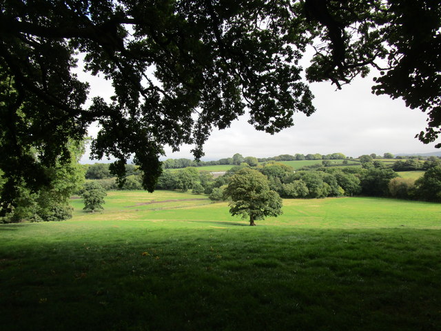
Forder is a small village located in the county of Devon, England. Situated near the southern coast of the country, it falls within the administrative district of South Hams. The village is surrounded by picturesque countryside and is known for its natural beauty and tranquility.

Forder is a tight-knit community with a population of around 200 residents. The village is primarily residential, consisting of traditional houses and cottages. Many of these buildings date back to the 18th and 19th centuries, adding to the village's charm and character.

Despite its small size, Forder has a few amenities to cater to its residents. There is a local pub, serving as a social hub for the community, and a village hall that hosts various events and gatherings throughout the year. The village also has a primary school, providing education for the local children.

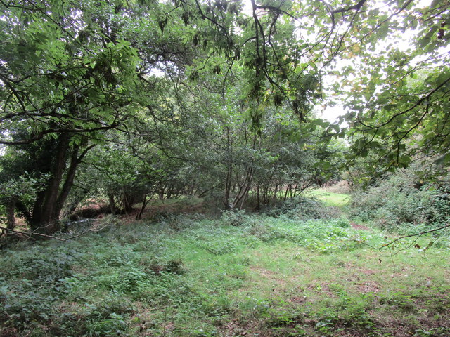
One of the main attractions of Forder is its proximity to the beautiful Devon coastline. The village is just a short drive away from sandy beaches, rugged cliffs, and stunning coastal walks. This makes it a popular destination for outdoor enthusiasts and nature lovers.

Overall, Forder is a peaceful and idyllic village in Devon, offering a quiet and rural lifestyle. With its stunning surroundings and strong sense of community, it is a place that attracts both locals and visitors looking to escape the hustle and bustle of city life.

If you have any feedback on the listing, please let us know in the comments section below.
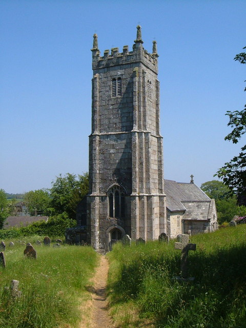
Forder Images

Images are sourced within 2km of 50.691229/-3.8829397 or Grid Reference SX6789. Thanks to Geograph Open Source API. All images are credited.

Holy Trinity Church, Gidleigh The church has Saxon or possibly Norman origins, but was completely rebuilt at the end of the 15th century. 

It comprises a nave continuous with the chancel which is covered with a waggon shaped roof of Devon oak. The side aisle on the south side is separated from the nave by a three-bay arcade, supported by granite columns. The tower at the west end contains the ring of bells, which are rung from the floor of the church.

The rood screen dates from the 15th century and was decorated in 1853 when the images of saints were added along the lower panels.

The font is 15th century but had a wooden cover made in 1843 by Charles Finch, the parish clerk. In 1853 John Aggett carved the granite pulpit and lectern. He also carved the reredos in 1868 which was originally installed in Chagford church.

In 1863 the rector, Arthur Whipham, divorced his wife on the grounds of her alleged adultery with Philip Rowe, a local farmer's son. They were caught in bed at the rectory by the village bobby.
Holy Trinity Church, Gidleigh
The church has Saxon or possibly Norman origins, but was completely rebuilt at the end of the 15th century. It comprises a nave continuous with the chancel which is covered with a waggon shaped roof of Devon oak. The side aisle on the south side is separated from the nave by a three-bay arcade, supported by granite columns. The tower at the west end contains the ring of bells, which are rung from the floor of the church. The rood screen dates from the 15th century and was decorated in 1853 when the images of saints were added along the lower panels. The font is 15th century but had a wooden cover made in 1843 by Charles Finch, the parish clerk. In 1853 John Aggett carved the granite pulpit and lectern. He also carved the reredos in 1868 which was originally installed in Chagford church. In 1863 the rector, Arthur Whipham, divorced his wife on the grounds of her alleged adultery with Philip Rowe, a local farmer's son. They were caught in bed at the rectory by the village bobby.
Prehistoric Round House on Throwleigh Common <span class="nowrap"><a title="https://historicengland.org.uk/listing/the-list/list-entry/1018916?section=official-listing" rel="nofollow ugc noopener" href="https://historicengland.org.uk/listing/the-list/list-entry/1018916?section=official-listing">Link</a><img style="margin-left:2px;" alt="External link" title="External link - shift click to open in new window" src="https://s1.geograph.org.uk/img/external.png" width="10" height="10"/></span>
Prehistoric Round House on Throwleigh Common
Road past Throwleigh Common Running along the edge of the open moor, north of Shilstone Cross, with extensive woodland behind the wall on the right, Seen in driving heavy drizzle.
Road past Throwleigh Common
Running along the edge of the open moor, north of Shilstone Cross, with extensive woodland behind the wall on the right, Seen in driving heavy drizzle.
Road along the edge of Throwleigh Common
Lych gate and cottage, Throwleigh
Access land by the Blackaton Brook
Landscape south east of East Ash
Lane at East Ash
Lane at East Ash
Road junction at East Ash
Old Wayside Cross in Throwleigh village, Throwleigh parish Throwleigh Village Cross, old base in a new cross, by the UC road, in parish of Throwleigh (West Devon District), in the street East of the church, at a wide junction.

Grade II listed.
List Entry Number: 1168299 <span class="nowrap"><a title="https://historicengland.org.uk/listing/the-list/list-entry/1168299" rel="nofollow ugc noopener" href="https://historicengland.org.uk/listing/the-list/list-entry/1168299">Link</a><img style="margin-left:2px;" alt="External link" title="External link - shift click to open in new window" src="https://s1.geograph.org.uk/img/external.png" width="10" height="10"/></span>

Surveyed

Milestone Society National ID: DVWD_THR03
Old Wayside Cross in Throwleigh village, Throwleigh parish
Throwleigh Village Cross, old base in a new cross, by the UC road, in parish of Throwleigh (West Devon District), in the street East of the church, at a wide junction. Grade II listed. List Entry Number: 1168299 LinkExternal link Surveyed Milestone Society National ID: DVWD_THR03
Old Wayside Cross - moved to Throwleigh churchyard Throwleigh Churchyard Cross, old shaft and base, by the footpath, in parish of Throwleigh (West Devon District), close to the East end of the church, set in grass. See also: <a href="https://www.geograph.org.uk/photo/3015675">SX6690 : Granite cross, Throwleigh</a>

Grade II listed.
List Entry Number: 1326041 <span class="nowrap"><a title="https://historicengland.org.uk/listing/the-list/list-entry/1326041" rel="nofollow ugc noopener" href="https://historicengland.org.uk/listing/the-list/list-entry/1326041">Link</a><img style="margin-left:2px;" alt="External link" title="External link - shift click to open in new window" src="https://s1.geograph.org.uk/img/external.png" width="10" height="10"/></span>

Surveyed

Milestone Society National ID: DVWD_THR01
Old Wayside Cross - moved to Throwleigh churchyard
Throwleigh Churchyard Cross, old shaft and base, by the footpath, in parish of Throwleigh (West Devon District), close to the East end of the church, set in grass. See also: SX6690 : Granite cross, Throwleigh Grade II listed. List Entry Number: 1326041 LinkExternal link Surveyed Milestone Society National ID: DVWD_THR01
Ordnance Survey Cut Mark This OS cut mark can be found on the east face of St Mary's Church. It marks a point 249.151m above mean sea level.
Ordnance Survey Cut Mark
This OS cut mark can be found on the east face of St Mary's Church. It marks a point 249.151m above mean sea level.
Flush Bracket OSBM 11129: Throwleigh Flush bracket on a cottage in Throwleigh.  See <a title="https://www.geograph.org.uk/photo/6117654" href="https://www.geograph.org.uk/photo/6117654">Link</a> for a wider view and <span class="nowrap"><a title="https://www.bench-marks.org.uk/bm22127" rel="nofollow ugc noopener" href="https://www.bench-marks.org.uk/bm22127">Link</a><img style="margin-left:2px;" alt="External link" title="External link - shift click to open in new window" src="https://s1.geograph.org.uk/img/external.png" width="10" height="10"/></span> for details of the mark.
Flush Bracket OSBM 11129: Throwleigh
Flush bracket on a cottage in Throwleigh. See Link for a wider view and LinkExternal link for details of the mark.
Flush Bracket OSBM 11129: Throwleigh There is a flush bracket benchmark on this cottage in Throwleigh.  See <a title="https://www.geograph.org.uk/photo/6117652" href="https://www.geograph.org.uk/photo/6117652">Link</a> for a closer view and <span class="nowrap"><a title="https://www.bench-marks.org.uk/bm22127" rel="nofollow ugc noopener" href="https://www.bench-marks.org.uk/bm22127">Link</a><img style="margin-left:2px;" alt="External link" title="External link - shift click to open in new window" src="https://s1.geograph.org.uk/img/external.png" width="10" height="10"/></span> for details of the mark.
Flush Bracket OSBM 11129: Throwleigh
There is a flush bracket benchmark on this cottage in Throwleigh. See Link for a closer view and LinkExternal link for details of the mark.
The turning to Throwleigh On the road between South Zeal and Gidleigh.
The turning to Throwleigh
On the road between South Zeal and Gidleigh.
Road to South Zeal A stone wall runs alongside the road from Gidleigh to South Zeal.
Road to South Zeal
A stone wall runs alongside the road from Gidleigh to South Zeal.
Entrance to the woodland In East Week.
Entrance to the woodland
In East Week.
Clannaborough Farm From the road.
Clannaborough Farm
From the road.
Show me another place!

Forder is located at Grid Ref: SX6789 (Lat: 50.691229, Lng: -3.8829397)

Administrative County: Devon

District: West Devon

Police Authority: Devon and Cornwall

What 3 Words

///owned.steadier.rank. Near Chagford, Devon

Nearby Locations

Forder Wonson

Related Wikis

Throwleigh

Throwleigh () is a village and civil parish located 3 miles from Chagford and 6 miles from Okehampton, in the West Devon district, in the county of Devon...

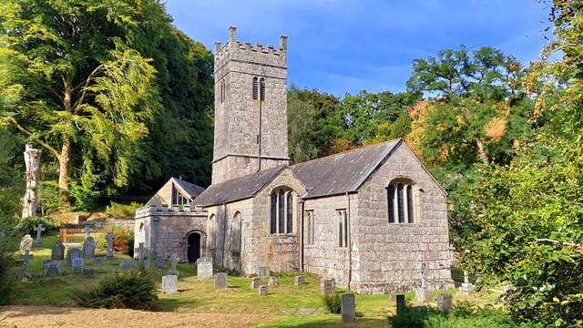
St Mary's Church, Throwleigh

St Mary's Church dates from the late 13th-century, and is a Grade I listed parish church in the Church of England Diocese of Exeter in Throwleigh, Devon...

Gidleigh Castle

Gidleigh Castle was the manor house of the manor of Gidleigh on the north-eastern edge of Dartmoor, about two miles (3.2 km) north-west of the town of...

Gidleigh

Gidleigh is a village and civil parish in the West Devon district of Devon, England. Located within Dartmoor National Park, the parish is surrounded clockwise...

Nearby Amenities

Located within 500m of 50.691229,-3.8829397
Barrowway
Place: locality
Lat/Long: 50.6907744/-3.8798499
Wonson
Created By: Potlatch 0.10f
Place: hamlet
Source: NPE
Lat/Long: 50.6911553/-3.877059
Pub
Northmore Arms
Wikidata: Q80476238
Lat/Long: 50.6914658/-3.8787883
Community Centre
Throwleigh Village Hall
Community Centre: village_hall
Lat/Long: 50.6909595/-3.879204
Post Box
Brand: Royal Mail
Brand Wikidata: Q638098
Brand Wikipedia: en:Royal Mail
Collection Times: Mo-Fr 16:00; Sa 09:30; Su off
Drive Through: no
Operator: Royal Mail
Operator Wikidata: Q638098
Post Box Design: type_c
Post Box Mounting: building
Post Box Type: wall
Ref: EX20 45
Royal Cypher: VR
Royal Cypher Wikidata: Q33102356
Source: survey;streetlevel imagery;aerial imagery
Lat/Long: 50.6907862/-3.8797778
Telephone
Defibrillator
Booth: K6
Covered: booth
Defibrillator Location: inside red phone box, Wonsford
Emergency: defibrillator
Man Made: telephone_box
Lat/Long: 50.6906977/-3.8797783
Generator Method: photovoltaic
Generator Output Electricity: yes
Generator Source: solar
Generator Type: solar_photovoltaic_panel
Location: roof
Power: generator
Lat/Long: 50.6911106/-3.8886774
Information: guidepost
Tourism: information
Lat/Long: 50.6907445/-3.8798777
The data included in this document is from www.openstreetmap.org. The data is made available under ODbL.

Have you been to Forder?

Leave your review of Forder below (or comments, questions and feedback).